Land-Use Mapping in a Mixed Urban-Agricultural Arid Landscape Using Object-Based Image Analysis: A Case Study from Maricopa, Arizona


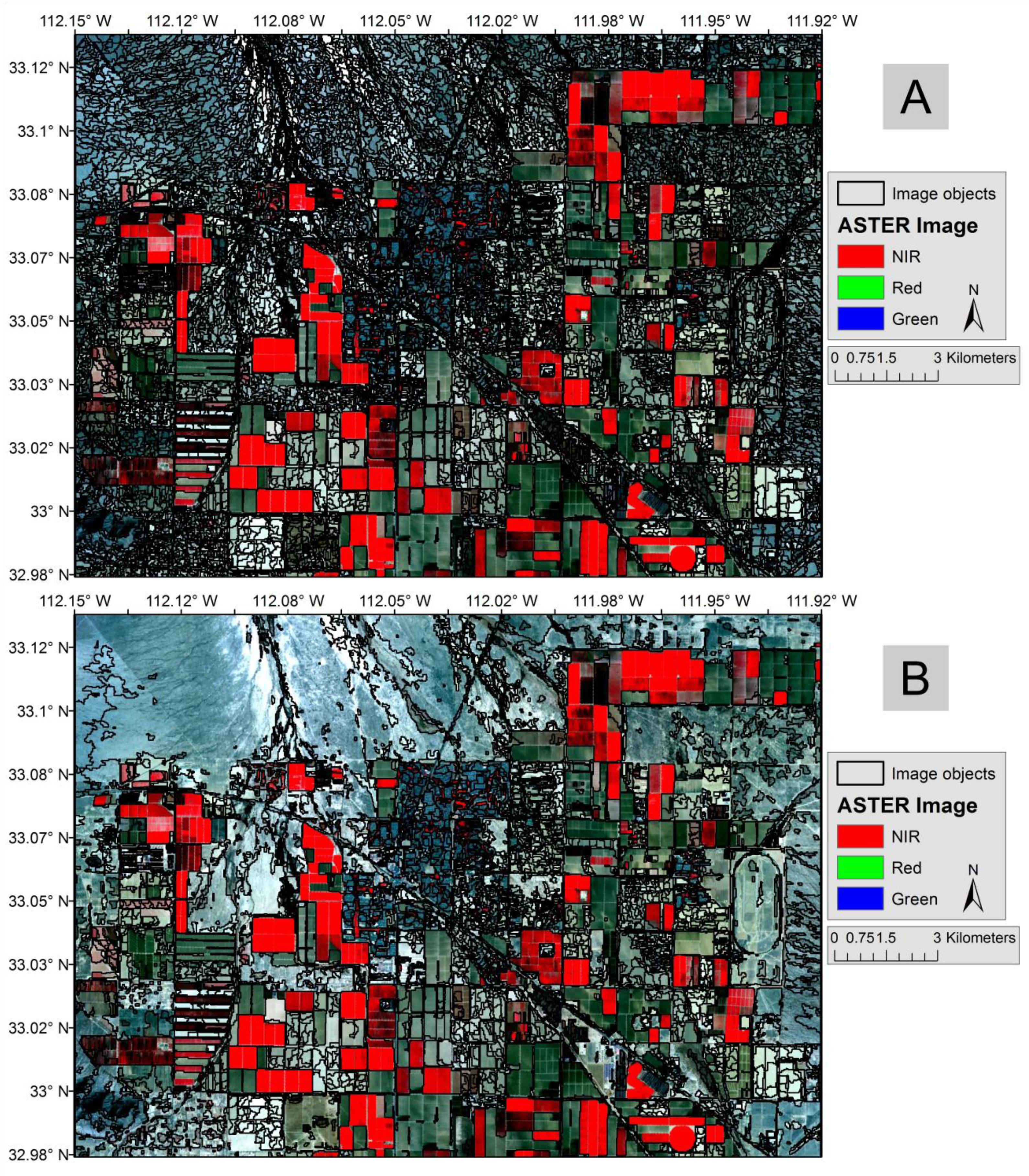
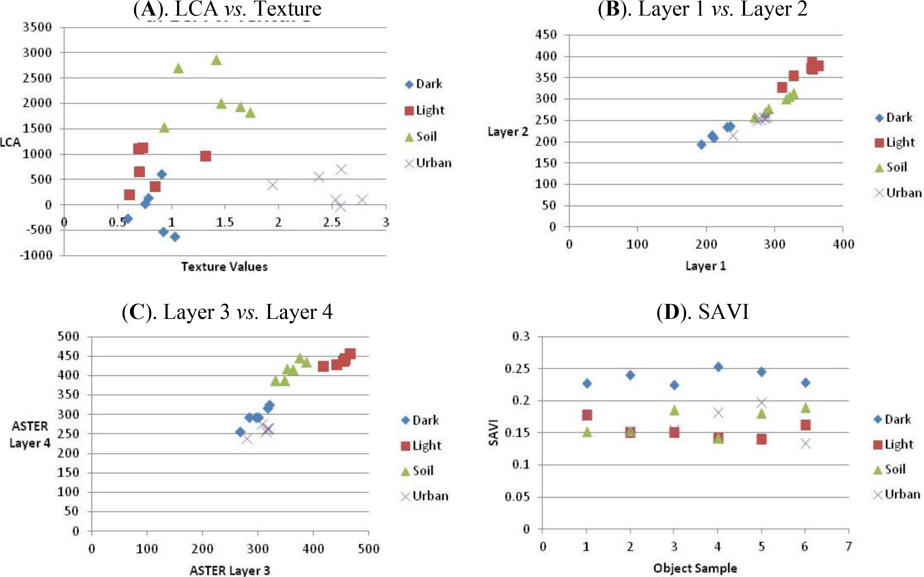
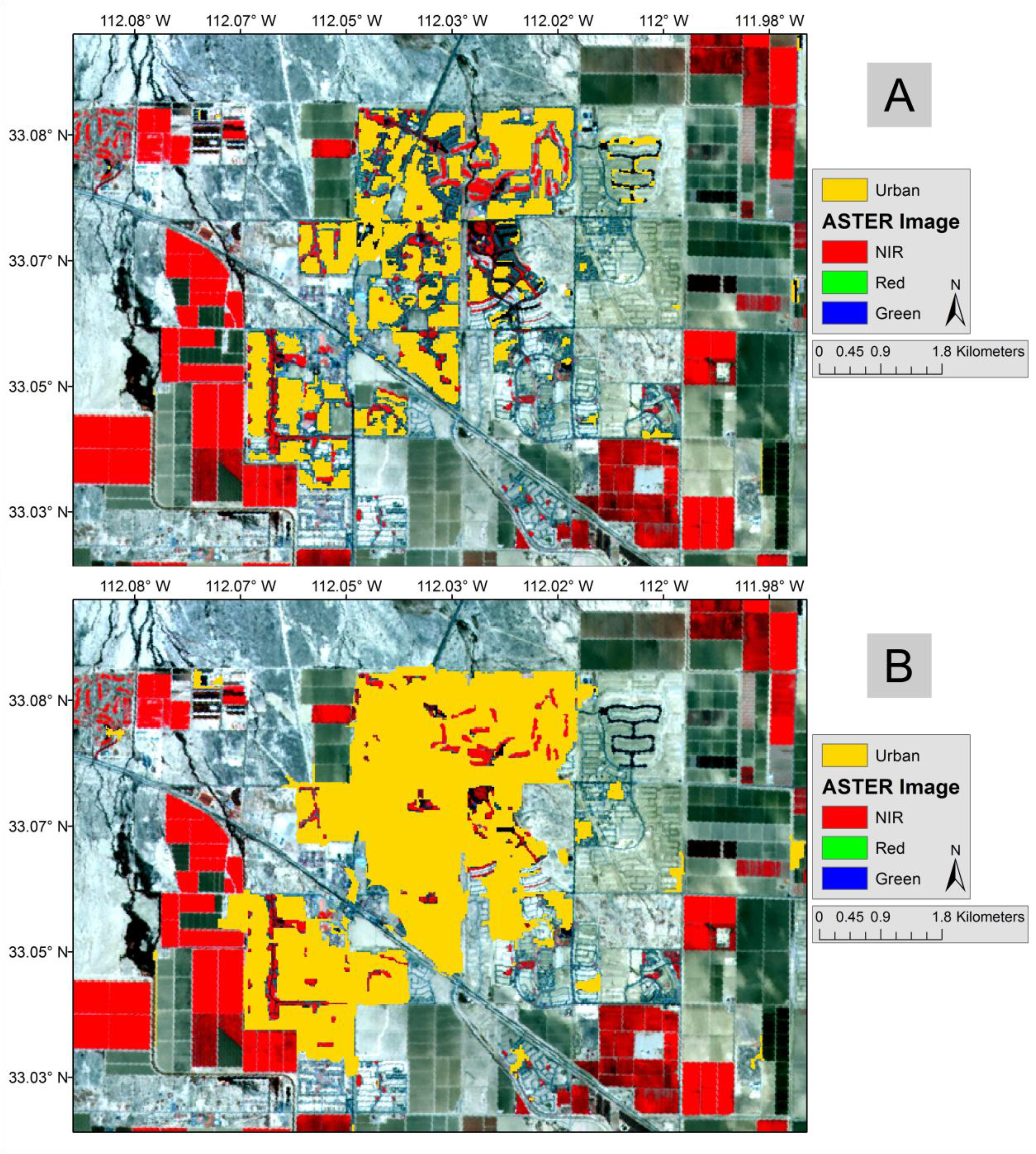
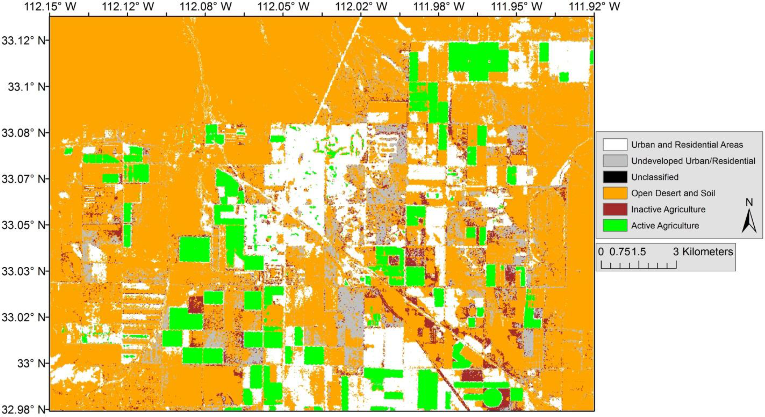
Abstract
Share and Cite
Galletti, C.S.; Myint, S.W. Land-Use Mapping in a Mixed Urban-Agricultural Arid Landscape Using Object-Based Image Analysis: A Case Study from Maricopa, Arizona. Remote Sens. 2014, 6, 6089-6110. https://doi.org/10.3390/rs6076089
Galletti CS, Myint SW. Land-Use Mapping in a Mixed Urban-Agricultural Arid Landscape Using Object-Based Image Analysis: A Case Study from Maricopa, Arizona. Remote Sensing. 2014; 6(7):6089-6110. https://doi.org/10.3390/rs6076089
Chicago/Turabian StyleGalletti, Christopher S., and Soe W. Myint. 2014. "Land-Use Mapping in a Mixed Urban-Agricultural Arid Landscape Using Object-Based Image Analysis: A Case Study from Maricopa, Arizona" Remote Sensing 6, no. 7: 6089-6110. https://doi.org/10.3390/rs6076089
APA StyleGalletti, C. S., & Myint, S. W. (2014). Land-Use Mapping in a Mixed Urban-Agricultural Arid Landscape Using Object-Based Image Analysis: A Case Study from Maricopa, Arizona. Remote Sensing, 6(7), 6089-6110. https://doi.org/10.3390/rs6076089