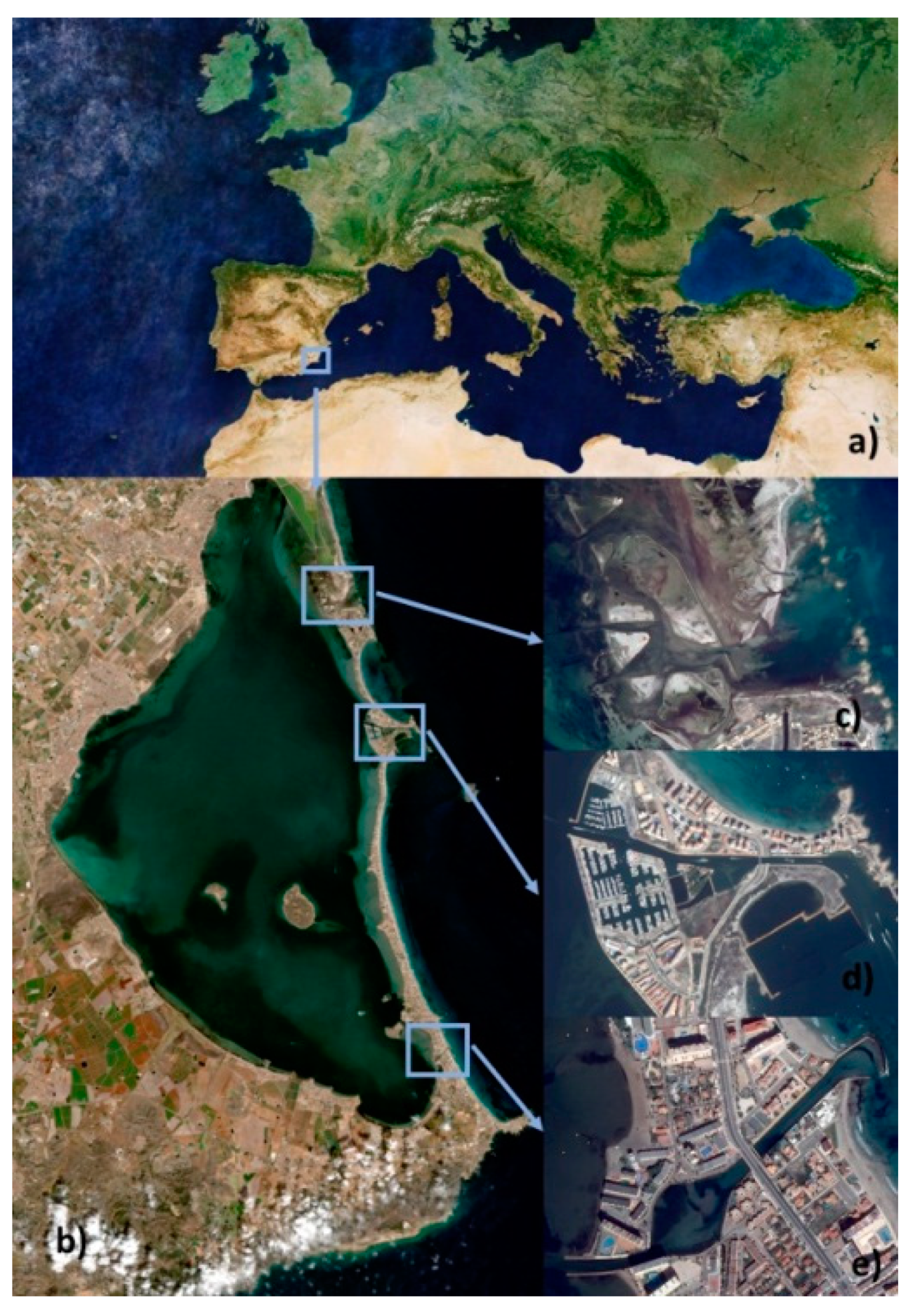
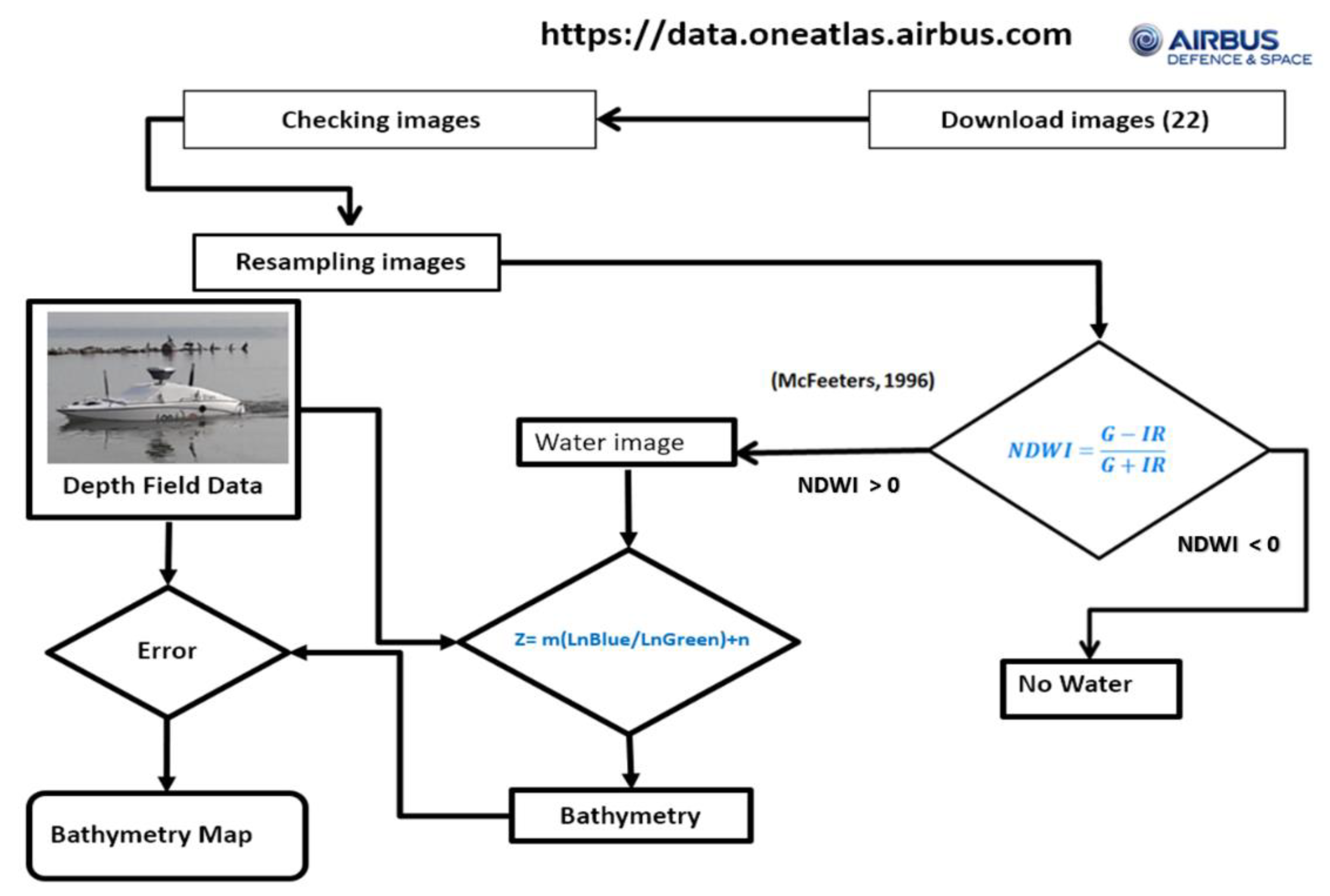
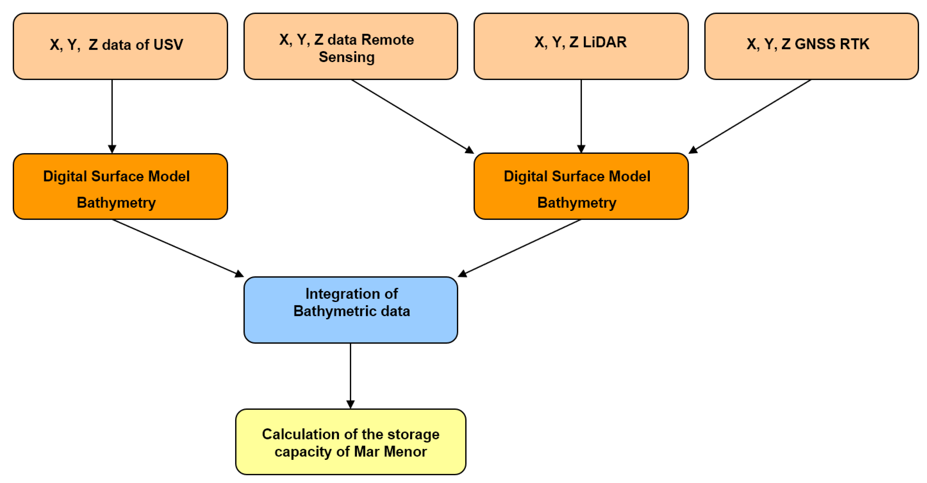
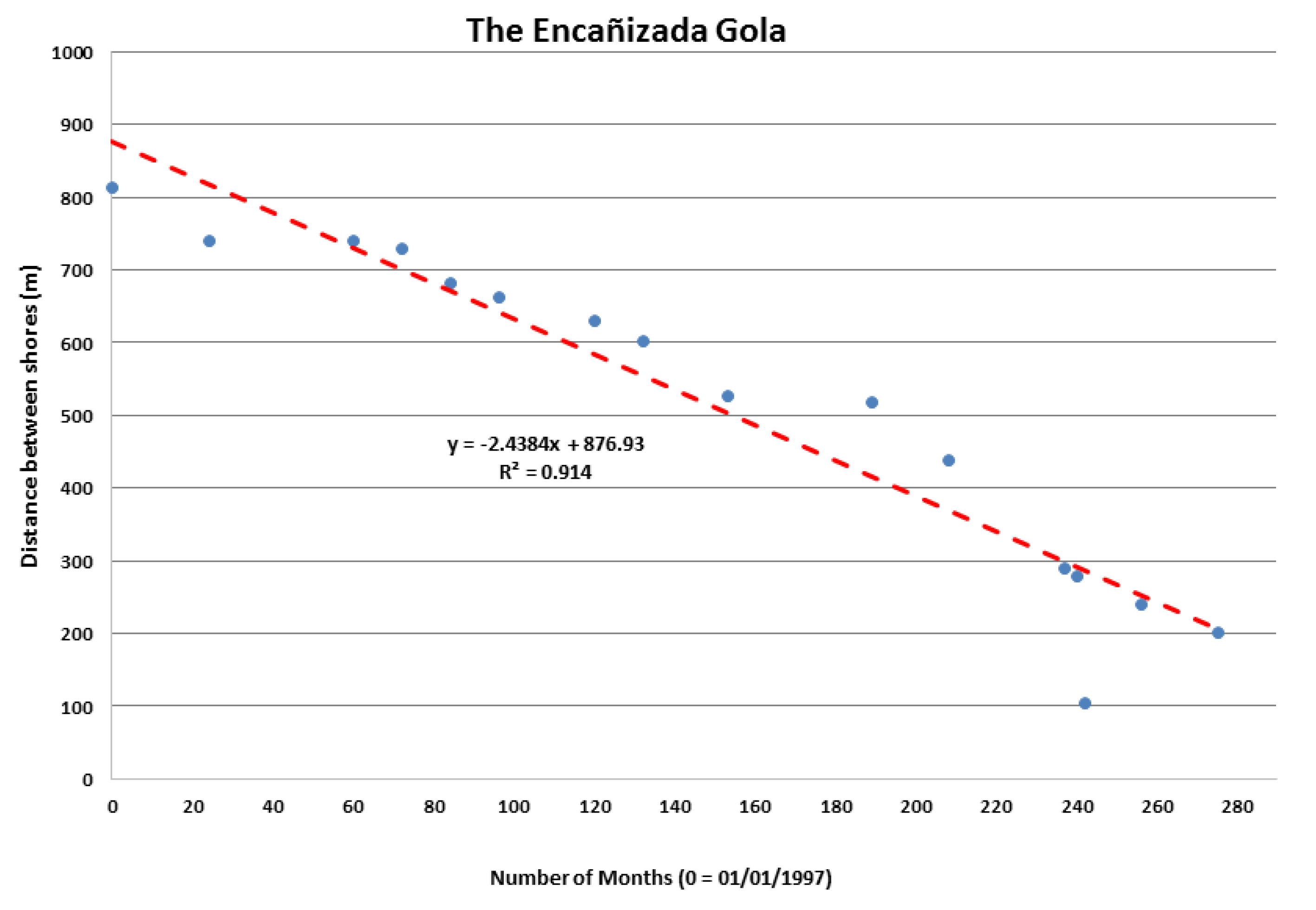
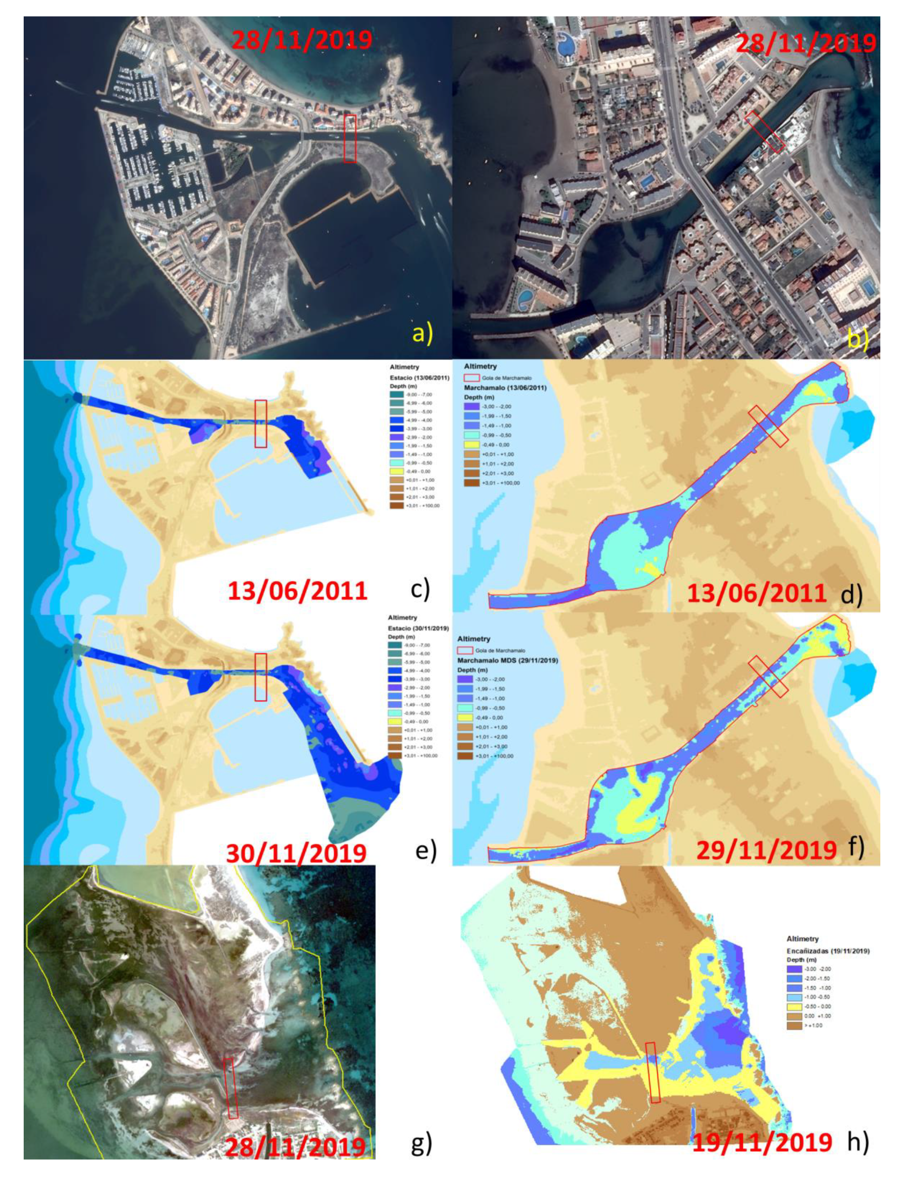
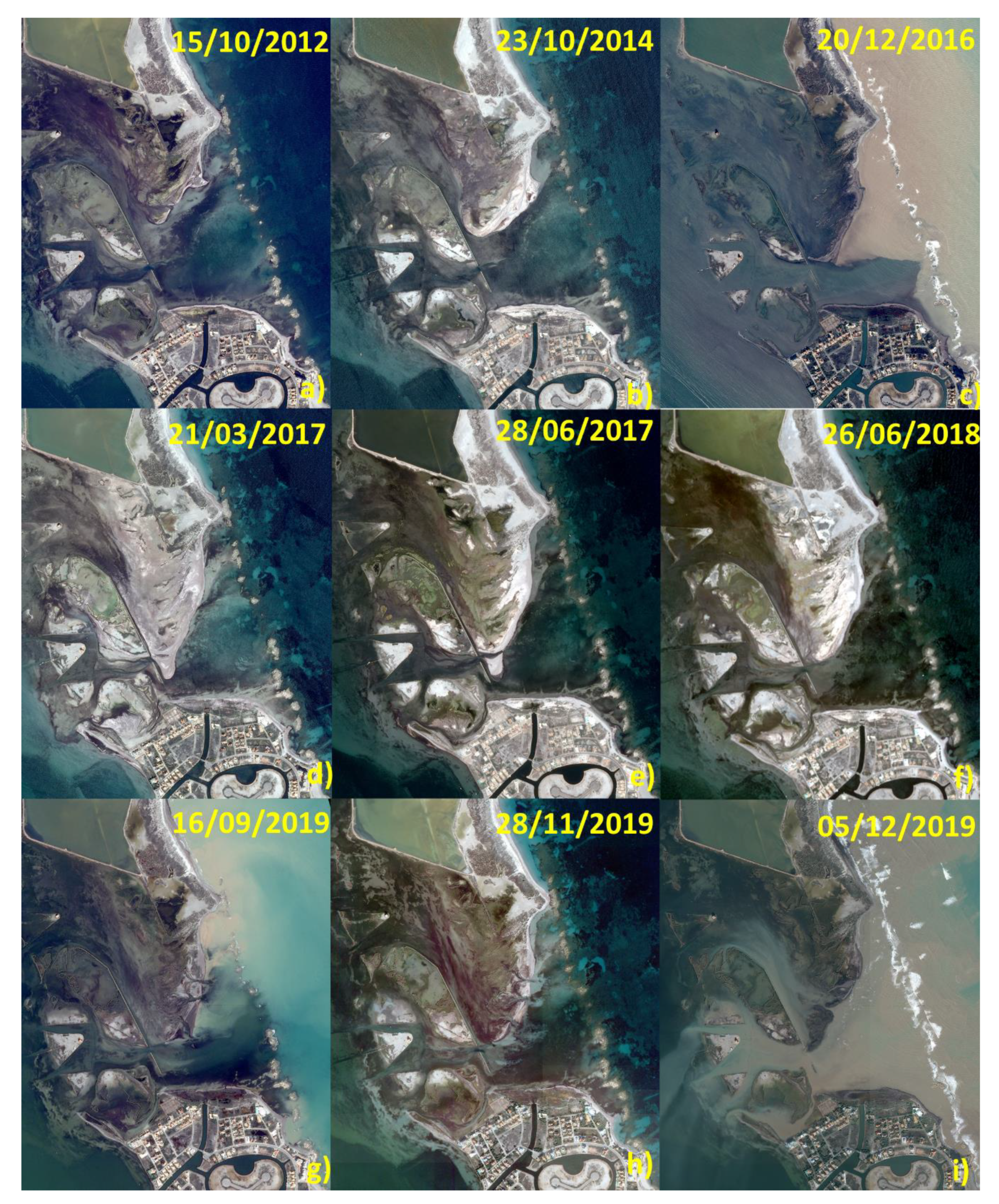
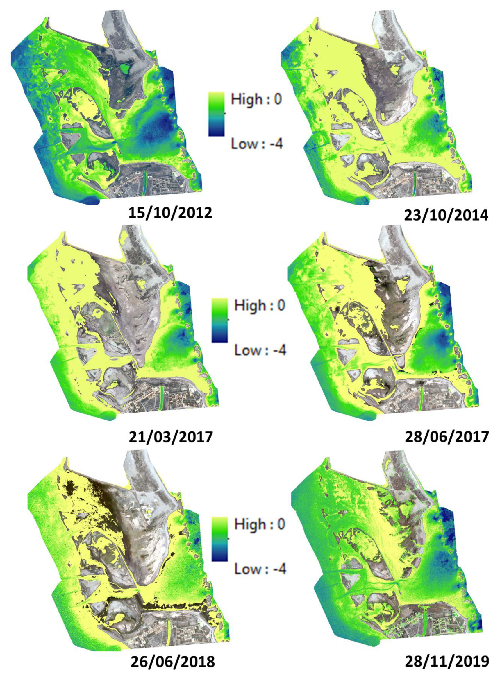
Bathymetry Time Series Using High Spatial Resolution Satellite Images

 ,
, 
 ,
,  ,
,  and
and 
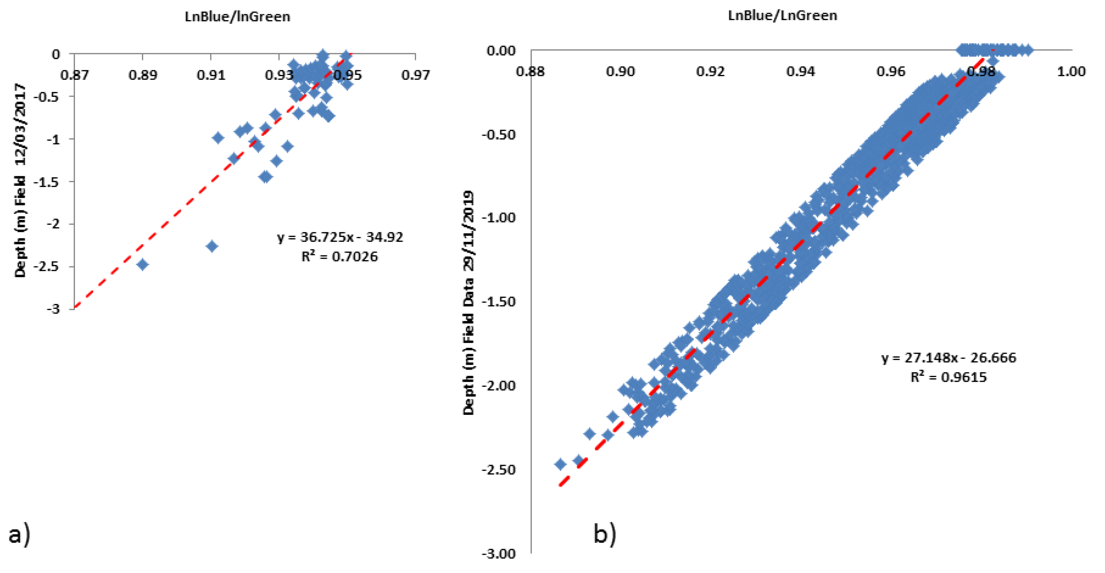
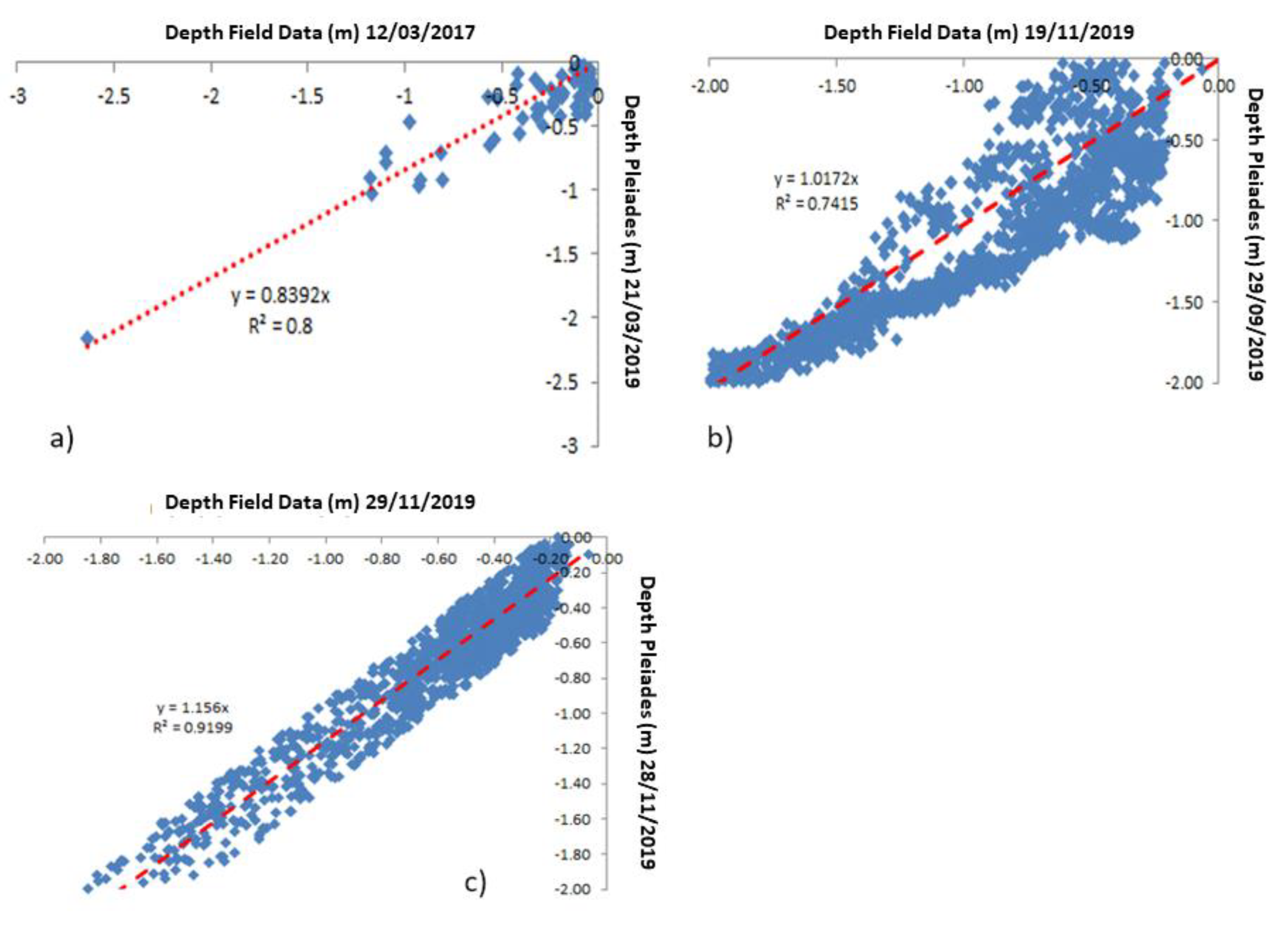
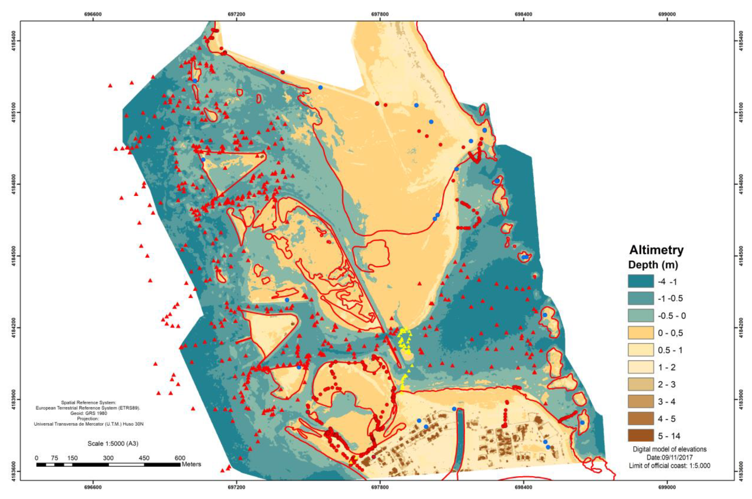
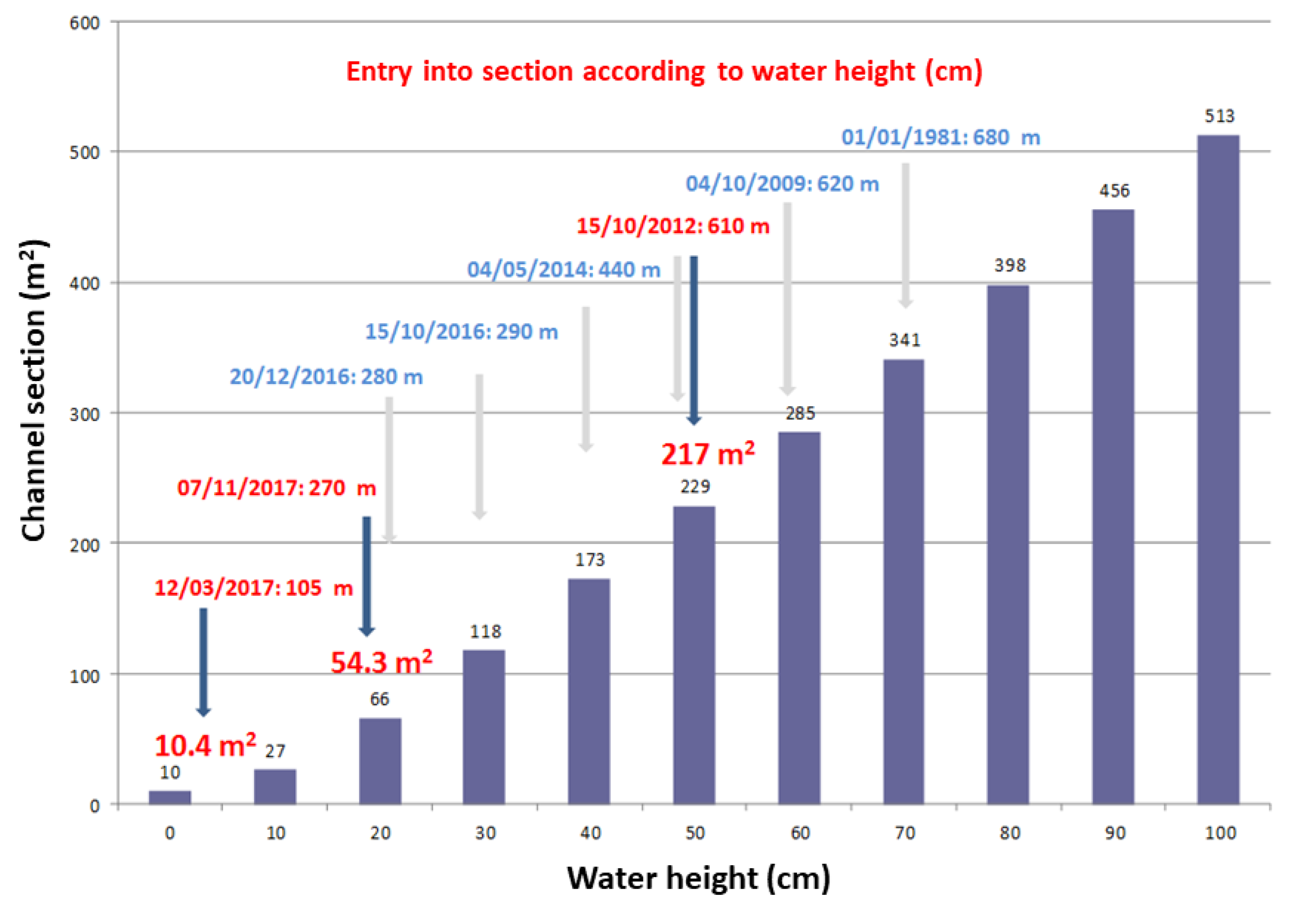
Abstract
Share and Cite
Erena, M.; Domínguez, J.A.; Atenza, J.F.; García-Galiano, S.; Soria, J.; Pérez-Ruzafa, Á. Bathymetry Time Series Using High Spatial Resolution Satellite Images. Water 2020, 12, 531. https://doi.org/10.3390/w12020531
Erena M, Domínguez JA, Atenza JF, García-Galiano S, Soria J, Pérez-Ruzafa Á. Bathymetry Time Series Using High Spatial Resolution Satellite Images. Water. 2020; 12(2):531. https://doi.org/10.3390/w12020531
Chicago/Turabian StyleErena, Manuel, José A. Domínguez, Joaquín F. Atenza, Sandra García-Galiano, Juan Soria, and Ángel Pérez-Ruzafa. 2020. "Bathymetry Time Series Using High Spatial Resolution Satellite Images" Water 12, no. 2: 531. https://doi.org/10.3390/w12020531
APA StyleErena, M., Domínguez, J. A., Atenza, J. F., García-Galiano, S., Soria, J., & Pérez-Ruzafa, Á. (2020). Bathymetry Time Series Using High Spatial Resolution Satellite Images. Water, 12(2), 531. https://doi.org/10.3390/w12020531