1. Introduction
Globally, wetlands are lost at a rate three times higher than that of natural forests [
1]. This is of concern because wetlands provide numerous services to the environment and direct benefits to humans, including the provision of food, fuel and fibers [
2,
3]. Furthermore, wetlands play a key role in mitigating climate change and sustaining species and ecological functions [
4]. Despite an increased understanding of the benefits of wetlands, they continue to be in decline: approximately 35% of wetland loss has occurred in the last 50 years [
5]. Historically, wetlands were exploited and often converted to agricultural land [
3]. Their decline can also be attributed to the mismanagement of water resources at different governance levels, which can turn scarce resources into sources of conflict.
Wetland conflict is often discussed as a conflict of uses. Villanueva et al. [
6] demonstrate that conflict in the Taim wetland area exists between conservation and irrigation. In this example, the source of the Taim, Lake Mangueira, was not included in the protections for the wetland itself. This exclusion of nearby waterbodies highlights the need for wetland management to be linked to the management of connected rivers and lakes, such as through integrated basin management, as well as transboundary in sociopolitical, geographic and ecological scales. Najafi and Vatanfada [
7] identify mismanagement and insufficiently functional governance, including the absence of a transboundary agreement, as one reason the Hamoun Wetlands experienced major degradation, due in part to the overexploitation of natural resources. Yet another example of wetland conflict is occurring in the Inner Niger Delta, where competition for use of the wetlands results in violence. Since 2012, violent conflict has occurred as a result of competing interests of farmers, herders, fishers, “fuelled by a lack of strong governance, a weak judicial system, confusing land rights and ethnic tensions” [
8]. These examples of conflict highlight the need for improvement in wetland management, to preserve the world’s wetlands and to prevent or mitigate conflict over them.
Conflict over shared water resources may be avoided through cooperative management. Through cooperation, countries discover opportunities to share not only responsibility, but also benefits, of managing water resources [
9]. Such management of transboundary wetlands may provide, “…health, food and water security benefits critical to the health and livelihoods of 4 billion people globally…” [
5]. Furthermore, cooperative management of transboundary waters contributes to water security [
10] and has been found to lead countries towards more cooperative relationships [
11]. While the water cooperation discourse has largely focused on rivers and lakes [
12,
13,
14,
15,
16,
17], and more recently also on aquifers [
18,
19,
20], we hypothesize that wetlands, too, require cooperation among states in order to ensure the sustainability of wetlands management. Indeed, Milanes-Murcia et al. [
21] posit that “integration and cooperation are fundamental in proper management of transboundary wetlands”. While wetland management occurs at multiple scales, from international to local, this research focuses specifically on two possible (and potentially interlinked) avenues for wetland management: the Ramsar Convention and river basin organizations (RBOs).
This research builds on the understanding that institutionalized cooperation—such as through international water treaties and especially RBOs that establish long-term mechanisms and approaches for addressing transboundary challenges in shared basins—makes a difference in managing shared water resources [
22,
23,
24,
25]. It therefore identifies where wetlands with international designations fall within transboundary river basins, and subsequently where they have RBOs. The goal of this paper is to compile information on transboundary wetlands to support future research on their management, especially in the context of water conflict and cooperation dynamics. The products of this research are a database and map of transboundary wetlands. These are necessary, foundational steps toward future research on transboundary wetlands in the broader conflict and cooperation context.
Transboundary Wetland Governance
Wetlands are protected under the 1971 Convention on Wetlands of International Importance especially as Waterfowl Habitat (better known as the Ramsar Convention as it was signed in Ramsar, Iran) [
26]. The Ramsar Convention, a global instrument, promotes the “wise use” of wetlands of “international significance” [
27]. Approximately 250 million hectares of wetlands are currently protected under the Ramsar Convention, amounting to about 15% of wetlands globally [
5]. Designation of a wetland as a Ramsar site gives the area recognition nationally and internationally for its significance to humanity. Currently, 172 countries are party to the Ramsar Convention, which is well above that of other international water treaties, such as the 1992 UNECE Convention on the Protection and Use of Transboundary Watercourses and International Lakes (UNECE) and the 1997 Convention on the Law of the Non-navigational Uses of International Watercourses (UNWC) (
Table 1). Signatories to the Ramsar Convention collectively recognize 2410 wetlands of international importance, amounting to about 2,544,670 km
2 [
28].
Through the Ramsar Convention, wetlands can be protected as individual or transboundary Ramsar Sites. An individual Ramsar Site is designated unilaterally by a country and the recognition applies only to the wetland area occurring within the country’s borders. Although, the Ramsar Convention requires countries that are party to the Ramsar Convention to participate in conserving any Ramsar Site they are riparian to or hydrologically connected to [
27]. The Ramsar Convention defines Transboundary Ramsar Sites as those where, “an ecologically coherent wetland extends across national borders and the Ramsar Site authorities on both or all sides of the border have formally agreed to collaborate in its management, and have notified the Secretariat of this intent” [
27]. This Transboundary protection mechanism is significant because wetlands, similar to other ecosystems, do not adhere to political boundaries. Approximately 60% of the world’s freshwaters are transboundary in nature, meaning that they cross country borders [
9]. Many wetlands are located in river and lake basins and/or are dependent on aquifers, thus it is likely that many wetlands are part of transboundary dynamics.
At the basin level, transboundary water resources are often managed on the basis of institutionalized cooperation mechanisms, especially RBOs. RBOs are defined as, “institutions that have been set up by riparian states to internationally govern shared water resources” [
29]. A recommendation adopted at the 1972 Stockholm Conference called for the formation of RBOs “for co-operation between interested States for water resources common to more than one jurisdiction” (Recommendation 51 of the Action Plan for the Human Environment, 1972 Stockholm Conference) [
30]. The Millennium Ecosystem Assessment [
4] identifies RBOs as responsible for managing wetlands because, “…they align with hydrologically defined geographical units”. Both can incorporate wetlands as well. Given the connectivity of wetlands to rivers [
31,
32], RBOs are a key party in wetland management [
33]. One example of an RBO managing wetlands is the Nile Basin Initiative, which writes guidance for the joint management of shared wetland resources [
34]. In order to better research the role RBOs can and do play in managing wetlands located in or related to transboundary river and lake basins as well as aquifers, for which in many parts of the world RBOs are responsible, this paper seeks to understand where transboundary wetlands fall within the management area of RBOs.
As a first step toward this, some foundational research is needed. A huge step in understanding transboundary freshwater management was documenting the world’s international river basins, of which there are 312 [
35]. Doing so has enabled researchers to understand which river basins are most at-risk for various stressors and which are most likely to be resilient based on institutional capacity (see [
13,
15,
36,
37,
38]. Given the wide variety of data available on indicators of water stress (e.g.,
http://twap-rivers.org/ accessed on 9 July 2020), mapping the world’s transboundary wetlands could enable practitioners and policymakers to mobilize and prevent conflict from happening in high-risk areas. Countries at high risk of conflict may find opportunities to collaborate on joint management of shared non-controversial wetlands as a means of building trust [
39]. Given the relative scarcity of information on transboundary wetlands, this research builds a database and map to understand current management arrangements for wetlands that cross country borders.
2. Materials & Methods
This research uses a mixed methods approach to provide the foundational basis for assessing institutional options for managing transboundary wetlands. The first step was a global analysis to document transboundary wetlands. Then, a spatial analysis was conducted to generate a map of how transboundary wetlands are distributed globally. Together, these analyses create a map and database of transboundary wetlands, integrating multiple sources of information into one easy-to-access location. This research builds on Griffin’s analysis of the Global Peace Index and Transboundary Ramsar Sites [
39] by expanding the list of transboundary wetlands.
Many sources were used to develop the database of transboundary wetlands, which was created in an effort to understand the scope of the topic. Data was sourced from wetland databases from the Ramsar Secretariat, scientific articles, and organizations that focus on wetland protection. The starting point was the Ramsar List of Transboundary Wetlands. Then, from the Ramsar Sites Information Service, a spreadsheet of global Ramsar sites was downloaded and then narrowed down to only those sites that had an answer of “yes” to their criteria, “Does the wetland extend onto the territory of one or more other countries?” [
28]. Next, the identified transboundary wetlands were cross-referenced with the list of 234 transboundary wetlands developed by Griffin and Ali [
40] to add sites that were missing. Finally, the search for transboundary wetlands culminated online through the Google search engine to identify other transboundary wetlands that were missing from the list. From these sources, the name of the transboundary wetland, the riparian countries and any Ramsar designation were obtained.
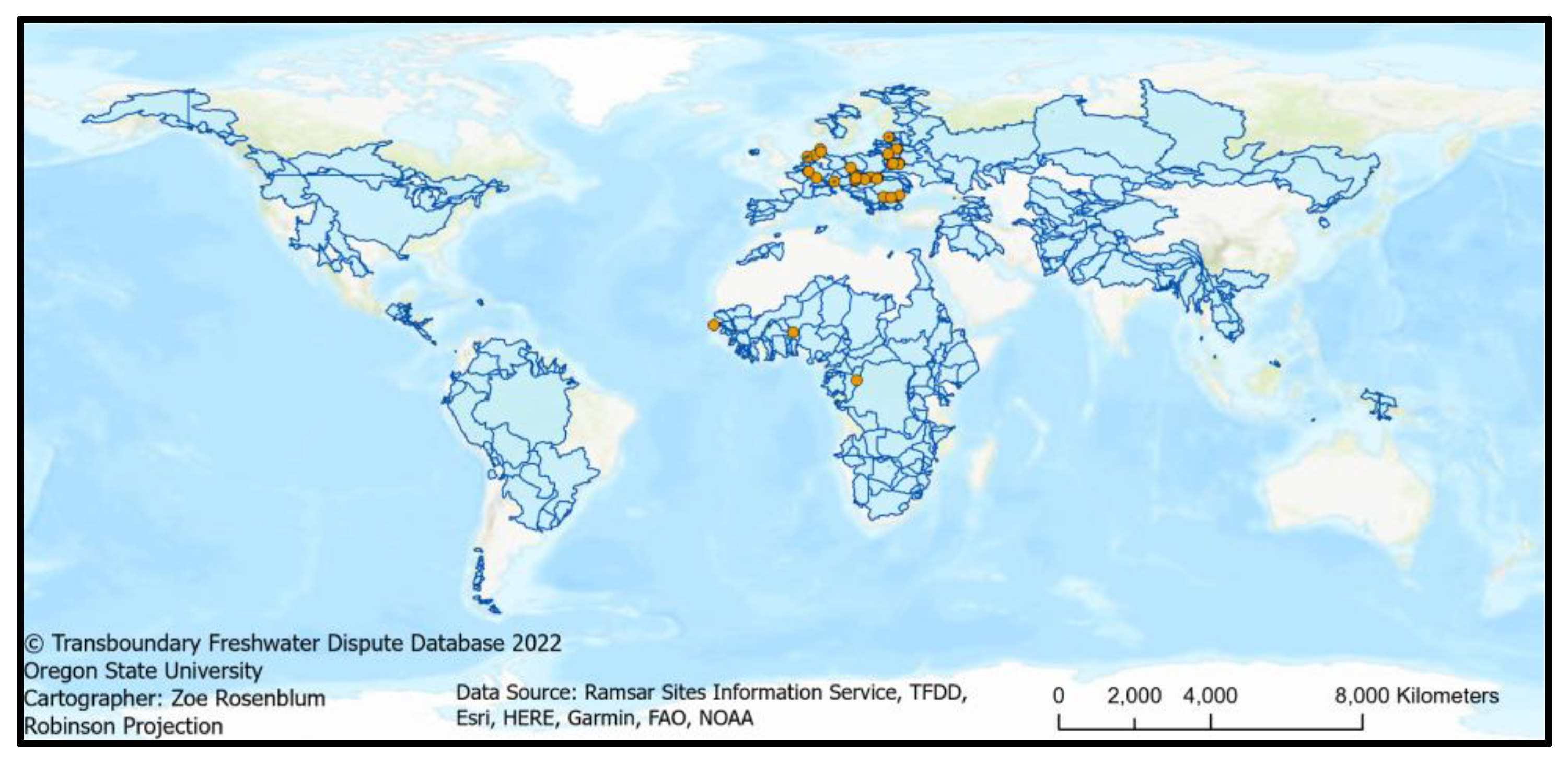
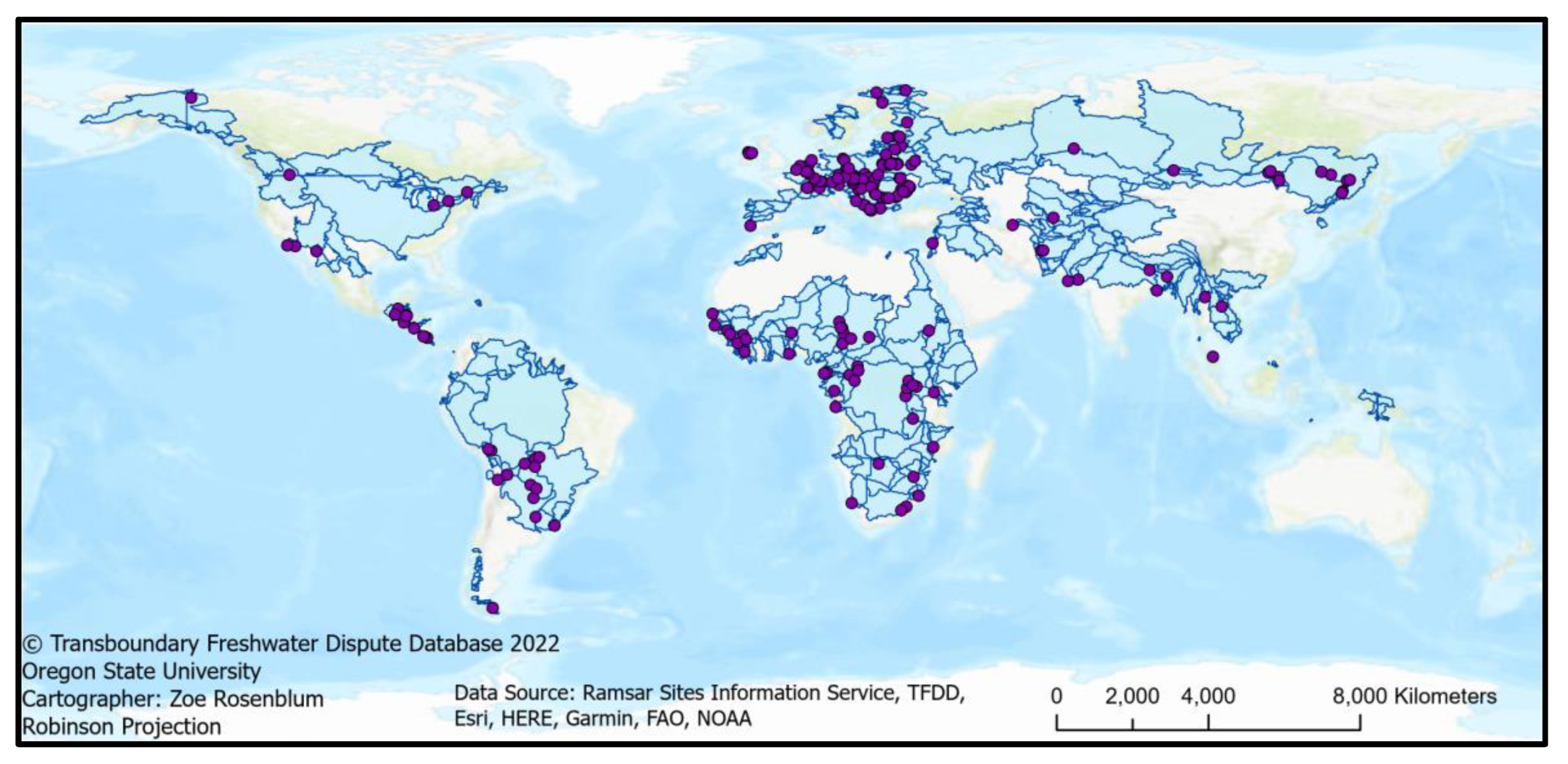
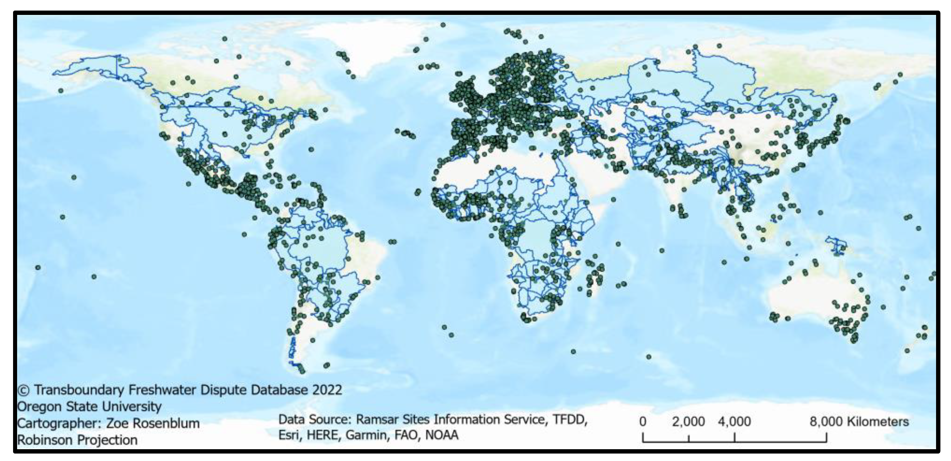
In the second step of the research, a spatial analysis was conducted to identify where transboundary wetlands are located within transboundary river basins. To do this, ArcGIS Pro was used to merge existing datasets (
Table 2) to create a global map of Ramsar wetlands overlaid by transboundary river basins (
Figure 1). From this map, the river basin in which each transboundary wetland is located was determined, and subsequently the river basins were transcribed into the Transboundary Wetlands Database. The spatial analysis was then expanded to explore the relation to RBOs. The International River Basin Organization Database, housed by Oregon State University, was used to determine which transboundary wetlands are located within basins overseen by RBOs. Finally, this information was added to a spreadsheet which became the Transboundary Wetlands Database.
4. Discussion and Conclusions
Despite an increasing acknowledgement of the importance of wetlands—many of them of transboundary nature—and the commitment of 172 countries to protect wetlands through the Ramsar Convention, global wetland coverage continues to decline. The loss of nearly 90% of the world’s wetlands indicates a need for new approaches of wetland management. In order to develop new approaches, it is important to first document where such wetlands are located, especially within transboundary basins which have special considerations for management. The strong connection between transboundary wetland management and water security, and the dearth of information available about shared wetland management, leaves an open door for research in this area. From our foundational research, we see a variety of directions for future studies. Four specific areas of further research seem particularly relevant for ensuring the sustainable management of transboundary wetlands in the future:
First, we need to better understand how wetlands are connected to other waters. Wetlands require thoughtful management to prevent their demise. Due to their connectedness to broader water systems such as river and lake basins [
31,
32], as well as aquifers [
41]—sometimes in a hidden or less obvious manner—such management is ideally integrated into broader basin management activities coordinated among riparian states. It is therefore important to understand not only how water resources are connected, but also the different policies that exist to manage them.
Conflict over wetlands can arise when different uses and users—including different states—have competing interests in the use or the protection of these wetlands. This often happens when they are not properly integrated into basin-wide management planning. The Inner Niger Delta in Mali experiences violent conflict over competing uses of wetlands between farmers, herders, and fishers [
8]. The international Niger River Basin is home to a Transboundary Ramsar Site—the Complexe transfrontalier W-Arly-Pendjari between Benin, Burkina Faso and Niger. There are also a number of Individual Ramsar Sites in each country, such as the Niger-Tinkisso in Guinea, which “extends as far as the frontier with Mali” [
28]. Despite these commitments to wetland governance through the Ramsar Convention, water abstractions upstream of the Inner Niger Delta have led to multiple violent insurrections in the wetlands since 2012 and also contribute to migration from the Sahel, and plans to increase irrigation in upstream Guinea will likely exacerbate this conflict [
42]. Developing water resources has clear impacts to wetlands downstream. Learning where wetlands are located in relation to other watercourses will therefore enable improved integration of wetlands into basin-wide water management.
Second, we need to understand how institutionalized forms of cooperation deal with wetlands. While the Ramsar Convention is one international mechanism for wetland conservation, there are very few cases in which all riparian countries have jointly designated a Transboundary Ramsar Site. The Hamoun Wetlands between Afghanistan and Iran provide an example of insufficient institutional governance. The wetland is unilaterally designated as a Ramsar Site by Iran, in part because Afghanistan is not party to the Ramsar Convention. The waters of the Helmand River, which feed the Hamoun Wetlands, are allocated by the 1973 Helmand River Water Treaty [
43]. Although the Helmand River Water Treaty mentions the possibility of drought and provides for low flow years and the need to develop a plan for the “Helmand Delta” [
44], it does not go so far as to set environmental flow requirements for the wetlands. Due to the environmental, social and economic significance of the Hirmand/Helmand River Basin, it has been “a source of water dispute [between Iran and Afghanistan] for more than 200 years” [
45]. Conflict continues as Afghanistan and Iran compete over increasingly scarce water resources—a conflict of uses in which the wetlands lose out.
Compiling information on how treaties allocate water to wetlands can help build safeguards against wetland conflict. There are many international agreements over shared rivers and lakes: Giordano et al. identified “688 agreements [that were] signed between 1820 and 2007 and constitute 250 independent treaties which apply to 113 basins” [
46]. Similar studies of how international freshwater treaties consider wetlands could provide useful insights for the future of transboundary wetland management and governance. These insights can help build stronger wetland provisions in future water treaties, contributing to enhanced security and decreased risk of conflict.
RBOs typically translate such treaty commitments into long-term joint management activities, which could, and in fact in some basins do, include transboundary wetlands. Now that we have information about which wetlands are located within the management boundaries of RBOs, the next question is whether and how RBOs manage transboundary wetlands. The 159 transboundary wetlands that are in international river basins that have an RBO to which all of the riparian countries are party to provide a potential for more integrated management and thus merit further research on the extent to which RBOs engage in wetland management.
Third, future research could explore the effectiveness of institutionalized cooperation. Such a study might explore some socioeconomic or ecological factors in relationship to the cooperation or management mechanisms in place, to see if there is any correlation. As climate change and unsustainable consumption threaten to deplete water resources, the role that wetlands play in climate mitigation and carbon sequestration may offer an opportunity for states to cooperate on wetland management. Transboundary wetland cooperation may become an important arrangement for sharing the burdens and benefits of wetland protection and development.
Finally, the majority of the wetlands considered in this research are, to a certain extent, governed by the Ramsar Convention. However, there are many wetlands in the world that are not protected by the Ramsar Convention. While this research identifies only three transboundary wetlands that are not governed by the Ramsar Convention, there are likely many more. Future research could work towards identifying these wetlands with techniques and resources that are beyond the scope of this paper. For example, the United States Fish and Wildlife Service analyzes aerial imagery to identify the extent of wetlands in the United States [
47]. This might be a useful method for mapping all of the transboundary wetlands in the world, although it would require perhaps an unrealistic amount of technical capacity and resources. Another option would be to conduct a spatial analysis of already existing datasets of global wetlands (see: [
48,
49,
50]), combined with data on transboundary river basins, to determine where there is overlap. Such research would offer a more complete picture of the extent of the world’s transboundary wetlands, which would then enable analyses to guide where to prioritize resources to enhance wetland cooperation. Our research identifies 300 transboundary wetlands, but we believe there are likely many more.
Moving beyond the Ramsar Convention opens the door to explore non-international transboundary wetlands. The online search for transboundary wetlands revealed cases that fall outside of the scope of this research, indicating the potential for a broader definition of transboundary wetlands. For example, Namatala Wetland in Uganda provides an interesting case of cross-county wetland conflict [
51]. The wetland is entirely within Uganda, but is part of the Upper White Nile River Basin, presenting a connection to Nile Basin countries, and furthermore it extends across four sub-national counties. The counties have different ethnic majorities, politics, and priorities for the wetland, which has resulted in clashes and deadly conflicts since colonial rule [
52]. Ostrovskaya et al. [
51] identified a lack of coordination between wetland and river basin planning and management as one of the key governance failures in the region. The case of the Namatala Wetland both underscores the need for basin-wide integration of wetland management and highlights the question of broadening the definition of transboundary wetlands to include those at the sub-national level.
It seems very likely that there are other wetlands that could be considered transboundary in this way, such as wetlands in the United States that cross state lines. These are important to consider in the future because counties and states also often have different, potentially conflicting, policies and interests. Identifying other wetlands that fit into this category could be useful in preventing future (or resolving existing) conflicts by better understanding the governance and management mechanisms in place and subsequently how contradictions between them may lead to cross-border conflict.
The Ramsar Convention provides essential guidance for states specifically on how to cooperatively manage shared wetland resources. Given the 172 countries that are party to the Ramsar Convention, wetlands may be less contested than other water resources and therefore may be an entry point for cooperation. Transboundary basin management efforts, especially through RBOs, can expand this toward a more integrated approach at the basin level, that is, in light of the specific needs of a basin and the challenges it faces. Together, this can help to not only manage wetlands and the important services they provide in a more sustainable manner, but to also prevent and mitigate disagreements and conflicts over shared resources.
The product of this research is the Transboundary Wetlands Database, available through the Oregon State University Transboundary Waters website. The database provides easily accessible information on the international river basin and river basin organization, as applicable, that each transboundary wetland occurs within. This foundational information can support future research into transboundary wetlands, which may offer benefits to enhance water security, prevent wetland degradation, and identify opportunities for increased water cooperation. It can also support awareness among decision-makers from the local to the international level and thus strengthen policy action in order to sustainably manage transboundary wetlands and thus serve the people that depend on them.


