
Water Dams: From Ancient to Present Times and into the Future †

 ,
,  , , , , ,
  ,
, 
Abstract
:1. Prolegomena
2. From Prehistoric Times to the Medieval Era (ca. 7000 BC–1400 AD)
2.1. Prehistoric Times
2.1.1. Middle East Prehistoric Civilizations (ca. 7000–1100 BC)


2.1.2. Minoan Civilization (ca. 3200–1100 BC)
2.1.3. Hittite Era (ca. 1600–1180 BC)
2.1.4. Babylonian, Assyrian, and Other Civilizations
2.2. Historical Times (ca. 1100 BC–330 AD)
2.2.1. Urartian Era (ca. Ninth to Sixth Centuries BC)
2.2.2. Archaic, Classical, and Hellenistic Periods (ca. 750 BC–31 BC)
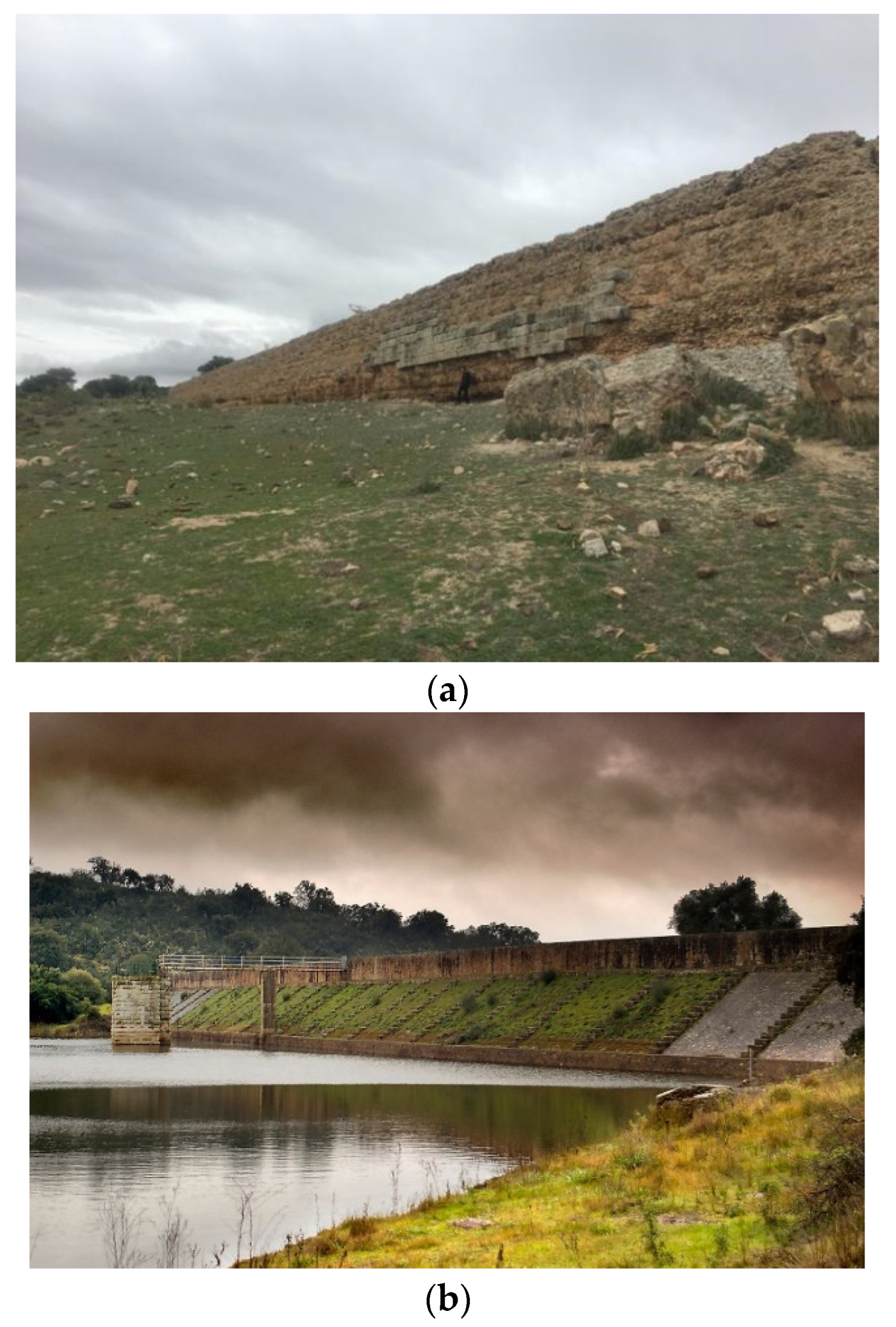
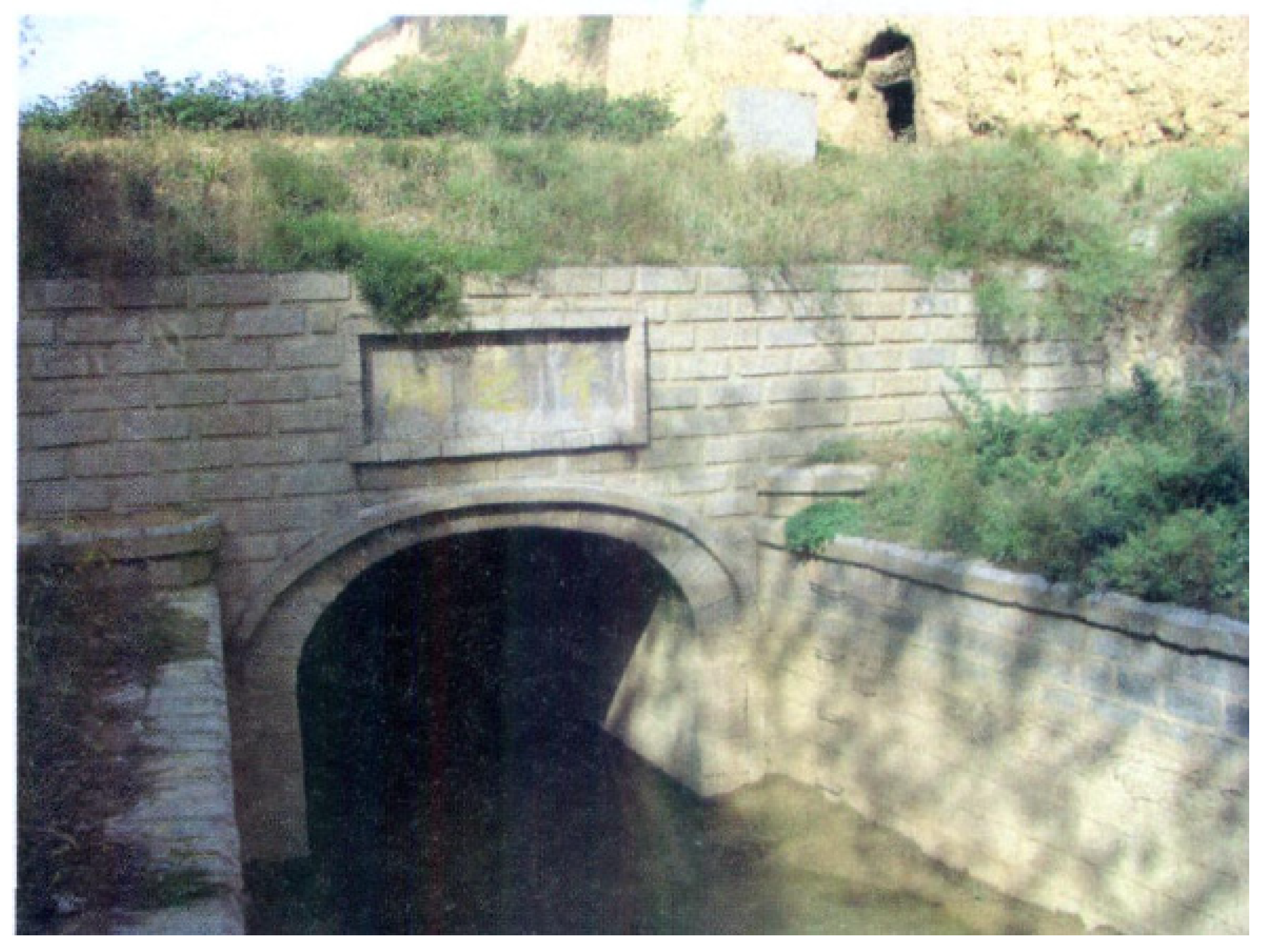
2.2.3. Roman Period (ca. 31 BC–476 AD)
2.2.4. Han China Dynasties (ca. 206 BC–220 AD)
2.2.5. Roman and Byzantine Period (ca. 330–1453 AD) in Anatolia
2.2.6. Medieval Times (ca. 476–1400 AD)
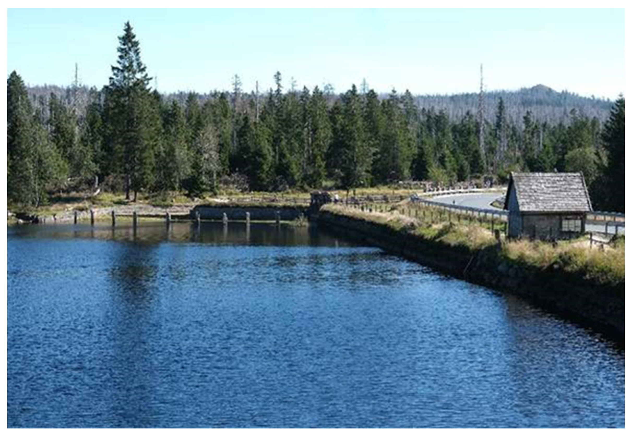
3. Water Dams in Early and Mid-Modern Times (ca. 1400–1850 AD)
4. Water Dams in Contemporary Times (1850 AD–Present)
- (a)
- The Three Gorges Dam in China with an energy-generating capacity of 22,500 MW and a surface area of 1.080 km2.
- (b)
- The Guri Dam in Venezuela with an energy-generating capacity of 10.200 MW and a surface area of 4.250 km2.
- (c)
- The Tucurui Dam in Brazil with an energy-generating capacity of 8.370 MW and a surface area of 3.014 km2.
- (d)
- The Itaipu Dam in Brazil and Paraguay with an energy-generating capacity of 14.000 MW and a surface area of 1.350 km2.
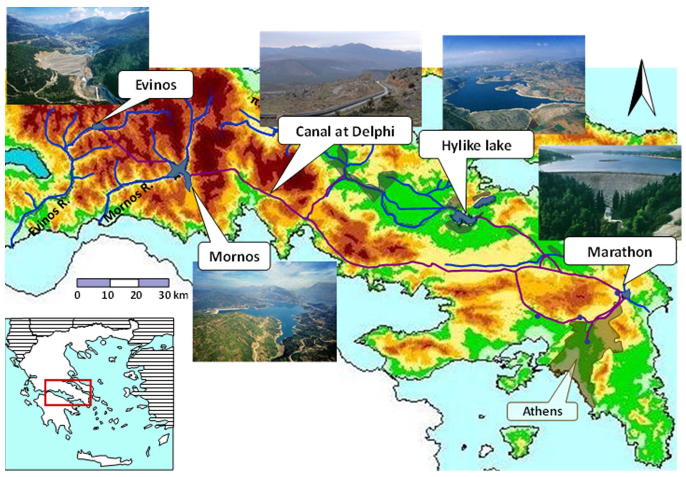
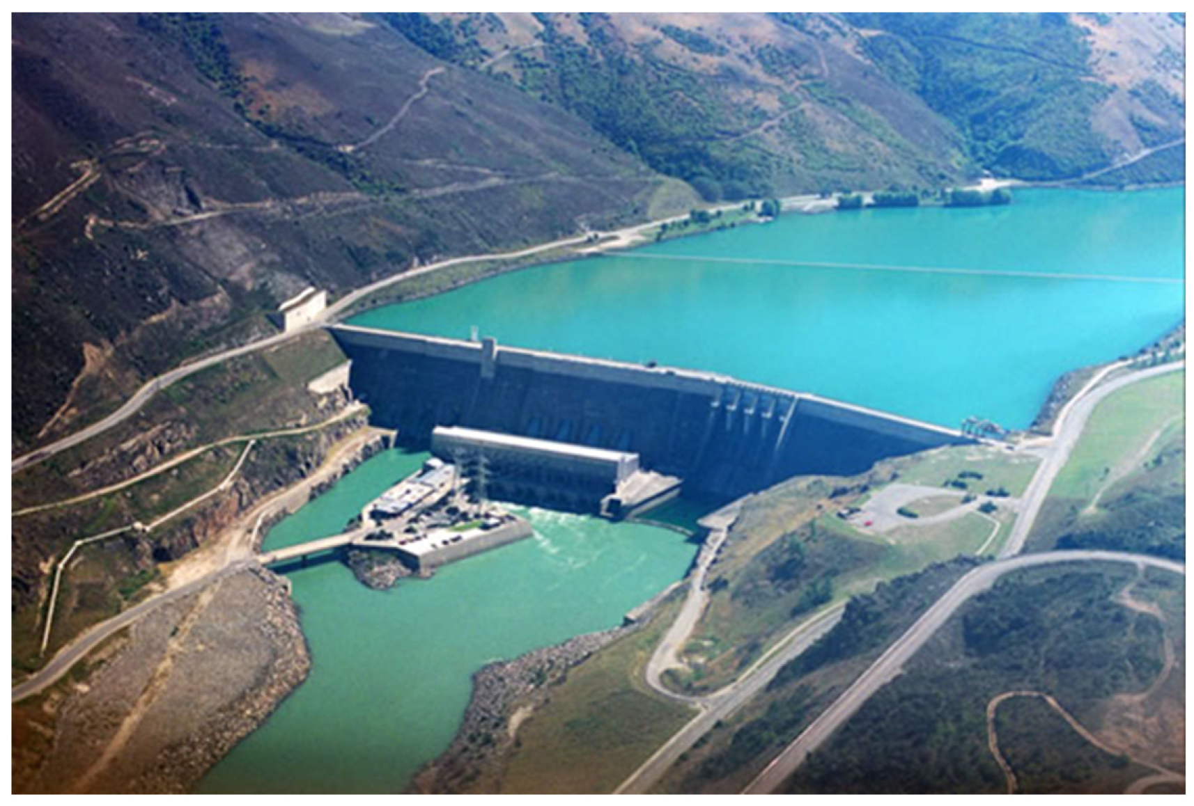
4.1. Greece
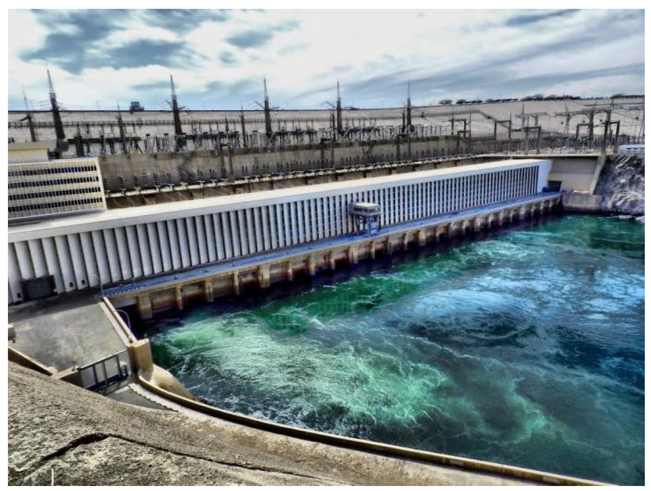
4.2. China
4.3. Türkiye
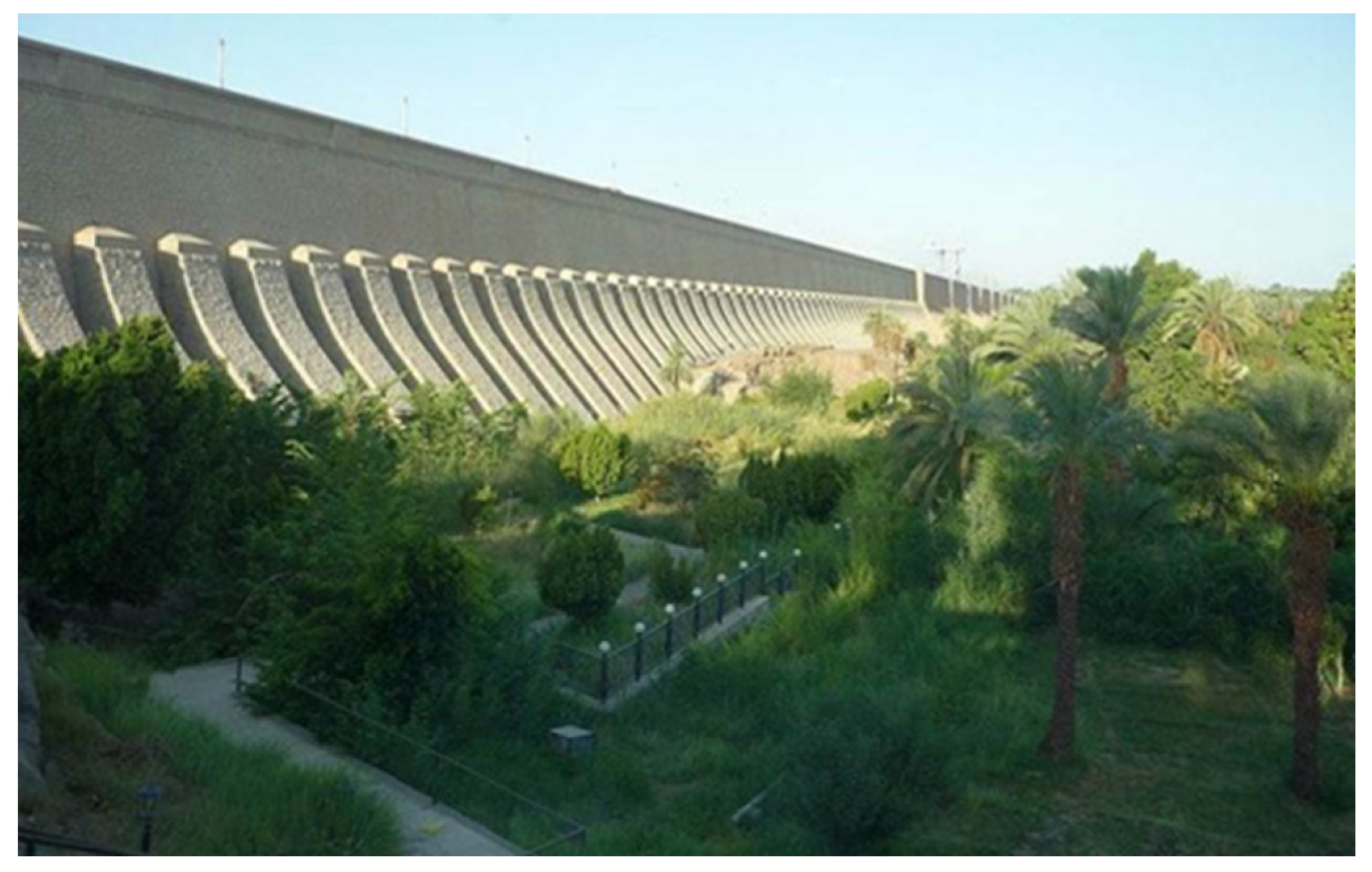
4.4. Egypt
4.5. Other Examples
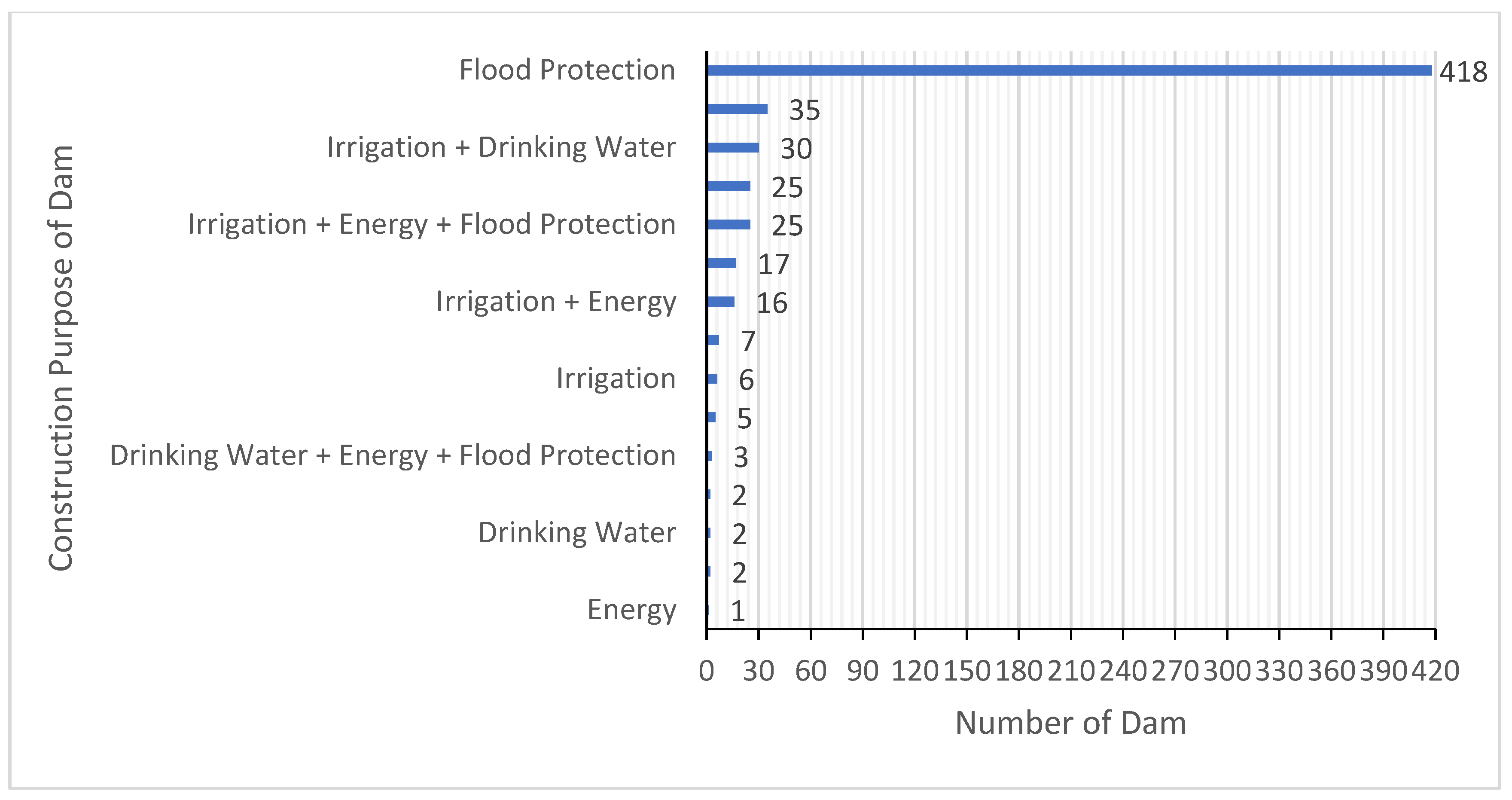
5. Emerging Trends and Challenges of Water Dams
5.1. Emergence of Mathematical Models in the Design and Operation of Dams
5.2. Balancing Benefits with Potential Negative Impacts
5.3. Shaping Future Multi-Purpose Dams
6. Rehabilitation of Dams
7. Epilogue
Author Contributions
Funding
Data Availability Statement
Acknowledgments
Conflicts of Interest
References
- Şenturk, F. Hydraulics of Dams and Reservoirs; Water Resources Publication: Highland Ranch, CO, USA, 1994; p. 788. ISBN 0-918334-80-2. [Google Scholar]
- Angelakis, A. Hydro-technologies in the Minoan Era. Water Sci. Technol. Water Supply 2017, 17, 1106–1120. [Google Scholar] [CrossRef]
- Antoniou, G.; Kathijotes, N.; Spyridakis, D.; Angelakis, A. Historical development of technologies for water resources management and rainwater harvesting in the Hellenic civilizations. Int. J. Water Resour. Dev. 2014, 30, 680–693. [Google Scholar] [CrossRef]
- Jarrige, C. The figurines of the first farmers at Mehrgarh and their offshoots. Pragdhara 2008, 18, 155–166. [Google Scholar]
- Quddus, S.A. Sindh: The Land of Indus Civilisation; Royal Book. Co.: Karachi, Pakistan, 2010. [Google Scholar]
- Milanović, P. Dam engineering and its environmental aspects. In Encyclopedia of Sustainability Science and Technology; Springer: New York, NY, USA, 2012; pp. 2788–2804. [Google Scholar]
- Schmitt, R.J.P.; Rosa, L. Dams for hydropower and irrigation: Trends, challenges, and alternatives. Renew. Sustain. Energy Rev. 2024, 199, 114439. [Google Scholar] [CrossRef]
- Fahlbusch, H. Early dams. Proc. Inst. Civ. Eng.-Eng. Hist. Herit. 2009, 162, 13–18. [Google Scholar] [CrossRef]
- Sanizadeh, S.K. Novel hydraulic structures and water management in Iran: A historical perspective. Options Mediterr. 2008, 83, 26–43. [Google Scholar]
- IRCOLD; Iranian National Committee on Large Dams. A General View on Iranian Dams, Past-Present-Future; Ministry of Energy: Teheran, Iran, 1993. [Google Scholar]
- Milanović, P.T. Dam Engineering and Its Environmental Aspects. In Environmental Geology; Encyclopedia of Sustainability Science and Technology Series; LaMoreaux, J., Ed.; Springer: New York, NY, USA, 2019. [Google Scholar]
- TNA. Tasnim News Agency. Amir Dam: One of the Most Glorious Ancient Dams. Retrieved 8 November 2023. 2017. Available online: https://www.tasnimnews.com/en/news/2017/07/17/1460596/amir-dam-one-of-the-most-glorious-ancient-dams (accessed on 19 June 2024).
- Vasilakis, A. Minoan Civilization; Iraklion: Crete, Greece, 2000. (In Greek) [Google Scholar]
- Betancourt, P.P. The Dams and Water: Management Systems of Minoan Psei-Ra; INSTAP Accademy Press: Philadelphi, PA, USA, 2012. [Google Scholar]
- Baba, A.; Tsatsanifos, C.; El Gohary, F.; Palerm, J.; Khan, S.; Mahmoudian, S.A.; Ahmed, A.T.; Tayfur, G.; Dialynas, Y.G.; Angelakis, A.N. Developments in water dams and water harvesting systems throughout history in different civilizations. Int. J. Hydrol. 2018, 2, 150–166. [Google Scholar] [CrossRef]
- Torun, Ö. Roman Period Dams in Anatolia. Master’s Thesis, Ankara University, Social Sciences Institute, Archaeology Department, Classical Archaeology Science Branch, Ankara, Turkey, 2020. Available online: http://hdl.handle.net/20.500.12575/72970 (accessed on 24 June 2024).
- Baykan, N.O.; Baykan, N. Water Engineering in Anatolia Over Millennia. In 4th Symposium on Hydraulic Structures; IMO: Antalya, Turkey, 2015; pp. 145–156. Available online: https://www.imo.org.tr/eklenti/6575,176463817pdf.Pdf?0&_Tag1=0a33b7f856d3c009cb423f319175a5bcf0823bf2 (accessed on 25 July 2023). (In Turkish)
- Üke, A. Water Weirs and Pool Structures in the Hittite Period in the Light of Philological-Archaeological Data. Hitit Univ. Soc. Sci. Inst. J. Anarsan Symp. 2018, 11, 1529–1551. (In Turkish) [Google Scholar] [CrossRef]
- İpek, Ö.; İbiş, R. Çakır Village Hittite Dam: Preliminary Report on the 2012 Excavation and Survey Work. In Proceedings of the 3rd Çorum Excavation and Research Symposium, Çorum, Turkey, 3 September 2012; pp. 37–59. Available online: https://corum.ktb.gov.tr/Eklenti/112498,3-kazisempozyumpdf.pdf?0 (accessed on 25 July 2023). (In Turkish).
- Belli, O. A Comprehensive View of Urartian Dams Discovered in the Eastern Anatolia Region; Turkish Historical Society: Belleten, LX, USA; Ankara, Turkey, 1996; pp. 631–756. (In Turkish) [Google Scholar]
- Belli, O. Investigation of Urartian Dams, Reservoirs, and Irrigation Channels in the Eastern Anatolia Region in 2010. In Proceedings of the 29th Research Results Meeting, Malatya, Turkey, 23–28 May 2011; Volume 3, pp. 293–316. Available online: http://www.kulturvarliklari.gov.tr/Eklenti/4650,29arastirma3.pdf?0 (accessed on 25 July 2023). (In Turkish).
- Özsoy, S. Evaluation of Water Structures Built During the Hittite Period from the Perspective of the Historical Development of Science. Mavi. Atlas. 2017, 5, 489–501. (In Turkish) [Google Scholar] [CrossRef]
- Öziş, Ü. Historical Dams in Turkey; Ankara, Turkey, 1999. [Google Scholar]
- Öziş, Ü. Water works through four millenia in Turkey. Environ. Process. 2015, 2, 559–573. [Google Scholar] [CrossRef]
- Apaydın, A.; Çınaroğlu, A.; Inal, I.; Dilektaşlı, C.; Çelik, D. Return to 3260 Years Ago at Çorum-Alaca Mound: Improvement of the Ancient Hittite Dam and Revival of Hittite Life. State Hydraul. Work. Tech. Bull. 2020, 18–35. (In Turkish) [Google Scholar]
- Çelik, D. Architectural Findings in the Light of the Most Recent Excavations in Alaca Höyük. Master’s Thesis, Ankara, Turkey, 2008; pp. 1–201. (In Turkish). [Google Scholar]
- Encyclopedia, B. Marid, Yemen. Dam History. 2023. Available online: https://www.britannica.com/place/Marib (accessed on 25 July 2023).
- Ma, Z. Impression and enlightenment of Dujiangyan Irrigation Project. China Water Resour. 2020, 71, 4–11. [Google Scholar]
- Li, S. Dujiangyan Irrigation Project:a great splendid program. Disaster Prev. Expo. 2021, 21, 48–49. [Google Scholar]
- Belli, O. Investigation of Urartian Dams, Reservoirs, and Irrigation Channels in the Eastern Anatolia Region in 2000. In Proceedings of the 19th Research Results Meeting, Ankara, Turkey, 2001; Volume 2, pp. 239–256. Available online: http://www.envanter.gov.tr/belge/makale/detay/68037 (accessed on 25 July 2023). (In Turkish).
- Öğün, B. Irrigation Facilities of Urartu and the Shamram (Semiramis) Canal in Van; Ankara, Turkey, 1970. [Google Scholar]
- Bildirici, M. Historical Water Structures: Konya, Karaman, Niğde, Aksaray, Yalvaç, Side, Mut, Silifke; Ministry of Environment and Forestry, State Hy-draulic Works Directorate General: Ankara, Turkey, 2009. Available online: https://cdniys.tarimorman.gov.tr/api/File/GetFile/425/KonuIcerik/767/1115/DosyaGaleri/tarihi-su-yapilari.pdf (accessed on 25 July 2023). (In Turkish)
- Kadıoğlu, M.; Görkay, K.; Mitchell, S. Ankyra in the Roman Period; Istanbul, Turkey, 2011; ISBN 978-975-08-2025-0. [Google Scholar]
- Belli, O. Investigation of Urartian Dams and Irrigation Systems in the Eastern Anatolia Region in 1997. In Proceedings of the 16th Research Results Meeting, Ankara, Turkey, 1998; Volume 2, pp. 267–291. Available online: http://www.envanter.gov.tr/belge/makale/detay/67830 (accessed on 25 July 2023). (In Turkish).
- Angelakis, A.N.; Capodaglio, A.G.; Passchier, C.W.; Valipour, M.; Krasilnikoff, J.; Tzanakakis, V.A.; Sürmelihindi, G.; Baba, A.; Kumar, R.; Haut, B. Sustainability of Water, Sanitation, and Hygiene: From Prehistoric Times to the Present Times and the Future. Water 2023, 15, 1614. [Google Scholar] [CrossRef]
- Koutsoyiannis, D.; Zarkadoulas, N.; Angelakis, A.N.; Tchobanoglous, G. Urban water management in Ancient Greece: Legacies and lessons. J. Water Resour. Plan. Manag. 2008, 134, 45–54. [Google Scholar] [CrossRef]
- Murray, W.M. The ancient dam of the Mytikas Valley. Am. J. Archaeol. 1984, 88, 195–203. [Google Scholar] [CrossRef]
- Zarkadoulas, N. The Dam of Ancient Alyzia (Το φράγμα της αρχαίας Aλυζίας). Master’s Thesis, Department of Water Recourses. Hydraulic and Maritime Engineering-National Technical University of Athens, Athens, Greece, 2005; 94p. (In Greek). [Google Scholar]
- Krasilnikoff, J.A. Irrigation as Innovation in Ancient Greek Agriculture. World Archaeol. 2010, 42, 108–121. Available online: http://www.jstor.org/stable/25679730 (accessed on 24 June 2024). [CrossRef]
- Hodge, A.T. Reservoirs and Dams. In Handbook of Ancient Water Technology; Wikander, Ö., Ed.; Technology and Change in History; Brill: Leiden, The Netherlands, 2000; Volume 2, pp. 331–339. [Google Scholar]
- Lindner, M. Nabaräische Talsperren. In Historische Talsperren; Garbrecht, G., Ed.; Verlag Konrad Wittwer: Stuttgart, Germany, 1987; Volume 1, pp. 147–174. [Google Scholar]
- Schnitter, N. Römische Talsperren. Antike Welt. 1978, 8, 25–32. [Google Scholar]
- Schnitter, N. Die Entwicklungsgeschichte der Pfeilerstaumauer. In Historische Talsperren; Garbrecht, G., Ed.; Verlag Konrad Wittwer: Stuttgart, Germany, 1987; Volume 1, pp. 57–74. [Google Scholar]
- Schnitter, N. Die Entwicklungsgeschichte der Bogenstaumauer. In Historische Talsperren; Garbrecht, G., Ed.; Verlag Konrad Wittwer: Stuttgart, Germany, 1987; Volume 1, pp. 75–96. [Google Scholar]
- Garbrecht, G.E. Historische Talsperren; Verlag Konrad Wittwer: Stuttgart, Germany, 1991; Volume 2. [Google Scholar]
- Smith, N. A History of Dams; Peter Davies: London, UK, 1971; pp. 25–49. ISBN 0-432-15090-0. [Google Scholar]
- Viollet, P.-L. Water Engineering in Ancient Civilizations. 5000 Years of History; CRC Press: Boca Raton, FL, USA, 2007. [Google Scholar]
- Vogel, A. Die historische Entwicklung der Gewichtsmauer. In Historische Talsperren; Garbrecht, G., Ed.; Verlag Konrad Wittwer: Stuttgart, Germany, 1987; Volume 1, pp. 47–56. [Google Scholar]
- Hodge, A.T. Roman Aqueducts & Water Supply; Duckworth: London, UK, 1992; ISBN 0-7156-2194-7. [Google Scholar]
- Smith, N. The Roman Dams of Subiaco. Technol. Cult. 1970, 11, 58–68. [Google Scholar] [CrossRef]
- Martínez, S.F.; Rodríguez, D.G. Descubrimiento y análisis de dos nuevas conducciones en el entorno de Mérida: Avances y resultados. In Ingeniería Hidráulica Romana: VI Congreso Internacional de las Obras Públicas Romanas; Moreno Gallo, I., Ed.; Instituto de Estudios Riojanos: La Rioja, Spain, 2023; pp. 169–187. [Google Scholar]
- Arenillas, M. Presas romanas en España. Ing. Territ. 2003, 62, 72–78. [Google Scholar]
- Marcellin, C. Les aqueducs de Vienne. Cart. Archéologique Gaule 2014, 38, 157–170. [Google Scholar]
- Burgers, A. The Water Supplies and Related Structures of Roman Britain; BAR Publishing: Oxford, UK, 2001. [Google Scholar]
- Yaşar, M.; Baykan, N.O.; Tanriöver, Y.E. Sebastapolis (Kızılca/Tavas/Denizli) Pınar Compilation Structure and Embankment. In Proceedings of the Historical Water Structures Conference, Izmir, Turkey, 26–27 June 2008; pp. 129–132. (In Turkish). [Google Scholar]
- Casagrande, M. Gli impianti di adduzione idrica romani in Byzacena e in Zeugitana. In Studi di Storia e di Archeologia; Nuove Grafiche Puddu: Ortacesus, Italy, 2008; Volume 4. [Google Scholar]
- Slimani, S. Types d’ouvrages hydrauliques antiques dans le Hodna occi-dental Etat des lieux. Nouvelles de l’Archéologie Algérienne 2020, 2, 92–99. [Google Scholar]
- Ferjaoui, A.; Pailler, J.-M.; Darles, C.; Bordes, J.-L. L’approvisionnement en eau de Zama (Tunisie), le barrage d’Aïn Jebour. In Regards Croisés d’Orient et d’Occident; Baratte, F., Robin, C.J., Rocca, E., Eds.; Les Barrages dans l’Antiquité tardive; 2013; Available online: https://africa.hypotheses.org/2946 (accessed on 25 July 2023).
- Sanchez Lopez, E. Los acueductos urbanos en Hispania. In Arquitectura Hidráulica y Forma Urbana; Camara Muñoz, A., Revuelta Pol, B., Eds.; Asociación Cultural y de Estudios Jamilenudos (ASCUESJA): Jaén, Spain, 2019; pp. 11–28. [Google Scholar]
- Bouffier, S.; Curie, J.; Dumas, V.; Lenhardt, P.; Marchello, A.; Ollivier, V.; Paillet, J.-L.; Trefiletti, M.; Turci, M. Aux Origines du Galermi. Un Aqueduc à Travers L’histoire; Maison Meditérannéenne des Sciences de l’Homme, Aix-Marseille Université: Aix-en-Provence, France, 2018. [Google Scholar]
- Rigal, D. L’aqueduc antique de Cahors et ses captages. In L’eau: Usages, Risques et Représentations dans le Sud-Ouest de la Gaule et le Nord de la Pé-Ninsule Ibérique; Bost, J.-P., Ed.; Aquitania Université de Bordeaux M de Montaigne: Pessac, France, 2012; Aquitania supplement 21; pp. 443–456. [Google Scholar]
- Breeze, D.J.; Jilek, S.; Graafstal, E.; Willems, W.J.H.; Bödecker, S. Frontiers of the Roman Empire. 2018. Available online: https://whc.unesco.org/en/list/430/ (accessed on 25 July 2023).
- Yongmei, H. General Survey and Research on the Longshou Canal of Guanzhong Water Conservancy Project. Relics Museolgy 2009, 26, 80–83. [Google Scholar]
- Li, P. Irrigation in the Upper Reaches of the Han River in History. Agric. Archaeol. 1990. [Google Scholar]
- Görcelioğlu, E. Historical Weirs in Belgrad Forest. J. Fac. For. Istanb. Univ. 1985, 42–59. (In Turkish) [Google Scholar] [CrossRef]
- İpek, Ö.; Sökmen, E. Örükaya Archaeological Excavation and Research Project: 2017 Work Report. In Proceedings of the 40th Excavation Results Meeting, Çanakkale, Turkey, 7–11 May 2018; Volume 3, pp. 225–238. Available online: https://kvmgm.ktb.gov.tr/Eklenti/63785,40kazi3pdf.pdf?0 (accessed on 25 July 2023). (In Turkish).
- Rheidt, K. Aizanoi, Çavdarhisar Guide; Ankara, Turkey, 1998; pp. 3–28. [Google Scholar]
- Özer, E.; Özcan, S. Archaeological and Restoration Work at Aizanoi Ancient City Penkalas Creek. Art-Sanat J. 2022, 295–318. (In Turkish) [Google Scholar] [CrossRef]
- Bildirici, M. Historical Irrigation, Water Storage, and Flood Protection Facilities. Ministry of Environment and Forestry, State Hydraulic Works Directorate General, Ankara. 2009. Available online: https://cdniys.tarimorman.gov.tr/api/File/GetFile/425/KonuIcerik/767/1115/DosyaGaleri/tarihi-sulama-su-depolama-ta%C5%9Fkin-koruma-tesisleri.pdf (accessed on 25 July 2023). (In Turkish)
- Ozis, U. Historical water schemes in Turkey. Int. J. Water Resour. Dev. 1996, 12, 347–384. [Google Scholar] [CrossRef]
- Çeçen, K. DSI Conference on the Development of Water and Soil Resources/Session on Historical Water Structures in Anatolia, 12–14 April 1994, Ankara/Proceedings Book 1994; Volume 1, pp. 11–22.
- Shaw, J.; Sutcliffe, J. Ancient dams, settlement archaeology and Buddhist propagation in central India: The hydrological background. Hydrol. Sci. J. 2003, 48, 277–291. [Google Scholar] [CrossRef]
- Parker, H. Ancient Ceylon. Repr. 1981; Asian Educational Services: New Delhi, India, 1909; ISBN 81-206-0208-0. [Google Scholar]
- Shaw, J.; Sutcliffe, J. Ancient irrigation works in the Sanchi area: An archaeological and hydrological investigation. S. Asian Stud. 2001, 17, 55–75. [Google Scholar] [CrossRef]
- Beach, T.; Dunning, N. An ancient Maya reservoir and dam at Tamarindito, el Peten, Guatemala. Lat. Am. Antiq. 1997, 8, 20–29. [Google Scholar] [CrossRef]
- Angelakis, A.N.; Capodaglio, A.G.; Valipour, M.; Krasilnikoff, J.; Ahmed, A.T.; Mandi, L.; Tzanakakis, V.A.; Baba, A.; Kumar, R.; Zheng, X. Evolution of Floods: From Ancient Times to the Present Times (ca 7600 BC to the Present) and the Future. Land 2023, 12, 1211. [Google Scholar] [CrossRef]
- Öziş, Ü. Ancient Water Works in Anatolia. Int. J. Water Resour. Dev. 1987, 3, 55–62. [Google Scholar] [CrossRef]
- Arif, A.Ş.; Keçeci, N. Investigation of Water Dams Built in Istanbul during the Ottoman State Period. Online J. Art Des. 2021, 9. [Google Scholar]
- Güngör, S.S. Ottoman Hydraulic Architecture and Ottoman Water Structures in the 19th Century. Turk. Hydraul. J. 2021, 5, 32–48. Available online: https://dergipark.org.tr/tr/pub/turhidder/issue/61342/912922 (accessed on 25 July 2023).
- Döring, M. Energieerzeugung Unter Tage–Die Reichenbach-Jordan’schen Wassersäulenmaschinen. In UNESCO-Weltkulturerbe Oberharzer Wasserwirtschaft; Schriften der DWhG 19; Ohlig, C., Ed.; Siegburg, Germany, 2012; pp. 39–59. ISBN 978-3-8482-0803-6. [Google Scholar]
- Roseneck, R. Die Oberharzer Wasserwirtschaft als UNESCO-Weltkulturerbe. In UNESCO-Weltkulturerbe Oberharzer Wasserwirtschaft; Schriften der DWhG. 19; Ohlig, C., Ed.; Siegburg, Germany, 2012; pp. 1–21. ISBN 978-3-8482-0803-6. [Google Scholar]
- OECD. Multi-Purpose Water Infrastructure Policy: Perspectives Recom-Mendations to Maximize Economic Benefits; OECD: Paris, France, 2017; Available online: https://www.oecd.org/env/outreach/MPWI_Perspectives_Final_WEB.pdf (accessed on 25 July 2023).
- Rehman, S.; Al-Hadhrami, L.M.; Alam, M.M. Pumped hydro energy storage system: A technological review. Renew. Sustain. Energy Rev. 2015, 44, 586–598. [Google Scholar] [CrossRef]
- Koutsoyiannis, D. Past and modern water problems: Progress or regression? In IWA Regional Symposium on Water; International Water Association: London, UK, 2014. [Google Scholar]
- Fragkos, E. The Mesochora Dam. European Parliament, Brussels, Belgium, Retrieved 24 October 2022. 2022. Available online: https://www.europarl.europa.eu/doceo/document/E-9-2022-003391_EN.html (accessed on 25 July 2023).
- Christofides, A.; Efstratiadis, A.; Koutsoyiannis, D.; Sargentis, G.-F.; Hadjibiros, K. Resolving conflicting objectives in the management of the Plastiras Lake: Can we quantify beauty? Hydrol. Earth Syst. Sci. 2005, 9, 507–515. [Google Scholar] [CrossRef]
- Anonymous. Kremasta (lake). Wikipedia. 2023. Available online: https://en.wikipedia.org/wiki/Kremasta_(lake) (accessed on 25 July 2023).
- Manariotis, I.D.; Yannopoulos, P.C. Adverse effects on Alfeios River Basin and an integrated management framework based on sustainability. Environ. Manag. 2004, 34, 261–269. [Google Scholar] [CrossRef]
- Tsatsanifos, C.; Mihalis, I. Tunnelling in Greece: Past, Present, and Future. In Proceedings of the 2nd Eastern European Tunnelling Conference, Athens, Greece, 28 September–1 October 2014. [Google Scholar]
- Wessels, J.I.; Vardakos, S.; Weingartner, H.; Eslamian, S.; Angelakis, A.N. Underground aqueducts: Past, present, and future trends. In Underground Aqueducts Handbook; CRC Press: Boca Raton, FL, USA, 2016; pp. 491–509. [Google Scholar]
- Grandori, R.; Jaeger, M.; Antonini, F.; Vigl, L. Evinos-Mornos Tunnel-Greece. Construction of a 30 km long hydraulic tunnel in less than three years under the most adverse geological conditions. In Proceedings of the RECT, San Francisco, Society for Mining, Metallurgy, and Exploration 1995; pp. 747–767.
- Jackson, D.C.; Brown, J.G. Dam Engineering. Encyclopedia Britannia. 2003. Available online: https://www.britannica.com/topic/Three-Gorges-Dam/History-and-controversy-of-the-Three-Gorges-Dam (accessed on 25 July 2023).
- Angelakis, A.N. About Dams: Past, Present and Future. PATRIS of Irakli-on, Greece 15 October 2015. 2015. Available online: https://archive.patris.gr/articles/289182 (accessed on 24 June 2024). (In Greek).
- Xinhua, Y. Three Gorges Hydropower Station Hits World Record of Electricity Generation. 2021. Available online: http://www.xinhuanet.com/english/2021-01/05/c_139642485.htm (accessed on 25 July 2023).
- DSİ. Soil and Water Resources. General Directorate of State Hydraulic Works (DSİ). 2023. Available online: https://www.dsi.gov.tr/sayfa/detay/754# (accessed on 25 July 2023). (In Turkish)
- Yiğitbaşıoğlu, H. Dams in Turkey. J. Turk. Geogr. Res. Appl. Cent. 1996, 5, 171–181. Available online: http://tucaum.ankara.edu.tr/wp-content/uploads/sites/280/2015/08/tucaum5_7.pdf (accessed on 25 July 2023). (In Turkish).
- Erdoğan, G. Dams in Turkey. Data source: Netdata. 2023. Available online: https://www.netdata.com/member/project/91e87094#selectoptions (accessed on 25 July 2023).
- Karabatan, Y. The Importance of Water and Soil Resources and Applied Strategy-Water Structures, Dams. Türkiye Mühendislik Haberleri Dergisi, Issue: 442-443/51-200672-3, 2006; pp. 90–115. Available online: https://eski.imo.org.tr/resimler/dosya_ekler/be9fde963dd860b_ek.pdf?dergi=154 (accessed on 25 July 2023). (In Turkish).
- Özgen, Y.; Büyüktolu, R. The First Dam of the Republic: Çubuk Dam (1929–1936). J. Atatürk Yolu 2016, 15. (In Turkish) [Google Scholar] [CrossRef]
- Öztekin Eke, D. The Status of the Cultural Heritage Under Dam Lakes and Protection of This Cultural Heritage. Master’s Thesis, İstanbul University, Institute of Social Sciences, Department of Conservation and Restoration of Movable Cultural Heritage, Istanbul, Turkey, 2014. Available online: https://acikbilim.yok.gov.tr/handle/20.500.12812/174955 (accessed on 25 July 2023).
- Polatoğlu, M.G. The First Dam Built within the Scope of the Water Case in The Early Republican Period: Çubuk Dam. J. Atatürk Yolu 2019, 343–380. Available online: https://dergipark.org.tr/tr/pub/ankuayd/issue/51828/675142 (accessed on 25 July 2023). (In Turkish).
- Ertunç, A. The Geological Problems of the Large Dams Constructed on the Euphrates River (Turkey). Eng. Geol. 1999, 51, 167–182. [Google Scholar] [CrossRef]
- Şehitoğlu, N. Geomorphological and Hydrogeological Observations in the Vi-cinity of the Atatürk Dam. J. Türk Coğrafya 1994, 495–513. Available online: https://dergipark.org.tr/tr/pub/tcd/issue/21258/228186 (accessed on 25 July 2023). (In Turkish).
- ŞGDWSA. Atatürk Dam. Şanlıurfa General Directorate of Water and Sewerage Administration (ŞGDWSA). 2023. Available online: https://www.suski.gov.tr/icerik/39/75/ataturk-baraji#:~:text=Nehir%20seviyesinden%20yüksek-lik%20bakımından%20minimum,Eni%20ise%2015%20m%20dir.&text=2400%20MW%20gücüyle%20yıllık%208%20900%20GW%20elektrik%20enerjisi%20üretim%20kapasitesine%20sahiptir (accessed on 25 July 2023). (In Turkish)
- Çakırtaş, Ş. A Transformation Story: Tigris-Euphrates. Indyturk.com. Re-trieved 18 May 2021. 2021. Available online: https://www.indyturk.com/node/360836/türkiçeden-sesler/bir-başkalaşma-hikayesi-dicle-fırat-4 (accessed on 25 July 2023). (In Turkish).
- Yıldırım, A. Karakaya Dam and Its Effects on the Natural Environment. Dicle University. J. Ziya Gökalp Educ. Fac. 2006, 32–39. Available online: https://dergipark.org.tr/tr/pub/zgefd/issue/47964/606855 (accessed on 25 July 2023). (In Turkish).
- Platform, E.T. Active Capacity. Data Source: DSI. 2023. Available online: https://seffaflik.epias.com.tr/transparency/barajlar/aktif-doluluk.xhtml (accessed on 25 July 2023).
- Turfan, M. Atatürk Dam and Hydroelectric Power Plant. J. Türkiye Mühendislik Haberleri 1981, 297, 3–15. Available online: https://www.imo.org.tr/eklenti/3297,3408pdf.pdf?0 (accessed on 25 July 2023). (In Turkish).
- Ultraenerji. Atatürk Dam and Hydroelectric Power Plant. Retrieved 31 January 2014. 2014. Available online: https://www.ultraenerji.com/hidroelektrik/hidroelektrik-santraller/ataturk-baraji-ve-hidroelektrik-santrali.html (accessed on 25 July 2023). (In Turkish).
- Özdemir, M.A.; Özgen, N. Water Leaks from Keban Dam and Its Natural Potential. Afyon Kocatepe Univ. J. Soc. Sci. 2004, 6, 65–85. (In Turkish) [Google Scholar]
- Güner, B. Culture Fisheries in Lake Keban. Fırat Univ. J. Soc. Sci. 2016, 25. (In Turkish) [Google Scholar] [CrossRef]
- Akbay, N.; Anul, N.; Yerli, S.; Soyupak, S.; Yurteri, C. Seasonal distribution of large phytoplankton in the Keban Dam Reservoir. J. Plankton Res. 1999, 21, 771–787. [Google Scholar] [CrossRef]
- Alpaslan, K.; Sesli, A.; Tepe, R.; Özbey, N.; Birici, N.; Şeker, T.; Koçer, M.A.T. Vertical and seasonal changes of water quality in Keban Dam Reservoir. J. Fish. Sci. 2012, 6, 252–262. [Google Scholar] [CrossRef]
- Gülşen, K. The influence of dams on surrounding climate: The case of Keban Dam. Gaziantep Univ. J. Soc. Sci. 2016, 15, 193–204. [Google Scholar] [CrossRef]
- EÜAŞ. Keban HEPP. The Electricity Generation Corporation (EÜAŞ). 2023. Available online: https://www.euas.gov.tr/en-us/power-plants/keban-hepp (accessed on 25 July 2023).
- Aydin, M.C.; Ulu, A.E.; Karaduman, Ç. CFD analysis of Ilısu Dam sluice outlet. Turk. J. Sci. Technol. 2018, 13, 119–124. [Google Scholar]
- EÜAŞ. Ilısu HES. The Electricity Generation Corporation (EÜAŞ). 2023. Available online: https://www.euas.gov.tr/santraller/ilisu-hes (accessed on 25 July 2023). (In Turkish)
- DSİ. The Longest Dam in The World, Ilısu, was Opened with a 2 Thousand Meters Ribbon. General Directorate of State Hydraulic Works (DSİ). 2021. Available online: https://dsi.gov.tr/Haber/Detay/4170 (accessed on 25 July 2023). (In Turkish)
- Ertunç, A.; Çetin, H. Dam Projects Affected by Landslides on the Çoruh River, Turkey. Bull. Eng. Geol. Environ. 2007, 66, 335–343. [Google Scholar] [CrossRef]
- DSİ. Yusufeli Dam and Hepp Project. General Directorate of State Hydrau-lic Works (DSİ). 2022. Available online: https://bolge26.dsi.gov.tr/haber/detay/2352 (accessed on 25 July 2023). (In Turkish)
- Apaydın, A. Applicability of Underground Dams in Turkey and Evaluation of the Underground Dams Action Plan. Konya J. Eng. Sci. 2022, 10, 130–146. (In Turkish) [Google Scholar] [CrossRef]
- Schamp, H. Sadd el-Ali, der Hochdamm von Assuan (Sadd el-Ali, the High Dam of Aswan). Geowiss. Unserer Zeit 1983, 1, 51–85. (In Germany) [Google Scholar]
- Willcocks, W.; Craig, J.I. Egyptian Irrigation; E. & F. N. Spon: London, UK, 1913. [Google Scholar]
- Cairo, G.E. Rehabilitation of Hydropower Plants in Aswan–Securing an Important Renewable Energy Resource. 2022. Available online: http://kairo.diplo.de/eg-de/aktuelles/-/2523132 (accessed on 25 July 2023).
- Çeçen, K. Sinan’s Water Supply System in İstanbul; Istanbul Water and Sewerage Administration, General Directorate: İstanbul, Turkey, 1992; p. 218. [Google Scholar]
- Elba, E.; Urban, B.; Ettmer, B.; Farghaly, D. Mitigating the impact of climate change by reducing evaporation losses: Sediment removal from the High Aswan Dam reservoir. Am. J. Clim. Chang. 2017, 6, 230. [Google Scholar] [CrossRef]
- Chen, J.; Shi, H.; Sivakumar, B.; Peart, M.R. Population, water, food, energy and dams. Renew. Sustain. Energy Rev. 2016, 56, 18–28. [Google Scholar] [CrossRef]
- Dorcey, A.H. Large Dams: Learning from the Past Looking at the Future: Workshop Proceedings, Gland, Switzerland, 11–12 April 1997; World Bank Publications: Gland, Switzerland, 1997. [Google Scholar]
- Rippl, W. The capacity of storage-reservoirs for water-slpply.(including plate). In Minutes of the Proceedings of the Institution of Civil Engineers; Thomas Telford-ICE Virtual Library, 1883; pp. 270–278. [Google Scholar]
- Loucks, D.P.; Van Beek, E. Water Resource Systems Planning and Management: An Introduction to Methods, Models, and Applications; Springer: Berlin/Heidelberg, Germany, 2017. [Google Scholar]
- Alrayess, H.; Ülke, A.; Gharbia, S. Comparison of Different Techniques about Reservoir Capacity Calculation at Sami Soydam Sandalcık Dam. Celal Bayar Univ. J. Sci. 2018, 14, 23–29. [Google Scholar] [CrossRef]
- Hall, W.A.; Buras, N. The dynamic programming approach to water-resources development. J. Geophys. Res. 1961, 66, 517–520. [Google Scholar] [CrossRef]
- Hall, W.A.; Howell, D.T. The optimization of single-purpose reservoir design with the application of dynamic programming to synthetic hydrology samples. J. Hydrol. 1963, 1, 355–363. [Google Scholar] [CrossRef]
- Loucks, D.P. Some comments on linear decision rules and chance constraints. Water Resour. Res. 1970, 6, 668–671. [Google Scholar] [CrossRef]
- Nayak, S.C.; Arora, S.R. Optimal capacities for a multireservoir system using the linear decision rule. Water Resour. Res. 1971, 7, 485–498. [Google Scholar] [CrossRef]
- Yeh, W.W.G. Reservoir management and operations models: A state-of-the-art review. Water Resour. Res. 1985, 21, 1797–1818. [Google Scholar] [CrossRef]
- Ahmad, S.K.; Hossain, F.; Holtgrieve, G.W.; Pavelsky, T.; Galelli, S. Predicting the likely thermal impact of current and future dams around the world. Earth’s Future 2021, 9, e2020EF001916. [Google Scholar] [CrossRef]
- Boyé, H.; Vivo, M.d. The Environmental and Social Acceptability of Dams. 2016. Available online: http://journals.openedition.org/factsreports/4055 (accessed on 25 June 2024).
- Ahmed, A.T.; Elsanabary, M.H. Hydrological and environmental impacts of grand Ethiopian renaissance dam on the Nile river. In Proceedings of the Eighteenth International Water Technology Conference, IWTC18, Sharm El Sheikh, Egypt, 12–14 March 2015; pp. 12–14. [Google Scholar]
- Mulat, A.G.; Moges, S.A. Assessment of the impact of the Grand Ethiopian Renaissance Dam on the performance of the High Aswan Dam. J. Water Resour. Prot. 2014, 2014, 45460. [Google Scholar] [CrossRef]
- Jalali, L.; Zarei, M.; Gutiérrez, F. Salinization of reservoirs in regions with exposed evaporites. The unique case of Upper Gotvand Dam, Iran. Water Res. 2019, 157, 587–599. [Google Scholar] [CrossRef]
- Xenaki, K. Who Gains from Sabotage? TA NEA,”The news” Journal, 7/6/2023; Athens, Greece, 2023. (In Greek).
- Jazeera, A. All to Know About Ukraine’s Nova Kakhovka Dam Explosion. Al Jazeera News. 2023. Available online: https://www.aljazeera.com/news/2023/6/6/the-nova-kakhovka-dam-what-you-need-to-know (accessed on 6 June 2023).
- Zhang, J.; Shang, Y. Nexus of dams, reservoirs, climate, and the environment: A systematic perspective. Int. J. Environ. Sci. Technol. 2023, 20, 12707–12716. [Google Scholar]
- Hassan, S.; Masood, M.U.; Haider, S.; Anjum, M.N.; Hussain, F.; Ding, Y.; Shangguan, D.; Rashid, M.; Nadeem, M.U. Investigating the effects of climate and land use changes on rawal dam reservoir operations and hydrological behavior. Water 2023, 15, 2246. [Google Scholar] [CrossRef]
- Shi, W.; Qin, B. Sediment and nutrient trapping by river dams: A critical review based on 15-year big data. Curr. Pollut. Rep. 2023, 9, 165–173. [Google Scholar] [CrossRef]
- Zeng, Y.; Jing, T.; Xu, B.; Yang, X.; Jian, J.; Zong, R.; Wang, B.; Dai, W.; Deng, L.; Fang, N. Vectorized dataset of silted land formed by check dams on the Chinese Loess Plateau. Sci. Data 2024, 11, 348. [Google Scholar] [CrossRef] [PubMed]
- Wang, T.; Li, Z.; Ge, W.; Zhang, Y.; Jiao, Y.; Zhang, H.; Sun, H.; van Gelder, P. Risk assessment methods of cascade reservoir dams: A review and reflection. Nat. Hazards 2023, 115, 1601–1622. [Google Scholar] [CrossRef]
- Qing, D.; Thibodeau, J.G.; Williams, M.R.; Dai, Q.; Yi, M.; Topping, A.R. The River Dragon Has Come!: Three Gorges Dam and the Fate of China’s Yangtze River and Its People; Routledge: London, UK, 2016. [Google Scholar]
- Cheng, L.; Opperman, J.J.; Tickner, D.; Speed, R.; Guo, Q.; Chen, D. Managing the Three Gorges Dam to Implement Environmental Flows in the Yangtze River. Front. Environ. Sci. 2018, 6, 64. [Google Scholar] [CrossRef]
- Dam, T.G. Missouri Chapter American Fisheries Society. 20 April 2002. Available online: https://web.archive.org/web/20081118193954/, https://www.moafs.org/newsletter/April%202002/3gorgestats.htm (accessed on 25 June 2024).
- Tzanakakis, V.A.; Angelakis, A.N.; Paranychianakis, N.V.; Dialynas, Y.G.; Tchobanoglous, G. Challenges and Opportunities for Sustainable Management of Water Resources in the Island of Crete, Greece. Water 2020, 12, 1538. [Google Scholar] [CrossRef]
- Vourdoubas, J. Estimation of solar electricity generation from floating photovoltaics installed in water dams in the island of Crete, Greece. Eur. J. Environ. Earth Sci. 2023, 4, 27–33. [Google Scholar] [CrossRef]
- Lele, S.; Del Bene, D.; Avcı, D.; Roa-Avendaño, T.; Roy, B.; Sahu, G.; Harris, M.; Moore, D. Values and knowledges in decision-making on environmentally disruptive infrastructure projects: Insights from large dams and mines. Curr. Opin. Environ. Sustain. 2023, 64, 101346. [Google Scholar] [CrossRef]
- Haftendorn, H. Water and international conflict. Third World Q. 2000, 21, 51–68. [Google Scholar] [CrossRef]
- Angelakis, A.N.; Valipour, M.; Ahmed, A.T.; Tzanakakis, V.; Paranychianakis, N.V.; Krasilnikoff, J.; Drusiani, R.; Mays, L.; El Gohary, F.; Koutsoyiannis, D.; et al. Water Conflicts: From Ancient to Modern Times and in the Future. Sustainability 2021, 13, 4237. [Google Scholar] [CrossRef]
- Hariri-Ardebili, M.A.; Mahdavi, G.; Nuss, L.K.; Lall, U. The role of artificial intelligence and digital technologies in dam engineering: Narrative review and outlook. Eng. Appl. Artif. Intell. 2023, 126, 106813. [Google Scholar] [CrossRef]
- Park, D.; You, H. A Digital Twin Dam and Watershed Management Platform. Water 2023, 15, 2106. [Google Scholar] [CrossRef]
- Central Water Commission of Ministry of Water Resources, River Development & Ganga Rejuvenation Government of India. Manual for Rehabilitation of Large Dams; 2018; Chapter 1; pp. 1–4. [Google Scholar]
- Association of State Dam Safety Officials (ASDSO). The Cost of Rehabilitation Dams in U.S.; ASDSO: Lexington, KY, USA, 2023. [Google Scholar]
- France, J.; Alvi, I.; Dickson, P.; Falvey, H.; Rigbey, S.; Trojanowski, J. Independent Forensic Team Report for Oroville Dam Spillway Incident; Final Report; 2018. [Google Scholar]
- Amini, R. Dez Dam Rehabilitation Project Role in Flood Damage Reduction. E3S Web Conf. 2022, 346, 02007. [Google Scholar] [CrossRef]
- Boroujeni, H.S. Sediment Management in Hydropower Dam (Case Study–Dez Dam Project). In Hydropower Practice and Application; Boroujeni, H.S., Ed.; IntechOpen Limited: London, UK, 2011; pp. 115–142. ISBN 978-953-51-0164-2. [Google Scholar]
- Delpasand, M.; Fallah-Mehdipour, E.; Azizipour, M.; Jalali, M.; Safavi, H.R.; Saghafian, B.; Loáiciga, H.A.; Babel, M.S.; Savic, D.; Bozorg-Haddad, O. Forensic engineering analysis applied to flood control. J. Hydrol. 2021, 594, 125961. [Google Scholar] [CrossRef]
- Sepehri, M.; Soudkhah, M.; Paknejad, A. Sedimentation and Assigning of Dredger for Dez Dam Hydropower Intake. Proc. Ninth Int. Sympo-Sium River Sediment. 2004, 17133, 1023–1028. Available online: https://www.iahr.org/library/infor?pid=17133 (accessed on 24 June 2024).
- CWC (Central Water Commission). Manual for Rehabilitation of Large Dams, Central Water Commission Central Dam Safety Organization Doc. No. CDSO_MAN_DS_02_v1.0. 2017. Available online: https://damsafety.cwc.gov.in/ecm-includes/PDFs/Manual_for_Rehabilitation_of_Large_Dams.pdf (accessed on 24 June 2024).
- WB. The World Bank. The Kariba Dam Rehabilitation Project: Fact Sheet. 2014. Available online: https://documents1.worldbank.org/curated/en/312711468191648859/pdf/PAD9070P146515010Box385378B00OUO090.pdft (accessed on 24 June 2024).
- Parent, J.R.; Gold, A.J.; Vogler, E.; Lowder, K.A. Guiding decisions on the future of dams: A GIS database characterizing ecological and social considerations of Dam decisions. J. Environ. Manag. 2024, 351, 119683. [Google Scholar] [CrossRef]
- Cavuslu, M.; Inyurt, S. Determination of future creep and seismic behaviors of dams using 3D analyses validated by long-term levelling measurements. J. Civ. Struct. Health Monit. 2024, 14, 1505–1532. [Google Scholar] [CrossRef]
- Chen, D.; Huang, B.; Kang, F. A Review of Detection Technologies for Underwater Cracks on Concrete Dam Surfaces. Appl. Sci. 2023, 13, 3564. [Google Scholar] [CrossRef]
- Angelakis, A.N. Το Ενεργειακό πρόβλημα της Ελλάδος. PATRIS, Iraklion, Crete, Greece, 16 November 2022. 2022. Available online: https://www.patris.gr/2022/11/16/to-energeiako-provlima-tis-elladas/ (accessed on 24 June 2024).
- Zafarnejad, F. The contribution of dams to Iran’s desertification. Int. J. Environ. Stud. 2009, 66, 327–341. [Google Scholar] [CrossRef]
- Papadaki, C.; Soulis, K.; Ntoanidis, L.; Zogaris, S.; Dercas, N.; Dimitriou, E. Comparative assessment of environmental flow estimation methods in a Mediterranean mountain river. Environ. Manag. 2017, 60, 280–292. [Google Scholar] [CrossRef] [PubMed]


| Characteristics | Value |
|---|---|
| Basin area | 161.3 km2 |
| Highest basin altitude | 2140 m |
| Maximum designed lake level | 794 m |
| Spill level | 792 m |
| Minimum release level | 776 m |
| Lake area at spill level | 25 km2 |
| Lake area at minimum release level | 15 km2 |
| Mean annual inflow | 153 hm3 |
| Mean annual inflow depth | 1029 mm |
Disclaimer/Publisher’s Note: The statements, opinions and data contained in all publications are solely those of the individual author(s) and contributor(s) and not of MDPI and/or the editor(s). MDPI and/or the editor(s) disclaim responsibility for any injury to people or property resulting from any ideas, methods, instructions or products referred to in the content. |
© 2024 by the authors. Licensee MDPI, Basel, Switzerland. This article is an open access article distributed under the terms and conditions of the Creative Commons Attribution (CC BY) license (https://creativecommons.org/licenses/by/4.0/).
Share and Cite
Angelakis, A.N.; Baba, A.; Valipour, M.; Dietrich, J.; Fallah-Mehdipour, E.; Krasilnikoff, J.; Bilgic, E.; Passchier, C.; Tzanakakis, V.A.; Kumar, R.; et al. Water Dams: From Ancient to Present Times and into the Future. Water 2024, 16, 1889. https://doi.org/10.3390/w16131889
Angelakis AN, Baba A, Valipour M, Dietrich J, Fallah-Mehdipour E, Krasilnikoff J, Bilgic E, Passchier C, Tzanakakis VA, Kumar R, et al. Water Dams: From Ancient to Present Times and into the Future. Water. 2024; 16(13):1889. https://doi.org/10.3390/w16131889
Chicago/Turabian StyleAngelakis, Andreas N., Alper Baba, Mohammad Valipour, Jörg Dietrich, Elahe Fallah-Mehdipour, Jens Krasilnikoff, Esra Bilgic, Cees Passchier, Vasileios A. Tzanakakis, Rohitashw Kumar, and et al. 2024. "Water Dams: From Ancient to Present Times and into the Future" Water 16, no. 13: 1889. https://doi.org/10.3390/w16131889
APA StyleAngelakis, A. N., Baba, A., Valipour, M., Dietrich, J., Fallah-Mehdipour, E., Krasilnikoff, J., Bilgic, E., Passchier, C., Tzanakakis, V. A., Kumar, R., Min, Z., Dercas, N., & Ahmed, A. T. (2024). Water Dams: From Ancient to Present Times and into the Future. Water, 16(13), 1889. https://doi.org/10.3390/w16131889