
The Impacts of River Channel Blockages Caused by Sliding Embankment Collapses during Earthquakes

Abstract
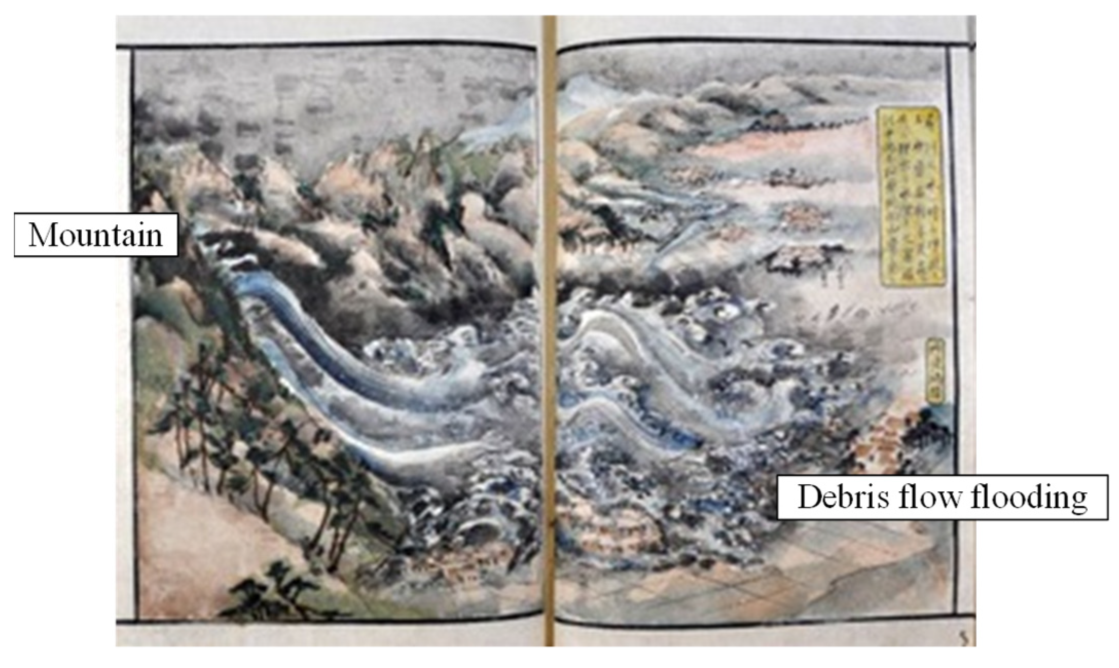
:1. Introduction
2. Prediction of Deposition Shape during River Channel Blockage by Embankments
3. Prediction of the Flood Outflow Risk When a Landslide Dam Breaches
4. Conclusions
Author Contributions
Funding
Data Availability Statement
Conflicts of Interest
References
- Zhou, Y.; Sheng, Q.; Li, N.; Fu, X. The dynamic mechanical properties of a hard rock under true triaxial damage-controlled dynamic cyclic loading with different loading rates: A case study. Rock Mech. Rock Eng. 2022, 55, 2471–2492. [Google Scholar] [CrossRef]
- Djalante, R. Key assessments from the IPCC special report on global warming of 1.5 °C and the implications for the Sendai framework for disaster risk reduction. Prog. Disaster Sci. 2019, 1, 100001. [Google Scholar] [CrossRef]
- Bai, S.; Lu, P.; Thiebes, B. Comparing characteristics of rainfall and earthquake-triggered landslides in the upper Minjiang catchment, China. Eng. Geol. 2020, 268, 105518. [Google Scholar] [CrossRef]
- Haque, U.; Da Silva, P.F.; Devoli, G.; Pilz, J.; Zhao, B.; Khaloua, A.; Wilopo, W.; Andersen, P.; Lu, P.; Lee, J.; et al. The human cost of global warming: Deadly landslides and their triggers (1995–2014). Sci. Total Environ. 2019, 682, 673–684. [Google Scholar] [CrossRef]
- Domènech, G.; Fan, X.; Scaringi, G.; van Asch, T.W.; Xu, Q.; Huang, R.; Hales, T.C. Modelling the role of material depletion, grain coarsening and revegetation in debris flow occurrences after the 2008 Wenchuan earthquake. Eng. Geol. 2019, 250, 34–44. [Google Scholar] [CrossRef]
- Zhou, W.W.; Fang, J.; Tang, C.; Yang, G. Empirical relationships for the estimation of debris flow runout distances on depositional fans in the Wenchuan earthquake zone. J. Hydrol. 2019, 577, 123932. [Google Scholar] [CrossRef]
- Ciccarese, G.; Mulas, M.; Alberoni, P.P.; Truffelli, G.; Corsini, A. Debris flows rainfall thresholds in the Apennines of Emilia-Romagna (Italy) derived by the analysis of recent severe rainstorms events and regional meteorological data. Geomorphology 2020, 358, 107097. [Google Scholar] [CrossRef]
- Liu, S.; Wei, L.; Hu, K. Topographical and geological variation of effective rainfall for debris-flow occurrence from a large-scale perspective. Geomorphology 2020, 358, 107134. [Google Scholar] [CrossRef]
- Zhang, S.J.; Xu, C.X.; Wei, F.Q.; Hu, K.H.; Xu, H.; Zhao, L.Q.; Zhang, G.P. A physics-based model to derive rainfall intensity-duration threshold for debris flow. Geomorphology 2020, 351, 106930. [Google Scholar] [CrossRef]
- Guo, Z.X.; Cao, S.Y.; Liu, X.N.; Fang, D. Experimental study on parameters affecting the river-blocking due to debris flow. J. Hydraul. Eng. 2004, 11, 39–45. (In Chinese) [Google Scholar] [CrossRef]
- Yan, Z.W.; Wei, Y.Q.; Cai, H. Formation mechanism and stability analysis of barrier dam. Chin. J. Geol. Hazard Control 2009, 20, 55–59. (In Chinese) [Google Scholar] [CrossRef]
- Chang, D.S.; Zhang, L.M.; Xu, Y.; Huang, R.Q. Field testing of erodibility of two landslide dams triggered by the 12 May Wenchuan earthquake. Landslides 2011, 8, 321–332. [Google Scholar] [CrossRef]
- Cui, P.; Chen, X.Q.; Zhu, Y.Y.; Su, F.H.; Wei, F.Q.; Han, Y.S.; Liu, H.J.; Zhuang, J.Q. The Wenchuan earthquake (May 12, 2008), Sichuan province, China, and resulting geohazards. Nat. Hazards 2011, 56, 19–36. [Google Scholar] [CrossRef]
- Chen, C.G.; Yao, L.K.; Yang, Q.H.; Liu, C.R. Study of river-blocking due to debris flow based on weir flow theory. J. Nat. Disasters 2012, 21, 131–135. (In Chinese) [Google Scholar] [CrossRef]
- Cui, P.; Zhou, G.G.D.; Zhu, X.H.; Zhang, J.Q. Scale amplification of natural debris flows caused by cascading landslide dam failures. Geomorphology 2013, 182, 173–189. [Google Scholar] [CrossRef]
- Liu, C.R.; Zhao, S.G. Experimental study on mechanism of large river blocking by debris flow. J. Chongqing Jiaotong Univ. (Nat. Sci.) 2016, 35, 90–95. [Google Scholar]
- Imaizumi, F.; Osanai, N.; Kato, M.; Koike, M.; Kosugi, K.; Sakai, Y.; Sakaguchi, H.; Satofuka, Y.; Takayama, S.; Tanaka, T.; et al. Debris flow disaster in Atami, Shizuoka Prefecture, in July 2021. J. Jpn. Soc. Eros. Control Eng. 2022, 74, 34–42. [Google Scholar]
- Ministry of Land, Infrastructure, Transport and Tourism. Embankment Regulation Law. Available online: https://www.mlit.go.jp/toshi/toshi_tobou_tk_000076.html (accessed on 10 January 2023).
- Ministry of Land, Infrastructure, Transport and Tourism. Basic Survey Implementation Guidelines (Designation of Regulatory Areas), Commentary. 2023. Available online: https://www.mlit.go.jp/toshi/toshi_tobou_tk_000086.html (accessed on 10 January 2023).
- Nishimoto, H. A Study on Changes in the Names of Sediment Transport Phenomena and Debris Flows. Ph.D. Dissertation, The University of Tokyo, Tokyo, Japan, 2010. [Google Scholar]
- Central Disaster Management Council. 1847 Zenkoji Earthquake Report; Central Disaster Management Council: Japan, 2007; 201p.
- Sanada Treasure Museum. “Earthquake Post-World Secular Language Seed”. Available online: https://www.iida-museum.org/user/nature/earthquake/dishin.html (accessed on 10 January 2023).
- Liu, Y.; Chen, X.J.; Hu, M. Three-dimensional large deformation modeling of landslides in spatially variable and strain-softening soils subjected to seismic loads. Can. Geotech. J. 2022, 60, 426–437. [Google Scholar] [CrossRef]
- Chen, X.Y.; Zhang, L.L.; Yang, H.Q. Probabilistic runout analysis of landslide considering spatial variability. In Proceedings of the 7th International Symposium on Geotechnical Safety and Risk (ISGSR), Taipei, Taiwan, 11–13 December 2019; pp. 745–749. [Google Scholar]
- Fenton, G.A.; Griffiths, D.V. Risk Assessment in Geotechnical Engineering; John Wiley & Sons Inc.: New York, NY, USA, 2008. [Google Scholar]
- Shirouzu, T. Twenty years from the Great Hanshin Awaji earthquake. Rev. Consum. Co-Oper. Stud. 2015, 470, 62–64. [Google Scholar]
- Sasa, K. An earthquake induced rapid landslide in Nikawa, Nishinomiya-city, Japan. Soil Mech. Found. Eng. 1996, 44, 83–85. [Google Scholar]
- Kikuyama, H.; Yokoyama, S. Earthquake disasters of geotechnical structures due to the 1995 southern Hyogo prefecture earthquake. Annu. Rep. Fukada Geol. Inst. Found. 2015, 16, 75–96. [Google Scholar]
- Minstry of Land, Infrastructure, Transport and Tourism. Large-Scale Sediment Disasters Occurrence Situation—Proposal. Available online: https://www.mlit.go.jp/common/001024314.pdf (accessed on 10 January 2023).
- Zheng, H.; Shi, Z.; Shen, D.; Peng, M.; Hanley, K.J.; Ma, C.; Zhang, L. Recent advances in stability and failure mechanisms of landslide dams. Front. Earth Sci. 2021, 9, 659935. [Google Scholar] [CrossRef]
- Fan, X.; Dufresne, A.; Subramanian, S.S.; Strom, A.; Hermanns, R.; Tacconi Stefanelli, C.; Hewitt, K.; Yunus, A.P.; Dunning, S.; Capra, L.; et al. The formation and impact of landslide dams—State of the art. Earth-Sci. Rev. 2020, 203, 103116. [Google Scholar] [CrossRef]
- Asada, A. A method for estimating and increasing the stability of artificial housing ground during earthquake. J. Jpn. Soc. Soil Mech. Found. Eng. Soils Found. 1978, 22, 191–202. [Google Scholar] [CrossRef]
- Asada, A. Natural disasters and geotechnical engineering in the Ttohoku region: A decade after the Miyagi offshore earthquake. Soil Mech. Found. Eng. 1989, 37, 57–62. [Google Scholar]
- Furuchi, Y.; Kunioki, G.; Ishizawa, T.; Yamamoto, J. Physico-mechanical characteristics of collapsed embankment during the Noto peninsula earthquake. J. Earthq. Eng. 2007, 1007–1010. [Google Scholar] [CrossRef]
- Yanagisawa, E.; Yasuda, S.; Yoshida, N.; Wakamatsu, K. Residential damage, disaster investigation report of the 1993 Kushiro-oki earthquake & Noto peninsula earthquake. Jpn. Geotech. Soc. 1994, 180625004, 231–275. [Google Scholar]
- Ministry of Land, Infrastructure, Transport and Tourism. Regarding the Damage and Response to the 2023 Noto Peninsula Earthquake. Available online: https://www.mlit.go.jp/saigai/saigai_240101.html (accessed on 10 January 2023).
- Yokoyama, O.; Uchida, T.; Kinoshita, A. Classification of landslide dams based on the duration until failure. J. Jpn. Soc. Eros. Control Eng. 2016, 68, 14–23. [Google Scholar]
- Hata, Y.; Ichii, K.; Tokida, K. A probabilistic evaluation of the size of earthquake-induced slope failure for an embankment. Georisk: Assess. Manage. Risk Eng. Syst. Geo-Hazards 2012, 6, 73–88. [Google Scholar] [CrossRef]
- Hata, Y.; Ichii, K.; Tokida, K. a study on the collapse range of slopes during earthquakes. J. Jpn. Soc. Civ. Eng. Ser. C 2007, 63, 677–690. [Google Scholar]
- Kadota, K.; Sato, S.; Motohashi, A.; Tougo, T.; Kaneko, S. Investigation of the factors causing the collapse of residential ground by black and red soils damaged by the Kumamoto earthquake. J. Geotech. Eng. 2023, 18, 193–210. [Google Scholar]
- Nakamura, S.; Sendo, N.; Umemura, J.; Otsuka, S.; Toyoda, H. Geotechnical disasters in the Nakadori and Iwaki regions of Fukushima prefecture caused by the 2011 Tohoku-pacific ocean earthquake. J. Geotech. Eng. 2012, 7, 91–101. [Google Scholar]
- Costa, J.E.; Schuster, R.L. The Formation and Failure of Landslide Dams. Geol. Soc. Am. Bull. 1988, 100. Available online: https://pubs.usgs.gov/of/1987/0392/report.pdf (accessed on 10 January 2023).
- Takahashi, Y.; Masunari, M. A study on the scale of debris flow caused by the collapse of a landslide dam. Ann. Disaster Prev. Res. Inst. Kyoto Univ. 1988, B-2, 1–12. [Google Scholar]
- Mizuyama, T.; Mori, S.; Sakaguchi, T.; Inoue, K. Landslide dams in japan and countermeasures. Kokin Shoin 2011, 9784772261104, 4–11. [Google Scholar]
- Harada, N.; Kosugi, K.; Satofuka, Y.; Mizuyama, T. Prediction of landslide dam formation affected by topographical and geological conditions. J. Jpn. Soc. Civ. Eng. B1 2015, 71, I_1267–I_1272. [Google Scholar]
- Kainthura, P.; Sharma, N. Hybrid machine learning approach for landslide prediction, Uttarakhand, India. Sci. Rep. 2022, 12, 20101. [Google Scholar] [CrossRef]
- Zhou, C.; Yin, K.; Cao, Y.; Ahmed, B.; Fu, X. A novel method for landslide displacement prediction by integrating advanced computational intelligence algorithms. Sci. Rep. 2018, 8, 7287. [Google Scholar] [CrossRef]
- Nakamura, H.; Tsunaki, R.; Ishihama, S. simulation model for debris movement of landslides. Proc. Japan-China Symp. Landslides Debris Flows Niigata 1989, BA0769199X, 81–86. [Google Scholar]
- Sako, Y.; Mori, T.; Nakamura, H.; Yusa, N. Prediction of landslide dam shape formed by deep-seated landslides. J. Jpn. Soc. Eros. Control Eng. 2015, 68, 44–51. [Google Scholar]
- Harada, N.; Kosugi, K.; Satofuka, Y.; Mizuyama, T. prediction of landslide-dam height and length based on previous data. J. Jpn. Soc. Eros. Control Eng. 2016, 68, 47–50. [Google Scholar]
- Satofuka, Y.; Yoshino, K.; Mizuyama, T.; Ogawa, N.; Uchikawa, T.; Mori, T. A study on the prediction method of flood discharge due to the collapse of a landslide dam. J. Hydraul. Eng. 2007, 51, 901–906. [Google Scholar] [CrossRef]
- Yang, M.; Cai, Q.; Li, Z.; Yang, J. Uncertainty analysis on flood routing of embankment dam breach due to overtopping failure. Sci. Rep. 2023, 13, 20151. [Google Scholar] [CrossRef] [PubMed]
- Nobarinia, M.; Kalateh, F.; Nourani, V.; Babaeian Amini, A. Dam failure peak outflow prediction through GEP-SVM meta models and uncertainty analysis. Water Supply 2021, 21, 3387–3401. [Google Scholar] [CrossRef]
- Harada, N.; Akazawa, F.; Hayami, S.; Yanagisaki, T.; Satofuka, Y.; Fujimoto, M.; Tsutsumi, D.; Miyata, H. Field experiment on landslide dam failure in the hill valley of ashitsuke river basin. J. Jpn. Soc. Eros. Control Eng. 2015, 67, 41–48. [Google Scholar]
- Harada, N.; Akazawa, F.; Hayami, S.; Satofuka, Y. Numerical simulation of landslide dam deformation caused by erosion. Adv. River Sediment Res. 2013, 1107–1116. [Google Scholar] [CrossRef]
- Hayashi, T. Quantification—Theory and Methods; Asakura Shoten: Tokyo, Japan, 1993; 233p. [Google Scholar]
- Geospatial Information Authority of Japan. Maps. Available online: https://maps.gsi.go.jp (accessed on 10 January 2023).
- NTT DATA. Satellite Images. Available online: https://www.nttdata.com/ (accessed on 10 January 2023).
- Ministry of Land, Infrastructure, Transport and Tourism. Available online: https://www.hrr.mlit.go.jp/yuzawa/sabo/chuetsu/pamphlet/pamphlet01.pdf (accessed on 10 January 2023).
- Ministry of Land, Infrastructure, Transport and Tourism. Available online: https://www.hrr.mlit.go.jp/yuzawa/sabo/chuetsu/taisaku/iinkai_2nd/genjou.pdf (accessed on 10 January 2023).
- Yoneyama, T.; Yanagida, M.; Ikeda, H.; Iseya, F.; Medai, K.; Kotama, Y.; Tamai, H. Are the terrace deposits along the Mogami river, Niigata prefecture, former Yamakoshi village, dammed by landslides (landslide dams)? J. Geol. Soc. Japan 2007, 116, 5. [Google Scholar]
- Japan Meteorological Agency. Available online: https://www.data.jma.go.jp/obd/stats/etrn (accessed on 10 January 2023).
- Takahashi, Y.; Nakagawa, I. Prediction of stony debris flow induced by severe rainfall. Jpn. Soc. Eros. Control Eng. 1991, 44, 12–19. [Google Scholar]
- Takahashi, Y.; Nakagawa, K.; Satofuka, Y. Sediment flushing using a reverse-flow system. J. Hydraul. Eng. 2002, 46, 785–790. [Google Scholar] [CrossRef]
- Ashida, K.; Egashira, S.; Kamoto, M. Study on erosion and channel changes in mountainous watersheds (part 2). Ann. Disaster Prev. Res. Inst. Kyoto Univ. 1983, B26, 353–361. [Google Scholar]
- Shimizu, Y.; Itakura, T. Calculation of flow and bed deformation with a general nonorthogonal coordinates system. Proc. XXIV IAHR Congr. Madr. Spain 1991, C-2, 241–248. [Google Scholar]
- Takahashi, T.; Satofuka, Y. Simulation model for channel variation braided channel reach. Ann. Disaster Prev. Res. Inst. Kyoto Univ. 1999, B-2, 189–200. [Google Scholar]
- Koike, T.; Sato, G.; Komori, J. Implementation of the global-scale earth issues international science and technology cooperation program and towards the social implementation of research achievements. J. Jpn. Soc. Landslide Sci. 2021, 58, 193–195. [Google Scholar] [CrossRef]
- Zhang, G.; Yao, T.; Xie, H.; Wang, W.; Yang, W. An inventory of glacial lakes in the third pole region and their changes in response to global warming. Glob. Planet. Chang. 2015, 131, 148–157. [Google Scholar] [CrossRef]


| α1 | β1 | γ1 | δ1 | |
|---|---|---|---|---|
| Earthquake Hearthquake | 0.11 | 0.014 | 0.032 | 0.039 |
| Heavy rain Hheavy_rain | 0.081 | 0.0039 | 0.063 | 0.35 |
| α2 | β2 | γ2 | ε2 | |
| Earthquake Learthquake | 0.27 | −0.0043 | 0.98 | 0.0001 |
| Heavy rain Lheavy_rain | 0.44 | 0.012 | 0.23 | 0.51 |
| h1 | l1 | w1 | A1 | B1 | |
|---|---|---|---|---|---|
| Nigawa-disaster, 1995 | ~50 m | ~150 m | 20–50 m | ~10,000 m2 (/100,000) | ~100 m |
Disclaimer/Publisher’s Note: The statements, opinions and data contained in all publications are solely those of the individual author(s) and contributor(s) and not of MDPI and/or the editor(s). MDPI and/or the editor(s) disclaim responsibility for any injury to people or property resulting from any ideas, methods, instructions or products referred to in the content. |
© 2024 by the authors. Licensee MDPI, Basel, Switzerland. This article is an open access article distributed under the terms and conditions of the Creative Commons Attribution (CC BY) license (https://creativecommons.org/licenses/by/4.0/).
Share and Cite
Harada, N.; Satofuka, Y.; Mizuyama, T. The Impacts of River Channel Blockages Caused by Sliding Embankment Collapses during Earthquakes. Water 2024, 16, 822. https://doi.org/10.3390/w16060822
Harada N, Satofuka Y, Mizuyama T. The Impacts of River Channel Blockages Caused by Sliding Embankment Collapses during Earthquakes. Water. 2024; 16(6):822. https://doi.org/10.3390/w16060822
Chicago/Turabian StyleHarada, Norio, Yoshifumi Satofuka, and Takahisa Mizuyama. 2024. "The Impacts of River Channel Blockages Caused by Sliding Embankment Collapses during Earthquakes" Water 16, no. 6: 822. https://doi.org/10.3390/w16060822