Article

Spatiotemporal Dynamics and Attribution Analysis of Blue and Green Water Resources During 1980–2019 in the Hanjiang River Basin, China

1
Key Laboratory for Geographical Process Analysis & Simulation of Hubei Province, Central China Normal University, Wuhan 430079, China
2
Hubei Key Laboratory of River Basin Water Resources and Ecological Environmental Sciences, Changjiang River Scientific Research Institute, Wuhan 430010, China
3
Changjiang Survey, Planning, Design and Research Co., Ltd., Wuhan 430010, China
4
Key Laboratory of Water Grid Project and Regulation of Ministry of Water Resources, Wuhan 430010, China
*
Author to whom correspondence should be addressed.
Water 2025, 17(7), 1008; https://doi.org/10.3390/w17071008
Submission received: 21 February 2025 / Revised: 20 March 2025 / Accepted: 27 March 2025 / Published: 29 March 2025

Abstract

:
A SWAT (soil and water assessment tool) model was built to elucidate the spatiotemporal dynamic changes in blue/green water resources during 1980–2019 in the Hanjiang River Basin, China. Several scenarios were constructed to analyze the spatiotemporal differentiation between green and blue water resources in diverse climate and land utilization conditions. The results showed that (1) the mean blue water and green water resources were 392.24 and 410.48 mm/year; (2) the blue water resources showed a non-significant fluctuating decreasing trend, while the green water resources showed a non-significant increasing trend in volume; (3) the high-value areas of the blue water resources were concentrated in the western, northeastern, and southeastern parts of the Hanjiang River Basin, whereas the western region had more abundant green water resources; (4) compared with the effects of land use change, the climate factors contributed much more to variations in the blue/green water resources of the Hanjiang River Basin. Overall, the blue/green water resources in most areas of the Hanjiang River Basin had a downward trend during 1980–2019. The findings may offer theoretical support for the optimal allocation and management of water resources in the Hanjiang River Basin, China, under climate change.

1. Introduction

Water is the material basis of all living things, and also the key to maintaining ecosystem function and promoting the progress of human society [1,2,3]. However, in the context of global warming and rapid population growth, frequent extreme weather and hydrological events have led to increased spatial and temporal variability in precipitation, resulting in increasingly prominent regional water scarcity issues [4,5]. Currently, numerous countries and regions across the globe are experiencing varying degrees of impact on their water environments. In some areas, drought, flood, and other disasters often occur [6,7]. Global climatic fluctuation will lead to the redistribution of water resources [8,9,10], which will affect the regional hydrological cycle and flow regimes [11,12]. With the acceleration of urbanization, land use in many areas is also in a changing stage [13,14]. With the increase in urban construction land, the structure of the underlying layer will change, which will bring various impacts on hydrological regimes, for instance, vegetation water storage, infiltration, and evaporation [15,16,17].
In the early 1990s, Falkenmark first introduced the concepts of blue and green water to assess the effect of water scarcity on food production in drought-prone regions of Africa [18]. Both blue water and green water originate from precipitation. Blue water refers to liquid water stored in rivers, lakes, reservoirs, and aquifers that can be harvested, stored and used directly. Green water is the portion of precipitation that percolates into the soil, is absorbed and utilized by plant roots, and is eventually returned to the atmosphere in the form of evapotranspiration. The notion of blue water and green water provides a new method and theoretical direction for the research on water resource management. The exploration of blue/green water also leads to a re-understanding of the evaluation of water resources. Traditional water programming and management concentrate on liquid water, also known as blue water. However, blue water, which used to dominate the concept of water conservation and the general studies on water resource assessment, only accounts for one-third of the freshwater resources on land, which is the precipitation of the entire continent [19,20]. Hence, in the study of water resources, green water is receiving increasing attention. Most of the rainwater is returned to the atmosphere as green water after being transpired by plants. As the core element of the water circulating system, the green water resource is crucial to maintain the health, stability, and sustainability of the world’s ecosystems [21]. In the practice of water resource assessment and administration, the method of hydrologic analogy is often used [22]. Among the various tools that can be used for hydrological processes modeling, the SWAT (Soil and Water Assessment Tool) model can integrate different elements like land use conditions, climate conditions, and agricultural irrigation conditions to simulate the cycling process of regional water resources. Therefore, it has been used extensively in the past studies [23,24]. After the input of spatial data and attribute data, the SWAT model can integrate this basic information to divide the complete watershed into several sub-basins, and subsequently even further into a large number of hydrological response units to carry out the required simulations and evaluations. The SWAT is able to establish the parameter model with physical significance, thus, the changes in runoff, sediment transport, and nutrients in the watershed can be simulated. As a typical physical model, it has the advantages of an easy access to input parameters, a high computing efficiency, and long-term simulation. The SWAT model can conveniently output individual variables that constitute the blue and green water resources, thus accurately evaluating the temporal and spatial differences as well as changes in water resources in a hydrographic water basin, analyzing and predicting the effects of climate and land utilization patterns on regional ecological and hydrological characteristics.
Simulation of blue water and green water is the precondition for realizing quantitative evaluation of water resources in a broad sense, rational development and utilization of water, and comprehensive management of generalized water resources. During the decades after the concept of blue/green water was put forward, the related research developed from an independent evaluation of blue water to the integrated analyses of green water; and from a single blue water simulation to the comprehensive calculation of both. For example, Faramarzi et al. [25] built a SWAT model based on basic data such as food production and river flow to model the status of green water resources and blue water resources in the Iranian region. Relying on the model, an integrated hydrological model for the European region was developed by Abbaspour et al. [26]. It can quantify the amount of water resources in a sub-basin in terms of months, and take into account HRU-scale analysis of crop growth and water quality.
Climate change and land use change are two important factors affecting changes in blue/green water resources. In recent years, many scholars have used SWAT models to explore the mechanisms by which climate change or land use change affect the evolution of blue/green water resources in a region. For example, Hordofa et al. [10] analyzed the blue/green water status of the Meki River Basin in Ethiopia under different climatic conditions and made predictions for the future blue/green water evolution of the basin. Sharma et al. [20] combined the SWAT model with AHP analysis to quantitatively evaluate the impact of climate change on the blue/green water accounting of Sabarmati River Basin, India. Li et al. [27] set up two land use scenarios and analyzed the blue/green water conditions in the Yanghe River Basin of China in three typical years. Woldensenbet et al. [28] used Guder Catchment in Ethiopia as an example to investigate the impact of land cover change on the allocation of blue and green water resources in the watershed. Meanwhile, some studies have analyzed how blue and green water change under the combined influence of climate and land use factors. Du et al. [29] systematically evaluated the impacts of climatic factors with land use and land cover transformation on blue and green water resource patterns in the watershed of Ohio River during the period of 1935–2014. On this basis, variations in water resources occurring at different spatial scales were evaluated by using the catastrophe test method. Liang et al. [21] integrated the advantages of land utilization change models and hydrological models and used multivariate statistical analysis to determine the major factors contributing to blue/green water shortages in parts of New Jersey, and the future water security situation of the region was predicted. Kang et al. [30] considered the blue/green water pattern in the valley of Wujiang River in China over 30 years based on three different time scales. By combining it with CMIP6, an improved model was used to predict the hydrological environment of the basin under future changing environments. To sum it up, the existing studies mainly focus on the assessment of the distribution features as well as the variation in the blue/green water resources through a quantitative analysis, while the contribution rate of the factors affecting the alteration of the blue water and green water resources is slightly lacking.
The watershed of the Hanjiang River, as the key region for promoting the coordinated development of the Yangtze River Economic Belt in China, is also a crucial headwater for the entire country to achieve optimal allocation of water resources [31,32]. The issues related to water resources, water ecology, as well as water disasters, are complex and extensive. In particular, after the completion of the first stage of the South–North water transfer project, significant variations have occurred in the hydrological situation and the supply and need of water resources; with aquatic ecological setting in the watershed, the management and protection of water resources are facing severe challenges [33,34]. For the past several years, due to the speedy development of urbanization and the construction of water and soil maintenance projects, the land utilization patterns in the watershed have been in a new stage of evolution [35]. However, the people’s understanding of the evolutionary rules of “green and blue water” in watershed research under the influence of complex changing environments is still unclear.
Attribution analysis is a research method used to identify and quantify the extent to which different factors contribute to an outcome or phenomenon. The method centers on breaking down an outcome or phenomenon into multiple influencing factors and quantifying the degree of contribution of each factor. The underlying assumption is that the outcome or phenomenon is produced by a combination of factors and that there is some interaction between the factors [36,37]. Through attribution analysis, the researcher can have a clearer understanding of the mechanism and degree of influence of different factors on the phenomenon under study. The evolution of water resources in a river basin is a complex process, which is affected by many factors [38,39]. The application of attributional analysis to water resource evolution studies can identify and quantify the extent to which different drivers contribute to water resource change. Therefore, attributional analysis of the spatial and temporal changes in blue and green water in the basin can explore the main influencing factors that lead to the spatial and temporal changes in blue and green water, and analyze the proportion of the corresponding contributions of different influencing factors, to provide a scientific basis for water resources management and policy formulation.
Therefore, exploring the spatial-temporal change in the Hanjiang River Basin, and quantitatively interpreting the influence of the different factors on the distribution pattern of water resources are of great relevance for identifying the potential of water resource exploitation and optimizing water resource allocation. Currently, research hotspots in the area studied primarily include the effects of vegetation succession [40,41,42], analyses of extreme weather patterns and disasters [43,44,45], and runoff modeling [46,47]. However, studies analyzing the attribution of blue/green water resources are rare. On the basis of the above, the main objectives of this study are (1) to perform hydrological simulations of the Hanjiang River Basin based on the SWAT model, and to make a statistical analysis of the results obtained, so as to obtain significant results on blue and green water; (2) to change the input climate and land use data, establish different scenarios, and explore the impact of climate and land use changes on the spatiotemporal changes in blue/green water resources; and (3) to quantitatively evaluate the contribution rate of climate and land use changes to blue and green water changes in the Hanjiang River Basin, China, through the attribution analysis.

2. Data and Methods

2.1. Research Region

The Hanjiang River originates in Hanzhong, Shaanxi Province, and joins the Yangtze River in Hankou, Hubei Province, with a total length of more than 1500 km. The longitude and latitude of the river basin are 106°12′~114°14′ E, 30°08′~34°20′ N, with a total area of about 159,000 square kilometers, spanning five provinces (or municipalities) of Shaanxi, Gansu, Sichuan, Chongqing, and Hubei. Since the famous South–North water transfer project was built, it has become a significant area for water resources administration and allocation. In topography, the mountains are predominantly distributed in the upstream, while the lower reaches are plain, and there is a hilly area between the two, with the overall higher elevation in the northwest and lower in the southeast. Woodlands and croplands are the main types of land use in the watershed, accounting for 39.66% and 35.31%, respectively. They are followed by grasslands (19.42%), watershed (2.80), construction land (2.78%), and bare land (0.04%). During the research period, the water area and construction land continued to increase, and correspondingly, the proportion of other land types decreased. The upstream of the region is the Qinba Mountain area, with woodland as the dominant land cover type. It has outstanding biodiversity and is a key water conservation zone. The mid-lower reaches of the whole watershed are the Jianghan Plain, which has vast arable land and is known for its abundant production of crops such as rice and cotton. The climatic belt of the basin is subtropics, and the dominant climate type is subtropical monsoon climate. It is warm and humid with abundant rainfall, but the precipitation varies significantly between seasons.

2.2. Data

The manufacture of a SWAT model needs diversified basic data, including meteorological factors, elevation, soil category, land cover patterns, and so on. The digital elevation information used in this project is SRTMDEMUTM 90M from the geospatial data cloud (www.gscloud.cn, accessed on 15 May 2023). The Chinese Academy of Sciences Resource, Environment, and Data Center (www.resdc.cn, accessed on 10 June 2023) provided 1 km accurate remote sensing grid data of the land cover patterns in the 1990s, 2000s, and 2010s. The Harmonised World Soil Database (HWSD) provides information on the soil types in the region of interest. The accuracy of the data is also 1 km. In terms of meteorological data, our project obtained daily data from meteorological stations of the China Meteorological Data Network (https://data.cma.cn, accessed on 20 June 2022) as the information source and selected eight climatological stations located in and near the region of interest to measure information such as precipitation, relative humidity, daily extreme temperature, and wind speed, from 1980 to 2019 (Figure 1). Solar radiation was calculated based on day-by-day sunshine hour data [48]. The hydrological data used were the 1980–2019 daily natural runoff data from the Baihe and Xiantao station in the basin.

2.3. Methodology

2.3.1. SWAT Model

SWAT is a well-known hydrological model that was first proposed by the USDA [50]. The model has been extensively used in water resource management as well as in optimal allocation after several modifications and optimizations [51,52]. The SWAT model was chosen as a hydrological simulation tool for the following reasons: First, as a semi-distributed hydrological model, it can effectively simulate the hydrological processes at the watershed scale, and it is especially suitable for analyzing the impacts of land use change and climate change on the hydrological cycle. Second, the SWAT model can simulate the dynamics of blue water and green water evolution simultaneously, which is very suitable for the objectives of this study [53]. In addition, the input data requirements of the SWAT model match the data availability in the study area, and its reliability and validity have been verified by its wide application worldwide. As an effective tool for blue/green water assessment, a SWAT model could export the sub-components of green water and blue water resources by simulating the hydrologic cycle system, then the total water of the whole basin can be estimated. The water quantity equilibrium expression of the model is as follows:
S W t = S W 0 + i = 1 t ( R d a y Q s u r f E a W s e e p Q g w )
where S W t is the final value of soil volumetric water content (mm); S W 0 is defined as the initial value of soil water capacity; t is defined as the number of days passed by the research institute (d); R d a y is the corresponding value of rainfall on the first day (mm); Q s u r f is the value of overland runoff on day i (mm); E a represents the value of evaporation on day i (mm); W s e e p represents the infiltration and lateral discharge in the subsoil on day i (mm); Q g w denotes the underground water storage (mm) on the first day.
Blue/green water is calculated as follows:
B W = W Y L D + D A _ R C H G
G W = E T + S W
where BW is the amount of blue water resources (mm), WYLD refers to the water produced from each HRU and entering the river channel (mm), and DA_RCHG refers to the water recharge from the deep aquifer in the interior of the simulated time step (mm). GW is the amount of green water resources (mm), and ET represents the actual evapotranspiration (mm) in HRU in the simulated time step, including soil evaporation and plant transpiration. SW stands for initial soil water content (mm).
The SWAT-CUP was employed to calibrate the model and evaluate its performance based on the measured runoff data. In this study, the coefficient of determination (R2), the Nash–Sutcliffe efficiency coefficient (NSE), and the Kling–Gupta efficiency (KGE) were used as indicators to reflect the reliability of the model output results, with R2 indicating the degree of agreement between the simulated results and the observed values, the NSE reflecting the degree of deviation between the modeled values and the actual data, and the KGE synthesizing the simulation performance of the model [54]. The closer the values of the three indicators are to 1, the better the performance of the model. Experience has shown that when the simulation results meet R2 ≥ 0.6 and NSE ≥ 0.7, the constructed model has satisfying simulation results and is suitable for simulating hydrological regimes in the corresponding region [55].
The validation of the SWAT model in the watershed of interest is based on the measured runoff information from the Baihe and Xiantao hydrometric stations in the area. The two hydrologic stations are located in different parts of the zone, with the Baihe station in the middle course, while the Xiantao station on the downstream side, near the outlet of the watershed. Therefore, the credibility level of the simulation results can be better reflected by integrating the data calibration models of the two stations. In SWAT-CUP, the model was corrected and verified by the SUFI-2. The first two years were set as the warm-up period, followed by a calibration phase from 1982 to 2000 and a validation phase from 2001 to 2019, respectively.

2.3.2. Pettitt Mutation Test

Pettitt mutation test [56] is a non-parametric mutation test calculation method that is simple to calculate and less affected by outliers. This method can test whether there is a mutation point in the changes in hydrological and meteorological elements when the mutation time cannot be determined, and verify the significance of the mutation, which helps to analyze the occurrence time and sustained characteristics of climate variation in long-term time series. The Mann–Whitney nonparametric statistic is defined as follows:
U t , N = U t 1 , N + i = 1 n s g n ( x t x i ) , t = 2,3 , 4 , , n
Depending on the statistic, it can be calculated as follows:
K t , N = m a x U t , N , 1 t N
p = 2 e x p 6 K t , N 2 N 2 + N 3
In general, a mutation point was considered to be present in the data if p ≤ 0.05 [57].

2.3.3. Scenario Setting and Impact Factor Contribution Calculation

Mutation analysis is the main entry point to study the characteristics of hydrological series. Considering that the measured values of runoff from Xiantao hydrological station are more obviously affected by the water diversion and transfer project, the data from Baihe hydrological station are selected for mutation analysis in this study. The day-by-day runoff data of Baihe hydrological station in the study area from 1980 to 2019 were collated into annual runoff volume, and the results were tested using the Pettitt mutation test, which showed that the runoff of Baihe station underwent a significant mutation in 1991 (Figure 2). This is consistent with the results of mutation analysis of river discharge from the Hanjiang River by Peng et al. [58].
The Xiantao Hydrological Station is situated downstream of the Danjiangkou Reservoir, the water fountainhead of the South to North Water Diversion Project. The interannual variation in its runoff is affected by the cross basin Water Diversion Project, and there is a certain difference from the sudden change law of runoff under natural conditions. Therefore, this research carries out the scenario set according to the detected runoff abrupt change time of Baihe station (Table 1). By fixing the land use factors and changing the time of meteorological information to reflect the impact of meteorological elements on blue/green water (scenario2/scenario1), the effects of the land use factor are represented using meteorological observations over the same period and land use over different periods (scenario3/scenario1), and the combined conditions of the meteorological elements and land cover patterns on water resources were studied by changing both sets of data (scenario4/scenario1).
The calculation process for calculating the changes in green water and blue water within the watershed under the climate change scenario are as follows:
R c l i m a t e b l u e = R 2 b l u e R 1 b l u e
R c l i m a t e g r e e n = R 2 g r e e n R 1 g r e e n
The changes that occur in the two types of water resources under the scenario of land utilization changes are as follows:
R L U C C b l u e = R 3 b l u e R 1 b l u e
R L U C C g r e e n = R 3 g r e e n R 1 g r e e n
The blue/green water change caused by meteorological element changes and land cover variations are calculated as follows:
R b l u e = R 4 b l u e R 1 b l u e
R g r e e n = R 4 g r e e n R 1 g r e e n
Based on the equation above, it can be concluded that the overall effect of climate characteristics and land use and land cover change factors on green and blue water are as follows:
η c l i m a t e b l u e = R c l i m a t e b l u e R b l u e
η c l i m a t e g r e e n = R c l i m a t e g r e e n R g r e e n
According to the above equation, we can conclude that the comprehensive impact of climate and landcover on blue and green water are as follows:
η L U C C b l u e = R L U C C b l u e R b l u e
η L U C C g r e e n = R L U C C g r e e n R g r e e n
where η c l i m a t e b l u e and η c l i m a t e g r e e n represents the proportion of the influence of meteorological factors on green and blue water variation, which is the contribution rate. And the degree of the impact of land use and land cover change to the variations in green water and blue water is represented by η L U C C b l u e and η L U C C g r e e n , respectively.

3. Results

3.1. Parameter Sensitivity Analysis

The DEM data were used to extract the river network system and set the catchment area threshold to generate the preliminary river network system. Subsequently, the geographic coordinates of Baihe and Xiantao hydrological stations were imported into the model as the key control points for the sub-basin delineation, and the total catchment area of the Hanjiang River Basin was finally determined to be 147,041.27 km2, with 49 sub-basins delineated in total. On this basis, the whole basin was divided into 475 HRUs using the model HRUs Definition module.
The SWAT model has numerous parameters, and the global sensitivity analysis is performed in SWAT-CUP. Among them, t represents the sensitivity degree of the parameters, and the larger the absolute value of t is, the more sensitive the parameter is; the p-value indicates the significance of the parameter sensitivity, and the closer the p-value is to 0, the more significant the parameter is. Using the t-value > 0.2 as the standard division, some parameters with low sensitivity were removed, and finally 16 parameters with high sensitivity were selected as the rate parameters of SWAT in the Hanjiang River Basin. The parameter sensitivity ranking, meaning and optimal values are shown in Table 2.

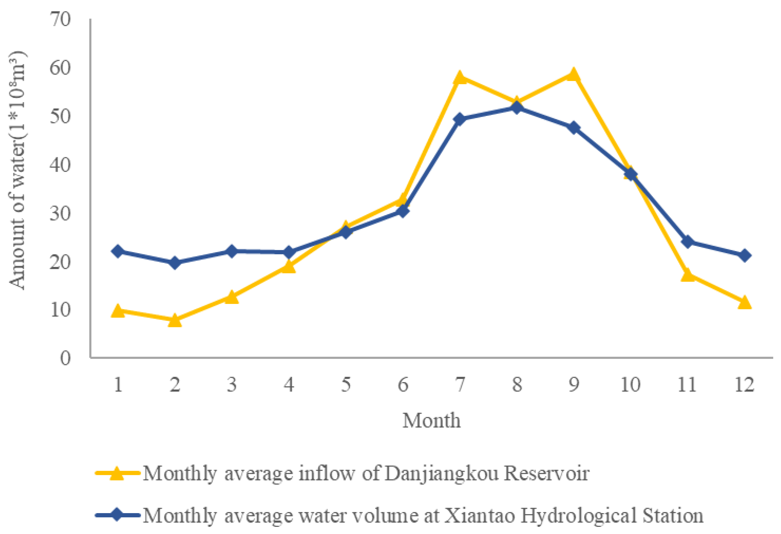
3.2. Calibration and Validation of the SWAT Model

Figure 3 and Figure 4 show the calibration and validation outcomes of the model, respectively. We can find that both measured and simulated runoff show significant seasonal variation for the two stations, and the peak value occurs in the same as the trough corresponding month. There are some differences only in the fluctuation amplitude between the two due to the unavoidable uncertainty in the model simulation. The R2 and NSE values of the Baihe station in both the periodic and validation periods were above 0.80, while those of the Xiantao station were above 0.70 in both periods. According to the above criteria, the calibration values of both measurement stations are within an acceptable range. Therefore, the SWAT model of the region of interest established in this study has a good simulation effect and is suitable for the further analysis of the blue/green water resource changes in the watershed.

3.3. Spatiotemporal Variations in Blue and Green Water

3.3.1. Temporal Variation Dynamics

The average annual blue water resources in the Hanjiang River Basin from 1982 to 2019 were 392.24 mm, the average annual green water resources were 410.48 mm, and the average annual precipitation was 839.15 mm. The sum of the annual average blue and green water resources is slightly smaller than the annual average precipitation, with a bias of about 4.34%. Overall, the blue/green water resources and precipitation in the watershed match and conform to the water balance equation of the SWAT model. The annual average green water resources account for 51.14% of the total water resources in the basin, which is approximately 1.05 times the amount of blue water resources (Figure 5).
Precipitation in the Hanjiang River Basin was characterized by cyclical fluctuations throughout the study period, with an overall slight downward trend. Meanwhile, the quantity of blue water resources also exhibited a periodic variation pattern similar to rainfall. In the long run, the blue water resources of the research area showed a descending tendency, though it was not obvious. The green water resources remained stable in each year and showed an increasing trend in the long term, but the rising trend was not obvious. According to the Pettitt test, there was a mutation point for blue water in 1985, and the mutation of green water occurred in 1991 (Figure 6).

3.3.2. Spatial Distribution Dynamics

The SWAT model divides the watershed of Hanjiang River into 49 sub-basins, and the mean annual precipitation, green water, and blue water in each sub-watershed between 1982 and 2019 was obtained by a statistical analysis of the model output results. Based on this, the spatial differentiation maps of the three are drawn, respectively (Figure 7).
Within the study period, the mean annual green and blue water levels of the interest region were 410.48 mm and 392.24 mm, respectively. Moreover, rainfall volume, green water, as well as blue water resources showed obvious heterogeneity. The distribution of rainfall and blue/green water in the whole region was uneven in space.
High-value zones of precipitation mainly appeared in the western, central, and southeastern regions. The high-value areas of blue water are mainly distributed in the westernmost, north-east, and south-east parts of the basin. The green water resources in the watershed exhibit a characteristic of “high in the west and low in the east”, and overall, the green water volume in the central and western regions was more abundant. The blue water’s extreme variance was 622.38 mm, while the extreme variance of the green water was more than 847.32 mm. Regionally, the blue water is most abundant along the Danjiang-Tangbaihe River. Observing the terrain of the whole area studied, we can clearly find that the eastern and southern regions of the region are dominated by alluvial plains, while the mountains gradually extend from the west to the east and from the north to the south. This terrain is conducive to the entry of warm and humid air from the southeast, resulting in abundant rainfall, hence there are plenty of blue water resources. Furthermore, the region is abundant in land and fertile soil and is a vital area for agricultural development, with abundant production of crops such as grain and cotton, and a large amount of evapotranspiration generated by crop growth, which is why there is sufficient green water.

3.4. Temporal Variation Dynamics of Blue and Green Water

3.4.1. Temporal Change Attribution Analysis

The blue/green water simulation value, the change quantity, and the contribution rate of the influence factors were analyzed under different scenarios (Table 3).
The values of green and blue water in the climatic fluctuation scenario were 384.78 mm and 407.99 mm, respectively, which were 37.51 mm and 10.05 mm lower than those under the original scenario of 422.30 mm and 418.04 mm, respectively. When it comes to land cover change scenarios, compared with the initial scenario, the blue water was 420.76 mm, which was a decrease of 1.54 mm compared to the original scenario; and the green water increased by 0.98 mm, reaching a value of 419.02 mm.
In the combined impact scenario, the blue water volume within the whole Hanjiang River watershed was 383.24 mm, while the volume of green water was 408.96 mm. The contribution rate of the climate to the alteration of blue water was 96.05%, while that of land use was only 3.95%. The contribution rate of the meteorological elements to the variation in green water was 110.74% and −10.74%. This suggests that the dominant factor in the alteration of blue/green water in the region was the climate.

3.4.2. Spatial Change Attribution Analysis

Figure 8 shows the difference in green water and blue water resources of the interest region in separate scenario conditions.
In the long run, the overall changes in climate factors have led to significant changes in the spatial distribution pattern of blue water in the area, with a decline in blue water in most regions. The most significant decrease is in the upper basin, occurring with a decrease in more than 100 mm in the corresponding subbasins, while the northeastern part of the basin shows a slight increase in blue water resources. The change in blue water resources due to land utilization changes is relatively small, with most subbasins having a change in blue water resources centered around −25~4 mm. The change in blue water in the integrated impact scenario was similar to that in the climate change scenario.
The green water in most regions is showing a downward trend. The most significant decreases are in the middle Danjiang basin and the upper reaches, with decreases in more than 20 mm, while the southern part shows a slight upward tendency in green water resources, with an increase of about 0~4 mm, and changes in green water resources due to land cover changes are small, with variations in green water resources in most areas concentrated in the range of −5~4 mm. The changes in green water were similar between the comprehensive impact scenario and the climate change scenario.
In conclusion, due to the synthesized effects of climate and land utilization factors, the reserves of blue/green water in the majority of regions decreased, and the reduction in blue water was much more obvious than that of green water.
In order to reveal the influence of the spatial distribution of land use on the amount of blue and green water resources, this study superimposed the data of spatial distribution of land use on the amount of blue and green water resources in each sub-basin (Figure 9). The results show that land use types are closely related to the spatial distribution of blue/green water resources.
As shown in the figure, in areas where forested land is concentrated, such as sub-basins 2 and 5 in the west and sub-basins 32, 33, and 40–43 in the south, the amount of green water resources is high, while the amount of blue water resources is low, and the difference between blue and green water resources is obvious. This is mainly due to the high vegetation cover and evapotranspiration in sub-basins with a concentrated distribution of forested land, which promotes the formation and accumulation of green water, while the amount of blue water resources is significantly lower than that in most areas of the basin due to precipitation retention and soil infiltration. In areas with concentrated distribution of cultivated land, such as sub-basins 21, 22, and 31 in the northeast, the amount of blue water resources is high while the amount of green water resources is low. This is because the sub-basins with concentrated cropland have high blue water resources due to low vegetation cover and weak evapotranspiration, while the green water resources are low due to the soil moisture loss and limited crop evapotranspiration capacity.

4. Discussion

4.1. Variations in Blue and Green Water Resources at the Catchment Scale

This research modeled and analyzed the temporal and spatial variations in green water and blue water in the Hanjiang River Basin over the period from 1980 to 2019, based on the SWAT model. The findings showed that the percentages of green and blue water within the watershed were relatively close to each other during the study period, with green water resources having a slightly larger impact at 51.14%. The primary reason for this is that the watershed is situated in a subtropical climate zone, which has obvious monsoon characteristics, high summer temperatures and abundant rainfall. Sufficient precipitation in the summer is often smoothly converted into green water under the influence of high temperature [59,60]. It is worth noting that the Hanjiang River Basin, as a critical area for agricultural development in China, is rich in crop production, including grain and cotton, and the amount of evapotranspiration generated by crop growth is also considerable. Therefore, the ratio of green water is higher than that of blue water. In previous studies, the Erhai basin [61] and the Meijiang basin [62], which also have monsoon-humid climates, reported similar results in terms of the ratio of blue water to green water. On the contrary, studies of the Yellow River source area [63] and the watershed of Xinjiang River [64], which are located in inland, arid regions, show that blue water dominates the water resources of these basins. The model simulation outputs show that the sum of annual average blue/green water resources slightly less than the amount of rainfall, with an error of about 4.34%. Possible reasons for this include factors such as human water withdrawals and changes in vegetation types that were not accounted for in the simulation, as well as some errors introduced by the parameterization process of the model.

4.2. Mechanisms Affecting the Temporal and Spatial Variability of Blue and Green Water Resources

The results of the attribution analyses indicate that variations in blue/green water in this region are visibly affected by the climate, while land cover changes do not have an evident effect on green water and blue water. Overall, there has been a mild decline in precipitation and a mild upward trend in temperature over the last few decades. As the main input of the water cycle, the decrease in precipitation will directly result in the reduction in the total blue water in the region. Furthermore, higher temperatures increase evapotranspiration, leading to a decline in blue water and an augment in green water resources. Under the combined effect of rainfall volume and atmospheric temperature, the volume of blue water in this region decreased slightly, on the contrary, the quantity of green water increased slightly. Table 4 reflects the discrepancy between the two periods of land use data used in this project. We can clearly find that woodland and cropland are the principal land use types in this region. In terms of trends, the proportion of construction land in the whole watershed increased by 0.31% from 1990 to 2010, which is closely linked to the rapid economic development and accelerated urbanization. Due to multiple factors, including the building of agricultural water conservancy facilities and the implementation of the project of returning cultivated land to lakes, the proportion of the water area has increased by 0.29%. However, over the study period, the land utilization change in the watershed was insignificant, and the proportion of variation within the watershed of each land utilization type was not more than 0.5%, so the land cover pattern change has less effect on the general change rules of the green and blue water resource quantity.
However, land use change remains one of the important driving factors affecting the hydrological process of the basin, which has a significant impact on the dynamic distribution of blue water and green water resources by changing land cover, soil characteristics and key links of the hydrological cycle. Although the land use change in the study area has been relatively stable in the past 30 to 40 years, the land use structure may still be significantly adjusted in light of the possible coordinated carbon reduction policies under the “dual carbon goals” in the future, which will have a potential impact on the hydrological process of the basin. Land use change will directly affect the generation and distribution of blue water. For example, the increase in impervious surface area during urbanization will reduce precipitation infiltration, increase surface runoff, and reduce groundwater recharge [65]. Agricultural expansion may lead to an increase in irrigation water use, which in turn affects the allocation of blue and green water. Moreover, land use change will also affect the status of green water resources by changing vegetation cover and soil characteristics. In the context of the “dual carbon goals”, the coordinated carbon reduction policy may further promote the optimization of land use structure [66]. For example, under the ecological priority scenario, the implementation of ecological restoration measures such as returning farmland to forest and wetland restoration will significantly increase the area of forests and wetlands, thereby enhancing the carbon sink capacity of the basin, and changing the hydrological process. Such land use changes may lead to an increase in the proportion of green water and a decrease in the proportion of blue water, thereby affecting the availability of water resources in the basin [67]. In addition, under the carbon reduction scenario, intensive management of agricultural land may reduce fertilizer use and non-point source pollution, but at the same time may affect the allocation of blue and green water by changing the soil water characteristics.
In addition, the influence of the water conservancy project on the amount of blue water resources is also a noteworthy issue. The South-to-North Water Diversion Project is a major strategic project to counterbalance the disparity in the regional distribution of China’s water resources, solve the problem of regional water shortages, and benefit future generations. Among them, the Central Route Project, which is an integral component of the South-to-North Water Diversion Project, was started in 2002, and after a long and arduous construction period, in December 2014, it formally assumed the responsibility of delivering water resources to the northern water receiving zones. Starting from the Danjiangkou Reservoir in Hubei Province, the Central Route Project of the South-to-North Water Diversion Project transfers water across four major catchments, namely the Yangtze River, Huaihe River, Yellow River and Haihe River, and ultimately feeds into the vast, but water-scarce, plains of northern China, as well as to major cities in northern China along the Beijing-Guangzhou Railway. The primary goal of the project is to provide water for the daily use of urban residents and for industrial production, while taking into account the amount of water needed for agricultural development and other purposes. The construction and operation of the project has had a considerable impact on the water situation and the ecological environment of the provinces and cities along the route. The monthly water inflow to Danjiangkou Reservoir and the monthly runoff fluctuation pattern of Xiantao Hydrological Station downstream of the basin are relatively consistent, and both show obvious seasonal differences: there is a clear peak in summer and autumn, while the amount of water in the winter and spring is relatively small. At the same time, the seasonal difference in the amount of water entering the Danjiangkou Reservoir is even greater (Figure 10). It can be observed that the reservoir storage has an obvious storage impact on the blue water flow downstream of the area, which makes the downstream of the reservoir reduce the proportion and concentration of the runoff during the rainy season, while the runoff in the arid season increases slightly [68,69].
In the five years after the commissioning of the South–North Water Transfer Project, the mean ratio of the annual water output of the project to the inflow of the Danjiangkou reservoir was about 18.52%, with 2018 accounting for 30.08% of the total (Figure 11). Therefore, the annual water output from the Danjiangkou dam is very significant for the overall storage capacity, which will inevitably lead to a reduction in the discharge of water out of the reservoir. Finally, the precipitation will increase in the ratio of blue water resources in the lower course of the basin [70,71].

4.3. Uncertainties and Limitations

Although the SWAT model showed good applicability in this study, it still has some potential limitations. The simulation results of the SWAT model are highly dependent on the quality and accuracy of the input data, and data uncertainty may affect the reliability of the simulation results. Considering the availability of data, the time series analyzed in this study was determined to be 1980–2019. To verify the reliability of the established SWAT model, we selected the runoff measurement information from two representative hydrological stations in the watershed as the basis. Both the R2 and NSE of the model in the calibration as well as the verification phases were more than 0.70, indicating that the simulation results meet the desired standards. However, because of the expansive area of the study basin, the data from the upstream hydrological stations were not used to validate the effectiveness of the model simulation results, which may lead to a certain degree of deviation between the simulation results and the actual situation. In the future studies, we will extend the years of the model simulation and collect data from hydrological stations located in the upper reaches of the area to improve the simulation accuracy. Moreover, the spatial resolution of the SWAT model is affected by sub-basin delineation and HRU definition, which may not reflect small-scale hydrological processes. The SWAT model may also have limitations in simulating extreme hydrologic events.
On the other hand, more research on surface water and groundwater modeling would be beneficial to understanding the interaction of water resources. However, the topography of the Hanjiang River Basin is predominantly mountainous, accounting for approximately 76% of the area [72]. This results in a large proportion of duplicates between surface water and groundwater resources in the basin [73]. Therefore, the simulation of groundwater resource quantity was not considered separately in this study. For future research, we believe that the interconversion of surface water and groundwater in the basin and its influencing factors is a direction worth exploring.

5. Conclusions

Taking the Hanjiang River Basin in China as the region of interest, this research constructed a SWAT model with a simulation accuracy that was up to standard. On the basis of the output data, the temporal and spatial variation characteristics in green water and blue water resources in the basin between 1980 and 2019 were comprehensively calculated and evaluated. The conclusions are as follows:
(1)
The annual mean blue water and green water resources within the whole valley were 392.24 mm and 410.48 mm, respectively. For the watershed of Hanjiang River green water dominates the water resources, accounting for 51.14%.
(2)
The quantity of the blue water in the region showed a fluctuating downward tendency, but the overall decreasing range was slight. Over a long period, the total quantity of green water was relatively stable, with a slight increase in the trend. In terms of interannual variability, 1985 was the mutation point for blue water and 1991 was the mutation point for green water.
(3)
The regional impact ratio of rainfall and blue/green water in the Hanjiang River Basin is not balanced. The high-value areas of blue water are mainly distributed in the westernmost, northeastern, and southeastern parts of the basin. Meanwhile, green water resources exhibit a characteristic of “high in the west and low in the east”.
(4)
The change in blue water resources in the area is mainly affected by the changes in meteorological elements and land utilization, with climate contributing 96.05% and land use contributing only 3.95%; The contribution rates to the change in green water is 110.74% and −10.74%, respectively. Climate factors are the key contributors of the changes in green water and blue water in this region. Green and blue water are declining in most areas. Moreover, blue water is declining at a much faster rate than green water.
This study aims to clarify the evolution of green/blue water resources in the watershed of Hanjiang River over the past few decades, and to provide a theoretical basis for the relevant authorities to manage water resources in a varying environment and promote sustainable development in the region.

Author Contributions

Methodology, P.T.; software, S.C. and Y.Y.; validation, P.T.; formal analysis, Y.Y.; resources, P.T. and Y.W.; data curation, S.C.; writing—original draft, P.T. and Y.Y.; writing—review and editing, P.T., S.C., Y.W. and W.W.; visualization, S.C.; project administration, P.T.; funding acquisition, P.T. All authors have read and agreed to the published version of the manuscript.

Funding

This research was funded by the National Natural Science Foundation of China (grant number No. 42377354, U21A20156, 42301031), the Natural Science Foundation of Hubei Province of China (grant number No. 2024AFB951), and the Project of Key Laboratory of Water Grid Project and Regulation of Ministry of Water Resources (grant number No. QTKS0034W2328).

Data Availability Statement

The data that support the findings of this study are available on request from the corresponding author.

Acknowledgments

The authors would like to thank the research team members for their contributions to this work. The authors are also thankful to the anonymous Reviewers for their valuable comments that improved our manuscript.

Conflicts of Interest

Yongyan Wu and Wei Wang were employed by the company Changjiang Survey, Planning, Design and Research Co., Ltd. The remaining authors declare that the research was conducted in the absence of any commercial or financial relationships that could be construed as a potential conflict of interest.

References

  1. Dalin, C.; Wada, Y.; Kastner, T.; Puma, M.J. Groundwater depletion embedded in international food trade. Nature 2017, 543, 700–704. [Google Scholar] [PubMed]
  2. Wei, F.; Zhang, X.; Xu, J.; Bing, J.; Pan, G. Simulation of water resource allocation for sustainable urban development: An integrated optimization approach. J. Clean. Prod. 2020, 273, 122537. [Google Scholar]
  3. Yang, Y.; Zhang, Y.; Wang, L. Water resource sustainable use assessment methodology and an impact factor analysis framework for SDG 6–oriented river basins: Evidence from the Yellow River basin (Shaanxi section) in China. Environ. Sci. Pollut. Res. 2023, 30, 110175–110190. [Google Scholar]
  4. Shukla, S.; Gedam, S. Evaluating hydrological responses to urbanization in a tropical river basin: A water resources management perspective. Nat. Resour. Res. 2019, 28, 327–347. [Google Scholar]
  5. Jiang, Q.; Ouyang, X.; Wang, Z.; Wu, Y.; Guo, W. System dynamics simulation and scenario optimization of China s water footprint under different SSP-RCP scenarios. J. Hydrol. 2023, 622, 129671. [Google Scholar]
  6. Chattopadhyay, S.; Jha, M.K. Hydrological response due to projected climate variability in Haw River watershed, North Carolina, USA. Hydrol. Sci. J. 2016, 61, 495–506. [Google Scholar]
  7. François, B.; Schlef, K.E.; Wi, S.; Brown, C.M. Design considerations for riverine floods in a changing climate—A review. J. Hydrol. 2019, 574, 557–573. [Google Scholar]
  8. Clifton, C.F.; Day, K.T.; Luce, C.H.; Grant, G.E.; Safeeq, M.; Halofsky, J.E.; Staab, B.P. Effects of climate change on hydrology and water resources in the Blue Mountains, Oregon, USA. Clim. Serv. 2018, 10, 9–19. [Google Scholar] [CrossRef]
  9. Khan, J.Z.; Zaheer, M. Hydrological response to changing climate: A case study of large watershed, Xiananning, Hubei, China. Geol. Ecol. Landsc. 2022, 6, 141–147. [Google Scholar]
  10. Hordofa, A.T.; Leta, O.T.; Alamirew, T.; Chukalla, A.D. Climate change impacts on blue and green water of Meki River Sub-Basin. Water Resour. Manag. 2023, 37, 2835–2851. [Google Scholar]
  11. Martínez-Retureta, R.; Aguayo, M.; Abreu, N.J.; Stehr, A.; Duran-Llacer, I.; Rodríguez-López, L.; Sauvage, S.; Sánchez-Pérez, J.M. Estimation of the climate change impact on the hydrological balance in basins of south-central chile. Water 2021, 13, 794. [Google Scholar] [CrossRef]
  12. Cheng, S.; Cheng, L.; Liu, P.; Qin, S.; Zhang, L.; Xu, C.Y.; Xiong, L.; Liu, L.; Xia, J. An analytical baseflow coefficient curve for depicting the spatial variability of mean annual catchment baseflow. Water Resour. Res. 2021, 57, e2020WR029529. [Google Scholar]
  13. Yu, G.; Liu, T.; Wang, Q.; Li, T.; Li, X.; Song, G.; Feng, Y. Impact of land use/land cover change on ecological quality during urbanization in the lower yellow river basin: A case study of Jinan city. Remote Sens. 2022, 14, 6273. [Google Scholar] [CrossRef]
  14. Hou, Y.; Chen, Y.; Li, Z.; Wang, Y. Changes in land use pattern and structure under the rapid urbanization of the Tarim River Basin. Land 2023, 12, 693. [Google Scholar] [CrossRef]
  15. Cheng, L.; Zhang, L.; Chiew, F.H.; Canadell, J.G.; Zhao, F.; Wang, Y.P.; Hu, X.; Lin, K. Quantifying the impacts of vegetation changes on catchment storage-discharge dynamics using paired-catchment data. Water Resour. Res. 2017, 53, 5963–5979. [Google Scholar]
  16. Peter, A.; Mujuru, M.; Dube, T. An assessment of land cover changes in a protected nature reserve and possible implications on water resources, South Africa. Phys. Chem. Earth Parts A B C 2018, 107, 86–91. [Google Scholar]
  17. Andualem, T.G.; Peters, S.; Hewa, G.A.; Boland, J.; Myers, B.R. Spatiotemporal trends of urban-induced land use and land cover change and implications on catchment surface imperviousness. Appl. Water Sci. 2023, 13, 223. [Google Scholar]
  18. Falkenmark, M. Coping with water scarcity under rapid population growth. In Proceedings of the Conference of SADC Ministers, Pretoria, South Africa; 1995; Volume 23, p. 24. [Google Scholar]
  19. Dai, C.; Qin, X.; Dong, F.; Cai, Y. Climate change impact on blue and green water resources distributions in the Beijiang River basin based on CORDEX projections. J. Water Clim. Change 2022, 13, 2780–2798. [Google Scholar]
  20. Sharma, A.; Patel, P.L.; Sharma, P.J. Blue and green water accounting for climate change adaptation in a water scarce river basin. J. Clean. Prod. 2023, 426, 139206. [Google Scholar]
  21. Liang, J.; Liu, Q.; Zhang, H.; Li, X.; Qian, Z.; Lei, M.; Li, X.; Peng, Y.; Li, S.; Zeng, G. Interactive effects of climate variability and human activities on blue and green water scarcity in rapidly developing watershed. J. Clean. Prod. 2020, 265, 121834. [Google Scholar]
  22. Abbaspour, K.C.; Faramarzi, M.; Ghasemi, S.S.; Yang, H. Assessing the impact of climate change on water resources in Iran. Water Resour. Res. 2009, 45. [Google Scholar] [CrossRef]
  23. Farsani, I.F.; Farzaneh, M.R.; Besalatpour, A.A.; Salehi, M.H.; Faramarzi, M. Assessment of the impact of climate change on spatiotemporal variability of blue and green water resources under CMIP3 and CMIP5 models in a highly mountainous watershed. Theor. Appl. Climatol. 2019, 136, 169–184. [Google Scholar] [CrossRef]
  24. Yuan, Z.; Xu, J.; Wang, Y. Historical and future changes of blue water and green water resources in the Yangtze River source region, China. Theor. Appl. Climatol. 2019, 138, 1035–1047. [Google Scholar] [CrossRef]
  25. Faramarzi, M.; Abbaspour, K.C.; Schulin, R.; Yang, H. Modeling blue and green water resources availability in Iran. Hydrol. Process. Int. J. 2009, 23, 486–501. [Google Scholar] [CrossRef]
  26. Abbaspour, K.C.; Rouholahnejad, E.; Vaghefi, S.; Srinivasan, R.; Yang, H.; Kløve, B. A continental-scale hydrology and water quality model for Europe: Calibration and uncertainty of a high-resolution large-scale SWAT model. J. Hydrol. 2015, 524, 733–752. [Google Scholar] [CrossRef]
  27. Li, D.; Bu, S.; Chen, S.; Li, Q.; Li, Y. Assessment of the impact of short-term land use/land cover changes on water resources in the Yanghe reservoir basin, China. Water Supply 2022, 22, 833–848. [Google Scholar] [CrossRef]
  28. Woldesenbet, T.A. Impact of land use and land cover dynamics on ecologically-relevant flows and blue-green water resources. Ecohydrol. Hydrobiol. 2022, 22, 420–434. [Google Scholar] [CrossRef]
  29. Du, L.; Rajib, A.; Merwade, V. Large scale spatially explicit modeling of blue and green water dynamics in a temperate mid-latitude basin. J. Hydrol. 2018, 562, 84–102. [Google Scholar]
  30. Kang, W.; Ni, F.; Deng, Y.; Xiang, J.; Zhou, J.; Du, Z.; Wu, M.; Jiang, N.; Yue, Z. Spatiotemporal dynamics of blue and green water resources in a mountainous watershed: A case study of the Wujiang River Basin, China. J. Hydrol. Reg. Stud. 2023, 48, 101484. [Google Scholar]
  31. Ai, L.; Shi, Z.H.; Yin, W.; Huang, X. Spatial and seasonal patterns in stream water contamination across mountainous watersheds: Linkage with landscape characteristics. J. Hydrol. 2015, 523, 398–408. [Google Scholar] [CrossRef]
  32. Mao, P.; Pang, J.; Huang, C.; Zha, X.; Zhou, Y.; Guo, Y.; Hu, H.; Liu, T. Chemical weathering characteristics and regional comparative study of the loess deposits in the upper Hanjiang River. Acta Geogr. Sin. 2017, 72, 279–291. [Google Scholar]
  33. Jin, H.; Chen, X.; Zhong, R.; Wu, P.; Li, D. Spatio-temporal changes of precipitation in the Hanjiang River Basin under climate change. Theor. Appl. Climatol. 2021, 146, 1441–1458. [Google Scholar] [CrossRef]
  34. Zhang, X.; Ren, G.; Bing, H.; Mikami, T.; Matsumoto, J.; Zhang, P.; Yang, G. Reconstruction and characterization of droughts and floods in the Hanjiang River Basin, China, 1426–2017. Clim. Change 2023, 176, 62. [Google Scholar] [CrossRef]
  35. Yang, H.; Zheng, L.; Wang, Y.; Li, J.; Zhang, B.; Bi, Y. Quantifying the relationship between land use intensity and ecosystem services’ value in the Hanjiang River Basin: A case study of the Hubei Section. Int. J. Environ. Res. Public Health 2022, 19, 10950. [Google Scholar] [CrossRef]
  36. Song, X.; Zhang, J.; Zhan, C.; Liu, C. Review for impacts of climate change and human activities on water cycle. J. Hydraul. Eng. 2013, 44, 779–790. (In Chinese) [Google Scholar]
  37. Wang, M.; Zhang, Y.; Lu, Y.; Gao, L.; Wang, L. Attribution analysis of streamflow changes based on large-scale hydrological modeling with uncertainties. Water Resour. Manag. 2023, 37, 713–730. [Google Scholar] [CrossRef]
  38. Haddeland, I.; Heinke, J.; Biemans, H.; Eisner, S.; Flörke, M.; Hanasaki, N.; Konzmann, M.; Ludwig, F.; Masaki, Y.; Schewe, J.; et al. Global water resources affected by human interventions and climate change. Proc. Natl. Acad. Sci. USA 2014, 111, 3251–3256. [Google Scholar] [CrossRef]
  39. Tang, X.; Fu, G.; Zhang, S.; Gao, C.; Wang, G.; Bao, Z.; Liu, Y.; Liu, C.; Jin, J. Attribution of climate change and human activities to streamflow variations with a posterior distribution of hydrological simulations. Hydrol. Earth Syst. Sci. 2022, 26, 5315–5339. [Google Scholar] [CrossRef]
  40. Chen, T.; Jia, J.; Zou, L.; Hong, S. Quantifying the influences of natural factors and human activities on NDVI changes in the Hanjiang River Basin, China. Remote Sens. 2020, 12, 3780. [Google Scholar] [CrossRef]
  41. Zhan, Y.; Fan, J.; Meng, T.; Li, Z.; Yan, Y.; Huang, J.; Chen, D.; Sui, L. Analysis on vegetation cover changes and the driving factors in the mid-lower reaches of Hanjiang River Basin between 2001 and 2015. Open Geosci. 2021, 13, 675–689. [Google Scholar] [CrossRef]
  42. Yang, S.; Liu, J.; Wang, C.; Zhang, T.; Dong, X.; Liu, Y. Vegetation dynamics influenced by climate change and human activities in the Hanjiang River Basin, central China. Ecol. Indic. 2022, 145, 109586. [Google Scholar] [CrossRef]
  43. Jiang, W.; Wang, L.; Zhang, M.; Yao, R.; Chen, X.; Gui, X.; Sun, J.; Cao, Q. Analysis of drought events and their impacts on vegetation productivity based on the integrated surface drought index in the Hanjiang River Basin, China. Atmos. Res. 2021, 254, 105536. [Google Scholar] [CrossRef]
  44. Deng, P.; Zhang, M.; Hu, Q.; Wang, L.; Bing, J. Pattern of spatio-temporal variability of extreme precipitation and flood-waterlogging process in Hanjiang River Basin. Atmos. Res. 2022, 276, 106258. [Google Scholar] [CrossRef]
  45. Wang, L.; Zhang, J.; Elmahdi, A.; Shu, Z.; Wu, Y.; Wang, G. Evolution characteristics and relationship of meteorological and hydrological droughts from 1961 to 2018 in Hanjiang River Basin, China. J. Water Clim. Change 2022, 13, 224–246. [Google Scholar] [CrossRef]
  46. Zhou, X.; Chen, W.; Liu, Q.; Shen, H.; Cai, S.; Lei, X. Future runoff forecast in Hanjiang River Basin based on Wetspa model and CMIP6 model. Front. Environ. Sci. 2022, 10, 980949. [Google Scholar] [CrossRef]
  47. Zou, Y.; Yan, B.; Feng, B.; Zhang, J.; Tang, Y. A three-parameterhydrological model for monthly runoff simulation—A case study of upper Hanjiang River Basin. Water 2023, 15, 474. [Google Scholar] [CrossRef]
  48. Pang, J.; Xu, Z.; Liu, C. Weather generator and database in the SWAT model. J. China Hydrol. 2007, 27, 25–30. (In Chinese) [Google Scholar]
  49. Ministry of Natural Resources of China. Standard Map Service (Approval No. GS (2022) 1873). 2022. Available online: http://bzdt.ch.mnr.gov.cn/ (accessed on 19 March 2025).
  50. Brighenti, T.M.; Bonumá, N.B.; Srinivasan, R.; Chaffe, P.L.B. Simulating sub-daily hydrological process with SWAT: A review. Hydrol. Sci. J. 2019, 64, 1415–1423. [Google Scholar] [CrossRef]
  51. Douglas-Mankin, K.R.; Srinivasan, R.; Arnold, J.G. Soil and Water Assessment Tool (SWAT) model: Current developments and applications. Trans. ASABE 2010, 53, 1423–1431. [Google Scholar] [CrossRef]
  52. Faramarzi, M.; Abbaspour, K.C.; Vaghefi, S.A.; Farzaneh, M.R.; Zehnder, A.J.; Srinivasan, R.; Yang, H. Modeling impacts of climate change on freshwater availability in Africa. J. Hydrol. 2013, 480, 85–101. [Google Scholar] [CrossRef]
  53. Zhao, A.; Zhu, X.; Liu, X.; Pan, Y.; Zuo, D. Impacts of land use change and climate variability on green and blue water resources in the Weihe River Basin of northwest China. Catena 2016, 137, 318–327. [Google Scholar]
  54. Kling, H.; Fuchs, M.; Paulin, M. Runoff conditions in the upper Danube basin under an ensemble of climate change scenarios. J. Hydrol. 2012, 424, 264–277. [Google Scholar]
  55. Zang, C.; Liu, J.; Van Der Velde, M.; Kraxner, F. Assessment of spatial and temporal patterns of green and blue water flows under natural conditions in inland river basins in Northwest China. Hydrol. Earth Syst. Sci. 2012, 16, 2859–2870. [Google Scholar]
  56. Pettitt, A.N. A non-parametric approach to the change-point problem. J. R. Stat. Soc. Ser. C (Appl. Stat). 1979, 28, 126–135. [Google Scholar]
  57. Villarini, G.; Serinaldi, F.; Smith, J.A.; Krajewski, W.F. On the stationarity of annual flood peaks in the continental United States during the 20th century. Water Resour. Res. 2009, 417, W08417. [Google Scholar]
  58. Peng, T.; Mei, Z.; Dong, X.; Wang, J.; Liu, J.; Chang, W.; Wang, G. Attribution of runoff changes in the Hanjiang River Basin based on Budyko hypothesis. South North Water Transf. Water Sci. Technol. 2021, 19, 1114–1124. (In Chinese) [Google Scholar]
  59. Blyth, E.M.; Martinez-de la Torre, A.; Robinson, E.L. Trends in evapotranspiration and its drivers in Great Britain: 1961 to 2015. Prog. Phys. Geogr. Earth Environ. 2019, 43, 666–693. [Google Scholar]
  60. Ruscica, R.C.; Sörensson, A.A.; Diaz, L.B.; Vera, C.; Castro, A.; Papastefanou, P.; Rammig, A.; Rezende, L.F.C.; Sakschewski, B.; Thonicke, K.; et al. Evapotranspiration trends and variability in southeastern South America: The roles of land-cover change and precipitation variability. Int. J. Climatol. 2022, 42, 2019–2038. [Google Scholar] [CrossRef]
  61. Yuan, Z.; Xu, J.; Meng, X.; Wang, Y.; Yan, B.; Hong, X. Impact of climate variability on blue and green water flows in the Erhai Lake Basin of Southwest China. Water 2019, 11, 424. [Google Scholar] [CrossRef]
  62. Liu, Y.; Yang, S.; Meng, L.; Liu, T.; Zhu, M.; Ou, X.; Xiong, Y.; Labat, D. How did blue and green water resource evolute spatially and temporally in the Meijiang River Basin, China? Front. Earth Sci. 2023, 11, 1130520. [Google Scholar] [CrossRef]
  63. Zhang, W.; Zha, X.; Li, J.; Liang, W.; Ma, Y.; Fan, D.; Li, S. Spatiotemporal change of blue water and green water resources in the headwater of Yellow River Basin, China. Water Resour. Manag. 2014, 28, 4715–4732. [Google Scholar] [CrossRef]
  64. Zhang, X.; Jiang, C.; Huang, J.; Ni, Z.; Sun, J.; Li, Z.; Wen, T. Spatiotemporal Evaluation of Blue and Green Water in Xinjiang River Basin Based on SWAT Model. Water 2022, 14, 2429. [Google Scholar] [CrossRef]
  65. Minnig, M.; Moeck, C.; Radny, D.; Schirmer, M. Impact of urbanization on groundwater recharge rates in Dübendorf, Switzerland. J. Hydrol. 2018, 563, 1135–1146. [Google Scholar] [CrossRef]
  66. Wu, L.; He, Y.; Tan, Q.; Zheng, Y. Land-use simulation for synergistic pollution and carbon reduction: Scenario analysis and policy implications. J. Environ. Manag. 2024, 356, 120603. [Google Scholar] [CrossRef] [PubMed]
  67. Chen, P.; Wang, S.; Song, S.; Wang, Y.; Wang, Y.; Gao, D.; Li, Z. Ecological restoration intensifies evapotranspiration in the Kubuqi Desert. Ecol. Eng. 2022, 175, 106504. [Google Scholar] [CrossRef]
  68. Dong, N.; Yang, M.; Yu, Z.; Wei, J.; Yang, C.; Yang, Q.; Liu, X.; Lei, X.; Wang, H.; Kunstmann, H. Water resources management in a reservoir-regulated basin: Implications of reservoir network layout on streamflow and hydrologic alteration. J. Hydrol. 2020, 586, 124903. [Google Scholar] [CrossRef]
  69. Xie, J.; You, J.; Ma, Z.; Deng, X.; Lin, P.; Gao, J. Methodology for including reservoir regulation in water scarcity evaluation. J. Clean. Prod. 2022, 365, 132657. [Google Scholar] [CrossRef]
  70. Liu, H.; Yin, J.; Feng, L. The dynamic changes in the storage of the Danjiangkou Reservoir and the influence of the South-North Water Transfer Project. Sci. Rep. 2018, 8, 8710. [Google Scholar] [CrossRef]
  71. Dai, X.; Yu, Z.; Yang, G.; Xu, C.; Wan, R. Investigation of inner-basin variation: Impact of large reservoirs on water regimes of downstream water bodies. Hydrol. Process. 2021, 35, e14241. [Google Scholar] [CrossRef]
  72. Liu, H.; Zheng, L.; Yin, S. Multi-perspective analysis of vegetation cover changes and driving factors of long time series based on climate and terrain data in Hanjiang River Basin, China. Arab. J. Geosci. 2018, 11, 509. [Google Scholar] [CrossRef]
  73. Feng, J.; Shao, D.; Gu, W.; Liu, L.; Dong, W.; Miao, D. Surface water–groundwater transformation patterns in the Jianghan Plain after the impoundment of the Three Gorges Project and the opening of the Yangtze-to-Hanjiang Water Transfer Project. Water 2023, 15, 2952. [Google Scholar] [CrossRef]
Figure 1. The general situation of the topography, water system and meteorological and hydrological stations in the study watershed. Note: This map is based on the standard map production downloaded from the Standard Map Service System of the Ministry of Natural Resources of China (Approval Number: GS (2022) 1873) [49].
Water 17 01008 g001
Figure 2. Results of Pettitt mutation test at Baihe hydrological station.
Water 17 01008 g002
Figure 3. Relations between measured and modeled monthly river discharge results at Baihe hydrological station.
Water 17 01008 g003
Figure 4. Relations between measured and modeled monthly river discharge results at Xiantao hydrological station.
Water 17 01008 g004
Figure 5. Interannual variations in green water, blue water and precipitation in the Hanjiang River Basin.
Water 17 01008 g005
Figure 6. Outputs of the Pettitt change-point test for blue/green water resource in the Hanjiang River Basin. (a) Mutation test results of blue water resources; (b) mutation test results of green water resources.
Water 17 01008 g006
Figure 7. Spatial distribution pattern of annual mean precipitation, the green and blue water in the study watershed according to the sub-basin division of SWAT model. (a) Amount of rainfall, (b) blue water, (c) green water.
Water 17 01008 g007
Figure 8. The difference between scenarios of green and blue water resources in the region of interest. (a) Variations in blue water resources due to climate factors; (b) variations in blue water resources because of land cover pattern change; (c) variations in blue water resources influenced by comprehensive elements; (d) variations in green water resources due to climate factors; (e) variations in green water resources because of land cover pattern change; and (f) variations in green water resources influenced by comprehensive elements.
Water 17 01008 g008
Figure 9. Overlay analysis of blue/green water resources and land use types in sub-basins.
Water 17 01008 g009
Figure 10. Comparison of monthly average inflow trends between the Danjiangkou reservoir and the Xiantao hydrological station.
Water 17 01008 g010
Figure 11. The annual trend of water inflow from Danjiangkou reservoir and Xiantao hydrological station, and the proportion of cross basin outflow to the inflow of Danjiangkou reservoir.
Water 17 01008 g011
Table 1. Scenario setting based on meteorological and land utilization information.
ScenariosMeteorological DataLand Use DataSimulation Results/mm
Scenario 11980–19911990 R 1 b l u e   R 1 g r e e n
Scenario 21992–20191990 R 2 b l u e   R 2 g r e e n
Scenario 31980–19912010 R 3 b l u e   R 3 g r e e n
Scenario 41992–20192010 R 4 b l u e   R 4 g r e e n
Table 2. SWAT model parameter sensitivity analysis and calibration results.
Sensitivity RankingParameter CodeParametertpInitial Range of ParameterOptimal Range of ParameterFitted Value
1ESCOSoil evaporation compensation coefficient10.410.000.01~10.31~0.600.45
2RCHRG_DPPermeability of deep aquifer8.000.000~10.88~0.910.90
3GWQMNShallow underground runoff coefficient−4.150.000~5000316.02~429.16372.59
4CN2SCS runoff curve number3.060.00−0.5~0.50.48~0.500.49
5SMFMNThe minimum snowmelt rate/mm2.490.020~108.93~9.079.00
6EPCOPlant absorption compensation factor−1.870.070.01~10.77~0.790.78
7GW_REVAPRe-evaporation coefficient of shallow groundwater−1.500.140.02~0.20.13~0.150.14
8SOL_Ksoil saturated hydraulic conductivity1.230.23−0.8~0.80.33~0.350.34
9SFTMPSnowfall temperature−1.220.23−5~5−4.64~−4.73−4.68
10SURLAGLag coefficient of surface runoff0.930.361~2421.56~22.1021.83
11SOL_ALBWet soil reflectance−0.900.37−0.5~0.50.42~0.440.43
12GW_DELAYGroundwater delay period/day−0.820.420~500468.06~469.82468.94
13OV_NManning coefficient of surface runoff0.720.470~0.80.38~0.420.40
14BIOMIXBiomixing efficiency0.560.58−0.5~0.50.08~0.120.10
15REVAPMNRe-evaporation depth of shallow groundwater−0.470.640~500197.30~234.81216.06
16SMFMXMaximum snowmelt rate/mm−0.290.770~101.33~1.461.40
Table 3. Blue/green water changes occurring within the area studied with the contribution of different factors.
ScenariosBlue WaterGreen Water
Simulated Value
(mm/a)
Variation
(mm/a)
Contribution Rate of Each Factor (%)Simulated Value
(mm/a)
Variation
(mm/a)
Contribution Rate of Each Factor (%)
Scenario 1422.30--418.04--
Scenario 2384.78−37.5196.05407.99−10.05110.74
Scenario 3420.76−1.543.95419.020.98−10.74
Scenario 4383.24−39.05-408.96−9.08-
Table 4. Proportion and change in land utilization in the watershed of Hanjiang River, 1990 and 2010.
Land UseArea Proportion (%)Percentage of Change Area (%)
19902010
Cropland35.79 35.31 −0.48
Woodland39.7239.66−0.07
Grassland19.4619.42−0.04
Water area2.512.800.29
Construction land2.472.780.31
Bare land0.050.04−0.01
Disclaimer/Publisher’s Note: The statements, opinions and data contained in all publications are solely those of the individual author(s) and contributor(s) and not of MDPI and/or the editor(s). MDPI and/or the editor(s) disclaim responsibility for any injury to people or property resulting from any ideas, methods, instructions or products referred to in the content.

