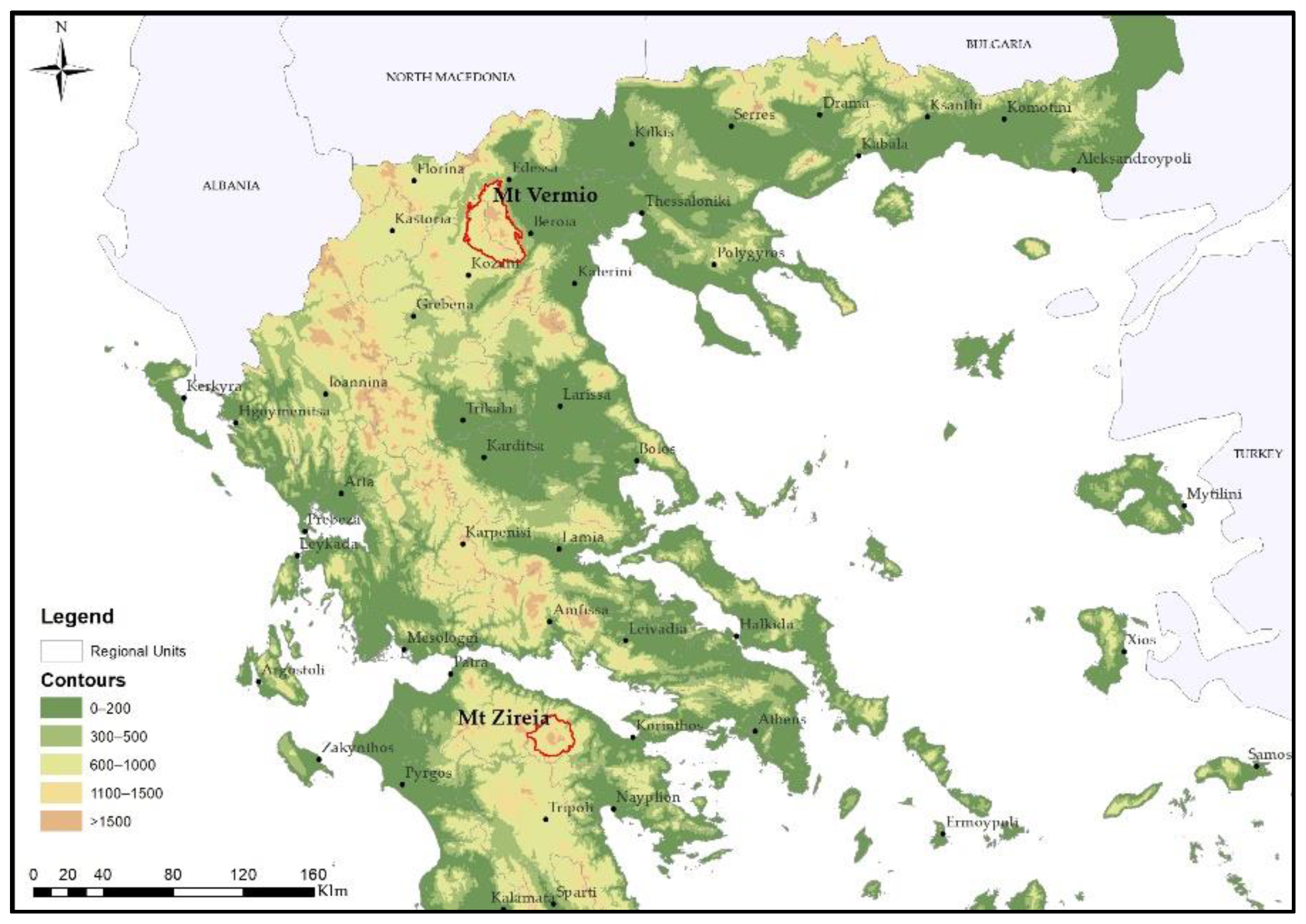
Article

Impact of Transhumant Livestock Grazing Abandonment on Pseudo-Alpine Grasslands in Greece in the Context of Climatic Change

by
Anna Sidiropoulou
1,
Dimitrios Chouvardas
1,
Konstantinos Mantzanas
1,
Stefanos Stefanidis
2 and
Maria Karatassiou
1,*
1
Laboratory of Rangeland Ecology, School of Forestry and Natural Environment, Aristotle University of Thessaloniki, P.O. Box 286, 54124 Thessaloniki, Greece
2
Laboratory of Mountainous Water Management and Control, School of Forestry and Natural Environment, Aristotle University of Thessaloniki, P.O. Box 268, 54124 Thessaloniki, Greece
*
Author to whom correspondence should be addressed.
Land 2022, 11(12), 2126; https://doi.org/10.3390/land11122126
Submission received: 31 October 2022 / Revised: 16 November 2022 / Accepted: 21 November 2022 / Published: 25 November 2022

Abstract

:
Pseudo-alpine grassland ecosystems have started to decline during the past few decades. According to many studies, climate change and abandonment of traditional anthropogenic activities are directly linked to this phenomenon. However, the interaction of these two factors with pseudo-alpine grasslands has not been studied in Greece. The aim of this study was to assess the impact of climatic change and abandonment of transhumant livestock grazing on pseudo-alpine grassland ecosystems structure and stability in Mt Vermio and Mt Zireia. Geographic Information System data on land use/land cover from 1945 and 2020, as well as climatological and livestock data, have been examined and presented. Landscape metrics were also used to quantify landscape structure changes. Although both mountains’ pseudo-alpine grasslands have reduced in size, Mt Zireia has experienced an upward treeline shift, which seems to be the result of climate change, while in Mt Vermio, the more severe transhumance abandonment caused horizontal tree expansion. There are strong indications that a rise in temperature is the main driver for the upward increase in treeline.

1. Introduction

Alpine and pseudo-alpine grasslands are uncultivated areas with natural vegetation, mainly herbaceous plants, managed with ecological principles [1,2] and characterized by harsh climatic conditions that limit the plant growth period to a few months [3]. In Greece, forest boundaries are between 1700 and 2000 m [4], however, grasslands over 1200 m are ecologically connected to the pseudo-alpine zone and are therefore considered as pseudo-alpine [5]. They are among the European regions where conservation is of the utmost importance (Council Directive 92/43/EEC of 21 May 1992) [6] and they make up most of Greece’s Special Protection Zones for Mountainous Areas [7].
Alpine and pseudo-alpine grasslands are hotspots for biodiversity and have significant cultural heritage values [8], supporting numerous rare and/or endangered animals and plants species. They provide many ecosystem services, such as nitrogen (N) and carbon (C) storage [6,9], water purification and retention [6,10], valuable genetic material storage [2], provision of pharmaceuticals [11], soil conservation [9,11], nutrient recycling, pollination and climate regulation [11], forage for animals [11], and can generate substantial economic value through the production of meat and milk [6]. They represent areas for recreation, tourism, and cultural heritage [6,9,11] and create a sustainable framework that ensures the future of rural areas [2].
Species diversity, ecosystem function and landscape structure in pseudo-alpine grasslands, like most terrestrial ecosystems, are concurrently affected by global climate change and anthropogenic activities such as livestock grazing, agriculture, urbanization, etc. [12,13,14,15,16,17,18]. Changes in vegetation pattern and floristic composition are the main effects of livestock grazing on the landscape. The nature and extent of these changes depend on livestock species [19], grazing period, pressure, and history [20,21,22], as well as on abiotic variables such as soil type, temperature, and precipitation [15,23].
Pseudo-alpine grasslands are often referred to as summer grasslands because they are grazed in the summer. For this reason, they were mostly associated with transhumance [24]. In the past, these grasslands were the hub of summer grazing activities with animals and herders, along with their families, living there for more than five months each year [25]. The animals arrived at the end of spring and left at the end of the summer, grazing the abundant annual growth of forage species. The herders made efficient use of natural resources and created unique natural landscapes [26,27], while also enhancing the genetic diversity by rearing autochthonous breeds and providing ecosystem services [28,29]. In addition, transhumance protected rural livelihoods, reducing the depopulation of marginal and remote areas, and effectively mitigated climate change effects (e.g., soil carbon stock in rangelands) [26].
Transhumance during the centuries has had a major impact on landscape structure, vegetation composition, and ecosystem services in the mountainous areas [30,31,32] not only in many Mediterranean mountains [33], but also in high mountains such as the Himalayas [34]. This kind of animal husbandry has helped conserve the rangelands and open forests—two important types of landscape. The decline in the transhumant livestock system over the last few decades has impacted the structure and composition of grassland ecosystems [30,35] and has reduced their multi-functionality, particularly in regions where grazing was prohibited for an extended period of time [35]. In addition to livestock grazing, strong evidence suggests that global warming is leading to dramatic shifts in structure, species diversity, and functioning in alpine vegetation communities [3,15,36,37]. Although climate change is affecting the entire globe, alpine regions are particularly vulnerable to its consequences [38,39,40]. The increase in air temperature may change the type of vegetation from grasslands to shrublands and finally to forests [41]. Most of the uses involving woody species tend to integrate rapidly, now forming a more homogeneous mosaic landscape [42].
Despite significant regional variations, the majority of Europe has seen temperature rises of roughly 0.8 °C on average this century [43]. The impact of climate change varies with latitude [44,45,46], with southern, drier regions being more affected than northern ones [43,47]. Treeline shifts due to climate change and the cessation of transhumance have significant implications for pseudo-alpine grassland spatial distribution [48]. In the Central Austrian Alps, for example, treelines that have been impacted by pastoral use for centuries respond to climate change differently than treelines that have not been altered [49].
Numerous studies demonstrate that grazing increases spatial heterogeneity, mostly because of differences between grazed and ungrazed patches as well as other grazing-related effects such as manuring and trampling [50]. A shift in treeline results in changes in the edge habitat, which could lead to either landscape fragmentation or homogenization, loss of diversity [20,51], and poses a major threat to the conservation value of grasslands [11]. Landscape spatial structure changes can be better described and quantified using landscape metrics [52,53,54,55].
While there have been numerous studies on how climate change affects treeline, there are no studies, as far as we are aware, about alpine grasslands. The changes in both climate and land use pose a threat to the long-term survival of the existing plant mosaic in the pseudo-alpine grasslands [8]. This study aimed to investigate the impact of climatic change and abandonment of transhumant livestock grazing system on the pseudo-alpine grassland ecosystem structure and stability of two mountains in Greece. We set out to answer the following question: Does the climate and the abandonment of transhumance affect land use changes in the pseudo-alpine zone, and how?

2. Materials and Methods

2.1. Study Area

The research was conducted on Mt Vermio and Zireia, in the pseudo-alpine zone over 1200 m (Figure 1).
Mt Vermio is located in central-western Macedonia and administratively belongs to Imathia, Kozani, and Pella Regional Units. It has a north-south orientation with its tallest peak at 2052 m [25]. The climate is sub-Mediterranean in the uplands and meso-Mediterranean in the lowlands. The driest months are July and August, but due to the vicinity of archipelagos, the atmosphere is never completely dry [56]. The climate under the Köppen and Geiger [57] classification system ranges from Mediterranean-influenced warm-summer humid continental (Dsb) to warm-summer humid continental (Dfb). According to the classification approach of Mavromatis [58], Mt Vermio belongs to the bioclimatic zone wet with severe winter and to two different bioclimatic character categories: axeric temperate and sub-Mediterranean. Most of Mt Vermio is part of the network of the Natura 2000 protected areas [59]. Forests and shrublands are found mainly on the eastern part of the mountain.
Vermio is a mountain where transhumant livestock animals used to have a very strong presence in the past. According to Chatzimichali [60], it accommodated 66% of Macedonia’s goats and sheep. It covered the needs for forage production for almost the whole of Thessaly (Central Greece) and beyond [25,61] because it was easily accessible and had plenty of grasslands with an abundance of forage production during summer [62]. The entire region served as summer grazing land for flocks owned by an ethnic group known as the “Sarakatsanaioi”. The “Tseligkata” social structure that the Sarakatsanaioi established allowed many small-scale transhumant families to collaborate and work together [63].
According to Katsaros [62], in the 1950s there were about 150,000–170,000 sheep and goats grazing in the area, but over the past few decades the number of animals and therefore the grazing pressure has significantly decreased. As in most of Greece, the Tseligkato system today has become almost extinct in Mt Vermio [64]. Sidiropoulou and co-authors [25] estimate that there were only 27,532 sheep and goats grazing freely in Mt Vermio in 2011. This declining trend in transhumance has caused changes in the size and distribution of grasslands and forests [20,65,66].
Mt Zireia (Kyllini) is southeast of the Corinth Regional Unit in Peloponnese. It is the second highest mountain of the Peloponnese peninsula, with the highest peak at 2374 m. The climate under the Köppen and Geiger [57] classification system ranges from Mediterranean-influenced warm-summer humid continental (Dsb) to warm-summer Mediterranean (Csb). According to the classification approach of Mavromatis [58], Mt Zireia belongs to the bioclimatic zone wet with severe winter and to three different bioclimatic character categories: sub-axeric cold with a sub-dry period, sub-Mediterranean and mild meso-mediterranean. The majority of Mt Zireia is protected by the Natura 2000 network [67,68]. The study area’s flora is rich and contains several significant endemic species for the Peloponnese and Greece as a whole [67,69]. Above 800 m there are forests and in the higher elevation zone there are mainly grasslands with thorny shrubs and grasses, many of which are unique and rare endemic and rocky areas [67]. In Mt Zireia there were about 38,000 transhumant sheep and goats in 1960 [70]. Families and flocks were moved on foot from different areas of the Peloponnese peninsula or West Attica [60]. However, in recent years, there was remarkable decrease of transhumant animals. According to Karatassiou and coauthors [70] in 2020 there were 13,717 transhumant sheep and goats in Mt Zireia.

2.2. Methods

Long-term (1990–2019) time series analysis of annual precipitation, mean annual air temperature, and maximum annual air temperature were based on the TerraClimate dataset [71], a high-spatial resolution (1/24°, ~4 km) dataset of monthly climate and climatic water balance for global terrestrial surfaces from 1958 until now. The aridity index of De Martonne (IdM) [72] was calculated for the same period using the following Formula (1):
IdM = P/(T + 10)
where P is the average annual precipitation (mm) and T the average mean annual air temperature (℃). The aridity index (IdM) is a key environmental component influencing the development of natural vegetation and categorizes climate types in proportion to water availability [15] because of its efficiency and relevance in relation to the arid/humid climate classification [73,74].
Livestock data were collected from Chatzimichali [60], Katsaros [62] and the Payment and Control Agency for Guidance and Guarantee Community [75]. Grazing pressure by transhumant sheep and goats in the pseudo-alpine zone was the quotient of transhumant animals/pseudo-alpine grazing areas (grasslands, shrublands, silvopastoral systems).
Land Use/Land Cover (LULC) data for Mt Vermio and Mt Zireia were obtained for 1945 and 2020, to analyze temporal land use changes in the two study areas:
  • Aerial orthophotographs (spatial resolution of 1 m) of 1945 provided by the National Cadastre and Mapping Agency S.A. [76] were used to digitize past LULC (scale 1:5000);
  • Google Earth satellites images were used to digitize current (2020) LULC types.
The LULC data for 1945 and 2020, for Mt Vermio and Mt Zireia, were classified according to Ref. [25] into the following six categories: pseudo-alpine grasslands, shrublands, silvopastoral systems, forests, agricultural land, and other land uses (mainly built-up areas and a few water surfaces).
Data was processed within ArcGIS v10.8.1 software [77], and the minimum cartographic unit was set to 1 ha. The selected classification method detected various components on aerial orthophotos and Google Earth images using basic photographic keys (tone, texture, pattern, shadow, shape, and size) and feature association [47,78]. Visual photointerpretation was supported by extensive field sampling verifications from a group of scientists, with more than 20-years of research experience in the specific areas. The pseudo-alpine zone was isolated using the “clip” command and a few peaks that were not part of the main mountain core were excluded. The transition matrix method was used to represent all possible landscape changes between 1945 and 2020 for both study areas.
To examine the slopes and elevation zones of the two mountains, a Digital Elevation Model (ASTER Global DEM) [79] with a resolution of 30 m (pixel size) was processed.
To assess the extent of forest invasion on grasslands, the temporal variations in altimeter forest distribution were analyzed by merging the elevation zones (100 m altitudinal difference) and forest cover with the “union” command in ArcGIS v10.8.1.
Patch Analyst/Grid Extension for ArcGIS [80] was used to compute four quantitative metrics for analyzing landscape structure [81,82]. Based on previous multi-temporal landscape studies [25,55] the chosen metrics were Number of patches (NumP), Mean patch size (MPS), Edge density (ED), and Interspersion Juxtaposition index (JI) (Table 1).
Metrics were calculated for all LULC types at the landscape level and exclusively for grasslands at the class level. Classes corresponded to the different LULC types, and each class consisted of numerous polygons (patches). The cell size for grid analysis was set to 10 m.

3. Results

The average values of mean annual air temperature for both Mt Zireia and Mt Vermio over the last 30 years are shown on Figure 2. Mt Vermio is substantially cooler compared to Mt Zireia by 1–2 °C and differences were rather consistent throughout the last 30 years.
The mean annual temperature between 1990 and 2019 was 8.3 °C and 9.8 °C for Mt Vermio and Mt Zireia, respectively, and the max annual temperature for the same period was 13.3 °C and 14.9 °C, respectively (Table 2).
The annual precipitation between 1990 and 2019 was 666.8 mm for Mt Vermio and 917.3 mm for Mt Zireia (Table 2). Similar to temperature, annual precipitation for both Mt Zireia and Mt Vermio during the past 30 years showed considerable year-to-year variation (Figure 3).
The aridity index (IdM) for the same period was 36.3 for Mt Vermio and 46.2 for Mt Zireia (Table 2) and the two study areas were classified as moderately humid and humid [74].
Transhumance was once prevalent on Mt Vermio, which could hold nearly 170,000 transhumant sheep and goats (Table 3). Currently, there are 22,308 transhumant animals, a dramatic decrease of approximately 86.1%. On the contrary, on Mt Zireia, the number of transhumant animals in the past was much smaller (38,230). However, just like on Mt Vermio, transhumance has declined. Today on Mt Zireia there are only 13,717 transhumant animals, a decrease of 64.1% (Table 3).
Today, there are fewer than 22,000 transhumant animals in both mountains, however grazing pressure (transhumant animals/pseudo-alpine grazing areas) in the pseudo-alpine zone of Mt Vermio is only 0.69, compared to 0.94 in Mt Zireia (Table 4).
The spatial distribution of LULC on Mt Vermio between 1945 and 2020 is presented in Figure 4.
In 1945, pseudo-alpine grasslands on Mt Vermio occupied most of the area (28,581.2 ha), followed by silvopastoral systems (6308.5 ha), forests (5568 ha), and shrublands (3623.9 ha) (Table 5). In 2020 there was a significant increase (245.7%) in forest size, while pseudo-alpine grasslands, silvopastoral systems, and shrublands have substantially decreased by −19.8%, −77.9%, and −92.8%, respectively.
The spatial distribution of LULC types on Mt Zireia for 1945 and 2020 is presented in Figure 5.
In 1945, most areas of Mt. Zireia were covered by pseudo-alpine grasslands (4712.3 ha), followed by forests (3130.5 ha), shrublands (2504.3 ha), and silvopastoral systems (2300.2 ha) (Table 6). In 2020 there was an increase (54.4%) in forests and shrublands (8.7%), while pseudo-alpine grasslands and silvopastoral systems decreased by −19.8% and −51.7%, respectively.
According to Table 7 and Table 8, between 1945–2020 almost 37% the total landscape area of Mt Vermio and 28% of Mt Zireia changed land use. The most important changes in terms of gain for both mountains were forest expansion and in terms of loss, pseudo-alpine grassland and silvopastoral systems reduction. On Mt Zireia a slight increase was also recorded for shrublands, silvopastoral areas, and pseudo-alpine grasslands (Table 8, gain values). Further analysis of the transition data showed that on Mt Vermio, the dominant expansion of forests occurred equally at the expense of silvopastoral systems and pseudo-alpine grasslands, and to a lesser extent at the expense of shrublands. On Mt Zireia however, the growth of forests was mainly done at the expense of silvopastoral systems.
According to the analysis of the Digital Elevation Model, Mt Vermio had primarily moderate slopes (16–30%), whereas Mt Zireia had primarily very steep slopes (>46%). As per the analysis of changes in forest cover (%) per altitudinal zone between 2020 and 1945 for the two mountains, Mt Zireia had an increase in forest cover in higher altitudes, indicating an upward shift in treeline, whereas Mt Vermio showed the opposite trend (Figure 6). On Mt Vermio, forest expansion was higher at 1200 m while in Mt Zireia it was at 1700 m.
On Mt Vermio, although the spread of the forest was intense and dynamic, it happened horizontally rather than vertically, as the treeline did not shift upwards (Figure 7).
Between 1945 and 2020, the forest area on Mt. Zireia had expanded upward, primarily on the mountain’s northeast side where the slopes were gentle (Figure 8).
The values of the landscape metrics, which constitute the most effective technique to measure and analyze changes in land uses, for Mt Vermio and Mt Zireia from 1945 to 2020, are presented in Table 9.
The NumP increased (32.2%) over the study period on Mt Vermio suggesting that larger vegetation areas had been divided up into smaller pieces. The MPS, which has reduced from 123.1 hectares in 1945 to 93.1 ha in 2020, also serves as a proxy for the degree of vegetation fragmentation. The decrease in IJI by 35% suggests that landscape patches have clumped, and they are interspersed disproportionally.
On Mt Zireia on the contrary, the NumP has substantially decreased (41.3%), while MPS dramatically increased from 65.3 ha in 1945 to 111.3 ha in 2020. This indicates that the landscape is less subdivided and fragmented.
For 1945 and 2020, a class level analysis focused on the grasslands of Mt Vermio and Mt Zireia revealed similar tendencies (Table 10).
On Mt Vermio, during the period 1945–2020, NumP increased significantly (51.1%) while MPS decreased from 317.6 ha in 1945 to 168.6 ha in 2020. The 45.6% decline in IJI values suggests that grasslands are less equally adjacent to each other.
On Mt Zireia, during the period from 1945 to 2020, NumP decreased by 41.7% while MPS increased from 56.1 ha in 1945 to 77.1 ha in 2020. Grasslands appear less fragmented and more united. In addition, grassland edges (ED) showed a reduction (−31.5%), indicating a negative impact of the changes to landscape patches to the ecotones and therefore in biodiversity.

4. Discussion

Our findings suggest that the climate and the abandonment of transhumance may have had a substantial impact on land use changes in the pseudo-alpine zone of the two mountains in the current study. Forests expanded at the expense of other land uses, mainly pseudo-alpine grasslands, shrublands, and silvopastoral systems. In the meantime, higher mean annual air temperature led to an upward shift in treeline and a subsequent retreat of pseudo-alpine grasslands.
In the past, grazing pressure of transhumant animals and the harvest of timber and firewood, maintained an open, mosaic-like landscape, and created openings and corridors in forests [25]. This way, not only the expansion of invasive or colonizing grass species [50], but also of trees, was prevented. Today, transhumance has declined in Greece, following a pattern that has been observed across Europe [83]. The reasons are agricultural reform, World War II, rural depopulation, and the restriction on grazing in mountainous areas [25,61,84]. On Mt Vermio and Mt Zireia, this trend led to the abandonment or underutilization of pseudo-alpine grasslands [85]. On Mt Vermio the number of transhumant animals decreased dramatically (Table 3), and the entire mountain was abandoned. The changes in landscape structure are depicted in the values of landscape metrics. Trees started to penetrate former unified, large grassland patches, creating a more fragmented landscape (NumP, MPS, IJI) (Table 9). This fragmentation reduced the habitat area and increased the spatial discontinuity [51] leading to a reduction in species richness and biodiversity, impeding the possibilities of dispersion and an increase of vulnerability that is associated with risk of extinction [11].
On Mt Zireia, grazing pressure was higher (0.94 animals/ha) than Mt Vermio (0.69 animals/ha) and it was constant in lower altitudes, thus preventing the expansion of forest over 1700 m. The abandonment of transhumance on higher altitudes seems to have affected mainly the small grassland patches inside the forest that began to disappear. This phenomenon led to a more cohesive and homogenized landscape (NumP, MPS, ED).
Overall, Mt. Vermio appears to be at an advanced stage of abandonment, where the trees have invaded the grasslands and broken their coherence, whereas Mt. Zireia is in an earlier stage of abandonment where the grassland gaps in the forest started to close. This result is consistent with the claims of many researchers [86,87,88,89] who suggest that variation in grazing pressure could be the driver of land use changes in the pseudo-alpine zone.
Similar to the rest of Europe, Mt. Vermio and Mt. Zireia’s temperature and precipitation have risen during the past 30 years [71,90]. However, Mt Zireia had higher mean annual air temperature and annual precipitation (Table 2) and therefore different water balance [91], plant growth period [92], and annual above-ground productivity [93]. The differences in climatic conditions were expected due to the influence of orography and spatial climate variability [94], but mainly due to the geographical location of the two mountains.
The higher mean annual air temperature in Mt Zireia could have led to the upward shift in treeline (Figure 7) since most researchers agree that it is the main driver of upward expansion of the treeline [8,95,96,97,98,99,100,101]. Particularly young trees respond to environmental change by closing the forest gaps [100,102]. Furthermore, the increase in annual precipitation over the past 30 years in Mt. Zireia (Figure 3) facilitated treeline upward elevation.
On the island of Crete’s Samaria National Park, Beloiu and colleagues [103] noted that despite a drop in precipitation over the previous 70 years, there had been no treeline change. A combination of meteorological and topographic conditions, such as decreased precipitation with rising warmth and the absence of a sheltering effect because of high topographic wind exposure, are the main causes of the absence of treeline shift in Crete. Even though changes in temperature and precipitation may intensify shifts in treeline, temperature increases and precipitation drop may interact unpredictable as far as an effect on the treeline is regarded. Precipitation restricts the growth of trees, especially in semi-arid regions with little water storage, where it raises evapotranspiration and aggravates moisture stress [104]. On the other hand, topographic factors, such as the lack of shelter due to high topographic wind exposure may interact with temperature and precipitation and regulate the trends in treeline shifts in Crete [105]. However, Zindros and coauthors [101] concluded that treeline shift results from the significant temperature increase during the growing season in National Park of Mt Olympus, Greece.
Today, on Mt Zireia, forests have replaced pseudo-alpine grasslands primarily in the northeast region, where the conditions were more favorable for forests to intrude (lower inclination) (Figure 7). Lundbäck and coauthors [105] estimate that 82% of the world’s forests grow on slopes <15°. The amount of solar radiation in mountainous or hilly environments is impacted by the slope aspect, which has an immediate impact on species distribution and tree growth [106]. At mid-latitudes in the Northern Hemisphere, south-facing slopes receive significantly more direct solar radiation than comparable northern slopes [107]. Thus, it is anticipated that treeline elevation will be higher on south-facing, warmer slopes than on their north-facing, cooler equivalents. However, in the Mediterranean region, south-facing slopes can be more vulnerable to dryness than north-facing slopes [107,108]. As a result, the elevation of the treeline can be significantly lowered. With a few exceptions, seasonal root temperatures globally coincide with treeline height [109]. Given that they are found in regions with warmer temperatures than indicated by the global distribution pattern, Mediterranean treelines serve as an example of one of these outliers. This has been explained by the absence of cold-resistant treeline taxa or by the prevalence of treelines that have been affected by anthropogenic use in the past [110]. Most mountainous regions of the world anticipate considerable increases in air temperatures in the future decades, but it is unclear how local characteristics (such as elevation, aspect, and soil) will affect how trees near treelines react to the warming. Because different bio-geographical patterns of tree development respond to temperature differently, a warmer climate may have distinct effects on treeline dynamics [111].
In our case study, we found the following trends considering forest expansion. Trees either moved up the mountain to a higher elevation (upward/vertical shift = elevational expansion) or expanded horizontally (latitudinal expansion). On Mt Vermio, the spread of the forest was intense and dynamic (245% increase) but happened horizontally rather than vertically (Figure 8). This is in accordance with a review study related to treelines in the world [112], where the majority of treeline sites (92%) addressed elevational treeline advances while 8% addressed the latitudinal advances. Hansson and coauthors [112], suggest that this is likely due to easier horizontal dispersal of trees across landscapes, because the elevational gradient acts as a barrier for seedling dispersal and the temperature remains consistent within the same altitudinal zone.
According to the values of gains and losses of forests and pseudo-alpine grasslands for the two mountains (Table 7), the “forest increase vs. pseudo-alpine grasslands reduction” trend was less extensive on Mt Zireia. The expansion of forests over grasslands was less than 3% of the total landscape and was limited on the northeast side. This may be explained by the “mountain effect”, which states that higher mountains face less abandonment than medium ones [113]. Simultaneously on Mt Zireia, there was an upward shift of treeline. As mentioned earlier, most researchers agree that treeline position is limited by the average temperatures, however, according to Piper and coauthors [108], in the Mediterranean region, the absence of an elevational trend in tree growth shows the presence of other abiotic factors than temperature, including drought, which towards the end of the growing season may overwhelm the temperature-driven elevational increase. Increased temperatures may have an impact on tree development, although Hansson and colleagues [112] report that it also depends on the topography and water availability of the area.

5. Conclusions

Pseudo-alpine grasslands on both mountains have reduced. The abandonment of the transhumant livestock grazing system on Mt Vermio has resulted in the horizontal expansion of the forest. However, this is not enough to cause a corresponding upward increase in treeline. The main driver for the latter seems to be climate change, specifically a rise in temperature, as in the case of Mt Zireia.
Pseudo-alpine grasslands have been significantly impacted by both climate change and transhumance abandonment. Given the importance of these areas, more field-based research is required. Long-term monitoring of landscape spatial patterns and climatic conditions could help prevent drastic changes in high-mountain ecosystems such as Mt Vermio and Mt Zireia.

Author Contributions

Conceptualization, A.S., D.C., K.M., S.S. and M.K.; methodology, A.S., D.C., K.M. and M.K.; software, A.S., D.C. and S.S.; validation, A.S., D.C., K.M., S.S. and M.K.; formal analysis, A.S. and D.C.; investigation, A.S., D.C., K.M., S.S. and M.K.; resources, M.K.; data curation, A.S., D.C., K.M., S.S. and M.K.; writing—original draft preparation, A.S., D.C., K.M. and M.K.; writing—review and editing, A.S., D.C., K.M., S.S. and M.K.; visualization, A.S., D.C., K.M. and M.K.; supervision, M.K.; project administration, M.K.; funding acquisition, M.K. All authors have read and agreed to the published version of the manuscript.

Funding

This research was part of the project «PACTORES» and was co-funded by the European Union (European Social Fund, ERANETMED2-72-303) and General Secretariat for Research and Innovation (GSRI, Τ8ΕΡA2-00022) through the Action “ERA-Net”.

Institutional Review Board Statement

Not applicable.

Informed Consent Statement

Not applicable.

Data Availability Statement

The data presented in this study are available in the Figures and Tables provided in the manuscript.

Conflicts of Interest

The authors declare no conflict of interest.

References

  1. Heady, H. Rangeland Management; McGraw-Hill, Inc.: New York, NY, USA, 1975; p. 460. [Google Scholar]
  2. Ispikoudis, I.; Sidiropoulou, A. Alpine landscapes. In Proceedings of the Natural Landscape Conference, Drama, Greece, 26–27 May 2006; pp. 199–214. (In Greek). [Google Scholar]
  3. García-González, R. Management of Natura 2000 Habitats. 6170 Alpine and Subalpine Calcareous Grasslands. Tech. Rep. 2008, 11, 23. [Google Scholar]
  4. Athanasiadis, N.; Eleutheriadou, E.; Theodoropoulos, K. Flora and Vegetation of Greece; Publications Department of Aristotle University of Thessaloniki: Thessaloniki, Greece, 2001; p. 76. (In Greek) [Google Scholar]
  5. Papanastasis, V. Ecology and management of pseudoalpine rangelands. In Proceedings of the Rangeland Management and Development of Mountainous Areas, Karpenisi, Greece, 4–6 September 2002; pp. 437–445. (In Greek). [Google Scholar]
  6. Schucknecht, A.; Kramer, A.; Asam, S.; Mejia-Aguilar, A.; Garcia-Franco, N.; Schuchardt, M.; Jentsch, A.; Kiese, R. Vegetation traits of pre-Alpine grasslands in southern Germany. Sci. Data 2020, 7, 316–327. [Google Scholar] [CrossRef] [PubMed]
  7. Trakolis, D.; Platis, P.; Meliadis, I. Biodiversity and Conservation Actions on Mount Voras, Greece. J. Environ. Manag. 2000, 26, 145–151. [Google Scholar] [CrossRef]
  8. Peringer, A.; Frank, V.; Snell, R. Climate change simulations in Alpine summer pastures suggest a disruption of current vegetation zonation. Glob. Ecol. Conserv. 2022, 37, e02140. [Google Scholar] [CrossRef]
  9. Homburger, H.; Schneider, M.; Scherer-Lorenzen, M.; Lüscher, A. Quantifying grazing intensity and ecosystem services in subalpine pastures. Opt. Mediterr. Ser. A 2014, 109, 495–498. [Google Scholar]
  10. Papanastasis, V.; Noitsakis, B. Rangeland Ecology; Giaxoudi-Giapouli: Thessaloniki, Greece, 1992; p. 244. [Google Scholar]
  11. Roch, L.; Jaeger, J. Monitoring an ecosystem at risk: What is the degree of grassland fragmentation in the Canadian Prairies? Environ. Monit. Assess. 2014, 186, 2505–2534. [Google Scholar] [CrossRef]
  12. Bogaert, J.; Vranken, I.; André, M. Anthropogenic effects in landscapes: Historical context and spatial pattern. In Biocultural Landscapes: Diversity, Functions and Values; Hong, S., Bogaert, J., Min, Q., Eds.; Springer: Dordrecht, The Netherlands, 2014; pp. 89–112. [Google Scholar]
  13. Chen, B.; Zhang, X.; Tao, J.; Wu, J.; Wang, J.; Shi, P.; Zhang, Y.; Yu, C. The impact of climate change and anthropogenic activities on alpine grassland over the Qinghai-Tibet Plateau. Agric. For. Meteorol. 2014, 189–190, 11–18. [Google Scholar] [CrossRef]
  14. Henkin, Z.; Hadar, L.; Noy-Meir, I. Human-scale structural heterogeneity induced by grazing in a Mediterranean woodland landscape. Landsc. Ecol. 2006, 22, 577–587. [Google Scholar] [CrossRef]
  15. Karatassiou, M.; Parissi, Z.; Panajiotidis, S.; Stergiou, A. Impact of grazing on diversity of semi-arid rangelands in Crete island in the context of climatic change. Plants 2022, 11, 982. [Google Scholar] [CrossRef]
  16. Wang, H.; Zhang, M.; Wang, C.; Wang, K.; Wang, C.; Li, Y.; Bai, X.; Zhou, Y. Spatial and temporal changes of landscape patterns and their effects on ecosystem services in the Huaihe River basin, China. Land 2022, 11, 513. [Google Scholar] [CrossRef]
  17. Li, M.; Zhang, X.; Wu, J.; Ding, Q.; Niu, B.; He, Y. Declining human activity intensity on alpine grasslands of the Tibetan Plateau. J. Environ. Manag. 2021, 296–305, 113198. [Google Scholar] [CrossRef] [PubMed]
  18. Valkó, O.; Venn, S.; Żmihorski, M.; Biurrun, I.; Labadessa, R.; Loos, J. The challenge of abandonment for the sustainable management of Palaearctic natural and semi-natural grasslands. Hacquetia 2018, 17, 5–16. [Google Scholar] [CrossRef]
  19. Rook, A.; Dumont, B.; Isselstein, J.; Osoro, K.; WallisDeVries, M.; Parente, G.; Mills, J. Matching type of livestock to desired biodiversity outcomes in pastures—A review. Biol. Conserv. 2004, 119, 137–150. [Google Scholar] [CrossRef]
  20. Lagka, V. The Dynamics of the Transhumant Sheep and Goat Farming System in Greece. Influences on Biodiversity; Final Project Report: Thessaloniki, Greece, 2015; p. 73. Available online: http://www.agreri.gr/sites/default/files/projects/Τελική%20Έκθεση%20ΘAΛHΣ.pdf (accessed on 12 April 2019). (In Greek)
  21. Coffin, D.; Laycock, W.; Lauenroth, W. Disturbance intensity and above-and belowground herbivory effects on long-term (14 Y) recovery of a semiarid grassland. Plant Ecol. 1998, 139, 221–233. [Google Scholar] [CrossRef]
  22. Perevolotsky, A.; Seligman, N. Role of grazing in Mediterranean rangeland ecosystems. Bioscience 1998, 48, 1007–1017. [Google Scholar] [CrossRef] [Green Version]
  23. Adler, P.; Levine, J. Contrasting relationships between precipitation and species richness in space and time. Oikos 2007, 116, 221–232. [Google Scholar] [CrossRef]
  24. Karatassiou, M.; Galidaki, G.; Ragkos, A.; Stefopoulos, K.; Sklavou, P.; Parissi, Z.; Lagka, V. Transhumant sheep and goat farming and the use of rangelands in Greece. Opt. Mediterr. Ser. A 2015, 115, 655–659. [Google Scholar]
  25. Sidiropoulou, A.; Karatassiou, M.; Galidaki, G.; Sklavou, P. Landscape pattern changes in response to transhumance abandonment on mountain Vermio (North Greece). Sustainability 2015, 7, 15652–15673. [Google Scholar] [CrossRef] [Green Version]
  26. Ragkos, A. Transhumance in Greece: Multifunctionality as an asset for sustainable development. In Grazing Communities: Pastoralism on the Move and Biocultural Heritage Frictions; Bindi, L., Ed.; Berghahn Books: Oxford, NY, USA, 2022; Volume 29, pp. 23–43. [Google Scholar]
  27. Ntassiou, K.; Doukas, I.D. Recording and mapping traditional transhumance routes in the South-Western Macedonia, Greece. GeoJournal 2019, 84, 161–181. [Google Scholar] [CrossRef]
  28. D’Ottavio, P.; Francioni, M.; Trozzo, L.; Sedić, E.; Budimir, K.; Avanzolini, P.; Trombetta, M.; Porqueddu, C.; Santilocchi, R.; Toderi, M. Trends and approaches in the analysis of ecosystem services provided by grazing systems: A review. Grass Forage Sci. 2018, 73, 15–25. [Google Scholar] [CrossRef]
  29. Varela, E.; Robles, A. Ecosystem services and socio-economic benefits of Mediterranean grasslands. Opt. Méditerr. 2016, 114, 13–27. [Google Scholar]
  30. Aryal, S.; Maraseni, T.N.; Cockfield, G. Changes in transhumance systems in Nepal: Analysing socio-ecological impacts using driver-pressure-state-impact-response framework. In Agriculture, Natural Resources and Food Security; Springer: Cham, Switzerland, 2022; pp. 297–314. [Google Scholar]
  31. Adler, P.Β.; Raff, D.A.; Lauenroth, W.Κ. The effect of grazing on the spatial heterogeneity of vegetation. Oecologia 2001, 128, 465–479. [Google Scholar] [CrossRef] [PubMed]
  32. Perevolotsky, A. Integrating landscape ecology in the conservation of Mediterranean ecosystems: The Israeli experience. Isr. J. Plant Sci. 2005, 53, 203–213. [Google Scholar] [CrossRef]
  33. Garcia-Ruiz, J.M.; Tomás-Faci, G.; Diarte-Blasco, P.; Montes, L.; Domingo, R.; Sebastián, M.; Lasanta, T.; Gonzalez-Samperiz, P.; López-Moreno, J.I.; Arnaez, J.J.C. Transhumance and long-term deforestation in the subalpine belt of the central Spanish Pyrenees: An interdisciplinary approach. Catena 2020, 195, 104744. [Google Scholar] [CrossRef]
  34. Haq, S.M.; Yaqoob, U.; Calixto, E.S.; Kumar, M.; Rahman, I.U.; Hashem, A.; Abd_Allah, E.F.; Alakeel, M.A.; Alqarawi, A.A.; Abdalla, M.; et al. Long-Term Impact of Transhumance Pastoralism and Associated Disturbances in High-Altitude Forests of Indian Western Himalaya. Sustainability 2021, 13, 12497. [Google Scholar] [CrossRef]
  35. Fernández-Guisuraga, J.M.; Fernández-García, V.; Tárrega, R.; Marcos, E.; Valbuena, L.; Pinto, R.; Monte, P.; Beltrán, D.; Huerta, S.; Calvo, L. Transhumant Sheep Grazing Enhances Ecosystem Multifunctionality in Productive Mountain Grasslands: A Case Study in the Cantabrian Mountains. Front. Ecol. Evol. 2022, 10, 861611. [Google Scholar] [CrossRef]
  36. Bollig, C.; Feller, U. Impacts of drought stress on water relations and carbon assimilation in grassland species at different altitudes. Agric. Ecosyst. Environ. 2014, 188, 212–220. [Google Scholar] [CrossRef]
  37. Chelli, S.; Canullo, R.; Campetella, G.; Schmitt, A.; Bartha, S.; Cervellini, M.; Wellstein, C. The response of sub-Mediterranean grasslands to rainfall variation is influenced by early season precipitation. Appl. Veg. Sci. 2016, 19, 611–619. [Google Scholar] [CrossRef] [Green Version]
  38. Fort, M. Impact of climate change on mountain environment dynamics. J. Alp. Res. 2015, 103, 2–7. [Google Scholar] [CrossRef] [Green Version]
  39. Mallet, R.; Burtscher, M.; Cogo, A. Climate change in mountainous areas and related health effects. Front. Physiol. 2021, 12, 768112. [Google Scholar] [CrossRef]
  40. Zemp, M.; Hoelzle, M.; Haeberli, W. Six decades of glacier mass-balance observations: A review of the worldwide monitoring network. Ann. Glaciol. 2009, 50, 101–111. [Google Scholar] [CrossRef] [Green Version]
  41. Elbehri, A.; Challinor, A.; Verchot, L.; Angelsen, A.; Hess, T.; Ouled Belgacem, A.; Clark, H.; Badraoui, M.; Cowie, A.; De Silva, S.; et al. FAO/IPCC Expert Meeting on Land Use, Climate Change and Food Security: Final Meeting Report; FAO and IPCC: Rome, Italy, 2017. [Google Scholar]
  42. Serrano, L.; Valdecantos, A.; Vallejo-Calzada, R. Mediterranean Desertificated Landscapes: Forests and Forest Areas. 2018, p. 14. (In Greek). Available online: https://docplayer.gr/6224958-Mesogeiaka-erimopoiimena-topia-dasi-kai-dasikes-ektaseis.html (accessed on 11 May 2022).
  43. Watson, R.; Zinyowera, M.; Moss, R. The Regional Impacts of Climate Change: An Assessment of Vulnerability; IPCC Special Report; Cambridge University Press: Cambridge, UK, 1998; p. 517. [Google Scholar]
  44. Deutsch, C.; Tewksbury, J.; Huey, R.; Sheldon, K.; Ghalambor, C.; Haak, D.; Martin, P. Impacts of climate warming on terrestrial ectotherms across latitude. Proc. Natl. Acad. Sci. USA 2008, 105, 6668–6672. [Google Scholar] [CrossRef] [PubMed] [Green Version]
  45. Louthan, A.; Peterson, M.; Shoemaker, L. Climate sensitivity across latitude: Scaling physiology to communities. Trends Ecol. Evol 2021, 36, 931–942. [Google Scholar] [CrossRef] [PubMed]
  46. Crosson, P. Climate change and mid-latitudes agriculture: Perspectives on consequences and policy responses. Clim. Change 1989, 15, 51–73. [Google Scholar] [CrossRef]
  47. Kiziridis, D.; Mastrogianni, A.; Pleniou, M.; Karadimou, E.; Tsiftsis, S.; Xystrakis, F.; Tsiripidis, I. Acceleration and relocation of abandonment in a Mediterranean mountainous landscape: Drivers, consequences, and management implications. Land 2022, 11, 406. [Google Scholar] [CrossRef]
  48. Wickham, J.; Riitters, K.; Wade, T.; Coulston, J. Temporal change in forest fragmentation at multiple scales. Landsc. Ecol. 2007, 22, 481–489. [Google Scholar] [CrossRef]
  49. Wieser, G.; Oberhuber, W.; Gruber, A.J.F. Effects of climate change at treeline: Lessons from space-for-time studies, manipulative experiments, and long-term observational records in the Central Austrian Alps. Forests 2019, 10, 508. [Google Scholar] [CrossRef] [Green Version]
  50. Glasser, T.; Hadar, L. Grazing management aimed at producing landscape mosaics to restore and enhance biodiversity in Mediterranean ecosystems. Opt. Mediterr. Ser. A 2014, 109, 437–452. [Google Scholar]
  51. Jongman, R. Homogenisation and fragmentation of the European landscape: Ecological consequences and solutions. Landsc. Urban Plan. 2002, 58, 211–221. [Google Scholar] [CrossRef]
  52. Barwicka, S.; Milecka, M. The use of selected landscape metrics to evaluate the transformation of the rural landscape as a result of the development of the mining function-A case study of the Puchaczów Commune. Sustainability 2021, 13, 12279. [Google Scholar] [CrossRef]
  53. de Agar, P.M.; Ortega, M.; de Pablo, C.L. A procedure of landscape services assessment based on mosaics of patches and boundaries. J. Environ. Manag. 2016, 180, 214–227. [Google Scholar] [CrossRef] [PubMed]
  54. Ghafouri, B.; Amiri, B.J.; Shabani, A.A.; Songer, M. Examining relationships between socioeconomic factors and landscape metrics in the Southern Basin of the Caspian Sea. Environ. Model. Assess. 2016, 21, 669–680. [Google Scholar] [CrossRef]
  55. Ricca, N.; Guagliardi, I. Multi-temporal dynamics of land use patterns in a site of community importance in Southern Italy. Appl Ecol. Environ. Res. 2015, 13, 677–691. [Google Scholar] [CrossRef]
  56. Zianis, D.; Mencuccini, M. Aboveground biomass relationships for beech (Fagus moesiaca Cz.) trees in Vermio Mountain, Northern Greece, and generalised equations for Fagus sp. Ann. For. Sci. 2003, 60, 439–448. [Google Scholar] [CrossRef] [Green Version]
  57. Köppen, W.; Geiger, R. Das geographische System der Klimate; De Gruyter: Berlin, Germany, 1936; p. 44. [Google Scholar] [CrossRef]
  58. Mavromatis, G. The bioclimate of Greece. Correlations of climate and natural vegetation-bioclimatic maps. For. Res. 1980, 1, 5–63. (In Greek) [Google Scholar]
  59. Natura 2000. Available online: https://natura2000.eea.europa.eu/Natura2000/SDF.aspx?site=GR1210001 (accessed on 27 May 2022).
  60. Chatzimichali, A. Sarakatsanoi, 2nd ed.; Angeliki Chatzimichali Foundation: Athens, Greece, 2007; p. 384. (In Greek) [Google Scholar]
  61. Sklavou, P.; Karatassiou, M.; Parissi, Z.; Galidaki, G.; Ragkos, A.; Sidiropoulou, A. The role of transhumance on land use /cover changes in Mountain Vermio, Northern Greece: A GIS based approach. Not. Bot. Horti Agrobot. Cluj-Napoca 2017, 45, 589–596. [Google Scholar] [CrossRef] [Green Version]
  62. Katsaros, Ν. Sarakatsanika Tseligkata of Mt Vermio and Their Life; Association of Sarakatsans of Imathias Prefecture “Oi Stavraetoi”: Imathia, Greece, 2009; p. 431. (In Greek) [Google Scholar]
  63. Hadjigeorgiou, I. Past, present and future of pastoralism in Greece. Pastoralism 2011, 1, 24. [Google Scholar] [CrossRef] [Green Version]
  64. Kavvadias, G. Sarakatsanoi: A Greek Pastoral Society; Lousi Mpratzioti Publishing: Athens, Greece, 1991; p. 448. (In Greek) [Google Scholar]
  65. Caballero, R.; Fernández-González, F.; Badia, R.; Molle, G.; Roggero, P.; Bagella, S.; D’Ottavio, P.; Papanastasis, V.; Fotiadis, G.; Sidiropoulou, A.; et al. Grazing systems and biodiversity in Mediterranean areas: Spain, Italy and Greece. Pastos 2011, 39, 9–154. [Google Scholar] [CrossRef]
  66. Karatassiou, M.; Parissi, Z.; Sklavou, P.; Ispikoudis, S. The impact of transhumant livestock system on the diversity of two mountainous grasslands in Northern Greece. Opt. Mediterr. Ser. A 2014, 109, 499–503. [Google Scholar]
  67. Markellou, V. The endemic flora of Mount Kyllini (Ziria) and Mount Oligyrtos. Bachelor’s Thesis, School of Agriculture Technology-Department of Plant Production, Kalamata, Greece, 2013. (In Greek). [Google Scholar]
  68. Chrysanthopoulou, G. Synergy of Climate and Grazing in the Evolution of Vegetation on Mountain Kyllini. Master’s Thesis, Aristotle University of Thessaloniki, Thessaloniki, Greece, 2021. (In Greek). [Google Scholar]
  69. Tan, K.; Iatrou, G.; Johnsen, B. Endemic Plants of Greece: The Peloponnese; Gads Forlag: Copenhagen, Denmark, 2001; p. 479. [Google Scholar]
  70. Karatassiou, M.; Parissi, Z.; Stergiou, A.; Chouvardas, D.; Mantzanas, K. Patterns of transhumant livestock system on Mount Zireia, Peloponnese, Greece. Opt. Mediterr. Ser. A 2021, 126, 197–200. [Google Scholar]
  71. Abatzoglou, J.; Dobrowski, S.; Parks, S.; Hegewisch, K. TerraClimate, a high-resolution global dataset of monthly climate and climatic water balance from 1958–2015. Sci. Data 2018, 5, 170191. [Google Scholar] [CrossRef] [PubMed] [Green Version]
  72. De Martonne, E. Aerisme, et índices d’aridite. C. R. Acad. Sci. 1926, 182, 1395–1398. [Google Scholar]
  73. Haider, S.; Adnan, S. Classification and Assessment of Aridity Over Pakistan Provinces (1960–2009). Int J. Environ. 2014, 3, 24–35. [Google Scholar] [CrossRef] [Green Version]
  74. Pellicone, G.; Caloiero, T.; Guagliardi, I. The De Martonne aridity index in Calabria (Southern Italy). J. Maps 2019, 15, 788–796. [Google Scholar] [CrossRef]
  75. PCAGGCA. Payment and Control Agency for Guidance and Guarantee Community Aid-Registry of Farms and Farmers; Ministry of Rural Development and Food: Athens, Greece, 2020. [Google Scholar]
  76. NCMA. National Cadastre and Mapping Agency Aerial Photographs; National Concrete Masonry Association: Athens, Greece, 1945. [Google Scholar]
  77. ESRI. ArcMap™ 10.1; Environmental Systems Resource Institute: Redlands, CA, USA, 2011. [Google Scholar]
  78. Paine, D.; Kiser, J. Aerial Photography and Image Interpretation, 3rd ed.; John Wiley & Sons, Inc.: Hoboken, NJ, USA, 2012; p. 648. [Google Scholar]
  79. Tachikawa, T.; Kaku, M.; Iwasaki, A.; Gesch, D.; Oimoen, M.; Zhang, Z.; Danielson, J.; Krieger, T.; Curtis, B.; Haase, J.; et al. ASTER Global Digital Elevation Model; Version 2—Summary of Validation Results. Arch. Cent. Jt. Japan US ASTER Sci. Team 2011, 2, 1–25. [Google Scholar]
  80. Elkie, P.C.; Rempel, R.S.; Carr, A. Patch Analyst User’s Manual: A Tool for Quantifying Landscape Structure; Ontario Ministry of Natural Resources, Boreal Science, Northwest Science & Technology: Thunder Bay, ON, Canada, 1999. [Google Scholar]
  81. McGarigal, K.; McComb, W.C. Relationships between landscape structure and breeding birds in the Oregon Coast Range. Ecol. Monogr. 1995, 65, 235–260. [Google Scholar] [CrossRef] [Green Version]
  82. Rempel, R.; Kaukinen, D.; Carr, A. Patch Analyst and Patch Grid; Ontario Ministry of Natural Resources. Centre for Northern Forest Ecosystem Research: Thunder Bay, ON, Canada, 2012. [Google Scholar]
  83. Kiviniemi, K.; Eriksson, O. Size-related deterioration of semi-natural grassland fragments in Sweden. Divers. Distrib. 2002, 8, 21–29. [Google Scholar] [CrossRef]
  84. Takola, E.; Sidiropoulou, A.; Karatassiou, M. The impact of transhumance abandonment on land use changes in Mount Pindos (Greece). Opt. Mediterr. Ser. A 2016, 114, 143–146. [Google Scholar]
  85. Caballero, R. The Common Agricultural Policy (CAP) towards 2020: How can fit farming in the marginal areas of the EU. In Recent Researches in Energy, Environment, Entrepreneurship, Innovation; WSEAS Press: Athens, Greece, 2011; pp. 88–102. [Google Scholar]
  86. Bender, O.; Boehmer, H.; Jens, D.; Schumacher, K. Analysis of land-use change in a sector of Upper Franconia (Bavaria, Germany) since 1850 using land register records. Landsc. Ecol. 2005, 20, 149–163. [Google Scholar] [CrossRef]
  87. Humphrey, J.; Patterson, G. Effects of late summer cattle grazing on the diversity of riparian pasture vegetation in an upland conifer forest. J. Appl. Ecol. 2000, 37, 986–996. [Google Scholar] [CrossRef]
  88. Olsson, E.G.; Austrheim, G.; Grenne, S. Landscape change patterns in mountains, land use and environmental diversity, Mid-Norway 1960–1993. Landsc. Ecol. 2000, 15, 155–170. [Google Scholar] [CrossRef]
  89. Wehn, S. A map-based method for exploring responses to different levels of grazing pressure at the landscape scale. Agric. Ecosyst. Environ. 2009, 129, 177–181. [Google Scholar] [CrossRef]
  90. Parry, M.; Canziani, O.F.; Palutikof, J.P.; van der Linden, P.J.; Hanson, C. IPCC Climate Change 2007: Impacts, Adaptation and Vulnerability; Contribution of Working Group II to the Fourth Assessment Report of the Intergovernmental Panel on Climate Change; Cambridge University Press: Cambridge, UK, 2007. [Google Scholar]
  91. Goliński, P.; Czerwiński, M.; Jørgensen, M.; Mølmann, J.; Golińska, B.; Taff, G. Relationship between climate trends and grassland yield across contrasting European locations. Open Life Sci. 2018, 13, 589–598. [Google Scholar] [CrossRef] [PubMed]
  92. Papanastasis, V.P.; Platis, P.D.; Dini-Papanastasi, O. Productivity of deciduous woody and fodder species in relation to air temperature and precipitation in a Mediterranean environment. Agrofor. Syst. 1997, 37, 187–198. [Google Scholar] [CrossRef]
  93. Craine, J. The importance of precipitation timing for grassland productivity. Plant Ecol. 2013, 214, 1085–1089. [Google Scholar] [CrossRef]
  94. Daly, C. Guidelines for assessing the suitability of spatial climate data sets. Int. J. Climatol. 2006, 26, 707–721. [Google Scholar] [CrossRef]
  95. Ma, W.; He, J.; Yang, Y.; Wang, X.; Liang, C.; Anwar, M.; Zeng, H.; Fang, J.; Schmid, B. Environmental factors covary with plant diversity–productivity relationships among Chinese grassland sites. Glob. Ecol. Biogeogr. 2010, 19, 233–243. [Google Scholar] [CrossRef]
  96. Beckage, B.; Osborne, B.; Gavin, D.; Pucko, C.; Siccama, T.; Perkins, T. A rapid upward shift of a forest ecotone during 40 years of warming in the Green Mountains of Vermont. Proc. Natl. Acad. Sci. USA 2008, 105, 4197–4202. [Google Scholar] [CrossRef] [Green Version]
  97. Cazzolla Gatti, R.; Callaghan, T.; Velichevskaya, A.; Dudko, A.; Fabbio, L.; Battipaglia, G.; Liang, J. Accelerating upward treeline shift in the Altai Mountains under last-century climate change. Sci. Rep. 2019, 9, 7678. [Google Scholar] [CrossRef] [Green Version]
  98. Paulsen, J.; Körner, C. A climate-based model to predict potential treeline position around the globe. Alp. Bot. 2014, 124, 1–12. [Google Scholar] [CrossRef]
  99. Paulsen, J.; Weber, U.; Körner, C. Tree growth near treeline: Abrupt or gradual reduction with altitude? Arct. Antarct. Alp. Res. 2000, 32, 14–20. [Google Scholar] [CrossRef]
  100. Walther, G.; Beißner, S.; Burga, C. Trends in the upward shift of alpine plants. J. Veg. Sci. 2005, 16, 541–548. [Google Scholar] [CrossRef]
  101. Zindros, A.; Radoglou, K.; Milios, E.; Kitikidou, K. Tree line shift in the Olympus Mountain (Greece) and climate change. Forests 2020, 11, 985. [Google Scholar] [CrossRef]
  102. Keller, F.; Kienast, F.; Beniston, M. Evidence of response of vegetation to environmental change on high-elevation sites in the Swiss Alps. Reg. Environ. Change 2000, 1, 70–77. [Google Scholar] [CrossRef] [Green Version]
  103. Beloiu, M.; Poursanidis, D.; Tsakirakis, A.; Chrysoulakis, N.; Hoffmann, S.; Lymberakis, P.; Barnias, A.; Kienle, D.; Beierkuhnlein, C. No treeline shift despite climate change over the last 70 years. For. Ecosyst. 2022, 9, 100002. [Google Scholar] [CrossRef]
  104. Peñuelas, J.; Sardans, J. Global change and forest disturbances in the Mediterranean basin: Breakthroughs, knowledge gaps, and recommendations. Forests 2021, 12, 603. [Google Scholar] [CrossRef]
  105. Lundbäck, M.; Persson, H.; Häggström, C.; Nordfjell, T. Global analysis of the slope of forest land. Forestry 2020, 94, 54–69. [Google Scholar] [CrossRef]
  106. Dutcă, I.; Cernat, A.; Stăncioiu, P.T.; Ioraș, F.; Niță, M.D. Does slope aspect affect the aboveground tree shape and volumea of European Beech (Fagus sylvatica L.) Trees? Forests 2022, 13, 1071. [Google Scholar] [CrossRef]
  107. Bonanomi, G.; Rita, A.; Allevato, E.; Cesarano, G.; Saulino, L.; Di Pasquale, G.; Allegrezza, M.; Pesaresi, S.; Borghetti, M.; Rossi, S.; et al. Anthropogenic and environmental factors affect the tree line position of Fagus sylvatica along the Apennines (Italy). J. Biogeogr. 2018, 45, 2595–2608. [Google Scholar] [CrossRef]
  108. Piper, F.I.; Viñegla, B.; Linares, J.C.; Camarero, J.J.; Cavieres, L.A.; Fajardo, A. Mediterranean and temperate treelines are controlled by different environmental drivers. J. Ecol. 2016, 104, 691–702. [Google Scholar] [CrossRef]
  109. Körner, C.; Paulsen, J. A world-wide study of high altitude treeline temperatures. J. Biogeogr. 2004, 31, 713–732. [Google Scholar] [CrossRef]
  110. Körner, C.; Riedl, S. Alpine Treelines: Functional Ecology of the Global High Elevation Tree Limits; Springer: Basel, Switzerland, 2012; p. 344. [Google Scholar] [CrossRef]
  111. de Andrés, E.; Camarero, J.; Büntgen, U. Complex climate constraints of upper treeline formation in the Pyrenees. Trees 2015, 29, 941–952. [Google Scholar] [CrossRef] [Green Version]
  112. Hansson, A.; Dargusch, P.; Shulmeister, J. A review of modern treeline migration, the factors controlling it and the implications for carbon storage. J. Mt. Sci. 2021, 18, 291–306. [Google Scholar] [CrossRef]
  113. Hinojosa, L.; Napoléone, C.; Moulery, M.; Lambin, E. The “mountain effect” in the abandonment of grasslands: Insights from the French Southern Alps. Agric. Ecosyst. Environ. 2016, 221, 115–124. [Google Scholar] [CrossRef]
Figure 1. The study areas (red outline) in Mt Vermio (North Greece) and Mt Zireia (South Greece).
Land 11 02126 g001
Figure 2. Mean annual air temperature between 1990 and 2019 for Mt Vermio and Mt Zireia.
Land 11 02126 g002
Figure 3. Annual precipitation between 1990 and 2019 for Mt Vermio and Mt Zireia.
Land 11 02126 g003
Figure 4. Spatial distribution of Land Use/Land Cover types of Mt Vermio for 1945 and 2020.
Land 11 02126 g004
Figure 5. Spatial distribution of Land Use/Land Cover (LULC) types of Mt Zireia for 1945 and 2020.
Land 11 02126 g005
Figure 6. Change (%) in forest area per altitudinal zone between 1945 and 2020 for Mt Zireia and Mt Vermio.
Land 11 02126 g006
Figure 7. Treeline shifts between 1945 and 2020 in relation to the slopes on Mt Vermio.
Land 11 02126 g007
Figure 8. Treeline shifts between 1945 and 2020 in relation to the slopes on Mt Zireia.
Land 11 02126 g008
Table 1. List and description of the landscape metrics used in the study.
Landscape MetricsAbbreviationDescriptionUnit
Number of PatchesNumPTotal number of patches-
Mean Patch SizeMPSAverage patch sizeha
Edge DensityEDAmount of edge relative to the landscapem/ha
Interspersion Juxtaposition IndexIJISpatial intermixing of different patch types%
Table 2. Climatological parameters for the study areas between 1990 and 2019. Values present means ± SD (n = 29).
Climatological ParametersMt VermioMt Zireia
Mean Annual Temperature (°C)8.3 ± 0.589.8 ± 0.54
Max Annual Temperature (°C)13.3 ± 0.6514.9 ± 0.55
Annual Precipitation (mm)666.8 ± 121.54917.3 ± 170.48
De Martonne Aridity Index36.346.2
Table 3. Number of transhumant animals (sheep, goat) in the entire mountainous zone.
Mountain1950–19602020
Vermio150,000–170,00022,308
Zireia38,23013,717
Table 4. Grazing pressure in the pseudo-alpine zone of the study areas.
Mt VermioMt Zireia
Transhumant animals16,8417124
Pseudo-alpine area (ha)24,585.27611.4
Grazing pressure0.690.94
Table 5. Temporal evolution of Land Use/Land Cover (LULC) types of Mt Vermio for 1945 and 2020.
LULC1945 (ha)2020 (ha)2020–1945 (%)
Silvopastoral systems6308.51397.1−77.9
Agricultural land585.7659.612.6
Forests5568.019,247.0245.7
Shrublands3623.9261.7−92.8
Pseudo-alpine grasslands28,581.222,926.3−19.8
Other land uses23.0198.5764.5
Total44,690.344,690.3
Table 6. Temporal evolution of Land Use/Land Cover (LULC) types of Mt Zireia for 1945 and 2020.
LULC1945 (ha)2020 (ha)2020–1945 (%)
Silvopastoral systems2300.21111.6−51.7
Agricultural land156.475.5−51.7
Forests3130.54833.854.4
Shrublands2504.32721.38.7
Pseudo-alpine grasslands4712.33778.5−19.8
Other land uses0.0283.1
Total12,803.812,803.8
Table 7. Transition matrix for Land Use/Land Cover (LULC) types on Mt Vermio between 1945 and 2020 (% from total area).
LULC 2020
LULC
1945
ForSilShrPsaAgrOthTotal 1945Loss
For *12.270.060.000.120.010.0012.460.19
Sil12.260.950.000.850.040.0114.1113.16
Shr6.100.310.371.330.010.008.127.75
Psa12.261.790.2148.670.660.3663.9515.28
Agr0.190.010.000.320.760.031.310.55
Oth0.000.000.000.000.000.050.050.00
Total 202043.083.120.5851.291.480.451000
Gain30.812.170.212.620.720.40036.93
* For: Forest; Sil: Silvopastoral systems; Shr: Shrublands; Psa: Pseudo-alpine grasslands; Agr: Agricultural land; Oth: Other land uses. Cells filled with a gray background display the percentage of each land use that remained unchanged.
Table 8. Transition matrix for Land Use/Land Cover (LULC) types on Mt Zireia between 1945 and 2020 (% from total area).
LULC 2020
LULC
1945
ForSilShrPsaAgrTotal 1945Loss
For *23.310.790.020.900.0025.021.71
Sil10.755.491.071.060.0018.3712.88
Shr1.720.3816.341.560.0020.003.66
Psa2.662.224.0726.330.1035.389.05
Agr0.170.000.230.330.501.230.73
Total 202038.618.8821.7330.180.601000
Gain15.303.395.393.850.10028.03
* For: Forest; Sil: Silvopastoral systems; Shr: Shrublands; Psa: Pseudo-alpine grasslands; Agr: Agricultural land. Cells filled with a gray background display the percentage of each land use that remained unchanged.
Table 9. The landscape level metric values for Mt Vermio and Mt Zireia for 1945 and 2020.
Mt VermioMt Zireia
194520202020–1945%194520202020–1945%
NumP *363.0480.032.2196.0115.0−41.3
MPS (ha)123.193.1−24.465.3111.370.4
ED (m/ha)40.044.511.190.156.9−36.8
IJI (%)69.144.9−35.075.470.5−6.5
* NumP: Number of Patches, MPS: Mean Patch Size, ED: Edge Density, IJI: Interspersion Juxtaposition Index.
Table 10. Class level metric values for the pseudo-alpine grasslands of Mt Vermio and Mt Zireia for 1945 and 2020.
Mt VermioMt Zireia
194520202020–1945%194520202020–1945%
NumP *90.0136.051.184.049.0−41.7
MPS (ha)317.6168.6−46.956.177.137.4
ED (m/ha)15.017.214.726.718.3−31.5
CA28581.222926.3−19.84712.33778.5−19.8
IJI (%)81.444.3−45.681.882.20.5
* NumP: Number of Patches, MPS: Mean Patch Size, ED: Edge Density, IJI: Interspersion Juxtaposition Index.
Publisher’s Note: MDPI stays neutral with regard to jurisdictional claims in published maps and institutional affiliations.

