1. Introduction
In rural villages, land is the principal production resource for comprehensive consolidation and village industrial development [
1]. In addition, the logical relationships (or interaction mechanisms) between land consolidation and rural industrial revitalization have been a key concern for scholars worldwide [
2,
3,
4,
5]. Currently, China has completed the historical task of building a moderately prosperous society and largely eliminating poverty in 2020. It has now entered the next stage of comprehensive transformation of villages through industrial revitalization. Here, we review the outcomes of historical development pathways in China in order to develop a framework to guide future village revitalizations.
China’s past revitalization included the Pilot Work of Regional Land Consolidation [
6], which had a core strategy to improve land quality for constructing high-standard basic farmland. Land consolidation under this policy required systematic and comprehensive management of mountains, rivers, forests, fields, lakes, and grasslands, to effectively improve production and living conditions, whilst also attempting to improve ecological systems. Similar land consolidation approaches have a long history in several developed countries worldwide [
7], but a framework, based on empirical studies, for consolidation that is comprehensive across the industrial, ecological, and cultural domains, is lacking.
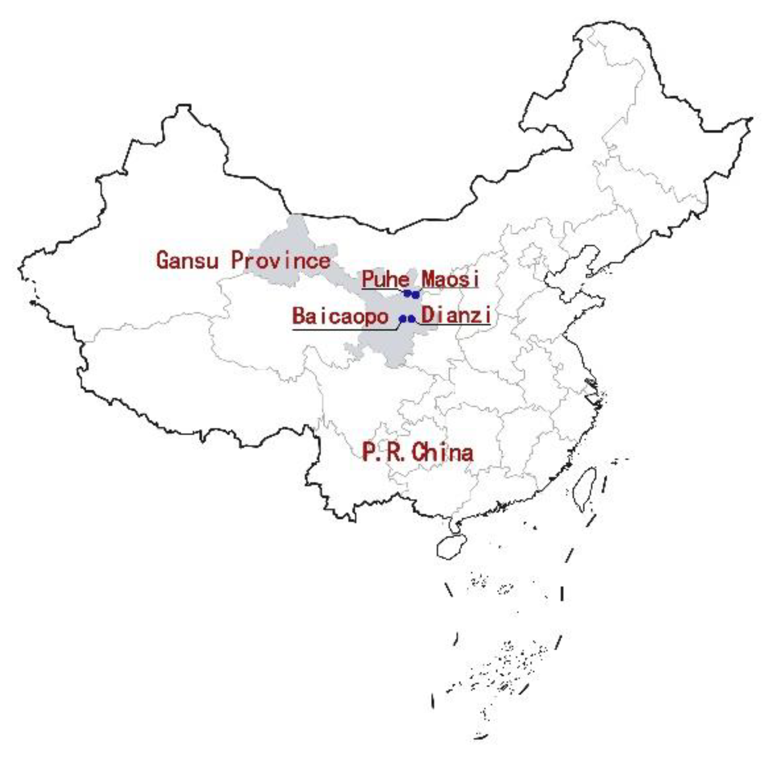
Current development issues facing most villages in northwestern China include extensive land use, land fragmentation, ineffective use of abundant natural resources, ecological impacts, lack of inclusion of cultural awareness, slow development or even stagnation of service industry development, slow growth of agricultural products processing, insufficient development of rural industries via rural tourism, few innovative rural industrial products, and low productivity of agricultural companies. These problems are more prominent and representative in the four villages in Gansu Province in the northwestern region located at the hilly and gully region of the Loess Plateau in northwestern China, which we chose as our case studies to enable more targeted analyses and conclusions.
Four specific rural planning practices were used to summarize, and deduce through analogy, the villages’ planning paths and strategies under comprehensive land consolidation. We expect that this experience can provide new development ideas for similar villages.
The locations of the study area are shown in
Figure 1.
2. Literature Review
2.1. Summary of Relevant Policies in China
Problems in the development of Chinese cities and towns led to the earliest comprehensive land consolidation effort founded upon land arrangements [
8], gradually revised and extended over the years. Contemporary land consolidation and water conservation began in China in 1949 (
Figure 2), but overall progress since then slowed [
9] due to a lack of updated policies and documents on land consolidation. Since 1986, farmland protection became a basic national policy that China has adhered to (
Figure 2). After 1997, the focus shifted to the demarcation of arable land deemed necessary to protect (
Figure 3). Since 2006, concerns involved the development of agriculture, industry, and service industries, and incorporating ecological conservation planning to promote rural revitalization (
Figure 4).
In December 2019, the Ministry of Natural Resources of the People’s Republic of China issued the Notice of the Ministry of Natural Resources on Carrying Out the Pilot Work of Land Consolidation in the Whole Region [
10] (hereinafter referred to as the Notice), which requires land consolidation to be comprehensively promoted, giving new connotations to land integration, and identifies new tasks. The Notice clearly stipulates that “in accordance with the requirements of comprehensive protection, and comprehensive management of rivers, forests, fields, lakes, and grasslands, we must protect and restore rural ecological functions, maintain biodiversity, and improve the level of protection.” [
11] Unlike in the past, this notice increases the task of rural ecological restoration.
Since then, rural areas have vigorously promoted the comprehensive consolidation of rural land. In addition, the development goal also extends to the entire space, including production, living and ecological spaces (all of which, together, are hereafter referred to as the Sansheng Space) [
12]. Relevant charts were created to illustrate the specific development processes of these policies at different stages (see
Figure 2,
Figure 3 and
Figure 4).
2.2. Prior Studies
Since 2014, adoption of problem-solving approaches in China increased the gradual introduction and improvements in policy documents related to land consolidation. Discussion at the policy level included policy initiatives to improve the multi-functionality of cultivated land [
13], incentive mechanisms, operation mode, and public participation measures [
14,
15,
16]. In addition, some scholars explored the implementation paths and impact mechanisms for the entire region, including ecological restoration, agricultural land consolidation, and high-standard farmland construction, and the land consolidation context [
17,
18]. Some studies analyzed the transfer mode of land use rights and the financing of agriculture land use rights to improve transformation of resource assets [
19,
20]. Since the Opinions of the Central Committee of the Communist Party of China and the State Council on the Implementation of the Rural Revitalization Strategy [
21] and the Rural Revitalization Strategic Plan (2018–2022) [
22] were issued in 2018, the relationship between comprehensive land consolidation and rural revitalization began to be explored.
On the research front, scholars such as Y. F. Jiang and D. M. Lu explored multi-functional development of land using an assessment system for land supply capacity. Their evaluation resulted in optimization strategies and plans for the Sansheng Space [
23,
24]. L. Chai mainly studied the transformation ideas and development paths of comprehensive land consolidation for rural revitalization [
25,
26]. A problem-solving approach led Cai Yuling to propose three new methods for comprehensive land governance, i.e., government-led, enterprise-led, and village independent, to realize village planning goals [
27]. The comprehensive development approach for the Sansheng Space has continuously improved the strategy and implementation of comprehensive land consolidation [
28]. Moreover, the trend has incorporated methods for realizing the integration of village planning and comprehensive land improvement under the national land space system [
29].
Studies of land consolidation, in China and other countries, focus on the need to readjust unfavorable land division to ensure land use is more intensive and efficient. In European countries (represented by Germany, Netherlands, France, Belgium, Luxembourg, Austria, Switzerland, Finland, and Norway), land consolidation standards are mostly encapsulated in laws and regulations on land remediation activities [
30]. A key difference is that these European countries began land consolidation efforts many years before China, hence their laws and policies are also relatively mature. It should be noted that in recent years, scholars in China and abroad have promoted rural development through land consolidation [
31]. Also, in contrast to Chinese policy research, some international scholars have studied priorities in other countries such as organization, objectives, legal procedures, costs, financing, and other aspects [
32,
33,
34]. Research methods include specific evaluation frameworks, comprehensive planning, and decision support systems [
35,
36,
37,
38].
Some studies reviewed the history of land consolidation in a region or a country. For example, in the Netherlands, land consolidation was explored as a negotiation between individual farmers, government and landowners, before decision-making by politicians [
39]. In Turkey, researchers evaluated the impact of land regulation on factors such as plot size, the proportions of manufacturing and service industries, gross domestic product, grain output, and plot distance from town [
40]. Land consolidation studies have investigated impacts on: residents’ livelihoods and land rights in South Africa [
41]; farmers’ livelihoods in Moldova [
42]; rural tourism in Poland [
43]; sustainable rural areas in Lithuania [
44]; cotton production in Uzbekistan [
45]; and agricultural use (from cropland to pasture land) in Galicia, Spain [
46]. Studies in Italy compared different land consolidation associations, aiming to improve the local tourism industry [
47]. Researchers in Eastern Europe have studied the long-term effects of different land consolidation models on agriculture, including government-led, or market and demand-driven models [
48].
Effective implementation of land consolidation was studied by some scholars from a regional perspective as a choice between some administrative regions with higher land consolidation potential than others. This aligns with EU’s support for the implementation of land consolidation projects where funds are strictly allocated for the most appropriate regions. Therefore, using administrative areas for implementing land consolidation is preferred over multi-standard analysis to determine priorities to ensure effective management of resources and success in securing financial support [
49].
In summary, comprehensive land consolidation has focused on the interaction mechanisms and promotion paths between land consolidation and rural revitalization, as well as planning and decision-making systems in different geographical regions. Despite numerous studies of these interactions, the logical relationships (or the interaction mechanisms) between comprehensive land consolidation and industrial revitalization are still not clear. A key requirement therefore is to investigate the specific implementation paths and interactions across diverse village situations. In this study, the development paths and interactions were studied across four Chinese villages qualitatively and quantitatively. Generalizations of these studies as a generic framework may be helpful for land spatial planning worldwide.
3. Methodology
Qualitative analysis was conducted to clarify the logical relationships (or the interaction mechanisms) between comprehensive land consolidation, village planning and industrial revitalization. Field investigation results, literature analysis, satellite images, and current village land use conditions provided by land management offices and descriptive analysis were used to extract the common problems of rural industrial development, and to demonstrate the effect of comprehensive land consolidation on the industrial revitalization of the study areas. Four rural villages, including Baicaopo and Dianzi villages in Pingliang City, and Maosi and Puhe villages in Qingyang City, were examined in this study. According to the basic industry data for the time periods before and after the transformation (based on field investigations and prediction calculation), the adjustment and comparison of the industrial land (i.e., refer to the actual village planning guidelines in Gansu Province, and the adjusted map point accounting area in ArcGIS), comparison of the construction quality of villagers’ housing, and the improvement of the residential environment were used to confirm the feasibility of the relevant path described in this study.
Quantitative analysis was conducted as well. A correlation index analysis, including patch shape index (PSI), land use fragmentation index (FS), contagion index (CONTAG), and aggregation index (AI) was used, and the calculations were based on the land use data of Puhe village, Gansu Province, before and after land consolidation. Calculations were performed with the software Fragstats 4.2 (copyright 2013 Kevin McGarigal and Eduard Ene) [
50]. The analysis aims to present the effect of land consolidation on land use and its impact on village industry. Detailed formulas are shown below.
In formula (1), P
ij is the perimeter of the patch; a
ij is the patch area. The smaller the value of PSI, the more regular and simpler the shape of the patch; the larger the value of PSI, the more complex the shape of the patch.
In formula (2), ASI is an area-weighted average shape fragmentation index; SI
i is the shape index of land use of patch i, P
i is the perimeter of land use patch i; A
i is the area of land use of patch i; A is the land use area, and n is the number of land use patches.
In formula (3), P
i is the percentage of area occupied by type i patches; g
ik is the number of type i patches and type (k) patches adjacent to each other; m is the total number of patch types, and the range of CONTAG is (0,100).
In formula (4), g
ii is the number of similar and neighboring patches of the corresponding land use type; the larger the value, the higher the same or similar patch aggregation in the landscape [
51].
4. Relationship between Comprehensive Land Consolidation and Village Industrial Revitalization
4.1. Logical Relation Sorting
The logical relationships between comprehensive land consolidation and industrial revitalization are mainly summarized and illustrated in
Figure 5, which integrates the comprehensive land consolidation into village planning and shows the development paths of industrial revitalization via land consolidation. Specifically, in the process of village development in China, some villages are currently experiencing problems such as extensive land use, land fragmentation, ineffective use of abundant natural resources, lack of inclusion of cultural awareness, low-quality cultivated land, the requirement to improve the human settlement environment, and insufficient industrial development. The solution to these problems is based on the premise that rural industrial revitalization can be achieved. The aims of comprehensive land consolidation are the improvement of the intensive use of village land, the promotion of the human settlement environment, and the optimization of the biophysical environment [
52] through improving village agricultural land, arranging construction land, protecting ecological land, and protecting historical cultural sites. These approaches can provide land for industrial development and can help to increase industrial competitiveness. The principles of village planning are related to cultivated land, construction land, and ecological land (
Figure 5). The goals of village planning are intensive land development, green and low-carbon industrial development (i.e., a highly efficient industrial chain using natural resources, and clean energy and recycled industrial waste), and ecological resource protection. Therefore, the aims of comprehensive land consolidation are consistent with the principles and goals of village planning, both of which build a solid basis for development paths of rural industrial revitalization. In addition, village planning also provides specific land for the implementation of land consolidation programs (e.g., rural industrial development and construction land arrangement) and its layout requirements in the future, which support the achievements of industrial revitalization via land consolidation. In addition, according to the framework illustrated in
Figure 5, the contents of the red dotted box are illustrated in
Figure 6,
Figure 7,
Figure 8 and
Figure 9 to show the development paths in detail.
4.2. The Role of Comprehensive Land Consolidation in Rural Industrial Revitalization
4.2.1. Agricultural Land Consolidation
The Notice on Carrying Out the Pilot Work of Comprehensive Land Consolidation ([2019] No. 194) issued by the Ministry of Natural Resources of the People’s Republic of China clearly proposes two 5% stipulations, namely the area of new cultivated land in the remediation area shall be at least 5% of the original area of the cultivated land and the newly added permanent basic farmland area shall be at least 5% of the adjusted area [
6]. The village will realize the large-scale operation of agriculture through the centralized connection of cultivated land, thus improving its agricultural competitiveness.
As the means of production and living for farmers, land can provide the most basic needs for survival, employment, and pensions. How to narrow the gap between urban and rural areas and provide more employment, medical care, and other social security for rural areas through land consolidation is also the focus of comprehensive land consolidation.
4.2.2. Construction Land Arrangement
The Several Opinions of the Central Committee of the Communist Party of China and the State Council on Deepening the Structural Reform of the Agricultural Supply Side and Accelerating the Cultivation of New Momentum for Agricultural and Rural Development proposes that the saved construction land can be used in various ways to support the development of village industries [
53]. Comprehensive land renovation takes land renovation as the platform, which not only carries out agricultural production, but also gradually develops rural tourism, homestays, rural handicrafts, and other industries to realize the transformation from the beautiful village landscape to an industrial foundation, to develop the tertiary industry of the service industry, and build a village with “ecological industry, characteristic style and residential urbanization.”
4.2.3. Ecological Protection and Restoration
Excavating and integrating the unique natural ecological resources in the countryside creates a unique rural style and new development pattern, as well as helping the development of rural industries, giving full play to economic benefits. Green development is the basic requirement for agricultural supply side structural reform. It is an economic growth and social development mode targeting efficiency, harmony, and sustainability. The focus of agricultural green development is on protection and utilization. For example, villages along a river can develop village industries through new wetland parks, ecological parks, fishponds, and fishing and can realize the transformation of natural ecological resources into economic benefits. Through the sharing, protection, and development of ecological benefits, villages can carry out high-quality and efficient overall planning and integration in accordance with the idea of “planning arrangements lead project arrangements, and project implementation promotes planning implementation” [
54].
4.2.4. Historical and Cultural Protection
Promoting the integration and harmonious coexistence of the natural environment and the human environment of a village is the best way to preserve and carry forward the village’s culture [
55]. For villages with rich historical and cultural resources, they should, on the premise of protection, rely on the village’s own historical, cultural, and regional folk customs, as well as traditional handicrafts and other non-material cultural resources with the unique cultural brand of the village. In doing so, villages could delimit the core protection areas and construction control zones, formulate protection measures, carry out tourism development, promote the development of cultural tourism capital in rural areas, and gradually cultivate the operational ability of the development of rural tourism industry. This will ultimately realize the benign cycle of interaction among village ecology, economy, and culture.
5. Paths of Village Industry Revitalization under the Guidance of Comprehensive Land Consolidation
5.1. Village Profile
5.1.1. Baicaopo and Dianzi—Abundant Agricultural Resources
The locations of the villages of Baicaopo and Dianzi are shown in
Figure 1. Baicaopo and Dianzi villages are located in the northwestern part of Lingtai County, Pingliang City, Gansu Province, to the east of Xitun Town. Baicaopo Village is adjacent to Dianzi Village to the east, Qiaozi Village and Xitun Forest Farm to the west, and Guoyang Village and Xiaocun Village to the north. The No. 202 provincial road passes through the northern parts of the two villages, making travel relatively convenient. The industries in these two villages are dominated by primary industry. The leading industries in Baicaopo Village mainly include grain planting, wormwood planting, fruit production, and the livestock industry. The secondary industry in the village includes cattle material processing factories, foam mesh factories, Baicaopo brick factories, and wood flooring factories. The leading industries in Dianzi Village mainly include forestry and fruit production, grain planting, and animal husbandry. The income of the villagers in these two villages is mainly from the secondary industry. In these two villages, forestry and fruit production are poverty alleviation industries. In addition, Dianzi Village contains the famous Shuanghouzi ancient tomb, which is a county-level cultural relic protection unit. These two villages have a good biophysical environment [
56]. There are a large number of birds, including cuckoos and pheasants. They have natural advantages and resources that are beneficial to the development of tourism [
56].
5.1.2. Puhe and Maosi—Abundant Tourism Resources
Puhe and Maosi villages are located in the southwestern part of Xiansheng Township, Xifeng District, Qingyang City, Gansu Province. Puhe Village is adjacent to Maosi Village to the south, Ranli Village to the east, and Maojiawan Village to the north. The West Huanchuan Highway connects the two villages, forming one of the Puhe River landscapes in the area, and transportation is convenient. The Pu River runs through the entire territory of the two villages.
The locations of the villages of Puhe and Maosi are shown in
Figure 1. Agriculture is the main type of industry in these two villages, and most of the villagers’ economic income comes from grain crops such as beans and wheat and cash crops such as melons and vegetables [
57]. These two villages are rich in tourism resources, and the development of tourism has already begun to take shape. Puhe Village has a century-old persimmon garden, the Moon Bay Herb Garden, and other resources. Maosi Village has the Longdong Ski Resort, Longquan Temple, and Heilaoguo Ice Cave, and it is located on the tourist axis of the Puhe River in the Xifeng District, which is conducive to the development of tourism. At present, the scale of the tourism development in these two villages is relatively small, the village brand has not yet been built, and the linkage between tourism and the primary and secondary industries in the village is not mature.
Currently, the four villages are in the same primary stage of industrial development. All of the development paths proposed in this paper need to be implemented in the future.
5.2. Analysis of the Current Situation
According to the classification of villages in The Rural Revitalization Strategic Plan (2018–2022) [
22] issued by the Community Party of the China Central Committee and the general office of the State Council, the villages of Baicaopo and Dianzi are cluster upgrading villages (i.e., central villages with a large population, convenient geographical location, convenient transportation, and relatively well-run infrastructure). The villages of Puhe and Maosi, meanwhile, are characteristic protected villages (i.e., villages with rich natural, historical, and cultural resources, such as famous historical and cultural villages, traditional villages, ethnic minority characteristic villages, and famous scenic tourism villages). Although the development of the two types of villages depends on their different characteristics in this stage, with the gradual advancement of comprehensive land consolidation in the entire region, industrial revitalization and development are facing many common problems.
5.2.1. Low Integration of Agricultural and Service Industries
The current situation is that farmers mostly depend on primary industry, that is, the cultivation of food crops and industrial raw materials are the main source of income, and the degree of agricultural mechanization is low. The livestock breeding industry is relatively scattered and generally small in scale, with a single variety. Taking Puhe and Maosi villages as examples, their primary industry is the cultivation of melons and other vegetables. However, the industrial chain is imperfect, lacking supporting industries for packaging of agricultural and sideline products, primary processing industries for agricultural and sideline products, and related intensive processing. The development of the two villages is similar, but regional cooperation is lacking. The linkage of the development is weak, and the added value from resources such as the large amount of lavender in the village and the century-old persimmon garden is not high. The leisure and tourism tertiary industry has not involved unified planning and is mainly an extension of the primary and secondary industries. Supporting industries such as logistics and warehouses are lacking, and the tourism industry has not established a regional characteristic tourism brand and has not effectively promoted and utilized the regional characteristic natural landscape, resulting in it being less well-known.
5.2.2. Uneven Distribution of Supporting Industries
The villages have not formed a unified style. Some villagers’ houses are idle all year round, and there are multiple houses in one household. In some villages, some cave dwellings are still in disrepair and cannot be used normally. The rural buildings are scattered and of different styles. There are few types of public service facilities, and the existing services cannot support the development of village industries. In addition, the utilization rate of some of the natural resources in the village, such as rivers, rapeseed fields, and woodland landscapes, is low.
5.2.3. Insufficient Protection of Ecological Resources
The ecological space of the village is mainly composed of a large area of forest land and natural ecological reserved land. In addition, there are also patches of farmland and garden landscapes, but they are scattered throughout the village, and a highly contiguous ecological barrier has not been formed. The utilization of the ecological space and its transformation into economic resources remains to be explored. There are some existing ecological problems. For example, there are steep slopes and bare land in the mountains around the village formed as a result of excavation, which are prone to vegetation destruction and soil erosion. Regarding the possibility of disasters and the possible geological disaster points in the village, effective measures for protection and engineering measures need to be taken.
5.2.4. Inadequate Protection of History and Culture
The value of cultural preservation units and historical relics has not been exploited. Some villages contain cultural relic protection units, but they have not been used effectively, and there is also a lack of delineation and protection measures for core protected areas and construction control areas. For some historical relics in the village that have been preserved throughout the formation and development of the village, the historical origin of its formation may be lost. Therefore, the goal of cultural industrialization has not been achieved in order to preserve the unique village culture.
5.3. Development Paths
5.3.1. Build Industrial Competitiveness
Clear Industrial Development Direction
For Dianzi and Baicaopo villages, their main sources of income are primary and secondary industries. The ruins of the Western Zhou Dynasty tombs in Baicaopo Village and the Shuanghouzi tombs in Dianzi Village both contain rich information about and characteristics of the Western Zhou culture and Neolithic culture [
58], but the tertiary industry is still under development. Its industrial development can realize the extension of the industrial chain through the idea of consolidating the agricultural economy and developing the tourism economy. Relying on vegetable, grain, apple planting and animal husbandry, we can create a green and circular agricultural industry and can continue to develop extended supporting industries. For example, cattle manure from cattle farms can be used to fertilize fields, vegetable fields, and orchards. After the wheat is harvested, the straw can be used in the cattle material processing plant, wheat straw board production, wheat straw handicraft production, sales, weaving, and construction of a wheat straw paradise during the harvest season. According to typical village planning cases, the leisure tourism industry can also be developed, the agricultural product industry chain can be extended, the benefit connection mechanism between farmers’ cooperatives and leading enterprises can be established, and relevant leisure tourism service facilities (i.e., characteristic bed and breakfast enterprises) can be built in combination with the viewing of rural scenery and a wheat straw paradise to realize the extension of the industrial chain.
For Puhe and Maosi villages, the tertiary industry has begun to take shape, and they also contain certain historical and cultural relics [
59]. The development of its industry can promote the integration of the three types of industries in accordance with the new pattern of “double circulation”—the idea of a double line parallel of leading industries—auxiliary development of supporting industries [
60]. Therefore, we need to rely on the current industrial base to optimize and strengthen the leading industries and to develop ancillary industries. The development of leading industries can be carried out in parallel based on two lines of thinking: using the village resources to form a visible leisure and tourism industry and creating commercial value with the theme generated by the physical resources in order to fully and clearly develop the village industry. The leading industries can promote the development of tourism based on the village’s characteristic leisure and sightseeing resources as the main line, create a tourism landscape axis, connect important landscape nodes, and form a combination point-line-surface industrial space system. In addition, the theme of the main landscape can be used to obtain commercial publicity value and promote the development of village tourism. The auxiliary line of industrial development can rely on the historical relics in the village to publicize the culture and inherit the spirit. Moreover, the creation of cultural and creative products can be used to obtain benefits. The supporting industries mainly assist the leading industries, and the secondary industries such as logistics warehousing and incense processing facilities can be extended with the primary industry providing the raw material (
Figure 6).
Shape of the Characteristics of the Industry
Regardless of the type of industrial development in the village, the village space can be divided into industrial functional areas, and the development of sub-areas can shape the characteristics of the industry. That is, the development of village industries should be linked to the interactions between the three types of industries to form a closed industrial loop. The cultivation of the agricultural production can provide raw materials for the deep processing of industrial production, and the processed products can be extended to edible, medicinal, popular science, and education uses. The service industry can provide services and tourism facilities based on the primary and secondary production. The flow chart in
Figure 6 illustrates the relationship between the above industries and their products.
5.3.2. Provide Land for Industrial Development via Agricultural Land Consolidation and Construction Land Arrangement
Agricultural Land Consolidation
Unified planning for the concentration and continuation of land in the village is important. This includes constructing high-standard farmland, improving the ecological service functions of the agricultural land, planning irrigation projects, repairing field roads, and meeting the requirements of agricultural machinery farming roads and their supporting facilities. Forming fields into squares, shaping the soil, creating a network of canals, connecting roads, connecting ditches, soil fertilization, ensuring drought energy irrigation, waterlogging energy drainage, and pollution prevention are important for achieving high-yield, stable, guaranteed grain fields [
61]. Concentrated and contiguous arable land is conducive to the improvement of the quality of the arable land, thereby driving the planned agricultural operation and increasing the industrial income.
Construction Land Arrangement
According to the land management law [
62] (according to the provisions of Article 62), the homestead of rural residents, which must have one household and more than one household, is an illegal use of land except for legal reasons. Of course, the illegal use of land cannot be registered and issued. Illegal houses may not be demolished, but they cannot be guaranteed, such as demolition compensation. In the People’s Republic of China, dilapidated homesteads and homesteads involving “one household with multiple homesteads” in the village shall be verified and demolished based on the confirmation of the right of the rural homestead to vacate the construction land required for village construction. The specific plan is to demolish the old homesteads and reclaim the land as arable land after the demolition. The vacated construction land indicators can be used for the construction and development of the village. For example, Puhe Village uses these vacated construction land indicators for new centralized settlements, construction of new public service facilities, construction of village history museums to promote village history and culture; promotion of agricultural universities, commercial facilities, party-building bases, marriage and funeral service halls convenient for villagers’ daily life; optimizing the spatial layout of the village, playing a supporting role in the development of the village, and providing land for industrial development (
Figure 7).
5.3.3. Ecological Protection and Restoration
In the past, villages have neglected ecological protection in the early stage of construction, which caused the natural ecology of the villages to suffer varying degrees of damage in the later stage of development. For villages, ecology is linked with the economy. Ecological restoration should be incorporated into the village construction plans, and restoration should be carried out according to the ecological problems in the different villages. The flow chart in
Figure 9 illustrates the corresponding solutions to each problem to prevent various geological disasters.
Second, in terms of earthquake resistance, the seismic fortification intensity area where the village is located is determined, the basic seismic acceleration value is determined, and the characteristic period is determined. According to various design specifications issued by the Ministry of Housing and Urban-Rural Development of China, the basic intensity of the seismic fortification, evacuation sites, and evacuation radius in the village are determined, and a unified arrangement is designed in combination with the planning layout [
63,
64]. The evacuation sites in the village are mainly green spaces, event plazas, farmland, vegetable fields, and other open refuge places. In addition, it is ensured that the passages remaining after the collapse of the buildings on both sides of the main road in the village will be at least 4 m wide.
Finally, for villages with rivers that pass through, the protection level of the rural protection area should be determined according to the Flood Control Standard [
65] and related technical standards, and the flood return period should be determined. After confirmation, the protection should be carried out in sections. For example, for the Puhe River running through Puhe and Maosi villages, the plan can be laid out according to the demarcation standard of the designed flood level and the boundary line of the land area for the river without an embankment section and for the river channel with an embankment section according to the embankment area. The 5–10 m extension of the foot of the embankment should be set as the demarcation standard for the management scope, and the demarcation standard for the protection scope should extend 5–15 m toward the outside based on the management scope of the flood control (
Figure 8).
5.3.4. Historical and Cultural Protection
Protection of Cultural Relic Protection Units
The protection of historical and cultural heritage begins with the delineation of core protection zones and construction control zones. The flow chart in
Figure 9 illustrates the specific protection measures and protection significance of the government, village committees, and enterprises for cultural heritage in village planning.
The core protected areas should be protected and repaired in strict accordance with the Cultural Relics Law [
66], and no construction activities that pollute the environment or damage cultural preservation units should be carried out within the scope of the protection area. Based on the protection and appropriate development, villages can develop cultural and creative products, develop tourism, enrich cultural characteristics, and increase industrial income by taking advantage of the historical culture contained in cultural relic protection units (
Figure 9). For example, the Liucheng site in Puhe Village and the Shuanghouzi site in Dianzi Village are protected and utilized in these ways.
Mining the Village’s Characteristic Culture
Regarding historical relics that have been preserved during the formation and development of villages, the historical culture contained in them should be valued and exploited. Through information excavation and project planning, characteristic industries can be shaped. One example is the Dazhai Spirit (Dazhai spirit is a socialist construction spirit cultivated in Dazhai, Shanxi Province under the leadership of Chenyonggui, the Party branch, and is led by Dazhai villagers during the socialist construction period). For example, based on the "Dazhai spirit" of Puhe village, the original features around the historical site "Shengli Bridge" can be restored through environmental improvement. The village can bring tourists a rich sense of cultural experience through activities such as scene restoration, building atmosphere, clothing rentals, and Dazhai spirit open-air movies. The cycle of Dazhai truly casts the spirit of Dazhai in the history, culture, and social life of Puhe Village. Victory Bridge is located in the Liucheng natural village group, and the former village committee land can be developed into a red memorial site. Projects such as the rural film projection project, the Dazhai Spiritual Education Base, and the Party Building Theme Activity Site can be planned, and a red cultural education and tourism base can be developed.
There are two main methods of excavating history and culture to promote the development of tertiary industry. One is to formulate protection measures for red culture, repair the environment around Victory Bridge, strengthen the protection of Victory Bridge, and determine the integrity of the red culture, which is the only way to protect the unique culture of the countryside. Excavation and utilization lay the foundation. The second is to develop red scenic spots to attract tourists for an immersive experience after restoration of the original style, to build a party building base and a Dazhai spiritual education base, to develop red products, and to transform cultural resources into economic resources [
67].
5.4. Comparison of the Statuses before and after Comprehensive Land Consolidation
5.4.1. Comparison of Industrial Land Adjustment
Taking Puhe village, Xiansheng Town, Xifeng District, Gansu Province as an example, with reference to the land classification principles in the guidelines for the preparation of practical village planning in Gansu Province, and with the support of the policy background of the government as the main driving force, the village land was reasonably adjusted through the comprehensive land consolidation of the entire region. With the land expansion of agricultural facilities (i.e., the refinement and new construction of field roads and the new construction of breeding land) under the balance of agricultural and forestry land, the expansion of breeding land and the improvement of roads were completed in the target year. Through the consolidation of construction land, the amount of new industrial land for public service facilities, commercial service facilities, warehousing and logistics facilities in villages can be increased. Natural protection and reserved land are protected, lands destroyed by village production are repaired, and the village human settlement environment is improved. The detailed adjustment indicators of village land are presented in
Table 1.
5.4.2. Comparison of the Quality of Buildings and Environment
Taking Dianzi village and Baicaopo village in Xitun Town, Pingliang City, Gansu Province as examples, both villages demolished the dilapidated rural houses and built new residential houses in an area according to the wishes of the villagers and the planning of the village, and as a result, the village building style was neat and unified (
Figure 10), and the scattered residential land was vacated and reorganized. In addition, according to the field investigation, the village human settlement environment was improved, including the popularization of village sanitary toilets, the laying of sewage treatment pipelines, the renewal of domestic waste facilities, in order to comprehensively improve the quality of the lives of the villagers. In addition, the cultural relics of the Western Zhou Dynasty stored in Baicaopo Village will be protected and excavated, and a new Western Zhou Culture and History Museum will be built to create a cultural brand for the village. The changes in the human settlement indicators are presented in
Table 2.
5.4.3. Comparison of the Quality of Land Use
According to Formulas (1) to (4), the calculation results of PSI, CONTAG, FS, and AI are shown in
Table 3. Compared with the size of the patch, the patch shape index (PSI) can more clearly express the spatial pattern of patches and the complexity of patch development. The smaller the value of PSI, the more regular the shape of the patches. The larger the value of PSI, the more complex the patch shape [
68,
69]. It can be seen that the PSI of Puhe village decreased from 19.5080 to 19.4292, meaning that after the land consolidation the shapes of land use patches in Puhe village gradually changed from irregular to regular, and thus, the spatial pattern of the village land has been significantly improved. Since the industrial production and life activities of the villagers require more regular land, the village industrial revitalization can be promoted by land consolidation.
The FS index refers to the degree of land fragmentation and reflects the complexity of the spatial structure of the land to a certain extent [
70,
71]. The FS of Puhe village decreased from 33.6380 to 33.4039, indicating that after the land consolidation, the land use in Puhe village became more concentrated, which was specifically reflected in the concentration of scattered residential areas, the reduction of abandoned and idle construction land, and the withdrawal of construction land. Based on our land consolidation and according to the rural village planning, the concentrated land can be used to support the development of the village tourism industry by means of shareholding and joint ventures in order to promote the integration of the three types of industries.
The CONTAG index is primarily used to describe the aggregation or expansion of different types of land use patches. A high degree of aggregation indicates that land patches have good splicing [
72]. The CONTAG of Puhe village increased from 61.7748 to 64.8910, indicating that the number of isolated patches decreased after land consolidation, and the splicing of dominant patch types also improved accordingly. This was more conducive to the scale management of the different types of land use.
The AI index refers to the aggregation degree of the same or similar patches for land use. The AI of Puhe village decreased from 84.1940 to 84.1673, indicating that the distribution of different types of land use became more aggregated after land consolidation, making it easier for farmers to engage in agricultural production and life activities. Thus, the industry of the village can be improved. For example, since the cultivated land is more aggregated, the agriculture production costs can be reduced through large-scale production, and the technological support can be improved with the modern mechanization and automation of agricultural production. Then, large-scale agriculture can be boosted.
6. Discussion
Based on the relevant national policies, previous studies conducted in China and abroad were reviewed and summarized. Although most scholars believe that comprehensive land consolidation will aid in the industrial development of villages, the existing research on the comprehensive land consolidation to promote the revitalization of village industries is still unclear. The results of this study not only further enrich the relevant theories on land consolidation at the theoretical level but also further guide the spatial planning of villages from the practical level, and thus, they can aid in the further development of village industries. Therefore, in this study, first the logical relationships between comprehensive land consolidation, village planning, and industrial revitalization were qualitatively analyzed. Once again, the necessity and scientific nature of comprehensive land consolidation in the new stage of industrial revitalization was determined, and the role of comprehensive land consolidation in rural industrial revitalization was summarized. Then, taking the specific village planning carried out in Baicaopo and Dianzi villages in Pingliang City and Maosi and Puhe villages in Qingyang City as examples, according to the actual situations of the village development, through field investigations, in this study the advantages and challenges in the future development of villages were summarized, the common problems of rural industrial development were extracted, and the specific development path of rural industrial revitalization under the background of comprehensive land consolidation from the perspective of planners was investigated. In addition, taking Puhe village as an example, the correlation index analysis (including the calculation of PSI, FS, CONTAG, and AI before and after land consolidation) was applied to demonstrate that the different types of land use became more regular, more concentrated, and more aggregated after land consolidation, thereby providing land that could meet the requirements of rural industry production and improving village industries. The results of this study provide references for villages worldwide to further understand the logical relationships (or interaction mechanisms) between land consolidation and rural industrial revitalization and to promote their industrial development from the four perspectives of land consolidation: land arrangement, rural ecological protection and restoration, agricultural land consolidation, and historical and cultural heritage protection.
During the process of land consolidation and rural industrial revitalization, the village management is very important. If problems emerge in this process, the village committee usually plays an important role in resolving them, and it commonly manages the village affairs according to relevant national, provincial, municipal, county and town policy documents and village rules and regulations. In detail, villagers can report their questions to the village committee, which will coordinate and solve these problems. If there are contradictions that cannot be solved by the village committee, the village committee can report these issues to the relevant departments of the town and county government, which will provide solutions according to the village committee’s reports. In addition, sometimes field visits and discussions with villagers are conducted to collect their opinions, and then, they propose their solutions to the village committee. Regarding ecological compensation and the protection of historical and cultural heritage, the county government should make specific policies and decisions and provide financial support. Then, the village committee should be responsible for mobilizing the villagers to implement these policies and decisions, and should use the funds reasonably. In addition, the village committee also has to accept supervision and assessment of the villagers and governments.
The results of this study also provide some arguments and supplements for some previous studies. Some scholars have mainly focused on the development path of village industry under rural revitalization [
73,
74,
75,
76,
77,
78]. Other scholars examined the promotion and integration of industry and land by studying specific planning examples and combining the background of land spatial planning [
79,
80,
81,
82]. Some studied the industrial development modes and paths of different types of villages from multiple perspectives, as well as the integrated development of industries, villages, and countries [
83,
84,
85,
86]; and some studied the coordinated development mechanism between industrial revitalization and talent revitalization [
87]. However, the logical relationships between industrial revitalization and comprehensive land consolidation are still unclear. Our study provides a new perspective under the background of the new era that can be used to solve the issue of industry and village revitalization under land consolidation via land arrangement, rural ecological protection and restoration, agricultural land consolidation, and historical and cultural heritage protection.
Moreover, rural revitalization covers many aspects. In this study, we only focused on the logical relationships between land consolidation and industrial revitalization. We did not examine the comprehensive logical relationships among land comprehensive improvement, industrial revitalization, talent revitalization and many other aspects. We also did not explore any methods of assessing/quantifying development goals at both the village and the province levels. All of the above issues may be worth further research in the future.
7. Conclusions
As one of the important tools for dealing with the problem of rural recession [
88], land consolidation is a complex comprehensive system with its own logic and connotation. This paper makes two contributions. First, it proposes a framework to promote rural industrial revitalization via land consolidation, which provides village planners and policy makers worldwide with a solid theoretical basis and case study results. The development paths of villages can be summarized as taking and shaping industrial characteristics as the guide, consolidating agricultural and construction land as the principle, optimizing the spatial layout as the core, strengthening ecological restoration as the strategy, and strengthening cultural protection as the supplement. Second, our study also contributes to the international literature on the logical relationship (or interaction mechanism) between rural industrial revitalization and land consolidation. It enriches the existing knowledge that has been established mainly through studies on rural revitalization and land consolidation. We believe that the logical relationships proposed here and the summarized development paths in China have rarely been examined, particularly in other developing countries.
In addition, villages in different regions around the world have different advantages and challenges. When applying the comprehensive land consolidation to promote industrial revitalization, we should have a thorough understanding of the actual situation of the villages in the region, conduct a qualitative summary and induction of the existing village problems, try to accommodate the policy background of this region as much as possible, and fully grasp the opportunities of the times. Thus, the comprehensive consolidation of land in the entire region can be promoted and the goal of rural industrial revitalization can be achieved.


