Article

Understanding Urban Green Spaces Typology’s Contribution to Comprehensive Green Infrastructure Planning: A Study of Canberra, the National Capital of Australia

School of Design, The University of Western Australia, 35 Stirling Highway, Perth, WA 6009, Australia
*
Authors to whom correspondence should be addressed.
Land 2023, 12(5), 950; https://doi.org/10.3390/land12050950
Submission received: 31 March 2023 / Revised: 17 April 2023 / Accepted: 19 April 2023 / Published: 24 April 2023

Abstract

:
The urban densification agenda for the Australian Capital Territory announced in 2012 as well as the climate-related impacts (such as flood and rising temperature) have made the role of green infrastructure in this city more critical than at any other time. The Living Infrastructure Plan for Canberra was proposed by the local government in 2019 and it is currently being developed. However, there is a lack of understanding of the variety of urban green infrastructure characters, associated urban green space types, and their contributions to the green infrastructure plan. Therefore, this research aims to study the existing types of urban green infrastructure and green spaces in Canberra and investigate their potential sociocultural and ecological contributions that need to be considered in developing green infrastructure plans. To achieve this, we employed a socioecological approach and a mix of methods including a literature review, a review of policy documents, semi-structured interviews with experts, geospatial data, and field observation. Ten main urban green infrastructures were identified in Canberra and associated green spaces and their ecosystem services were discussed. Finally, a framework was delineated to suggest recommendations for the identified urban green infrastructure types with the aim of improving the green infrastructure planning practice by enhancing, preserving, and reinforcing green spaces. The findings provide a foundation for coordinating green infrastructure decision making and suggest a framework for designing high-quality and multifunctional green spaces. The study concludes that further investigation is required to comprehend the diversity of urban green infrastructures and their ecosystem services, co-benefits, synergies, and trade-offs.

1. Introduction

Green infrastructure (GI) was conceptualised as a network to preserve green spaces for social benefits, enhance biodiversity, and mitigate habitat fragmentation [1]. Since the 2010s, GI has gained recognition as a crucial infrastructure and an approach to making cities more resilient to environmental challenges [2,3]. The GI network, often discussed together with blue infrastructure, delivers valuable socioecological benefits, and encompasses a range of ecosystem services (ESS). These ESS involve both material and non-material services that are classified into four broad categories: regulating, provisioning, habitat and supporting, and cultural ESS [4,5]. In recent years, the concept of incorporating nature into cities with the focus of the ESS was reconceptualised and introduced under the umbrella of nature-based solutions (NBS). NBS was defined as practical solutions and actions that imitate the natural process to improve or create vegetation structures in order to promote ecosystem functionality and human wellbeing [6]. For example, water-sensitive urban design (WSUD) is a design approach to NBS. NBS serves as a useful tool for facilitating research and communication between practice and academia [7,8].
GI includes all types of green space regardless of location (urban, urban edge, rural, or intact areas) and their origin (remnants of native vegetation, designed, and spontaneously appeared). Urban green infrastructure (UGI) specifically focuses on green spaces within urban footprints and includes different types of green space ranging from parks and gardens to cemeteries and derelict lands [9,10]. Urban green spaces (UGS) play a crucial role in urban life by serving aesthetic, recreational, and cultural purposes, as well as conserving biodiversity and improving the environment. Accordingly, UGS design, management, and connectivity are crucial for maximising UGI functionality [11,12].
UGS typology is an important tool for UGI planning and can inform policymakers [3]. Preparing an inventory of UGS types and mapping them can facilitate the design of a comprehensive regulatory framework to guide interventions and decisions [13,14]. Moreover, developing a comprehensive UGS typology can serve as a basis for engaging the public in the decision making and planning process through methods such as Public Participation GIS [12] or City Digital Twin [15]. Typology helps to put the available data into distinct categories to standardise the landscape and provide some pragmatic solutions for landscape management and planning [16]. With the invention of the Geographic Information System (GIS), which allows researchers and planners to illustrate and analyse the variation of landscape types, defining a typology has become very critical in landscape architecture [17]. GIS and open databases contain information that provides the opportunity to categorise landscapes based on the available information at different scales in a way that is less reliant on personal observation [18].
Although there are some attempts to provide a general list of green space types, researchers believe that it is not realistic to define one unified typology that would be applicable to all regions [3,19]. Alternatively, they suggest categorising the green spaces based on the local context of the case studies [20].
In Australia, the classification of UGS has been mostly driven by the need to address the Urban Heat Island effect (UHI) [19,21], reflecting the ecological conditions of the country with a dry climate and hot summer. Accordingly, urban forests and tree canopies have become a priority in many Australian cities’ urban planning and design. Canberra is one such city, known for its abundant green spaces, reflecting its unique design history as the national capital of Australia. Canberra was constructed on a grassland plain (a modified native landscape used for grazing) in the 20th century to function as the national capital of Australia. Its planning structure stands out for its natural (remnant native forest and grassland) and designed green spaces managed by the local government (ACT Government), the federal government (Commonwealth), and the residents.
Canberra’s earliest residential suburbs including Reid, Ainslie, and Campbell reflect some of the Garden City principles, such as having easy access to the natural landscape and a central common green space in the neighbourhood with a playground. The city’s lush green character is the result of tireless efforts and challenges throughout the 20th century to transform the harsh, treeless landscape into a liveable and resilient environment through soil modification and tree planting. The term ‘Treed Infrastructure’ has been used to highlight the influential role and contribution of trees to improve the city’s ecological, physical, and psychological conditions [22].
Nevertheless, Canberra is prone to environmental hazards such as flash floods (experienced in 1971 and 2018) and bushfires (catastrophic fires in 2003 sparked in the Namadgi National Park and Brindabella Ranges).
Meanwhile, the compact city vision was announced in 2012. It aimed to curb the urban sprawl and concentrate urban development within existing urban boundaries, but at the same time, it presents a challenge for preserving and enhancing Canberra’s UGI. Although it is an effective strategy to minimise the urban development impact on the surrounding natural landscape, it is a challenge to conserve and enhance the quality and quantity of UGS. A review of the literature conducted by Haaland and Konijnendijk van den Bosch [23] revealed that the decrease in UGS due to infill urban and suburban development is critical in Australia and Europe.
Since 2019, the ACT Government has been working on a Living Infrastructure Plan to conserve and enhance Canberra’s green and blue infrastructure. To create a socially and ecologically inclusive and effective UGI plan, it is vital to gain a thorough understanding of the existing UGI characteristics and associated UGS types and ecosystem services (ESS) they provide. Therefore, this research seeks to develop a typology of Canberra’s green spaces based on a socioecological approach. This method relies on the ESS classifications outlined in the Millennium Ecosystem Assessment of 2005 and takes into account societal factors such as human wellbeing and cultural and spiritual values, as well as natural factors, in order to address both social and environmental concerns. The study is focused on green spaces but its linkage with blue and grey infrastructure was also discussed.
This research investigates the following research questions:
  • What are the common green space typologies in the global literature?
  • What are the significant types of UGS in Canberra?
  • How can the UGS typology inform UGI planning and guide urban development in Canberra?
UGS typology for Canberra was proposed by a generic literature review of existing green space typologies and an examination of UGS types mentioned in policy documents published by the ACT Government Directorates and National Capital Authority (NCA), as well as by the field observation. Furthermore, experts from various relevant fields of study with knowledge of Canberra’s urban landscape were consulted through semi-structured interviews to gain insights into the city’s significant UGS. Accordingly, based on the findings of the research and a study of available geospatial data in QGIS, a framework was designed to guide Canberra’s UGI planning as a socioecological network.

2. Methods

M. Dennis et al. [24] suggested that to develop comprehensive GI planning, researchers should adopt a socioecological approach to green space classification, considering both form (land cover) and function (land use). Therefore, to define a typology of Canberra’s UGS based on both ecological and sociocultural values a combination of methods was employed (Figure 1).
First, a review of the critical literature was conducted. Peer-reviewed papers and reports on green space typologies in Australia, the USA, and Europe were analysed to gather common green space typologies. Second, the latest drafts of policy documents by the ACT Government and NCA, published by December 2020, were reviewed, to extract the green space types used for policymaking. This step was crucial as these documents are the most influential for Canberra’s UGI planning. Based on their contribution to green space conservation, management, and planning, 6 documents were selected to review. Third, semi-structured interviews were conducted with experts from relevant disciplines to gain an understanding of the ecological and sociocultural values of Canberra’s green spaces and to identify the significant and critical green spaces in the city. The experts were selected using purposeful sampling by reviewing published papers and reports on Canberra’s urban landscape. Snowball sampling was also employed to find more suitable participants [25]. In total, 12 experts from fields such as landscape architecture, urban design, urban planning, and urban forestry were interviewed (Table 1). They were asked about significant green spaces, unique green spaces, and neglected or understudied green spaces in Canberra (Table 2).
The responses from the interviewees were recorded, transcribed, and analysed using NVivo 12 aiming to identify green space types unique to Canberra.
Finally, all the collected data along with the available QGIS Shape Files and field observation data were reflexively analysed and synthesised based on a constructionist approach to establish a typology for Canberra’s green spaces that would inform UGI planning. A field observation study in April 2021 and June 2022 was conducted to confirm or adjust the chosen green space types and their characteristics and provide visual materials to communicate the identified typologies.

3. Results

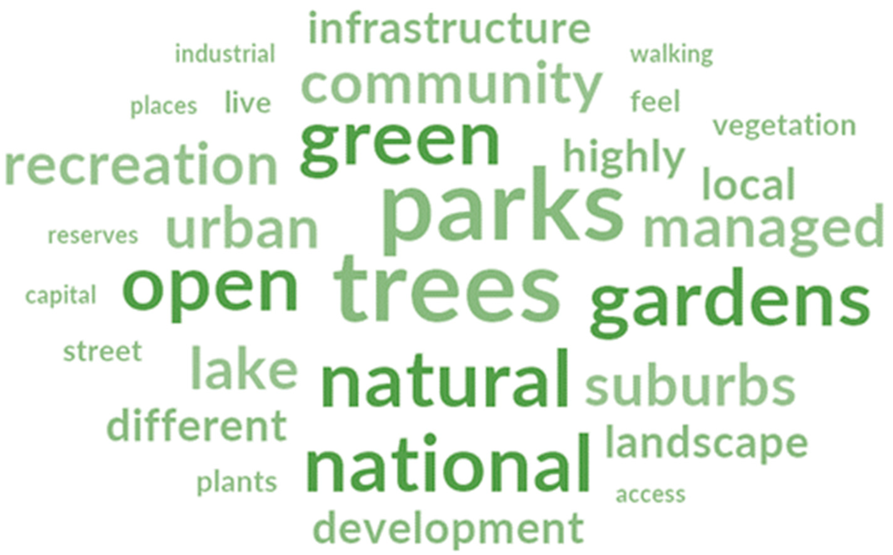
3.1. Diversity of Green Infrastructure Characters

According to Kowarik, 2018 [26], urban nature can be divided into four categories: (1) remnants of the natural landscape, (2) agrarian landscapes, (3) designed green spaces, and (4) spontaneous green spaces. These major categories were defined based on ecological characteristics and functions such as plant communities and human intervention. The most commonly used green space typology was defined as natural, semi-natural, and human-made [27,28] (Figure 2). ‘Natural’ green spaces are remnant areas considered for conservation values, and ‘semi-natural’ green spaces are the remnants that are modified and used by humans for recreation and education purposes. Human-made green space is subcategorised further based on the design approach and degree of human intervention. Some researchers categorised human-made green spaces as formal and informal (with management or without management). However, the definition of human-made green space expands to more than designed green spaces and covers ‘functional spaces’ that were merely created or altered to meet human needs such as agricultural lands and industrial sites [24,29,30,31].
A formal green space could be described as a ‘designed’, organised, and structured green space that requires good maintenance with the goal to address prevalent aesthetic values for urban green spaces being ‘green and clean’ [32]. This type of green space is the key part of civic areas in which the influence of humans is very evident, including “mown turf, flowerbeds, trees, fountains and planned places everywhere that have traditionally been the focus of the civic design” [29] (p. 6). This type of landscape often does not contain the high-level dynamic characteristics that nature offers and may have less diversity of flora and fauna. For example, mowed lawn surfaces have less biodiversity than green spaces with a variety of vegetation types. However, the mowed lawn surfaces are associated with people’s social life and thus have a high social value [33].
Another type of designed green space is ecologically managed landscapes such as swales, rain gardens, green roofs, and reconstructed wetlands. This NBS approach to landscape design aims to mimic natural processes (hydrological balance, plant communities’ structure and composition, and plant successional process). The approach also addresses biodiversity conservation and the reinforcement of existing vegetation by including different types of plants. The recent tendency in Australia is to concentrate on returning native plants to urban settings, but exotic and a mixture of native and non-native plants are also allowed in some cases. Similar to formal landscapes, ecologically managed landscapes need efforts for maintenance, using horticultural knowledge and technology. In this category, plants are allowed to grow naturally, conveying a less managed feeling [32]. However, it is important to distinguish managed ecologically designed landscapes (urban vegetation in a natural appearance) from informal green spaces. Informal green spaces are the green spaces that grow naturally (spontaneous/ruderal) in unmanaged lands. This type of landscape includes spontaneous ruderal plant communities growing by the force of nature in unmanaged or neglected urban areas. Informal green spaces could be as small as a cracked paved path (microsites/biotopes) or areas such as wastelands, vacant lands, abandoned industrial lands, and railways [10,34]. In the last decade, cemeteries, railways, and carriageways were identified as informal green areas. Informal green spaces also include street verges (unmanaged), vacant and abandoned lots, brownfields (such as landfills and post-use factory grounds), and power lines [30], (p. 599). Informal green space offers ecological services (such as temperature mitigation, flood absorption, and habitat provision for fauna) and they need insignificant or no maintenance. However, this type of green space is usually neglected in GI planning due to its small scale or its temporal and transitory character [35]. In the case of Australia, informal green space is covered with invasive exotic plant species, which adds more challenges to their recognition as a type of green space [36].

3.2. Common Green Space Typologies

The existing green space typologies are based on the analysis of published articles and research reports from Australia, the USA, Canada, and European countries (Table 3). The most common criteria that have been used to classify green spaces are land use (e.g., parks, nature reserves, cemeteries, etc.) and land cover, using plant form and origin as dominant features (e.g., grassland, woodland, shrubland, native/exotic plants). Other typologies are based on a mix of criteria, such as users’ age group, accessibility (e.g., local park), size hierarchy and spatial scale (e.g., corner park, pocket park, regional park), function and activity (e.g., cricket oval, skateboard park, dog park), the aggregated function (e.g., education, recreation), management responsibility and ownership (e.g., national park, state park, city park), and ecological information (e.g., plant species, tree cover, and the degree of naturalness [11,14,37,38,39,40,41,42,43]. Accordingly, the most repeated types of green spaces were identified as parks, gardens, forests, sports grounds, woodlands, cemeteries, residential green spaces, natural green spaces, and community gardens.

3.3. Green Space Typology in Canberra’s Policy Documents

In 1977, George Seddon categorised Canberra’s green spaces based on a mix of land use, visual, and natural values. The categories were Mount Ainslie lookout, Parliament House lookout, tree-lined streets, gardens, and parks. This typology formed the basis for defining the National Capital Open Space System (NCOSS) in Canberra [45].
Various typologies of green space were identified in the reviewed policy documents (Table 4). In these documents, the green spaces were categorised based on different criteria such as a type of plant communities based on a dominant plant life form and the spatial structure (e.g., forest, woodland, bushland, and grassland), land use (e.g., parks, private garden, and sports grounds), size (e.g., single trees, large habitat patches, and regional connectivity), accessibility (e.g., public, private, and limited access), and scale and distance standards (e.g., neighbourhood parks and district parks). Other important criteria were the dominant character and function (e.g., linking areas, conservation areas, etc.) and the cultural and symbolic significances (e.g., NCOSS, National Triangle).
In Canberra, NCOSS provides a potential attribute of connecting UGS to the surrounding landscape and contains various green space types. Accordingly, four broad categories of NCOSS were defined in the National Capital Plan (NCP) as ‘symbolic spaces’, ‘conservation spaces’, ‘living spaces’, and ‘linking spaces’ [46]. A guide report was published by the ACT Government in 2013 to introduce Canberra’s green spaces to visitors and tourists. The green spaces in this report include a range of human-made green spaces (e.g., town and district parks, neighbourhood and local parks) and natural green spaces (e.g., national parks and nature reserves). This report introduced two other green space types: forest reserves and recreation areas, and National Capital Authority parks [47]. The forest reserve was defined as a green space usually on the urban fringe allocated for plantations with commercial or recreational purposes. Most of these forest reserves include planted Monterey pine (Pinus radiata), a fast-growing tree native to North America. The National Capital Authority parks were categorised based on their management responsibility. They include green spaces such as the Parliamentary Triangle and the parks around Lake Burley Griffin.
Canberra’s Living Infrastructure Plan listed several types of UGS such as biodiverse gardens, ovals, nature reserves, and private backyards. This report addresses the opportunity of greening walls, roofs, and balconies with vegetation to mitigate the UHI effect. The urban forest is a key term in this document which mainly addresses tree canopy and encompasses all trees located within the urban environment on both public and private lands [48].
Table 4. Green space typology in the relevant policy documents for Canberra.
TypologyCriteriaReference
Tree canopy, biodiverse gardens, urban forest, local parks, watered grass and trees
street trees, ovals, wetlands, creeks, nature reserves, parks, private yards, a system of trees, gardens, green walls and roofs balconies, reserves and open spaces, parkland trees, open space, and engineered wetlands.
A mix of land use and land coverCanberra’s living infrastructure plan: Cooling the city [48]
Single trees, large habitat patches, and regional connectivitySpatial scaleACT Nature Conservation Strategy 2013–23 [49]
Linking, living, symbolic, and conservation areas.Dominant character and functionNational Capital Plan [46]
Human-made: recreation green spaces, town and district parks, neighbourhood and local parks, and National Capital Authority parks and forest reservesLocation, land use, plant community, and management responsibilityExplore: your free guide to Canberra’s urban parks, nature reserves, national parks, and recreational areas
[47]
Natural green space: National Parks and nature reserves
Parks, playing grounds, landscape buffers, and community pathsUGS with unrestricted accessThe Territory Plan 2008 Version R231 [50]
Parks, playing fields, pedestrian/cycle pathways, equestrian trails, and landscape buffers.
Town parks, district parks, neighbourhood parks (central, local, and pocket), micro parks, community recreation parks (CRP), sports grounds, pedestrian parklands, laneways, informal use ovals, natural open space (grasslands or woodland sites), semi-natural open space, heritage parks, verges and medians (nature strips), special-purpose areas, and broadacre open space.
A mix of land cover (plant communities), function, size, and locationUrban Open Space, Municipal infrastructure standards 16
[51]

3.4. The Green Space Typology from the Experts’ Perspective

The experts interviewed revealed a mixture of ecological and sociocultural values associated with the green spaces in Canberra. Natural green spaces and NCOSS were consistently mentioned as the most important types of Canberra’s green spaces. Natural green space means undisturbed native green space (remnants of native vegetation) located within the urban footprint, on the edge of the urban footprint, and in the surroundings. This type of green space was highlighted not only for native biodiversity and habitat services but also for residents’ appreciation of nature, recreation (such as walking, jogging, and bushwalking), symbolic values, and visual backdrop to the city.
People, particularly value access to the natural green infrastructure. So that’s the nature reserves that are immediately adjacent to the suburbs.
(P7)
Natural green spaces are actually part of our backyard and so they are intimately woven into our everyday life.
(P10)
…especially being called the bush capital people have a strong connection to natural infrastructure.
(P8)
Bush gives the identity to the city and people want it to be preserved in future.
(P3)
Natural areas of vegetation are on some of the hills around the city like Black Mountain and Mount Ainslie, so from that point of view it was comfortable and attractive, that was familiar, without having any particular botanical interest.
(P5)
The ecologist expert (p2) added: “…here [in Australia] nature meaning is understood as natural bushland. In Britain, nature means not built up”.
Similarly, the significance of natural landscape was emphasised through the mention of natural green spaces within NCOSS.
NCOSS is a very high-value landscape because it has high environmental value, biodiversity value, it’s really important for water catchment… So that’s a very successful landscape. Canberra is unusual because it has this very high-quality green space, this open space, very close to the city.
(P1)
Areas that represent national importance, cultural environment diversity, and Griffin’s plan for the city were assigned to symbolic values. The green spaces designated to Griffin’s design legacy such as the National Institutions’ Landscape, the Parliamentary Triangle, and Anzac Parade were addressed by the interviewees as unique to Canberra, with high sociocultural significance.
I think you need to draw a distinction there between the national capital open space system and Parliamentary Triangle. So, there are two very distinct things.
(P12)
Symbolic spaces have always been well protected and well managed, when tourists come, these are the places that they go, they can’t avoid going to the Anzac parade. A lot of attention is being paid towards protecting and maintaining the trees, and when some of the trees were dying, along Anzac parade they have specific plans to replace those trees.
(P8)
Sports ovals, parks, and playgrounds are another green space type that was noted as a source for social infrastructure and active recreation. Other sports’ green spaces with limited access due to the membership of users and private use such as golf courses were discussed for their contested function as a source of UGI.
Although people used their local park, local sporting oval is another sort of green infrastructure. Every suburb has a sporting oval. That’s fine for walking the dog, or that sort of thing, but wasn’t valued as highly as access to the more natural green spaces.
(P7)
Ovals and sports fields have probably been some of the most contentious spaces in the debate about green space provision.
(P9)
A critical point addressed by an urban ecologist was the importance of acknowledging environmental values and characteristics of the human-made green spaces that mainly matter for recreation.
Sometimes we do have recreation spaces with lots of remnant vegetation in some areas but because it is a recreation space no value is given to that remnant vegetation.
(P2)
The green spaces that maintain environmental values such as biodiversity and water quality were addressed as the most sustainable green spaces in the long term. Moreover, the high-quality environmental green space that caters for people and communities was mentioned as crucial for a liveable city. Experts consider water landscapes to be critical for GI planning. These landscapes, such as wetlands, lakes, creeks, and rivers, offer opportunities for creating linear ecological corridors and promoting social activities and recreation, such as cycling.
Lake Burley Griffin and its surrounding green spaces play a crucial role in shaping the urban form and providing socioecological services. These parks are distinctive for their high biodiversity and strong community engagement. The landscape of Lake Burley Griffin’s encompasses a range of green spaces, including cultural green spaces such as national galleries and institutions, as well as events such as the annual Floriade.
Linear green spaces such as rivers, creeks, parkways, road landscapes, and green corridors were addressed as valuable green spaces for their ability to integrate social infrastructure with ecological connectivity.
…the parks that were say, for instance, going up through Sullivan’s Creek, and around down away they’ve created like the micro parks and the community really acting in managing and maintaining those parks.
(P11)
…the network of corridors through the city. Besides the roadways arterials and highways. They form a green space network…
…increasingly people who ride bicycles or cycle network or another set of linear corridors, often following the creek lines.
(P12)
The streetscape was another category that was often mentioned by the experts. The different components of streets such as trees and verges were highlighted for birds’ habitats and providing shade.
The street trees are the most widespread form of urban green infrastructure.
The urban planner expert (P6) highlighted: “…Canberra’s beautiful suburbs to live in are unique because they have these incredible street trees, which have a generous feel with the house’s setback rather than modern urban planning.”(P7)
The exotic street trees such as cherries were mentioned by an interviewee as a pleasant and unique characteristic of Canberra which can be rarely seen in other Australian cities.
“…One of the things that I like about the gardens and street plantings and so on in Canberra is that people are able to grow a lot of those [exotic plants] for flowering, cherries for example, which are lovely trees very attractive, but you rarely see them in other states because summers are too hot for them.
(P5)
major parkways to plant exotic conifers and some exotic broadleaf trees. The streets which were originally intended to be big enough to have a fully grown oak tree.
(P6)
… one of the really nice things is the beautiful oak trees in the older suburbs and the verges are designed to be able to accommodate like those really big trees as well.
(P11)
The experts talked about trees being the defining feature of Canberra’s green spaces. They cited examples such as cultural and historical trees or a collection of trees planted by a person as well as native trees that have a connection to indigenous heritage and biodiversity values.
In addition, the experts discussed public parks and gardens as another important aspect of green spaces. They emphasised the importance of local parks and pocket parks for socialising and community gatherings.
The suburban landscape, including ovals and green corridors, was also noted for its recreational value and potential for integration with recreational activities. One of the interviewees shared their research experience and compared the recreational values of two types of natural green spaces and a local park.
…another sort of green infrastructure is that every suburb has a sporting oval. That’s fine for walking the dog, or that sort of activities, but wasn’t valued as highly as access to the more natural spaces.
(P7)
The importance of community gardens for food production, socialising, and mental health as well as the potential of inclusion of residential gardens in UGI planning were highlighted by several experts. Other green spaces discussed in the interviews are he National Arboretum, urban plazas in the civic centre, and cemeteries. The National Arboretum was described as a unique, large-scale, well-manicured green space that serves as both a recreational area and a tourist destination. The experts noted that cemeteries have great potential for greenery and wildlife habitat.
I think there’s a lot of potentials there considering the cemetery’s ability to provide habitat for biodiversity, I think is potentially huge, because they’re massive land holdings.
(P9)
The opinion of the experts regarding industrial spaces in Canberra was contested. For example, some experts believed that the industrial sites in Canberra are insignificant since the main function of the city is the seat of government and public services and, therefore, the industrial sites do not matter. However, P7 and P12 mentioned that we need to think about the green spaces within the light industrial areas.
…those light industrial areas Fyshwick and Mitchell showed up the high temperature, because of the way they’ve been designed, they don’t have a lot of canopy cover.
(P7)
Some experts also discussed other important green spaces in Canberra, including industrial plantation sites (forest reserves) and agricultural and pastoral landscapes. Pastoral landscapes were particularly addressed due to their historical significance in Canberra which should be preserved.
The word frequency survey presented in (Figure 3) displays the 30 most frequent words in the interviews with a minimum length of 4 letters and grouping with stemmed words. Among all the above-mentioned green space types in the interviews, the words ‘park’, ‘tree’, ‘natural’, and ‘national’ are the most repeated ones. A comparison of the word frequency of the interviews with the word frequency of the typology in the general literature reflects the special status of natural green spaces and trees in the case of Canberra.

3.5. Towards a Green Space Typology for Canberra’s GI Planning

The interviewees addressed the four urban natures introduced by Kowarik, which present the diversity of urban nature features that contribute to UGI in Canberra. Figure 4 shows the area of nature 1 (natural GI), nature 2 (productive GI), and nature 3 (designed GI) on the city scale. Informal GI on a city scale is not possible to be mapped at this scale due to its temporary nature. However, a review of land uses can help identify the potential of informal spaces such as railways, quarries, landfills, and mining areas.
The study of the existing data on Canberra’s land cover shows the lack of information on the designed urban nature. Thus, a land use study could provide some insight into the current urban nature based on the functions (e.g., suburban and urban forests, nature reserves, parks, parklands, and gardens).
The inclusion of cultural ESS in defining the green space typology is critical but challenging. Apart from general social ESS such as recreation and aesthetic values that are associated with high-quality green spaces and careful design, some special values are specific to the region. For Canberra, there are four main categories of cultural heritage that need to be considered. These four categories include designed heritage and symbolic values, Aboriginal heritage (Ngunnawal heritage spaces and features such as meeting space and trees), natural heritage (native vegetation), and European heritage. The categorisation of green spaces based on national significance and the design legacy has led to new green space types that are specific to Canberra. Some precincts have been recognised as fundamental to present the city as the National Capital and are introduced as designated areas. These lands contain the key elements of Griffin’s design and national functions, or they are influential in defining the garden character of this city. Moreover, the Ngunnawal people’s history, their connection to the original landscape, their landscape management and cultural practices (e.g., hunting, gathering, and ceremony), and their measures to address threats such as controlling weeds, managing fires, and protecting endangered species are highly valued in the landscape planning practice and need to be respected in the landscape development process.
The focus of green space typology has shifted from merely identifying the characteristics of urban green spaces to understanding the various benefits they provide and how to effectively design them to maximise these benefits. Based on the literature review, the review of policy documents, and the semi-structured interviews, a typology for Canberra’s green spaces is suggested in Table 5. This typology approaches UGI planning from a socioecological perspective, considering symbolic values, vegetation community, ecological services, land use, and sociocultural values. The ESS scoring for some types of designed green spaces (e.g., private gardens and parks) is subjective and dependent on the quality of the design and the design approach. However, the general rate for each category was defined based on the results of interviewees’ discussions and a study conducted by Jones et al., 2022 [44], which scored different types of green spaces according to the ESS they offer. The cultural ESS not only includes physical and experiential interactions but also acknowledges the symbolic values of Canberra as the national capital of Australia. The specific characteristics and considerations for each green space type were described in the additional information and consideration column. Figure 5, Figure 6, Figure 7, Figure 8, Figure 9, Figure 10, Figure 11, Figure 12, Figure 13 and Figure 14 that follow the table illustrate special characteristics of Canberra’s green spaces such as ecological and visual connectivity, and ecological and symbolic values.

4. Discussion

The identified typology of green spaces and their associated ESS can inform decision making, particularly when specific data are lacking for certain types. However, the level of service provided by a UGS is heavily influenced by its design and level of maintenance. One example is planting a diverse range of native species in urban areas, which not only serves social purposes but also helps to enhance native biodiversity. Another example can be residential yards or apartment rooftops that can serve several ESS in the case they are designed as green spaces with several plant species or are used for urban agriculture purposes.

4.1. Enabling the Potential of Functional Green Spaces and Private Land Use in UGI

While there is a significant body of research regarding natural green spaces in Canberra, the UGI categories and associated human-made UGS still need further study. To make the urban landscape sustainable and resilient, it is critical to include land uses other than parks, gardens, and sports fields. The potential of land uses such as cemeteries and private land uses such as residential areas and industrial precincts (both in use or abandoned), schoolyards, and private gardens in UGI planning need to be studied further on. For example, cemeteries are public vegetated spaces in cities that have been gaining interest for their potential as UGS [52,53,54,55,56].
Tryjanowski et al. [56] explored birds’ biodiversity in cemeteries in central Europe. Another study by Sallay et al., 2022 [55], investigated the roles of cemeteries as a part of UGI, suggesting that the capacity of urban cemeteries can be utilised to expand the variety of guided tours and enhance the educational aspect of the environment in these cultural facilities. These areas even can be attractive for tourism when they offer more than just their original purpose, such as their unique architectural features, natural beauty, artistic significance, graves of famous individuals, or culturally and historically significant locations. However, these types of green spaces are often excluded from discussions on green space due to their primary purpose.
Industrial sites are another category that is usually excluded from UGI planning while abandoned industrial areas can provide ecological services. Additionally, the in-use industrial sites occupy a significant area of land but lack green spaces, which intensifies the UHI effect. According to a study by Meyers et al., 2017 [57], high temperatures are more pronounced in areas with limited tree canopy and vegetation cover, such as industrial sites.
The incorporation of industrial sites into the overall UGI plan can influence adopting a biophilic design approach to reduce the number of hard surfaces in those areas and push the owners to take responsibility to cooperate with the government in reducing the UHI impacts. For example, by creating green roofs and walls, and using permeable pavements and rain gardens, industrial sites can reduce UHI and the risk of flooding and improve air and water quality [44]. Moreover, incorporating industrial sites into UGI planning can lead to improving the health and wellbeing of the community by providing green spaces.

4.2. The Potential of Neglected Space in GI Planning for a More Densified City

Another example of green space type that is neglected in research, design, and planning in Canberra’s UGI is spontaneous landscape. This type of green space offers a range of services. Spontaneous landscapes can be seen in abandoned unmanaged sites such as vacant lands, neglected public lands, and brownfields [34]. There is a lack of research on the possibilities of the consideration of controlled spontaneous vegetation within urban landscapes, since they are considered as spaces where invasive plants degrade the Australian natural environment [58] (p.634) [59,60]. However, research conducted by Ruprecht and Byrne, 2014 [34], on two case studies in Brisbane and Sapporo, revealed that spontaneous green spaces have the potential to increase the diversity of UGS and plant species. While spontaneous landscapes can offer some environmental and social quality in urban areas, they can also create challenges and risks that need to be addressed through effective planning and management. For example, the potential risk of invasion of non-native grasses into the native grasslands located in the urban footprint is being addressed in Canberra in the ACT Weeds Strategy [61]. The objective of the ACT is to avoid the takeover of the native grasslands by weeds. However, within more human-made areas of an urban landscape, it is important to apply the transdisciplinary approach that incorporates urban ecology knowledge and resident values and perceptions. Some actions such as using a weed killer could have unintended consequences for human health and ecosystem services [62]. The absence of interest in researching potential biodiversity or any other values of informal spontaneous vegetation in Australia can be explained by the delineation between native nature from other types of urban nature from the very beginning of European colonisation at the end of the 19th to the beginning of the 20th century. Firstly, the native ‘bush’ was very different from European landscapes, and the settlers tried to ‘civilise’ it by introducing familiar designed landscapes with thousands of new plants and animals. Many new biota species escaped from cultivation and invaded native ecosystems, creating a new ecological crisis [60]. Due to the unique ancient character, native Australian biota were not capable to compete with pioneer plants from the northern to react to natural disturbance. As a result, all spontaneous vegetation in Australian cities is dominated by non-desirable, non-native plants or weeds [36]. Accordingly, ecological design approaches based on planting native ground covers and shrubs were introduced in Australian cities. Another approach to improve neglected urban public green spaces is to use these sites for community gardens [63,64]. The transformation of a neglected public land in Sydney to a community garden (James Street Reserve Community Garden) is a good example of how landscape architects and urban decision makers can incorporate site-level thinking into UGI planning.

4.3. Preservation of Natural Green Spaces and Cultural Heritage

Natural green spaces and native trees are highly valued by the local community and government. Planning mechanisms such as NCOSS play a significant role in preserving natural landscapes from urban development. Canberra’s UGI contains threatened remnant species and native habitats that are situated within or on its periphery. These areas are considered as part of an urban forest, presenting both opportunities and challenges. Native grasslands and bushlands within and surrounding the city provide a rich habitat for wildlife and easy access to nature for people [65].
In Canberra, there is a good effort and mechanisms to protect the nationally significant green spaces (containing symbolic green spaces, cultural spaces, and Griffin’s design legacy), which can serve as an example to others. These green spaces with hidden meanings such as design heritage, national significance, heritage trees, Aboriginal heritage, vistas to the surrounding landscape, and significant landscape features should be mapped and incorporated into the UGI plan. Aboriginal people emphasise the interconnectivity between humans, animals, resources, and plants within the natural systems of the landscape [66]. Green and blue infrastructure planning should consider this interconnectedness to support all aspects of the environment.

4.4. Reinforcing Productive Landscapes

Productive lands in the surroundings of urban environments, such as pastureland and agricultural land, play a significant role in Canberra. They matter not only for the provisioning ESS they offer to the residents and the economy but also for conserving the historic character of the primary land use of Canberra’s site as a pastureland. Their role as greenbelt can be highlighted by learning from international examples such as Ottawa in Canada, where the Canadian national government commission actively supports farmers.
Urban agriculture is rooted in the cultural practice of early European settlers in Canberra, being engaged in gardening as a hobby, producing fruits and vegetables for ornamental purposes [67]. This hobby is now being considered in terms of utilising available lands in neighbourhoods or on the outskirts of urban areas (such as Canberra City Farm) for food production, community engagement, and promoting community responsibility.

4.5. Reinforcing the Role of Local UGS and Pocket Parks

Suburban landscapes, neighbourhood parklands, local parks, private gardens, and private buildings’ incorporation in UGI planning is another area of research that requires further study. Private green spaces include a significant area of land; however, there is a gap in knowledge on the possible ways and mechanisms to include these green spaces in practice. Green roofs and walls, rain gardens, bioswales, and tree planting are the introduced NBS approaches worldwide to enhancing water quality and biodiversity as well as mitigating UHI [68]. These new types of NBS can be widely used in suburban landscapes and private lands to provide a nature-positive environment in Canberra.
Currently, Canberra has abundant green space; however, with the increased urban density, the availability of green spaces and wildlife habitats may decline, leading to negative impacts on both native wildlife and human populations [23,40]. A study conducted by Ikin et al., 2013 [69], found that rising residential density negatively impacts bird populations and species richness. Meanwhile, this study suggests that small green spaces such as pocket parks proved to be critical for birds’ habitats.
Additionally, according to the compensation hypothesis, when people have less green space, they seek ways of accessing green space [40]. A bottom-up approach can help to create small green spaces within the suburbs which are adaptable to the needs of the community at the time (Figure 15).
It calls for the change in ‘business as usual’ and the design of new planning logic and rethinking of the suburban parklands and ovals in a way that better serves the community, which will potentially lead to fostering community stewardship. Accordingly, it is crucial to engage citizens in urban green policymaking. People can be encouraged to express their connections with different types of nature through a range of methods supported by mediums such as art, photography, and music. The ultimate goal is to foster a sense of care and responsibility for nature, exploring people’s feelings of purpose, attachment, and stewardship [70].

4.6. Linear Green Spaces Need to Be Preserved and Strengthened

To mitigate urban compaction impacts, it is essential to prioritise the preservation and linking of large and small green spaces to provide a network for wildlife and social corridors. In Canberra, the potential of parkways, streetscapes, and wide road layouts and verges is immense and should be protected against urban densification. Linear green spaces are a unique characteristic of Canberra which provide vistas, serve as a habitat corridor, manage stormwater runoff, reduce UHI, and support social activity. This green space type can provide recreational opportunities, such as walking and biking trails, which promote physical activity and improve public health [71].
Parkways are one of the main elements of Griffins’ design, and an essential element of UGI, and they play a critical role in creating a liveable urban environment. The potential of existing linear landscape structures and their components in making a socioecological resilient urban landscape needs to be studied further. There is a growing body of research on the potential of street verges or nature strips for urban ecosystems [72,73,74] or on designing the verges based on a WSUD approach.
Lake Burley Griffin also plays a critical role in creating social and ecological connectivity. The 19th General Assembly of ICOMOS in 2017 addressed the necessity of the preservation of Lake Burley Griffin and the lakeshore landscape and acknowledged the national heritage value of the lake landscape [75]. However, it is important to consider the flexibility to change based on social needs while retaining the core heritage values. The Haig Park experiment provides a good example of modifying a landscape towards a place that caters to the community’s needs while conserving heritage values.

4.7. Investing in Trees for Ecological and Socioecological Values

Trees in Canberra hold not only ecological value but also historical significance. Trees’ cultural significance is an opportunity to further enhance the urban streetscape and highlight the role of trees. In the face of climate change and the end-of-life cycle of some mature trees, it is important to proactively plant trees within urban environments, taking into consideration the attached cultural and heritage values. Accordingly, an adaptive planting design and management framework need to be developed. An example of a framework developed for the city of Porto in Portugal shows a promising approach to value the existing formal and informal UGS while enhancing the ecosystem function and introducing new species to make the urban landscape more resilient [76]. Such an approach can be adopted in Canberra while being tailored to its socioecological conditions. To implement high-quality green spaces, residents need to be informed of the benefits and provided with guidelines and incentives to invest in UGI.
Generous verges and parkways in Canberra are a bonus, and are critical to be preserved and amplified against urban compaction, due to their vital role in supporting the growth of large and healthy trees. Moreover, the exotic street tree characteristic of Canberra, which sets it apart from other Australian cities due to its unique climate, needs to be considered by investigating the trade-offs while promoting native tree plantation (Figure 16).

4.8. Canberra’s UGI Future Direction

The future UGI plan for Canberra needs to include all UGI characters and UGS in planning to be effective in developing a resilient landscape and sustainably responding to urban development. Table 6 provides a set of recommendations for each type of UGI and associated UGS. Each type of UGI required focused research to identify opportunities and challenges and provide more detailed recommendations and guidelines. The strategic UGI planning needs to be linked with clear guidelines and a set of standards for each type of UGS that can be followed in practice. Compensation measures in Berlin and neighbourhood action plans in Edinburgh are good examples of such practices [77].
Meanwhile, using the potential of all types of UGS in UGI planning requires an integrated approach. For example, the Gray to Green (G2G) planning toolset was designed to facilitate communication by providing users with maps that visualise a site and the potential placement of best management practices [9]. To implement these sorts of green spaces on a large scale, residents need to be informed of the benefits and provided with guidelines and incentives to invest in this infrastructure. The technologies such as City Digital Twin can provide a valuable tool to facilitate effective decision making for the complex socioecological urban system.
To include the variety of UGI and associated UGS in planning and decision making, a transdisciplinary collaboration is required. Planning a comprehensive UGI is a complex process and requires not only a socioecological understanding of the different types of UGS but also the possible interventions to make those environments more nature positive. Accordingly, landscape architects have an important role in linking the theoretical understanding of the different types of urban nature to practice.

5. Conclusions

As Canberra’s population grows, the pressure on its green spaces and natural environment increases. It is crucial for the city to strike a balance between accommodating its growing population and preserving its unique identity as a “Bush capital” and “Garden city”. The local government is currently making an attempt to enhance its capacity to adapt and respond to urban development requirements, with a specific emphasis on preserving and promoting green areas. The development of a GI plan is ongoing and requires a comprehensive interdisciplinary analysis from a socioecological standpoint to gain a better comprehension of the present state of Canberra’s GI and the diversity of its green space types.
This research studied Canberra’s green space types and various UGI characters, uncovered the co-benefits and trade-offs related to different types of green spaces, and identified the areas that require further investigation. The study expands the concept of urban nature in the context of Canberra by including all possible land uses and covers that could support the UGI plan. Accordingly, a framework was delineated to assist decision making for UGI in Canberra, which considers the various socioecological functions of different green spaces. The framework suggests strategies to preserve and improve green spaces despite the challenges posed by urban expansion and climate change. The research findings can support decision makers in developing a landscape plan that is sensitive to nature by preserving valuable green spaces, maintaining green spaces’ quantity and quality, improving accessibility and connectivity, and reinforcing and restoring the unique Australian biota. Additionally, the identified green space types could aid planners and designers in site analysis and decision making by developing a geospatial map.
More research is needed to fully understand the potential of different UGI and their associated green spaces, their co-benefits, synergies, trade-offs, and people’s perception. The barriers and enablers of UGI implementation at different scales (e.g., neighbourhood and district) and regarding different UGI types (e.g., ecologically designed, productive landscape, informal landscape) discussed in this paper need to be studied further. New research can investigate the social and cultural values attached to each specific type of UGS, adopting a targeted social survey. Additionally, the application of NBS in promoting UGI needs to be explored and experimented using innovative design and planning approaches. Accordingly, landscape architects can play a crucial role in bridging the gap between theory and practice.

Author Contributions

Conceptualisation, F.M.; methodology, F.M.; validation, F.M. and M.I.; investigation, F.M.; resources, F.M. and M.I.; data curation and interpretation of results, F.M.; writing—original draft preparation, F.M., writing—review and editing, F.M. and M.I.; visualisation, F.M.; supervision, F.M. and M.I.; project administration, F.M. All authors have read and agreed to the published version of the manuscript.

Funding

This research received no external funding.

Institutional Review Board Statement

The Human Ethics approval for this research was obtained from The University of Western Australia Human Research Ethics Committee (Reference number 2019/RA/4/20/6073).

Data Availability Statement

Data cannot be made publicly available.

Acknowledgments

We appreciate the interviewees for their valuable time and contribution. We also would like to thank the three anonymous reviewers for their comments and suggestions.

Conflicts of Interest

The authors declare no conflict of interest.

References

  1. Benedict, M.A.; McMahon, E.T. Green Infrastructure: Smart Conservation for the 21 Century. Renew. Resour. J. 2002, 20, 12–17. [Google Scholar]
  2. Lennon, M.; Scott, M.; Collier, M.; Foley, K. The emergence of green infrastructure as promoting the centralisation of a landscape perspective in spatial planning—The case of Ireland. Landsc. Res. 2017, 42, 146–163. [Google Scholar] [CrossRef]
  3. Young, R.; Zanders, J.; Lieberknecht, K.; Fassman-Beck, E. A comprehensive typology for mainstreaming urban green infrastructure. J. Hydrol. 2014, 519, 2571–2583. [Google Scholar] [CrossRef]
  4. de Groot, R.S.; Alkemade, R.; Braat, L.; Hein, L.; Willemen, L. Challenges in integrating the concept of ecosystem services and values in landscape planning, management and decision making. Ecol. Complex. 2010, 7, 260–272. [Google Scholar] [CrossRef]
  5. Millennium Ecosystem Assessment. Millenium Ecosystem Assessment Synthesis Report; Island Press: Washington, DC, USA, 2005. [Google Scholar]
  6. Sarabi, S.E.; Han, Q.; Romme, A.G.L.; de Vries, B.; Wendling, L. Key enablers of and barriers to the uptake and implementation of nature-based solutions in urban settings: A review. Resources 2019, 8, 121. [Google Scholar] [CrossRef]
  7. Frantzeskaki, N.; Ossola, A.; Bush, J. Nature-based solutions for changing urban landscapes: Lessons from Australia. Urban For. Urban Green. 2022, 73, 127611. [Google Scholar] [CrossRef]
  8. Wellmann, T.; Andersson, E.; Knapp, S.; Lausch, A.; Palliwoda, J.; Priess, J.; Scheuer, S.; Haase, D. Reinforcing nature-based solutions through tools providing social-ecological-technological integration. Ambio 2022, 52, 489–507. [Google Scholar] [CrossRef]
  9. Davies, C.; MacFarlane, R.; McGloin, C.; Roe, M. Green Infrastructure Planning Guide. Project: Final Report. 2006. Available online: https://doi.org/10.13140/RG.2.1.1191.3688 (accessed on 21 September 2021).
  10. Ignatieva, M. Evolution of the Approaches to Planting Design of Parks and Gardens as Main Greenspaces of Green Infrastructure. In Urban Services to Ecosystems. Future City; Catalano, C., Andreucci, M.B., Guarino, R., Bretzel, F., Leone, M., Pasta, S., Eds.; Springer: Cham, Switzerland, 2021; Volume 17, pp. 435–452. [Google Scholar]
  11. Braquinho, R.C.; Cvejić, R.; Eler, K.; Gonzales, P.; Haase, D.; Hansen, R.; Kabisch, N.; Rall, E.L.; Niemela, J.; Pauleit, S.; et al. A Typology of Urban Green Spaces, Eco-System Services Provisioning Services and Demands. 2015. Available online: https://assets.centralparknyc.org/pdfs/institute/p2p-upelp/1.004_Greensurge_A+Typology+of+Urban+Green+Spaces.pdf (accessed on 16 July 2021).
  12. Ives, C.D.; Oke, C.; Hehir, A.; Gordon, A.; Wang, Y.; Bekessy, S.A. Capturing residents’ values for urban green space: Mapping, analysis and guidance for practice. Landsc. Urban Plan. 2017, 161, 32–43. [Google Scholar] [CrossRef]
  13. Koc, C.B.; Osmond, P.; Peters, A.; Irger, M. Mapping Local Climate Zones for urban morphology classification based on airborne remote sensing data. In Proceedings of the 2017 Joint Urban Remote Sensing Event (JURSE), Dubai, United Arab Emirates, 6–8 March 2017. [Google Scholar] [CrossRef]
  14. Peña-Salmón, C.; Leyva-Camacho, O.; Rojas-Caldelas, R.; Alonso-Navarrete, A.; Iñiguez-Ayón, P. The identification and classification of green areas for urban planning using multispectral images at Baja California, Mexico. In The Sustainable City IX: Urban Regeneration and Sustainability; Marchettini, S.B.N., Brebbia, C.A., Pulselli, R., Eds.; WIT Press: Siena, Italy, 2014; Volume 191, pp. 611–621. [Google Scholar]
  15. Ye, X.; Du, J.; Han, Y.; Newman, G.; Retchless, D.; Zou, L.; Ham, Y.; Cai, Z. Developing Human-Centered Urban Digital Twins for Community Infrastructure Resilience: A Research Agenda. J. Plan. Lit. 2022, 38, 187–199. [Google Scholar] [CrossRef]
  16. Marusie, J. Landscape Typology as the Basis for Landscape Protection and Development. Agric. Conspec. Sci. 1999, 64, 269–274. [Google Scholar]
  17. Simensen, T.; Halvorsen, R.; Erikstad, L. Methods for landscape characterisation and mapping: A systematic review. Land Use Policy 2018, 75, 557–569. [Google Scholar] [CrossRef]
  18. Manzanares, J.A.; Álvarez, J.M.M. Landscape classification of Huelva (Spain): An objective method of identification and characterization. Estud. Geogr. 2015, 76, 447–471. [Google Scholar] [CrossRef]
  19. Koc, C.B.; Osmond, P.; Peters, A. Towards a comprehensive green infrastructure typology: A systematic review of approaches, methods and typologies. Urban Ecosyst. 2017, 20, 15–35. [Google Scholar] [CrossRef]
  20. Jerome, G.; Sinnett, D.; Burgess, S.; Calvert, T.; Mortlock, R. A framework for assessing the quality of green infrastructure in the built environment in the UK. Urban For. Urban Green. 2019, 40, 174–182. [Google Scholar] [CrossRef]
  21. Alexandra, J. The city as nature and the nature of the city—Climate adaptation using living infrastructure: Governance and integration challenges. Aust. J. Water Resour. 2017, 21, 63–76. [Google Scholar] [CrossRef]
  22. Cooper, M. Report on the Investigation into the Government’s Tree Management Practices and the Renewal of Canberra’s Urban Forest; Office of the Commissioner for Sustainability and the Environment: Canberra, Australia, 2011.
  23. Haaland, C.; van den Bosch, C.K. Challenges and strategies for urban green-space planning in cities undergoing densification: A review. Urban For. Urban Green. 2015, 14, 760–771. [Google Scholar] [CrossRef]
  24. Dennis, M.; Barlow, D.; Cavan, G.; Cook, P.; Gilchrist, A.; Handley, J.; James, P.; Thompson, J.; Tzoulas, K.; Wheater, P.; et al. Mapping Urban Green Infrastructure: A Novel Landscape-Based Approach to Incorporating Land Use and Land Cover in the Mapping of Human-Dominated Systems. Land 2018, 7, 17. [Google Scholar] [CrossRef]
  25. Palinkas, L.A.; Horwitz, S.M.; Green, C.A.; Wisdom, J.P.; Duan, N.; Hoagwood, K. Purposeful Sampling for Qualitative Data Collection and Analysis in Mixed Method Implementation Research. Adm. Policy Ment. Health Ment. Health Serv. Res. 2015, 42, 533–544. [Google Scholar] [CrossRef]
  26. Kowarik, I. Urban wilderness: Supply, demand, and access. Urban For. Urban Green. 2018, 29, 336–347. [Google Scholar] [CrossRef]
  27. Berg, P.G.; Ignatieva, M.; Granvik, M.; Hedfors, P. Green-blue infrastructure in urban-rural landscapes-Introducing resilient city-lands. Nord. J. Archit. Res. 2013, 11–37. Available online: http://arkitekturforskning.net/na/article/view/475 (accessed on 2 January 2022).
  28. Tzoulas, K.; Korpela, K.; Venn, S.; Yli-Pelkonen, V.J.; Kazmierczak, A.; Niemela, J.; James, P. Promoting ecosystem and human health in urban areas using Green Infrastructure: A literature review. Landsc. Urban Plan. 2007, 81, 167–178. [Google Scholar] [CrossRef]
  29. Hough, M. Cities and Natural Process: A Basis for Sustainability; Taylor & Francis Group: Boca Raton, FL, USA, 2004. [Google Scholar]
  30. Rupprecht, C.D.; Byrne, J.A. Informal urban greenspace: A typology and trilingual systematic review of its role for urban residents and trends in the literature. Urban For. Urban Green. 2014, 13, 597–611. [Google Scholar] [CrossRef]
  31. Mooney, P. A systematic approach to incorporating multiple ecosystem services in landscape planning and design. Landsc. J. 2014, 33, 141–171. [Google Scholar] [CrossRef]
  32. Coombes, E.; Jones, A.P.; Hillsdon, M. The relationship of physical activity and overweight to objectively measured green space accessibility and use. Soc. Sci. Med. 2010, 70, 816–822. [Google Scholar] [CrossRef] [PubMed]
  33. Ignatieva, M.; Haase, D.; Dushkova, D.; Haase, A. Lawns in Cities: From a Globalised Urban Green Space Phenomenon to Sustainable Nature-Based Solutions. Land 2020, 9, 73. [Google Scholar] [CrossRef]
  34. Rupprecht, C.D.D.; Byrne, J.A. Informal urban green-space: Comparison of quantity and characteristics in Brisbane, Australia and Sapporo, Japan. PLoS ONE 2014, 9, e99784. [Google Scholar] [CrossRef]
  35. Pietrzyk-Kaszy’nskaa, A.; Czepkiewicz, M.; Kronenberg, J. Eliciting non-monetary values of formal and informal urban green spaces using public participation GIS. Landsc. Urban Plan. 2017, 160, 85–95. [Google Scholar] [CrossRef]
  36. Ignatieva, M.; Dushkova, D.; Martin, D.J.; Mofrad, F.; Stewart, K.; Hughes, M. From One to Many Natures: Integrating Divergent Urban Nature Visions to Support Nature-Based Solutions in Australia and Europe. Sustainability 2023, 15, 4640. [Google Scholar] [CrossRef]
  37. Barrett, S.; Hough, M. Rethinking city landscapes. Leis. Loisir. 2000, 25, 133–142. [Google Scholar] [CrossRef]
  38. Bell, S.; Montarzino, A. Green and Public Space Research: Mapping and Priorities; Department for Communities and Local Government: London, UK, 2006. Available online: https://www.openspace.eca.ed.ac.uk/wp-content/uploads/2015/12/Green-and-Public-Space-Research-Mapping-and-Priorities-full-report.pdf (accessed on 20 July 2021).
  39. Biernacka, M.; Kronenberg, J. Classification of institutional barriers affecting the availability, accessibility and attractiveness of urban green spaces. Urban For. Urban Green. 2018, 36, 22–33. [Google Scholar] [CrossRef]
  40. Byrne, J.; Sipe, N. Green and Open Space Planning for Urban Consolidation—A Review of the Literature and Best Practice, Brisbane. 2010. Available online: https://research-repository.griffith.edu.au/bitstream/handle/10072/34502/62968_1.pdf (accessed on 5 May 2021).
  41. Hunter, A.J.; Luck, G.W. Defining and measuring the social-ecological quality of urban greenspace: A semi-systematic review. Urban Ecosyst. 2015, 18, 1139–1163. [Google Scholar] [CrossRef]
  42. Sikorska, D.; Edyta, Ł.; Krauze, K.; Sikorski, P. The role of informal green spaces in reducing inequalities in urban green space availability to children and seniors. Environ. Sci. Policy 2020, 108, 144–154. [Google Scholar] [CrossRef]
  43. Swanwick, C.; Dunnett, N.; Woolley, H. Nature, Role and Value of Green Space in Towns and Cities: An Overview. Built Environ. 2003, 29, 94–106. [Google Scholar] [CrossRef]
  44. Jones, L.; Anderson, S.; Læssøe, J.; Banzhaf, E.; Jensen, A.; Bird, D.N.; Miller, J.; Hutchins, M.G.; Yang, J.; Garrett, J. A typology for urban Green Infrastructure to guide multifunctional planning of nature-based solutions. Nat.-Based Solut. 2022, 2, 100041. [Google Scholar] [CrossRef]
  45. Seddon, G. An Open Space System for Canberra: A Policy Review Prepared for the National Capital Development Commission; Technical Paper 23; National Capital Development Commission: Canberra, Australia, 1977.
  46. National Capital Authority. National Capital Plan, Canberra. 2016. Available online: https://www.nca.gov.au/planning/plans-policies-and-guidelines/national-capital-plan (accessed on 22 April 2020).
  47. ACT Government. Explore: Your Free Guide to Canberra’s Urban Parks, Nature Reserves, National Parks and Recreational Areas, Canberra. 2013. Available online: https://www.environment.act.gov.au/__data/assets/pdf_file/0010/906472/Explore-Canberra-Parks-and-Recreation-Guide.pdf (accessed on 9 November 2020).
  48. ACT Government. Canberra’s Living Infrastructure Plan: Cooling the City; Environment Planning and Sustainable Development Directorate: Canberra, Australia, 2019.
  49. ACT Government. ACT Nature Conservation Strategy 2013–23; ACT Government Environment and Sustainable Development Directorate: Canberra, Australia, 2013.
  50. ACT Parliamentary Counsel. The Territory Plan 2008 Version R231, Canberra, Australia. 2019. Available online: https://www.legislation.act.gov.au/ni/2008-27/Current (accessed on 13 July 2020).
  51. ACT Government. Urban Open Space, Municipal Infrastructure Standards 16; Transport Canberra and City Services Directorate: Canberra, Australia, 2019.
  52. Klingemann, H. Cemeteries in transformation—A Swiss community conflict study. Urban For. Urban Green. 2023, 76, 127729. [Google Scholar] [CrossRef]
  53. Nordh, H.; Stahl, A.; Kajosaari, A.; Liu, Y.; Rossi, S.; Gentin, S. Similar spaces, different usage: A comparative study on how residents in the capitals of Finland and Denmark use cemeteries as recreational landscapes. Urban For. Urban Green. 2022, 73, 127598. [Google Scholar] [CrossRef]
  54. Quinton, J.M.; Duinker, P.N. Beyond burial: Researching and managing cemeteries as urban green spaces, with examples from Canada. Environ. Rev. 2019, 27, 252–262. [Google Scholar] [CrossRef]
  55. Sallay, Á.; Mikh, Z.; Gecs, I.; Tak, K. Cemeteries as a Part of Green Infrastructure and Tourism. Sustainability 2022, 14, 2918. [Google Scholar] [CrossRef]
  56. Tryjanowski, P.; Morelli, F.; Mikula, P.; Kri, A.; Indykiewicz, P. Bird diversity in urban green space: A large-scale analysis of di ff erences between parks and cemeteries in Central Europe. Urban For. Urban Green. 2017, 27, 264–271. [Google Scholar] [CrossRef]
  57. Meyers, J.; Devereux, D.; Van Niel, T.; Barnett, G. Mapping Surface Urban Heat in Canberra, CSIRO, Australia. 2017. Available online: https://www.environment.act.gov.au/__data/assets/pdf_file/0005/1170968/CSIRO-Mapping-Surface-Urban-Heat-In-Canberra.pdf (accessed on 17 September 2020).
  58. Aitken, R.; Looker, M.; Australian Garden History Society. The Oxford Companion to Australian Gardens; Oxford University Press: Oxford, UK, 2002. [Google Scholar]
  59. Ignatieva, M. Spontaneous Urban Nature: Opportunities for Planting Design in Europe and Australia, 29; Uro Publications: Melbourne, Australia, 2021. [Google Scholar]
  60. Instone, L. Unruly grasses: Affective attunements in the ecological restoration of urban native grasslands in Australia. Emot. Sp. Soc. 2014, 10, 79–86. [Google Scholar] [CrossRef]
  61. ACT Government. ACT Native Grassland Conservation Strategy and Action Plans, Environment, Planning and Sustainable Development, Canberra. 2017. Available online: https://www.environment.act.gov.au/__data/assets/pdf_file/0010/1156951/Grassland-Strategy-Final-WebAccess.pdf (accessed on 20 December 2020).
  62. Nassauer, J.I.; Raskin, J. Urban vacancy and land use legacies: A frontier for urban ecological research, design, and planning. Landsc. Urban Plan. 2014, 125, 245–253. [Google Scholar] [CrossRef]
  63. Reiner, V. Build and They Will Come. Green Sustain. Archit. Landsc. Des. 2012, 25, 74–79. Available online: https://search.informit.org/doi/abs/10.3316/INFORMIT.543321364932730 (accessed on 8 January 2023).
  64. Committe for Sydney. Nature Positive Sydney: Valuing Sydney’s Living Infrastructure. 2023. Available online: https://sydney.org.au/wp-content/uploads/2023/02/Committee-for-Sydney-Nature-Positive-Sydney-February-2023.pdf (accessed on 7 March 2023).
  65. Mofrad, F.; Ignatieva, M. What Is the Future of the Bush Capital? A Socio-Ecological Approach to Enhancing Canberra’s Green Infrastructure. Land 2023, 12, 39. [Google Scholar] [CrossRef]
  66. GANSW. Better Placed—Connecting with Countary Draft Framework; GANSW: Parramatta, Australia, 2020.
  67. Knowles, B. The history of a Canberra house. Block 1 Section 1 (15 Mugga Way) Red Hill. Canberra Hist. J. 1996, 37, 19–24. [Google Scholar]
  68. Tsegaye, S.; Singleton, T.L.; Koeser, A.K.; Lamb, D.S.; Landry, S.M.; Lu, S.; Barber, J.B.; Hilbert, D.R.; Hamilton, K.O.; Northrop, R.J.; et al. Transitioning from gray to green (G2G)—A green infrastructure planning tool for the urban forest. Urban For. Urban Green. 2019, 40, 204–214. [Google Scholar] [CrossRef]
  69. Ikin, K.; Beaty, R.M.; Lindenmayer, D.B.; Knight, E.; Fischer, J.; Manning, A.D. Pocket parks in a compact city: How do birds respond to increasing residential density? Landsc. Ecol. 2013, 28, 45–56. [Google Scholar] [CrossRef]
  70. de Kleyn, L.; Mumaw, L.; Corney, H. From green spaces to vital places: Connection and expression in urban greening. Aust. Geogr. 2020, 51, 205–219. [Google Scholar] [CrossRef]
  71. Zhang, Z.; Meerow, S.; Newell, J.P.; Lindquist, M. Enhancing landscape connectivity through multifunctional green infrastructure corridor modeling and design. Urban For. Urban Green. 2019, 38, 305–317. [Google Scholar] [CrossRef]
  72. Pauli, N.; Mouat, C.M.; Prendergast, K.; Chalmer, L.; Ramalho, C.E.; Ligtermoet, E. The Social and Ecological Values of Native Gardens Along Streets: A Socio-Ecological Study in the Suburbs of Perth; Report; Clean Air and Urban Landscapes Hub (CAUL): Melbourne, Australia, 2020. [Google Scholar] [CrossRef]
  73. Kingsley, J.; Egerer, M.; Nuttman, S.; Keniger, L.; Pettitt, P.; Frantzeskaki, N.; Gray, T.; Ossola, A.; Lin, B. Aisling Bailey Urban agriculture as a nature-based solution to address socio-ecological challenges in Australian cities. Urban For. Urban Green. 2021, 60, 127059. [Google Scholar] [CrossRef]
  74. Ligtermoet, E.; Ramalho, C.E.; Foellmer, J.; Pauli, N. Greening urban road verges highlights diverse views of multiple stakeholders on ecosystem service provision, challenges and preferred form. Urban For. Urban Green. 2022, 74, 127625. [Google Scholar] [CrossRef]
  75. ICOMOS. Resolutions of the General Assembly Resolution 19GA 2017/15—Conservation of the Lake Burley Griffin and Lakeshore Landscape, Australia. In Proceedings of the 19th General Assembly of ICOMOS, New Dehli, India, 12–15 December 2017. [Google Scholar]
  76. Teixeira, C.P.; Fernandes, C.O.; Ahern, J. Adaptive planting design and management framework for urban climate change adaptation and mitigation. Urban For. Urban Green. 2022, 70, 127548. [Google Scholar] [CrossRef]
  77. Hansen, R.; Olafsson, A.S.; van der Jagt, A.P.N.; Rall, E.; Pauleit, S. Planning multifunctional green infrastructure for compact cities: What is the state of practice? Ecol. Indic. 2019, 96, 99–110. [Google Scholar] [CrossRef]
Figure 1. The data collection and analysis process. Authors.
Land 12 00950 g001
Figure 2. The origin of urban green spaces, and their ecosystem services. Authors.
Land 12 00950 g002
Figure 3. Word cloud of the most frequent words in the discussions with experts on the typology of green spaces. Source: Authors.
Land 12 00950 g003
Figure 4. Different types of urban nature in Canberra. Map produced by F.Mofrad based on the data sourced and adapted from ABARES 2015, Catchment Scale Land Use Mapping for the Australian Capital Territory 2012, ABARES, Canberra, March. CC BY 3.0. https://www.agriculture.gov.au/abares/aclump/land-use/data-download (accessed on 2 January 2021).
Land 12 00950 g004
Figure 5. Linear landscape is crucial for ecological connectivity. Provides an opportunity for social infrastructure and visual connectivity (highly important to conserve vistas due to symbolic values and design legacy). Examples: Sullivan creek, Northbourne Ave, Limestone Ave. Photos: Authors.
Land 12 00950 g005
Figure 6. Ecologically designed landscape, using native plants and WSUD approach. Examples: Australian Botanic Garden, The Christina and Trevor Kennedy Garden, bioswales and rain garden in Central Canberra. Photos: Authors.
Land 12 00950 g006
Figure 7. Ceremonial landscape includes symbolic values and serves as tourist destinations. It contains significant heritage trees which provide canopy cover and habitat for birds. Examples: Anzac Parade, National Triangle. Photos: Authors.
Land 12 00950 g007
Figure 8. Recreational landscape provides high social values. Examples: Civic Plaza in Central Canberra, urban parks. Photos: Authors.
Land 12 00950 g008
Figure 9. Functional landscape contains natural elements. Example: Woden Cemetery. Photos: Authors.
Land 12 00950 g009
Figure 10. Informal landscape is a part of UGS in Canberra. Photos: Authors.
Land 12 00950 g010
Figure 11. Productive landscape including community gardens and farmlands. Examples: Haig Park village market, school community gardens, and farmlands located in Majura. Photos: Authors.
Land 12 00950 g011
Figure 12. Suburban landscape includes mostly exotic trees in older suburbs (e.g., Campbell, Anzac, Braddon) and native tree species are mostly used in the recently established suburbs (e.g., Gungahlin, Belconnen). Photos: Authors.
Land 12 00950 g012
Figure 13. Natural landscape. Critical for native biodiversity, symbolic values, and social values such as bushwalking and cognitive restoration. Examples: Mulanggari and Gungaderra grassland nature reserves, Black Mountain, Mount Majura, Mount Ainslie, Red Hill, and Mount Mugga Mugga nature reserves. Photos: Authors.
Land 12 00950 g013
Figure 14. Cultural landscape. Lake Burley Griffin pertains to sociocultural values as it provides a setting for cultural institutions. Photos: Authors.
Land 12 00950 g014
Figure 15. A bottom-up approach to reinforce UGI and create high-quality UGS. Authors.
Land 12 00950 g015
Figure 16. Designed exotic green spaces make Canberra colourful in autumn and unique among other Australian cities. Photos: Authors.
Land 12 00950 g016
Table 1. List of experts and their expertise.
Participants (P)Expertise
P1Landscape Architecture
P2Urban Ecology
P3Urban Design
P4Town and Regional Planning and Urban Governance
P5Urban ecology and Botany
P6Urban Planning
P7Urban Forestry
P8Urban Forestry and Environmental science
P9Urban Design
P10Urban Planning
P11Landscape Architecture and Urban design
P12Landscape Architecture
Total12
Table 2. List of main questions for the semi-structured interview discussion.
1What types of urban green spaces are significant in Canberra? Why?
2What types of urban green spaces are unique in Canberra? Why?
3Which category of green spaces in your opinion is more vulnerable to climate-related challenges and urban development pressure in Canberra? (Why? Which factors do they contain that make them more vulnerable?)
4Which type of green spaces do you think would be more resilient? (Why? Which factors do they contain that make them ecologically and socially resilient?)
Table 3. Common green space typologies used in the literature.
SourceOrigin of StudyGreen Space Types
[19]AustraliaGreen open spaces, water bodies, tree canopies, green roofs, and vertical greenery systems.
[41]AustraliaCity parks, city gardens, sports ovals, nature strips, green roofs, domestic gardens, institutional grounds, cemeteries, urban agriculture, and conservation reserves.
[40]AustraliaUrban parks, nature parks, pocket parks, district parks, community parks, neighbourhood parks, sporting fields, and urban forests.
[37]CanadaCorner park, plaza, local park, community park, regional park, and national park.
[14]USAPublic services, recreation, sport, functional green spaces, roads landscape, natural green spaces, agriculture, livestock, industrial landscape, commercial, touristic, housing, and private green spaces.
[11]EuropeGreen balcony, green wall, green roof, atrium, bioswale, tree alley, street tree, hedge, house garden, railroad bank, green playground, school ground, river bank, urban park, historical park, historical garden, pocket park, botanical garden, zoological garden, neighbourhood green space, institutional green space, cemetery, churchyard, sports grounds, camping area, allotment, community garden, arable land, grassland, tree meadow, meadow orchard, agroforestry, horticulture, remnant forest, managed woodlands, shrubland, abandoned land, ruderal landscape, derelict lands, vegetated rocky areas, sand dunes, sandpit, quarry, open cast mine; wetland, bog, fen, marsh, lake, pond, river, stream, dry riverbed, rambla, canal, estuary, delta, and seacoast.
[42]EuropeFormal: parks, squares, cemeteries, urban forests, and allotment gardens.
Informal:
(1) Managed green space types:
Road landscape, railway landscape, airport, social services areas, recreational green space, grasslands and agriculture, water, and residential green space.
(2) Unmanaged:
Protected green space, non-forested vacant lots, forested vacant lots, and industrial and post-industrial areas.
[39]EuropeStreet greenery, private garden, neighbourhood green space, educational garden, botanical garden and zoological garden, green spaces along railway tracks, green square, allotment garden, cemetery, park, urban forest (public and private), arable land, grassland, orchard, brownfield, and greenfield.
[43]EuropeRecreation green space (parks and gardens, informal recreation areas, outdoor sports areas, and; play areas), incidental green space (housing green space), private green space (domestic gardens), productive green space (remnant farmland, city farms, and allotments), burial grounds (cemeteries and churchyards), institutional grounds (school grounds and other institutional grounds), wetlands (open/running water, marsh, and fen), woodlands (deciduous woodland, coniferous woodland, and mixed woodland), other habitats (moor/health, grassland, and disturbed ground), and linear green space (river and canal banks, transport corridors, and other linear features)
[38]EuropeParks and gardens (urban parks and gardens, private gardens, and country parks), natural and semi-natural spaces (water and wetlands, woodlands, remnant, vacant land, green belt, and post-industrial land), green corridors (tree belts and woodland, linear green spaces, canal and riverbanks, and disused railways), outdoor sports facilities (school playing fields, other playing fields and pitches, and other sports), amenity green spaces (including housing green space), children’s playground, allotments, community gardens and urban farms, urban agriculture, cemeteries, and public space (streets, residential roads, civic squares, seafronts and promenades, market places, shopping precincts, settings for the public, and heritage buildings landscape).
[44]EuropeGardens, parks, amenity areas, other public spaces, linear features, constructed GI on infrastructure, hybrid GI for water, waterbodies, and other non-sealed urban areas.
Table 5. Different UGI and UGS and associated ESS.
UGIUGSAssociated Value and Benefits (ESS) *Additional Information And Considerations
RPSHC
Natural landscapeNature reserve Contains native grassland, woodland, and grassy woodland.
National parks A piece of land that is safeguarded against development for its significance regarding native natural attributes, such as its natural history, physical features, flora, and fauna.
NCOSS It contains significant areas of the native natural landscape (excluding Lake Burley Griffin (a human-made lake)). NCOSS has attained symbolic values and is critical in conserving the national capital’s significance.
Productive landscapeUrban agriculture Includes orchards, community gardens, and city farms. Promotes environmental involvement and provides fresh produce, managed by the users.
Agricultural and horticultural lands Dryland/irrigated agriculture and plantations.
Linked to the idea of a garden city and important for serving provisioning ESS.
Forest reserves Include massive tree plantations for industrial usage. These sites can be used for recreation.
Linear landscapeWater corridors River corridors, creek corridors.
Road landscape Parkways, main roads’ boulevards and verges with trees and plants. It could have high cultural values in case being integrated with pedestrian and cycling pathway.
Railway landscape Depending on the management level, it can be covered by spontaneous vegetation or can be designed adopting WSUD approach to provide native green corridors that serve multiple ESS.
Recreational landscapePublic parks and gardens They dominate by exotic vegetation character in central Canberra (historical part) and native vegetation in the newly established suburbs.
Some parks were assigned to heritage values.
Civic plaza Mainly includes trees to provide shade and vegetation (native and exotic) for aesthetic values.
Playing fields Includes sports ovals and golf courses.
National Arboretum Designed green space. Serves as a tourist destination.
Ceremonial landscapeWar Memorial landscape Anzac parade. Symbolic space. Unique to Canberra. Serves as a tourist destination.
National Triangle landscape Symbolic landscape, associated with design heritage values. Serves as a tourist destination.
Cultural landscapeNational Gallery and museums landscapes Tourist destination, high sociocultural value green spaces located around Lake Burley Griffin.
Heritage trees/landscapes High value from an ecological and sociocultural perspective. It includes two categories of European and Aboriginal history.
Pastoral landscape Linked to the heritage of the first European settlers and the landscape setting before the city’s establishment.
Lake Burley Griffin Includes the cultural landscape, and recreational green spaces. Provides a setting for ecological connectivity. Offers social and recreational services.
Suburban landscapeSuburban parklands Public parks offer recreational and conservation opportunities. With potential amenities and practical uses such as stormwater management.
Streetscape Verge gardening.
Nature strip: (native verges gardens, mowed lawn verges), street trees, exotic street trees.
Pocket parks Can include community gardens.
Neighbourhood parks Important for the neighbourhood residents to have quick access to green space during a pandemic and for physical activities. Can include community gardens.
Private yards Their ESS varies as it is dependent on the green space coverage and plants planted by the owner.
Can be used for food production such as planting herbs and citrus trees.
Water landscape Suburban lakes and ponds.
Ecologically designed landscapeBioswales, rain gardens Designed for ecological services but also adds to the amenity and aesthetic values.
Critical for water-sensitive urban design and sustainable water management.
Biodiverse gardens Designed green spaces using native vegetation. Associated with the aesthetic and symbolic values of native vegetation, and highly contributes to biodiversity.
Wetlands Designed for ecological services but also adds to the amenity and aesthetic values.
Functional landscapesIndustrial sites In the case of being planned and designed ecologically, they can offer regulating ESS, provide habitat, and enhance human environment. Area in and around Fyshwick and Mitchell.
Cemetery Significant land holding, mostly exotic vegetation (lawns, scattered trees).
Included in land use planning but its potential for being included in UGI planning needs to be researched.
Landscape setting of public and private buildings Biodiversity, climate, aesthetic, and social values.
Green roof, green wall, site landscaping. Can be used as a common area and for urban agriculture purposes (for example on apartments rooftops). Could be accessible by public (e.g., a mall rooftop).
Plants—no need for irrigation (intensive), plant—needs to be maintained (extensive).
Informal landscapeBrownfields Abandoned industrial site, landfill covered with by weeds. Serve as habitats for fauna. Provide regulating ESS when they are green.
Vacant lands Non-managed private lands covered with non-native spontaneous weeds. Serve as habitats for fauna. Provide regulating ESS when they are green.
* Regulating ESS = R, Provisioning ESS = P, Supporting and habitat ESS = SH, Cultural ESS = C. Colours: Dark green = strong; Medium green = Medium; Light green = low; White = insignificant.
Table 6. The framework (general recommendations) for UGI planning in Canberra. Authors.
UGI TypeRecommendations
Natural landscapeRestoring and celebrating the unique native ecology.
Ensuring ongoing engagement with the local community and Aboriginal people.
Educating people to look after the natural green space.
Productive landscapeValuing the productive green spaces located on the green belt and their connection with early settlers on the site.
Encouraging the owner to better invest in the area through education, cultural practice, and incentives.
Linear landscapePromoting the design legacy of vistas and linear green corridors.
Developing the concept and idea in design interventions.
Strengthening the linear green spaces by connecting various green spaces and integrating them with grey infrastructure for social and ecological benefits.
Land acquisition for developing green corridors.
Significant potential for adopting a WSUD approach.
Recreational landscapeConsidering different active and passive recreation in the green space design.
Designing multifunctional green spaces.
Considering biodiversity values in the design and planning of green spaces such as oval.
Working with the communities, adopting a bottom-up approach.
Ceremonial landscapeConserving and promoting these green spaces for symbolic values and tourist attraction.
Designing multifunctional green spaces to better link the community with the formal landscape.
Considering biodiversity values in the design of formal spaces.
Cultural landscapeConserving green spaces within and as a setting for green spaces with cultural values.
Designing green spaces with an ecological approach to strengthening the connection with the native environment.
Designing multifunctional green spaces.
Suburban landscapeDesigning green spaces that encourage social interactions.
Considering community gardens which are designed in attractive ways.
Designing multifunctional green spaces, adopting a bottom-up approach.
Ecologically designed approach for verges and suburban green spaces and private land uses in the suburb.
Incentives for implementing green roofs and green walls for apartments.
Ecologically designed landscapeIncentives to promote ecologically designed landscapes in different land uses such as residential gardens and neighbourhood verges.
Encouraging the landscape and urban design firms to adapt this approach.
Educating people about the benefits and the methods to implement and maintain these green spaces.
Functional landscapeTheir potential for greenery and offering multiple ESS should be studied further.
Should be considered in GI planning.
Encouraging adapting of the NBS approach to enhance microclimate and social health.
Informal landscapeConducting more research on the vegetation types, services, and disservices.
Replacing these landscapes with nature-positive green spaces if it is possible.
Exploring the possible ways to use these types of landscapes in a controlled way in urban areas when there is not an opportunity to take a nature-positive ecological approach to design.
Changing land use or temporary use of the space for human activity purposes.
Disclaimer/Publisher’s Note: The statements, opinions and data contained in all publications are solely those of the individual author(s) and contributor(s) and not of MDPI and/or the editor(s). MDPI and/or the editor(s) disclaim responsibility for any injury to people or property resulting from any ideas, methods, instructions or products referred to in the content.

