1. Introduction
From the early 1980s onward, the management of rural land in China has primarily been carried out by individual families overseeing small areas of cropland, following the adoption of the “Household Responsibility System of Contracting Land” policy [
1,
2]. This policy was tailored to address China’s sizable agricultural population and constrained arable land, significantly enhancing agricultural production efficiency through intensified cultivation on smaller plots [
3]. Therefore, up until recently, there has been a consistent rise in crop production and farmers’ income in China [
4]. Concurrently, there has been a rise in the expenses related to agricultural inputs, farmers’ livelihoods, and other merchandise. As a result, farmers have increasingly opted to become migrant workers in urban areas, seeking greater job opportunities, higher incomes, and improved access to medical services, rather than predominantly engaging in agricultural activities in rural areas with limited social services [
5]. Due to this extensive migration, traditional farmers moved away from agriculture, which generated an array of adverse effects on production efficiency, as well as farmland degradation and abandonment, in many areas [
6]. The decline in production efficiency and arable acreage posed significant challenges to crop production in China [
7]. In response to these challenges, the Chinese government launched a range of policies and programs aimed at encouraging individual families to expand the scale of their agricultural production [
8].
Scaled agricultural production is generally achieved through the adoption of cutting-edge cultivation technologies, such as mechanized operations, high-yielding seeds, and agrochemical inputs across extensive areas of cropland [
9]. However, in China, scaling up agricultural production is not straightforward due to the combined influences of socio-economic factors and the inherent characteristics of China’s existing agricultural system. The initial requirement for increasing the production scale is that farmers (traditional individual families, agricultural corporations, and cooperative groups) who are willing to continue agricultural production must be able to oversee the cultivation of sizable croplands. Accordingly, such farmers should be able to acquire the usage rights for vast tracts of land. However, the land transfer market is still in its infancy and falls short of the expected efficiency [
10,
11]. Even if a fully operational market is established, it is crucial to motivate farmers to engage in agricultural production by ensuring sufficient profits from cultivation activities [
12]. Earning adequate profits hinges not just on farmers’ proficiency in orchestrating production processes through meticulous coordination of cultivation operations, judicious allocation of production inputs, and efficient management of expenses and risks, but also relies on favorable policies and robust agricultural markets for selling. The ramifications of these socio-economic parameters are intricate and intertwined, and their effects on agricultural production pathways are highly dynamic.
In addition to the social and economic aspects already discussed, the expansion of agricultural production depends on the fertility and productivity of the land, as well as the spatial distribution of croplands. The productivity of the land can influence land rent, as it directly impacts agricultural revenue and may necessitate additional investments to enhance fertility, especially for marginal lands [
13]. Land fertility in China exhibits significant heterogeneity due to diverse soil and topographical conditions, as well as the range of management strategies adopted by individual households. Consequently, extensive research has been conducted to comprehend the spatial distribution, either by measuring actual crop yields on different land parcels or by directly assessing soil fertility [
14]. Furthermore, several approaches have been suggested to enhance or preserve land fertility. These include using chemical fertilizers or manure to address nutrient deficiencies, incorporating legume crops into crop rotations to boost nitrogen levels and prevent problems associated with continuous crops, implementing deep plowing to improve soil structure, employing different irrigation techniques to address arid conditions, and installing drainage facilities to regulate the water table [
15,
16,
17]. Besides soil fertility considerations, the spatial layout of croplands also impacts the scalability of agricultural production by influencing machinery operations, transportation distances, and associated challenges [
18,
19]. The spatial pattern of croplands encompasses their areas, configurations, and the distances between different parcels of cropland [
20]. The influence of spatial patterns on scaling up has received limited attention in existing research, with a predominant focus on fragmented aspects [
21]. The outcomes regarding the effects of arable land spatial patterns are unclear, impeding a comprehensive understanding of the evolution of the agricultural sector.
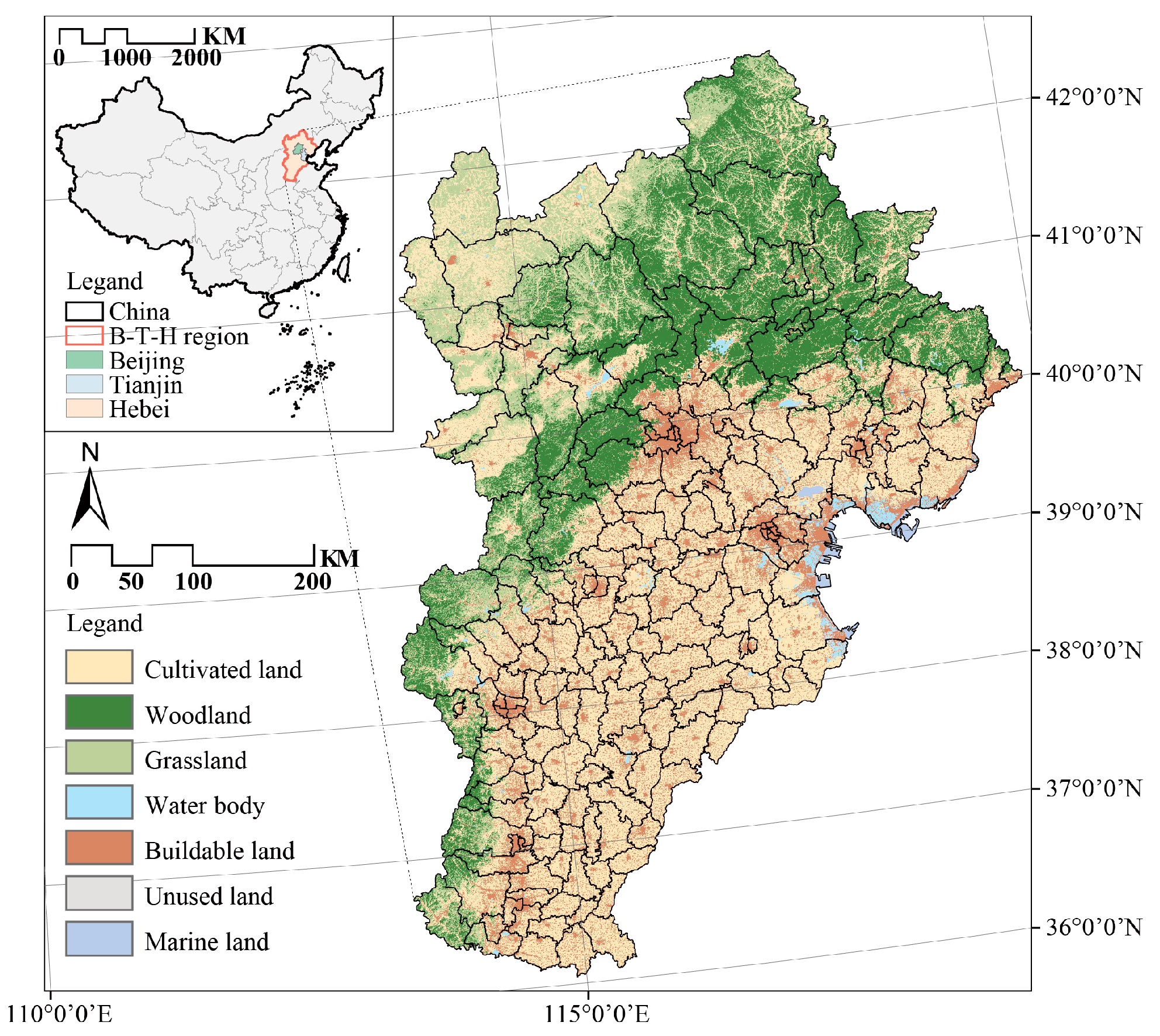
Therefore, this study aims to advance our comprehension of the factors affecting the expansion of the agricultural production scale. This will be achieved by analyzing and quantifying the trends and factors contributing to the evolution of the spatial pattern of croplands in the Beijing–Tianjin–Hebei (B-T-H) region in China. Specific objectives include: (1) quantifying the trend in the spatial pattern of croplands in the B-T-H region using landscape indices, (2) assessing the impacts of agricultural production scale expansion on the total production of two major field crops (wheat and corn), as well as their yields per unit area, and (3) identifying the role of socio-economic factors on the trends observed in the spatial pattern of croplands.
4. Discussion
4.1. Trends in the Evolution of Cropland Spatial Patterns and Their Influence on Grain Production
The evolution of cropland spatial patterns and their impact on grain production varies within the B-T-H urban agglomeration, comprising Beijing, Tianjin, and Hebei, despite their geographic proximity and similar climates. Overall, the advances in seed quality, fertilizers, mechanization, and irrigation resulting from large-scale operations contribute positively to total grain yield [
23]. Additionally, factors such as production and living conditions, as well as socio-economic development (
Figure 8), exert varying degrees of influence on the physical characteristics resulting from the scaling of arable land to different degrees. Existing research primarily concentrates on the spatial alterations resulting from different types of land use conversions [
24,
25], yet there is limited analysis regarding the evolving internal spatial pattern of arable land. As for the relationship between the spatial pattern of arable land and grain yield, existing studies predominantly examine the indirect impacts of land policies on fertilizer application [
26], the influence of diverse cropland management methods [
27], and other agricultural practices on grain yield. Conversely, fewer studies investigate the direct effects of the physical characteristics of arable land on grain yield. Consistent with the studies centered on land fragmentation, this study also observed that the ENN and SHI indices of arable land patches increased with the enforcement of the scaling policy, reflecting a progressive rise in their fragmentation levels from year to year [
28]. Although the spatial pattern of arable land is influenced by external factors, such as urban expansion encroaching on arable land and the transition between productive and ecological land use, the primary drivers of these changes are the combined effects of natural resource conditions and human activities. Therefore, rather than emphasizing integrated land use transfer, as previous studies have, this research concentrated on analyzing changes in arable land spatial patterns from an internal perspective, particularly at the patch level using landscape ecology. It prioritized analyzing these patterns over investigating the impacts of external influences on food production.
4.1.1. Correlation between the Spatial Bureau of Arable Land and Grain Yields in Beijing
The principal influences on Beijing’s agricultural economy and ecological environment include the degree of urbanization, agricultural acreage, and water resources [
29]. Although Beijing has well-developed infrastructure (
Figure 8), the extensive land management associated with large-scale development has, nonetheless, had a detrimental impact on grain production efficiency.
The rapid urbanization of Beijing has drastically altered the distribution of arable land, leading to a gradual decline in the agricultural sector’s contribution, particularly in field crops (
Figure 9), consequently reducing food production. This transformation has been accompanied by an increase in the ENN and SHI indices (
Figure 4, Beijing), indicating the encroachment of urbanization, fragmentation of farmland, and increased distance between farmland patches. These changes have complicated planting and harvesting operations, leading to a decline in the input–output ratio [
30]. As part of efforts toward sustainable agriculture, Beijing has, in recent years, increasingly promoted rainwater and recycled water irrigation, reducing the reliance on furrow irrigation [
31]. The ENN index, reflecting the width of field roads and canals, partly indicates the effective irrigation area. When irrigation conditions are met, wider field roads require greater mechanical power, hence the negative correlation between landscape pattern indices and grain yield.
In recent years, agricultural development in Beijing has mainly focused on experimenting with novel agricultural business models. With a significant decrease in available arable land in the city, food production has transitioned from being the primary focus of agricultural development to the advancement of multifunctional urban agriculture and innovative farming approaches [
32]. This shift was evident in the increasing SHI (
Figure 5c,d), indicating the intensified development of novel sustainable agricultural industries, such as picking gardens, resulting in a more intricate field landscape due to diverse development initiatives. Notably, the construction of high-standard farmland in Beijing has overly emphasized the standardization of plot shapes, tree rows, connecting roads, adjacent watercourses, and drainage systems [
33]. However, this trend toward more dispersed patterns and complex shapes has instead resulted in escalating costs, potentially leading to suboptimal agricultural outcomes.
4.1.2. Correlation between the Spatial Bureau of Cultivated Land and Grain Production in Tianjin City
Tianjin is characterized by urban agriculture, but despite possessing good infrastructure (
Figure 8), its complex geographic terrain results in limited advantages in food production, and there is no obvious correlation between spatial patterns and food production. Being a coastal city, Tianjin’s complex natural topography leads to messy land divisions, large distances between plots, complex shapes of arable land, and high ENN and SHI indices (
Figure 4, Tianjin). Initially, Tianjin benefited from a high level of mechanization due to early industrialization. However, as infrastructure in other regions improves, Tianjin’s original advantages can no longer offset the severe disadvantages of land fragmentation. Despite still maintaining a relatively advanced level of agricultural production nationally, the intricate spatial distribution of arable land patches diminishes the advantage of cultivating field crops. This disadvantage was exacerbated in the 1990s when restructuring in grain cultivation aimed at boosting feed grain production resulted in a notable increase in the maize cultivation area [
34]. Due to the larger size of machines required for maize cultivation, the planting of densely cultivated land led to a proliferation of distances between farm plots, further fragmenting the land and diminishing the advantages of crops other than maize. As a result, there is no significant correlation between land patterns and total grain production. In recent times (from 2016), Tianjin has shifted toward agricultural sectors with greater comparative advantages, such as vegetable cultivation (
Figure 10).
4.1.3. Correlation between the Spatial Bureau of Arable Land and Grain Yield per Unit in Hebei Province
In tandem with infrastructure development, cultivated land patches in Hebei Province have undergone a shift toward an increase in distance and complexity of shape, resulting in increased grain production and unit yield (
Figure 4, Hebei). Despite its vast expanse of arable land, Hebei Province, as a largely agricultural province in China, has struggled with inadequate infrastructure (
Figure 8). The grain planting area in Hebei Province is several tens of times larger than that in Beijing and Tianjin. However, the agricultural mechanization levels in Hebei indicate that its infrastructure development is far from sufficient. However, enhancements in irrigation systems and the rise in mechanization coverage have contributed to the widening of irrigation ditches and field roads, as evidenced by the increase in the ENN and SHI indices (
Figure 4, Hebei). These infrastructure improvements have heightened the input–output ratio, thereby boosting food production. Concurrently, with the return of agricultural populations, and considering that farming operations remain at a moderate scale, there has been a shift toward more intensive cultivation under the “family farm” model. The increased maize yields are likely attributed to intercropping practices [
35], which require fine management and a certain level of mechanization. A notable aspect of the “family farm” model is its moderate scale, which prioritizes large-scale, intensive production over traditional small-scale farming methods. Moreover, it emphasizes joint family operations and relies predominantly on farm income, particularly from production, as the primary source of revenue, as opposed to relying on hired agricultural capital enterprises [
36].
4.1.4. Comparison of Spatial Patterns and Food Production in the B-T-H Region
A comparison of research findings within the B-T-H region revealed that the influence of alterations in the ENN and SHI indices on food production largely hinges on the state of agricultural infrastructure development and the extent of land cultivation. The fundamental principle underlying large-scale farming, which emerged from the household contract responsibility system, is moderation. According to Barrett [
37], there exists an inverse relationship between productivity and farm size—small farms tend to exhibit higher productivity in comparison to larger ones. In areas where irrigation and mechanization infrastructure are deficient and agricultural advancement is skewed toward small-scale precision farming, field patterns indicate improvements in food production due to this factors. In areas where irrigation and mechanization infrastructure are inadequate and agricultural development is biased toward small-scale intensive farming, food production and cropland patterns are strongly positively influenced by infrastructure. However, in areas boasting better irrigation and mechanization infrastructure, the degree of land dispersion and shape indices directly impact the land input-output ratio, thereby influencing field scalability [
38].
Therefore, development strategies should be differentiated for Beijing, Tianjin, and Hebei. Despite the Beijing–Tianjin–Hebei region’s achievement of a ‘coordinated development’ policy as a city cluster, it is crucial to clarify the specific roles of each area within the region. Based on the comparative advantages and development characteristics of different production zones [
39], respective suggestions for sustainable agricultural utilization should be proposed. At the same time, by moderately controlling the spatial layout, the highest input–output ratio for large-scale production can be achieved. Maintaining the grain production advantage of the Hebei Plain, exploring characteristic agricultural development in Tianjin and its surroundings, and achieving regional agricultural self-sufficiency and sustainable development are all essential.
4.2. Influence of Socio-Economic Factors on Spatial Patterns of Croplands
From the correlation analysis between cropland patterns and food production, it was evident that socio-economic factors, among others, play a pivotal role (
Figure 6). Both the Random Forest algorithm and SEM revealed that land ownership impacts serve as fundamental influencing factors, affecting land division, shape alteration, and various socio-economic factors (
Figure 7). While specific circumstances may vary from place to place, the significant role of policies and socio-economic conditions cannot be overlooked. Many scholars have delved into agricultural changes resulting from policies and socio-economic conditions [
39], but there remains a dearth of comprehensive understanding regarding the interconnections among policies, spatial patterns of arable land, and socio-economic factors, with unclear influence mechanisms among them. Hence, this study employed SEM to elucidate the relationships among these three parameters (
Figure 7).
Meanwhile, as farmers return from the B-T-H region (
Figure 11), more people are settling back in rural areas and engaging in agricultural labor. In this process, property rights (land division) become increasingly complex. In recent years, China has vigorously implemented a ‘one household, one housing’ policy; thus, the ‘total number of households’ has become an indicator of land ownership to some extent. A higher number indicates more complex divisions of land ownership but also implies greater participation of labor in agricultural activities. Therefore, an increase in the “total number of households” results in more fragmented land ownership, leading to an elevation in both the ENN and SHI indices. Moreover, the increased labor force implies a larger cultivated area, thereby intensifying the demand for irrigation and mechanization [
40]. The complex property rights system imposes limitations on the scale of agricultural production. China has adhered to the family contract responsibility system, which poses challenges to the transfer of land on a larger scale. Although China’s land contract management rights allow for land transfers under institutional design and corresponding policy and legal safeguards, implementation remains hindered by the level of socio-economic development and the sentiments of farmers [
41]. The decline in the total arable land area and the index of large-scale farming can reflect this constraint. Furthermore, the positive correlation observed in this study between the total number of households and the ENN index also underscores this point.
This not only impacts the implementation of land transfer but also subsequent land cultivation and preservation, thereby indirectly affecting food production. Throughout the B-T-H region, there has been noticeable progress in infrastructure development following several rounds of land consolidation. The fragmentation of land, as indicated by indices such as the ENN and SHI, has adverse effects on socio-economic factors. As cropland patches became more fragmented and complex in shape, socio-economic factors, such as irrigation power, mechanization, and cropland area, diminished [
42]. Simultaneously, as cropland patches become more dispersed, each one has the potential to develop a more intricate shape. Presently, many scholars advocate adjusting ownership relationships through plot exchanges and cropland transfers to mitigate cropland fragmentation. This approach is deemed a crucial developmental pathway for land consolidation, aiming to establish conditions conducive to the realization of agricultural scale and modern agricultural development [
43].
Research confirms that alterations in cropland patterns indeed impact food production to a certain degree. Moreover, specific factors contributing to the formation of cropland patterns in different regions have been analyzed. Therefore, adjusting ownership arrangements and mitigating agricultural land fragmentation via plot replacement and land transfer remain crucial aspects of land restructuring. These measures aim to facilitate the expansion of the scale of agriculture and the development of modern agriculture.
4.3. Limitations and Further Studies
The primary constraint arises from the quantitative approaches used to assess the spatial pattern of arable land. The methodologies employed for quantifying the ENN and SHI indices draw upon landscape ecology principles, traditionally utilized to characterize spatial pattern trends spanning three decades. However, arable land exhibits multifaceted characteristics, and a quantitative analysis focused solely on the shape of farmland patches and physical distances may fail to encompass all relevant attributes. In practice, evaluating farmland also necessitates considerations of economic efficiency, environmental sustainability, and broader social benefits. In this research, the evolutionary mechanism of scale changes was primarily scrutinized through temporal changes in landscape pattern indices and rudimentary correlation analyses. In order to attain a more comprehensive understanding of arable land evolution and establish optimal patterns for food production, further extensive and nuanced investigations are imperative.
The second limitation pertained to the identification of socio-economic factors. The data regarding grain production, grain yield per unit, and socio-economic indicators utilized in this study were derived from statistical data, which inherently possess a high degree of uncertainty. The availability of agricultural survey data was limited, posing challenges in analyzing the evolving patterns of specific cropland utilization. Nonetheless, following thorough validation, the reliability and validity of the data appeared relatively robust. They offered partial insights into the relationship between land patterns and grain production, thereby laying a foundation for promoting land consolidation through standardized land-scaling measures. Cultivated land functions as a carrier for integrated agricultural–ecological and socio-economic composite systems. Therefore, implementing comprehensive management practices to enhance resource utilization and diminish external inputs represents a crucial avenue for further research.
As part of sustainable agricultural practices, exploration within arable land should not be limited solely to increasing grain yields [
44]. Changes in the pattern of cultivated land are also crucial topics for the protection of agricultural ecosystems and biodiversity, soil health management, and water resource management [
45]. A comprehensive consideration of these agricultural ecological practices can enhance the capacity for sustainable agricultural development and provide more comprehensive insights into the dynamics of land use [
46]. Additionally, with the implementation of China’s “Grain for Green” and “Consolidation and Reclamation” policies, the integration and coordination between agricultural production spaces and external urban and ecological spaces is an important issue to explore and represents a significant direction for future efforts.
5. Conclusions
China continues to grapple with conventional challenges to food supply and demand, alongside the ongoing rise in demand for biomass energy. In terms of total grain production, the equilibrium between grain supply and demand remains precarious in both 2020 and 2030. Structurally, there is anticipated growth in grain utilization for feed, primarily driven by corn supply, further exacerbating regional imbalances in grain supply and demand. Enhancing the layout of arable land and achieving large-scale agricultural production are crucial avenues for attaining China’s grain production goals. Considering the imperative of expanding the agricultural production scale, existing research predominantly examines static perspectives, such as fine-grained cultivated land, resulting in limited insights into its developmental trajectory and the identification of driving factors, which is pivotal for advancing the scale of agricultural production.
In this study, the landscape ecology method was utilized to assess the landscape pattern, employing two key indicators, ENN and SHI, to measure the spatial pattern and investigate its dynamic trend. Correlation analysis was conducted to examine the relationship between landscape patterns and grain yield. The Random Forest algorithm was used to identify socio-economic indicators with the most significant impact on spatial patterns, while SEM was used to dissect the mechanisms through which socio-economic factors influence the spatial patterns of arable land. The findings revealed several key points: (1) the landscape pattern of arable land tended toward larger patch spacing and more complex shapes, (2) the grain yield exhibited a positive correlation with the landscape pattern index in Beijing, a negative correlation in Hebei, and no significant correlation in Tianjin, and (3) land ownership emerged as a fundamental factor influencing land fragmentation, shape alteration, and other socio-economic factors. Studying the spatial pattern of arable land in conjunction with socio-economic factors facilitates comprehensive management, enhances resource utilization, reduces external inputs, and represents a critical avenue for addressing the food crises.
Therefore, China should strive to maintain favorable conditions for increasing food production and optimizing the food structure and yield. Future research efforts should focus on refining the quantification of actual interventions, enhancing the simulation and prediction of applied measures, and aiding policy decisions to maximize food production in the B-T-H region. In conclusion, it is believed that examining the case of arable land scaling in the B-T-H region of China can offer valuable insights into the development of complex agroecological and socio-economic systems.


