Article

The Role of Remote Sensing for Understanding Large-Scale Rubber Concession Expansion in Southern Laos
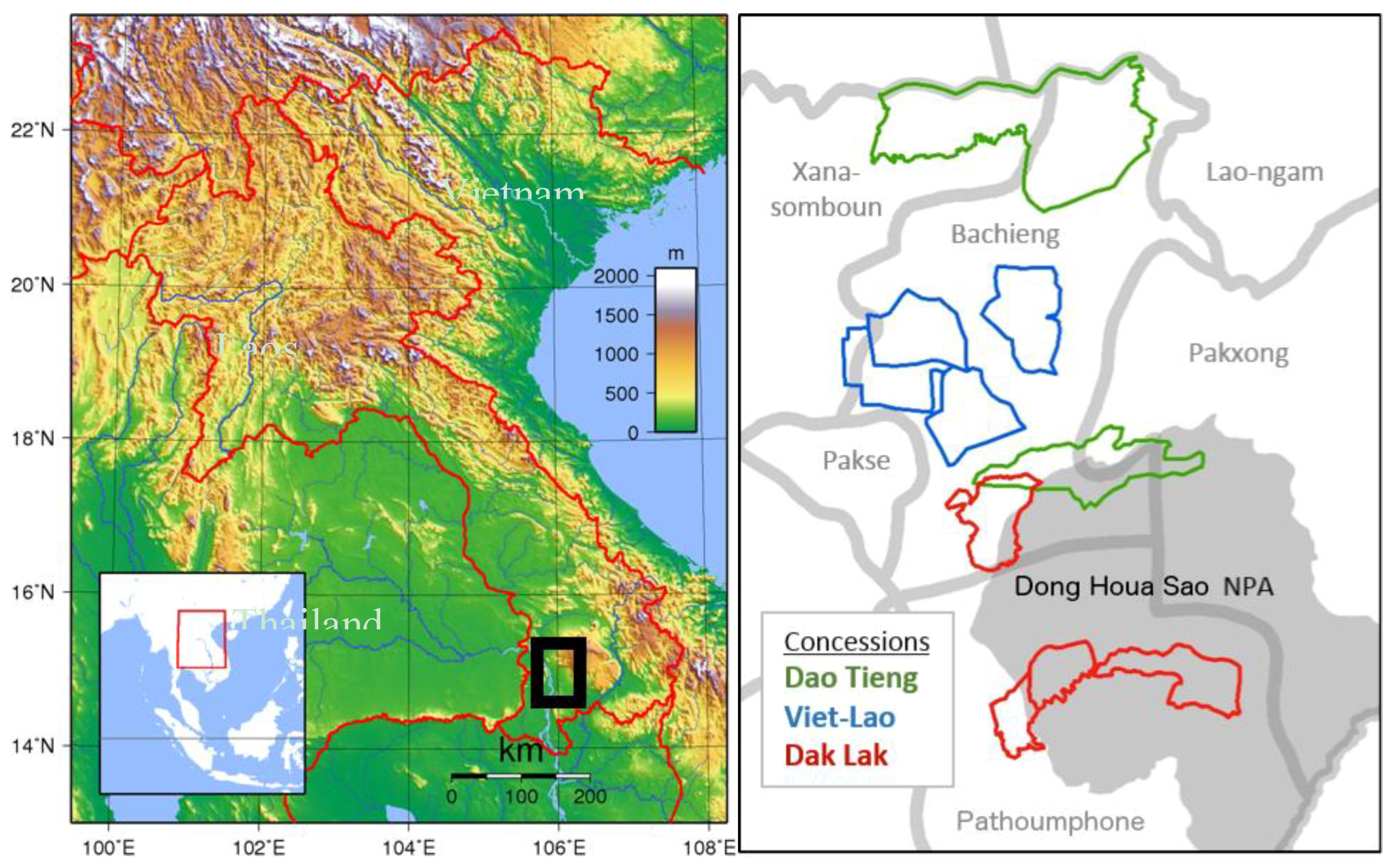
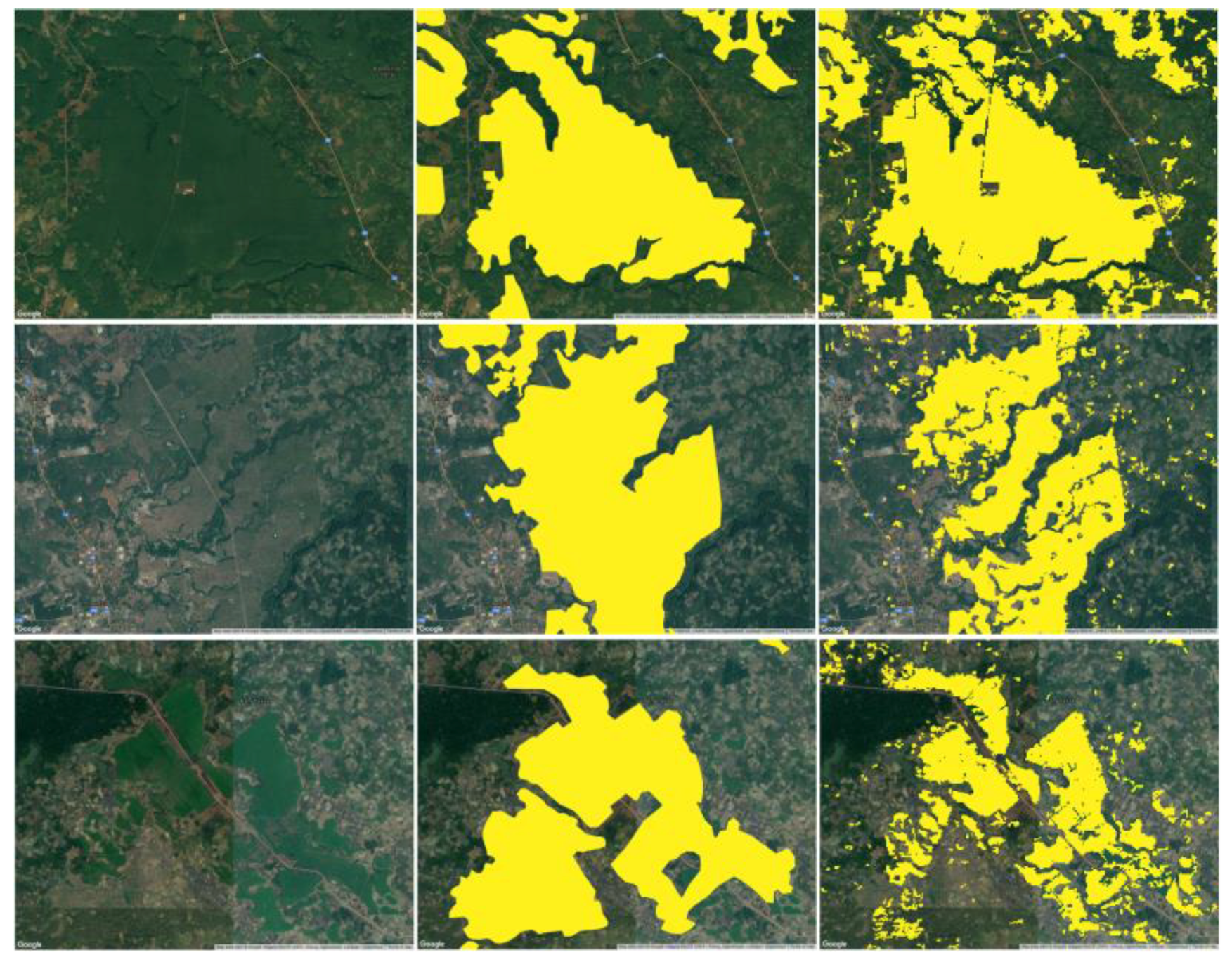
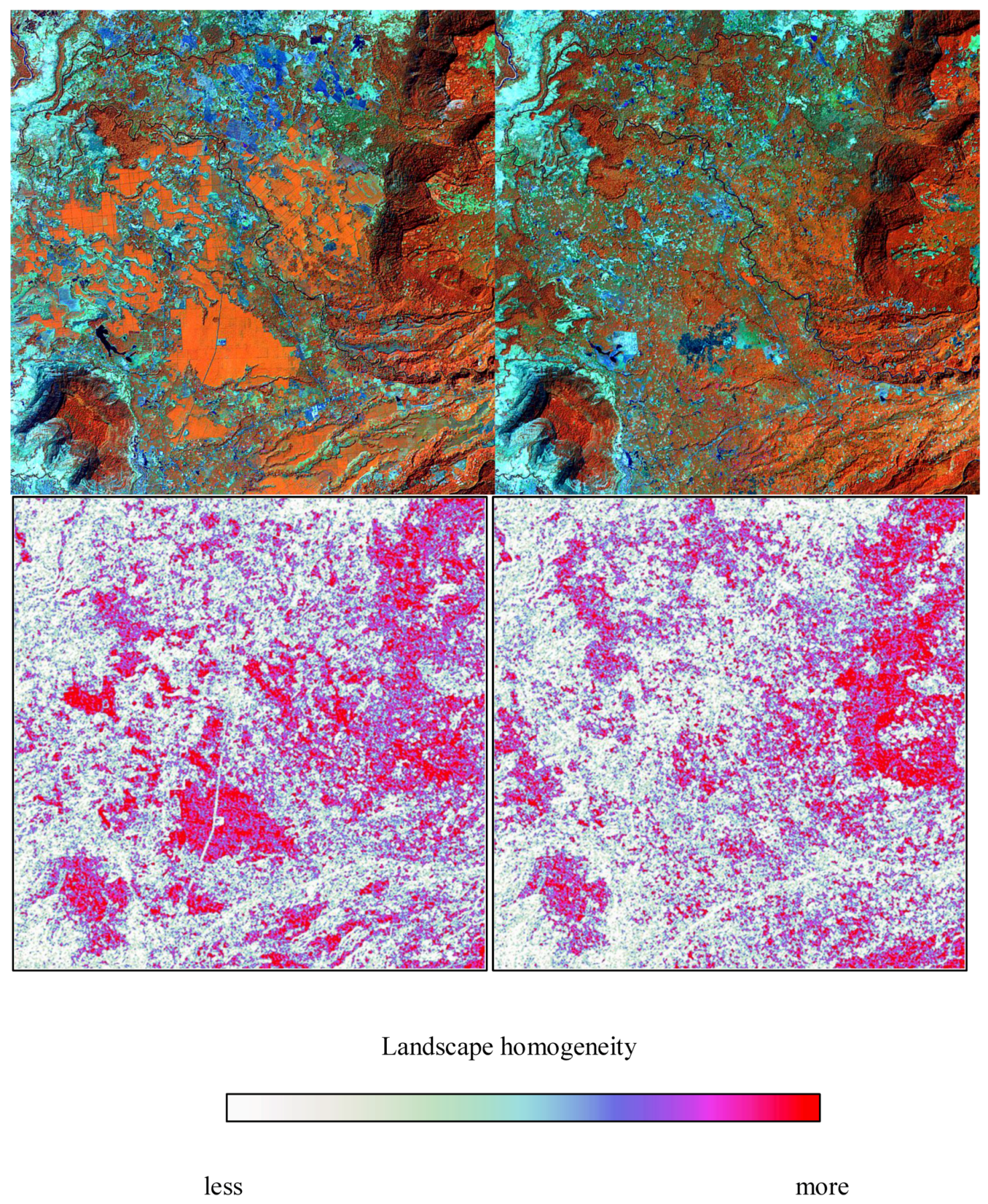
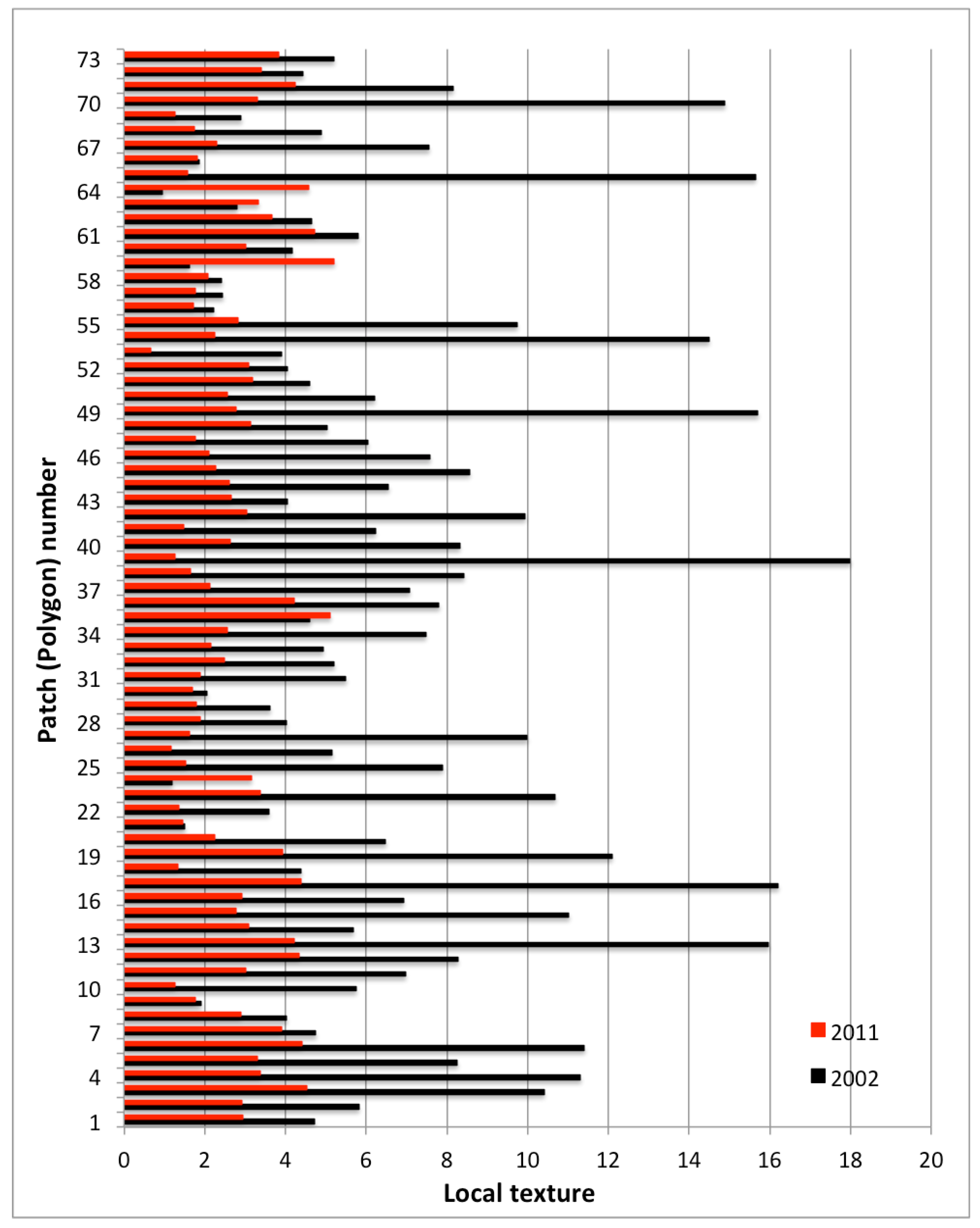
1
Nelson Institute for Environmental Studies & Department of Forest and Wildlife Ecology, University of Wisconsin-Madison, Madison, WI 53706, USA
2
Department of Geography, University of Wisconsin-Madison, Madison, WI 53706, USA
3
Centre for Development and Environment, University of Bern, 3012 Bern, Switzerland
*
Author to whom correspondence should be addressed.
Submission received: 4 April 2018 / Revised: 18 April 2018 / Accepted: 18 April 2018 / Published: 20 April 2018

Abstract

Increasing global demand for natural rubber began in the mid-2000s and led to large-scale expansion of plantations in Laos until rubber latex prices declined greatly beginning in 2011. The expansion of rubber did not, however, occur uniformly across the country. While the north and central Laos experienced mostly local and smallholder plantations, rubber expansion in the south was dominated by transnational companies from Vietnam, China and Thailand through large-scale land concessions, often causing conflicts with local communities. In this study we use satellite remote sensing to identify and map the expansion of large-scale rubber plantations in Champasak Province—the first area in southern Laos to host large-scale rubber development—and document the biophysical impacts on the local landscape, which of course is linked to social impacts on local people. Our study demonstrates that the expansion of rubber in the province was rapid and did not always conform to approved concession area locations. The mono-culture nature of rubber plantations also had the effect of homogenizing the landscape, eclipsing the changes caused by local populations. We argue that by providing a relatively inexpensive way to track the expansion of rubber plantations over space and time, remote sensing has the potential to provide advocates and other civil society groups with data that might otherwise remain limited to the restricted domains of state regulation and private sector reporting. However, we also caution that while remote sensing has the potential to provide strong public evidence about plantation expansion, access to and control of this information ultimately determines its value.
Keywords: land concessions; rubber; Champasak; agrarian change land concessions; rubber; Champasak; agrarian change

