Sustainable Land Management, Wildfire Risk and the Role of Grazing in Mediterranean Urban-Rural Interfaces: A Regional Approach from Greece

 ,
, 

Abstract
1. Introduction
2. Methodology
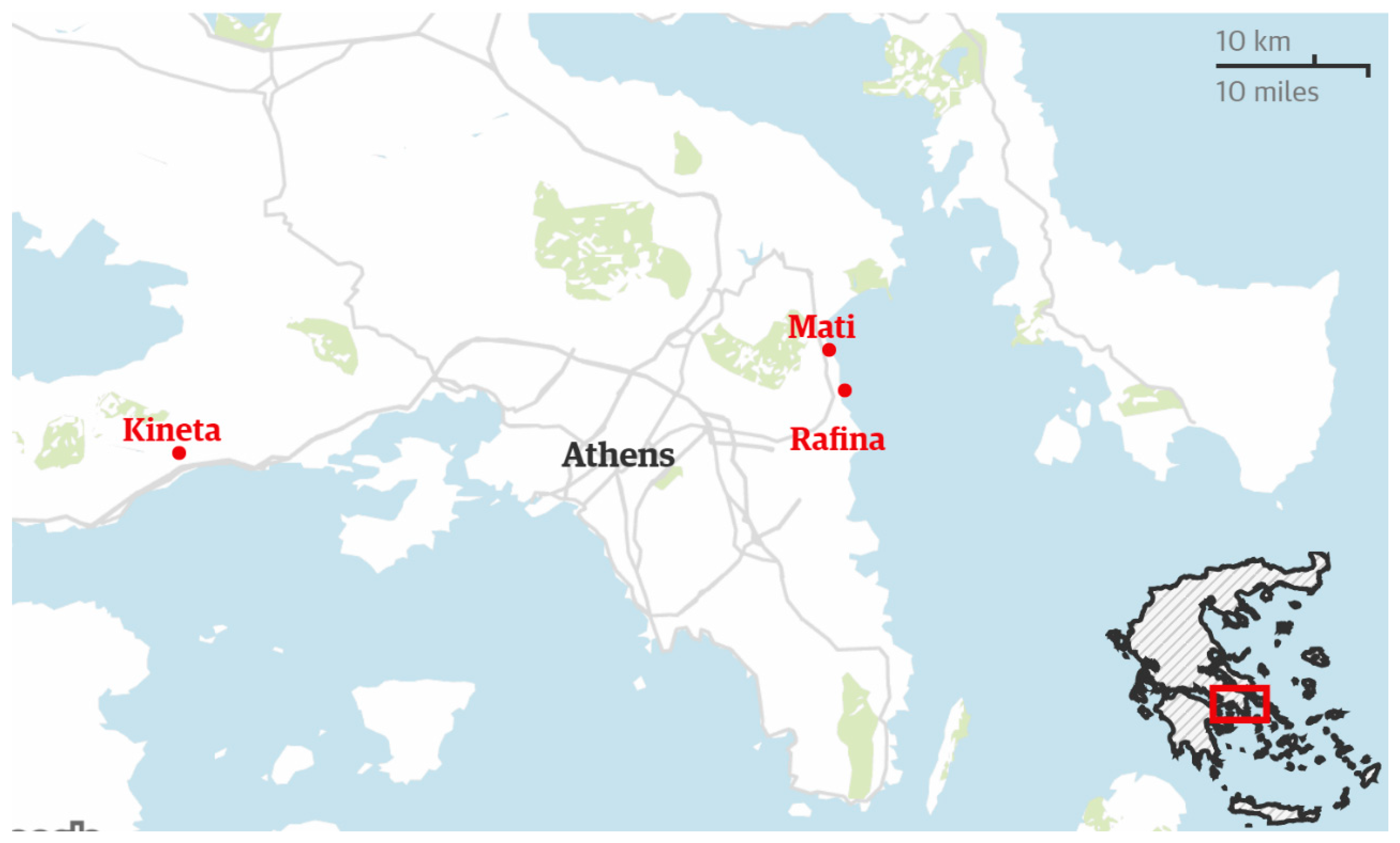
2.1. Study Area
2.2. Livestock in Greece
2.3. Data Sources and Variables
2.3.1. Wildfires
2.3.2. Livestock
2.4. Data Analysis
3. Results
3.1. A Preliminary Analysis of Wildfire Regimes and Livestock Density in Greek Prefectures
3.2. Wildfire’s Characteristics in Attica
3.3. Livestock Dynamics in Attica
4. Discussion
5. Conclusions
Author Contributions
Funding
Conflicts of Interest
References
- Corona, P.; Ascoli, D.; Barbati, A.; Bovio, G.; Colangelo, G.; Elia, M.; Lovreglio, R. Integrated forest management to prevent wildfires under mediterranean environments. Ann. Silvic. Res. 2014, 38, 24–45. [Google Scholar]
- Valese, E.; Conedera, M.; Held, A.C.; Ascoli, D. Fire, humans and landscape in the European Alpine region during the Holocene. Anthropocene 2014, 6, 63–74. [Google Scholar] [CrossRef]
- Keeley, J.E. Fire management of California shrubland landscapes. Environ. Manag. 2002, 29, 395–408. [Google Scholar] [CrossRef]
- Castellnou, M.; Kraus, D.; Miralles, M. Prescribed burning and suppression fire techniques: From fuel to landscape management. Best practices of fire use—Prescribed burning and suppression fire programmes in selected case-study Regions in Europe. Eur. For. Inst. Res. Rep. 2010, 24, 3–16. [Google Scholar]
- Cissel, J.H.; Swanson, F.J.; Weisberg, P.J. Landscape management using historical fire regimes: Blue River, Oregon. Ecol. Appl. 1999, 9, 1217–1231. [Google Scholar] [CrossRef]
- Cochrane, M.A. Fire science for rainforests. Nature 2003, 421, 913–919. [Google Scholar] [CrossRef]
- Connor, S.E.; Vannière, B.; Colombaroli, D.; Anderson, R.S.; Carrión, J.S.; Ejarque, A.; Revelles, J. Humans take control of fire-driven diversity changes in Mediterranean Iberia’s vegetation during the mid-late Holocene. Holocene 2019, 29, 886–901. [Google Scholar] [CrossRef]
- Zambon, I.; Benedetti, A.; Ferrara, C.; Salvati, L. Soil matters? A multivariate analysis of socioeconomic constraints to urban expansion in Mediterranean Europe. Ecol. Econ. 2018, 146, 173–183. [Google Scholar] [CrossRef]
- Schmuck, G.; San-Miguel-Ayanz, J.; Camia, A.; Durrant, T.; Boca, R.; Libertà, G.; Schulte, E. Forest Fires in Europe Middle East and North Africa 2012; Joint Research Centre Technical Report; Publications Office of the European Union: Luxembourg, 2013.
- San Miguel-Ayanz, J.; Moreno, J.M.; Camia, A. Analysis of large fires in European Mediterranean landscapes: Lessons learned and perspectives. For. Ecol. Manag. 2013, 294, 11–22. [Google Scholar] [CrossRef]
- San Miguel-Ayanz, J.; Schulte, E.; Schmuck, G.; Camia, A. The European Forest Fire Information System in the context of environmental policies of the European Union. For. Policy Econ. 2013, 29, 19–25. [Google Scholar] [CrossRef]
- Beilin, R.; Lindborg, R.; Stenseke, M.; Pereira, H.; Llausàs, A.; Slätmo, E.; Cerqueira, Y.; Navarroe, L.; Rodrigues, P.; Reichelt, N. Analysing how drivers of agricultural land abandonment affect biodiversity and cultural landscapes using case studies from Scandinavia, Iberia and Oceania. Land Use Policy 2014, 36, 60–72. [Google Scholar] [CrossRef]
- Pausas, J.G.; Paula, S. Fuel shapes the fire-climate relationship: Evidence from Mediterranean ecosystems. Glob. Ecol. Biogeogr. 2012, 21, 1074–1082. [Google Scholar] [CrossRef]
- Renwick, A.; Jansson, T.; Verburg, P.H.; Revoredo-Giha, C.; Britz, W.; Gocht, A.; McCracken, D. Policy reform and agricultural land abandonment in the EU. Land Use Policy 2013, 30, 446–457. [Google Scholar] [CrossRef]
- Moreira, F.; Viedma, O.; Arianoutsou, M.; Curt, T.; Koutsias, N.; Rigolot, E.; Barbati, A.; Corona, P.; Vaz, P.; Xanthopoulos, G.; et al. Landscape e wildfire interactions in southern Europe: Implications for landscape management. J. Environ. Manag. 2011, 92, 2389–2402. [Google Scholar] [CrossRef]
- Cansler, C.A.; McKenzie, D. Climate, fire size, and biophysical setting control fire severity and spatial pattern in the northern Cascade Range, USA. Ecol. Appl. 2014, 24, 1037–1056. [Google Scholar] [CrossRef]
- Koutsias, N.; Arianoutsou, M.; Kallimanis, A.S.; Mallinis, G.; Halley, J.M.; Dimopoulos, P. Where did the fires burn in Peloponnisos, Greece the summer of 2007? Evidence for a synergy of fuel and weather. Agric. For. Meteorol. 2012, 156, 41–53. [Google Scholar] [CrossRef]
- Steel, Z.L.; Safford, H.D.; Viers, J.H. The fire frequency-severity relationship and the legacy of fire suppression in California forests. Ecosphere 2015, 6, 1–23. [Google Scholar] [CrossRef]
- Williams, M.A.; Baker, W.L. Spatially extensive reconstructions show variable-severity fire and heterogeneous structure in historical western United States dry forests. Glob. Ecol. Biogeogr. 2012, 21, 1042–1052. [Google Scholar] [CrossRef]
- Zambon, I.; Cerdà, A.; Cudlin, P.; Serra, P.; Pili, S.; Salvati, L. Road Network and the Spatial Distribution of Wildfires in the Valencian Community (1993–2015). Agriculture 2019, 9, 100. [Google Scholar] [CrossRef]
- Zapata, V.M.; Robledano, F. Assessing biodiversity and conservation value of forest patches secondarily fragmented by urbanisation in semiarid southeastern Spain. J. Nat. Conserv. 2014, 22, 166–175. [Google Scholar] [CrossRef]
- Fernandes, P.M. Fire-smart management of forest landscapes in the Mediterranean basin under global change. Landsc. Urban Plan. 2013, 110, 175–182. [Google Scholar] [CrossRef]
- Marcos, R.; Turco, M.; Bedía, J.; Llasat, M.C.; Provenzale, A. Seasonal predictability of summer fires in a Mediterranean environment. Int. J. Wildland Fire 2015, 24, 1076–1084. [Google Scholar] [CrossRef]
- Moreno, J.M.; Zuazua, E.; Pérez, B.; Luna, B.; Velasco, A.; Resco de Dios, V. Rainfall patterns after fire differentially affect the recruitment of three Mediterranean shrubs. Biogeosciences 2011, 8, 3721–3732. [Google Scholar] [CrossRef]
- Stockmann, K.; Burchfield, J.; Calkin, D.; Venn, T. Guiding preventative wildland fire mitigation policy and decisions with an economic modelling system. For. Policy Econ. 2010, 12, 147–154. [Google Scholar] [CrossRef]
- Molina, J.R.; González-Cabán, A.; Rodríguez y Silva, F. Potential Effects of Climate Change on Fire Behavior, Economic Susceptibility and Suppression Costs in Mediterranean Ecosystems: Córdoba Province, Spain. Forests 2019, 10, 679. [Google Scholar] [CrossRef]
- Tedim, F.; Leone, V.; Amraoui, M.; Bouillon, C.; Coughlan, M.; Delogu, G.; Parente, J. Defining extreme wildfire events: Difficulties, challenges, and impacts. Fire 2018, 1, 9. [Google Scholar] [CrossRef]
- Rodrigues, M.; Jiménez, A.; de la Riva, J. Analysis of recent spatial-temporal evolution of human driving factors of wildfires in Spain. Nat. Hazards 2016, 84, 2049–2070. [Google Scholar] [CrossRef]
- Viedma, O.; Urbieta, I.R.; Moreno, J.M. Wildfires and the role of their drivers are changing over time in a large rural area of west-central Spain. Sci. Rep. 2018, 8, 17797. [Google Scholar] [CrossRef] [PubMed]
- Corona, P. Forestry research to support the transition towards a bio-based economy. Ann. Silvic. Res. 2015, 38, 37–38. [Google Scholar]
- Corona, P.; Cutini, A.; Chiavetta, U.; Paoletti, E. Forest-food nexus: A topical opportunity for human well-being and silviculture. Ann. Silvic. Res. 2016, 40, 1–10. [Google Scholar]
- Lafortezza, R.; Sanesi, G.; Chen, J. Large-scale effects of forest management in Mediterranean landscape of Europe. iForest-Biogeosci. For. 2013, 6, 331–335. [Google Scholar] [CrossRef]
- Lafortezza, R.; Tanentzap, A.J.; Elia, M.; John, R.; Sanesi, G.; Chen, J. Prioritizing fuel management in urban interfaces threatened by wildfires. Ecol. Indic. 2015, 48, 342–347. [Google Scholar] [CrossRef]
- Noss, R.F.; Franklin, J.F.; Baker, W.L.; Schoennagel, T.; Moyle, P.B. Managing fire-prone forests in the western United States. Front. Ecol. Environ. 2006, 4, 481–487. [Google Scholar] [CrossRef]
- Badia, A.; Serra, P.; Modugno, S. Identifying dynamics of fire ignition probabilities in two representative Mediterranean wildland-urban interface areas. Appl. Geogr. 2011, 31, 930–940. [Google Scholar] [CrossRef]
- Calkin, D.E.; Cohen, J.D.; Finney, M.A.; Thompson, M.P. How risk management can prevent future wildfire disasters in the wildland-urban interface. Proc. Natl. Acad. Sci. USA 2014, 111, 746–751. [Google Scholar] [CrossRef]
- Oliveras, I.; Anderson, L.O.; Malhi, Y. Application of remote sensing to understanding fire regimes and biomass burning emissions of the tropical Andes. Glob. Biogeochem. Cycles 2014, 28, 480–496. [Google Scholar] [CrossRef]
- Finney, M.A. A computational method for optimizing fuel treatment locations. Int. J. Wildland Fire 2007, 16, 702–711. [Google Scholar] [CrossRef]
- Fulé, P.Z.; Crouse, J.E.; Cocke, A.E.; Moore, M.M.; Covington, W.W. Changes in canopy fuels and potential fire behavior 1880-2040: Grand Canyon; Arizona. Ecol. Model. 2004, 175, 231–248. [Google Scholar] [CrossRef]
- Salis, M.; Laconi, M.; Ager, A.A.; Alcasena, F.J.; Arca, B.; Lozano, O.; de Oliveira, A.F.; Spano, D. Evaluating alternative fuel treatment strategies to reduce wildfire losses in a Mediterranean area. For. Ecol. Manag. 2016, 368, 201–221. [Google Scholar] [CrossRef]
- Schmidt, D.A.; Taylor, A.H.; Skinner, C.N. The influence of fuels treatment and landscape arrangement on simulated fire behavior, Southern Cascade Range, California. For. Ecol. Manag. 2008, 255, 3170–3184. [Google Scholar] [CrossRef]
- Stephens, S.L.; Moghaddas, J.J. Experimental fuel treatment impacts on forest structure; potential fire behavior; and predicted tree mortality in a California mixed conifer forest. For. Ecol. Manag. 2005, 215, 21–36. [Google Scholar] [CrossRef]
- Stewart, S.I.; Radeloff, V.C.; Hammer, R.B.; Hawbaker, T.J. Defining the wildland-urban interface. J. For. 2007, 105, 201–207. [Google Scholar]
- Ager, A.A.; Vaillant, N.M.; Finney, M.A. A comparison of landscape fuel treatment strategies to mitigate wildland fire risk in the urban interface and preserve old forest structure. For. Ecol. Manag. 2010, 259, 1556–1570. [Google Scholar] [CrossRef]
- Bar-Massada, A.; Radeloff, V.C.; Stewart, S.I.; Hawbaker, T.J. Wildfire risk in the wildland-urban interface: A simulation study in northwestern Wisconsin. For. Ecol. Manag. 2009, 258, 1990–1999. [Google Scholar] [CrossRef]
- Cohen, J. The wildland-urban interface fire problem. Fremontia 2010, 38, 16–22. [Google Scholar]
- Dumas, E.; Jappiot, M.; Tatoni, T. Mediterranean urbanforest interface classification (MUFIC): A quantitative method combining SPOT5 imagery and landscape ecology indices. Landsc. Urban Plan. 2008, 84, 183–190. [Google Scholar] [CrossRef]
- Elia, M.; Lovreglio, R.; Ranieri, N.A.; Sanesi, G.; Lafortezza, R. Cost-effectiveness of fuel removals in mediterranean wildland-urban interfaces threatened by wildfires. Forests 2016, 7, 149. [Google Scholar] [CrossRef]
- Lampin-Maillet, C.; Jappiot, M.; Long, M.; Bouillon, C.; Morge, D.; Ferrier, J.P. Mapping wildland-urban interfaces at large scales integrating housing density and vegetation aggregation for fire prevention in the South of France. J. Environ. Manag. 2010, 91, 732–741. [Google Scholar] [CrossRef]
- Lein, J.K.; Stump, N.I. Assessing wildfire potential within the wildland-urban interface: A southeastern Ohio example. Appl. Geogr. 2009, 29, 21–34. [Google Scholar] [CrossRef]
- Radeloff, V.C.; Hammer, R.B.; Stewart, S.I.; Fried, J.S.; Holcomb, S.S.; McKeefry, J.F. The wildland-urban interface in the United States. Ecol. Appl. 2005, 15, 799–805. [Google Scholar] [CrossRef]
- Whitman, E.; Rapaport, E.; Sherren, K. Modeling fire susceptibility to delineate wildland-urban interface for municipal-scale fire risk management. Environ. Manag. 2013, 52, 1427–1439. [Google Scholar] [CrossRef]
- Zhang, Y.; He, H.S.; Yang, J. The wildland-urban interface dynamics in the southeastern U.S. from 1990 to 2000. Landsc. Urban Plan. 2008, 85, 155–162. [Google Scholar] [CrossRef]
- Theobald, D.M.; Romme, W.H. Expansion of the US wildland-urban interface. Landsc. Urban Plan. 2007, 83, 340–354. [Google Scholar] [CrossRef]
- Gill, A.M.; Stephens, S.L. Scientific and social challenges for the management of fire-prone wildland-urban interfaces. Environ. Res. Lett. 2009, 4, 034014. [Google Scholar] [CrossRef]
- Biasi, R.; Colantoni, A.; Ferrara, C.; Ranalli, F.; Salvati, L. In-between sprawl and fires: Longterm forest expansion and settlement dynamics at the wildland-urban interface in Rome, Italy. Int. J. Sustain. Dev. World Ecol. 2015, 22, 467–475. [Google Scholar] [CrossRef]
- Tsilimigkas, G.; Kizos, T. Space, pressures and the management of the Greek landscape. Geogr. Ann. Ser. Hum. Geogr. 2014, 96, 159–175. [Google Scholar] [CrossRef]
- Bowman, D.M.J.S.; Balch, J.K.; Artaxo, P.; Bond, W.J.; Carlson, J.M.; Cochrane, M.A.; D’Antonio, C.M.; DeFries, R.S.; Doyle, J.C.; Harrison, S.P.; et al. Fire in the Earth System. Science 2009, 324, 481–484. [Google Scholar] [CrossRef]
- Lovreglio, R.; Leone, V.; Giaquinto, P.; Notarnicola, A. Wildfire cause analysis: Four case-studies in southern Italy. iForest-Biogeosci. For. 2010, 3, 8–15. [Google Scholar] [CrossRef]
- Lovreglio, R.; Meddour-Sahar, O.; Leone, V. Goat grazing as a wildfire prevention tool: A basic review. iForest-Biogeosci. For. 2014, 4, 260–268. [Google Scholar] [CrossRef]
- Mancilla-Leytón, J.M.; Pino Mejías, R.; Martín Vicente, A. Do goats preserve the forest? Evaluating the effects of grazing goats on combustible Mediterranean scrub. Appl. Veg. Sci. 2013, 16, 63–73. [Google Scholar] [CrossRef]
- Valdecantos, A.; Baeza, M.J.; Vallejo, V.R. Vegetation management for promoting ecosystem resilience in Fire-Prone Mediterranean Shrublands. Restor. Ecol. 2009, 17, 414–421. [Google Scholar] [CrossRef]
- Elia, M.; Lafortezza, R.; Colangelo, G.; Sanesi, G. A streamlined approach for the spatial allocation of fuel removals in wildland-urban interfaces. Landsc. Ecol. 2014, 29, 1771–1784. [Google Scholar] [CrossRef]
- Elia, M.; Lafortezza, R.; Lovreglio, R.; Sanesi, G. Developing custom fire behavior fuel models for Mediterranean Wildland-Urban Interfaces in Southern Italy. Environ. Manag. 2015, 56, 754–764. [Google Scholar] [CrossRef] [PubMed]
- European Commission. Forest Fire in Europe 2009—EUR 24502 EN; Official Publication on the European Communities: Ispra, Italy, 2010.
- Calleja, J.A.; Escolà, M.; Carvalho, J.; Forcadell, J.M.; Serrano, E.; Bartolomé, J. Cattle Grazing Fails to Control Shrub Encroachment in Mediterranean Landscapes. Rangel. Ecol. Manag. 2019, 72, 803–811. [Google Scholar] [CrossRef]
- Dubeuf, J.P.; Morales, F.D.A.R.; Guerrero, Y.M. Evolution of goat production systems in the Mediterranean basin: Between ecological intensification and ecologically intensive production systems. Small Rumin. Res. 2018, 163, 2–9. [Google Scholar] [CrossRef]
- De Rancourt, M.; Fois, N.; Lavín, M.P.; Tchakérian, E.; Vallerand, F. Mediterranean sheep and goat’s production: An uncertain future. Small Rumin. Res. 2006, 62, 167–179. [Google Scholar] [CrossRef]
- Papanastasis, V.P.; Bautista, S.; Chouvardas, D.; Mantzanas, K.; Papadimitriou, M.; Mayor, A.G.; Vallejo, R.V. Comparative assessment of goods and services provided by grazing regulation and reforestation in degraded Mediterranean rangelands. Land Degrad. Dev. 2017, 28, 1178–1187. [Google Scholar] [CrossRef]
- Salvati, L. Agro-forest landscape and the ‘fringe’ city: A multivariate assessment of land-use changes in a sprawling region and implications for planning. Sci. Total Environ. 2014, 490, 715–723. [Google Scholar] [CrossRef]
- Colantoni, A.; Zambon, I.; Gras, M.; Mosconi, E.; Stefanoni, A.; Salvati, L. Clustering or Scattering? The Spatial Distribution of Cropland in a Metropolitan Region, 1960–2010. Sustainability 2018, 10, 2584. [Google Scholar] [CrossRef]
- Colantoni, A.; Grigoriadis, E.; Sateriano, A.; Venanzoni, G.; Salvati, L. Cities as selective land predators? A lesson on urban growth, deregulated planning and sprawl containment. Sci. Total Environ. 2016, 545, 329–339. [Google Scholar] [CrossRef]
- Salvati, L.; Serra, P. Estimating rapidity of change in complex urban systems: A multidimensional, local-scale approach. Geogr. Anal. 2016, 48, 132–156. [Google Scholar] [CrossRef]
- Pili, S.; Grigoriadis, E.; Carlucci, M.; Clemente, M.; Salvati, L. Towards sustainable growth? A multi-criteria assessment of (changing) urban forms. Ecol. Indic. 2017, 76, 71–80. [Google Scholar] [CrossRef]
- Cecchini, M.; Zambon, I.; Pontrandolfi, A.; Turco, R.; Colantoni, A.; Mavrakis, A.; Salvati, L. Urban sprawl and the ‘olive’landscape: Sustainable land management for ‘crisis’ cities. GeoJournal 2019, 84, 237–255. [Google Scholar] [CrossRef]
- Kapotas, P.; Maria, E.A. Livestock grazing, forest protection and law in Greece. Manag. Environ. Qual. Int. J. 2017, 28, 57–69. [Google Scholar] [CrossRef]
- Chorianopoulos, I.; Tsilimigkas, G.; Koukoulas, S.; Balatsos, T. The shift to competitiveness and a new phase of sprawl in the Mediterranean city: Enterprises guiding growth in Messoghia—Athens. Cities 2014, 39, 133–143. [Google Scholar] [CrossRef]
- Salvati, L. From sprawl to compactness and back: Population dynamics (1848–2011) and the economic structure of a Mediterranean city. GeoJournal 2016, 81, 319. [Google Scholar] [CrossRef]
- Tsilimigkas, G.; Kizos, T.; Gourgiotis, A. Unregulated urban sprawl and spatial distribution of fire events: Evidence from Greece. Environ. Hazards 2018, 17, 436–455. [Google Scholar] [CrossRef]
- Rontos, K.; Grigoriadis, E.; Sateriano, A.; Syrmali, M.; Vavouras, I.; Salvati, L. Lost in protest, found in segregation: Divided cities in the light of the 2015 “Οχι” referendum in Greece. City Cult. Soc. 2016, 7, 139–148. [Google Scholar] [CrossRef]
- Kosmas, C.; Detsis, V.; Karamesouti, M.; Kounalaki, K.; Vassiliou, P.; Salvati, L. Exploring long-term impact of grazing management on land degradation in the socio-ecological system of Asteroussia Mountains, Greece. Land 2015, 4, 541–559. [Google Scholar] [CrossRef]
- Polyzos, N. Exploitation of rangelands: Actual situation, problems and perspectives. Anim. Sci. Rev. 1991, 7, 154–167. [Google Scholar]
- Zervas, G. Quantifying and optimizing grazing regimes in Greek mountain systems. J. Appl. Ecol. 1998, 35, 983–986. [Google Scholar] [CrossRef]
- Salvati, L.; Bajocco, S.; Ceccarelli, T.; Zitti, M.; Perini, L. Towards a process-based evaluation of land vulnerability to soil degradation in Italy. Ecol. Indic. 2011, 11, 1216–1227. [Google Scholar] [CrossRef]
- Fernandes, P.M.; Barros, A.M.; Pinto, A.; Santos, J.A. Characteristics and controls of extremely large wildfires in the western Mediterranean Basin. J. Geophys. Res. Biogeosci. 2016, 121, 2141–2157. [Google Scholar] [CrossRef]
- Bajocco, S.; Salvati, L.; Ricotta, C. Land degradation versus fire: A spiral process? Prog. Phys. Geogr. 2011, 35, 3–18. [Google Scholar] [CrossRef]
- Bernués, A.; Riedel, J.; Asensio, M.; Blanco, M.; Sanz, A.; Revilla, R.; Casasis, I. An integrated approach to studying the role of grazing livestock systems in the conservation of rangelands in a protected natural park (Sierra de Guara, Spain). Livest. Prod. Sci. 2005, 96, 75–85. [Google Scholar] [CrossRef]
- Munafò, M.; Salvati, L.; Zitti, M. Estimating soil sealing rate at national level—Italy as a case study. Ecol. Indic. 2013, 26, 137–140. [Google Scholar] [CrossRef]
- Salvati, L.; Carlucci, M. A composite index of sustainable development at the local scale: Italy as a case study. Ecol. Indic. 2014, 43, 162–171. [Google Scholar] [CrossRef]
- Salvati, L.; Zitti, M. Land degradation in the Mediterranean basin: Linking bio-physical and economic factors into an ecological perspective. Biota 2005, 5, 67–77. [Google Scholar]
- Salvati, L.; Zitti, M.; Perini, L. Fifty years on: Long-term patterns of land sensitivity to desertification in Italy. Land Degrad. Dev. 2016, 27, 97–107. [Google Scholar] [CrossRef]
- Lasanta, T.; Nadal-Romero, E.; García-Ruiz, J.M. Clearing shrubland as a strategy to encourage extensive livestock farming in the Mediterranean mountains. Cuad. Investig. Geográfica 2018, 42, 487–513. [Google Scholar] [CrossRef]
- Kennedy, M.C.; Johnson, M.C. Fuel treatment prescriptions alter spatial patterns of fire severity around the wildland-urban interface during the Wallow Fire, Arizona, USA. For. Ecol. Manag. 2014, 318, 122–132. [Google Scholar] [CrossRef]
- Mell, W.E.; Manzello, S.L.; Maraghides, A.; Butry, D.; Rehm, R.G. The wildland-urban interface fire problem—Current approaches and research needs. Int. J. Wildland Fire 2010, 19, 238–251. [Google Scholar] [CrossRef]
- Safford, H.D.; Schmidt, D.A.; Carlson, C.H. Effects of fuel treatments on fire severity in an area of wildland-urban interface; Angora Fire; Lake Tahoe Basin; California. For. Ecol. Manag. 2009, 258, 773–787. [Google Scholar] [CrossRef]
- Thompson, M.P.; Calkin, D.E.; Finney, M.A.; Ager, A.A.; Gilbertson-Day, J.W. Integrated national-scale assessment of wildfire risk to human and ecological values. Stoch. Environ. Res. Risk Assess. 2011, 25, 761–780. [Google Scholar] [CrossRef]
- Fares, S.; Bajocco, S.; Salvati, L.; Camarretta, N.; Dupuy, J.L.; Xanthopoulos, G.; Corona, P. Characterizing potential wildland fire fuel in live vegetation in the Mediterranean region. Ann. For. Sci. 2017, 74, 1. [Google Scholar] [CrossRef]
- Van Wagner, C.E. Conditions for the start and spread of crown fire. Can. J. For. Res. 1977, 7, 23–34. [Google Scholar] [CrossRef]
- Arianoutsou, M.; Koukoulas, S.; Kazanis, D. Evaluating post-fire forest resilience using GIS and multi-criteria analysis: An example from Cape Sounion National Park, Greece. Environ. Manag. 2011, 47, 384–397. [Google Scholar] [CrossRef]
- Laneve, G.; Castronuovo, M.M.; Cadau, E.G. Continuous monitoring of forest fires in the Mediterranean area using MSG. IEEE Trans. Geosci. Remote Sens. 2006, 44, 2761–2768. [Google Scholar] [CrossRef]
- Evans, D.; Redpath, S.; Elston, D.; Evans, S.; Mitchell, R.; Dennis, P. To graze or not to graze? Sheep, voles, forestry and nature conservation in the British uplands. J. Appl. Ecol. 2006, 43, 499–505. [Google Scholar] [CrossRef]
- Colantoni, A.; Ferrara, C.; Perini, L.; Salvati, L. Assessing trends in climate aridity and vulnerability to soil degradation in Italy. Ecol. Indic. 2015, 48, 599–604. [Google Scholar] [CrossRef]
- Cutino, I.; Pasta, S.; Maggiore, C.V.; Badalamenti, E.; La Mantia, T. The role of dominant tree cover and silvicultural practices on the post-fire recovery of Mediterranean afforestations. Ann. Silvic. Res. 2018, 42, 20–31. [Google Scholar]
- Ducci, F.; Donnelly, K. Forest tree marginal populations in Europe-report on the state of knowledge on forest tree marginal and peripheral populations in Europe. Ann. Silvic. Res. 2017, 41, 1–12. [Google Scholar]
- Fabbio, G. An eighty years long history. Ann. Silvic. Res. 2013, 37, 1–12. [Google Scholar]
- Galiana-Martin, L.; Herrero, G.; Solana, J. A wildland-urban interface typology for forest fire risk management in Mediterranean areas. Landsc. Res. 2011, 36, 151–171. [Google Scholar] [CrossRef]
- Salvati, L.; Zitti, M. The environmental “risky” region: Identifying land degradation processes through integration of socio-economic and ecological indicators in a multivariate regionalization model. Environ. Manag. 2009, 44, 888. [Google Scholar] [CrossRef] [PubMed]


| Variable | Wildfire Density | Share of Burnt Area in Total Burnt Area | Average Fire Size | Share of Medium-Large Fires in Total Fires | Share of Burnt Woodland | Share of Burnt Pastureland | Share of Burnt Cropland |
|---|---|---|---|---|---|---|---|
| Population density | 0.56 | 0.24 | −0.11 | −0.26 | −0.08 | −0.06 | 0.03 |
| Density of sheep (2000, per km2) | 0.42 | −0.09 | −0.30 | −0.36 | −0.31 | 0.48 | 0.02 |
| Per cent share of domestic sheep in total sheep | 0.27 | 0.48 | 0.25 | 0.22 | 0.31 | −0.21 | −0.29 |
| Per cent share of in-flock sheep in total sheep | −0.38 | −0.45 | −0.18 | −0.17 | -0.21 | 0.10 | 0.21 |
| Per cent share of nomadic sheep in total sheep | 0.20 | 0.22 | 0.12 | 0.02 | 0.09 | 0.12 | −0.05 |
| Density of goats (2000, per km2) | 0.29 | 0.17 | 0.01 | −0.03 | −0.02 | 0.09 | −0.13 |
| Per cent share of domestic goats in total goats | 0.39 | 0.38 | 0.09 | 0.06 | 0.14 | 0.00 | −0.22 |
| Per cent share of in-flock goats in total goats | −0.42 | −0.35 | −0.06 | −0.01 | −0.11 | −0.02 | 0.18 |
| Per cent share of nomadic goats in total goats | 0.13 | 0.11 | 0.06 | −0.09 | 0.08 | 0.01 | −0.02 |
| Change over time in sheep density (2000–2017, %) | −0.11 | −0.19 | −0.06 | −0.06 | −0.34 | 0.17 | 0.30 |
| Change over time in goat density (2000–2017, %) | 0.00 | 0.01 | 0.07 | 0.04 | −0.27 | 0.21 | 0.24 |
| Change in sheep density, in-flock (2000–2017, %) | 0.01 | −0.10 | −0.04 | −0.03 | −0.35 | 0.20 | 0.28 |
| Change in goat density, in-flock (2000–2017, %) | 0.24 | 0.10 | −0.01 | −0.08 | −0.25 | 0.19 | 0.20 |
| Change in sheep density, nomadic (2000–2017, %) | −0.26 | −0.10 | 0.00 | 0.10 | −0.10 | −0.05 | 0.10 |
| Change in goat density, nomadic (2000–2017, %) | −0.05 | 0.03 | 0.03 | 0.15 | −0.20 | 0.15 | 0.17 |
| Variable | Attica | Greece | ||
|---|---|---|---|---|
| 2000–2008 | 2009–2018 | 2000–2008 | 2009–2018 | |
| Fire density (per km2) | 7.5 | 5.9 | 8.4 | 6.9 |
| Average fire size (ha) | 4.3 | 19.1 | 5.6 | 3.2 |
| Share of burnt land in total land by use (%) | ||||
| Forests | 20.9 | 15.6 | 23.2 | 13.8 |
| Woodland | 51.8 | 47.2 | 28.7 | 33.3 |
| Pastures | 15.2 | 17.6 | 13.5 | 20.5 |
| Cropland | 10.8 | 15.8 | 32.8 | 29.0 |
| Wildfire selectivity (%) | ||||
| Forests | 0.68 | 1.80 | 0.64 | 0.18 |
| Woodland | 0.47 | 1.51 | 0.49 | 0.27 |
| Pastures | 0.61 | 2.50 | 0.46 | 0.33 |
| Cropland | 0.11 | 0.57 | 0.40 | 0.17 |
| Variable | Sheep | Goats | ||||||
|---|---|---|---|---|---|---|---|---|
| Total | Domestic | In Flock | Nomadic | Total | Domestic | In Flock | Nomadic | |
| Density per km2, Greece (1961) | 67.9 | 6.3 | 51.2 | 10.3 | 34.9 | 6.1 | 24.2 | 4.6 |
| Density per km2, Attica (1961) | 60.5 | 9.4 | 34.0 | 17.2 | 32.5 | 8.8 | 11.6 | 12.1 |
| Density per km2, Greece (2017) | 66.9 | 1.8 | 62.4 | 2.7 | 30.3 | 1.4 | 27.8 | 1.1 |
| Density per km2, Attica (2017) | 34.5 | 0.6 | 33.8 | 0.1 | 14.5 | 0.9 | 13.6 | 0.1 |
| Attica vs. Greece (%), 1961 | 2.04 | 3.38 | 1.52 | 3.81 | 2.13 | 3.32 | 1.10 | 6.04 |
| Attica vs. Greece (%), 2017 | 0.01 | 0.01 | 0.01 | 0.00 | 0.01 | 0.01 | 0.01 | 0.00 |
| Variable | Sheep | Goats | ||
|---|---|---|---|---|
| Total Births | Births/Population | Total Births | Births/Population | |
| Density per km2, Greece (1961) | 48.0 | 0.7 | 25.3 | 0.7 |
| Density per km2, Attica (1961) | 43.2 | 0.7 | 24.9 | 0.8 |
| Density per km2, Greece (2017) | 59.7 | 0.9 | 27.8 | 0.9 |
| Density per km2, Attica (2017) | 31.9 | 0.9 | 15.9 | 1.1 |
| Attica vs. Greece (%), 1961 | 2.07 | 1.0 | 2.3 | 1.1 |
| Attica vs. Greece (%), 2017 | 1.23 | 1.0 | 1.3 | 1.2 |
© 2020 by the authors. Licensee MDPI, Basel, Switzerland. This article is an open access article distributed under the terms and conditions of the Creative Commons Attribution (CC BY) license (http://creativecommons.org/licenses/by/4.0/).
Share and Cite
Colantoni, A.; Egidi, G.; Quaranta, G.; D’Alessandro, R.; Vinci, S.; Turco, R.; Salvati, L. Sustainable Land Management, Wildfire Risk and the Role of Grazing in Mediterranean Urban-Rural Interfaces: A Regional Approach from Greece. Land 2020, 9, 21. https://doi.org/10.3390/land9010021
Colantoni A, Egidi G, Quaranta G, D’Alessandro R, Vinci S, Turco R, Salvati L. Sustainable Land Management, Wildfire Risk and the Role of Grazing in Mediterranean Urban-Rural Interfaces: A Regional Approach from Greece. Land. 2020; 9(1):21. https://doi.org/10.3390/land9010021
Chicago/Turabian StyleColantoni, Andrea, Gianluca Egidi, Giovanni Quaranta, Roberto D’Alessandro, Sabato Vinci, Rosario Turco, and Luca Salvati. 2020. "Sustainable Land Management, Wildfire Risk and the Role of Grazing in Mediterranean Urban-Rural Interfaces: A Regional Approach from Greece" Land 9, no. 1: 21. https://doi.org/10.3390/land9010021
APA StyleColantoni, A., Egidi, G., Quaranta, G., D’Alessandro, R., Vinci, S., Turco, R., & Salvati, L. (2020). Sustainable Land Management, Wildfire Risk and the Role of Grazing in Mediterranean Urban-Rural Interfaces: A Regional Approach from Greece. Land, 9(1), 21. https://doi.org/10.3390/land9010021