
Updated Understanding of the Ripley Landslide Kinematics Using Satellite InSAR


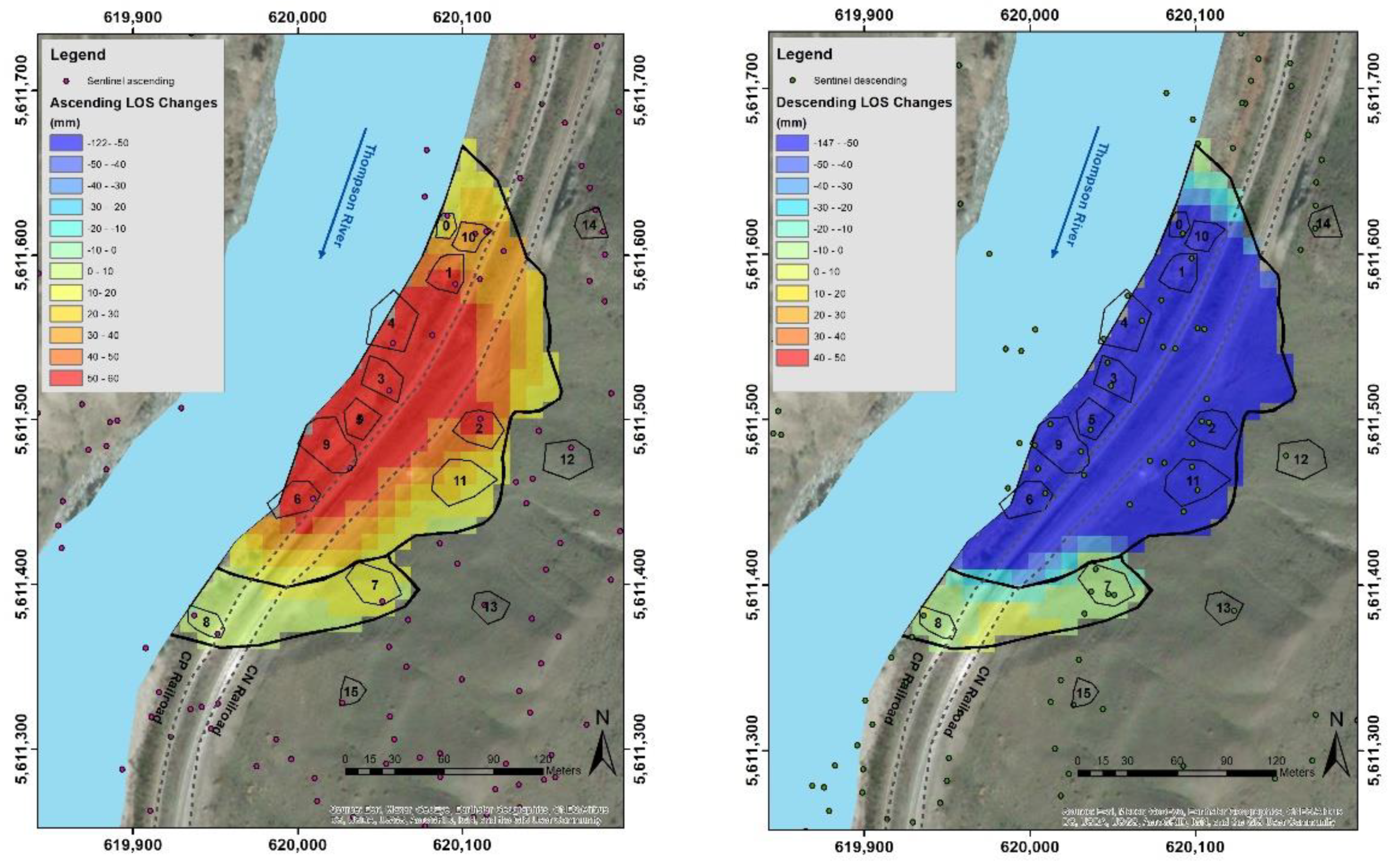
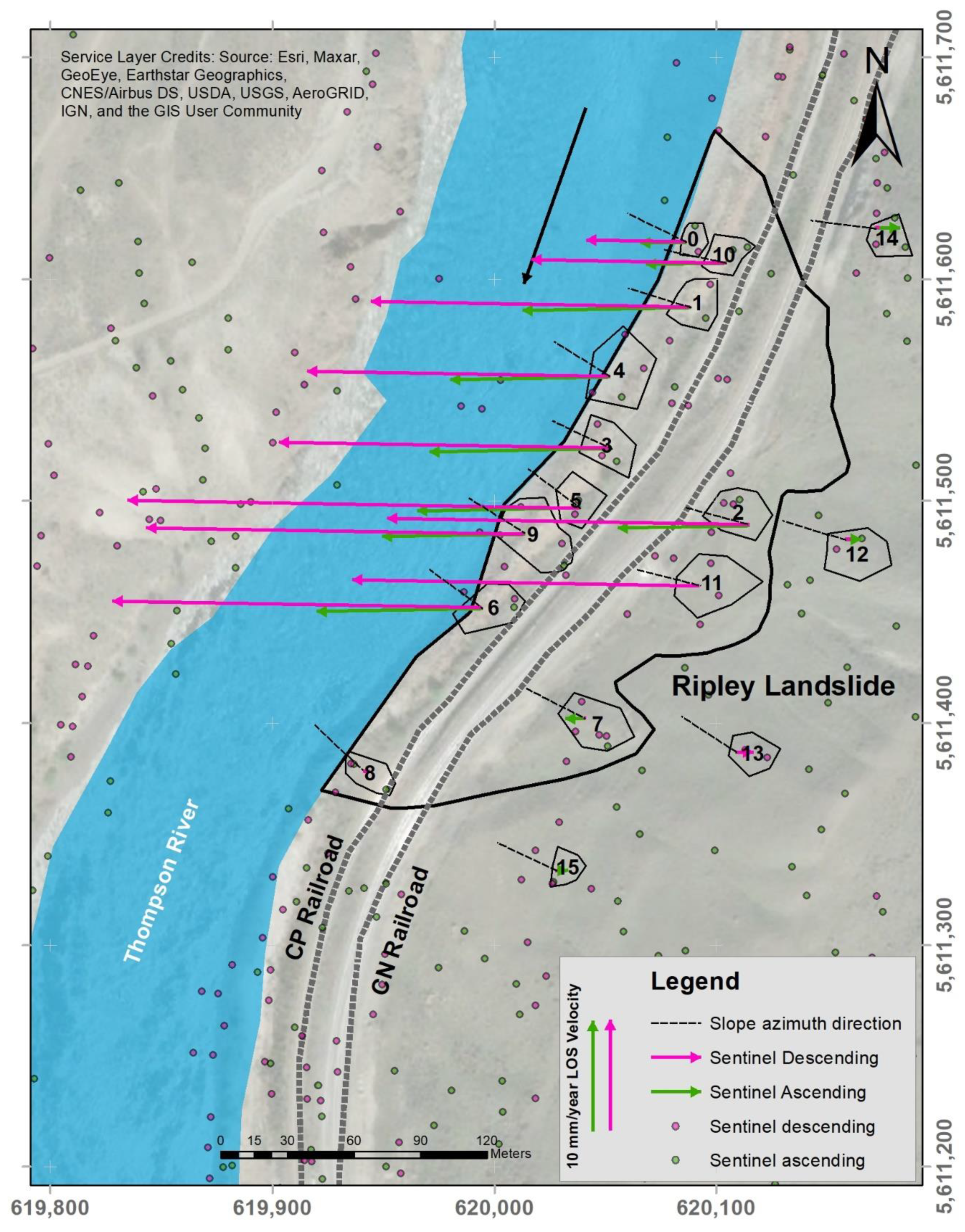
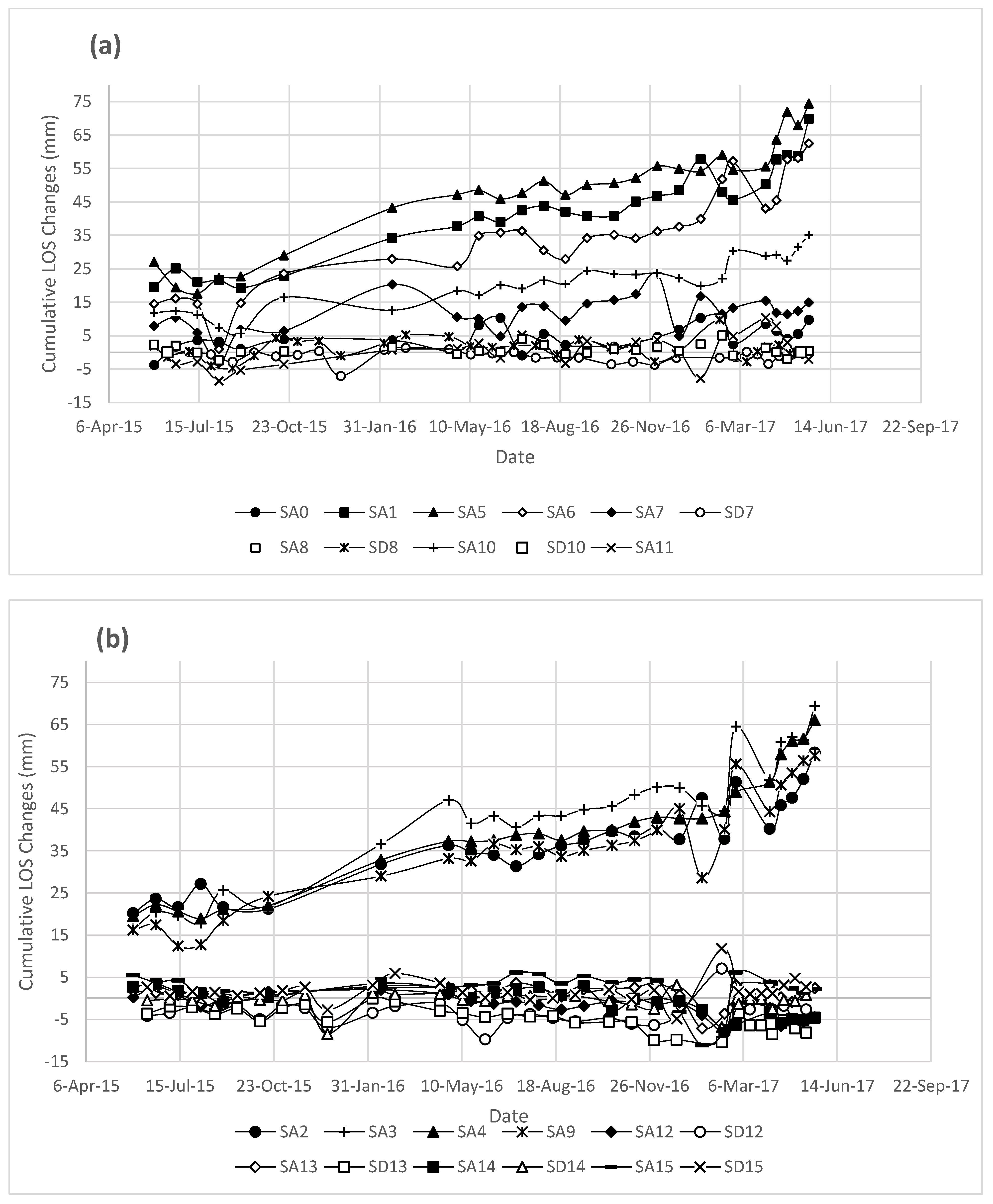
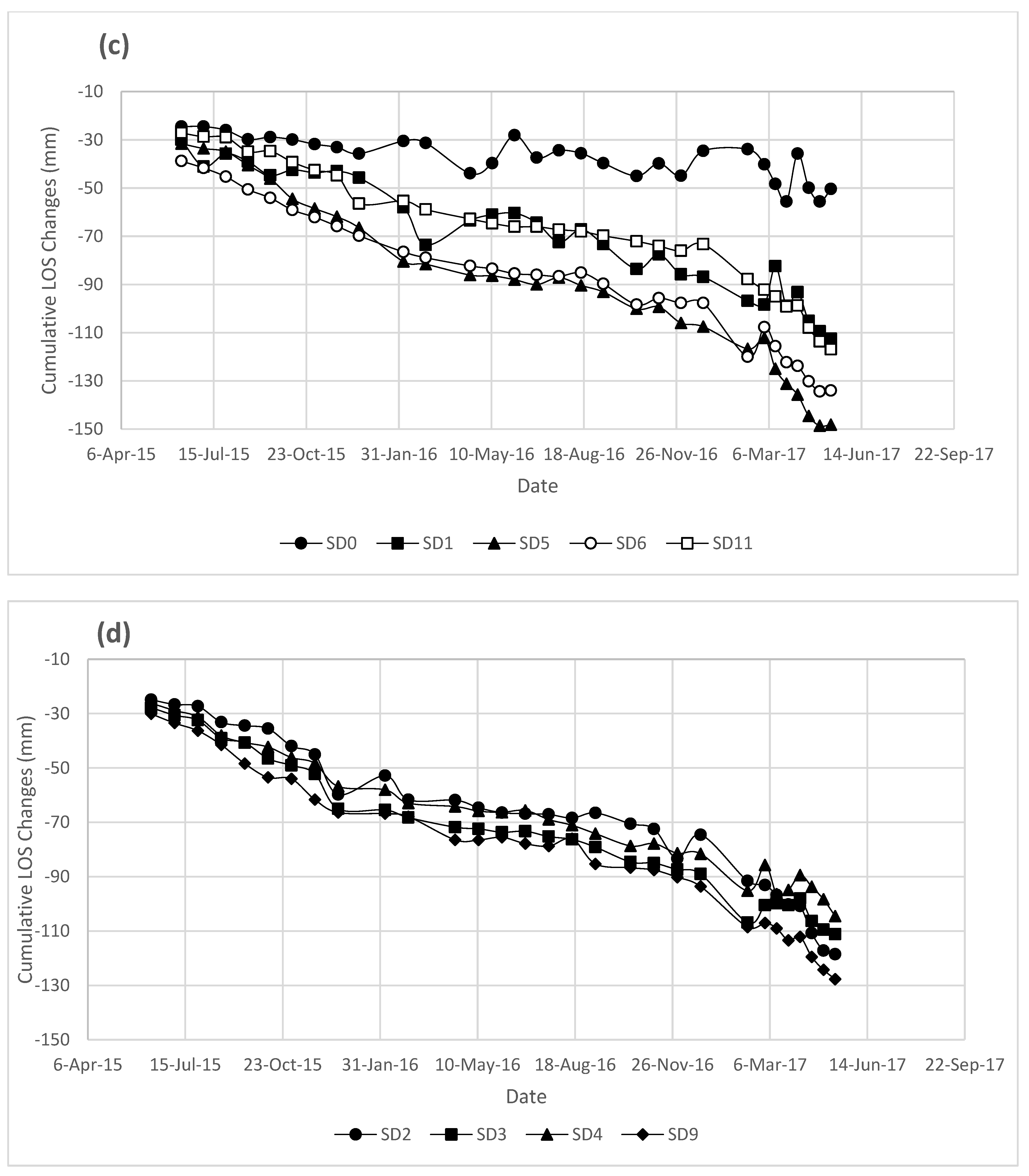
Abstract
Share and Cite
Soltanieh, A.; Macciotta, R. Updated Understanding of the Ripley Landslide Kinematics Using Satellite InSAR. Geosciences 2022, 12, 298. https://doi.org/10.3390/geosciences12080298
Soltanieh A, Macciotta R. Updated Understanding of the Ripley Landslide Kinematics Using Satellite InSAR. Geosciences. 2022; 12(8):298. https://doi.org/10.3390/geosciences12080298
Chicago/Turabian StyleSoltanieh, Amir, and Renato Macciotta. 2022. "Updated Understanding of the Ripley Landslide Kinematics Using Satellite InSAR" Geosciences 12, no. 8: 298. https://doi.org/10.3390/geosciences12080298
APA StyleSoltanieh, A., & Macciotta, R. (2022). Updated Understanding of the Ripley Landslide Kinematics Using Satellite InSAR. Geosciences, 12(8), 298. https://doi.org/10.3390/geosciences12080298