Article

DSE-NN: Discretized Spatial Encoding Neural Network for Ocean Temperature and Salinity Interpolation in the North Atlantic

College of Meteorology and Oceanology, National University of Defense Technology, Changsha 410073, China
*
Author to whom correspondence should be addressed.
J. Mar. Sci. Eng. 2024, 12(6), 1013; https://doi.org/10.3390/jmse12061013
Submission received: 27 April 2024 / Revised: 1 June 2024 / Accepted: 14 June 2024 / Published: 18 June 2024
(This article belongs to the Special Issue Recent Scientific Developments in Ocean Observation)

Abstract

:
The precise interpolation of oceanic temperature and salinity is crucial for comprehending the dynamics of marine systems and the implications of global climate change. Prior neural network-based interpolation methods face constraints related to their capacity to delineate the intricate spatio-temporal patterns that are intrinsic to ocean data. This research presents an innovative approach, known as the Discretized Spatial Encoding Neural Network (DSE-NN), comprising an encoder–decoder model designed on the basis of deep supervision, network visualization, and hyperparameter optimization. Through the discretization of input latitude and longitude data into specialized vectors, the DSE-NN adeptly captures temporal trends and augments the precision of reconstruction, concurrently addressing the complexity and fragmentation characteristic of oceanic data sets. Employing the North Atlantic as a case study, this investigation shows that the DSE-NN presents enhanced interpolation accuracy in comparison with a traditional neural network. The outcomes demonstrate its quicker convergence and lower loss function values, as well as the ability of the model to reflect the spatial and temporal distribution characteristics and physical laws of temperature and salinity. This research emphasizes the potential of the DSE-NN in providing a robust tool for three-dimensional ocean temperature and salinity reconstruction.

1. Introduction

Interpolation techniques for ocean temperature and salinity are pivotal components of marine scientific research, significantly contributing to the comprehension of ocean dynamics, global climate change, and the sustenance of marine ecosystems [1,2,3]. With advancements in observational technologies and innovations in data processing methodologies, this domain has witnessed remarkable progress—particularly with the application of neural networks, which has greatly propelled the evolution of ocean temperature and salinity interpolation techniques [4]. In early research endeavors, traditional interpolation methods such as optimal interpolation (OI), Kriging interpolation, and triangular mesh linear interpolation were extensively applied for the processing of ocean temperature and salinity data [5,6,7]. While these methods ameliorated the spatio-temporal distribution of the data, to some extent, they exhibited limitations when dealing with complex oceanic phenomena [8,9], such as the spurious information and discontinuities [10].
The complexity of marine information poses significant challenges for the interpolation of the sea temperature and salinity [11,12]. The expansive ocean system is laced with diverse and intricate patterns of temperature and salinity that vary greatly across regions and depths. Phenomena such as ocean eddies, nearshore turbulence, and underwater waves further disrupt the consistency of data, both spatially and temporally, complicating the reconstruction process [13]. Moreover, the limitations inherent in data collection methods and observational technologies restrict the acquisition of comprehensive and reliable oceanic data. Despite the temporal flow provided by continuous monitoring, there are still instances where the data are discontinuous, impacting the application of time-series analyses and the examination of long-term trends within oceanic data sets [14,15,16]. The advent of machine learning techniques has seen foundational methods such as support vector machines (SVMs), support vector regression (SVR), and random forests (RFs) being utilized for the intelligent detection of ocean temperature and salinity [17,18,19].
The introduction of neural networks has heralded new breakthroughs in ocean temperature and salinity interpolation. The application of back propagation (BP) and radial basis function (RBF) neural network models for short-term forecasting of sea surface temperature and salinity data has yielded significant results, with studies demonstrating the high accuracy of RBF neural network models in predicting sea surface temperature and salinity data [20]. Convolutional neural networks (CNNs) have also been employed in sea surface temperature remote sensing inversion applications, where high-precision prediction of sea surface temperature was achieved through the training of CNN models [21,22]. Moreover, deep neural networks (DNNs) have been applied to enhance the precision of soil moisture and ocean salinity (SMOS) satellite sea surface salinity products [23]. DNNs are structurally different from CNNs and are more commonly associated with the term “deep learning.” Through constructing deep neural network models and utilizing Argo buoy-measured salinity data as reference ground truth values, researchers have been able to obtain more accurate datasets. Recurrent neural networks (RNNs) and long short-term memory (LSTM) networks also have played crucial roles in this field, effectively capturing the long-term dependencies within time-series data [24,25]. Numerous investigations have concentrated on improving the ability of neural networks to comprehend the worldwide dynamics of oceanic systems in space and time across various magnitudes; however, the outcomes have been less than optimal. For example, efforts to stack convolutional layers atop LSTMs for spatial pattern recognition or to merge physical principles with past data on thermal and saline properties have not yielded a highly satisfactory performance [26]. It is widely believed that those who can more effectively harmonize the interplay of time and space will craft superior techniques for oceanic data interpolation.
This study proposes a new methodology, called the DSE-NN interpolation method, for reconstructing ocean temperature and salinity using deep neural networks. The input latitude and longitude data are discretized into a specialized vector, which has been proven to be effective in accurately capturing temporal patterns and improving the accuracy of the reconstruction process [27]. We demonstrate the effectiveness of our approach by utilizing the latitude and longitude range of 35° W to 65° W and the latitude range of 20° N to 50° N in the North Atlantic as a case study. Consequently, by forcibly attenuating the spatial relationships in the processing of ocean data, the focus is shifted toward enhancing temporal continuity. We convert EN4 data (see Section 2.1) into gridded temperature and salinity data to experimentally verify that our method achieves a higher temperature and salinity reconstruction accuracy than other neural network methods [28]. Our proposed method holds promising prospects for ocean temperature and salinity reconstruction applications, and it provides novel research insights into understanding oceanic environmental changes and dynamics.

2. Materials and Methods

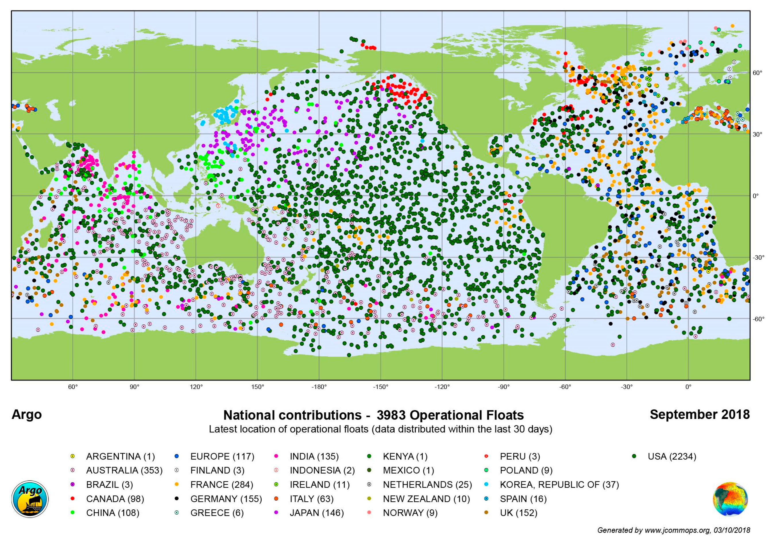
2.1. Data: In Situ Measurements (EN4.2.2)

The EN4 data set, developed by the Met Office Hadley Centre in the United Kingdom, is the latest version of a global ocean temperature and salinity profile data set [29,30]. Available from: https://hadleyserver.metoffice.gov.uk/en4/index.html (accessed on 25 March 2024). It integrates monthly objective analysis data of global ocean temperature and salinity from 1900 to the present day, along with associated uncertainty estimates. This data set merges various data sources, including the World Ocean Database (WOD), the Global Temperature and Salinity Profile Program (GTSPP), the Argo project [31,32,33], and the Arctic Synoptic Basin Wide Oceanography (ASBO) project. EN4 employs the analysis correction (AC) scheme to generate monthly potential temperature and salinity objective analyses, which are computed based on the previous month’s ocean state forecast and the current month’s quality-controlled profile data. Through providing high-quality historical and real-time ocean data, EN4 supports an in-depth understanding of global ocean changes and offers essential foundational data for climate change research [33,34,35,36] (Figure 1). We chose the North Atlantic Ocean (35°~65° W, 20°~50° N) for the interpolation test. The North Atlantic’s central role in the thermohaline circulation—a critical component of the Earth’s climate system—contributes to its primary influence on global weather patterns and the broader impacts of climate change. Furthermore, the density of Argo profiles in this region is large, which is convenient for spatial interpolation analysis.

2.2. Methods: DSE-NN Data Discretization Method

Spatio-temporal discretization techniques are crucial steps to achieve efficient and accurate data processing. This study aims to provide high-quality input data for deep learning models through performing fine-grained discretization on the longitude, latitude, depth, and time data in the EN4.2.2 data set.

2.2.1. Spatial Discretization Method

Specialized processing of longitude and latitude data is vital in the processing and interpolation of re-analysis data. Through discretizing longitude and latitude data into a series of grid points, we can capture and analyze these data within a structured spatial framework, making subsequent data processing and model training more efficient and accurate. Figure 2 demonstrates our method of spatial encoding. This mathematical technique is relatively inspired and was derived from the insights gained from Hash Encoding and Manhattan distance.
Compared to traditionally connected neural networks, the proposed longitude- and latitude-based discretization method provides significant advantages. While fully connected networks are flexible in handling unstructured data, they often overlook the inherent spatial relationships and patterns in the data, especially when dealing with geospatial data. Through discretizing the data into longitude and latitude grids beforehand, we can capture this crucial spatial information before inputting the data into the model, thus reducing the complexity that the model needs to learn and enhancing its capability for spatial understanding. The spatial code of each point is written as an N-dimensional vector. For example, when N = 10 and the longitude is 4.6, the vector is written as [1, 1, 1, 1, 0.6, −0.4, −1, −1, −1, −1]. The coding for the latitude is the same. Therefore, the latitude and longitude of each point is written as a 2 × N matrix (as shown in Figure 2).
The process of converting any two-dimensional coordinate within the grid to a series of discretized boundary values is described in Equation (1). First, given a two-dimensional coordinate point ( λ , ϕ ) , where λ and ϕ represent the longitude and latitude values, respectively, we can determine which longitude and latitude grid the point falls into using the following formula:
i = λ λ min Δ λ + 1 ,   j = ϕ ϕ min Δ ϕ + 1 ,
Here,   represents the floor operation; Δ λ and Δ ϕ are the spacing between grid points in the longitude and latitude directions; and λ min and φ min represent the minimum values of the longitude and latitude ranges, respectively. We can map any geographical coordinate point to the corresponding discrete grid position, thus converting it into a series of discretized boundary values. Furthermore, we introduce a method to map the geographical coordinates to a new vector space, in order to preserve continuity information during the discretization process. This method aims to maintain the relative positional information of the original coordinates within their respective grids. The transformation rules for the output vector corresponding to the longitude and latitude axes are given as Equations (2) and (3), respectively:
f ( λ ) = { 1 ,             if   λ < λ i 1 ,                   if   λ > λ i + Δ λ λ λ i ,   if   λ i λ λ i + Δ λ ,
f ( ϕ ) = { 1 ,               if   ϕ < ϕ j 1 ,                     if   ϕ > ϕ j + Δ ϕ ϕ ϕ j ,   if   ϕ j ϕ ϕ j + Δ ϕ .
Through this method, we can not only accurately map each original geographical coordinate point to the discrete space but can also effectively maintain its continuity characteristics by using values that vary within the range of −1 to 1.

2.2.2. Time Discretization Method

Discretization methods provide an effective way for models to capture the dynamic characteristics of time. The discretization strategy used in this study refines the time information into three dimensions: year (Y), day within the year (D), and seconds within the day (S). The transformation from continuous time information to discrete time dimensions is achieved through the following Equation (4):
Y = T s S d D y ,   D = T s S d   mod   D y , S = T s   mod   S d ,
Here, Ts represents the total number of seconds since a reference time point, Sd is the number of seconds in a day, and D y is the number of days in a year. The advantage of this method is its directness and efficiency, particularly in avoiding the need to learn the relationships between years, days, and seconds during the model training phase. These relationships between time units are known in the real world and do not need to be rediscovered through data-driven approaches.
The vertical stratification of ocean temperature and salinity has profound impacts on ocean currents, climate systems, and even global climate change. However, the precise boundaries of these stratifications are often challenging to pinpoint, posing difficulties for traditional oceanographic research when dealing with depth data [37,38,39,40]. Using the powerful learning capability of neural networks, complex patterns of temperature and salinity variations with depth can be learned directly from continuous depth data without explicit boundaries for stratification.

2.3. Method: Construction of a Deep Neural Network

This study uses the DNN as the main machine learning model to achieve four-dimensional spatio-temporal data interpolation of ocean temperature and salinity. Deep neural networks have been widely used in various complex spatio-temporal data processing tasks, due to their excellent non-linear fitting ability and adaptive feature extraction capabilities [41,42,43,44]. Particularly, in the task of the four-dimensional spatio-temporal interpolation of ocean temperature and salinity data, deep learning provides an effective approach to capture complex patterns and relationships in the data. On the other hand, the use of DNNs may also bring about some problems such as complexity (computationally intensive and requiring large amounts of data for training) and overfitting, which should be considered when building the network [45].
Feature learning is performed automatically in neural networks, where the network learns and extracts key features and patterns from the data through training. In the task of four-dimensional spatio-temporal data interpolation of ocean temperature and salinity, the ability to effectively identify and utilize spatio-temporal dependencies in the data is crucial for the success of the model. Through different levels of feature combinations, our network can progressively abstract higher-level data representations, revealing the complex mechanisms behind temperature and salinity variations.
Multiple strategies may be applied during the model training phase. The data set was divided into training, validation, and testing sets to monitor the model’s generalization ability on unseen data. We chose a ratio of 99:1 for the selection of the training set samples with respect to the test set. The early stopping strategy was utilized to terminate training when the performance on the validation set does not significantly improve over multiple training epochs, thus avoiding overfitting and ensuring training efficiency. In addition, we incorporated a weight decay term in the loss function.
The evaluation of model performance is mainly based on the prediction accuracy of the testing set. We used the weighted mean absolute error (MAE) metric to comprehensively evaluate the model’s temperature and salinity prediction accuracy, ensuring high accuracy and stability in handling the four-dimensional spatio-temporal interpolation task of ocean temperature and salinity data prediction.

2.3.1. Network Architecture

For this study, we developed a deep neural network model aimed at improving the prediction accuracy of temperature ( T ) and salinity ( S ) in four-dimensional ocean data, including longitude ( λ ) , latitude ( ϕ ) , depth ( z ) , and time ( t ) . The model structure consists of alternating fully connected layers (FCL) and Leaky Rectified Linear Unit (LeakyReLU) layers, which handle pre-processed spatio-temporal discretized data. Specifically, the input layer receives the discretized data D ( λ , ϕ , z , t ) , which includes special discretized representations for longitude and latitude, the discretized treatment of time, and integrated depth information. Defining D as the input data set, the model processes the data through fully connected layers FCL : n m and the LeakyReLU activation function f ( x ) = max ( 0.01 x , x ) to introduce non-linearity and capture complex spatio-temporal relationships. In addition, it significantly reduces the number of necessary floating-point operations and memory access times through the use of a smaller neural network combined with a special matrix table.

2.3.2. Weight Decay

During the process of training deep learning models—particularly in the case of the four-dimensional spatio-temporal interpolation task of ocean temperature and salinity with high-dimensional inputs and noise—overfitting and model complexity management become crucial. Weight decay, also known as L2 regularization, is a commonly used regularization technique applied to parameterized machine learning models. Essentially, weight decay achieves regularization through adding a regularization term to the loss function which is proportional to the L2 norm (i.e., the sum of squares) of the model’s weight vector. This helps to limit the size of the model’s weights and reduces the risk of overfitting, as a penalty term is added to the loss function during training [46].
Considering the model’s loss function L, the modified loss function L′ with weight decay can be expressed as Equation (5):
L = L + λ 2 w 2 ,
Here, L represents the original loss function; λ is the regularization coefficient, which controls the impact of the weight decay term; and | | w | | 2 represents the L2 norm of the model’s weight vector. This approach encourages the model to favor smaller weight values during the training process, helping to reduce the model’s complexity while improving its generalization ability.
In oceanographic data analysis, particularly when the input dimension is high—such as the natural extension of polynomial regression to multivariate data—the complexity of the model increases rapidly with the degree [47]. Given d variables, the number of monomials with the degree D is given by the combination number ( d + D 1 D ) . Therefore, we need a more granular tool to adjust the complexity of the function. The implementation details of the weight decay are as follows: for linear regression models, the loss is
L = 1 n i = 1 n ( y i w T x i b ) 2 ,
In Equation (6), x i represents the features, y 1 represents the labels, and w and b are the weight and bias parameters, respectively. After incorporating the weight decay term, the loss function becomes:
L = L + λ 2 n w 2 .
Here, dividing by n (the number of data points) ensures that the regularization term’s magnitude is independent of the sample size, ensuring that the impact of weight decay does not become insignificant as the data volume increases. In the model update step, the update rule for the weights takes into account the effect of weight decay, as reflected by the following equation:
w w α ( L w + λ w ) ,
Here, α is the learning rate, λ is the weight decay coefficient, and L w is the partial derivative of the loss function L with respect to the weight w . This update rule not only considers reducing the training error, but also reduces the magnitude of w to decrease the model complexity, thereby enhancing model generalization while mitigating overfitting.
Weight decay provides a continuous mechanism to adjust the complexity of the model and, through appropriately choosing the value of λ , a good balance can be found between the model complexity and improved generalization ability. In practical applications, especially when dealing with high-dimensional and noisy oceanographic data, weight decay becomes a crucial technique to ensure that deep learning models can learn effectively and provide reliable predictions.

2.3.3. Design of Loss Function and Data Testing Criteria

In the process of training deep learning models, constructing an effective loss function is a key step in optimizing model parameters to improve prediction accuracy. Particularly in scenarios involving multi-label data, the design of the loss function needs to consider the contribution of each label and how to extract a comprehensive loss value from these contributions to guide model training. Assume the model’s predicted output is y p r e d and the corresponding true labels are y t r u e . For the multi-label case, the following loss function can be designed to compute the loss for a single data point:
L y p r e d , y t r u e = 1 θ i = 1 θ L i y p r e d i , y t r u e i ,
Here, θ is the number of labels and L i is the loss calculation function for the i th label. In multi-label learning tasks, if a data point has two labels, the loss L i is the average of the losses for the two labels; if there is only one label, the loss for that label is directly used.
For the entire training set, the total loss L t o t a l is the average of the losses for all data points:
L t o t a l = 1 M j = 1 M L ( y p r e d ( j ) , y t r u e ( j ) ) ,
Here, M represents the total number of data points in the training set. Through minimizing the total loss L t o t a l , the model’s parameters can be updated using the backward propagation algorithm.
One commonly used optimization algorithm to optimize these parameters is the adaptive moment estimation (Adam) optimizer. Adam combines the benefits of the momentum and RMSProp algorithms by adjusting the learning rate of each parameter based on estimates of the first moment (mean) and second moment (uncentered variance) of the gradient [48]. Given the gradient g t at the time step t , the parameter update rule for Adam is given by the following equations:
m t = β 1 m t 1 + ( 1 β 1 ) g t v t = β 2 v t 1 + ( 1 β 2 ) g t 2 m ^ t = m t 1 β 1 t v ^ t = v t 1 β 2 t θ t + 1 = θ t η m ^ t v ^ t + ε
In the above formulas, m t and v t represent the estimates of the first and second moments of the gradient, respectively; β 1 and β 2 are decay rate parameters that control the weights of historical information; η is the learning rate; and ε is a very small number to prevent division by zero. Through adaptively adjusting the learning rate, the Adam optimizer can achieve fast and stable convergence in deep learning models.

3. Results

3.1. RMSE Curves

RMSE (root mean square error) is a commonly used statistical measure for assessing the difference between the model’s predicted values and the actual observed values. DSE-NN and DNN (without space discretization) present significant differences in salinity and temperature interpolation, with the results also varying based on different years, depths, and months of a year. Figure 3 demonstrates the loss curve results, comparing the DSE-NN and DNN curves from different aspects.
In terms of salinity between 1995 and 2020, it can be seen that the DNN curve had greater salinity error than that of DSE-NN, but they both had a stable decreasing trend of salinity loss over the years (Figure 3a). At different depths, the results show that the salinity loss of both DSE-NN and DNN decreases when the depth increases, with DNN having the greater error at the same depth than DSE-NN. At depths greater than 1000 m, DSE-NN and DNN share almost the same salinity loss (Figure 3c). The temperature loss showed a similar trend between 1995 and 2020 (Figure 3b), with the DNN temperature loss being about 0.5 degrees higher than that of DSE-NN. The temperature loss of both DSE-NN and DNN decreases dramatically with depth, with a small increase from about 250 m to 700 m. However, at depths greater than 1300 m, the two values tend to coincide.
When comparing the curves of DSE-NN and DNN in different months, it can be seen that both DSE-NN and DNN presented a stable increase in salinity loss from January to August, while the salinity loss of both DSE-NN and DNN decreases steadily from August to December. Furthermore, DNN had a higher salinity loss than DSE-NN, despite the fact that they presented a similar change over months. In conclusion, DSE-NN has comprehensive advantages compared with DNN, especially at depths greater than 1000 m.

3.2. North Atlantic Data Interpolation Demonstration

Figure 4 displays the effects of the North Atlantic data interpolation renderings at different POTM (potential temperature) and PSAL (potential salinity) values. Specifically, when the POTM decreases from 50 m to 1000 m, the impacts of interpolation renderings show more significant changes with water temperatures rapidly dropping. The temperature of the surface layer varies significantly with the latitude, with lower latitude surface waters being significantly warmer than those in higher latitudes, as the lower latitudes receive more solar radiation. However, in the deep ocean, this temperature change is less pronounced.
The salinity of surface seawater is greatly affected by evaporation and precipitation. Evaporation leads to an increase in salinity, while precipitation reduces it. The surface salinity of the North Atlantic usually ranges from 33 to 37 parts per thousand (ppt). As the depth increases, the salinity varies less as the mixing of deep seawater tends to make the salinity more uniform. However, in the waters at higher latitudes, the sea temperature is low due to the lower temperature and, at this time, a part of the dissolved salt in the sea water is precipitated and dissolved in the surrounding sea water, making the surrounding sea water less likely to freeze, thus becoming extremely cold and salty sea water with high salinity. In general, the interpolation results are consistent with the basic physical laws of the ocean and can well represent the spatial and temporal distribution characteristics of temperature and salinity.
The seasonal variations in temperature and salinity in the North Atlantic are influenced by a variety of factors, including solar radiation, wind stress, ocean circulation, and atmospheric precipitation and evaporation. In the surface waters, the water temperature of the North Atlantic is quite susceptible to seasonal changes. During the summer, due to the increased solar radiation, the surface water temperature will rise and can reach between 10 °C to 20 °C (or higher). In contrast, during the winter, the surface water temperature will decrease, especially in higher latitude areas, where the water temperature may drop close to freezing.
Figure 5 shows that the temperature at 100 m is relatively stable across the seasons; however, we can still discern some details of the temperature fluctuations from our interpolation results. Such results are quite rare in the display of oceanic interpolation, reflecting the details of small- and medium-scale processes captured by our results at a very high resolution. Although the seasonal differences in temperature and salinity in the deep subsurface water are not as obvious as those in the surface water, the interpolation results still reflect certain changes. For example, in the summer and autumn seasons of the northern hemisphere (Figure 5e,g), the temperature of the sea area at middle and low latitudes is significantly higher than that in winter and spring (Figure 5a,c), which is also in line with the objective law of physical oceanography.

3.3. Comparison of DSE-NN and DNN Results

Figure 6 compares the distribution of the DSE-NN and DNN training scatter. In statistical error graphs, KDE refers to kernel density estimate, which is a non-parametric statistical method used to estimate the probability density function of a random variable. The KDE operates by placing a smooth kernel function around each data point, then summing all the kernel functions of the data points and normalizing them to generate an estimated graph of the probability density. The KDE can provide richer information than traditional histograms or bar charts, especially when dealing with a large volume of data or complex data distributions. Through KDE plots, one can intuitively observe the distribution patterns of the data, potential multimodal structures, skewness, and possible outliers or anomalies. In terms of the DSE-NN and DNN distributions, it can be seen that there is a narrow curve for salinity and temperature loss, and the peak of DSE-NN is more concentrated in the smaller value interval, which indicates that the errors of DSE-NN are more focused and stable than those of DNN (Figure 6e,f). Similarly, in the spatial loss scatter plots, the loss of the DSE-NN method is significantly smaller than that of the DNN, especially in the middle and low latitudes.

4. Results with Weight Decay

Weight decay has different impacts on the salinity and temperature, in terms of different years, months, and depth. Figure 7 displays the results of weight decay in different situations. It is worth mentioning that the temperature and salinity are higher when there is no weight decay than when a weight decay of 1 × 10⁻⁸ was used.
Between 1995 and 2020, the losses with no weight decay were a little higher than that with the weight decay of 1 × 10⁻⁸; however, as the weight decay increased, the increase in losses became greater. Over time, all salinity and temperature losses under different decays decreased steadily, with some small fluctuations (Figure 7a,b). Generally, the losses under all weight decay values show a slight decrease from 1995 to 2015, while the temperature loss increased from 2015 to 2020.
According to the relationship between the depth and temperature under different weight decay levels, the weight decay-based temperature loss dramatically decreases when the depth increases. When the depth is between 0 and 1000, the higher the weight decay is, the higher is the temperature loss. However, when the depth is greater than 1000 m, it can be seen that the temperature loss under different weight decay values shares a similar decreasing trend (Figure 7c,d).
In different months of the year, the salinity and temperature losses with no weight decay are higher than that with a weight decay of 1 × 10⁻⁸, and nearly the same as the weight decay of 1 × 10⁻⁷. However, the weight decay of 1 × 10⁻⁶ lead to the highest losses over different months. Generally, from January to August, the losses increase, while they decrease between August and December (Figure 7e,f).
As a result, in terms of salinity loss, the weight decay of 1 × 10⁻⁸ had the highest KDE, followed by no weight decay, weight decay of 1 × 10⁻⁷, and weight decay of 1 × 10⁻⁶. Between 0.0 and 0.1 salinity loss, there is a narrow curve, meaning that the effect is better. A similar trend can be seen when the temperature loss is between 0.0 and 0.25 (Figure 7g,h).

5. Conclusions

This study introduces a revolutionary method in the realm of oceanographic data analysis: the Discretized Spatial Encoding Neural Network (DSE-NN). This cutting-edge methodology was specifically engineered for the interpolation of ocean temperature and salinity. By employing a pioneering discretization strategy for input latitude and longitude data, DSE-NN effectively harnesses the formidable computational capabilities of deep neural networks. This innovative approach markedly strengthens the temporal coherence and enhances the overall accuracy of the interpolation process, thereby presenting a heightened level of detail in the depiction of oceanographic phenomena.
Our extensive case study, conducted within the expansive region of the North Atlantic (35°~65° W, 20°~50° N), serves as a compelling testament to the efficacy of DSE-NN. The superiority of the proposed DSE-NN over a conventional neural network approach was demonstrated, particularly in terms of the precision of its temperature and salinity interpolations. It skillfully captures spatial-temporal characteristics and adeptly manages the inherent complexity and discontinuities found within oceanic data, thereby solidifying its status as an essential instrument in marine science research.
The discretization technique used in the model not only provides a structured framework for geospatial data analysis but also serves as a critical tool for handling the extensive and intricate datasets that are a hallmark of ocean science. By discretizing the spatial dimensions, DSE-NN adeptly learns and replicates the spatial relationships within the data, subsequently elevating the reliability and precision of the obtained interpolations.
This study also highlights the nuanced equilibrium and synergy between the temporal and spatial continuity within neural network models. Through the mathematical operation of increasing dimensions via spatial discretization, we significantly enhanced the interpolation efficiency and accuracy without altering the computational load. In the face of escalating challenges posed by a growing urgency for precise oceanographic data, DSE-NN, with its encoder–decoder architecture and augmentation through deep supervision and hyperparameter optimization, offers a new idea for data interpolation or downscaling analysis. It is also helpful for the evolution of advanced ocean models, as well as improving our capacity to monitor, predict, and adapt to the impacts of climate change on oceanic ecosystems.
Compared to the methods used in previous studies [21,22,23,24,25,26], DSE-NN has demonstrated greater flexibility and robustness when dealing with large-scale complex ocean datasets. However, this research is still in its infancy, with the area limited to the North Atlantic Ocean, and its performance on a global scale has yet to be tested. In addition, whether the discretization method is effective for other complex neural networks is also worth further study.

Author Contributions

Conceptualization, W.Z. and S.L.; methodology, S.L.; software, W.J. and S.L.; validation, S.L., W.J. and W.Z.; formal analysis, W.J.; data curation, S.L.; writing—review and editing, W.J.; visualization, S.L.; supervision, W.Z.; project administration, W.J.; funding acquisition, W.Z. All authors have read and agreed to the published version of the manuscript.

Funding

This study was supported by the National Natural Science Foundation of China (No. 41830964).

Institutional Review Board Statement

Not applicable.

Informed Consent Statement

Not applicable.

Data Availability Statement

Publicly available datasets were analyzed in this study. The EN4.2.2 data can be found here https://hadleyserver.metoffice.gov.uk/en4/index.html (accessed on 25 March 2024).

Acknowledgments

The authors acknowledge the technical support from the National University of Defense Technology. We are grateful to anonymous referees and the editor who provided valuable comments improving the manuscript.

Conflicts of Interest

The authors declare no conflict of interest.

References

  1. Vargas-Yanez, M.; Mallard, E.; Michel, R. The effect of interpolation methods in temperature and salinity trends in the Western Mediterranean. Mediterr. Mar. Sci. 2012, 12, 117–125. [Google Scholar] [CrossRef]
  2. Ran, J.; Chao, N.; Yue, L.; Chen, G.; Wang, Z.; Wu, T.; Li, C. Quantifying the contribution of temperature, salinity, and climate change to sea level rise in the Pacific Ocean: 2005–2019. Front. Mar. Sci. 2023, 10, 1200883. [Google Scholar] [CrossRef]
  3. Stammer, D.; Bracco, A.; AchutaRao, K.; Beal, L.; Bindoff, N.L.; Braconnot, P.; Cai, W.; Chen, D.; Collins, M.; Danabasoglu, G.; et al. Ocean climate observing requirements in support of climate research and climate information. Front. Mar. Sci. 2019, 6, 444. [Google Scholar] [CrossRef]
  4. Smith, P.A.H.; Sorensen, K.A.; Nardelli, B.B.; Chauhan, A.; Christensen, A.; John, M.S.; Rodrigues, F.; Mariani, P. Reconstruction of subsurface ocean state variables using convolutional neural networks with combined satellite and in situ data. Front. Mar. Sci. 2023, 10, 1218514. [Google Scholar] [CrossRef]
  5. Cui, Y.; Li, Q.; Li, Q.; Zhu, J.; Wang, C.; Ding, K.; Wang, D.; Yang, B. A triangular prism spatial interpolation method for mapping geological property fields. ISPRS Int. J. Geo-Inf. 2017, 6, 241. [Google Scholar] [CrossRef]
  6. Zhang, C.; Wang, D.; Liu, Z.; Lu, S.; Sun, C.; Wei, Y.; Zhang, M. Global gridded argo dataset based on gradient-dependent optimal interpolation. J. Mar. Sci. Eng. 2022, 10, 650. [Google Scholar] [CrossRef]
  7. Dobesch, E.; Dumolard, P.; Dyras, I. Spatial Interpolation for Climate Data: The Use of GIS in Climatology and Meteorology; John Wiley & Sons: Hoboken, NJ, USA, 2013. [Google Scholar]
  8. Li, L.; Revesz, P. A Comparison of Two Spatio-Temporal Interpolation Methods. In Proceedings of the International Conference on Geographic Information Science, Boulder, CO, USA, 25–28 September 2002; Springer: Berlin/Heidelberg, Germany, 2002. [Google Scholar]
  9. Lv, C.; Yu, F. The application of a complex composite fractal interpolation algorithm in the seabed terrain simulation. Math. Probl. Eng. 2018, 2018, 8641471. [Google Scholar] [CrossRef]
  10. Troccoli, A.; Balmaseda, M.A.; Segschneider, J.; Vialard, J.; Anderson, D.L.T.; Haines, K.; Stockdale, T.; Vitart, F.; Fox, A. Salinity adjustments in the presence of temperature data assimilation. Mon. Weather Rev. 2002, 130, 89–102. [Google Scholar] [CrossRef]
  11. Xie, C.; Li, M.; Wang, H.; Dong, J. A survey on visual analysis of ocean data. Vis. Inform. 2019, 3, 113–128. [Google Scholar] [CrossRef]
  12. Kurylyk, B.L.; Smith, K.A. Stuck in the middle: Thermal regimes of coastal lagoons and estuaries in a warming world. Environ. Res. Lett. 2023, 18, 061003. [Google Scholar] [CrossRef]
  13. Van der Zanden, J.; Cáceres, I.; Larsen, B.E.; Fromant, G.; Petrotta, C.; Scandura, P.; Li, M. Spatial and temporal distributions of turbulence under bichromatic breaking waves. Coast. Eng. 2019, 146, 65–80. [Google Scholar] [CrossRef]
  14. Johnson, G.C.; Fassbender, A.J. After two decades, Argo at PMEL, looks to the future. Oceanography 2023, 36, 54–59. [Google Scholar] [CrossRef]
  15. Bovenga, F.; Pasquariello, G.; Refice, A. Statistically-based trend analysis of MTInSAR displacement time series. Remote Sens. 2021, 13, 2302. [Google Scholar] [CrossRef]
  16. Benway, H.M.; Lorenzoni, L.; White, A.; Fiedler, B.; Levin, N.M.; Nicholson, D.P.; DeGrandpre, M.D.; Sosik, H.M.; Church, M.J.; O’Brien, T.D.; et al. Ocean time series observations of changing marine ecosystems: An era of integration, synthesis, and societal applications. Front. Mar. Sci. 2019, 6, 393. [Google Scholar] [CrossRef]
  17. Sunder, S.; Ramsankaram, R.; Ramakrishnan, B. Machine learning techniques for regional scale estimation of high-resolution cloud-free daily sea surface temperatures from MODIS data. ISPRS J. Photogramm. Remote Sens. 2020, 166, 228–240. [Google Scholar] [CrossRef]
  18. Xu, J.; Xu, Z.; Kuang, J.; Lin, C.; Xiao, L.; Huang, X.; Zhang, Y. An alternative to laboratory testing: Random forest-based water quality prediction framework for inland and nearshore water bodies. Water 2021, 13, 3262. [Google Scholar] [CrossRef]
  19. Wu, W.; Zucca, C.; Muhaimeed, A.S.; Al-Shafie, W.M.; Al-Quraishi, A.M.F.; Nangia, V.; Zhu, M.; Liu, G. Soil salinity prediction and mapping by machine learning regression in Central Mesopotamia, Iraq. Land Degrad. Dev. 2018, 29, 4005–4014. [Google Scholar] [CrossRef]
  20. Haghbin, M.; Sharafati, A.; Motta, D.; Al-Ansari, D.; Noghani, M.H.M. Applications of soft computing models for predicting sea surface temperature: A comprehensive review and assessment. Prog. Earth Planet. Sci. 2021, 8, 4. [Google Scholar] [CrossRef]
  21. Tan, J.; NourEldeen, N.; Mao, K.; Shi, J.; Li, Z.; Xu, T.; Yuan, Z. Deep learning convolutional neural network for the retrieval of land surface temperature from AMSR2 data in China. Sensors 2019, 19, 2987. [Google Scholar] [CrossRef]
  22. Han, M.; Feng, Y.; Zhao, X.; Sun, C.; Hong, F.; Liu, C. A convolutional neural network using surface data to predict subsurface temperatures in the Pacific Ocean. IEEE Access 2019, 7, 172816–172829. [Google Scholar] [CrossRef]
  23. Zhang, L.; Zhang, Y.; Yin, X. Aquarius sea surface salinity retrieval in coastal regions based on deep neural networks. Remote Sens. Environ. 2023, 284, 113357. [Google Scholar] [CrossRef]
  24. Tran, T.T.; Nguyen, L.D.; Ngoc, H.P.; Pham, Q.B.; Thanh, H.P.T.; Dong, N.N.P.; Hieu, H.H.; Hien, N.T. Long Short-Term Memory (LSTM) neural networks for short-term water level prediction in Mekong river estuaries. Songklanakarin J. Sci. Technol. 2022, 44, 1057–1066. [Google Scholar] [CrossRef]
  25. Pyo, J.; Pachepsky, Y.; Kim, S.; Abbas, A.; Kim, M.; Kwon, Y.S.; Ligaray, M.; Cho, K.H. Long short-term memory models of water quality in inland water environments. Water Res. X 2023, 21, 100207. [Google Scholar] [CrossRef] [PubMed]
  26. Mohammed, A.; Corzo, G. Spatiotemporal convolutional long short-term memory for regional streamflow predictions. J. Environ. Manag. 2024, 350, 119585. [Google Scholar] [CrossRef] [PubMed]
  27. Wang, Z.; Zhang, S.; Yu, J.J. Reconstruction of Missing Trajectory Data: A Deep Learning Approach. In Proceedings of the Conference: 2020 IEEE 23rd International Conference on Intelligent Transportation Systems (ITSC), Rhodes, Greece, 20–23 September 2020. [Google Scholar] [CrossRef]
  28. Langehaug, H.R.; Sagen, H.; Stallemo, A.; Uotila, P.; Rautianinen, L.; Olsen, S.M.; Devilliers, M.; Yang, S.; Storheim, E. Constraining CMIP6 estimates of Arctic Ocean temperature and salinity in 2025–2055. Front. Mar. Sci. 2023, 10, 1211562. [Google Scholar] [CrossRef]
  29. Killick, R.; National Center for Atmospheric Research Staff. (Eds.) The Climate Data Guide: EN4 Subsurface Temperature and Salinity for the Global Oceans. Available online: https://climatedataguide.ucar.edu/climate-data/en4-subsurface-temperature-and-salinity-global-oceans (accessed on 25 March 2024).
  30. Met Office Hadley Centre Observations Datasets. En4 Quality Controlled Ocean Data: Select Version to Download. Available online: https://www.metoffice.gov.uk/hadobs/en4/download.html (accessed on 25 March 2024).
  31. NASA. Argo. Available online: https://sealevel.nasa.gov/missions/argo (accessed on 25 March 2024).
  32. USCD. What Is Argo? Available online: https://argo.ucsd.edu/ (accessed on 25 March 2024).
  33. NOAA’s Atlantic Oceanographic and Meteorological Laboratory. Argo. Available online: https://www.aoml.noaa.gov/argo/ (accessed on 25 March 2024).
  34. Hosoda, S.; Ohira, T.; Nakamura, T. A monthly mean dataset of global oceanic temperature and salinity derived from Argo float observations. JAMSTEC Rep. Res. Dev. 2008, 8, 47–59. [Google Scholar] [CrossRef]
  35. Wong, A.P.; Gilson, J.; Cabanes, C. Argo salinity: Bias and uncertainty evaluation. Earth Syst. Sci. Data 2023, 15, 383–393. [Google Scholar] [CrossRef]
  36. Wong, A.P.; Wijffels, S.E.; Riser, S.C.; Pouliquen, S.; Hosoda, S.; Roemmich, D.; Gilson, J.; Johnson, G.C.; Martini, K.; Murphy, D.J.; et al. Argo data 1999–2019: Two million temperature-salinity profiles and subsurface velocity observations from a global array of profiling floats. Front. Mar. Sci. 2020, 7, 700. [Google Scholar] [CrossRef]
  37. Sze, V.; Chen, Y.-H.; Yang, T.-J.; Emer, J.S. Efficient processing of deep neural networks: A tutorial and survey. Proc. IEEE 2017, 105, 2295–2329. [Google Scholar] [CrossRef]
  38. Liu, W.; Wang, Z.; Liu, X.; Zeng, N.; Liu, Y.; Alsaadi, F.E. A survey of deep neural network architectures and their applications. Neurocomputing 2017, 234, 11–26. [Google Scholar] [CrossRef]
  39. Wang, S.; Cao, J.; Yu, P.S. Deep learning for spatio-temporal data mining: A survey. IEEE Trans. Knowl. Data Eng. 2022, 34, 3681–3700. [Google Scholar] [CrossRef]
  40. Wikle, C.K. Comparison of deep neural networks and deep hierarchical models for spatio-temporal data. J. Agric. Biol. Environ. Stat. 2019, 24, 175–203. [Google Scholar] [CrossRef]
  41. Olmedo, E.; Turiel, A.; González-Gambau, V.; González-Haro, C.; García-Espriu, A.; Gabarró, C.; Portabella, M.; Corbella, I.; Martín-Neira, M.; Arias, M.; et al. Increasing stratification as observed by satellite sea surface salinity measurements. Sci. Rep. 2022, 12, 6279. [Google Scholar] [CrossRef] [PubMed]
  42. Legg, S.; McWilliams, J.C. Temperature and salinity variability in heterogeneous oceanic convection. J. Phys. Oceanogr. 2000, 30, 1188–1206. [Google Scholar] [CrossRef]
  43. Kara, A.B.; Rochford, P.A.; Hurlburt, H.E. Mixed layer depth variability over the global ocean. J. Geophys. Res. Ocean. 2003, 108, C3. [Google Scholar] [CrossRef]
  44. Boyer Montégut, C.; Madec, G.; Fischer, A.S.; Lazar, A.; Iudicone, D. Mixed layer depth over the global ocean: An examination of profile data and a profile-based climatology. J. Geophys. Res. Ocean. 2004, 109, C12. [Google Scholar] [CrossRef]
  45. Kuhlbrodt, T.; Swaminathan, R.; Ceppi, P.; Wilder, T. A glimpse into the future: The 2023 ocean temperature and sea-ice extremes in the context of longer-term climate change. Bull. Am. Meteorol. Soc. 2024, 105, E474–E485. [Google Scholar] [CrossRef]
  46. Nakamura, K.; Hong, B.W. Adaptive weight decay for deep neural networks. IEEE Access 2019, 7, 118857–118865. [Google Scholar] [CrossRef]
  47. Reddy, T.; RM, S.P.; Parimala, M.; Chowdhary, C.L.; Hakak, S.; Khan, W.Z. A deep neural networks based model for uninterrupted marine environment monitoring. Comput. Commun. 2020, 157, 64–75. [Google Scholar] [CrossRef]
  48. Kingma, D.P.; Ba, J. Adam: A method for stochastic optimization. arXiv 2014, arXiv:1412.6980. [Google Scholar]
Figure 1. Global map of operational Core Argo floats, by nation, in September 2018 (Source: JCOMMOPS).
Jmse 12 01013 g001
Figure 2. Schematic diagram of matrix construction for unified grid discretization method.
Jmse 12 01013 g002
Figure 3. Comparative analysis of DSE-NN and DNN loss curves for salinity and temperature interpolation across various timeframes and depths. (a,b) loss curves in different years, (c,d) and (e,f) are respectively for different depth and months.
Jmse 12 01013 g003
Figure 4. Visualization of North Atlantic Data Interpolation results at different depths (35°~65° W, 20°~50° N, 1 October 2020). From top row to bottom are the interpolation results of 50 m (a,b), 100 m (c,d), 200 m (e,f), 500 m (g,h) and 1000 m (i,j) respectively.
Jmse 12 01013 g004
Figure 5. Visualization of North Atlantic Data Interpolation results for different seasons (35°~65° W, 20°~50° N, 100 m depth). From top row to bottom are the interpolation results of 1 January (a,b), 1 April (c,d), 1 July (e,f) and 1 October 2020 (g,h) respectively.
Jmse 12 01013 g005
Figure 6. Comparison of the annual mean error distribution of DSE-NN and DNN models. (ad) loss scatter; (e,f) KDE curve.
Jmse 12 01013 g006
Figure 7. The impact of weight decay on the annual mean temperature and salinity. (af) RMSE comparison; (g,h) KDE curves.
Jmse 12 01013 g007
Disclaimer/Publisher’s Note: The statements, opinions and data contained in all publications are solely those of the individual author(s) and contributor(s) and not of MDPI and/or the editor(s). MDPI and/or the editor(s) disclaim responsibility for any injury to people or property resulting from any ideas, methods, instructions or products referred to in the content.

