1. Introduction
Dykelands are agricultural lands protected from coastal inundation via dyke infrastructure and constitute some of the most agriculturally productive lands in NS, Canada. Agricultural dykelands are used mainly to produce hay and pasture, corn, and cereal crops [
1]; however, many other crops have historically been found to be agriculturally viable on the dykelands, such as root crops, soybeans, chives, sunflowers, salad greens, and cabbage [
2]. Other sources also reported that on well-drained dykelands, beans, beets, swedes, carrots, spinach, and celery had been successfully grown on these soils [
3]. It is estimated that 17,401 hectares of tidal land are being protected by the Nova Scotia Department of Agriculture (NSDA), which represents approximately 10% of Nova Scotia’s active agricultural land [
4,
5].
In 1954, Baird [
3] estimated the total area of dykelands in the Maritime Provinces ranged between 28,300 to 32,300 hectares and suggested that another 6000 to 8000 hectares could be reclaimed by the construction of mud dykes. He also noted that out of this number, approximately 4000 to 6000 hectares had a different soil texture from the average dykelands soils and could be made very productive when properly drained and cultivated [
3].
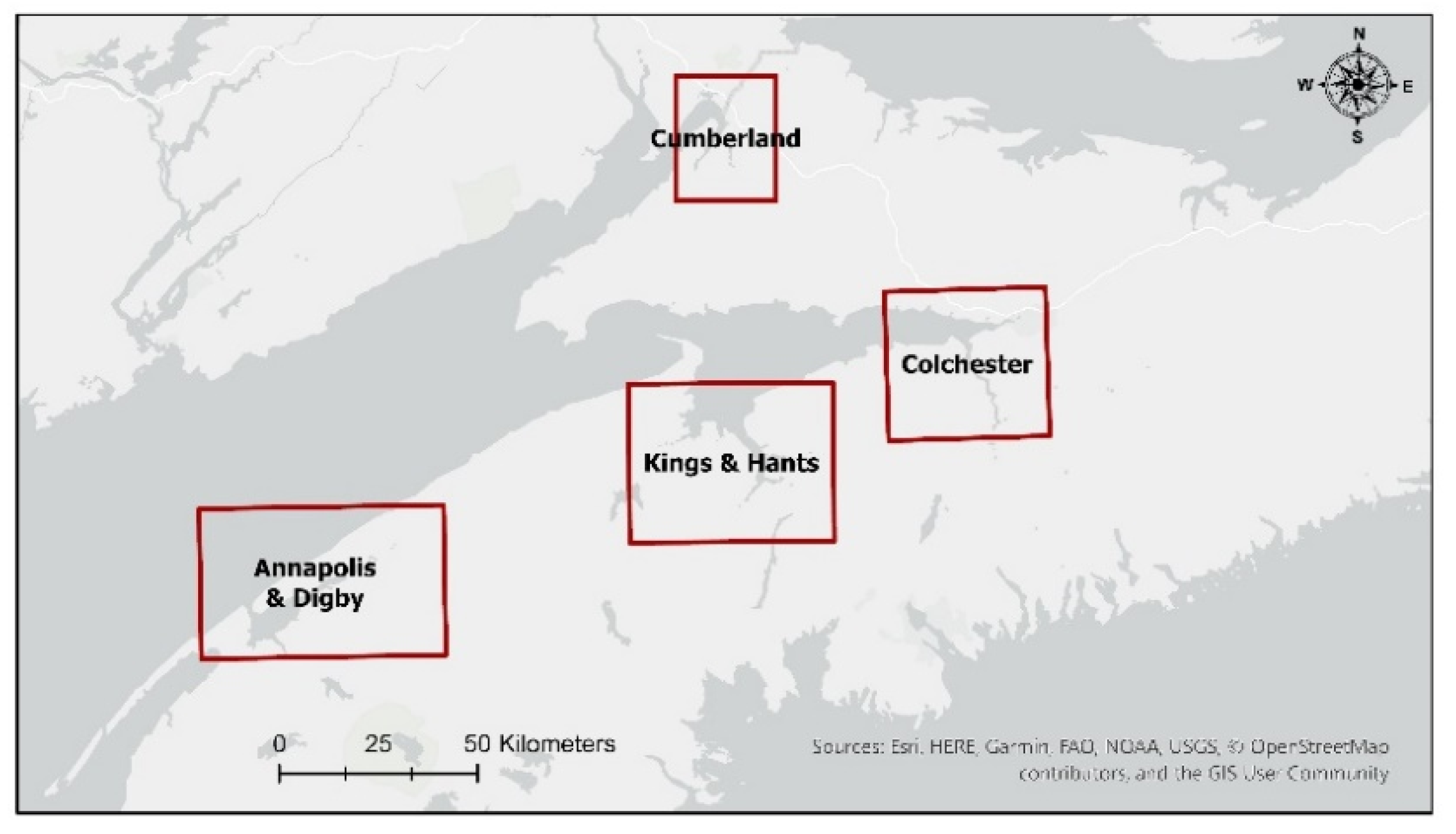
In 1939, the Maritime Beef Cattle Committee funded a study on the dykelands to understand the challenges that the dykeland owners of the Chignecto Isthmus area (45.8482° N, 64.2881° W) were facing. As a results from this study, twelve elements were highlighted to be of vital interest to dykelands owners at the time. These recommendations can be summarized into two important themes: the importance of maintaining and improving dyke infrastructure and associated drainage systems; and improving hay production on grazing lands [
3]. These recommendations shaped long-term land management practices and are still prevalent to this day through the adoption of recent federal and provincial government policies [
6]. Today, dykelands still play an important role in Nova Scotia since they hold a diversity of public and private assets and infrastructures, such as roads, malls, suburbs, and sewage treatment plants [
7].
A report on agricultural dykelands published in 2013 suggested that the importance of dykelands in the province is attributable to the large production of forage on this land, estimated at 24.8% of the province’s overall forage production [
2,
8]. Other reports estimated that roughly 15% of marshlands (2610 hectares) are not being farmed in Nova Scotia and are used for non-agricultural practices and development [
9]. To date, these estimates remain vague and do not provide a clear characterization of the state of agricultural situation on the dykelands.
This is especially pertinent in the context of current and future climate change [
10,
11,
12]. This situation was outlined in a study by van Proosdij and Page [
13], which predicted a relative sea-level rise in Nova Scotia, ranging from 70 to 140 cm over the next century and will therefore increase the vulnerability of the dyke system to storm surges [
13]. Within the next 50 years, approximately 70% of the 241 km of dykes in the province could be at high risk of coastal erosion and overtopping [
14].
Today, dykeland stakeholders are seeking to understand in which scenario underutilized dykelands should be maintained, converted to agricultural use, or restored into salt marshes. Knowing when and how to manage these scenarios is especially pertinent, considering that most of these dyke infrastructures will have to be maintained in the coming years due to rising sea levels. Unfortunately, very little information on what is being grown and how many hectares of crops are being grown are currently available for dykelands [
10,
11,
12]. Given the predictions of rising sea levels, challenges regarding a proper assessment of the resources of the dykelands must be addressed. To develop suitable land-use policies, there must be an accurate quantitative assessment of the land utilization of dykelands.
To address the challenges associated with quantifying land use in dykelands, remote sensing techniques may be leveraged. The rich literature related to land-cover mapping can be mainly categorised into satellite-based techniques and survey-based methodology. Satellite-based techniques of land-cover mapping involves the interpretation of remotely sensed data generally derived from satellite images [
15]. Early efforts of land cover mapping used either a coarse resolution sensor and focused on the characterization land cover for a single point in time (e.g., Loveland et al. [
16]), or used moderate resolution imagery for single class mapping [
17,
18].
4. Discussion
The in-depth analysis of the Annual Crop Inventory revealed that roughly one-third of the approximately 11,735 hectares of forage inventoried on the dykelands were classified in the NSPRD as non-agricultural fields. This represents approximately 3844 hectares of forage fields that were not utilized for agricultural production. Although this represents a large area, two factors can explain the main causes of this discrepancy.
First, the zonal statistics tool used to calculate the dominant class within each polygon tended to categorize residential and commercial property fields as forages. Large areas of lawn grass in rural areas often resulted in these areas being categorized as forage fields. However, this issue was corrected by filtering out these fields using property records from the NSPRD and satellite images. Additionally, the overall accuracy of the Annual Crop Inventory model used to generate the inventory for non-agricultural land cover was approximately 70%, yearly [
29]. The presence of large lawn areas and a reduced accuracy for non-agricultural cover could mean that this analysis underestimated the number of hectares of fields used for residential and commercial applications, thus overestimating the total forage hectares.
The second factor that may explain the discrepancies between the number of hectares of forages from the Annual Crop Inventory and the calculated values could be that some forage fields were isolated, inaccessible to farmers, or owned by provincial and federal agencies who are not farming these fields. For example, the Minudie dyke system (45.8086°N, 64.3229°W) represented 1422 hectares of forage dykeland that was not utilized for farming [
34]. This large land area was removed from the analysis since it was not currently used for agricultural production.
4.1. Fields Crops and Forages on the Dykelands
Historically, there was no significant difference in which crops could be successfully produced on the uplands versus the dykelands [
35]. The problem with high value cash crops was not so much that dykelands could not support the crops but resides in the inherent difficulty associated with drainage [
36]. Dykelands soils have low permeability and poor surface drainage, thus requiring land forming to maximize their potential [
37]. Over time, however, plowing causes soil redistribution and thereby modifies the topography; hence, dykeland fields must be reformed—a process known as “recrowning”.
In Nova Scotia, field drainage is often the limiting factor on the types of crops that may be successfully grown (
Figure 4) [
33]. Gartley et al. noted that it is generally difficult to grow valuable cash crop on recently drained land [
33]. It is advised to grow grain or hay crop for several years following an initial re-crowning to help improve the soil structure. This management practice will in turn, improve soil drainage and aeration over time, as the crop rooting zone extends deeper into the soil profile [
33].
High value cash crops often require more intensive machinery use, which may increase the risk of soil compaction [
33]. Intensive farming of row crops may then lead to the degradation of soil structure, which will negatively impact the mobility of water and reduce the effectiveness of the drainage [
38]. This creates a cycle that is difficult to recover from without a complete recrowning of the field. On poorly drained dykelands, farmers are often cautious to seed field crops since they are concerned that they will not be able to harvest their fields in the fall [
34]. This could explain the prevalence of forage and pasture on the dykelands, relative to other crops. Forages makes up the largest commodity grown, representing around 80% of the total agricultural dykelands. This production is even more essential considering that dykelands are usually more productive than the uplands [
39].
Langille and Warren demonstrated in their study that over a 3-year period, forage yields on dykelands were 20% greater as compared to upland crops. Furthermore, they noticed that seasonal distribution of forage was better on the dykelands than the uplands, which allows them to excel in the production of timothy (
Phleum pratense), orchard grass (
Dactylis glomerata L.), red clover (
Trifolium pratense L.), alfalfa (
Medicago sativa L.) or Ladino clover forages (
Trifolium repens L.) [
39].
Information from the federal census of agriculture also revealed that forage production in Nova Scotia represented 60% of the total agricultural land in the province [
27,
40]. It is important to note that 80% of the agricultural dykeland fields in the province are used to grow forage, which far surpasses forage production on provincial upland fields.
4.2. Limitations
The strength of this methodology depends mainly on the quality of both the AAFC’s Annual Crop Inventory and the NSPRD. The NS property boundaries can either over- or underestimate the hectares of land cultivated. A more in-depth segmentation of the field boundaries, followed by field surveys, could increase the overall accuracy of the estimations. Additionally, if not up to date, the property boundaries database could lead to discrepancies between estimation of lands cultivated and reality. For instance, if the land use of a property boundary has changed from agricultural production to residential and the information has not been updated to the database, this could misrepresent the results. This type of discrepancy can be minimized by using the latest dataset available and, if possible, by ground proofing the results to reduce ambiguity.
Another limitation of this analysis lies in the fact that it only contained the results from the last five years. Unfortunately, the 2020 AAFC Annual Crop Inventory could not be completed in Nova Scotia due to COVID-19 travel restrictions. These restrictions prevented the collection of ground data collected, making it impossible to define an agricultural class precisely [
29]. An in-depth analysis over a more extended period would provide a detailed representation of the agricultural situation on the dykelands. Finally, the technique presented in this analysis requires users to have a fair understanding of GIS software, thus requiring qualified GIS professionals to conduct the analysis.
5. Conclusions
To make more informed land management decisions on dykelands, a detailed inventory of corn, barley, soybeans, wheat, and forages was compiled. This paper aimed to increase the understanding of the land allocation of field crops and forages on the dykelands of Nova Scotia by estimating the total number of hectares of cropland produced from 2015 to 2019. Evidence from previous report on agricultural dykelands by Baird [
3], Milligan [
4] and Singh et al. [
9] demonstrated a vague understanding of the state of agricultural situation on the dykelands. This research is particularly important in today’s context, where challenging decisions will have to be made in the upcoming years when considering the future of the Nova Scotia dyke system, thus affecting agricultural dykelands. If it is not cost-effective to maintain dykelands, it may be necessary to compensate landowners with upland lots. Knowing when and how to manage these scenarios requires more study on the long-term economic value of agricultural dykelands, which requires a deep understanding of the cropping potentials. To date, there has been no comprehensive crop inventory of the dykelands. Understanding cropping potential on the dykelands will help prepare for long-term food security for the region, which is essential given the possible impacts of climate change. This study provides quantifiable information on the land usage of the dykelands, thus helping government agencies to make informed decisions regarding agricultural protection on the dykelands. Furthermore, the work presented in this paper lays the framework for how this method can be duplicated for future years. This would allow the possibility to evaluate changes in production and the number of acres farmed over time. In addition, this work could be beneficial to local authorities for decision making. The model presented in this analysis could also be expanded to other regions of Canada. For example, the province of New Brunswick, Canada, is currently facing similar issues to Nova Scotia and is protecting almost 15,000 hectares of dykelands in which 41% are not being farmed. This analysis could improve decision making by increasing the knowledge on crops cultivated [
9].
This analysis provides a more precise representation of the agricultural utilization of the dykelands. To date, this work represents the first robust crop inventory of the major crops grown on the dykelands. Results from the five-year averages of this analysis revealed two significant trends. First, more than half of the Nova Scotian dykelands are being used for agricultural production. Second, the production of forage is predominant on the agricultural dykelands constituting approximately 80% of the total crop land area. This finding is important considering that the second (corn) and third (soybeans) crops of abundance only represent 12 and 4% of the total crop land area, respectively.
Further research will be conducted to improve the field boundaries segmentation and provide recommendations for future cultivation based on the information gathered in this analysis. This will be accomplished by refining the resolution of the crop inventory by using higher-resolution satellite images (e.g., Sentinel 2) and conducting field interviews with dykelands farmers to understand the economics of dykelands farming.


 ,
, 


