Article

Quantitative Analysis of Land Subsidence and Its Effect on Vegetation in Xishan Coalfield of Shanxi Province

Department of Surveying and Mapping, College of Mining Engineering, Taiyuan University of Technology, Taiyuan 030024, China
*
Author to whom correspondence should be addressed.
ISPRS Int. J. Geo-Inf. 2022, 11(3), 154; https://doi.org/10.3390/ijgi11030154
Submission received: 29 December 2021 / Revised: 16 February 2022 / Accepted: 20 February 2022 / Published: 22 February 2022
(This article belongs to the Special Issue Geomorphometry and Terrain Analysis)

Abstract

:
It is of great significance for the monitoring and protection of the original ecological environment in coal mining areas to identify the ground subsidence and quantify its influence on the surface vegetation. The surface deformation and vegetation information were obtained by using spaceborne SAR and Landsat OLI images in the Xishan Coalfield. The relative change rate, coefficient of variation, and trend analysis methods were used to compare the vegetation growth trends in the subsidence center, subsidence edge, and non-subsidence zones; and the vegetation coverage was predicted by the pixel dichotomy and grey model from 2021 to 2025. The results indicated that the proportions of vegetation with high fluctuation and serious degradation were 6.60% and 5.64% in the subsidence center, and its NDVI values were about 10% lower than that in the subsidence edge and non-subsidence zones. In addition, vegetation coverage showed a wedge ascending trend from 2013 to 2020, and the prediction values of vegetation coverage obtained by GM (1,1) model also revealed this trend. The residuals of the predicted values were 0.047, 0.047, and 0.019 compared with the vegetation coverage in 2021, and the vegetation coverage was the lowest in the subsidence center, which was consistent with the law obtained by using NDVI. Research suggested that ground subsidence caused by mining activities had a certain impact on the surface vegetation in the mining areas; the closer to the subsidence center, the greater the fluctuation of NDVI, and the stronger the vegetation degradation trend; conversely, the smaller the fluctuation, and the more stable the vegetation growth.

Graphical Abstract

1. Introduction

Shanxi is a major coal mining province in China; the ecological environment protection and restoration of its coal mining areas have an important impact on the ecological environment of the region and even on the Yellow River Basin [1]. Long-term high-intensity and large-area mining of coal resources have caused serious land subsidence and ecological and environmental problems; therefore, identifying mining activities and quantifying the impacts on surface vegetation are of great significance for monitoring and protecting the original ecological environment in coal mining areas [2,3,4].
The Normalized Difference Vegetation Index (NDVI) can be used to measure the degradation and improvement trend of vegetation [5]. Many scholars have used remote sensing techniques to indirectly measure vegetation growth status by calculating the vegetation index. GIMMS3g NDVI and statistical methods were used to analyze the mechanisms of vegetation degradation on the global and Tibetan plateau. It was found that the dynamic trend of long time series data and regression analysis can describe the potential status of vegetation degradation more accurately [6,7]. MODIS NDVI and meteorological variables were selected to analyze the characteristics of seasonal or annual vegetation in different regions, and the trend analysis method was chosen to study the robustness of regional vegetation change [1,8,9,10]. Meanwhile, combined with higher resolution Landsat NDVI and the grey forecasting model can calculate and predict vegetation coverage better [11,12].
At the same time, some research efforts have applied remote sensing techniques to obtain vegetation information in the mining areas. Fang et al. obtained the changing trend of surface vegetation before and after mining in 25 large mining areas in eastern Inner Mongolia by GIMMS NDVI [13]. MODIS NDVI was used to detect the abrupt changes of surface vegetation in the mining areas [14], and combined with the changes of surface vegetation in subsidence and non-subsidence areas to analyze the impacts of mining activities on the ecological environment in Yushengfu and Jinjitan mining areas [15,16]. In addition, Landsat satellite emissions have greatly improved the resolution of surface monitoring in the mining areas. Increasing evidence suggests that Landsat NDVI can effectively monitor the temporal and spatial variation characteristics of surface vegetation in seven open-pit coal mines, such as Pingshuo, Curragh, Appalachian, Keshutang, Jiazibei, Yimin, and Shengli. Meanwhile, the spatial variability of soil and vegetation characteristics can be expressed by the coefficient of variation [2,17,18,19,20,21]; therefore, it can be known from the above literature survey that most of the studies mainly analyzed the surface vegetation of opencast coal mines, less attention has been placed on the surface vegetation degradation caused by underground coal mining, and synchronous monitoring of regional surface subsidence and vegetation degeneration researches are relatively limited [3,22]. In particular, there are few studies on coal mining and its effect on surface vegetation in Xishan Coalfield of Shanxi Province.
In summary, it is still unclear about the long-time trend between land subsidence and vegetation in coal mining areas. Thus, the main objectives of this study are as follows: (1) Firstly, we used the SBAS-InSAR technique to analyze land subsidence in Xishan Coalfield in recent ten years. (2) Secondly, we attempted to reveal the dynamic characteristics of vegetation in the subsidence center, subsidence edge, and non-subsidence zones by the relative change rate, coefficient of variation, and trend analysis methods. (3) Finally, we used the pixel dichotomy and grey prediction model to predict vegetation coverage in the next five years and verified the reliability of the predicted value. This study provides some experience for further analysis of the quantitative relationship between land subsidence and corresponding vegetation in the mining areas.

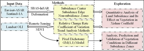
2. Materials and Methods

2.1. Study Area

The Xishan Coalfield of Shanxi Province is between 111°52′~112°31′ E, 37°24′~38°02′ N and includes parts of Taiyuan urban District, Gujiao City, Qingxu, Jiaocheng, and Wenshui County (Figure 1). It is located in the north temperate and semi-arid monsoon climate zone; the annual mean temperature and precipitation are 7~9 °C and 410~500 mm. The main types of soil are cinnamon soil in the mining areas, including loess, red cinnamon soil, and leached cinnamon soil, in addition to a small amount of coarse bone soil and weathered stone soil. The Xishan Coalfield is one of the six coalfields in Shanxi Province, the coal-bearing strata are the Lower Permian Shanxi Formation and the Upper Carboniferous Taiyuan Formation, with a total of 15 coal-bearing strata, numbered as 01~03# and 1~15# from top to bottom. The average thickness of the two groups is about 14.4 m. The average dip angle of the coal seam is generally 2~6°, and a few can reach 8~12°. The upper group 2# and 3# and the lower group 8# and 9# are stable and recoverable coal seams, the 6# and 7# are relatively stable and recoverable coal seams, and the others are locally recoverable or unrecoverable. The proven total geological reserves are 12.12 billion tons, of which 3.06 billion tons are currently in production and mainly produce coking coal, fat coal, and lean coal, with an annual output of more than 30 million tons. Its high-intensity coal mining not only causes a series of land subsidence phenomena, but also causes varying degrees of damage to the local ecological environment [23,24].

2.2. Data

Active remote sensing images included Envisat-ASAR data (36 scenes) and Sentinel-1A data (108 scenes). Envisat-ASAR data from 2008 to 2010 were downloaded at the European Space Agency (https://earth.esa.int, accessed on 29 January 2022), the images used were one scene per month; Sentinel-1A data from 2015 to 2017 and 2019 to 2020 were obtained from the Alaska Satellite Facility (https://search.asf.Alaska.edu, accessed on 29 January 2022), the images used were two scenes per month, Table 1 describes the parameters of the above data [25]. Passive remote sensing images included Landsat images (45 scenes) from the United States Geological Survey (http://glovis.usgs.gov/, accessed on 29 January 2022), its spatial resolution was 30 m, and the date of image acquisition was one scene per month. Considering the spectral range discrepancy of different sensors, we selected Landsat OLI L1 product from May to September (2013~2021) to ensure the reliability of the annual maximum value composites (MVC) results. Other auxiliary data included SRTM1 DEM, DORIS, POD precision orbit data, etc.

2.3. Data Processing

SAR data were processed using the SARscape version 5.2 and the SBAS-InSAR technique was applied to extract the surface deformation information of LOS from 2008~2010, 2015~2017, and 2019~2020 in Xishan Coalfield [26]. The focused images and precise orbit data were used to accurately position SAR data in the process of data format conversion, and the connection graphs were generated according to the space-time baseline thresholds. In the interferometry process, the Digital Elevation Model (SRTM1 DEM), the Goldstein filtering, and the Delaunay MCF method were selected to reduce phase noise and remove signals in low coherence regions [27,28]. Then, ground control points and the polynomial optimization method were performed for the orbital refinement and the phase re-flattening process [29]. SVD inversion and atmospheric filtering were selected to obtain more accurate LOS displacement, and the results were projected to the vertical direction according to the geometric relationship of incident angle for further analysis [30,31].
Landsat OLI images were preprocessed using ENVI 5.3 software, DN value conversion and atmospheric correction were performed using radiometric calibration and FLAASH atmospheric correction module [12]. Then, the NDVI values were extracted by using the reflection characteristics of vegetation to near-infrared and infrared bands, and the results from May to September were applied to calculate the annual maximum NDVI [18]. Finally, the maximum value of NDVI in Xishan Coalfield from 2013 to 2021 was obtained by using the maximum value composites (MVC) method [1].

2.4. Methods

The coefficient of variation is a statistic that can reflect the degree of data dispersion; it has become an important index to measure the stability of data quality and can be used to represent the fluctuation and stability of vegetation [18,19]. The formula is:
C v = σ X ¯ = 1 X ¯ i = 1 n ( X i X ¯ ) 2 n
where Cv is the coefficient of variation, σ is the standard deviation, X ¯ is the average NDVI value, n is the total number of years, and Xi is the NDVI value of each pixel. The greater the coefficient of variation, the weaker the stability of regional vegetation. That is, the stronger the disturbance of vegetation growth.
The trend analysis method mainly uses linear regression and the least square method to find the optimal fitting slope of long time series data and can be used to characterize the degeneration and growth trend of vegetation [1,5,8]. It can reflect the annual variation of NDVI. The formula is as follows:
S = n × i = 1 n ( i × NDVI i ) i = 1 n i i = 1 n NDVI i n × i = 1 n i 2 ( i = 1 n i ) 2
where S represents the slope of the NDVI trend, NDVIi is the annual maximum NDVI value. S > 0 indicates that regional NDVI is increasing, S < 0 indicates that regional NDVI is decreasing.
The pixel dichotomy model is a remote sensing estimation method based on vegetation index and mixed pixel decomposition. It assumes that each pixel is composed of vegetation and soil, and the reflection value of any pixel can be expressed as the linear weighted sum of vegetation and soil [12]. The expression for calculating vegetation coverage is as follows:
f c = NDVI - NDVI soil NDVI veg - NDVI soil
where fc is the vegetation coverage, NDVIsoil is approximately the NDVI value of bare soil or non-vegetation pixel, NDVIveg is the NDVI value of pure vegetation pixel. Based on the NDVI frequency statistics table and the sparse vegetation characteristics in some regions, the values at 5% and 95% of cumulative frequency were respectively taken as NDVIsoil and NDVIveg [3,11].
The GM (1,1) model was used to predict vegetation coverage from 2013 to 2020, and we obtained the relationship between the actual values and the predicted values. Meanwhile, vegetation coverage was predicted in the next five years, and vegetation coverage in 2021 was used to verify the predicted results. GM (1,1) model represents the first-order single-variable differential equation model. It is established by using the generation of a new data sequence with an obvious trend; then, the cumulative method is used to perform reverse calculation and restore the original data sequence to achieve the purpose of prediction [12,32,33,34,35]. The calculation method is as follows:
(1)
Assume that the raw sequence x(0) = {x(0)(1), x(0)(2),…, x(0)(n)}, and then add up to form
x ( 1 ) ( k ) = i = 1 k x ( 0 ) ( i )         k = ( 1 , 2 , , n ) x ( 1 ) = { x ( 1 ) ( 1 ) , x ( 1 ) ( 2 ) , , x ( 1 ) ( n ) }
(2)
Take the average sequence
z ( 1 ) ( k ) = 0.5 x ( 1 ) ( k ) + 0.5 x ( 1 ) ( k 1 ) k = ( 2 , 3 , , n )
(3)
The grey differential equation and albinism equation model are
x ( 0 ) ( k ) + a z ( 1 ) ( k ) = b k = ( 2 , 3 , , n ) d x ( 1 ) d t + a x ( 1 ) = b
(4)
Introduce matrix-vector
μ = ( a , b ) T , Y = { x ( 0 ) ( 2 ) , , x ( 0 ) ( n ) } T B = [ z ( 1 ) ( 2 ) 1 z ( 1 ) ( 3 ) 1 z ( 1 ) ( n ) 1 ]
(5)
The least square method is used to obtain the minimum value
J ( μ ^ ) = ( Y B μ ^ ) T ( Y B μ ^ ) μ ^ = ( a , b ) T = ( B T B ) 1 B T Y
(6)
Establishment of the prediction formula
x ^ ( 1 ) ( k + 1 ) = { x ( 0 ) ( 1 ) b a } e a k + b a k = ( 1 , 2 , , n 1 ) x ^ ( 0 ) ( k + 1 ) = x ^ ( 1 ) ( k + 1 ) x ^ ( 1 ) ( k ) k = ( 1 , 2 , , n 1 )
To verify the accuracy of the grey prediction model, the posteriori error ratio, class ratio dispersion, and mean square error were calculated. The smaller the value of each index, the better the prediction effect of the model.

3. Results and Analysis

3.1. Ground Settlement Condition

The SBAS-InSAR technique was used to extract the average annual ground deformation rates in Xishan Coalfield from 2008 to 2010, 2015 to 2017 and 2019 to 2020, four large subsidence regions P1, P2, P3, and P4 were found (Figure 2), and Zonal statistics and Raster Calculator tools were used to count the rates of deformation in different periods and regions (Table 2).
According to Figure 2 and Table 2, the P1 region is located at the junction of Qingxu and Jiaocheng County, and the Jiaocheng fault separates mountains and plains [36]. The subsidence center was located in Nailin village, and the maximum subsidence rate reached −103 mm/year from 2008 to 2010. Subsequently, the subsidence trend extended to Xinmin village along Jiaocheng fault, Wang and Xinmin villages became new subsidence centers, the maximum subsidence rates exceeded −50 mm/year from 2015 to 2017 and 2019 to 2020. The subsidence rates of Anze village, Liuduandi village, and Houhuoshan village were lower than −25 mm/year in the north of Jiaocheng fault from 2008 to 2010, and the above areas continued to deform, the maximum subsidence rates reached −77 mm/year, −75 mm/year, and −64 mm/year with the advance of the mining face from 2019 to 2020.
P2 region is located in Xiayuan and Xishan. From 2008 to 2010, several funnel-shaped settlement areas appeared near Xiayuan, and the maximum subsidence rate was −46 mm/year. The Xishan area has been deformed since 2008, and the maximum subsidence rate was −75 mm/year by 2017, which was an intense subsidence area; from 2019 to 2020, no obvious deformation has occurred in the Xiayuan area. The maximum subsidence rate of the Xishan area dropped to −48 mm/year, and an ecological park from Huangpo village to the Xiyu coal mining area has been established (Figure 3). Figure 3 shows the restored surface of the mining area, and it can be seen that the implementation of ecological and environmental protection policies has greatly improved the surface condition of the mining area in Wanbailin District.
P3 region is the Gujiao mining area, which is adjacent to the Xishan mining area in the east and the Qingjiao mining area in the south, covering an area of about 660 km2. The surface deformation of the mining area has been continuously occurring since 2008, and several funnel-shaped subsidence areas have been formed by 2020, including Zhenchengdi, Tunlan, Dongqu, Xingjiashe, Xiqu, and Suoyu village, the maximum subsidence in the northeast of Baicaota village was −90 mm/year. Gujiao City has carried out comprehensive treatment of key coal mining areas in the above-mentioned subsidence areas, but the subsidence areas are large, and the influence ranges are wide; the restoration of subsidence areas and land reclamation also need long-term efforts.
P4 region is located near Banyu village and Hedi village in Wenshui County. From 2019 to 2020, a large funnel-shaped subsidence area appeared in the east of Banyu village and the southeast of Hedi village; the maximum subsidence rate was −133 mm/year. According to the geological disaster prevention plan of Wenshui County in 2018, this area was a new geological hazard site with potential landslide and collapse risks. The monitoring results provide an important basis for the positioning of other disaster points and later treatment.
To sum up, the land subsidence areas of Xishan Coalfield had a certain similarity and continuity from 2008~2010, 2015~2017, and 2019~2020. The land subsidence areas have been improved in Nailin village, Qin village, Wang village, Xiayuan, and Xishan. The subsidence rate decreased to below −30 mm/year in Nailin village and Xiayuan from 2019 to 2020, and the regional surface condition was significantly improved. In addition, the land subsidence had an aggravating trend in Anze village, Liuduandi village, Houhuashan village, Baicaota village, and Banyu village, and the maximum subsidence rate was up to −133 mm/year in Banyu village.

3.2. Surface Vegetation Analysis

We selected the black rectangular region as the experimental area in Figure 2c and superimposed the area with a subsidence rate over −30 mm/year in the three periods; the results are shown in Figure 4 below. The subsidence funnels A, B, and C were divided into subsidence center, subsidence edge, and non-subsidence zones, respectively (corresponding to 0, 1, and 2 zones, the same size and shape), and combined with the maximum NDVI values extracted from Landsat OLI images from May to September (2013~2020) to further analyze the spatial variation characteristics of NDVI. Zonal statistics were used to calculate the mean value of NDVI in 0, 1, and 2 zones, and then Excel software was used to calculate the relative change rate of NDVI in the subsidence center relative to the subsidence edge and non-subsidence zone in each subsidence funnel from 2013 to 2020 (Table 3). In Table 3 below, 0–1 represents the relative change ratio of average NDVI between the subsidence center (0 zones) and the subsidence edge (1 zones). 0–2 represents the relative change ratio of average NDVI between the subsidence center (0 zones) and non-subsidence zone (2 zones).
Table 3 displays the annual relative change rate of NDVI is mostly negative in the subsidence center, subsidence edge, and non-subsidence zones, and the variation degree is around −10%, indicating that the surface NDVI value of the subsidence center is generally smaller than that of subsidence edge and non-subsidence zones. In addition, the relative change rates of zone 0–2 in subsidence funnels A and C are greater than 0–1, indicating that the average NDVI of the subsidence center is the smallest, and the farther away from the subsidence center, the larger the NDVI value and the more vigorous the vegetation growth; however, the relative change rate of 0–1 zone in the subsidence funnel B is larger, it is found that there are more buildings and roads in zone 2, which has a certain influence on calculating the mean value of NDVI; therefore, the relative change rate of 0–2 zone is smaller in subsidence funnel B.

3.3. Stability Analysis

Table 4 shows the coefficient of variation in the subsidence center, subsidence edge, and non-subsidence zones. According to the standard deviation, the results were divided into five levels: low, relatively low, medium, relatively high, and high fluctuation, so as to analyze the fluctuation of regional vegetation.
According to Table 4, the proportion of low fluctuation variation areas is the largest in the non-subsidence zone, followed by the edge and center of subsidence, accounting for 35.49%, 29.29%, and 11.97%, respectively, indicating that the closer to the subsidence center, the greater the fluctuation of NDVI; otherwise, the smaller the fluctuation, the more stable the vegetation growth. At the same time, the areas of medium fluctuation, relatively high fluctuation, and high fluctuation are the largest in the subsidence center (zone 0), accounting for 22.15%, 8.53%, and 6.60% of the total area. The proportion of its high fluctuation (6.60%) is about 2.5 times that of the subsidence edge (2.24%) and non-subsidence zone (2.75%), indicating that the vegetation in the subsidence center is strongly disturbed and its stability is weak.

3.4. Trend Analysis

The trend analysis method was used to calculate the changing trend of NDVI over time in subsidence center, subsidence edge, and non-subsidence zones. The division of NDVI trend was mainly based on the Natural Breaks method (Jenks method), which was finally determined by referring to standard deviation and Quantile classification method. The results were divided into five categories: serious degradation, slight degradation, basically unchanged, slight improvement and obvious improvement, and the proportion of each zone was counted (Table 5).
As can be seen from Table 5, the proportion of vegetation with serious degradation is 5.64% in the subsidence center from 2013 to 2020, which is twice and five times that in the subsidence edge (2.71%) and non-subsidence zones (1.10%). The proportion of slight degradation is 13.89%, which is about 3% more than that of the subsidence edge and non-subsidence zones. At the same time, the proportion of obvious improvement accounts for 28.34% in the subsidence center, which is much higher than 17.22% and 13.82% in the subsidence edge and non-subsidence zones. It can be seen that the vegetation degradation accounts for a large proportion in the subsidence center, and the closer it is to the subsidence center, the stronger the trend of surface vegetation degradation. Meanwhile, the vegetation status in the subsidence center has also been significantly improved due to the implementation of ecological and environmental protection policies in recent years.

3.5. Vegetation Coverage Prediction

The pixel dichotomy model was used to calculate vegetation coverage in 0, 1, and 2 zones from 2013 to 2020. The vegetation coverage in the next five years was predicted by the grey model, and verified by the vegetation coverage in 2021 (Figure 5). In Figure 5 below, the red rectangles represent the actual vegetation coverage was obtained by Landsat OLI images; the black circles represent the vegetation coverage predicted by GM (1,1) model; the black rectangles represent the vegetation coverage used for verification.
According to Figure 5, the vegetation coverage shows a wedge-shaped upward trend from 2013 to 2020 in 0, 1, and 2 zones; the predicted value is the closest to the true value in zone 0, followed by 1 and 2 zones, the residuals are all less than 0.05. Compared with the vegetation coverage in 2021, the residuals of the predicted values are 0.047, 0.047, and 0.019, maintaining the consistency of the development trend. We can also obtain from the ordinate that the vegetation coverage is the lowest in the subsidence center (zone 0). It is consistent with the law obtained by using NDVI, the results obtained by vegetation coverage and NDVI can be verified by each other. In addition, the posteriori error ratio, class ratio dispersion, and mean square error were calculated to verify the accuracy of GM (1,1) model, as shown in Table 6.
Table 6 displays the prediction accuracy is better in zone 0, and the posterior errorratio, class ratio dispersion, and mean square error are 0.21, 0.066, and 0.023, respectively. The class ratio dispersion and mean square error are relatively close in 1 and 2 zones, which may be related to the similar curve characteristics and values in Figure 5b,c.

4. Discussion

Ground subsidence monitoring and vegetation analysis in the mining areas have always been the key topics of coal mine safety production and ecological environment protection research [17,18]. The surface deformation and vegetation information were obtained by using spaceborne SAR and Landsat OLI images in Xishan Coalfield. Firstly, the land subsidence conditions were analyzed in different regions from 2008~2010, 2015~2017, and 2019~2020. Secondly, the subsidence areas were divided into subsidence center, subsidence edge, and non-subsidence zones, respectively, and combined with the maximum NDVI values extracted from Landsat OLI images from May to September (2013~2020) to further analyze the spatial variation characteristics of NDVI in the subsidence areas. Finally, the grey prediction model was used to predict vegetation coverage in the subsidence areas in the next five years and verified by vegetation coverage in 2021.
The Xishan Coalfield of Shanxi Province is located in loess hilly and gully regions, its underground water level is relatively deep, and regional land subsidence disturbs the vegetation growth [38]. The results suggested that the NDVI value of the subsidence center was about 10% smaller than that of the subsidence edge and non-subsidence zones, and the farther away from the subsidence center, the larger the average surface NDVI value (Table 2); however, some scholars indicated that the changes in groundwater levels caused by coal mining might promote vegetation growth, and meteorological factors were not predominant influencing factors [16].
The cause of the argument was that the ground subsidence would reduce the groundwater depth, but the impact on vegetation was little when the water depth was less than 5 m [39]. Meanwhile, vegetation growth could rarely depend on groundwater when the water level was deep [15]; therefore, underground coal mining had a certain destructive effect on the growth of surface vegetation in Xishan Coalfield.
From the perspective of research methods, there are many common vegetation analysis methods, such as coefficient of variation [19], trend analysis [5], pixel dichotomy model [11], grey model [12], and so on. Coefficient of variation can be used to represent the spatial variability of soil and vegetation characteristics; combining coal mining and non-mining areas can determine the coefficient of variation threshold, which can distinguish the disturbance areas [18]. The results indicated that the proportion of vegetation disturbed in the subsidence center was about 2.5 times that in the subsidence edge and non-subsidence zones. Meanwhile, the proportion of serious degradation in the subsidence center was 5.64% by trend analysis method, which was twice and five times that in the subsidence edge and non-subsidence zones. It can be found that the coefficient of variation and trend analysis methods have the same development trend in the mining areas, and combining the two methods to monitor the surface vegetation can better analyze the vegetation characteristics [8,21].
In addition, long time series NDVI data directly reflects the vegetation growth status and has shown robust results to identify damaged vegetation [1,10]; however, the saturation property of NDVI posed a known weakness which limited the application of vegetation index in dense vegetation areas, and some scholars did not improve the sensitivity of NDVI conversion to vegetation components greater than 0.6 [40,41]; therefore, other scholars have proposed a remote sensing estimation method based on the combination of vegetation index and mixed pixel decomposition [3]. The pixel dichotomy model was widely selected to establish the transformation relationship between vegetation coverage and NDVI, because the vegetation coverage can not only indicate vegetation growth but also can describe surface vegetation in dense vegetation areas, so it can be used as an indicator for monitoring surface vegetation in the mining areas [42,43]. Meanwhile, it is feasible to predict the change of vegetation coverage by the grey prediction model, which also provides a basis to further improve the surface vegetation in the mining areas [12,32,33,34,35].
Most scholars focused on mineralogy and geochemistry in Xishan Coalfield [44], and there were few studies on surface vegetation. This study can better analyze the quantitative relationship between surface vegetation in subsidence areas and non-subsidence areas by comparing the vegetation status in subsidence centers, subsidence edges, and non-subsidence zones. Selecting the adjacent areas for comparison does not need to consider the impact of meteorological and environmental factors and can effectively eliminate other interference factors [4,13,37]. Meanwhile, the application of radar technology has also greatly promoted surface monitoring in the mining areas [45] and provided references for future research on land subsidence and vegetation in Xishan Coalfield; however, it is necessary to select appropriate comparative analysis region and more research methods to further quantitatively analyze the lag effect of the settlement on vegetation, this will become the focus of follow-up research.

5. Conclusions

Based on the long-term SAR and Landsat data, this study analyzed the spatial-temporal characteristics and quantitative relationship between the subsidence and vegetation in the Xishan Coalfield, and predicted the variation trend of vegetation in the next five years.
(1)
Land subsidence occurred continuously from 2008~2010 to 2019~2020 in Xishan Coalfield. Four serious subsidence areas in Qingxu-Jiaocheng, Wanbailin District, Gujiao City, and Wenshui County were obtained by SBAS-InSAR technology, the maximum subsidence rates in the above areas were −103 mm/year, −75 mm/year, −90 mm/year, and −133 mm/year, respectively. By comparing the deformation rates in different periods and regions, it can not only help to understand the surface conditions of different areas, but also provide a basis for comprehensive management in coal mining subsidence areas.
(2)
The NDVI value of the subsidence center was about 10% smaller than that of the subsidence edge and non-subsidence zones. The proportion of vegetation with high fluctuation was 6.60% in the subsidence center, about 2.5 times that of the subsidence edge (2.24%) and non-subsidence zones (2.75%). Meanwhile, the proportions of serious degradation in the subsidence center, subsidence edge, and non-subsidence zones were 5.64%, 2.71%, and 1.10%, the vegetation degradation trend was most intense in the subsidence center. The above results show that vegetation will be affected in the subsidence center, and the closer the surface vegetation is to the subsidence center, the stronger the degradation and fluctuation trend is.
(3)
Vegetation coverage generally showed a wedge ascending trend in Xishan Coalfield, and the GM (1,1) model also revealed this trend. Compared with the vegetation coverage in 2021, the residuals of the predicted values were 0.047, 0.047, and 0.019, maintaining the consistency of the development trend. At the same time, the law obtained by using NDVI and vegetation coverage was consistent; that is, the surface vegetation grew poorly in the subsidence center.
We only obtained the Landsat data before 2020 due to the time limit of the first draft, and the results were checked and verified with Landsat data in 2021.

Author Contributions

Conceptualization, Shangmin Zhao; methodology, Ding Ma; software, Ding Ma; validation, Ding Ma; writing—original draft preparation, Ding Ma; writing—review and editing, Shangmin Zhao; supervision, Shangmin Zhao. All authors have read and agreed to the published version of the manuscript.

Funding

This research was funded by the Natural Science Foundation of Shanxi Province (201901D111098), the National Key Research and Development Program (2017YFB0503603), and the National Natural Science Foundation of China (42130110, 42171424).

Institutional Review Board Statement

Not applicable.

Informed Consent Statement

Not applicable.

Data Availability Statement

Envisat-ASAR data and DORIS orbit data (https://earth.esa.int accessed on 29 January 2022); Sentinel-1A data (https://search.asf.Alaska.edu accessed on 29 January 2022), POD orbit data (https://scihub.copernicus.eu/ accessed on 29 January 2022); Landsat images (http://glovis.usgs.gov/ accessed on 29 January 2022); Derived data are generated by the authors.

Conflicts of Interest

The authors declare no conflict of interest.

References

  1. Wang, M.; Fu, J.E.; Wu, Z.; Pang, Z. Spatiotemporal variation of NDVI in the vegetation growing season in the source region of the Yellow River, China. ISPRS Int. J. Geo-Inf. 2020, 9, 282. [Google Scholar] [CrossRef] [Green Version]
  2. Zhang, M.; Wang, J.; Li, S. Tempo-spatial changes and main anthropogenic influence factors of vegetation fractional coverage in a large-scale opencast coal mine area from 1992 to 2015. J. Clean. Prod. 2019, 232, 940–952. [Google Scholar] [CrossRef]
  3. Li, S.; Wang, J.; Zhang, M.; Tang, Q. Characterizing and attributing the vegetation coverage changes in North Shanxi coal base of China from 1987 to 2020. Resour. Policy 2021, 74, 102331. [Google Scholar] [CrossRef]
  4. Yu, X.; Mu, C.; Zhang, D. Assessment of land reclamation benefits in mining areas using fuzzy comprehensive evaluation. Sustainability 2020, 12, 2015. [Google Scholar] [CrossRef] [Green Version]
  5. Peng, L.; Deng, W.; Liu, Y. Understanding the Role of Urbanization on Vegetation Dynamics in Mountainous Areas of Southwest China: Mechanism, Spatiotemporal Pattern, and Policy Implications. ISPRS Int. J. Geo-Inf. 2021, 10, 590. [Google Scholar] [CrossRef]
  6. Li, H.; Yang, X.; Zhang, K. Understanding global land degradation processes interacted with complex biophysics and socioeconomics from the perspective of the Normalized Difference Vegetation Index (1982–2015). Glob. Planet Change 2021, 198, 103431. [Google Scholar] [CrossRef]
  7. Cai, S.; Song, X.; Hu, R.; Guo, D. Ecosystem-Dependent Responses of Vegetation Coverage on the Tibetan Plateau to Climate Factors and Their Lag Periods. ISPRS Int. J. Geo-Inf. 2021, 10, 394. [Google Scholar] [CrossRef]
  8. Islam, S.; Ma, M. Geospatial monitoring of land surface temperature effects on vegetation dynamics in the Southeastern Region of Bangladesh from 2001 to 2016. ISPRS Int. J. Geo-Inf. 2018, 7, 486. [Google Scholar] [CrossRef] [Green Version]
  9. Sharma, I.; Tongkumchum, P.; Ueranantasun, A. Regression Analysis of Normalized Difference Vegetation Index (NDVI) to Compare Seasonal Patterns and 15 Year Trend of Vegetation from East to West of Nepal. Nat. Environ. Poll. Techy. 2021, 20, 267–273. [Google Scholar] [CrossRef]
  10. Sanz, E.; Saa-Requejo, A.; Díaz-Ambrona, C.H.; Ruiz-Ramos, M.; Rodríguez, A.; Iglesias, E.; Esteve, P.; Soriano, B.; Tarquis, A.M. Normalized Difference Vegetation Index Temporal Responses to Temperature and Precipitation in Arid Rangelands. Remote Sens. 2021, 13, 840. [Google Scholar] [CrossRef]
  11. Dou, X.; Ma, X.; Huo, T.; Zhu, J.; Zhao, C. Assessment of the environmental effects of ecological water conveyance over 31 years for a terminal lake in Central Asia. Catena 2022, 208, 105725. [Google Scholar] [CrossRef]
  12. Zhou, L.; Wang, S.; Du, M.; Yang, J.; Zhu, Y.; Wu, J. An Integrated approach for detection and prediction of greening situation in a typical desert area in China and its human and climatic factors analysis. ISPRS Int. J. Geo-Inf. 2020, 9, 364. [Google Scholar] [CrossRef]
  13. Fang, A.; Dong, J.; Cao, Z.; Zhang, F.; Li, Y. Tempo-Spatial Variation of Vegetation Coverage and Influencing Factors of Large-Scale Mining Areas in Eastern Inner Mongolia, China. Int. J. Environ. Res. Public Health 2020, 17, 47. [Google Scholar] [CrossRef] [PubMed] [Green Version]
  14. Wu, Q.; Liu, K.; Song, C.; Wang, J.; Ke, L.; Ma, R.; Deng, X. Remote sensing detection of vegetation and landform damages by coal mining on the Tibetan Plateau. Sustainability 2018, 10, 3851. [Google Scholar] [CrossRef] [Green Version]
  15. Liu, S.; Li, W.; Qiao, W.; Wang, Q.; Hu, Y.; Wang, Z. Effect of natural conditions and mining activities on vegetation variations in arid and semiarid mining regions. Ecol. Indic. 2019, 103, 331–345. [Google Scholar] [CrossRef]
  16. Chen, W.; Li, W.; Yang, Z.; Wang, Q. Analysis of mining-induced variation of the water table and potential benefits for ecological vegetation: A case study of Jinjitan coal mine in Yushenfu mining area, China. Hydrogeol. J. 2021, 29, 1629–1645. [Google Scholar] [CrossRef]
  17. Yang, Y.; Erskine, P.D.; Lechner, A.M.; Mulligan, D.; Zhang, S.; Wang, Z. Detecting the dynamics of vegetation disturbance and recovery in surface mining area via Landsat imagery and LandTrendr algorithm. J. Clean. Prod. 2018, 178, 353–362. [Google Scholar] [CrossRef]
  18. Yang, Z.; Li, J.; Zipper, C.E.; Shen, Y.; Miao, H.; Donovan, P.F. Identification of the disturbance and trajectory types in mining areas using multitemporal remote sensing images. Sci. Total Environ. 2018, 644, 916–927. [Google Scholar] [CrossRef]
  19. Li, H.; Xu, F.; Li, Q. Remote sensing monitoring of land damage and restoration in rare earth mining areas in 6 counties in southern Jiangxi based on multisource sequential images. J. Environ. Manag. 2020, 267, 110653. [Google Scholar] [CrossRef]
  20. Wang, S.; Huang, J.; Yu, H.; Ji, C. Recognition of landscape key areas in a coal mine area of a semi-arid steppe in China: A case study of Yimin open-pit coal mine. Sustainability 2020, 12, 2239. [Google Scholar] [CrossRef] [Green Version]
  21. Chen, G.; Yang, Y.; Liu, X.; Wang, M. Spatial Distribution Characteristics of Heavy Metals in Surface Soil of Xilinguole Coal Mining Area Based on Semivariogram. ISPRS Int. J. Geo-Inf. 2021, 10, 290. [Google Scholar] [CrossRef]
  22. Padmanaban, R.; Bhowmik, A.K.; Cabral, P. A remote sensing approach to environmental monitoring in a reclaimed mine area. ISPRS Int. J. Geo-Inf. 2017, 6, 401. [Google Scholar] [CrossRef] [Green Version]
  23. Liu, J. The Application of RS Technology to investigate Geology Disaster in Xishan Taiyuan. Master’s Thesis, Taiyuan University of Technology, Taiyuan, China, 2006. Available online: https://kns.cnki.net/kcms/detail/detail.aspx?FileName=2006152795.nh&DbName=CMFD2006 (accessed on 16 February 2022).
  24. Sun, B. Time-event Serious of Formation and Evolutuon of Xishan Coal Bearing Strata, Taiyuan and Geological Factors. Ph.D. Thesis, Taiyuan University of Technology, Taiyuan, China, 2014. [Google Scholar] [CrossRef]
  25. Ma, D.; Guan, Y.; Zhao, S. Monitoring of Surface Deformation in Xishan Coalfield Area of Shanxi Province Based on SBAS-InSAR Technology. Coal Technol. 2021, 40, 130–135. [Google Scholar] [CrossRef]
  26. Berardino, P.; Fornaro, G.; Lanari, R.; Sansosti, E. A new algorithm for surface deformation monitoring based on small baseline differential SAR interferograms. IEEE Trans.Geosci. Remote. Sens. 2002, 40, 2375–2383. [Google Scholar] [CrossRef] [Green Version]
  27. Pepe, A.; Lanari, R. On the extension of the minimum cost flow algorithm for phase unwrapping of multitemporal differential SAR interferograms. IEEE Trans.Geosci. Remote Sens. 2006, 44, 2374–2383. [Google Scholar] [CrossRef]
  28. Chaabani, A.; Deffontaines, B. Application of the SBAS-DInSAR technique for deformation monitoring in Tunis City and Mornag plain. Geomat. Nat. Hazards Risk. 2020, 11, 1346–1377. [Google Scholar] [CrossRef]
  29. Loesch, E.; Sagan, V. SBAS analysis of induced ground surface deformation from wastewater injection in East Central Oklahoma, USA. Remote Sens. 2018, 10, 283. [Google Scholar] [CrossRef] [Green Version]
  30. Tao, Q.; Ding, L.; Hu, L.; Chen, Y.; Liu, T. The performance of LS and SVD methods for SBAS InSAR deformation model solutions. Int. J. Remote Sens. 2020, 41, 8547–8572. [Google Scholar] [CrossRef]
  31. Boloorani, A.D.; Darvishi, M.; Weng, Q.; Liu, X. Post-War Urban Damage Mapping Using InSAR: The Case of Mosul City in Iraq. ISPRS Int. J. Geo-Inf. 2021, 10, 140. [Google Scholar] [CrossRef]
  32. Liu, S.; Deng, J. The Range Suitable for GM (1,1). Syst. Eng.-Theory Pract. 2000, 5, 121–124. [Google Scholar]
  33. Zhang, D.; Jiang, S.; Shi, K. Theoretical Defect of Grey Prediction Formula and Its Improvement. Syst. Eng.-Theory Pract. 2002, 8, 140–142. [Google Scholar]
  34. Xie, N.; Liu, S. Discrete GM (1,1) and Mechanism of Grey Forecasting Model. Syst. Eng.-TheoryPract. 2005, 1, 93–99. [Google Scholar]
  35. Xie, N.; Wang, R. A historic Review of Grey Forecasting Models. J. Grey Syst. 2017, 29, 1–29. [Google Scholar]
  36. Liu, Y.; Zhao, C.; Zhang, Q.; Yang, C. Complex surface deformation monitoring and mechanism inversion over Qingxu-Jiaocheng, China with multi-sensor SAR images. J. Geodyn. 2018, 114, 41–52. [Google Scholar] [CrossRef]
  37. Li, X. Research of Vegetation Change Trend with Remote Sensing Technology in Coal Mine Surface Subsidence Area of BinChang. Master’s Thesis, Xi’an University of Science and Technology, Xi’an, China, 2013. Available online: https://kns.cnki.net/KCMS/detail/detail.aspx?dbname=CMFD201401&filename=1014000407.nh (accessed on 16 February 2022).
  38. Chen, S.; Yin, D.; Cao, F.; Liu, Y.; Ren, K. An overview of integrated surface subsidence-reducing technology in mining areas of China. Nat. Hazards 2016, 81, 1129–1145. [Google Scholar] [CrossRef]
  39. Liu, S.; Li, W.; Qiao, W.; Li, X.; Wang, Q.; He, J. Zoning method for mining-induced environmental engineering geological patterns considering the degree of influence of mining activities on phreatic aquifer. J. Hydrol. 2019, 578, 124020. [Google Scholar] [CrossRef]
  40. Tesfaye, A.A.; Awoke, B.G. Evaluation of the saturation property of vegetation indices derived from sentinel-2 in mixed crop-forest ecosystem. Spat. Inf. Res. 2021, 29, 109–121. [Google Scholar] [CrossRef]
  41. Zhen, Z.; Chen, S.; Yin, T.; Chavanon, E.; Lauret, N.; Guilleux, J.; Henke, M.; Qin, W.; Cao, L.; Li, J.; et al. Using the Negative Soil Adjustment Factor of Soil Adjusted Vegetation Index (SAVI) to Resist Saturation Effects and Estimate Leaf Area Index (LAI) in Dense Vegetation Areas. Sensors 2021, 21, 2115. [Google Scholar] [CrossRef]
  42. Tong, S.; Zhang, J.; Bao, Y.; Lai, Q.; Lian, X.; Li, N.; Bao, Y. Analyzing vegetation dynamic trend on the Mongolian Plateau based on the Hurst exponent and influencing factors from 1982–2013. J. Inf. Sci. 2018, 28, 595–610. [Google Scholar] [CrossRef] [Green Version]
  43. Ai, L.; Wang, S.; Zhang, Z. Spatial-temporal evolution and prediction of vegetationcover in central part of Xilingol Grassland during 1977–2017. Bull. Soil Water Conserv. 2019, 39, 249–256. [Google Scholar] [CrossRef]
  44. Li, X.; Kang, J.; Wang, P.; Liu, Y.; Fu, Q. Geochemistry and mineralogy of Late Carboniferous coal (No. 8) from the Jialequan Mine, Xishan Coalfield, Shanxi Province, China: Evidences for the geologic controls of trace elements. Arab. J. Geosci. 2020, 13, 1–17. [Google Scholar] [CrossRef]
  45. Liu, D.; Shao, Y.; Liu, Z.; Riedel, B.; Sowter, A.; Niemeier, W.; Bian, Z. Evaluation of InSAR and TomoSAR for monitoring deformations caused by mining in a mountainous area with high resolution satellite-based SAR. Remote Sens. 2014, 6, 1476–1495. [Google Scholar] [CrossRef] [Green Version]
Figure 1. Geographic location of Xishan Coalfield. Landsat 8 panchromatic and multispectral fusion image.
Ijgi 11 00154 g001
Figure 2. Average annual vertical deformation rate in the Xishan Coalfield.
Ijgi 11 00154 g002
Figure 3. Ecological restoration of Xishan in Wanbailin District.
Ijgi 11 00154 g003
Figure 4. Study partitions of A, B, and C.
Ijgi 11 00154 g004
Figure 5. The predicted VC trends using the grey forecasting model in 0, 1, and 2 zones.
Ijgi 11 00154 g005
Table 1. SAR data parameters [25].
ParametersEnvisat-ASARSentinel-1A
Satellite image width/km105250
Radar wavelength/cm5.65.6
Spatial resolution/m30 × 305 × 20
Revisiting period/d3512
Polarization modeVVVV
Number of images/scenes36108
Time coverage2008.12.28–2010.09.192015.04.11–2017.03.19
2019.04.02–2020.05.14
Angle of incidence/°2339
Orbitdescendingascending
Acquisition modeIMIW
Precision orbit dataDORISPOD
Table 2. Comparison of subsidence rates between different periods in Xishan Coalfield (mm/year).
Subsidence Area2008–20102015–20172019–2020Surface Condition
Nailin −10300better
Tan village−79−37−30better
Wang village−80−51−59better
Anze−9−68−77worse
Liuduandi−20−13−75worse
Houhuoshan−22−21−64worse
Xiayuan−46−23−19better
Xishan−27−75−48better
Baicaota−26−59−90worse
Banyu0−23−133worse
Table 3. Relative change rate of NDVI in different zones from 2013 to 2020.
Relative Change RateABC
0–10–20–10–20–10–2
2013−1.68%1.68%−9.71%−12.31%−11.92%−12.05%
2014−6.35%−8.44%−12.04%−6.71%−11.21%−13.00%
2015−9.46%−13.55%−10.35%−4.50%−13.53%−16.05%
2016−9.78%−10.62%−8.38%−9.19%−10.82%−9.58%
2017−10.20%−10.37%−11.75%−7.31%−11.59%−12.85%
2018−9.76%−11.14%−13.17%−13.56%−7.23%−8.97%
2019−10.67%−11.02%−5.55%−6.51%−10.27%−10.21%
2020−8.92%−9.55%−10.05%−7.67%−6.94%−5.03%
Mean value−8.35%−9.13%−10.13%−8.47%−10.44%−10.97%
Relative change rate = (NDVIsubsidence center − NDVInon-subsidence center)/NDVInon-subsidence center ∗ 100% [37].
Table 4. Analysis on the stability of NDVI change from 2013 to 2020.
Degree of FluctuationVariation Range of CvZone 0 Zone 1 Zone 2
Low Cv ≤ 0.0511.97%29.29%35.49%
Relatively low0.05 < Cv ≤ 0.1050.76%51.46%41.33%
Medium0.10 < Cv ≤ 0.1522.15%13.42%17.47%
Relatively high0.15 < Cv ≤ 0.208.53%3.59%2.96%
HighCv > 0.206.60%2.24%2.75%
Table 5. Trend of NDVI from 2013 to 2020.
Trend AnalysisSlopeZone 0 Zone 1 Zone 2
SeriousdegradationS ≤ −0.0255.64%2.71%1.10%
Slight degradation−0.025 < S ≤ −0.00613.89%10.44%10.59%
Basically unchanged−0.006 < S ≤ 0.00620.63%28.81%43.33%
Slight improvement0.006 < S ≤ 0.01531.50%40.81%31.16%
Obvious improvementS > 0.01528.34%17.22%13.82%
Table 6. Prediction accuracy of the grey model.
ZonePosteriori Error RatioClass Ratio DispersionRMSERatings
00.210.0660.023Good
10.290.0740.030Good
20.370.0780.032Eligible
Publisher’s Note: MDPI stays neutral with regard to jurisdictional claims in published maps and institutional affiliations.

