Article

Skyline-Based Sorting Approach for Rail Transit Stations Visualization
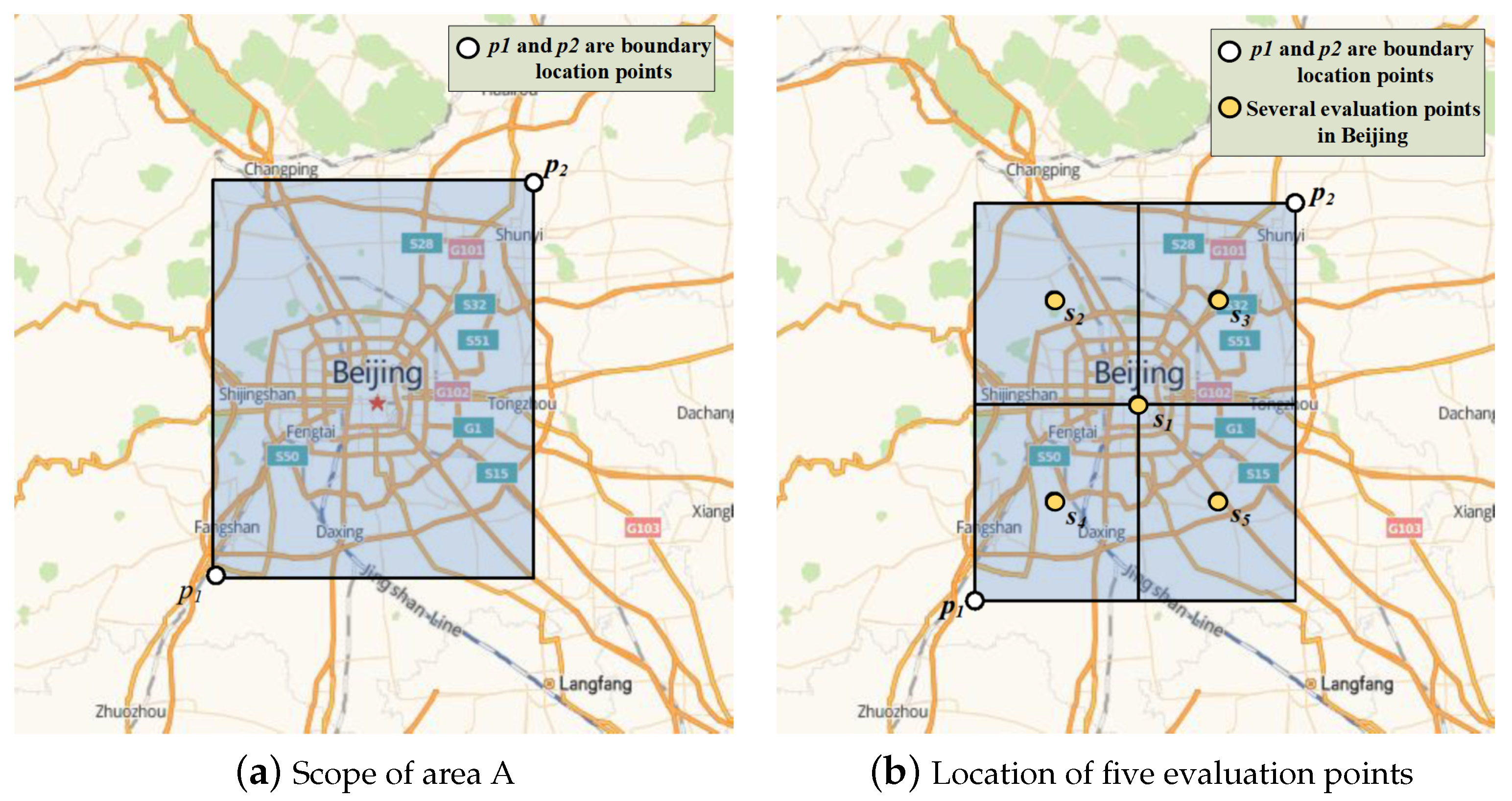
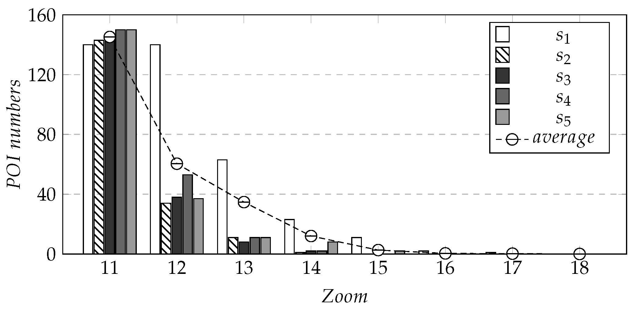
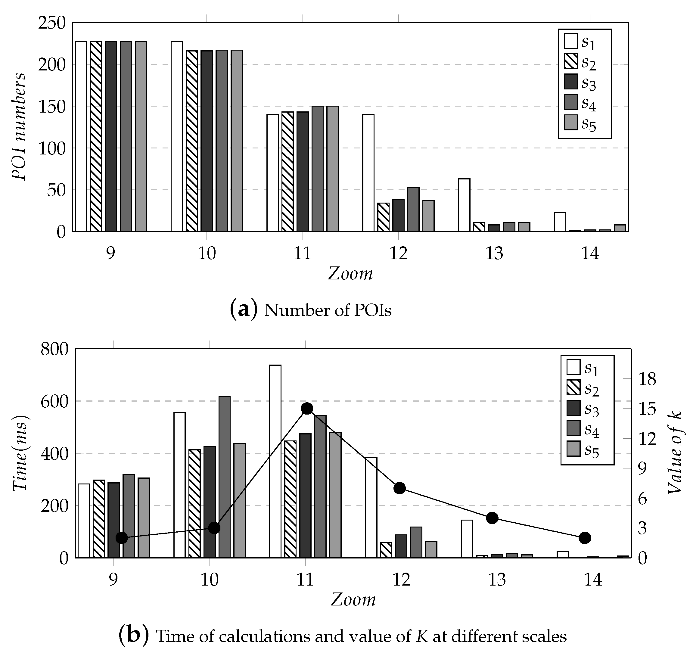
1
The College of Computer Science, Beijing University of Technology, Beijing 100124, China
2
Art College, Hebei Normal University of Science and Technology, Qinhuangdao 066004, China
*
Author to whom correspondence should be addressed.
ISPRS Int. J. Geo-Inf. 2023, 12(3), 110; https://doi.org/10.3390/ijgi12030110
Submission received: 15 December 2022 / Revised: 22 February 2023 / Accepted: 26 February 2023 / Published: 6 March 2023

Abstract

Urban rail transit is an essential part of the urban public transportation system. The reasonable spatial data visualization of urban rail transit stations can provide a more intuitive way for the majority of travelers to arrange travel plans and find destinations. The map service of rail transit stations generated by data visualization has gradually become indispensable information guidance in the rail transit system. The existing map service icons block each other when the scale changes, and new stations cannot be displayed dynamically when users drag the map. This paper uses filtering and sorting methods to dynamically query and visualize the relatively more important transportation stations within the users’ visible range, so as to solve the above problems and provide people with better transportation services. Our method introduces three constraints: spatial diversity, time-sharing passenger flow analysis and whether it is a transit station, and calculates the scores of constraint relationships of feature objects to evaluate stations. On the basis of the skyline query, the scores of feature objects are combined and sorted to obtain an ordered object set of the most interesting k points(top-k POIs), and the rail transit stations are dynamically retrieved and visualized. Before sorting POIs, we filter out POIs that need to be fitted, so that only the k most representative POIs in the currently visible range are displayed. When the map scale changes, the displayed POIs are updated. Finally, through the statistics of efficiency calculation of this method under different scales and centers, combined with users’ evaluations, it was proved that our method could better display critical information and improve user experience.
Keywords: dynamic query; visualization; skyline query; similarity; urban traffic dynamic query; visualization; skyline query; similarity; urban traffic

