Article

Application of Hydro-Based Morphological Models for Environmental Assessment of Watersheds

by
Silvio Luís Rafaeli Neto
1,
Vanessa Jutel dos Santos
1,
Emili Louise Diconcili Schutz
1,
Leticia Margarete de Moliner
1,
Cristiane Gracieli Kloth
1,
Daiane Teixeira Schier
1,
Arsalan Ahmed Othman
2,3,
Veraldo Liesenberg
1 and
Polyanna da Conceição Bispo
4,*
1
Graduate Program in Environmental Sciences, Santa Catarina State University (UDESC), Av. Luiz de Camões 2090, Lages 88520-000, SC, Brazil
2
Iraq Geological Survey, Al-Andalus Square, Baghdad 10068, Iraq
3
Iraq Geological Survey, Department of Petroleum Engineering, Komar University of Science and Technology, Sulaimaniyah 460013, Iraq
4
Department of Geography, School of Environment, Education and Development, University of Manchester, Oxford Road, Manchester M13 9PL, UK
*
Author to whom correspondence should be addressed.
ISPRS Int. J. Geo-Inf. 2023, 12(8), 314; https://doi.org/10.3390/ijgi12080314
Submission received: 17 May 2023 / Revised: 26 July 2023 / Accepted: 28 July 2023 / Published: 31 July 2023
(This article belongs to the Special Issue Geo-Information for Watershed Processes)

Abstract

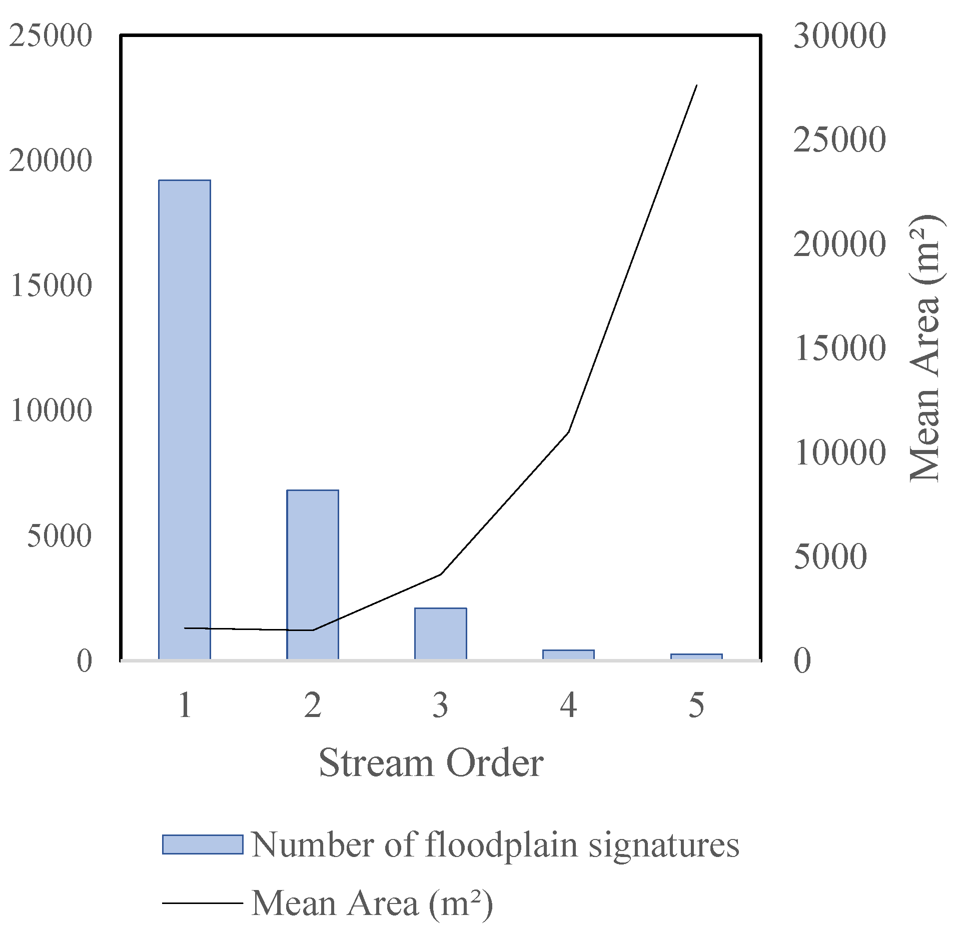
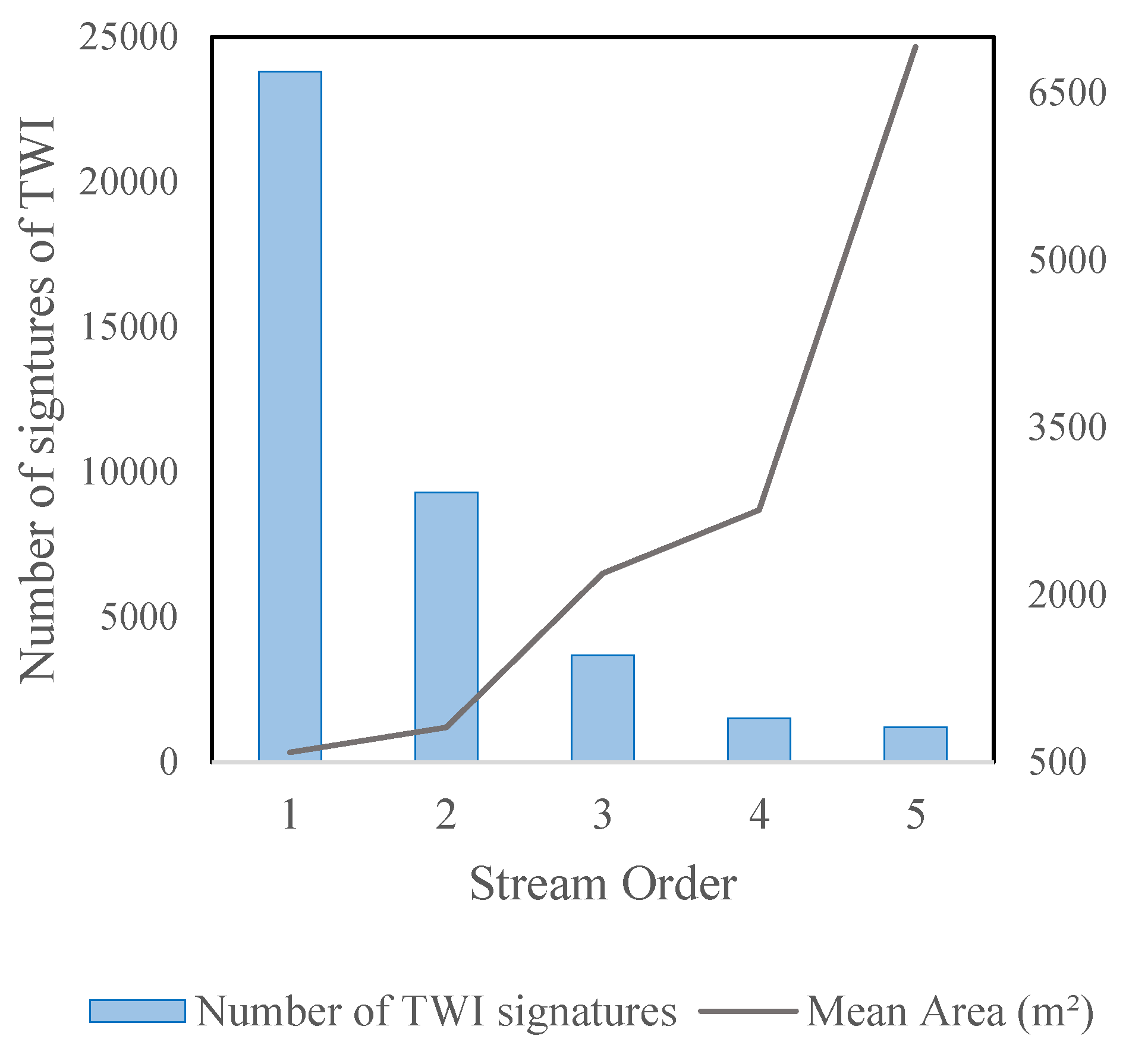
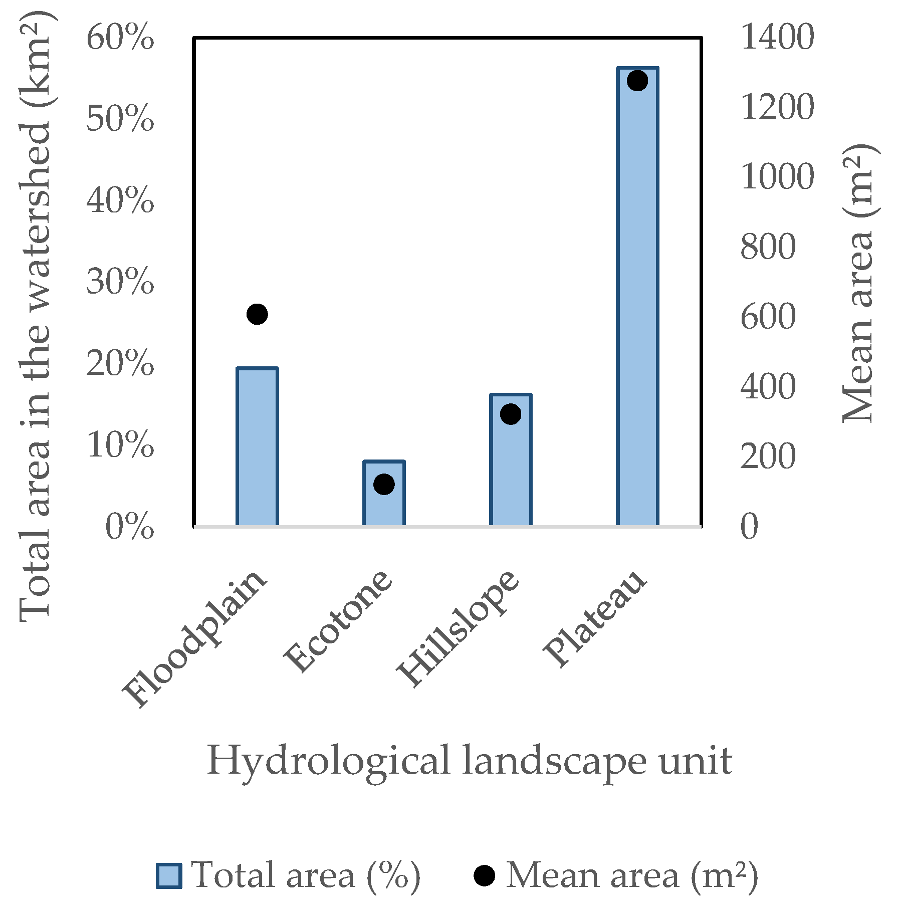
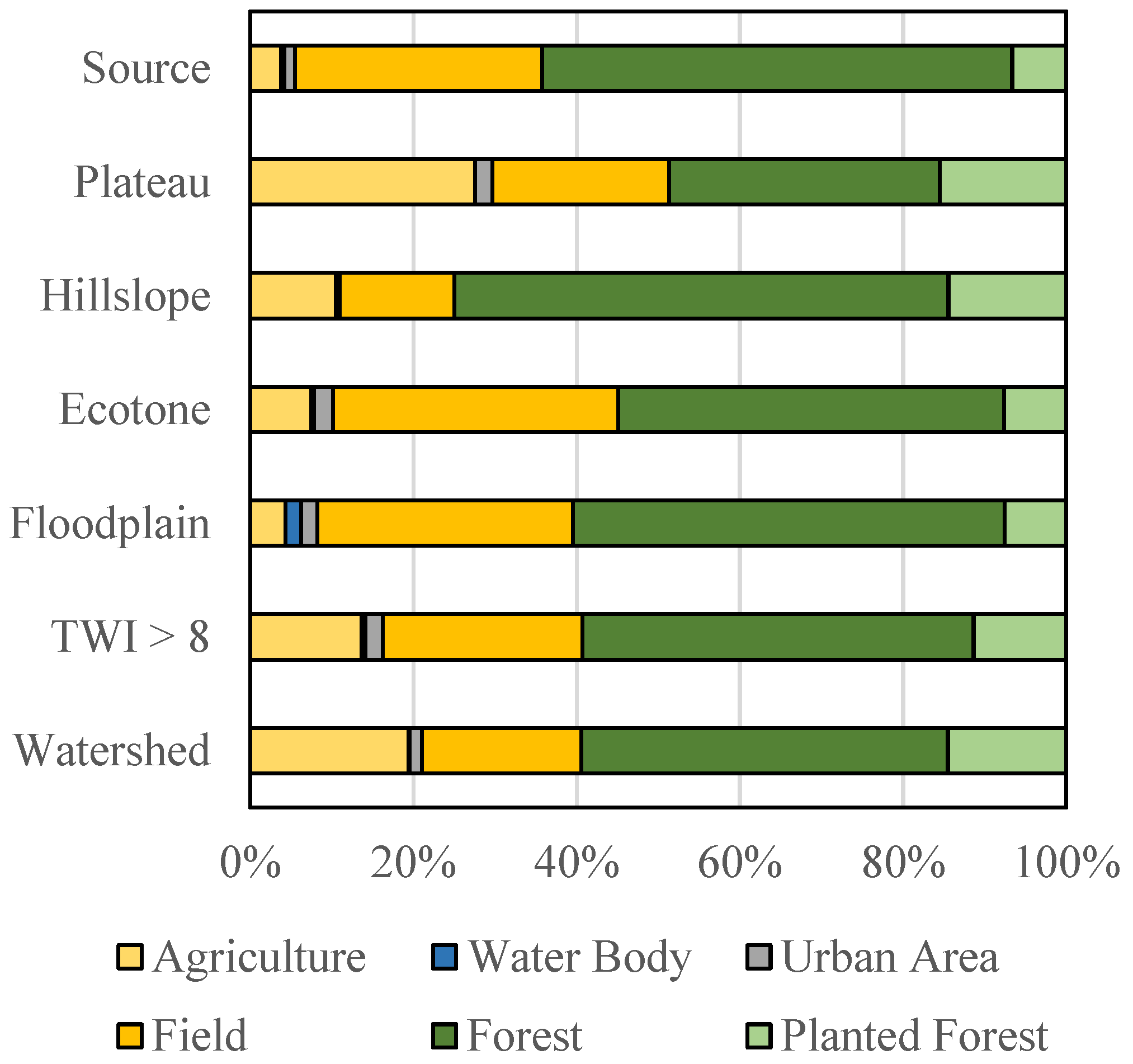
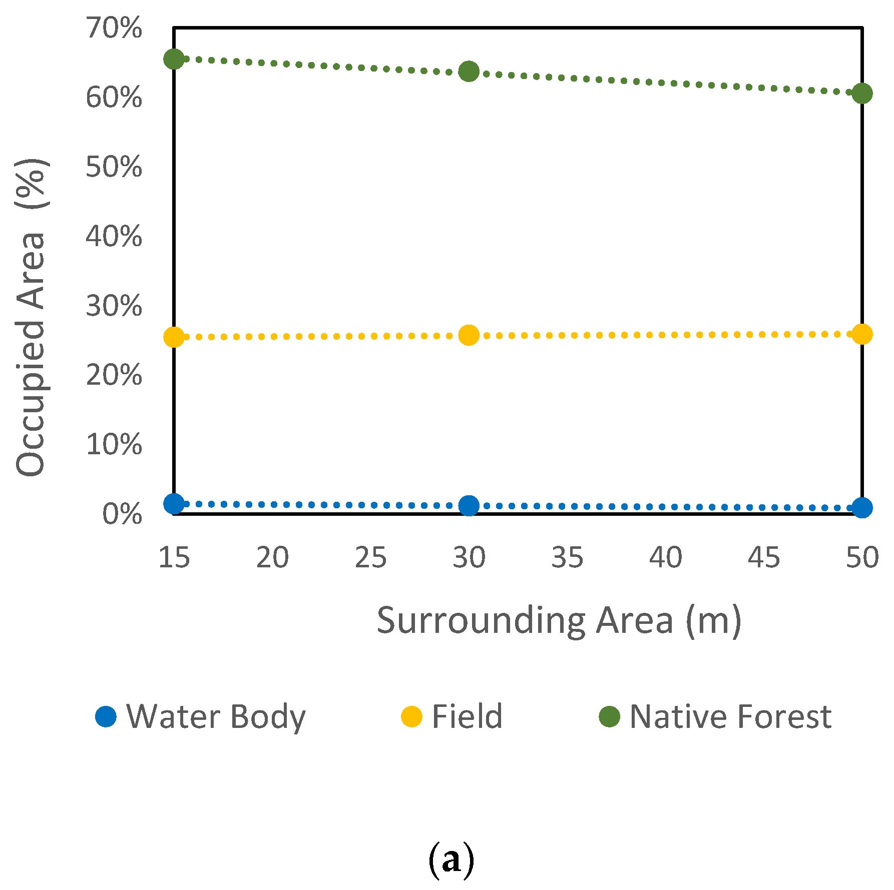
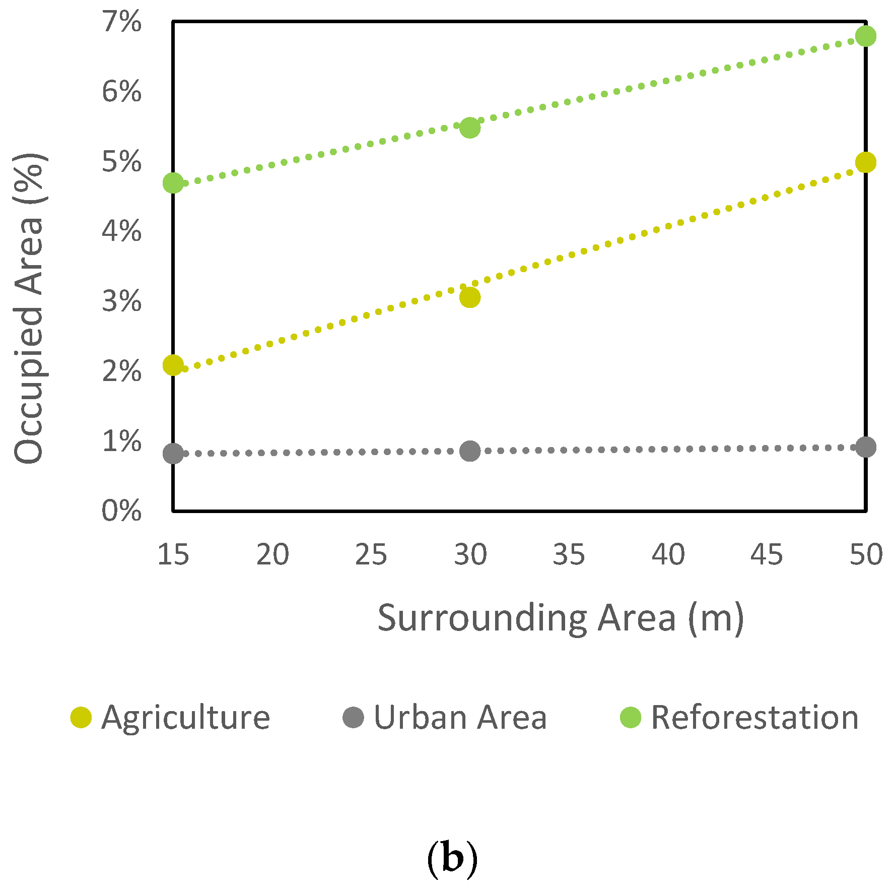
Hydro-based morphological models are representations of the terrain related to the flow or storage of water in the landscape. However, their application in the context of an integrated environmental assessment has been scarcely explored in the literature, despite the well-known importance of water for ecosystems and land use planning. Here, we derive the HAND and TWI models, which present solid conceptual bases based on water–landscape relationships from digital terrain models. We aim to present these models as useful representations in the environmental assessment of watersheds as they are relatively easy to generate and interpret. To this end, we applied these models in a Brazilian watershed and evaluated their spatial and reciprocal occurrence in the hydrological landscape through geographic entities and their spatial relationships with other landscape elements such as land use. We argue that HAND and TWI are simple hydrological-based models with robust premises that can reveal intrinsic relationships between relief parameters and water, providing new perspectives for the environmental assessment of small watersheds. Their outcomes have tremendous implications for land management initiatives. Our results show that geometric signatures of the TWI appeared through all the structural units of the hydrological landscape. The plateau areas were most prone to water accumulation/soil saturation, followed by floodplains, hillslopes, and ecotones. Thus, there is a tendency for the greatest geometric signatures of water accumulation/soil saturation entities to be located near the higher-order channels as well as the greatest geometric signatures of the floodplains. Agriculture and planted forests increased with distance, while the areas occupied by forest remnants tended to decrease within a range of up to 50 m from channels. However, they were also found within 50 m around the springs, whereas open fields, urban areas, and water bodies remained stable. We argue that HAND and TWI are simple hydrological-based models with robust premises that can reveal intrinsic relationships between the relief parameters and water, providing new perspectives for the environmental assessment of small watersheds whose outcomes have tremendous implications for land management initiatives.
Keywords: HAND; topographic wetness index; land use; hydrological landscape; topographic footprint; geometric signature HAND; topographic wetness index; land use; hydrological landscape; topographic footprint; geometric signature