
Gully Erosion Mapping and Monitoring at Multiple Scales Based on Multi-Source Remote Sensing Data of the Sancha River Catchment, Northeast China


 ,
, 
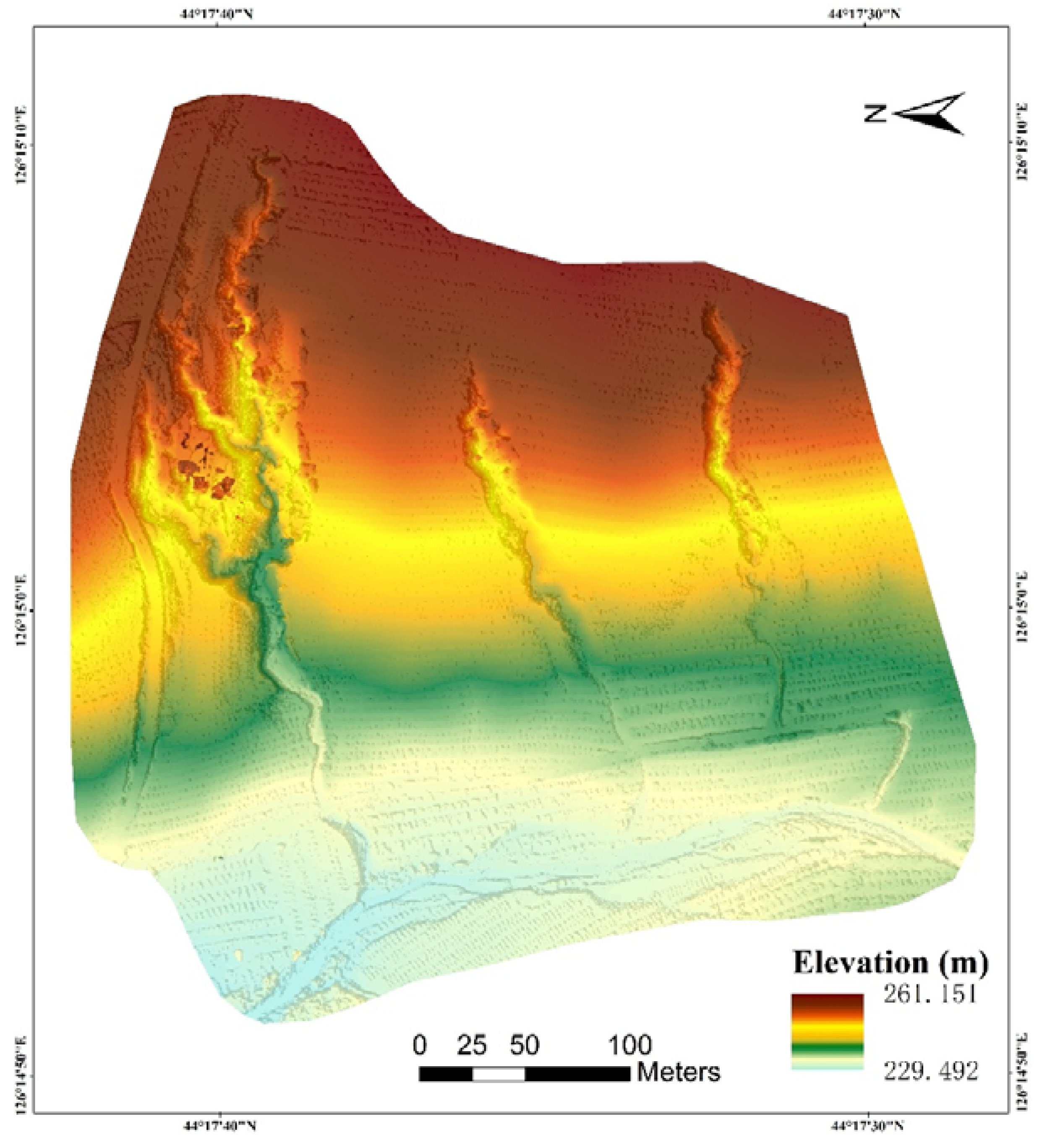
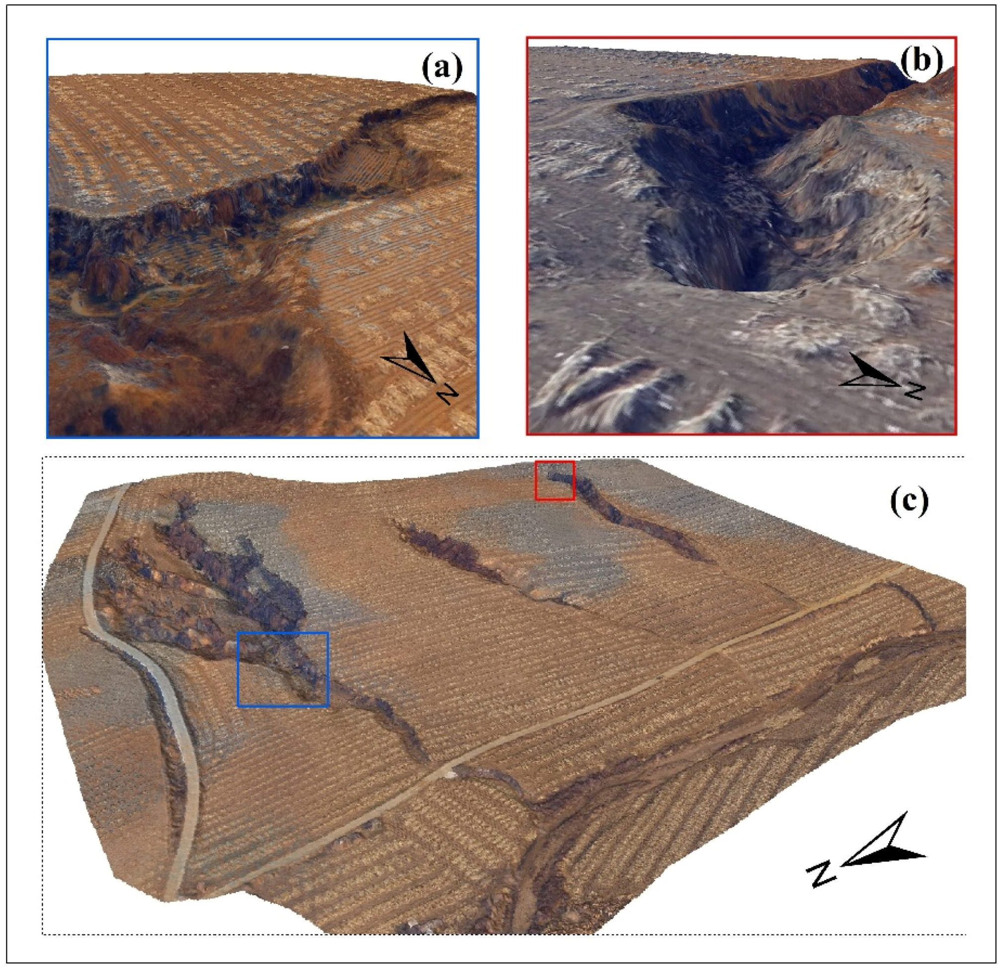
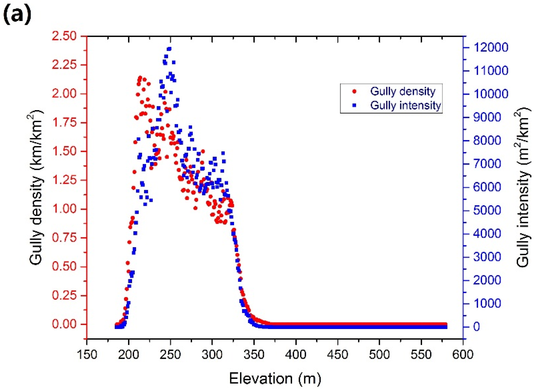
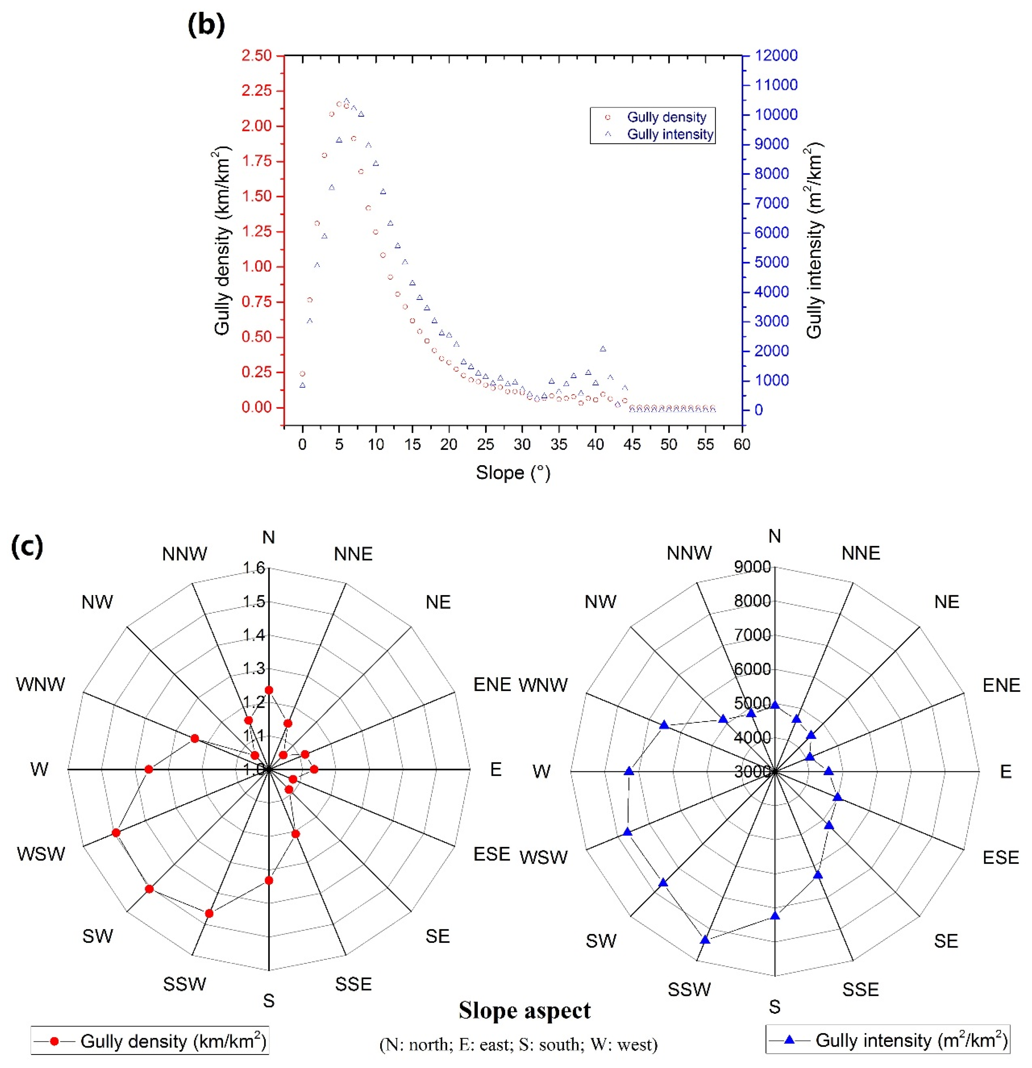
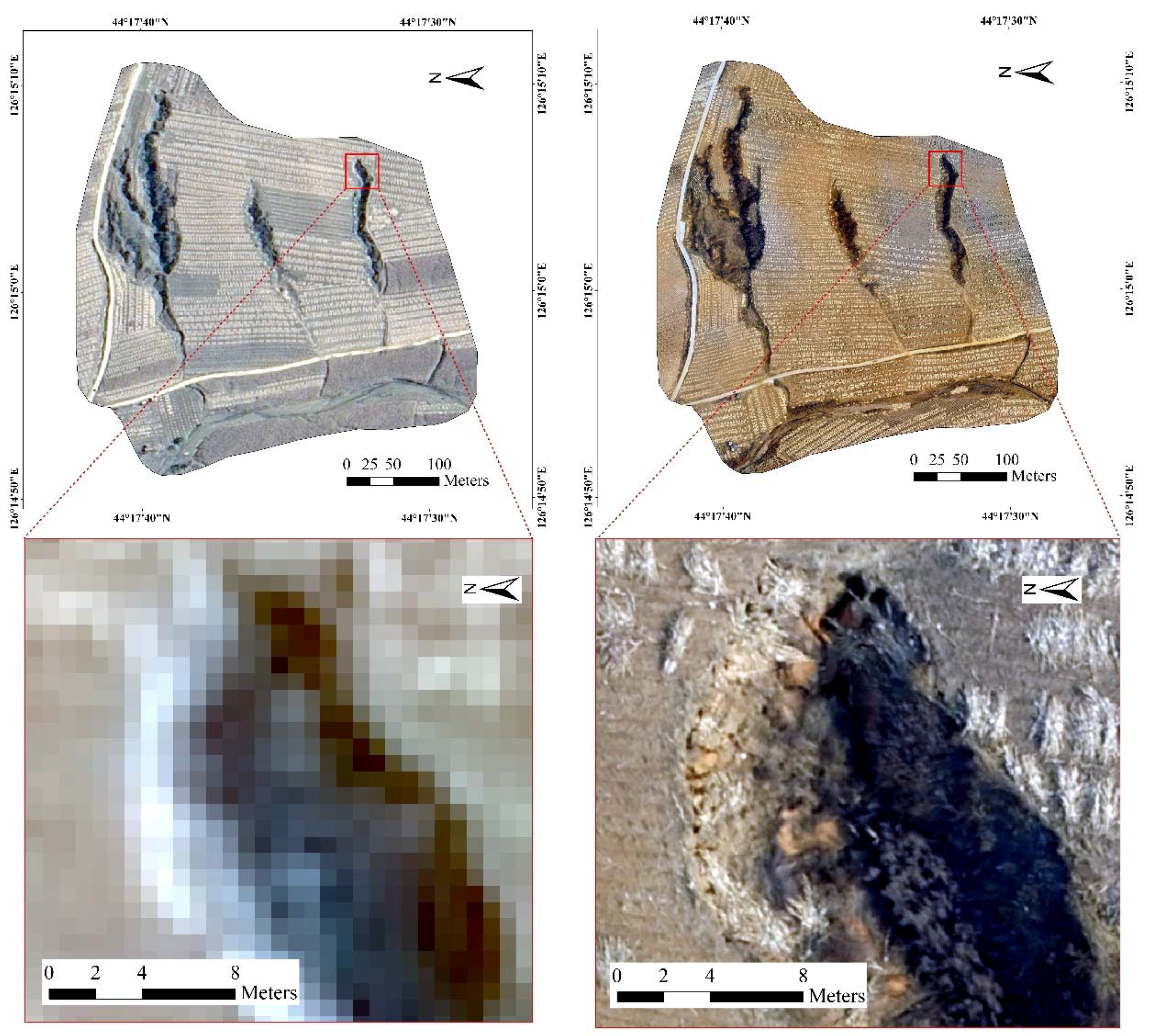
Abstract
Share and Cite
Wang, R.; Zhang, S.; Pu, L.; Yang, J.; Yang, C.; Chen, J.; Guan, C.; Wang, Q.; Chen, D.; Fu, B.; et al. Gully Erosion Mapping and Monitoring at Multiple Scales Based on Multi-Source Remote Sensing Data of the Sancha River Catchment, Northeast China. ISPRS Int. J. Geo-Inf. 2016, 5, 200. https://doi.org/10.3390/ijgi5110200
Wang R, Zhang S, Pu L, Yang J, Yang C, Chen J, Guan C, Wang Q, Chen D, Fu B, et al. Gully Erosion Mapping and Monitoring at Multiple Scales Based on Multi-Source Remote Sensing Data of the Sancha River Catchment, Northeast China. ISPRS International Journal of Geo-Information. 2016; 5(11):200. https://doi.org/10.3390/ijgi5110200
Chicago/Turabian StyleWang, Ranghu, Shuwen Zhang, Luoman Pu, Jiuchun Yang, Chaobin Yang, Jing Chen, Cong Guan, Qing Wang, Dan Chen, Bolin Fu, and et al. 2016. "Gully Erosion Mapping and Monitoring at Multiple Scales Based on Multi-Source Remote Sensing Data of the Sancha River Catchment, Northeast China" ISPRS International Journal of Geo-Information 5, no. 11: 200. https://doi.org/10.3390/ijgi5110200
APA StyleWang, R., Zhang, S., Pu, L., Yang, J., Yang, C., Chen, J., Guan, C., Wang, Q., Chen, D., Fu, B., & Sang, X. (2016). Gully Erosion Mapping and Monitoring at Multiple Scales Based on Multi-Source Remote Sensing Data of the Sancha River Catchment, Northeast China. ISPRS International Journal of Geo-Information, 5(11), 200. https://doi.org/10.3390/ijgi5110200