Mapping Heritage: Geospatial Online Databases of Historic Roads. The Case of the N-340 Roadway Corridor on the Spanish Mediterranean

Abstract
:1. Introduction
1.1. Background: Limitations of Heritage Catalogues
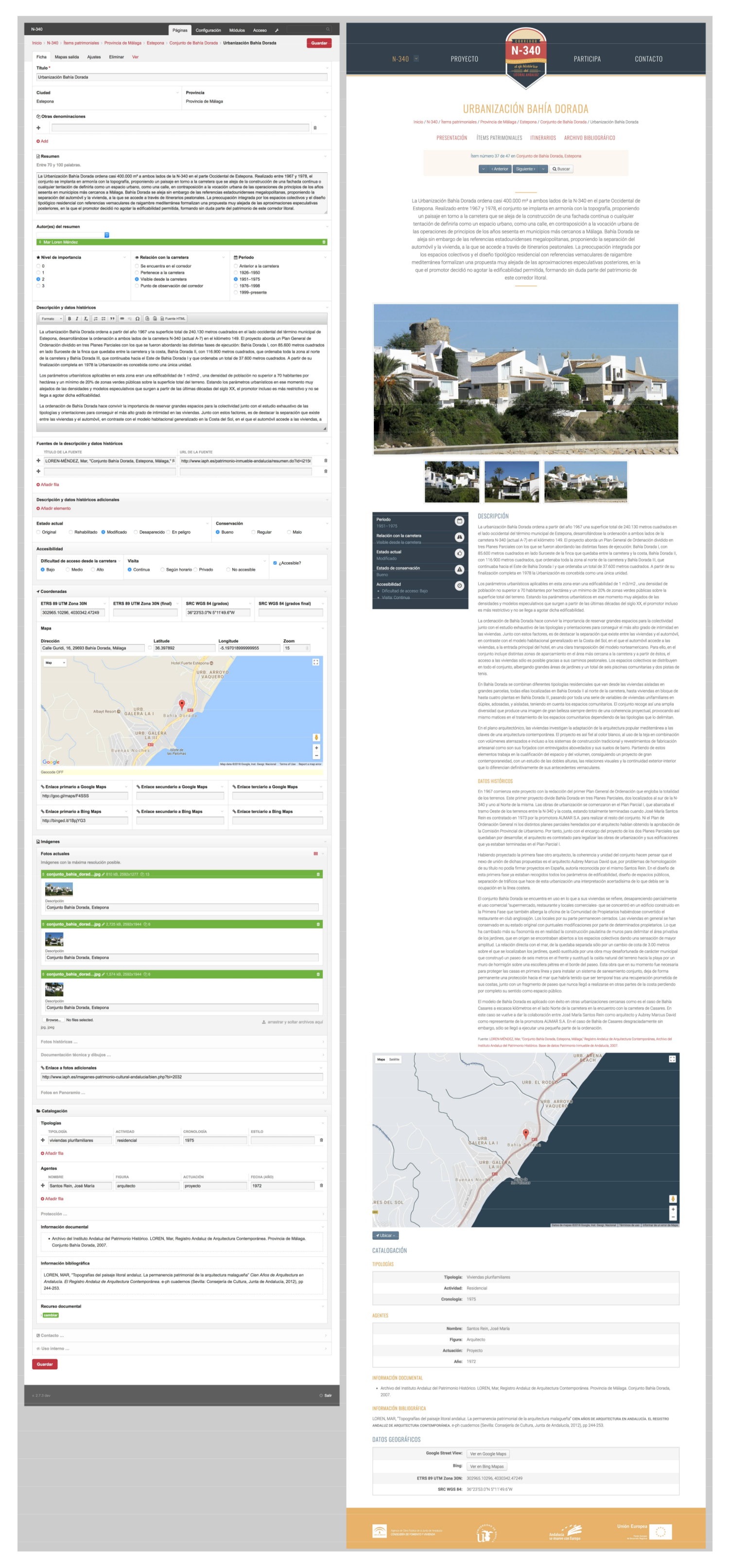
- The isolated character of assets listed in traditional heritage catalogues. In the context of Spain, heritage catalogues included in urban development plans essentially consist of a collection of item cards displaying the heritage protection level, a photograph, a location map, and basic identification data, sometimes supplemented with historical detail. The format makes it difficult to attain a satisfactory integrated overview of the extent and cohesion of the heritage characteristics the city and territory have to offer.
- Although assets are generally indicated on a map, their general isolated itemization is worsened by a lack of systematized geographical information on the databases, thus hindering the process of establishing territorial relationships, locating areas of heritage concentration, and elaborating an integrated heritage reading of the study area. In the last decade, geographical information has been produced with specialized GIS software, accessible in most cases, however, only to experts, rather than researchers, institutions, and the general public.
- The rigidity of heritage databases systemizing cultural heritage in general, and architectural, urban, and archaeological heritage in particular.
1.2. Current State of the Research Field
2. System Design: Consistency in the Conceptual Methodology Applied to the Characterization of Heritage
- Sufficiently flexible to include all the different layers of heritage, while ensuring utmost rigor.
- A user-friendly work tool, while remaining coherent within the different fields of expertise involved.
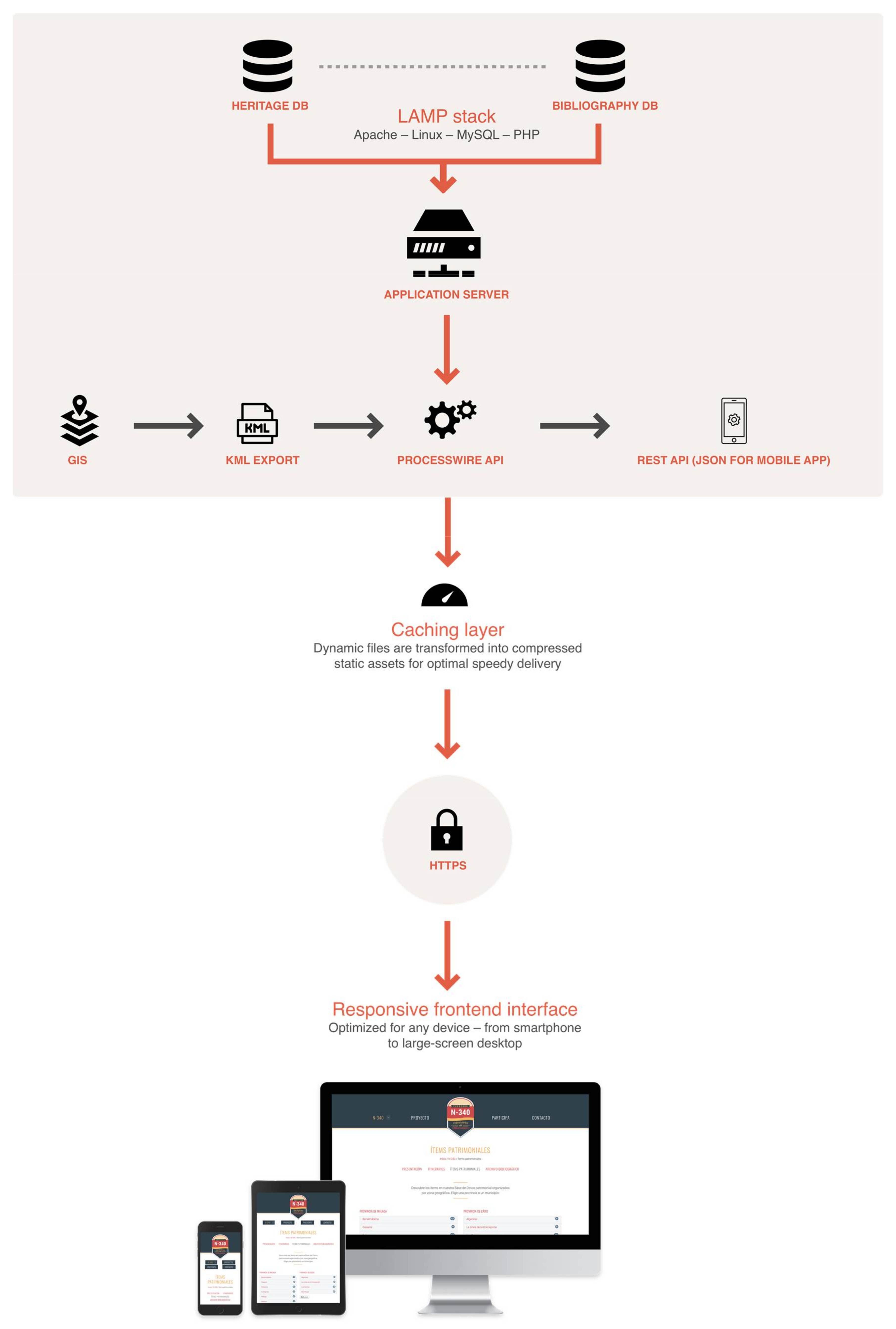
2.1. Flexibility of the System: ProcessWire
2.2. A Secondary Database: A Specialized and Accessible Bibliographical Archive
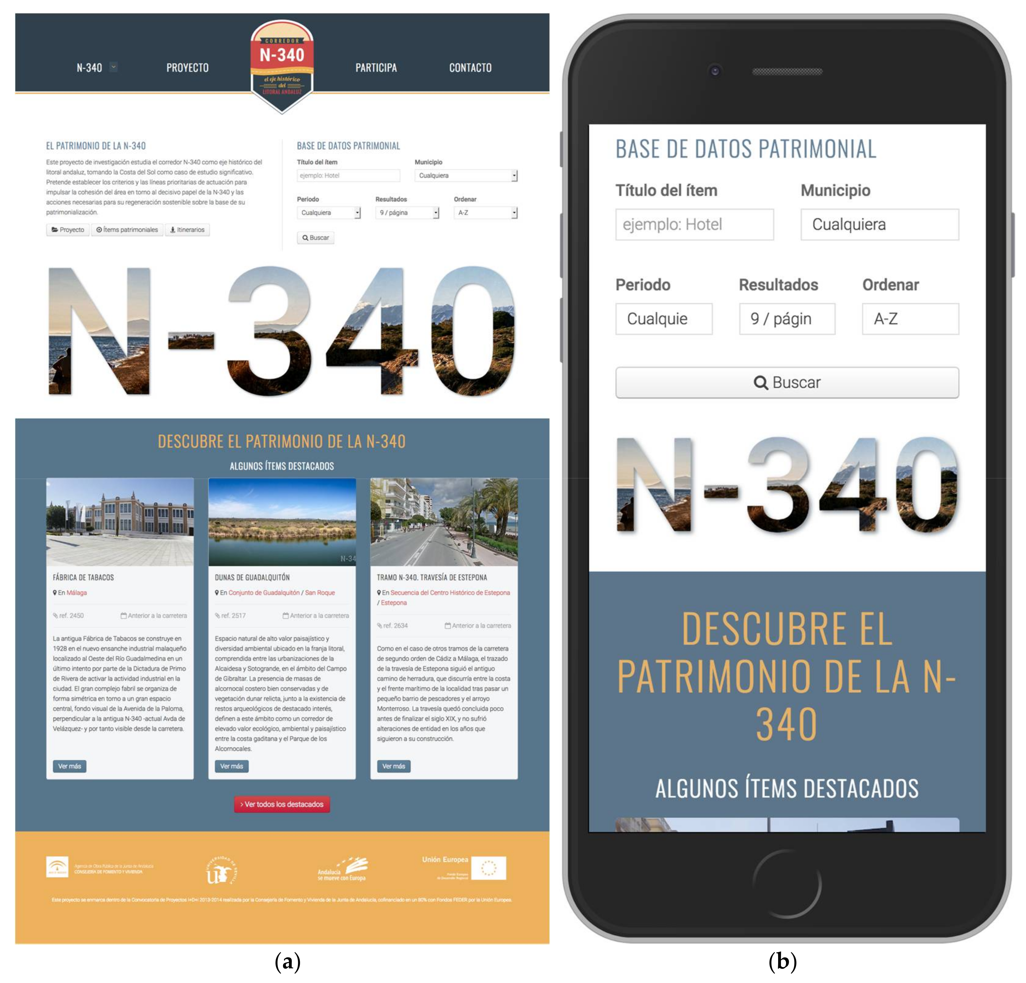
2.3. Usability of the System: Instant Public Access to a Working Tool for Research Collaboration
3. Geospatial Heritage Characterization
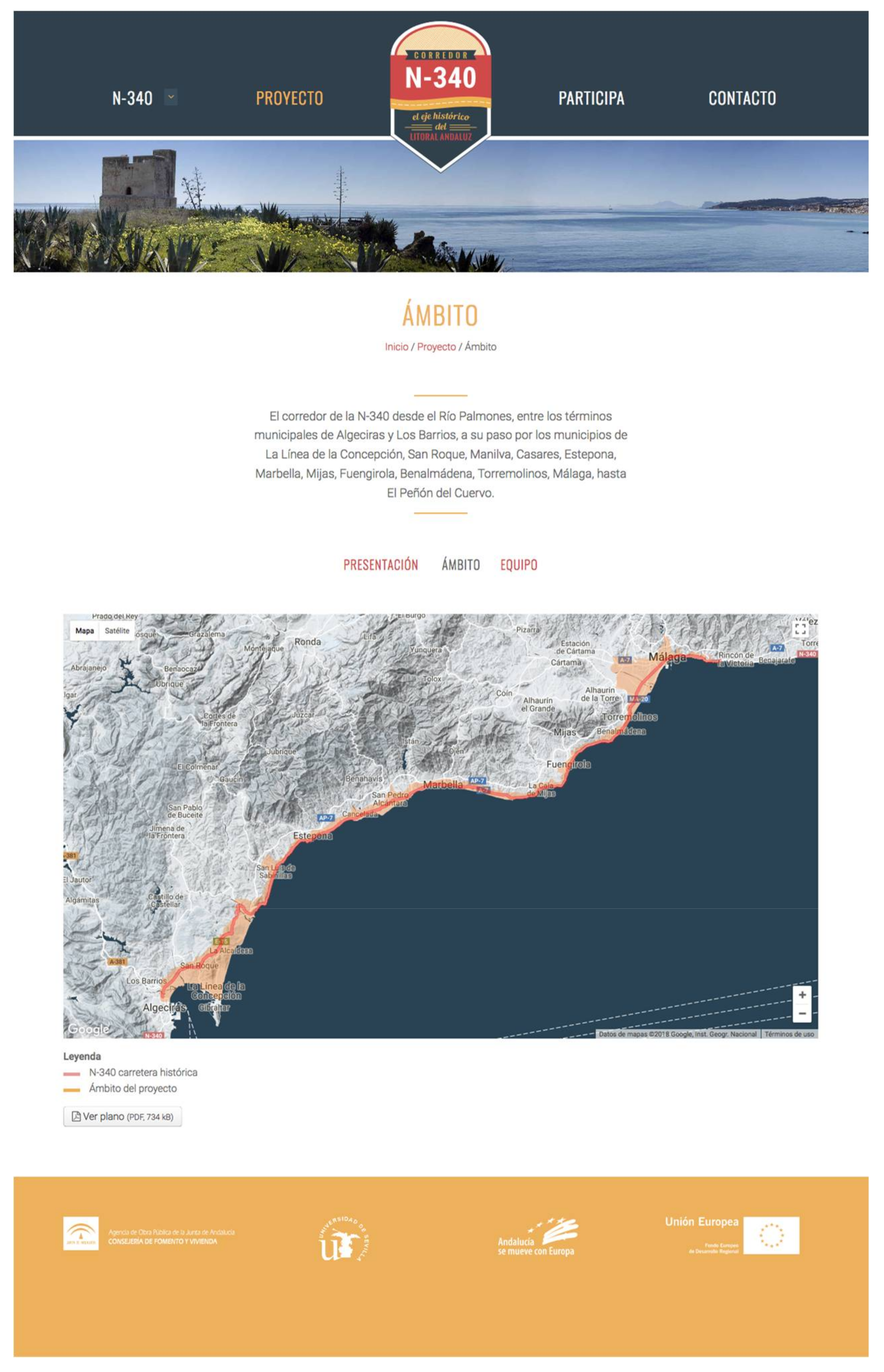
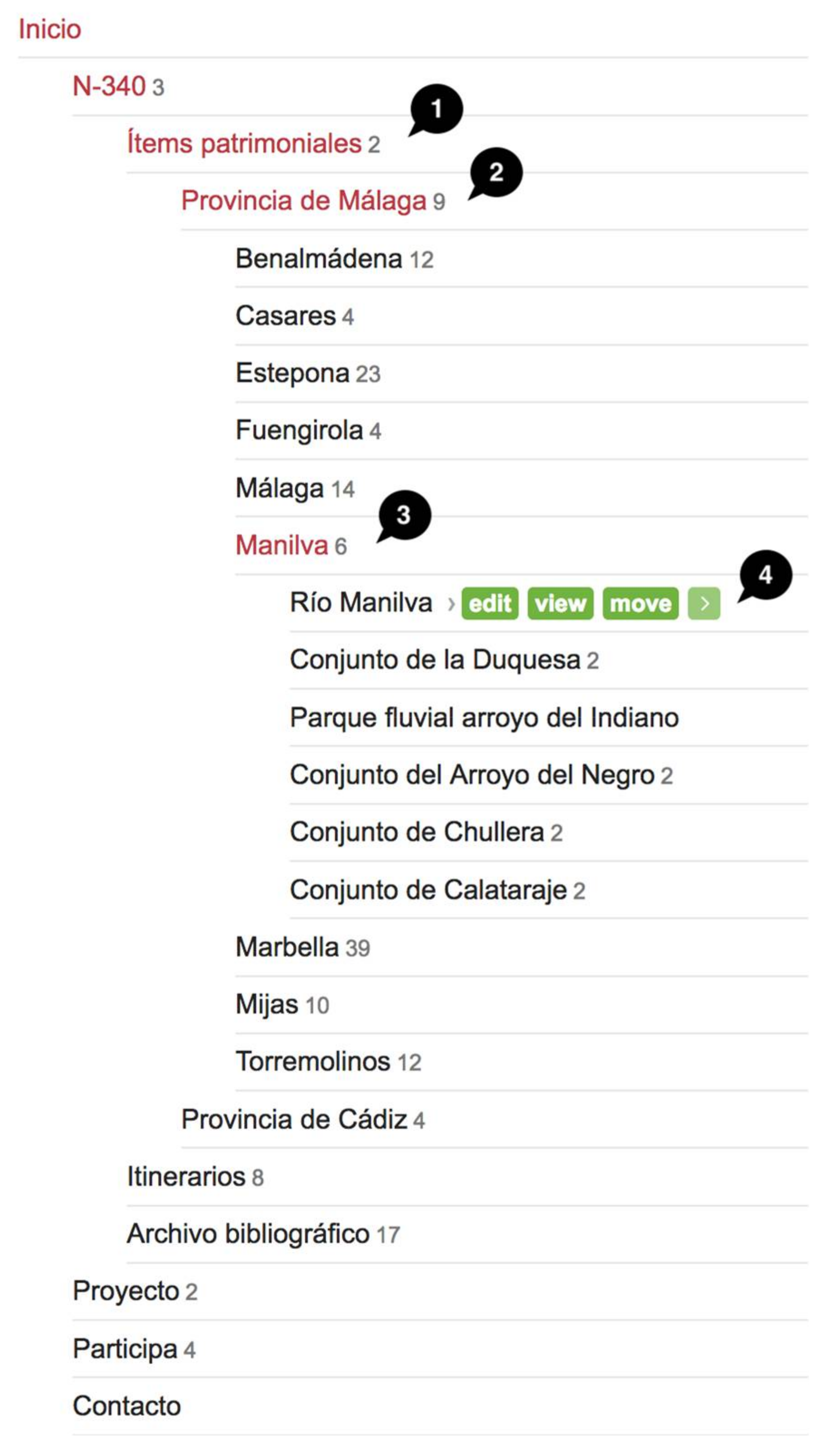
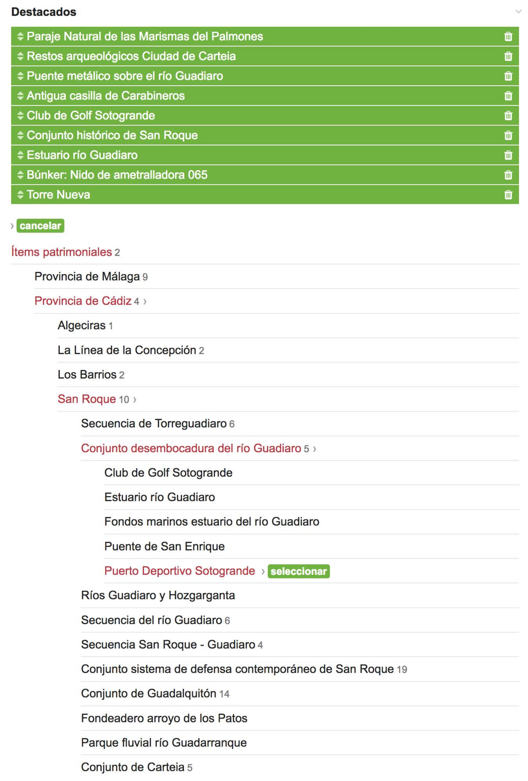
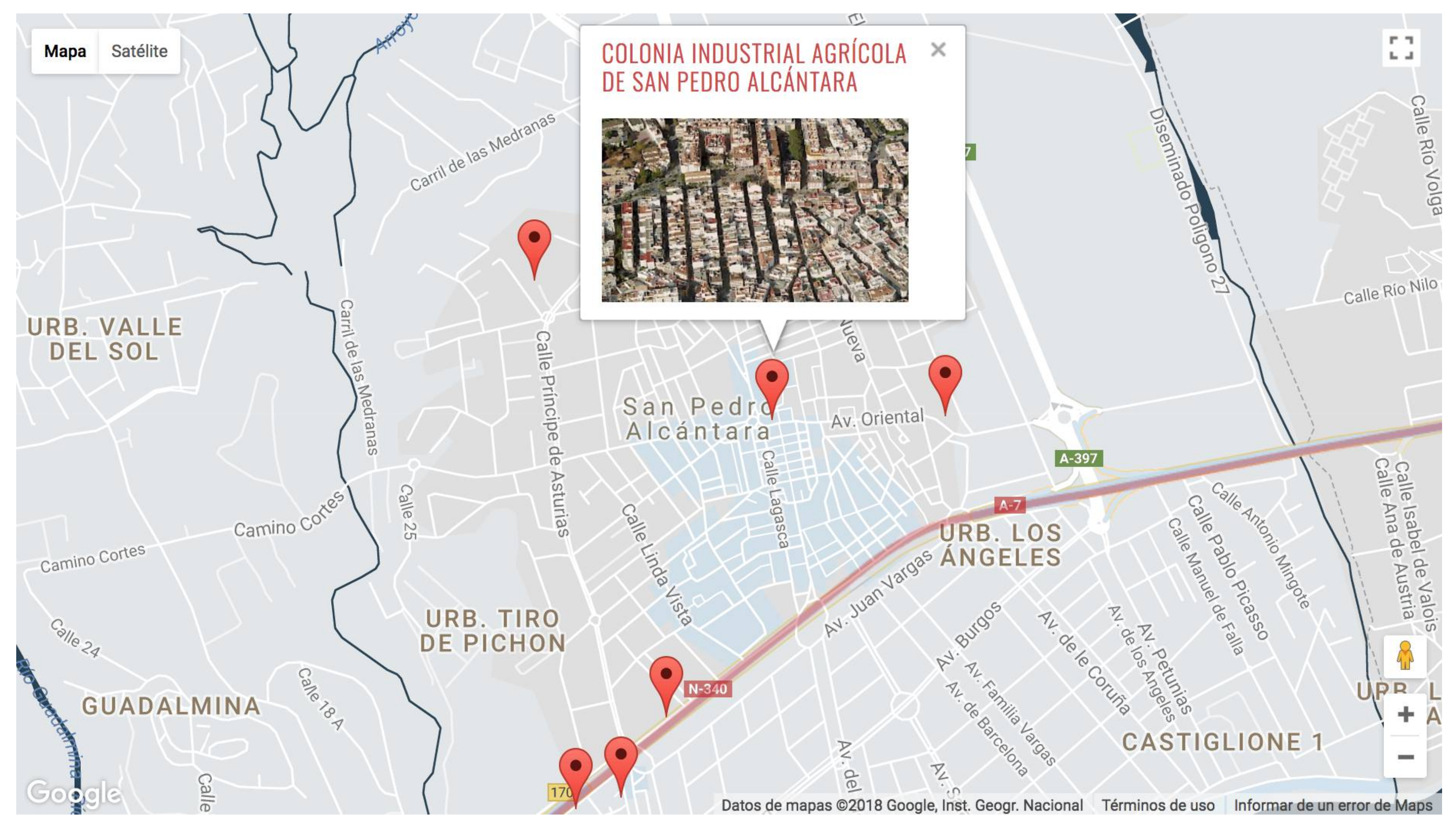
3.1. Producing Geo-Information in the Heritage Database: The Different Scales: Heritage Item, Sequence, and Itineraries
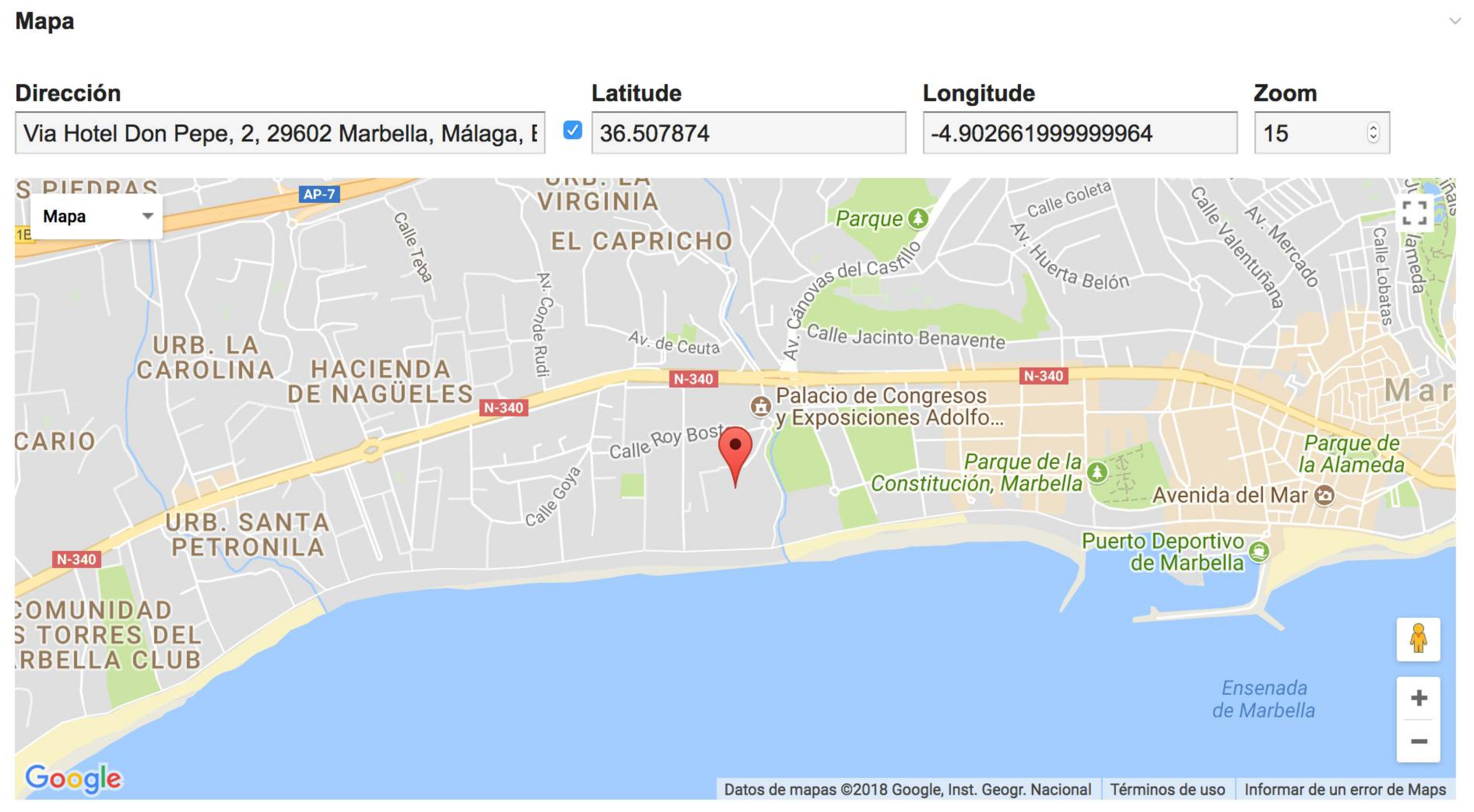
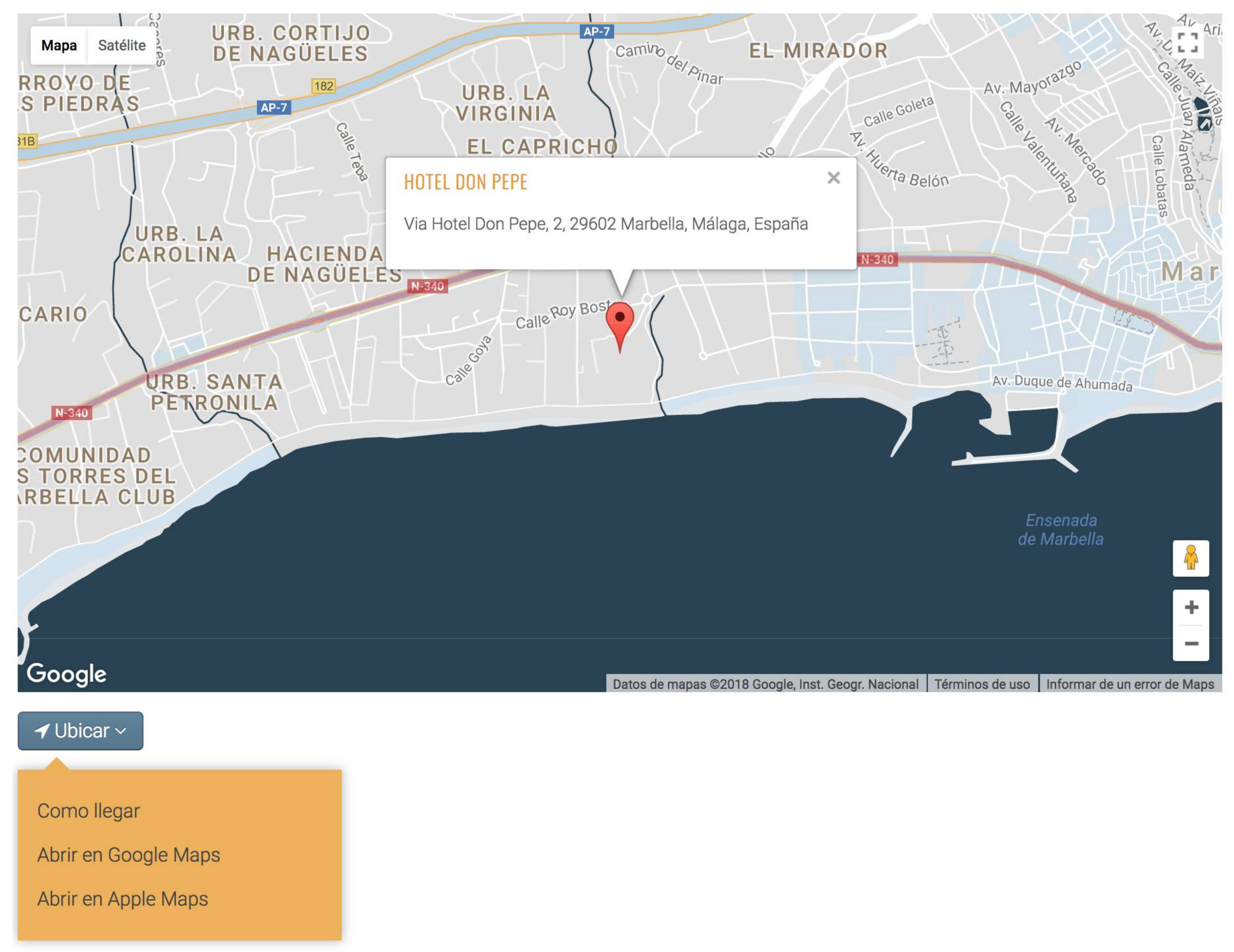
3.2. Geo-Accessibility: The Use of Google Maps in Conjunction with GIS
4. Results
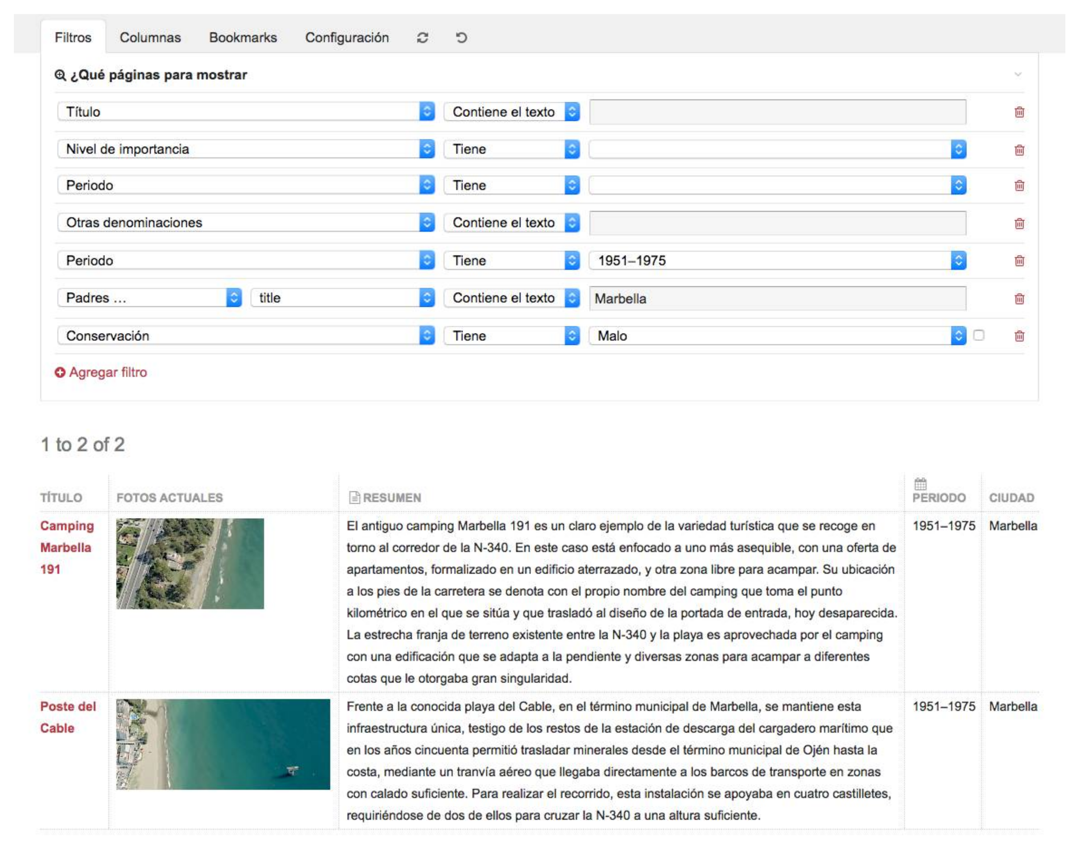
4.1. An Online Geospatial Heritage Database
4.2. Bibliographical Archive
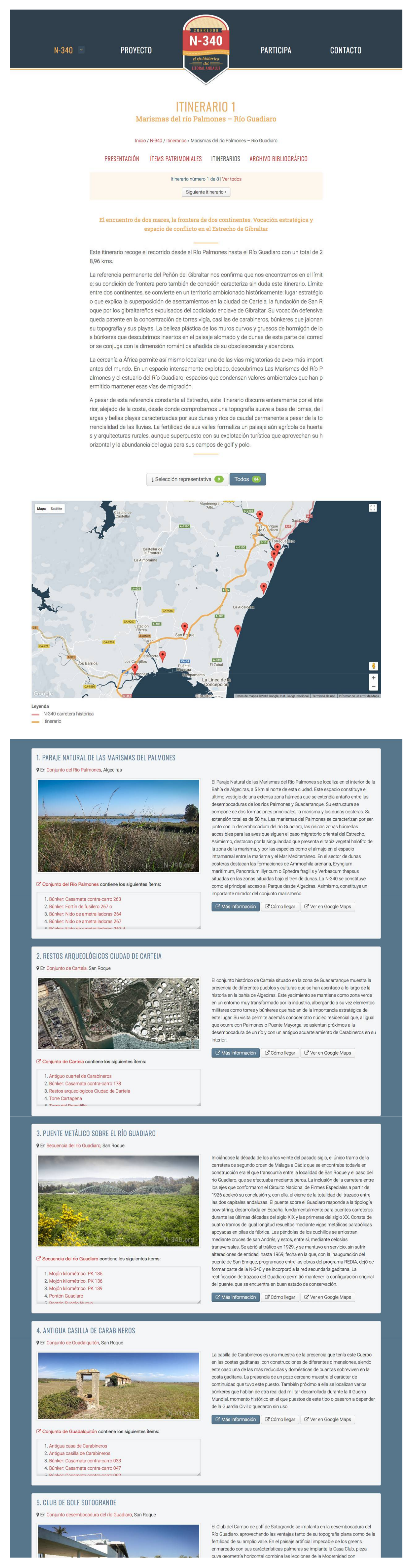
4.3. The Development of the Itineraries
4.4. An Intuitive, Real-Time Collaborative Tool for Researchers
5. Discussion
Acknowledgments
Author Contributions
Conflicts of Interest
References
- Loren-Méndez, M.; Mata-Olmo, R.; Ruiz, R.; Pinzón-Ayala, D. An interdisciplinary methodology for the characterization and visualization of the heritage of roadway corridors. Geogr. Rev. 2016, 106, 489–515. [Google Scholar] [CrossRef]
- Agathos, M.; Sarantos, K. Discovering current practices for records of historic buildings and mapping them to standars. In Proceedings of the First Workshop on Digital Information Management, Corfu, Greece, 30–31 March 2011. [Google Scholar]
- Giaccardi, E.; Leysia, P. The social production of heritage through cross-media interaction: Making place for place-making. Int. J. Heritage Stud. 2008, 14, 281–297. [Google Scholar] [CrossRef]
- Carlisle, P.K.; Avramides, I.; Dalgity, A.; Myers, D. The arches heritage inventory and management system: A standards-based approach to the management of cultural heritage information. In Proceedings of the Access and Understanding-Networking in the Digital Era, Dresden, Germany, 6–11 September 2014. [Google Scholar]
- Morrish, S.; Laefer, D.F. Web-enabling of architectural heritage inventories. Int. J. Archit. Heritage 2009, 4, 16–37. [Google Scholar] [CrossRef]
- Kaimaris, D.; Sylaiou, S.; Georgoula, O.; Patias, P. GIS of landmarks management. J. Cult. Heritage 2011, 12, 65–73. [Google Scholar] [CrossRef]
- Maio, C.V.; Tenenbaum, D.E.; Brown, C.J.; Mastone, V.T.; Gontz, A.M. Application of geographic information technologies to historical landscape reconstruction and military terrain analysis of an american revolution battlefield: Preservation potential of historic lands in urbanized settings, Boston, Massachusetts, USA. J. Cult. Heritage 2013, 14, 317–331. [Google Scholar] [CrossRef]
- Li, R.Y.M. 5D GIS virtual heritage. In Proceedings of the 8th International Conference on Advances in Information Technology (IAIT 2016), Macau, China, 19–22 December 2016. [Google Scholar]
- Fernández Cacho, S.; García Sanjuán, L. Los SIG en la tutela del Patrimonio Arqueológico de Andalucía. In Jornadas Técnicas ‘Patrimonio y Territorio. Desarrollo de estrategias en entornos SIG’; Activos Digitales IAPH: Aracena/Huelva, Spain, 2003. [Google Scholar]
- Villafranca, M.; Lamolda, F.; Montufo, A.M.; Pérez, L.; Prados, B. El Sistema de Información de la Alhambra SIALH. Nuevas tecnologías en la tutela del Conjunto Monumental de la Alhambra y el Generalife. Virt. Archaeol. Rev. 2012, 3, 13–17. [Google Scholar] [CrossRef]
- Maiellaro, N.; Varasano, A. One-page multimedia interactive map. Int. J. Geo-Inf. 2017, 6, 34. [Google Scholar] [CrossRef]
- Anguix, A.; Higón, J.V.; Herráez, J. SIG del Departamento de Conservación Preventiva del Instituto de Patrimonio Cultural de Espala. Mapping 2017, 26, 52–56. [Google Scholar]
- Rodríguez Pérez, S. SIG y Gestión de Bases de Datos: Una aplicación en el estudio arqueológico de la arquitectura tradicional del occidente asturiano. Sémata 2015, 27, 239–264. [Google Scholar]
- Angheluță, L.M.; Ratoiu, L.; Chelmus, A.I.; Rădvan, R.; Petculescu, A. Integrated digital platform for the valorization of a cultural landscape. In Proceedings of the Geomatics & Restoration—Conservation of Cultural Heritage in the Digital Era, Florence, Italy, 22–24 May 2017. [Google Scholar]
- Myers, D. Heritage inventories: Promoting effectiveness as a vital tool for sustainable heritage management. J. Cult. Heritage Manag. Sustain. Dev. 2016, 2, 102–112. [Google Scholar] [CrossRef]
- Jan, J.-F. Digital heritage inventory using open source geospatial software. In Proceedings of the 22nd International Conference on Virtual System Multimedia (VSMM 2016), Kuala Lumpur, Malaysia, 17–21 October 2016. [Google Scholar]
- Li, Q.; Mao, F.; Zhou, W. Study on the grand canal conservation geographic information system. Geomat. World 2009, 3. [Google Scholar] [CrossRef]
- Eizaguirre-Iribar, A.; Etxepare-Igiñiz, L.; Hernández-Minguillón, R.J. The analysis of disused railway lines as complex systems: GIS-based inventory and comprehensive analysis method. Int. J. Sustain. Dev. Plan. 2017, 12, 1018–1031. [Google Scholar] [CrossRef]
- Duperré, G.N. Proposing a digital information system for the management and conservation of the Qhapaq Ñan—Andean road system. In Proceedings of the International Archives of the Photogrammetry, Remote Sensing and Spatial Information Sciencies, Ottawa, ON, Canada, 28 August–1 September 2017. [Google Scholar]
- Miller, W.; Collins, M.G.; Steiner, F.R.; Cook, E. An approach for greenway suitability analysis. Landsc. Urban Plan. 1998, 42, 91–105. [Google Scholar] [CrossRef]
- Mizutani, Y.; Yamamoto, K. A sightseeing spot recommendation system that takes into account the change in circumstances of users. Int. J. Geo-Inf. 2017, 6, 303. [Google Scholar] [CrossRef]
- Bhati, A.; Pryce, J.; Chaiechi, T. Industrial railway heritage trains: the evolution of a heritage tourism genre and its attributes. J. Heritage Tour. 2014, 9, 114–133. [Google Scholar] [CrossRef]
- Ha, I.; Grunwell, S.S. The economic impact of a heritage tourism attraction on a rural economy: The great smoky mountains railroad. Tour. Anal. 2011, 16, 629–636. [Google Scholar] [CrossRef]
- Bennis, E.; Davison, M. Hit the road: Preserving historic routes. In Proceedings of the UNESCO Cultural Landscapes for the 21st Century, Newcastle, UK, 11–16 April 2005. [Google Scholar]
- Barthuli, K.; Romero Taylor, M. Route 66: Opening the Way for the Protection and Management of Historic Routes. Thema Collect. 2015, 4, 76–84. [Google Scholar]
- What Differentiates Process Wire? Available online: https://processwire.com/about/what (accessed on 21 January 2018).
- Meyer, E.; Grussenmeyer, P.; Perrin, J.P.; Durand, A.; Drap, P. A web information system for the management and the dissemination of cultural heritage data. J. Cult. Heritage 2007, 8, 396–411. [Google Scholar] [CrossRef]


© 2018 by the authors. Licensee MDPI, Basel, Switzerland. This article is an open access article distributed under the terms and conditions of the Creative Commons Attribution (CC BY) license (http://creativecommons.org/licenses/by/4.0/).
Share and Cite
Loren-Méndez, M.; Pinzón-Ayala, D.; Ruiz, R.; Alonso-Jiménez, R. Mapping Heritage: Geospatial Online Databases of Historic Roads. The Case of the N-340 Roadway Corridor on the Spanish Mediterranean. ISPRS Int. J. Geo-Inf. 2018, 7, 134. https://doi.org/10.3390/ijgi7040134
Loren-Méndez M, Pinzón-Ayala D, Ruiz R, Alonso-Jiménez R. Mapping Heritage: Geospatial Online Databases of Historic Roads. The Case of the N-340 Roadway Corridor on the Spanish Mediterranean. ISPRS International Journal of Geo-Information. 2018; 7(4):134. https://doi.org/10.3390/ijgi7040134
Chicago/Turabian StyleLoren-Méndez, Mar, Daniel Pinzón-Ayala, Rita Ruiz, and Roberto Alonso-Jiménez. 2018. "Mapping Heritage: Geospatial Online Databases of Historic Roads. The Case of the N-340 Roadway Corridor on the Spanish Mediterranean" ISPRS International Journal of Geo-Information 7, no. 4: 134. https://doi.org/10.3390/ijgi7040134
APA StyleLoren-Méndez, M., Pinzón-Ayala, D., Ruiz, R., & Alonso-Jiménez, R. (2018). Mapping Heritage: Geospatial Online Databases of Historic Roads. The Case of the N-340 Roadway Corridor on the Spanish Mediterranean. ISPRS International Journal of Geo-Information, 7(4), 134. https://doi.org/10.3390/ijgi7040134