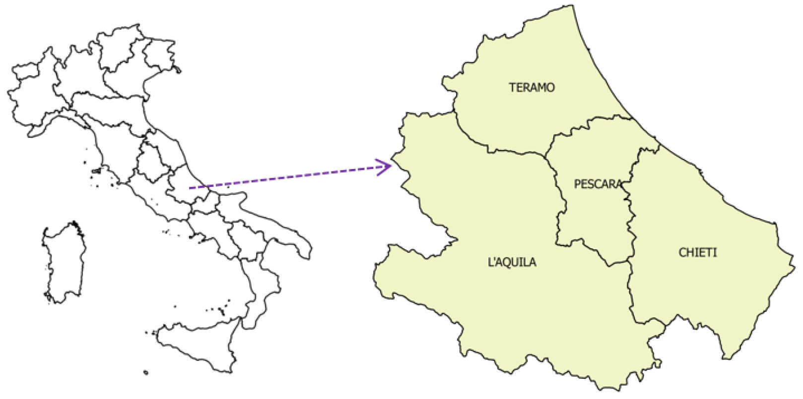
2.1. Relevance of the Problem
Kundzewicz et al. [
4] pointed out that in the near future in Europe the risk of flooding will increase. To limit the damages caused by this hazard, it will be fundamental to (a) make urban planning that takes into account this increased hazard—a suggestion emerged also from other studies (e.g., [
5]); (b) increase the severity of intervention against the IBs.
Many studies have investigated the impact of urbanization on flood events (e.g., [
5,
6,
7,
8,
9,
10,
11,
12,
13,
14,
15]). According to the findings in the study by Agbola et al. [
6], besides prolonged rainfalls and river overflows, there are
anthropogenic factors of flooding. Uncontrolled building construction is a relevant factor because such constructions obstruct the free flow of water (and, as a consequence, they are at high risk of being flooded). Reporting about the August 2011 flood in Ibadan (Nigeria), Agbola et al. [
6] say that in the city there were 600 buildings close to the riverbanks.
The remainder of this section focuses on the phenomenon of IBs. In recent decades, municipalities and governments in all parts of the world have been struggling against IBs. The problem of IBs is becoming dramatic in developing countries due to the population explosion (a case study about informal settlements in Bandung, Indonesia, is reported by Jones, [
16]. References [
17,
18,
19] are further papers on the same tipic). In [
19], Qian reported that in 2013, in Shenzhen (China), the IBs were 273,000, covering about 43% of the total construction area. Unfortunately, IBs are an unsolved issue also in the so-called
advanced states. This is the case of Italy (e.g., [
20,
21]).
In 2007, LegAmbiente, an Italian nongovernmental organization, published the results of a nationwide study [
22]. In the report, it is mentioned that 402,676 IBs were built in Italy from 1994 to 2003. In 2018, LegAmbiente published the results of another study, [
23]. The data refer to the registered violations (i.e., the infringements for which a demolition sentence was issued) in
all the Italian regions. The report covers the period from 2005–(June) 2018 (in 2004, in Italy there was the last building amnesty). 57,432 is the total number of registered infringements.
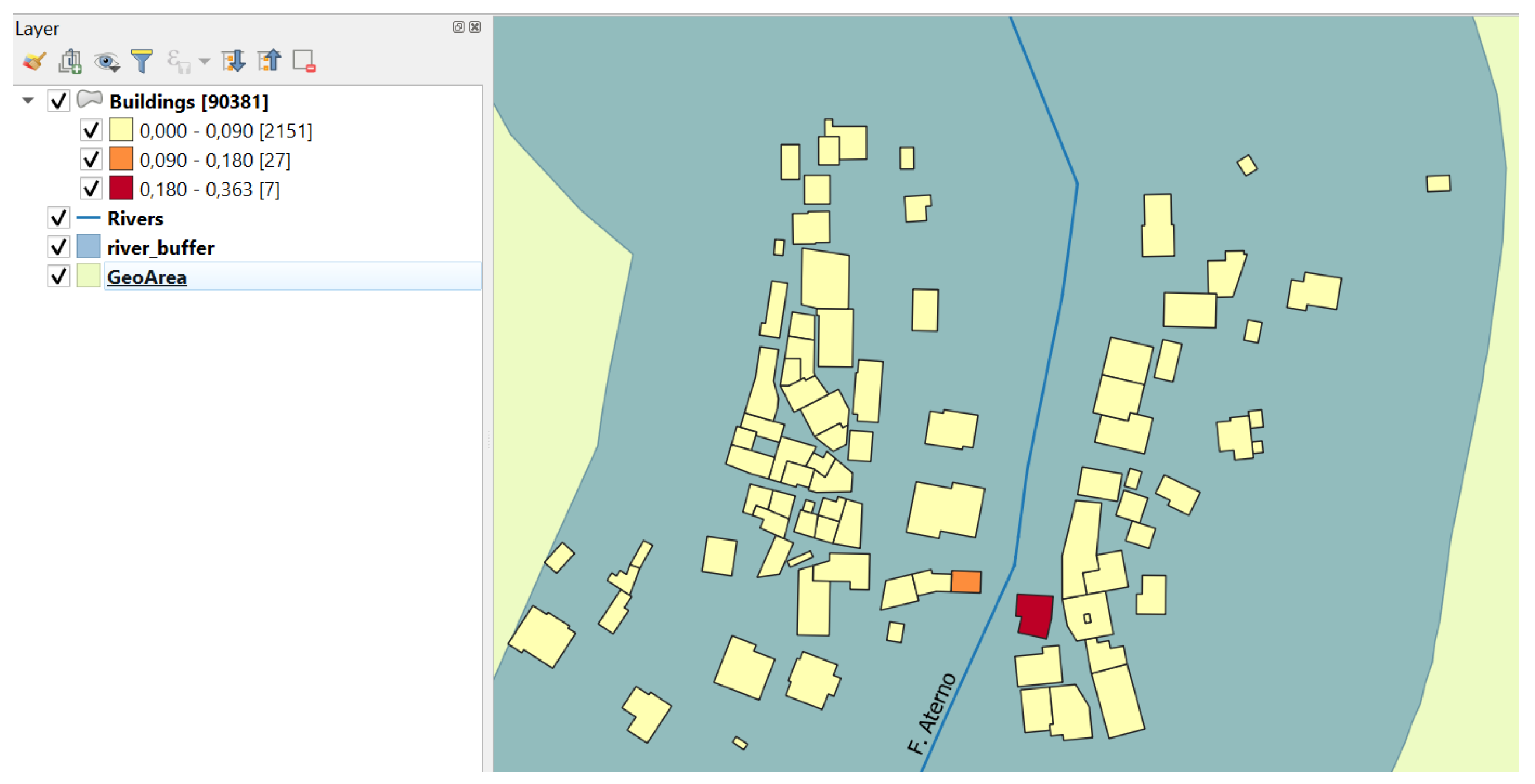
Table 1 (taken from [
21]) gives the index of IBs in Italy (i.e., the ratio between the number of unauthorized buildings to the number of building permits issued by municipalities). The relevance of detecting IBs in Italy was stressed also by Cialdea and Quercio [
24] with a case study concerning illegal settlements in the city of Campobasso (the capital of the Molise region, South of Italy) and its hinterland.
So far, several methods have been proposed for automatic building detection from high-resolution remote sensing images ([
25,
26,
27,
28,
29]); few of them are specifically focused on IBs detection (e.g., [
30,
31,
32,
33,
34]). Soon, most of them will be available on the marketplace as a plugin of GIS software. This is the easiest and fastest way to produce cyclically new datasets about the study area of interest to keep the underlying SDB updated.
Today, many urban planning departments all over the world use a Land Information System software to deal with IBs; for example Yang et al. [
33] describe the architecture of one of them. A relevant part of those systems is the SDB storing city maps in the vector data format. Our proposal can be seen as an extra functionality of these systems, since it operates on data stored into the SDB.
In order to protect the environment, and hence people, land authorities must respond to the challenge of IBs by demolishing them. However, where the phenomenon of constructions against the law is extended, it is essential to help land managers with an IT tool that guides them in prioritizing demolitions. Using remote sensing methods, the suspicious buildings can be identified with a good approximation (even if rarely with 100% accuracy), but all them remain ex aequo. Returning to the land authorities, the ranking of the IBs overcomes this shortcoming.
In this paper, we give a contribution to the solution of the problem of ranking the IBs to be demolished located close to rivers, in connection to two Italian laws. The laws we refer to are Law no. 42 of 2004 and Law no. S 580-B of 2018. Our proposal is general, so it can be adapted to the laws of other countries.
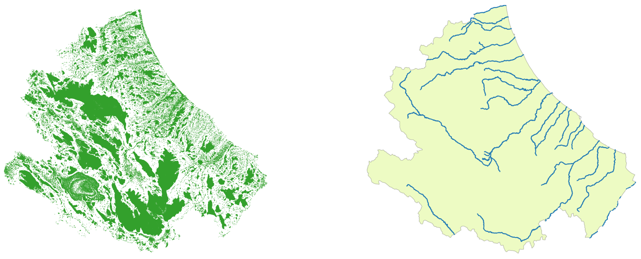
As already mentioned, Article 142 of Law no. 42 fixes in 150 m the width of the
around rivers. Law no. 42 is relevant because it implements the point of view of many scholars about the fact that to limit the losses due to the more frequent and violent floods, the attention of the academia and, hence, the attention of land authorities has to be shifted away from
towards more emphasis on
. The findings of scholars such as, for instance, Burby [
35] and Holway and Burby [
36] are on the same line. In fact, they have pointed out that to limit the negative effects of extreme flood events, it is necessary, first of all, to restore river spaces to their original state and, then, to add an extra
horizontal space. The importance of procuring horizontal river spaces rather than reinforcing embankments has been reiterated recently by Ha and Jung [
37] as the more effective solution in the long-term to prevent damage to buildings and, therefore, to the people living or working inside them. In their paper, they call
conservation easement the strip of land of predetermined size along a river that remains of public ownership. The notion of conservation easement is equivalent to the concept of
rolling easement proposed by McLaughlin [
38] years before as a conceptual tool to protect sea coastlines. The conservation/rolling easement notion is a simple and at the same time flexible mechanism whose implementation and success is highly dependent upon a clear legislative action. In the case of Italy, Law no. 42 is the expression of such intent.
The
of Law no. 42 is a “rigid” implementation of the notion of
freedom space for rivers that constitutes the basis of the work by Biron et al. [
39]. Those authors’ hope is that such a notion will “be implemented in future river management legislation because it promotes a sustainable way to manage river systems, and it increases their resilience to climate and land use changes in comparison with traditional river management approaches which are based on frequent and spatially restricted interventions.”, ([
39], p. 1056). Biron et al. proposed a hydrogeomorphic approach to delimit the freedom space around a river. Their method requires a combination of geographical information system analysis and field observations. In the meanwhile that the countries in the world make available the freedom space map for each of the rivers that cross them, the easiest solution consists of equipping land authorities with a law like Law no. 42, adopted by the Italian government a long time ago.
Very recently, Pathak and Ahmad [
40] investigated the fundamental role that the government of a country can play after a flood disaster event has occurred, to improve the recovery process. However, evidently, the governments must also play an active role in preventing or at least in mitigating the damage caused by a flood disaster. The Italian Law no. 42 also plays this role.
Law no. S 580-B lists the set of general criteria that the land authorities have to take into account in the definition of an objective order of demolition of the IBs present over their administrative unit (either a municipality, a province or a region). The criteria in Article 1 of such a law are recalled below.
Environmental issues They regard IBs of either (a) relevant environmental impact or built on state-owned area or (b) that violate an environmental constraint (i.e., IBs built on an area subject to either environmental, landscape, seismic, hydrogeological, archaeological, or historical-artistic constraint). Law no. 42, for example, fixes an environmental constraint.
Dangerousness for (public and private) Safety This criteria imposes to assess to which degree an IB may represent a danger for the safety. Aspects to be taken into account concern the deterioration of structural elements and the danger of collapse of nonstructural parts. Moreover, it is important to take under consideration if the IBs were realized without a structural design.
Realization Phase IBs that are still under construction must be demolished before the finished ones.
Destination of Usage Examples of pertinent options are as follows: IBs used by convicted subjects; IBs used for illegal economic activities; IBs used as second/holiday home; IBs used for commercial/industrial activities; IBs used as unique dwelling of a poor family without/with children.
Data of Crime Older IBs have to be demolished first.
Identifying a demolition order that makes multiple conflicting criteria coexist falls into the category of problems called
Multiple Criteria Decision Making problems—MCDM (e.g., [
41]) or
Multiple Attribute Decision Making problems (e.g., [
42]). Among the methods proposed for the solution of MCDM problems, the so-called
Technique for Order Preference by Similarity to Ideal Solution (
) assumes an important role. TOPSIS was proposed by Hwang and Yoon [
43]. Forte et al. [
44] have addressed the problem of calculating the demolition order of the IBs located in Italy with reference to a draft version of Law no. S 580-B (in their paper, called Bill no.580-A), by using TOPSIS. In this frame, metric
S may be used as one specific category of environmental constraints, namely, that set by the Italian Law no. 42.


