
A Multispectral UAV Imagery Dataset of Wheat, Soybean and Barley Crops in East Kazakhstan

 , ,
, , 
Abstract
:1. Summary
- The journal “Data” contains just one relevant data descriptor article [10], which showcases a dataset of UAV RGB images captured over a pistachio orchard.
- The journal “Data in Brief” features seven relevant articles [11,12,13,14,15,16,17], including one that pertains to UAV images of a cotton field [11], another that focuses on UAV data for avocado classification [12], two that present UAV images obtained over a vineyard [13,14], and one that presents plant and soil data for forage crops [15]. Additionally, there is an article that showcases UAV RGB images of soybean crops [16] and another that features hyperspectral imagery of potato cultivation [17].
2. Data Description
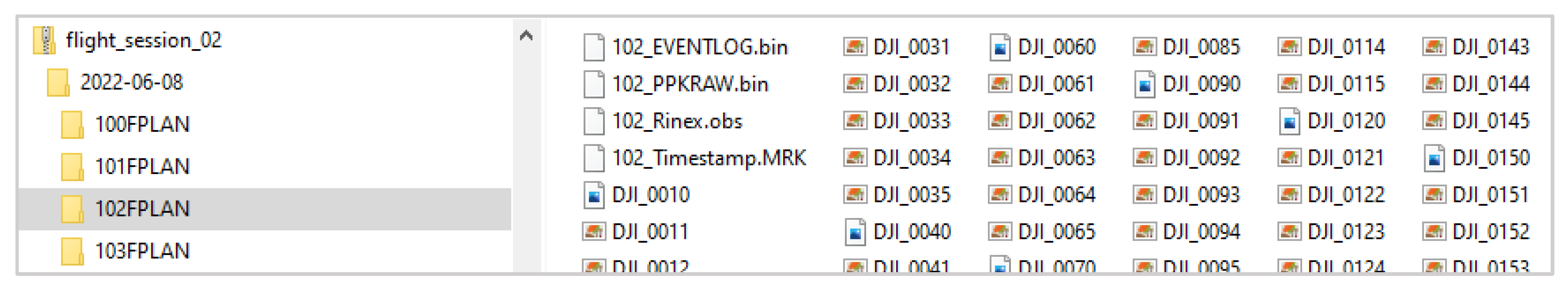
2.1. The Raw Imagery Captured by the UAV
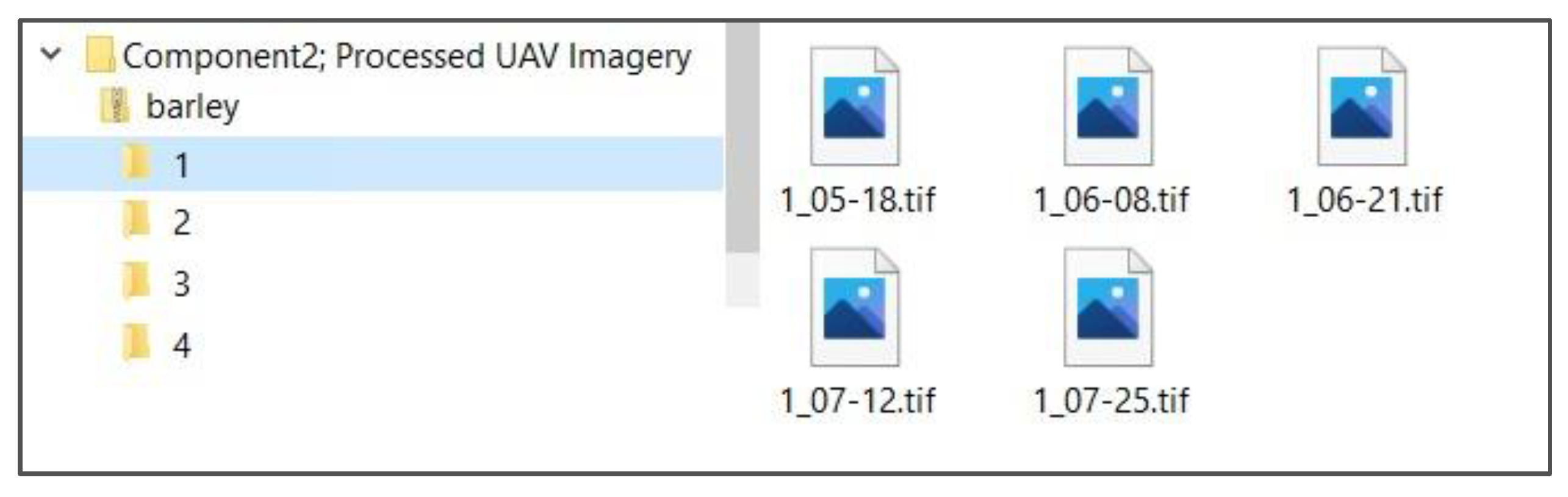
2.2. The Processed and Enhanced UAV Imagery Dataset
3. Methods
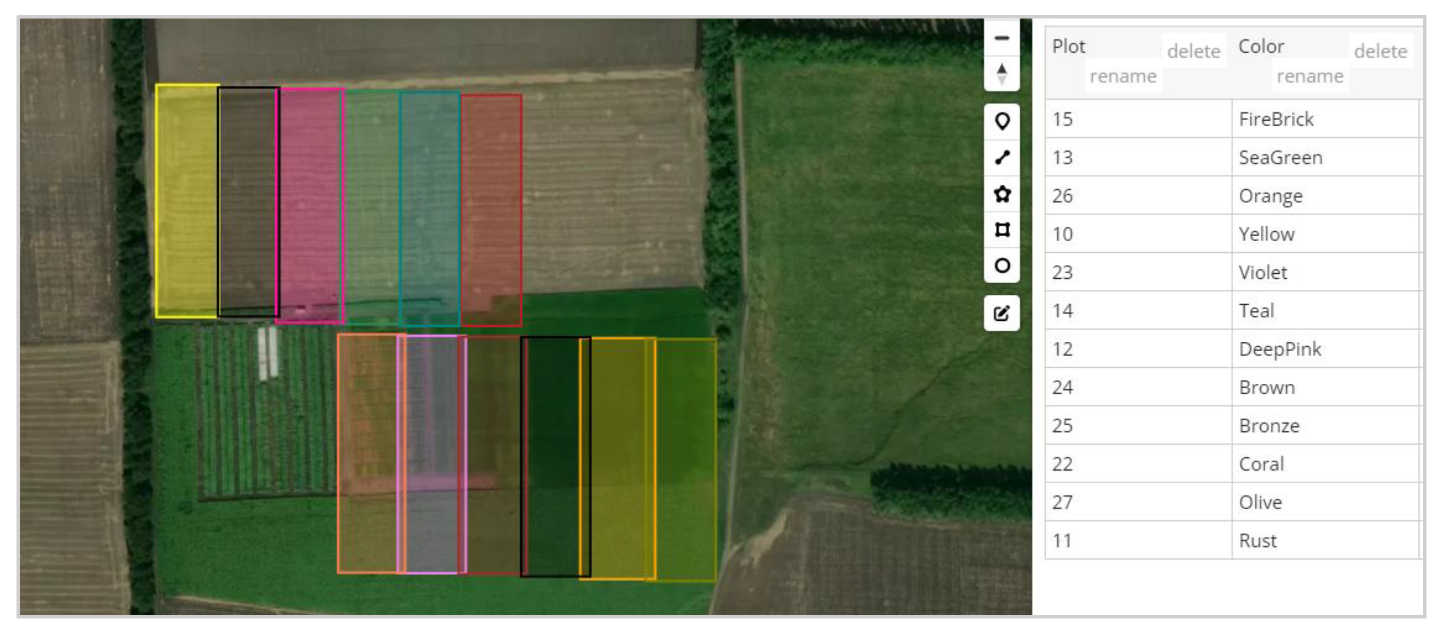
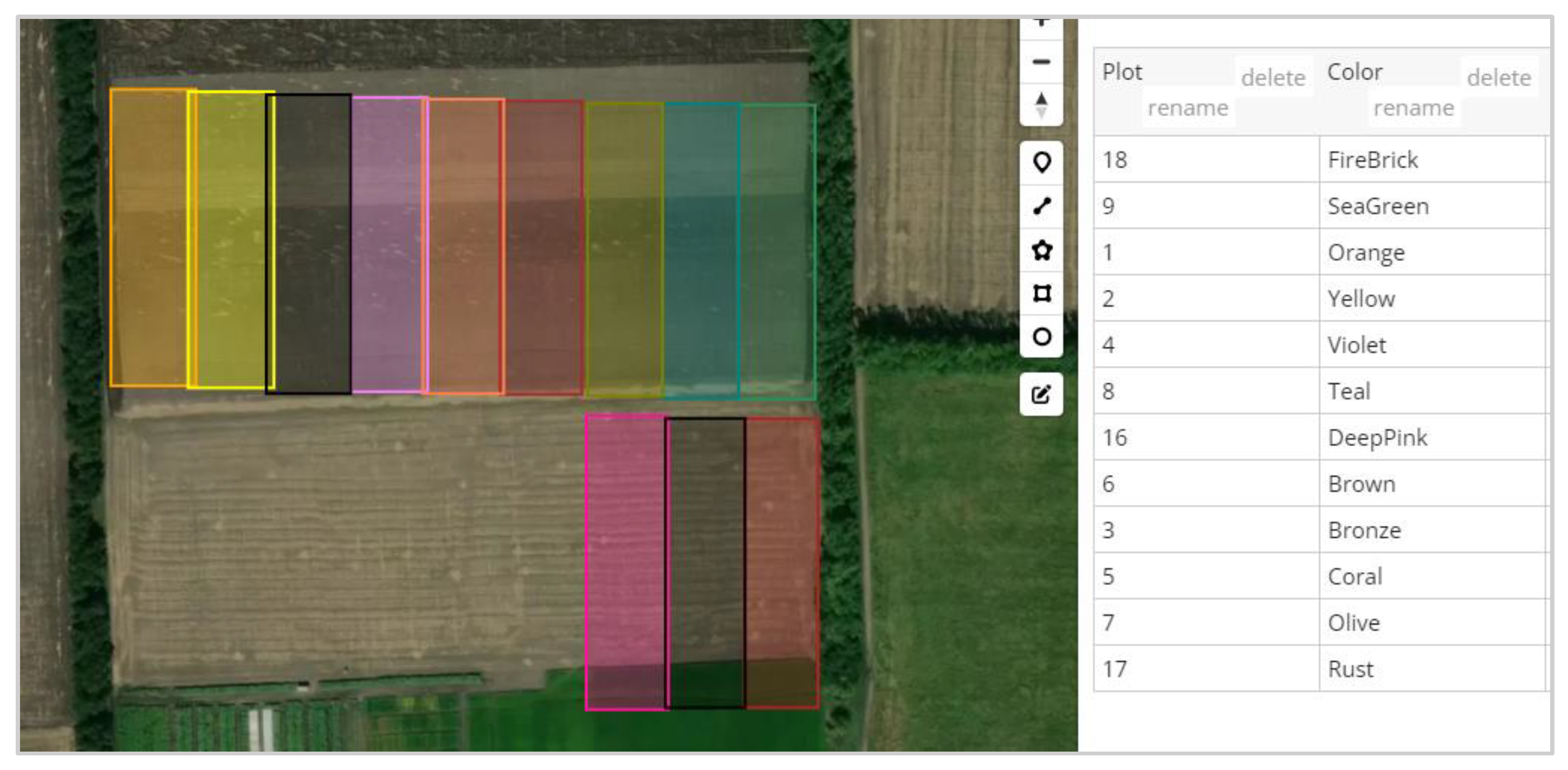
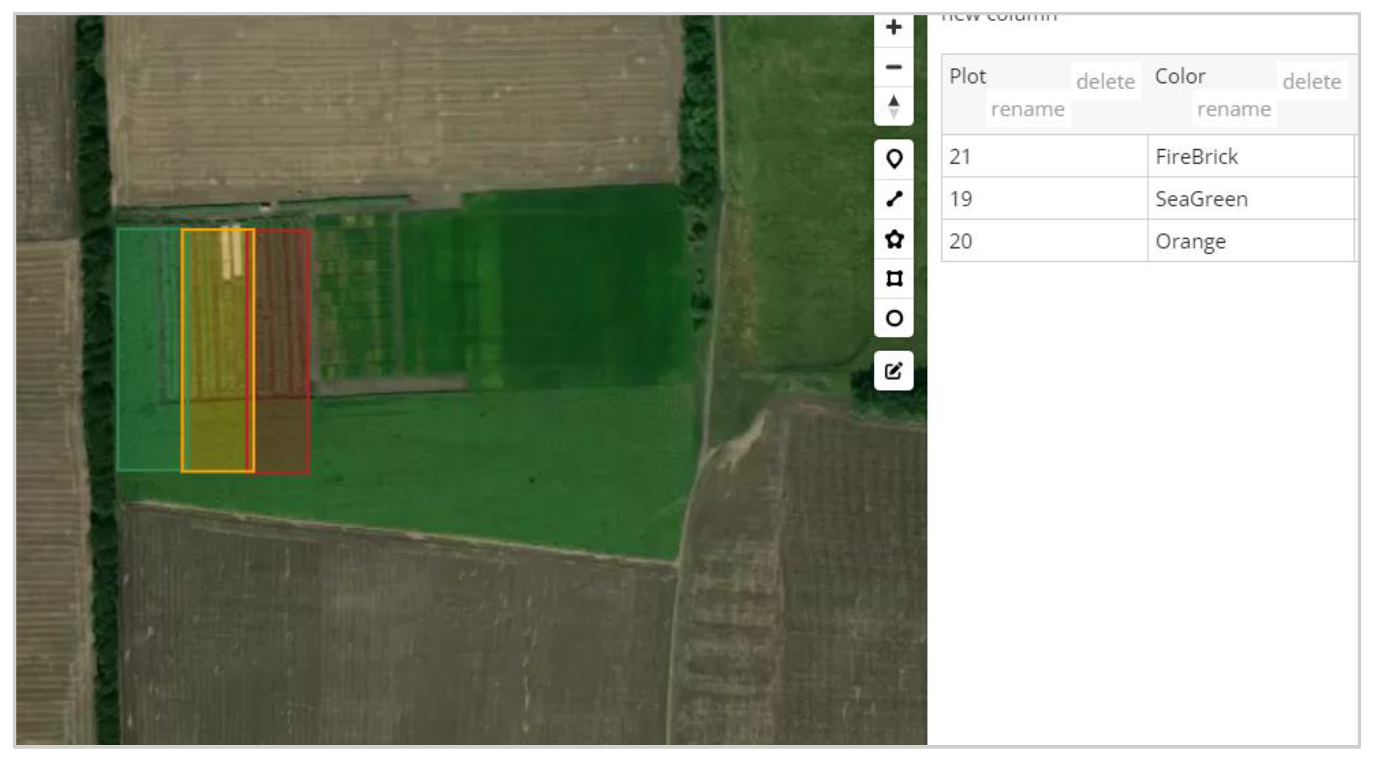
3.1. Experimental Site and Plots
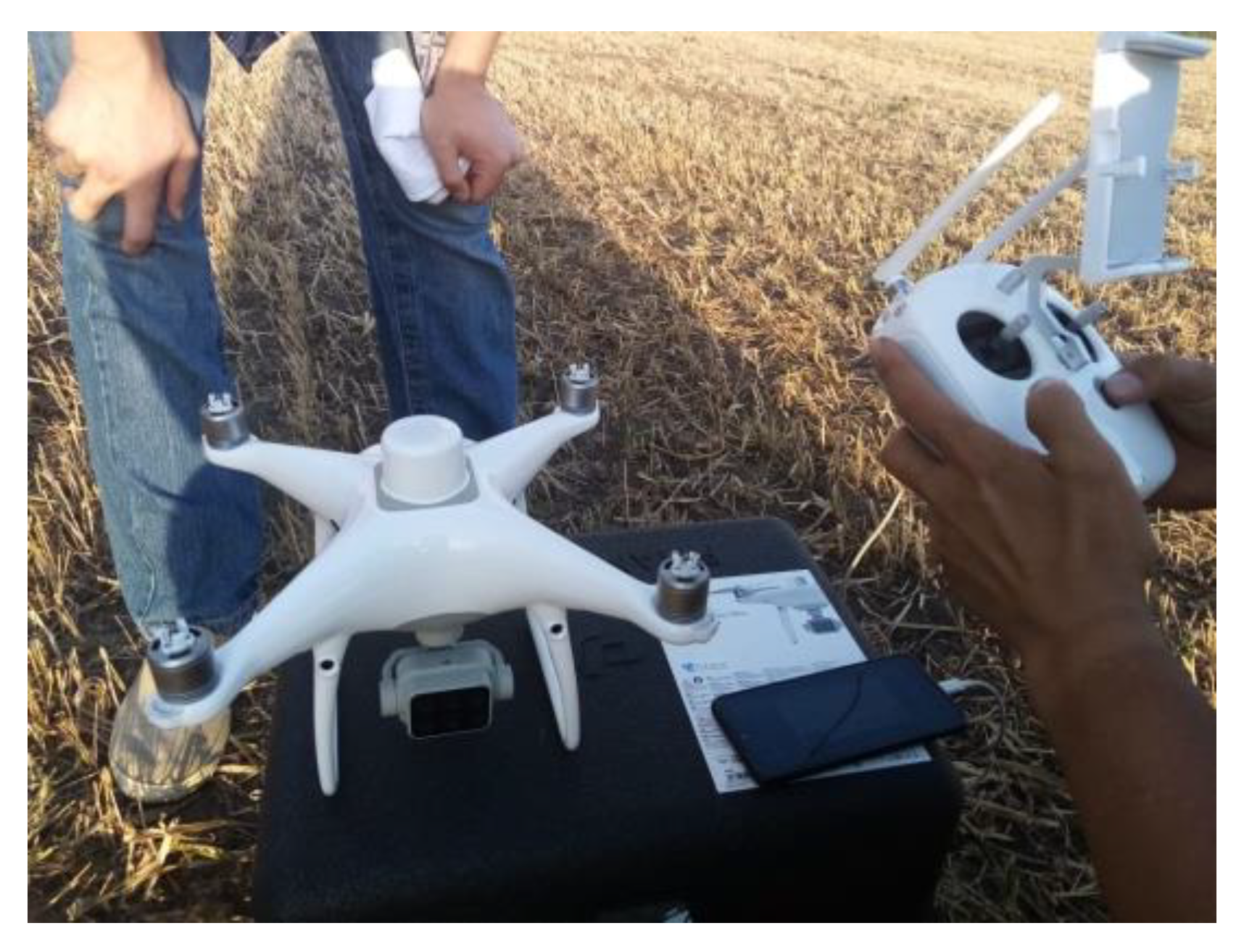
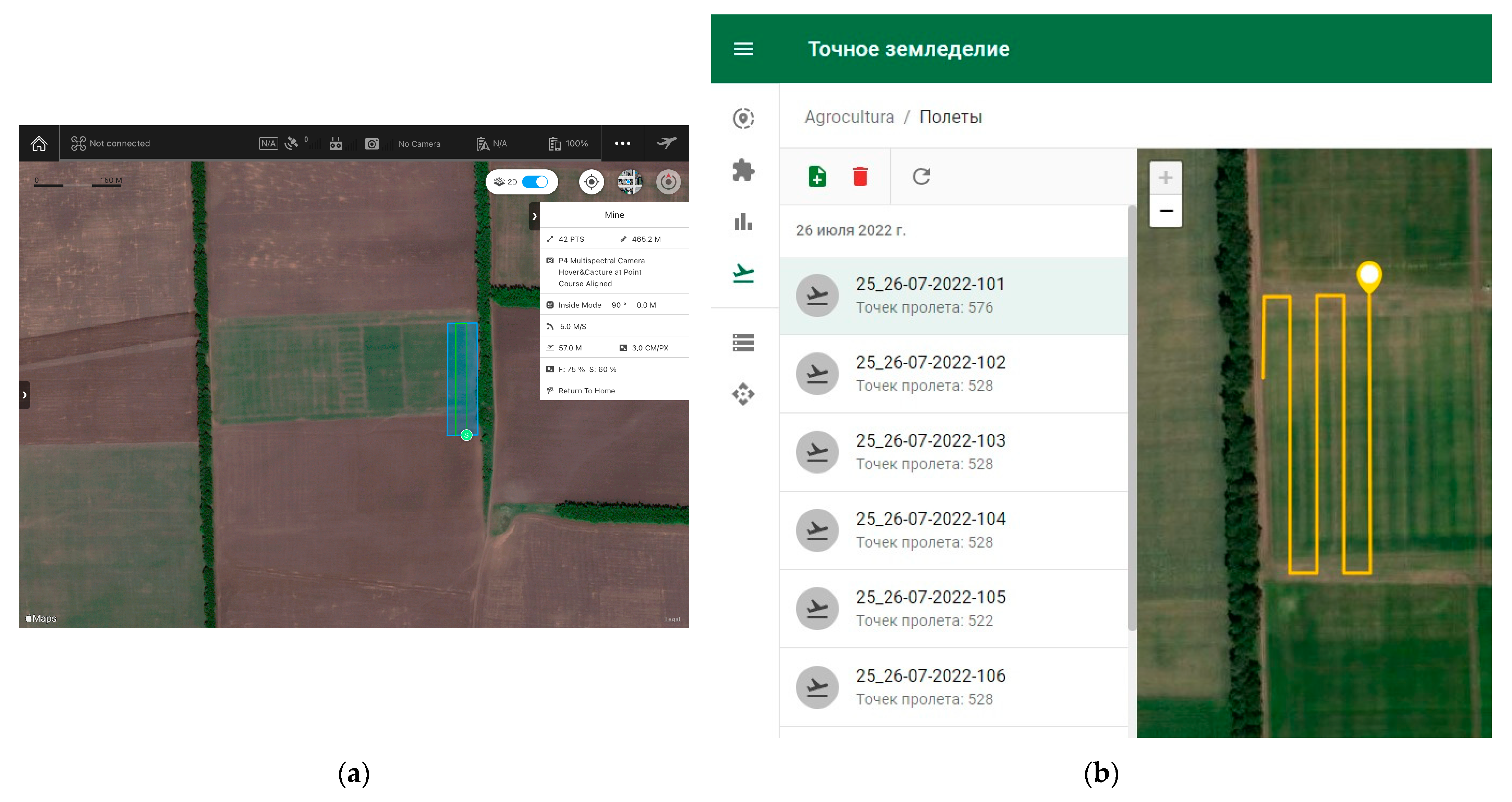
3.2. UAV Platform and Mission
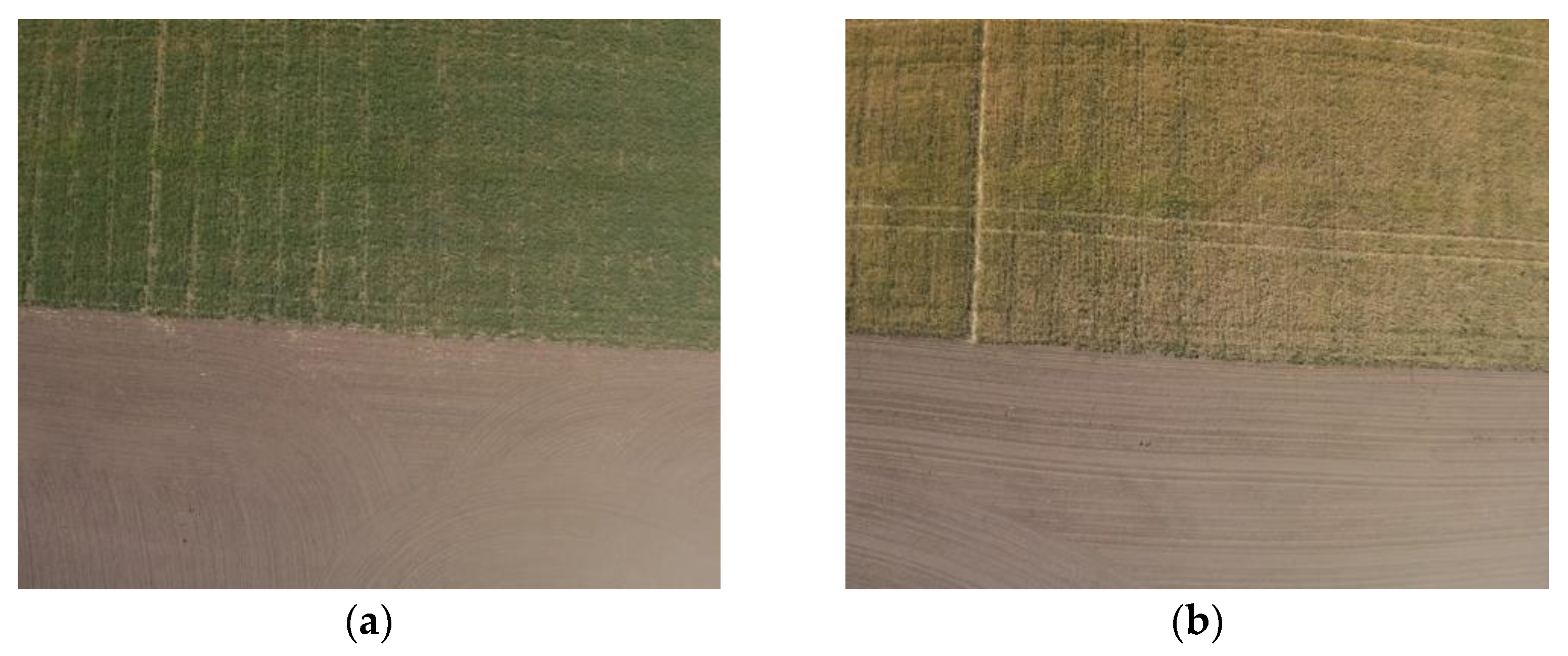
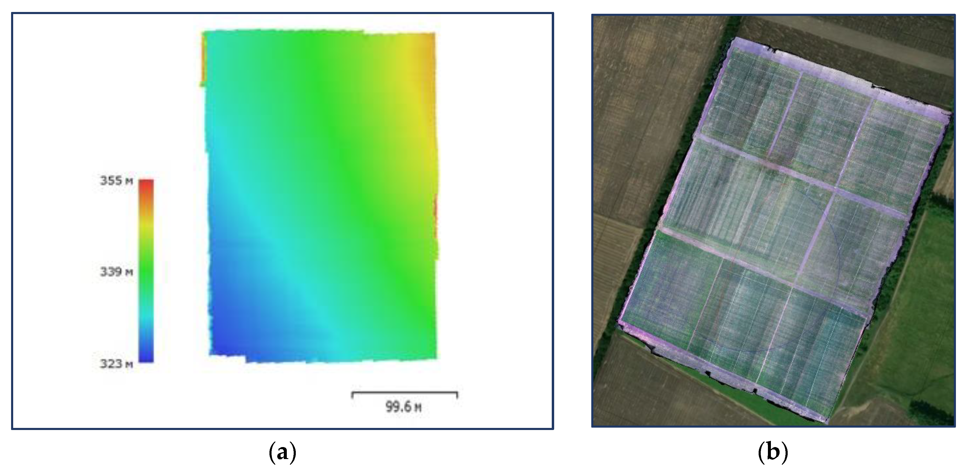
3.3. Processing the UAV Imagery Dataset
3.4. Enhancing the UAV Imagery Dataset
4. User Notes
- The dataset is findable, as it has unique and persistent identifiers (DOIs).
- The dataset is accessible since it is hosted on Zenodo, an open-access repository that allows users to access and download the data.
- The dataset is interoperable since it is provided in commonly used formats (TIF, GeoTIF and JPEG) and includes an additional NDVI band for enhanced compatibility with other tools and platforms.
- The dataset is reusable since it includes metadata and is licensed under a Creative Commons Attribution 4.0 International License, which allows users to freely use and redistribute the data if they give appropriate credit.
4.1. A Use Case for Utilizing Component One of the UAV Imagery Dataset
- Read the input image file and retrieve its width () and height () in pixels.
- Extract GPS coordinates (latitude and longitude) of the bottom-left pixel from the image.
- Convert the extracted longitude and latitude from Degrees/Minutes/Seconds format to decimal degree format as and , respectively using the following formula:where is +1 for North latitude or East longitude and −1 for South latitude or West longitude (in this case, sign is +1).
- Compute the pixel size (in degrees) for both X and Y directions. Pixel size for X direction is calculated using the following formula:
- 5.
- Create the geotransform matrix (Affine transformation) to convert the pixel coordinates of the image into geographic coordinates by:
- Translating the origin of the image coordinate system to the bottom-left corner of the image using the decimal degree longitude and latitude values of the bottom-left corner of the image. This ensures that subsequent transformations are performed relative to this corner, which is the reference point for geographic coordinates.
- Scaling the X (longitude) and Y (latitude) dimensions of the image by their respective pixel sizes in degrees. Scaling ensures that the transformation from pixel coordinates to geographic coordinates will be performed with the correct spacing between them.
- 6.
- Save the geotransform matrix as metadata within the GeoTIF file.
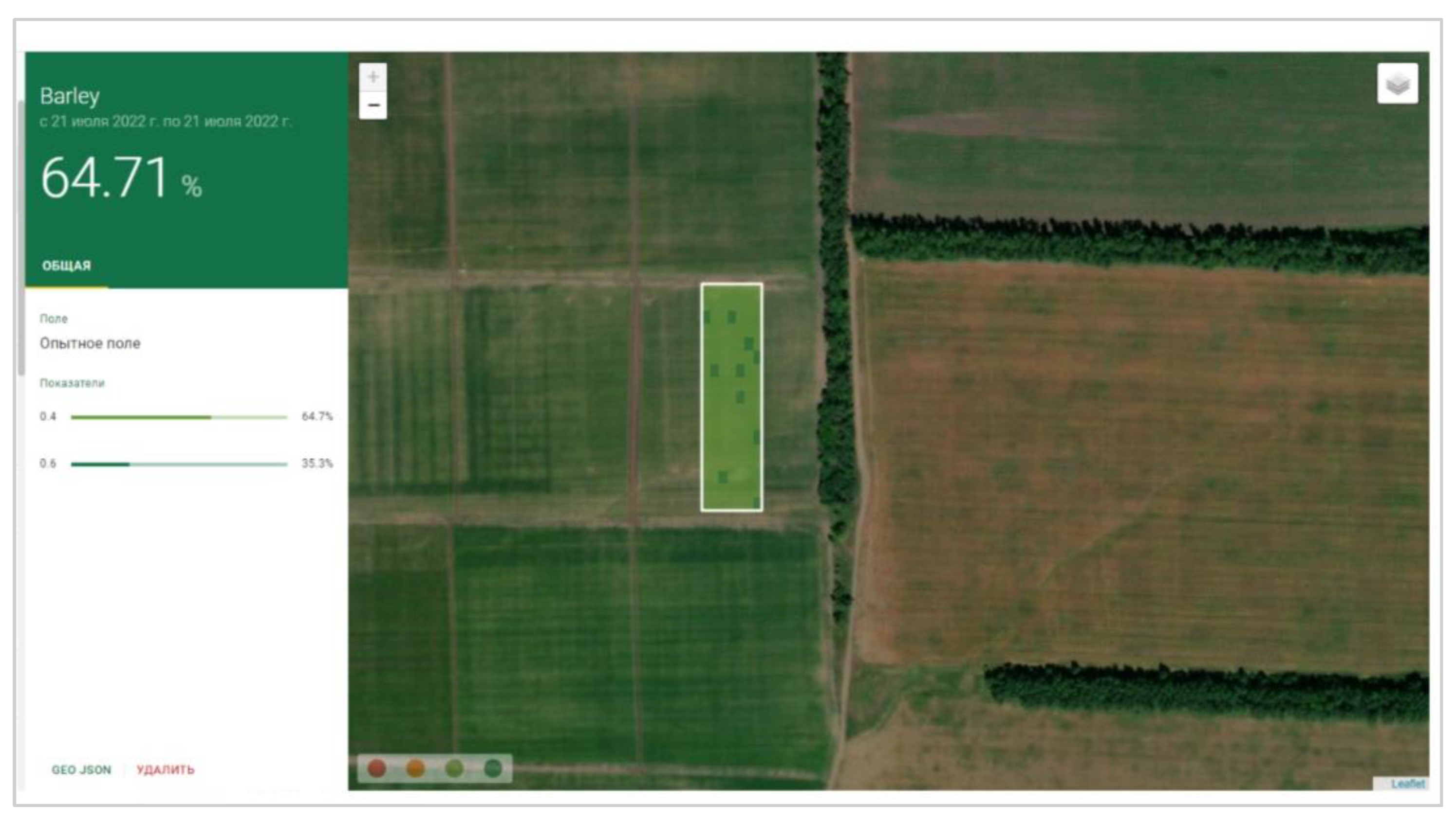
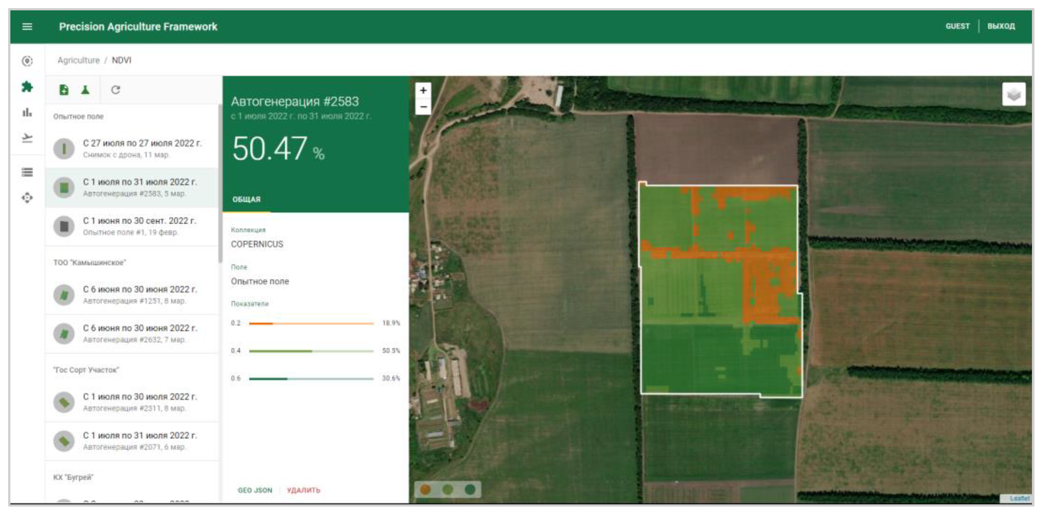
4.2. A Use Case for Integration of Component Two of the UAV Imagery Dataset in a Framework to Support Beginning Farmers
- Read the source GeoTIF file.
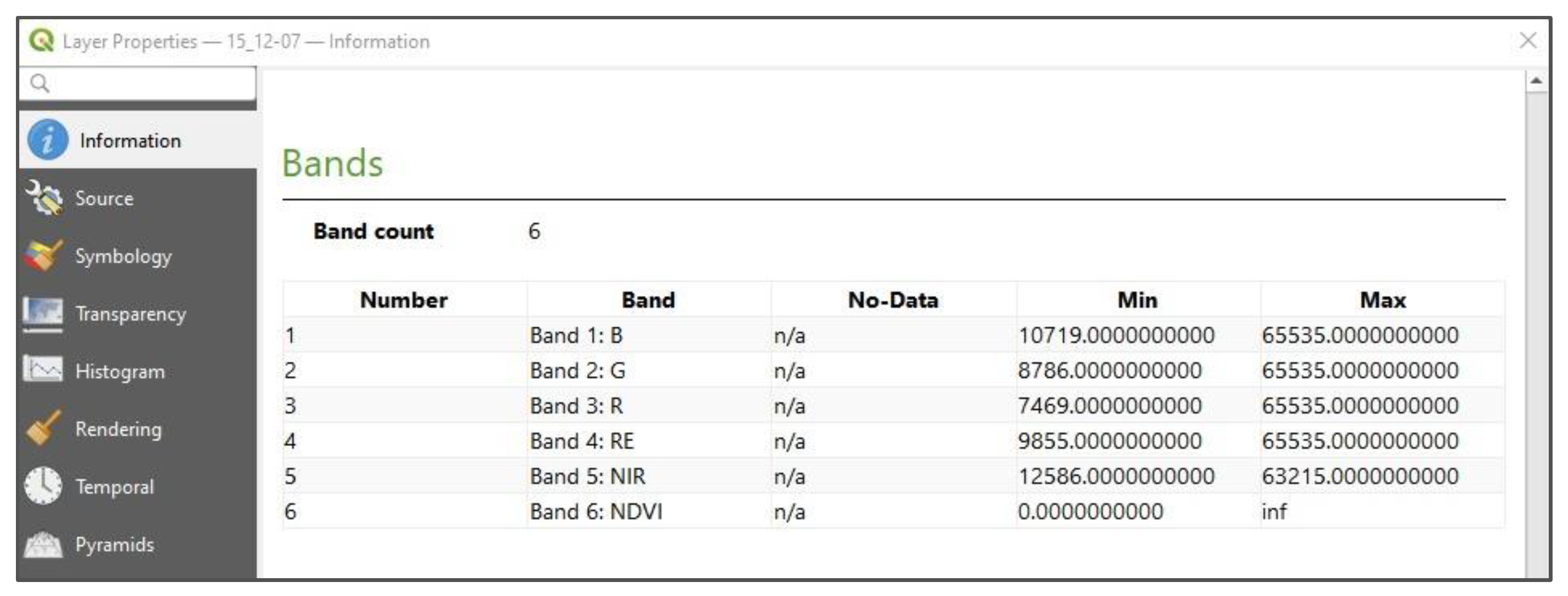
- Read the sixth layer of the file, which represents the calculated NDVI values.
- Extract the GPS coordinates and NDVI values for each pixel.
- Create a polygon based on the GPS coordinates.
- Create a GeoDataFrame from the polygon and NDVI values.
- Generate GeoJSON from the GeoDataFrame.
Author Contributions
Funding
Institutional Review Board Statement
Informed Consent Statement
Data Availability Statement
Acknowledgments
Conflicts of Interest
References
- Nhamo, L.; Magidi, J.; Nyamugama, A.; Clulow, A.D.; Sibanda, M.; Chimonyo, V.G.; Mabhaudhi, T. Prospects of improving agricultural and water productivity through unmanned aerial vehicles. Agriculture 2020, 10, 256. [Google Scholar] [CrossRef]
- Hegarty-Craver, M.; Polly, J.; O’Neil, M.; Ujeneza, N.; Rineer, J.; Beach, R.H.; Temple, D.S. Remote crop mapping at scale: Using satellite imagery and UAV-acquired data as ground truth. Remote Sens. 2020, 12, 1984. [Google Scholar] [CrossRef]
- Shamshiri, R.R.; Hameed, I.A.; Balasundram, S.K.; Ahmad, D.; Weltzien, C.; Yamin, M. Fundamental research on unmanned aerial vehicles to support precision agriculture in oil palm plantations. In Agricultural Robots-Fundamentals and Applications; IntechOpen: London, UK, 2018; pp. 91–116. [Google Scholar]
- Hafeez, A.; Husain, M.A.; Singh, S.P.; Chauhan, A.; Khan, M.T.; Kumar, N.; Soni, S.K. Implementation of drone technology for farm monitoring & pesticide spraying: A review. Inf. Process. Agric. 2022, 10, 192–203. [Google Scholar]
- Daponte, P.; De Vito, L.; Glielmo, L.; Iannelli, L.; Liuzza, D.; Picariello, F.; Silano, G. A review on the use of drones for precision agriculture. In IOP Conference Series: Earth and Environmental Science; IOP Publishing: Bristol, UK, 2019; Volume 275, p. 012022. [Google Scholar]
- Li, M.; Shamshiri, R.R.; Weltzien, C.; Schirrmann, M. Crop Monitoring Using Sentinel-2 and UAV Multispectral Imagery: A Comparison Case Study in Northeastern Germany. Remote Sens. 2022, 14, 4426. [Google Scholar] [CrossRef]
- Liu, Y.; Hatou, K.; Aihara, T.; Kurose, S.; Akiyama, T.; Kohno, Y.; Omasa, K. A robust vegetation index based on different UAV RGB images to estimate SPAD values of naked barley leaves. Remote Sens. 2021, 13, 686. [Google Scholar] [CrossRef]
- Almeida-Ñauñay, A.F.; Tarquis, A.M.; López-Herrera, J.; Pérez-Martín, E.; Pancorbo, J.L.; Raya-Sereno, M.D.; Quemada, M. Optimization of soil background removal to improve the prediction of wheat traits with UAV imagery. Comput. Electron. Agric. 2023, 205, 107559. [Google Scholar] [CrossRef]
- Zhang, J.; Wang, W.; Krienke, B.; Cao, Q.; Zhu, Y.; Cao, W.; Liu, X. In-season variable rate nitrogen recommendation for wheat precision production supported by fixed-wing UAV imagery. Precis. Agric. 2022, 23, 830–853. [Google Scholar] [CrossRef]
- Vélez, S.; Vacas, R.; Martín, H.; Ruano-Rosa, D.; Álvarez, S. High-Resolution UAV RGB Imagery Dataset for Precision Agriculture and 3D Photogrammetric Reconstruction Captured over a Pistachio Orchard (Pistacia vera L.) in Spain. Data 2022, 7, 157. [Google Scholar] [CrossRef]
- Krestenitis, M.; Raptis, E.K.; Kapoutsis, A.C.; Ioannidis, K.; Kosmatopoulos, E.B.; Vrochidis, S.; Kompatsiaris, I. CoFly-WeedDB: A UAV image dataset for weed detection and species identification. Data Brief 2022, 45, 108575. [Google Scholar] [CrossRef] [PubMed]
- Amraoui, K.E.L.; Lghoul, M.; Ezzaki, A.; Masmoudi, L.; Hadri, M.; Elbelrhiti, H.; Simo, A.A. Avo-AirDB: An avocado UAV Database for agricultural image segmentation and classification. Data Brief 2022, 45, 108738. [Google Scholar] [CrossRef] [PubMed]
- Ariza-Sentís, M.; Vélez, S.; Valente, J. Dataset on UAV RGB videos acquired over a vineyard including bunch labels for object detection and tracking. Data Brief 2023, 46, 108848. [Google Scholar] [CrossRef] [PubMed]
- Vélez, S.; Ariza-Sentís, M.; Valente, J. Dataset on unmanned aerial vehicle multispectral images acquired over a vineyard affected by Botrytis cinerea in northern Spain. Data Brief 2023, 46, 108876. [Google Scholar] [CrossRef] [PubMed]
- Garba, I.I.; Williams, A. Datasets supporting the adoption of multifunctional cover crops related to soil water and nitrogen in water-limited environments. Data Brief 2023, 46, 108841. [Google Scholar] [CrossRef] [PubMed]
- Mignoni, M.E.; Honorato, A.; Kunst, R.; Righi, R.; Massuquetti, A. Soybean images dataset for caterpillar and Diabrotica speciosa pest detection and classification. Data Brief 2022, 40, 107756. [Google Scholar] [CrossRef] [PubMed]
- Ruszczak, B.; Boguszewska-Mańkowska, D. Deep potato–the hyperspectral imagery of potato cultivation with reference agronomic measurements dataset: Towards potato physiological features modeling. Data Brief 2022, 42, 108087. [Google Scholar] [CrossRef] [PubMed]
- Zhang, H.; Tang, Z.; Wang, B.; Kan, H.; Sun, Y.; Qin, Y.; Yi, S. A 250 m annual alpine grassland AGB dataset over the Qinghai–Tibet Plateau (2000–2019) in China based on in situ measurements, UAV photos, and MODIS data. Earth Syst. Sci. Data 2023, 15, 821–846. [Google Scholar] [CrossRef]
- Milz, S.; Wäldchen, J.; Abouee, A.; Ravichandran, A.A.; Schall, P.; Hagen, C.; Mäder, P. The H AI nich: A multidisciplinary vision data-set for a better understanding of the forest ecosystem. Sci. Data 2023, 10, 168. [Google Scholar] [CrossRef] [PubMed]
- Agisoft, L.L.C. Metashape, 1.8; Agisoft: Saint Petersburg, Russia, 2021. [Google Scholar]
- Wilkinson, M.D.; Dumontier, M.; Aalbersberg, I.J.; Appleton, G.; Axton, M.; Baak, A.; Mons, B. The FAIR Guiding Principles for scientific data management and stewardship. Sci. Data 2016, 3, 1–9. [Google Scholar] [CrossRef] [PubMed]


| No. | File Name | Size | Number of Files | Description |
|---|---|---|---|---|
| 1 | flight_session_01.zip | 17.7 Gb | 8277 | Component 1: raw aerial images from the corresponding UAV flight session |
| 2 | flight_session_02.zip | 17.4 Gb | 7957 | |
| 3 | flight_session_03.zip | 16.7 Gb | 7721 | |
| 4 | flight_session_04.zip | 17.5 Gb | 7267 | |
| 5 | flight_session_05.zip | 15.8 Gb | 7155 | |
| 6 | barley.zip | 12.7 Gb | 59 | Component 2: processed orthomosaic images of plots, categorized by crop type (barley, wheat, soybean) |
| 7 | wheat.zip | 11.8 Gb | 60 | |
| 8 | soybean.zip | 2.34 Gb | 12 |
| Plot ID | Crop Type | Crop Variety | Sowing Rate (kg/ha) | Date of Sowing |
|---|---|---|---|---|
| 1 | barley | Ilek 16 | 280 | 4 May 2022 |
| 2 | barley | Ilek 16 | 260 | 5 May 2022 |
| 3 | barley | Ilek 16 | 240 | 5 May 2022 |
| 4 | barley | L 29 | 280 | 5 May 2022 |
| 5 | barley | L 29 | 260 | 5 May 2022 |
| 6 | barley | L 29 | 240 | 6 May 2022 |
| 7 | barley | 339 A | 280 | 6 May 2022 |
| 8 | barley | 339 A | 260 | 6 May 2022 |
| 9 | barley | 339 A | 240 | 6 May 2022 |
| 10 | wheat | Altay | 240 | 7 May 2022 |
| 11 | wheat | Altay | 220 | 8 May 2022 |
| 12 | wheat | Altay | 200 | 8 May 2022 |
| 13 | wheat | Ulbinka | 240 | 13 May 2022 |
| 14 | wheat | Ulbinka | 220 | 13 May 2022 |
| 15 | wheat | Ulbinka | 200 | 13 May 2022 |
| 16 | barley | B 2015 | 280 | 7 May 2022 |
| 17 | barley | B 2015 | 260 | 7 May 2022 |
| 18 | barley | B 2015 | 240 | 7 May 2022 |
| 19 | soybean | Birlik | 120 | 21 May 2022 |
| 20 | soybean | Birlik | 100 | 21 May 2022 |
| 21 | soybean | Birlik | 80 | 21 May 2022 |
| 22 | wheat | Nargiz | 240 | 13 May 2022 |
| 23 | wheat | Nargiz | 220 | 13 May 2022 |
| 24 | wheat | Nargiz | 200 | 13 May 2022 |
| 25 | wheat | GBK 2120/3 | 240 | 14 May 2022 |
| 26 | wheat | GBK 2120/3 | 220 | 14 May 2022 |
| 27 | wheat | GBK 2120/3 | 200 | 14 May 2022 |
| Flight Session | Milestone (Corresponding Phenological Stage) | Date | Covered Plots |
|---|---|---|---|
| 01 | 75% emergence | 17 May 2022 | 15 |
| 18 May 2022 | 13 | ||
| 02 | Tillering | 8 June 2022 | 14 |
| 9 June 2022 | 7 | ||
| 03 | 75% heading | 21 June 2022 | 8 |
| 22 June 2022 | 7 | ||
| 04 | Milky ripe | 11 July 2022 | 9 |
| 12 July 2022 | 6 | ||
| 05 | Waxy ripe | 25 July 2022 | 8 |
| 26 July 2022 | 7 |
| Date of 2022 | Local Time | Sun Elevation Angle, ° | Sun Azimuth Angle, ° | Temperature, °C | Wind Speed, m/s | Cloud Coverage |
|---|---|---|---|---|---|---|
| 17 May | 13:00–17:00 | 54.25–19.09 | 219.66–277.9 | 27.7–13.7 | 1–2 | clear |
| 18 May | 11:00–14:30 | 59.16–42.85 | 167.61–246.97 | 30.2–22.0 | 1–2 | clear |
| 8 June | 09:30–12:30 | 54.22–60.39 | 128.31–209.1 | 26.8–27.2 | 2–3 | clear |
| 9 June | 09:30–12:30 | 54.26–60.48 | 128.17–209.07 | 30.6–31.0 | 1–2 | clear |
| 21 June | 09:30–12:30 | 54.33–61.11 | 126.89–208.26 | 32.7–24.0 | 5–6 | clear |
| 22 June | 09:30–12:30 | 54.3–62.65 | 126.82–163.62 | 34.9–35.2 | 3–4 | clear |
| 11 July | 10:30–12:30 | 59.15–60.05 | 149.13–205.7 | 30.7–30.9 | 2–3 | clear |
| 12 July | 09:30–11:30 | 52.57–61.84 | 127.08–177.01 | 31.3–29.7 | 4 | clear |
| 25 July | 10:00–12:30 | 53.95–57.72 | 138.91–203.88 | 24.6 –24.8 | 2–3 | clear |
| 26 July | 09:30–11:00 | 50.3–58.42 | 129.03–163.19 | 27.5–29.1 | 2–3 | clear |
Disclaimer/Publisher’s Note: The statements, opinions and data contained in all publications are solely those of the individual author(s) and contributor(s) and not of MDPI and/or the editor(s). MDPI and/or the editor(s) disclaim responsibility for any injury to people or property resulting from any ideas, methods, instructions or products referred to in the content. |
© 2023 by the authors. Licensee MDPI, Basel, Switzerland. This article is an open access article distributed under the terms and conditions of the Creative Commons Attribution (CC BY) license (https://creativecommons.org/licenses/by/4.0/).
Share and Cite
Maulit, A.; Nugumanova, A.; Apayev, K.; Baiburin, Y.; Sutula, M. A Multispectral UAV Imagery Dataset of Wheat, Soybean and Barley Crops in East Kazakhstan. Data 2023, 8, 88. https://doi.org/10.3390/data8050088
Maulit A, Nugumanova A, Apayev K, Baiburin Y, Sutula M. A Multispectral UAV Imagery Dataset of Wheat, Soybean and Barley Crops in East Kazakhstan. Data. 2023; 8(5):88. https://doi.org/10.3390/data8050088
Chicago/Turabian StyleMaulit, Almasbek, Aliya Nugumanova, Kurmash Apayev, Yerzhan Baiburin, and Maxim Sutula. 2023. "A Multispectral UAV Imagery Dataset of Wheat, Soybean and Barley Crops in East Kazakhstan" Data 8, no. 5: 88. https://doi.org/10.3390/data8050088