Evaluating the Archaeological Efficacy of Bathymetric LiDAR across Oceanographic Contexts: A Case Study from Apalachee Bay, Florida
Abstract
:1. Introduction
1.1. Background on Bathymetric LiDAR in Archaeological and Cultural Heritage Research
1.2. Apalachee Bay: Geological and Archaeological Background
1.2.1. Bedrock Geology
1.2.2. Hydrogeological Conditions and Regional Fluvial and Coastal Geomorphology
1.2.3. Paleohydrology and the Archaeology of Apalachee Bay
1.3. Early Coastal Sites in the Region
2. Materials and Methods
2.1. Bathymetric LiDAR
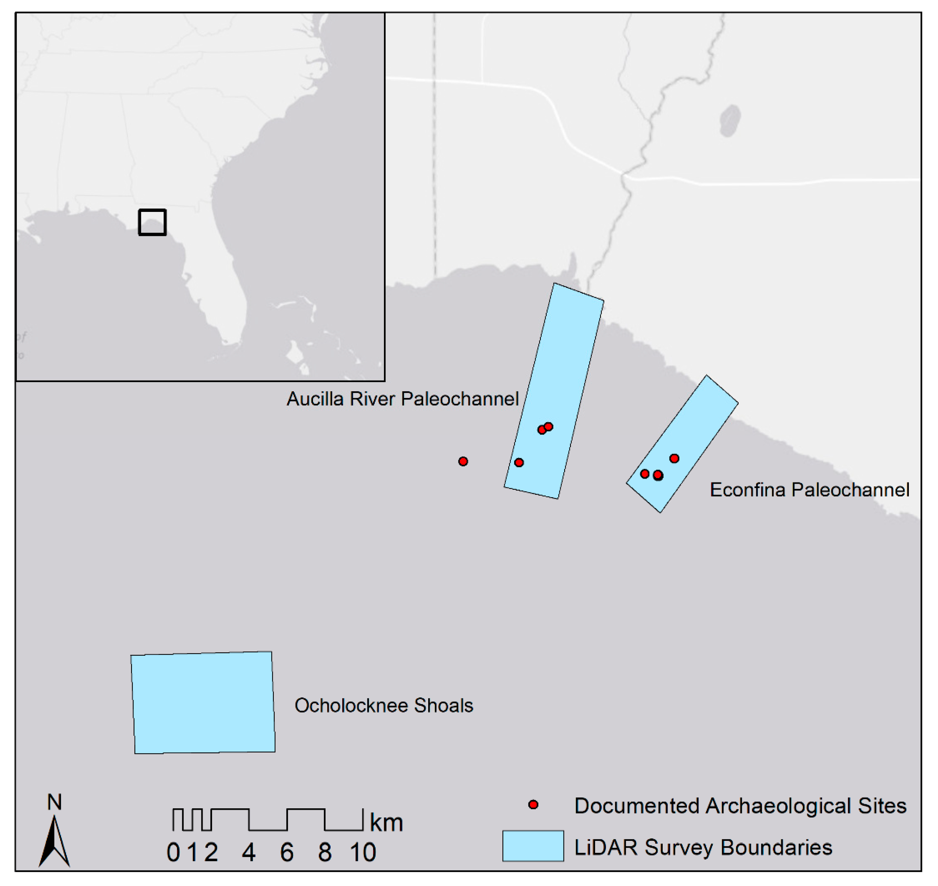
2.1.1. Aucilla and Econfina River Paleochannels
2.1.2. Ocholocknee Shoals
2.1.3. Visualizations
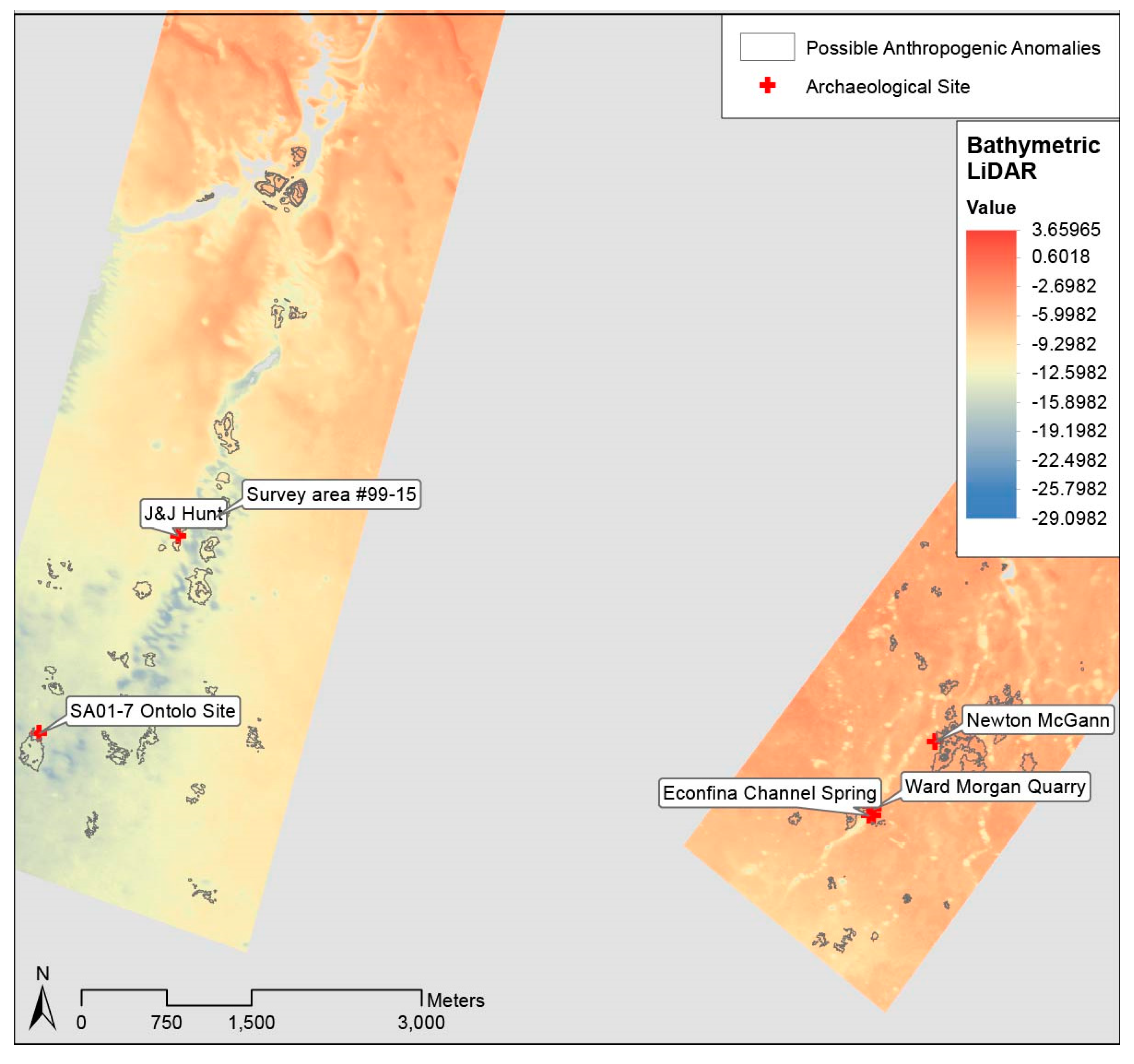
2.2. Distribution of Known Archaeological Sites
2.3. SCUBA Surveys and Environmental Analysis
3. Results
3.1. Bathymetric LiDAR Survey
3.2. Diver Surveys
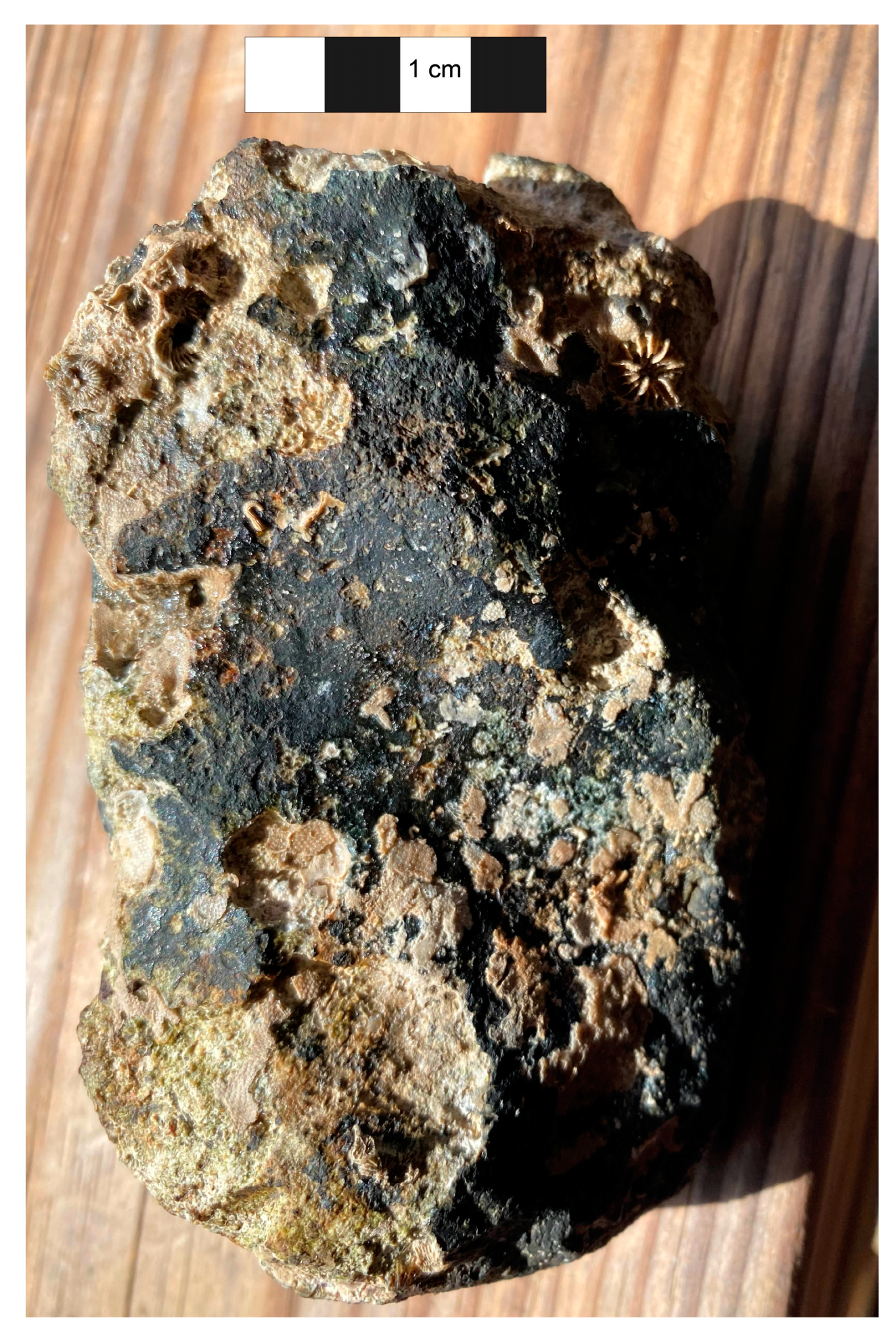
3.2.1. Ocholocknee Shoals
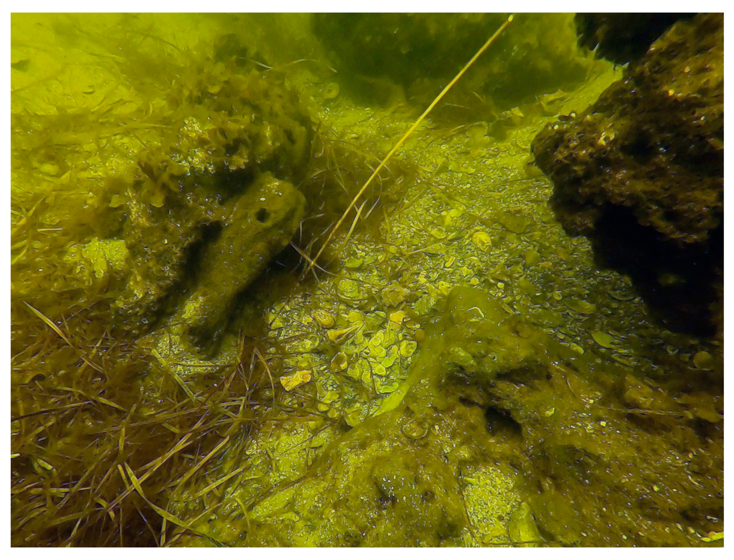
3.2.2. Econfina River Paleochannel
4. Discussion
5. Conclusions
Author Contributions
Funding
Data Availability Statement
Acknowledgments
Conflicts of Interest
References
- Bailey, G.N.; Parkington, J. The Archaeology of Prehistoric Coastlines. In The Archaeology of Prehistoric Coastlines; Cambridge University Press: Cambridge, MA, USA, 1988. [Google Scholar]
- Crabtree, S.A.; White, D.A.; Bradshaw, C.J.A.; Saltré, F.; Williams, A.N.; Beaman, R.J.; Bird, M.I.; Ulm, S. Landscape rules predict optimal superhighways for the first peopling of Sahul. Nat. Hum. Behav. 2021, 5, 1303–1313. [Google Scholar] [CrossRef] [PubMed]
- Flemming, N.C.; Harff, J.; Moura, D.; Burgess, A.; Bailey, G.N. Submerged Landscapes of the European Continental Shelf; John and Wiley: Hoboken, NJ, USA, 2017. [Google Scholar] [CrossRef]
- IDMC. Global Report on Internal Displacement 2021: Internal Displacement in a Changing Climate. 2021. Available online: https://www.internal-displacement.org/global-report/grid2021/ (accessed on 3 December 2021).
- IPCC. Climate Change 2022: Impacts, Adaptation and Vulnerability; Cambridge University Press: Cambridge, MA, USA, 2022. [Google Scholar]
- Bailey, G.N.; Harff, J.; Sakellariou, D. Under the Sea: Archaeology and Palaeolandscapes of the Continental Shelf; Springer International Publishing: Berlin/Heidelberg, Germany, 2017; Volume 20. [Google Scholar]
- Kelley, J.T.; Belknap, D.F.; Kelley, A.R.; Claesson, S.H. A model for drowned terrestrial habitats with associated archeological remains in the northwestern Gulf of Maine, USA. Mar. Geol. 2013, 338, 1–16. [Google Scholar] [CrossRef]
- Faught, M.K.; Gusick, A.E. Submerged Prehistory in the Americas. In Submerged Prehistory; Benjamin, J., Bonsall, C., Pickard, C., Fischer, A., Eds.; Oxbow Book: Oxford, UK, 2011; pp. 145–157. [Google Scholar]
- Larsen, C.E. Quaternary Coastlines and Marine Archaeology: Towards the Prehistory of Land Bridges and Continental Shelves; Academic Press: Cambridge, MA, USA, 1983. [Google Scholar] [CrossRef]
- Fitch, S.; Thomson, K.; Gaffney, V. Late Pleistocene and Holocene depositional systems and the palaeogeography of the Dogger Bank, North Sea. Quat. Res. 2005, 64, 185–196. [Google Scholar] [CrossRef]
- Gaffney, V.; Thomson, K.; Fitch, S. Mapping Doggerland: The Mesolithic Landscapes of the Southern North Sea; Archaeopress: Oxford, UK, 2007. [Google Scholar]
- Gaffney, V. Doggerland and the Lost Frontiers Project. In Under the Sea: Archaeology and Palaeolandscapes of the Continental Shelf; Bailey, G.N., Harff, J., Sakellariou, D., Eds.; Springer International Publishing: Berlin/Heidelberg, Germany, 2017. [Google Scholar]
- Menna, F.; Agrafiotis, P.; Georgopoulos, A. State of the art and applications in archaeological underwater 3D recording and mapping. J. Cult. Herit. 2018, 33, 231–248. [Google Scholar] [CrossRef]
- Doneus, M.; Doneus, N.; Briese, C.; Pregesbauer, M.; Mandlburger, G.; Verhoeven, G. Airborne laser bathymetry—detecting and recording submerged archaeological sites from the air. J. Archaeol. Sci. 2013, 40, 2136–2151. [Google Scholar] [CrossRef]
- Doneus, M.; Miholjek, I.; Mandlburger, G.; Doneus, N.; Verhoeven, G.; Briese, C.; Pregesbauer, M. Airborne Laser Bathymetry for Documentation of Submerged Archaeological Sites in Shallow Water. ISPRS Int. Arch. Photogramm. Remote. Sens. Spat. Inf. Sci. 2015, XL-5/W5, 99–107. [Google Scholar] [CrossRef] [Green Version]
- Cunningham, A.G.; Lillycrop, W.J.; Guenther, G.C.; Brooks, M.W. Shallow Water Laser Bathymetry: Accomplishments and Applications; US Army Corps of Engineers Mobile United States: Mobile, AL, USA, 2016.
- Luo, L.; Wang, X.; Guo, H.; Lasaponara, R.; Zong, X.; Masini, N. Airborne and spaceborne remote sensing for archaeological and cultural heritage applications: {A} review of the century (1907–2017). Remote Sens. Environ. 2019, 232, 111280. [Google Scholar] [CrossRef]
- Chase AS, Z.; Chase, D.Z.; Chase, A.F. LiDAR for Archaeological Research and the Study of Historical Landscapes. In Sensing the {Past}; Masini, N., Soldovieri, F., Eds.; Springer International Publishing: Berlin/Heidelberg, Germany, 2017; Volume 16, pp. 89–100. [Google Scholar]
- Tian-Yuan Shih, P.; Chen, Y.-H.; Chen, J.-C. Historic Shipwreck Study in Dongsha Atoll with Bathymetric LiDAR: Historic Shipwreck Study with Bathymetric LiDAR. Archaeol. Prospect. 2014, 21, 139–146. [Google Scholar] [CrossRef]
- Lobb, M.A. Developing Terrestrial Laser Scanning of Threatened Coastal Archaeology with Special Reference to Intertidal Structures; University of Southampton: Southampton, UK, 2016. [Google Scholar]
- Davis, D.S.; Buffa, D.C.; Wrobleski, A.C. Assessing the utility of open-access bathymetric data for shipwreck detection in the United States. Heritage 2020, 3, 364–383. [Google Scholar] [CrossRef]
- Character, L.; Ortiz, A., Jr.; Beach, T.; Luzzadder-Beach, S. Archaeologic Machine Learning for Shipwreck Detection Using Lidar and Sonar. Remote Sens. 2021, 13, 1759. [Google Scholar] [CrossRef]
- Veth, P.; McDonald, J.; Ward, I.; O’Leary, M.; Beckett, E.; Benjamin, J. A Strategy for Assessing Continuity in Terrestrial and Maritime Landscapes from Murujuga (Dampier Archipelago), North West Shelf, Australia. J. Isl. Coast. Archaeol. 2020, 15, 477–503. [Google Scholar] [CrossRef]
- Wiseman, C.; O’Leary, M.; Hacker, J.; Stankiewicz, F.; McCarthy, J.; Beckett, E.; Leach, J.; Baggaley, P.; Collins, C.; Ulm, S.; et al. A multi-scalar approach to marine survey and underwater archaeological site prospection in Murujuga, Western Australia. Quat. Int. 2020, 584, 152–170. [Google Scholar] [CrossRef]
- Chust, G.; Grande, M.; Galparsoro, I.; Uriarte, A.; Borja, Á. Capabilities of the bathymetric Hawk Eye LiDAR for coastal habitat mapping: A case study within a Basque estuary. Estuar. Coast. Shelf Sci. 2010, 89, 200–213. [Google Scholar] [CrossRef]
- Ward, I.A.K.; Larcombe, P.; Veth, P. A New Process-based Model for Wreck Site Formation. J. Archaeol. Sci. 1999, 26, 561–570. [Google Scholar] [CrossRef]
- Quinn, R.; Boland, D. The role of time-lapse bathymetric surveys in assessing morphological change at shipwreck sites. J. Archaeol. Sci. 2010, 37, 2938–2946. [Google Scholar] [CrossRef]
- Hine, A.C.; Belknap, D.F.; Hutton, J.G.; Osking, E.B.; Evans, M.W. Recent Geological History and Modern Sedimentary Processes Along an Incipient, Low-Energy, Epicontinental-Sea Coastline: Northwest Florida. SEPM J. Sediment. Res. 1988, 58, 567–579. [Google Scholar]
- Upchurch, S.B. An Introduction to the Cody Escarpment, North-Central Florida; Suwannee River Water Management District: Live Oak, FL, USA, 2007.
- Brooks, G.R.; Doyle, L.J.; Suthard, B.C.; Locker, S.D.; Hine, A.C. Facies architecture of the mixed carbonate/siliciclastic inner continental shelf of west-central Florida: Implications for Holocene barrier development. Mar. Geol. 2003, 200, 325–349. [Google Scholar] [CrossRef]
- Goodbred, S.L.; Wright, E.E.; Hine, A.C. Sea-level change and storm-surge deposition in a late Holocene Florida salt marsh. J. Sediment. Res. 1998, 68, 240–252. [Google Scholar] [CrossRef]
- Mattson, R.A.; Frazer, T.K.; Hale, J.; Blitch, S.; Ahijevych, L. Florida Big Bend. Seagrass Status and Trends in the Northern Gulf of Mexico: 1940–2002. 2007. Available online: http://pubs.usgs.gov/sir/2006/5287/pdf/FloridaBigBend.pdf (accessed on 15 December 2022).
- Faught, M.K. Submerged Paleoindian and Archaic Sites of the Big Bend, Florida. J. F. Archaeol. 2004, 29, 273–290. [Google Scholar] [CrossRef]
- Faught, M.K. The Underwater Archaeology of Paleolandscapes, Apalachee Bay, Florida. Am. Antiq. 2004, 69, 275–289. [Google Scholar] [CrossRef] [Green Version]
- Faught, M.K.; Donoghue, J.F. Marine Inundated Archaeological Sites and Paleofluvial Systems: Examples from a Karst-Controlled Continental Shelf Setting in Apalachee Bay, Northeastern Gulf of Mexico. Geoarchaeology 1997, 12, 417–458. [Google Scholar] [CrossRef]
- Dunbar, J.S. Paleoindian archaeology. In First Floridians and Last Mastodons: The Page-Ladson Site in the Aucilla River; Springer: Dordrecht, The Netherlands, 2006; pp. 403–435. [Google Scholar]
- Duggins, R.M. Florida’s Paleoindian and Early Archaic: A GIS Approach to Modeling Submerged Landscapes and Site Distribution on the Continental Shelf; The Florida State University: Tallahassee, FL, USA, 2012. [Google Scholar]
- Thulman, D.K. Freshwater availability as the constraining factor in the middle Paleoindian occupation of north-central Florida. Geoarchaeology 2009, 24, 243–276. [Google Scholar] [CrossRef]
- Dunbar, J.S.; Webb, S.D.; Faught, M.K.; Anuskiewicz, R.J.; Stright, M.J. Archaeological sites in the drowned tertiary karst region of the Eastern Gulf of Mexico. In Underwater Archaeology Proceedings from the Society for Historical Archaeology Conference; The Society: Burlington, ON, Canada, 1989. [Google Scholar]
- Dunbar, J.S. Paleoindian Societies of the Coastal Southeast; University Press of Florida: Gainsville, FL, USA, 2016. [Google Scholar]
- Halligan, J.J.; Waters, M.R.; Perrotti, A.; Owens, I.J.; Feinberg, J.M.; Bourne, M.D.; Fenerty, B.; Winsborough, B.; Carlson, D.; Fisher, D.C.; et al. Pre-Clovis occupation 14,550 years ago at the Page-Ladson site, Florida, and the peopling of the Americas. Sci. Adv. 2016, 2, e1600375. [Google Scholar] [CrossRef] [PubMed] [Green Version]
- Anuskiewicz, R.J.; Dunbar, J.S. Of Prehistoric Man at Ray Hole Springs: A Drowned Sinkhole Located 32 KM Offshore on the Continental Shelf in 12 M Seawater. In Diving for Science....1993: Proceedings of the American Academy of Underwater Sciences Thirteenth Annual Scientific Diving Symposium; Heine, J.N., Crane, N.L., Eds.; American Academy of Underwater Sciences: Mobile, AL, USA, 1993; pp. 1–22. [Google Scholar]
- Cook Hale, J.W.; Hale, N.L.; Garrison, E.G. What is past is prologue: Excavations at the Econfina Channel site, Apalachee Bay, Florida, USA. Southeast. Archaeol. 2019, 38, 1–22. [Google Scholar] [CrossRef]
- Garrison, E.G.; Cook Hale, J.W. Geoarchaeology Underwater and Its Challenges: An Example from Florida. In New Directions in the Search for the First Floridians; Thulman, D.K., Garrison, E.G., Eds.; University Press of Florida: Gainsville, FL, USA, 2019; pp. 175–193. [Google Scholar]
- Hale, J.C.; Benjamin, J.; Woo, K.; Astrup, P.M.; McCarthy, J.; Hale, N.; Stankiewicz, F.; Wiseman, C.; Skriver, C.; Garrison, E.; et al. Submerged landscapes, marine transgression and underwater shell middens: Comparative analysis of site formation and taphonomy in Europe and North America. Quat. Sci. Rev. 2021, 258, 106867. [Google Scholar] [CrossRef]
- Cook Hale, J.W.; Hale, N.L.; Newton, M.; Garrison, E.G. The tempest: Geoarchaeological examinations of tropical cycle/hurricane signatures in a submerged, formerly coastal shell midden site, Econfina Channel, Florida, USA. J. Archaeol. Sci. 2022, 144, 105636. [Google Scholar] [CrossRef]
- Joy, S. Coastally-adapted: A developing model for coastal Paleoindian sites on the North American eastern continental shelf. J. Isl. Coast. Archaeol. 2020, 16, 150–169. [Google Scholar] [CrossRef]
- Bailey, G.N.; Flemming, N. Archaeology of the continental shelf: Marine resources, submerged landscapes and underwater archaeology. Quat. Sci. Rev. 2008, 27, 2153–2165. [Google Scholar] [CrossRef] [Green Version]
- Quinn, R.L.; Tucker, B.D.; Krigbaum, J. Diet and mobility in Middle Archaic Florida: Stable isotopic and faunal evidence from the Harris Creek archaeological site (8Vo24), Tick Island. J. Archaeol. Sci. 2008, 35, 2346–2356. [Google Scholar] [CrossRef]
- Tuross, N.; Fogel, M.L.; Newsom, L.A.; Doran, G.H. Subsistence in the Florida Archaic: The Stable-Isotope and Archaeobotanical Evidence from the Windover Site. Am. Antiq. 1994, 59, 288–303. [Google Scholar] [CrossRef] [Green Version]
- Randall, A.; Sassaman, K. Terraforming the middle ground in ancient Florida. Hunt. Gatherer Res. 2017, 3, 9–29. [Google Scholar] [CrossRef]
- Mikell, G.A.; Saunders, R. Terminal Middle to Late Archaic Settlement in Coastal Northwest Florida: Early Estuarine Exploitation on the Northern Gulf Coast. Southeast. Archaeol. 2007, 26, 169–195. [Google Scholar]
- Randall, A.R. The Chronology and History of Mount Taylor Period (ca. 7400-4600 Cal B.P.) Shell Sites on the Middle St. Johns River, Florida. Southeast. Archaeol. 2013, 32, 193–217. [Google Scholar] [CrossRef]
- Randall, A.R.; Sassaman, K.E.; Gilmore, Z.I.; Blessing, M.E.; O’Donoughue, J.M. Archaic Histories Beyond the Shell ‘Heap’ on the St. John’s River. In New Histories of Pre-Columbian Florida; Wallis, N.J., Randall, A.R., Eds.; University Press of Florida: Gainsville, FL, USA, 2014; pp. 18–37. [Google Scholar]
- Russo, M. Coastal adaptations in eastern Florida: Models and methods. Archaeol. East. North Am. 1988, 16, 159–176. [Google Scholar]
- Saunders, R.; Wrenn, J.H.; Krebs, W.; Bryant, V.M. Coastal Dynamics and Cultural Occupations on Choctawhatchee Bay, Florida, USA. Playnology 2009, 33, 135–156. [Google Scholar] [CrossRef]
- Saunders, R. The Archaic above Choctawhatchee Bay: Hydrodynamics, adaptation, and abandonment. In Trend, Tradition, and Turmoil: What Happened To The Southeastern Archaic? Thomas, D.H., Sanger, M., Eds.; American Museum of Natural History: New York, NY, USA, 2010; pp. 103–112. [Google Scholar]
- Saunders, R.; Russo, M. Coastal shell middens in Florida: A view from the Archaic period. Quat. Int. 2011, 239, 38–50. [Google Scholar] [CrossRef]
- Russo, M. Why We Don’t Believe in Archaic Ceremonial Mounds and Why We Should: The Case from Florida. Southeast. Archaeol. 1994, 13, 93–109. [Google Scholar]
- Marks, B.S. Site Formation Processes and Activity Areas at Ontolo (8JE1577): A Submerged Prehistoric Human Occupation Site in Apalachee Bay, Florida; The Florida State University: Tallahassee, FL, USA, 2006. [Google Scholar]
- Pearson, C.E.; Weinstein, R.A.; Gagliano, S.M.; Kelley, D.B. Prehistoric Site Discovery on the Outer Continental Shelf, Gulf of Mexico, United States of America. In Prehistoric Archaeology on the Continental Shelf: A Global Review; Evans, A.M., Flatman, J.C., Flemming, N.C., Eds.; Springer International Publishing: Berlin/Heidelberg, Germany, 2014; pp. 53–72. [Google Scholar] [CrossRef]
- Thomas, D.H. Native American Landscapes of St. Catherines Island, Georgia; American Museum of Natural History: New York, NY, USA, 2008. [Google Scholar]
- N|V|5. Apalachee Bay, Florida, Topobathymetric LiDAR Technical Data Report; NV5 Geospatial Corvallis: Corvallis, OR, USA, 2022. [Google Scholar]
- Davis, D.S.; Sanger, M.C.; Lipo, C.P. Automated mound detection using lidar and object-based image analysis in Beaufort County, South Carolina. Southeast. Archaeol. 2019, 38, 23–37. [Google Scholar] [CrossRef]
- Davis, D.S.; Caspari, G.; Lipo, C.P.; Sanger, M.C. Deep learning reveals extent of Archaic Native American shell-ring building practices. J. Archaeol. Sci. 2021, 132, 105433. [Google Scholar] [CrossRef]
- CEI. Cultural Resources Evaluation of the Northern Gulf of Mexico Continental Shelf; Coastal Environments, Inc.: Baton Rouge, LA, USA, 1977. [Google Scholar]
- Garrison, E.G.; Cook Hale, J.W. “The early days”–underwater prehistoric archaeology in the USA and Canada. J. Isl. Coast. Archaeol. 2020, 16, 27–45. [Google Scholar] [CrossRef]
- Gagliano, S.M.; Pearson, C.E.; Weinstein, R.A.; Wiseman, D.E.; McClendon, C.M.; Simmons, J. Sedimentary Studies of Prehistoric Archaeological Sites Criteria for the identification of submerged archaeological sites of the northern Gulf of Mexico continental shelf. Contract 1982, C35003, 79. [Google Scholar]
- Murphy, L. Natural Site-Formation Processes of a Multiple-Component Underwater Site in Florida; US Department of the Interior, National Park Service, Southwest Region, Southwest Cultural Resources Center, Submerged Cultural Resources Unit: Santa Fe, NM, USA, 1990.
- Swift, D.J.P. Coastal Erosion and Transgressive Stratigraphy. J. Geol. 1968, 76, 444–456. [Google Scholar] [CrossRef]
- Swift, D.J.P.; Stanley, D.J.; Curray, J.R. Relict Sediments on Continental Shelves: A Reconsideration. J. Geol. 1971, 79, 322–346. [Google Scholar] [CrossRef]
- Straume, E.O.; Gaina, C.; Medvedev, S.; Hochmuth, K.; Gohl, K.; Whittaker, J.M.; Fattah, R.A.; Doornenbal, J.C.; Hopper, J.R. GlobSed: Updated Total Sediment Thickness in the World’s Oceans. Geochem. Geophys. Geosystems 2019, 20, 1756–1772. [Google Scholar] [CrossRef]
- BOEM. Guidelines for Providing Archaeological and Historical Property Information, Pursuant to 30 CFR Part 585; United States Department of the Interior, Bureau of Ocean Energy Management: Washington, DC, USA, 2020.
- Bradshaw, C.J.A.; Norman, K.; Ulm, S.; Williams, A.N.; Clarkson, C.; Chadœuf, J.; Lin, S.C.; Jacobs, Z.; Roberts, R.G.; Bird, M.I.; et al. Stochastic models support rapid peopling of Late Pleistocene Sahul. Nat. Commun. 2021, 12, 2440. [Google Scholar] [CrossRef]
- Douglass, K.; Cooper, J. Archaeology, environmental justice, and climate change on islands of the Caribbean and southwestern Indian Ocean. Proc. Natl. Acad. Sci. USA 2020, 117, 8254–8262. [Google Scholar] [CrossRef] [Green Version]
- Anderson, D.G.; Bissett, T.G.; Yerka, S.J.; Wells, J.J.; Kansa, E.C.; Kansa, S.W.; Myers, K.N.; DeMuth, R.C.; White, D.A. Sea-level rise and archaeological site destruction: An example from the southeastern United States using DINAA (Digital Index of North American Archaeology). PLoS ONE 2017, 12, e0188142. [Google Scholar] [CrossRef] [Green Version]
- Kintigh, K.W.; Altschul, J.H.; Beaudry, M.C.; Drennan, R.D.; Kinzig, A.P.; Kohler, T.A. Grand challenges for archaeology. Proc. Natl. Acad. Sci. USA 2014, 79, 5–24. [Google Scholar] [CrossRef]
- Astrup, P.M.; Skriver, C.; Benjamin, J.; Stankiewicz, F.; Ward, I.; McCarthy, J.; Ross, P.; Baggaley, P.; Ulm, S.; Bailey, G. Underwater Shell Middens: Excavation and Remote Sensing of a Submerged Mesolithic site at Hjarnø, Denmark. J. Isl. Coast. Archaeol. 2019, 15, 457–476. [Google Scholar] [CrossRef]
- Benjamin, J.; O’Leary, M.; McDonald, J.; Wiseman, C.; McCarthy, J.; Beckett, E. Aboriginal artefacts on the continental shelf reveal ancient drowned cultural landscapes in northwest Australia. PLoS ONE 2020, 15, e0233912. [Google Scholar] [CrossRef]


| Dates | Chronozone | Cultural Period |
|---|---|---|
| >14,500 to 11,700 cal BP | Terminal Pleistocene | Paleoindian culture |
| 11,700 to 8300 cal BP | Early Holocene/Greenlandian | Early Archaic culture |
| 8300 to 4200 cal BP | Middle Holocene/Northgrippian | Middle Archaic culture |
| Survey Zone | Site Name | Depth Range (m) | Survey Notes | Cultural Materials Found | Cultural Period | Site Number |
|---|---|---|---|---|---|---|
| Ocholocknee | Station 01 | 1.89–2.86 | Eel grass, sand, 3–5 ft, diverse taxa | N | NA | NA |
| Ocholocknee | Station 02 | 1.49–2.45 | Eel grass, sand, 3–5 ft, diverse taxa | N | NA | NA |
| Ocholocknee | Station 09 | 6.36–7.33 | Outcrops 21 ft. | Y (but equivocal) | NA | NA |
| Ocholocknee | Station 10 | 4.53–5.49 | Eel grass beds, 12–14 ft. | N | NA | NA |
| Ocholocknee | Station 15 | 5.21–6.18 | Infilled paleochannel, fine sands | N | NA | NA |
| Ocholocknee | Station 19 | 6.43–7.39 | Fines, silts observed. Likely near spring. | N | NA | NA |
| Ocholocknee | Station 20 | 2.32–3.29 | Eel grass beds, shallow | N | NA | NA |
| Ocholocknee | Station 21 | 3.99–4.96 | Eel grass beds, shallow | N | NA | NA |
| Ocholocknee | Station 22 | 3.49–4.46 | Eel grass beds, shallow | N | NA | NA |
| Ocholocknee | Station 10a | 4.68–5.65 | Eel grass beds, 12–14 ft. | N | NA | NA |
| Aucilla | J&J Hunt | 4.28–5.25 | Surveyed, excavated by Faught | Y | Pleistocene | JE00740 |
| Aucilla | Survey area #99-15 | 3.56–4.53 | Surveyed, excavated by Faught | Y | Pleistocene | JE01550 |
| Aucilla | SA01-7 Ontolo Site | 4.55–5.51 | Surveyed, excavated by Faught and Marks | Y | Pleistocene | JE01577 |
| Econfina | Ward Morgan small midden | 2.28–3.25 | Midden within eel grass beds | Y | NA | NA |
| Econfina | Econfina Channel Spring | 3.21–4.18 | Quarry within rocky outcrops | Y | NA | NA |
| Econfina | Econfina Channel Midden/Quarry | 2.36–3.33 | Quarry within rocky outcrops | Y | Middle Holocene | TA139 |
| Econfina | Ward Morgan Quarry | 4.36–5.33 | Midden within eel grass beds plus rocky outcrops | Y | NA | NA |
| Econfina | Ward Morgan large midden | 1.95–2.92 | Midden within eel grass beds | Y | NA | NA |
| Econfina | Newton McGann | 1.78–2.74 | Midden within eel grass beds | Y | NA | NA |
Disclaimer/Publisher’s Note: The statements, opinions and data contained in all publications are solely those of the individual author(s) and contributor(s) and not of MDPI and/or the editor(s). MDPI and/or the editor(s) disclaim responsibility for any injury to people or property resulting from any ideas, methods, instructions or products referred to in the content. |
© 2023 by the authors. Licensee MDPI, Basel, Switzerland. This article is an open access article distributed under the terms and conditions of the Creative Commons Attribution (CC BY) license (https://creativecommons.org/licenses/by/4.0/).
Share and Cite
Hale, J.W.C.; Davis, D.S.; Sanger, M.C. Evaluating the Archaeological Efficacy of Bathymetric LiDAR across Oceanographic Contexts: A Case Study from Apalachee Bay, Florida. Heritage 2023, 6, 928-945. https://doi.org/10.3390/heritage6020051
Hale JWC, Davis DS, Sanger MC. Evaluating the Archaeological Efficacy of Bathymetric LiDAR across Oceanographic Contexts: A Case Study from Apalachee Bay, Florida. Heritage. 2023; 6(2):928-945. https://doi.org/10.3390/heritage6020051
Chicago/Turabian StyleHale, Jessica W. Cook, Dylan S. Davis, and Matthew C. Sanger. 2023. "Evaluating the Archaeological Efficacy of Bathymetric LiDAR across Oceanographic Contexts: A Case Study from Apalachee Bay, Florida" Heritage 6, no. 2: 928-945. https://doi.org/10.3390/heritage6020051
APA StyleHale, J. W. C., Davis, D. S., & Sanger, M. C. (2023). Evaluating the Archaeological Efficacy of Bathymetric LiDAR across Oceanographic Contexts: A Case Study from Apalachee Bay, Florida. Heritage, 6(2), 928-945. https://doi.org/10.3390/heritage6020051


