An Innovative System for Enhancing Archaeological In Situ Excavation through Geospatial Integration
Abstract
1. Introduction
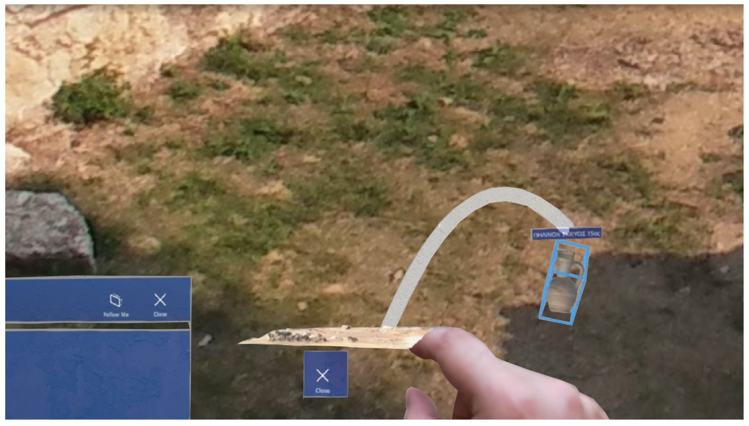
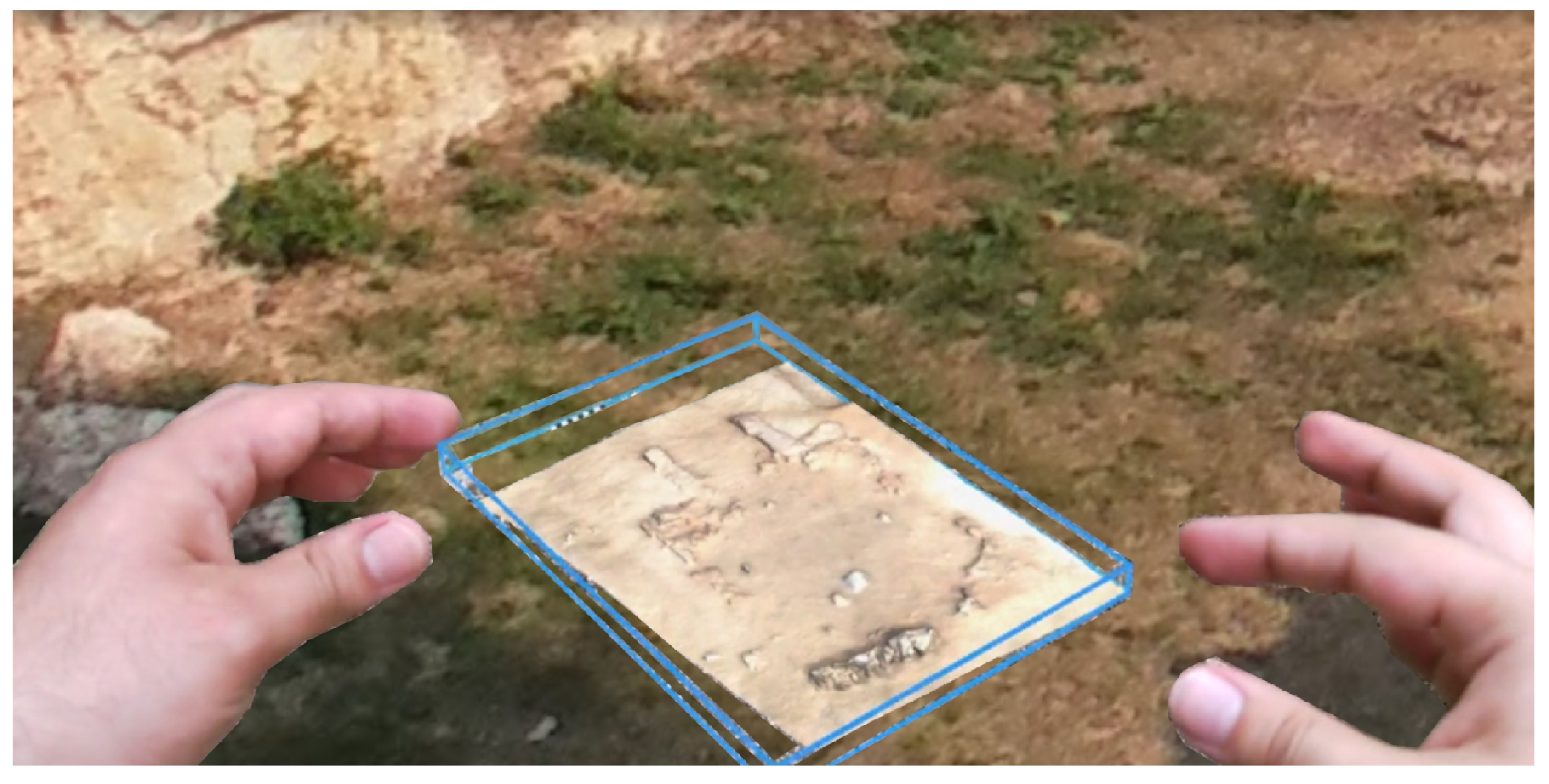
- Integration of various digital technologies into one holistic system, like GIS, Google Maps, interactive user interfaces, 3D modeling, and augmented reality, significantly enhancing the process of archaeological documentation and scientific analysis.
- Dual purpose of the application as a direct result of its sophisticated integration of various digital technologies. The app serves as a powerful documentation tool, enhancing the accuracy and efficiency of recording archaeological findings through advanced geospatial technologies and 3D modeling. Moreover, it revolutionizes the way archaeological data are interpreted and shared by leveraging augmented reality and interactive interfaces.
2. Literature Review
2.1. Geospatial Technologies in Archaeological Research
2.2. Augmented Reality in Archaeology
2.3. Challenges in Archaeological Excavation and Data Documentation
2.4. Current Solutions and Their Limitations
3. Methodology
3.1. Use Case Scenarios
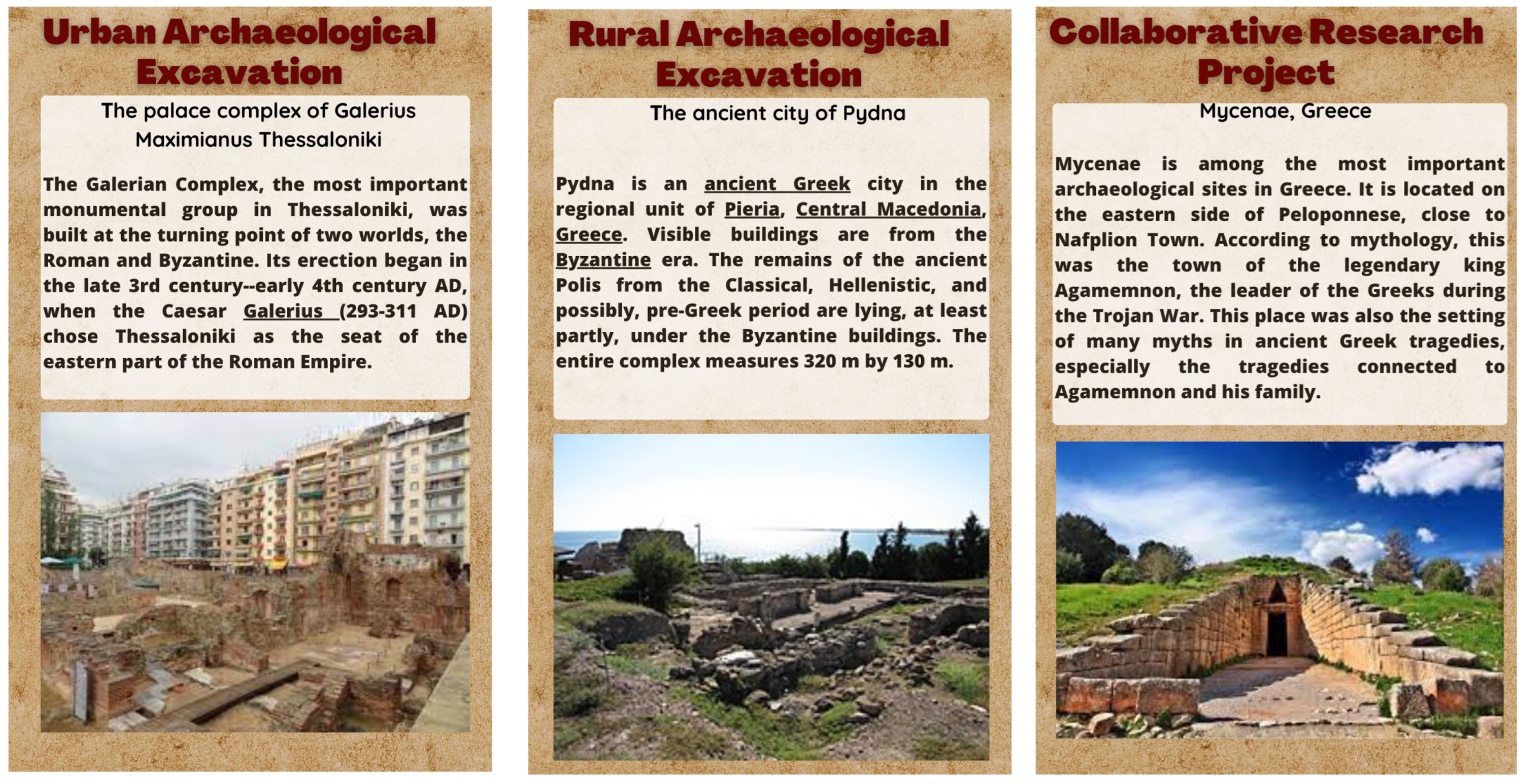
3.1.1. Urban Archaeological Excavation Scenario
3.1.2. Rural Archaeological Site
3.1.3. Collaborative Research Project
3.2. Mobile App Development
3.2.1. Concept and Requirements
3.2.2. Platform and Technology Selection
3.3. User Interface (UI) Design
3.4. Geospatial Integration
3.5. Integration with Hololens II
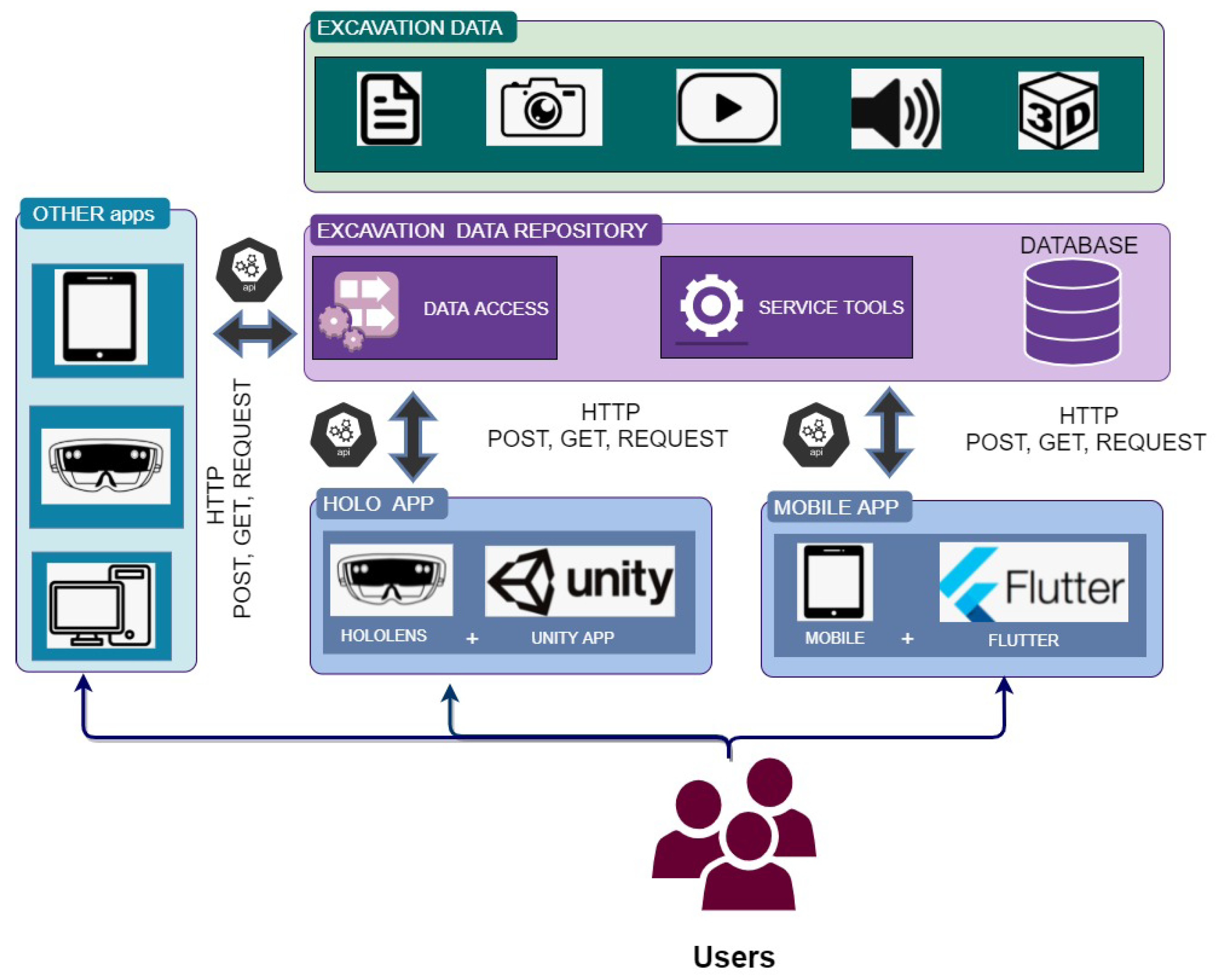
3.6. System Architecture and Design
4. Experimental Results
4.1. Experiment Set-Up
4.2. Mobile App
4.2.1. Auxiliary Menu
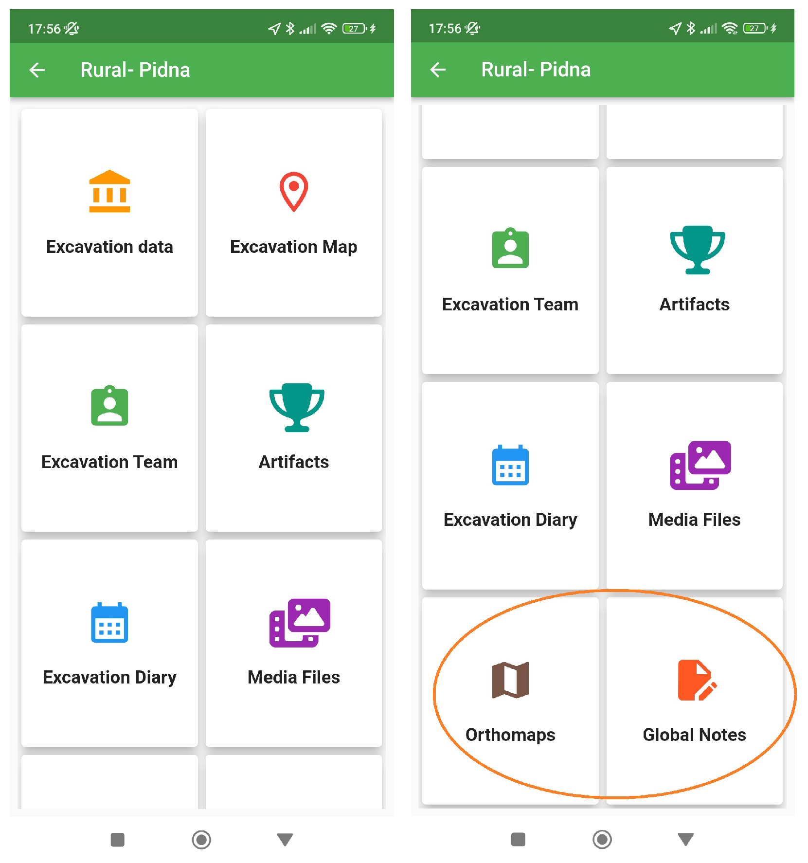
4.2.2. Excavation Main Menu
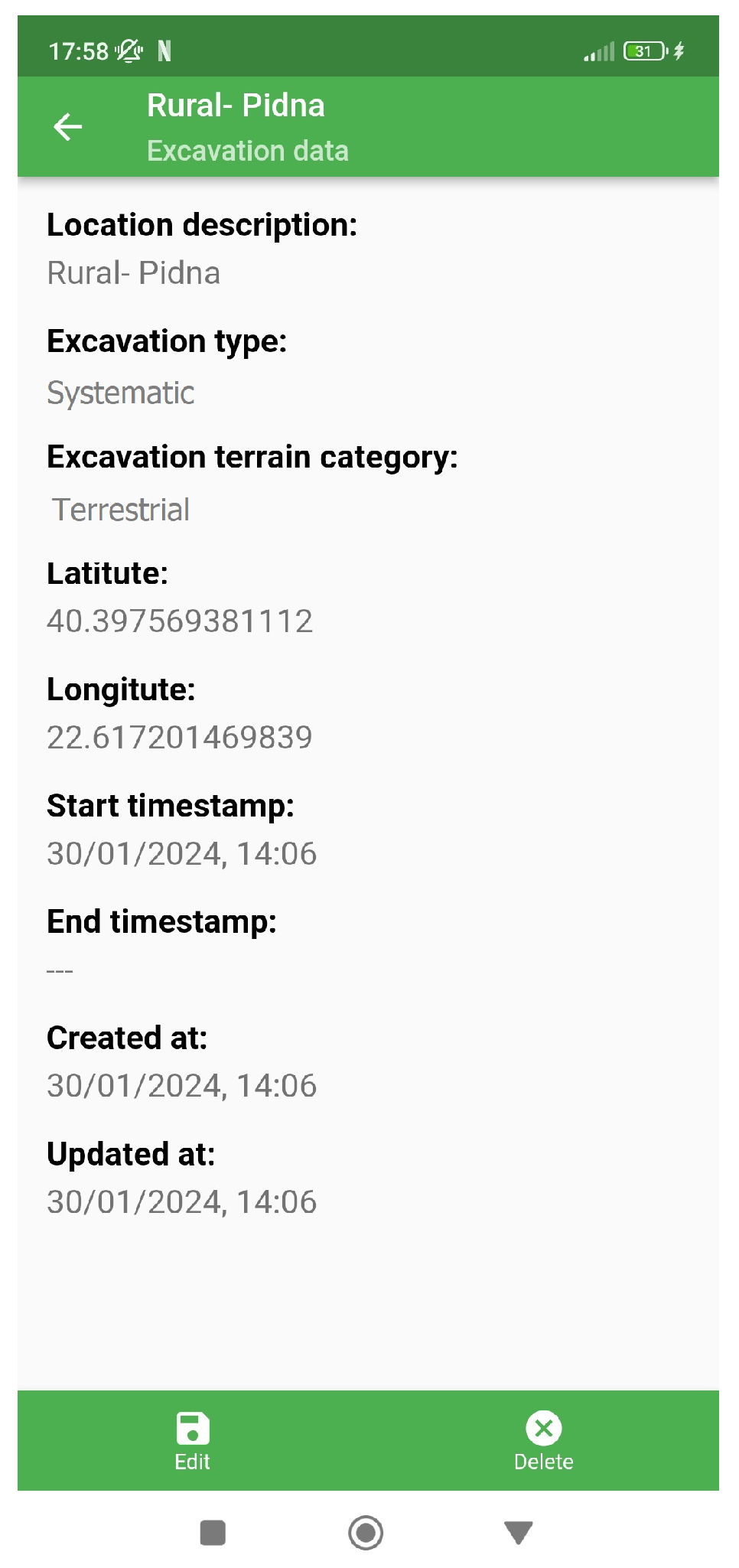
4.2.3. Excavation Data
4.2.4. Excavation Map Exploiting GIS
4.2.5. Excavation Team
4.2.6. Excavation Artifacts
4.2.7. Excavation Diary
4.2.8. Media Files
4.2.9. Orthomaps
4.2.10. Global Notes
4.3. Hololens II
4.3.1. Menu
4.3.2. Excavation Media
4.4. Mobile App and Hololens II Performance during Real-World Excavation Scenarios
4.5. Discussion
4.5.1. Limitations
4.5.2. Future Work
5. Conclusions
Author Contributions
Funding
Data Availability Statement
Acknowledgments
Conflicts of Interest
References
- Psarros, D.; Stamatopoulos, M.I.; Anagnostopoulos, C.N. Information Technology and Archaeological Excavations: A Brief Overview. Sci. Cult. 2022, 8, 147–167. [Google Scholar]
- Previtali, M.; Valente, R. Archaeological documentation and data sharing: Digital surveying and open data approach applied to archaeological fieldworks. Virtual Archaeol. Rev. 2019, 10, 17–27. [Google Scholar] [CrossRef]
- Morgan, C. Current digital archaeology. Annu. Rev. Anthropol. 2022, 51, 213–231. [Google Scholar] [CrossRef]
- Jebur, A.K. Uses and applications of geographic information systems. Saudi J. Civ. Eng. 2021, 5, 18–25. [Google Scholar] [CrossRef]
- Brutto, M.L.; Meli, P. Computer vision tools for 3D modelling in archaeology. Int. J. Herit. Digit. Era 2012, 1, 1–6. [Google Scholar] [CrossRef]
- Kansa, E.; Kansa, S.W. Digital data and data literacy in archaeology now and in the new decade. Adv. Archaeol. Pract. 2021, 9, 81–85. [Google Scholar] [CrossRef]
- Nobles, G.R.; Roosevelt, C.H. Filling the void in archaeological excavations: 2D point clouds to 3D volumes. Open Archaeol. 2021, 7, 589–614. [Google Scholar] [CrossRef]
- McCoy, M.D. The site problem: A critical review of the site concept in archaeology in the digital age. J. Field Archaeol. 2020, 45, S18–S26. [Google Scholar] [CrossRef]
- McCoy, M.D. Defining the geospatial revolution in archaeology. J. Archaeol. Sci. Rep. 2021, 37, 102988. [Google Scholar] [CrossRef]
- Vos, D.; Heeren, S.; van Ruler, N.; Smallenbroek, K.; Lassche, R. PAN (Portable Antiquities of the Netherlands): Harnessing Geospatial Technology for the Enrichment of Archaeological Data. J. Geogr. Inf. Sci. 2018, 6, 13–20. [Google Scholar] [CrossRef]
- Rajani, M.; Dixit, S. Potential of geospatial technologies as a cognitive and spatio-visual tool for mapping the past. Natl. Secur. Vivekananda Int. Found. 2021, 4, 63–80. [Google Scholar]
- Stylianidis, E.; Evangelidis, K.; Vital, R.; Dafiotis, P.; Sylaiou, S. 3D Documentation and visualization of cultural heritage buildings through the application of geospatial technologies. Heritage 2022, 5, 2818–2832. [Google Scholar] [CrossRef]
- Rajani, M.; Dixit, S. Potential of Geospatial Technologies. Natl. Secur. 2021, 4, 73–92. [Google Scholar]
- Poslončec-Petrić, V.; Vuković, V.; Bačić, Ž.; Kljajić, I. Use of Augmented Reality to Present Archaeological Contents. In Proceedings of the International Symposium on Innovative and Interdisciplinary Applications of Advanced Technologies, Tuzla, Bosnia and Herzegovina, 1–4 June 2023; Springer: Berlin/Heidelberg, Germany, 2023; pp. 186–194. [Google Scholar]
- Ajili, L.; Louati, H.; Ben Ameur, F. Augmented Reality Coupled with Deep Convolution Neural Networks to Enhance Archaeological Sites Experience. In New Trends in Intelligent Software Methodologies, Tools and Techniques; IOS Press: Amsterdam, The Netherlands, 2023; pp. 97–108. [Google Scholar]
- Dragoni, A.F.; Quattrini, R.; Sernani, P.; Ruggeri, L. Real scale augmented reality. A novel paradigm for archaeological heritage fruition. In Proceedings of the 1st International and Interdisciplinary Conference on Digital Environments for Education, Arts and Heritage: EARTH 2018 1; Springer: Berlin/Heidelberg, Germany, 2019; pp. 659–670. [Google Scholar]
- Varinlioglu, G.; Halici, S.M. Gamification of Heritage through augmented reality. Ecaade Sigradi 2019, 1, 513–518. [Google Scholar]
- Marto, A.; Gonçalves, A.; Martins, J.; Bessa, M.C. Applying UTAUT Model for an Acceptance Study Alluding the Use of Augmented Reality in Archaeological Sites. In Proceedings of the VISIGRAPP (2: HUCAPP), Prague, Czech Republic, 25–27 February 2019; pp. 111–120. [Google Scholar]
- Barrile, V.; Fotia, A.; Ponterio, R.; Mollica Nardo, V.; Giuffrida, D.; Mastelloni, M. A combined study of art works preserved in the archaeological museums: 3D survey, spectroscopic approach and augmented reality. Int. Arch. Photogramm. Remote Sens. Spat. Inf. Sci. 2019, 42, 201–207. [Google Scholar] [CrossRef]
- Karaarslan, S.V. Application of augmented reality technologies in archaeology. Engl. Artic. 2018, 2018, 181–200. [Google Scholar]
- Faniel, I.M.; Austin, A.; Kansa, E.; Kansa, S.W.; France, P.; Jacobs, J.; Boytner, R.; Yakel, E. Beyond the archive: Bridging data creation and reuse in archaeology. Adv. Archaeol. Pract. 2018, 6, 105–116. [Google Scholar] [CrossRef]
- Henninger, M. From mud to the museum: Metadata challenges in archaeology. J. Inf. Sci. 2018, 44, 658–670. [Google Scholar] [CrossRef]
- Kansa, S.W.; Atici, L.; Kansa, E.C.; Meadow, R.H. Archaeological analysis in the information age: Guidelines for maximizing the reach, comprehensiveness, and longevity of data. Adv. Archaeol. Pract. 2020, 8, 40–52. [Google Scholar] [CrossRef]
- May, K.; Taylor, J.S.; Binding, C. Stratigraphic Analysis and The Matrix: Connecting and reusing digital records and archives of archaeological investigations. Internet Archaeol. 2023, 61, 64. [Google Scholar] [CrossRef]
- Lercari, N.; Shiferaw, E.; Forte, M.; Kopper, R. Immersive visualization and curation of archaeological heritage data: Çatalhöyük and the Dig@ IT App. J. Archaeol. Method Theory 2018, 25, 368–392. [Google Scholar] [CrossRef]
- Admin. Innovation in Archaeological Documentation Methods. Available online: https://mycoordinates.org/innovation-in-archaeological-documentation-methods/ (accessed on 18 September 2023).
- Admin. Principal Archaeological Applications. Available online: https://ebrary.net/205884/geography/principal_archaeological_applications (accessed on 19 September 2023).
- Georgiadis, C.; Tsioukas, V.; Sechidis, L.; Stylianidis, E.; Patias, P. Fast and accurate documentation of archaeological sites using in the field photogrammetric techniques. Int. Arch. Photogramm. Remote Sens. 2000, 33, 28–32. [Google Scholar]
- iDig. Available online: https://idig.tips/ (accessed on 19 September 2023).
- Montagnetti, R.; Guarino, G. From qgis to qfield and vice versa: How the new android application is facilitating the work of the archaeologist in the field. Environ. Sci. Proc. 2021, 10, 6. [Google Scholar] [CrossRef]
- Masson-MacLean, E.; O’Driscoll, J.; McIver, C.; Noble, G. Digitally recording excavations on a budget: A (low-cost) DIY approach from Scotland. J. Field Archaeol. 2021, 46, 595–613. [Google Scholar] [CrossRef]
- Lindsay, I.; Kong, N.N. Using the ArcGIS collector mobile app for settlement survey data collection in Armenia. Adv. Archaeol. Pract. 2020, 8, 322–336. [Google Scholar] [CrossRef]
- De Roo, B.; Stal, C.; Lonneville, B.; De Wulf, A.; Bourgeois, J.; De Maeyer, P. Spatiotemporal data as the foundation of an archaeological stratigraphy extraction and management system. J. Cult. Herit. 2016, 19, 522–530. [Google Scholar] [CrossRef]
- Roosevelt, C.H.; Cobb, P.; Moss, E.; Olson, B.R.; Ünlüsoy, S. Excavation is destruction digitization: Advances in archaeological practice. J. Field Archaeol. 2015, 40, 325–346. [Google Scholar] [CrossRef]
- Smith, N.G.; Levy, T.E. ArchField in Jordan: Real-time GIS data recording for archaeological excavations. Near East. Archaeol. 2014, 77, 166–170. [Google Scholar] [CrossRef][Green Version]
- Tripcevich, N.; Wernke, S.A. On-site recording of excavation data using mobile GIS. J. Field Archaeol. 2010, 35, 380–397. [Google Scholar] [CrossRef]
- Katsianis, M.; Tsipidis, S.; Kotsakis, K.; Kousoulakou, A. A 3D digital workflow for archaeological intra-site research using GIS. J. Archaeol. Sci. 2008, 35, 655–667. [Google Scholar] [CrossRef]
- Pradeep, A.; Paracha, M.T.; Bhowmick, P.; Davanian, A.; Razaghpanah, A.; Chung, T.; Lindorfer, M.; Vallina-Rodriguez, N.; Levin, D.; Choffnes, D. A comparative analysis of certificate pinning in Android & iOS. In Proceedings of the 22nd ACM Internet Measurement Conference, Nice, France, 25–27 October 2022; pp. 605–618. [Google Scholar]
- AL-atraqchi, O.M. A Proposed Model for Build a Secure Restful API to Connect between Server Side and Mobile Application Using Laravel Framework with Flutter Toolkits. Cihan Univ.-Erbil Sci. J. 2022, 6, 28–35. [Google Scholar] [CrossRef]
- Bähr, S.; Haas, G.C.; Keusch, F.; Kreuter, F.; Trappmann, M. Missing data and other measurement quality issues in mobile geolocation sensor data. Soc. Sci. Comput. Rev. 2022, 40, 212–235. [Google Scholar] [CrossRef]
- Nielsen, K.E.; Mejía, S.T.; Gonzalez, R. Deviations from typical paths: A novel approach to working with GPS data in the behavioral sciences. Int. J. Health Geogr. 2022, 21, 5. [Google Scholar] [CrossRef] [PubMed]
- Park, S.; Bokijonov, S.; Choi, Y. Review of microsoft hololens applications over the past five years. Appl. Sci. 2021, 11, 7259. [Google Scholar] [CrossRef]
- Nieminen, T. Unity Game Engine in Visualization, Simulation and Modelling. Bachelor’s Thesis, Tampere University, Tampere, Finland, 2021. [Google Scholar]
- How to Do an Excavation. Available online: https://www.athinodromio.gr/%CF%80%CF%8E%CF%82-%CE%BA%CE%AC%CE%BD%CE%BF%CF%85%CE%BC%CE%B5-%CE%BC%CE%B9%CE%B1-%CE%B1%CE%BD%CE%B1%CF%83%CE%BA%CE%B1%CF%86%CE%AE-2/ (accessed on 11 May 2024).
- Technologies, U. Unity-Manual: Practical Guide to Optimization for Mobiles. Available online: https://docs.unity3d.com/2020.1/Documentation/Manual/MobileOptimizationPracticalGuide.html (accessed on 11 May 2024).
- Biggs, J. You Can Now Use Your Cellphone as a 3D Modeling Tool|TechCrunch. Available online: https://techcrunch.com/2015/04/01/you-can-now-use-your-cellphone-as-a-3d-modeling-tool/?guccounter=1&guce_referrer=aHR0cHM6Ly9lZGdlc2VydmljZXMuYmluZy5jb20v&guce_referrer_sig=AQAAALvXV663Xid78FISxffFO4X9EiBxkzdFthIUenSOnn41KixSXEN5_hPpjV6JOEHMSov7Q42aeBLzPbcTHwy3HMqq90xQRFu7taeSIt8UHSoSLZ9OTTcHNwU8noPs-hUun6-HBLeuBU36wwcz0R2X5HBnM1Y4ZiobfqWKDQPaunpj (accessed on 11 May 2024).



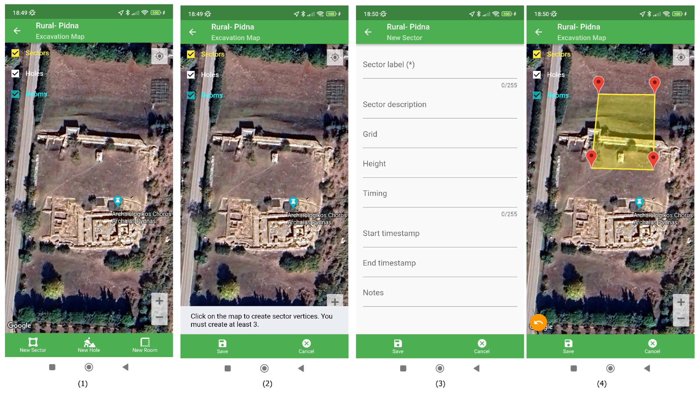

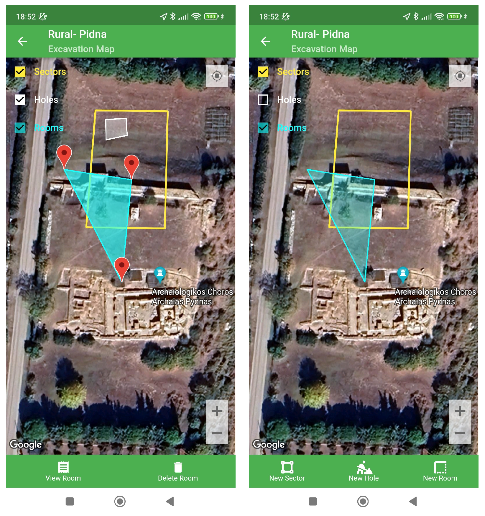
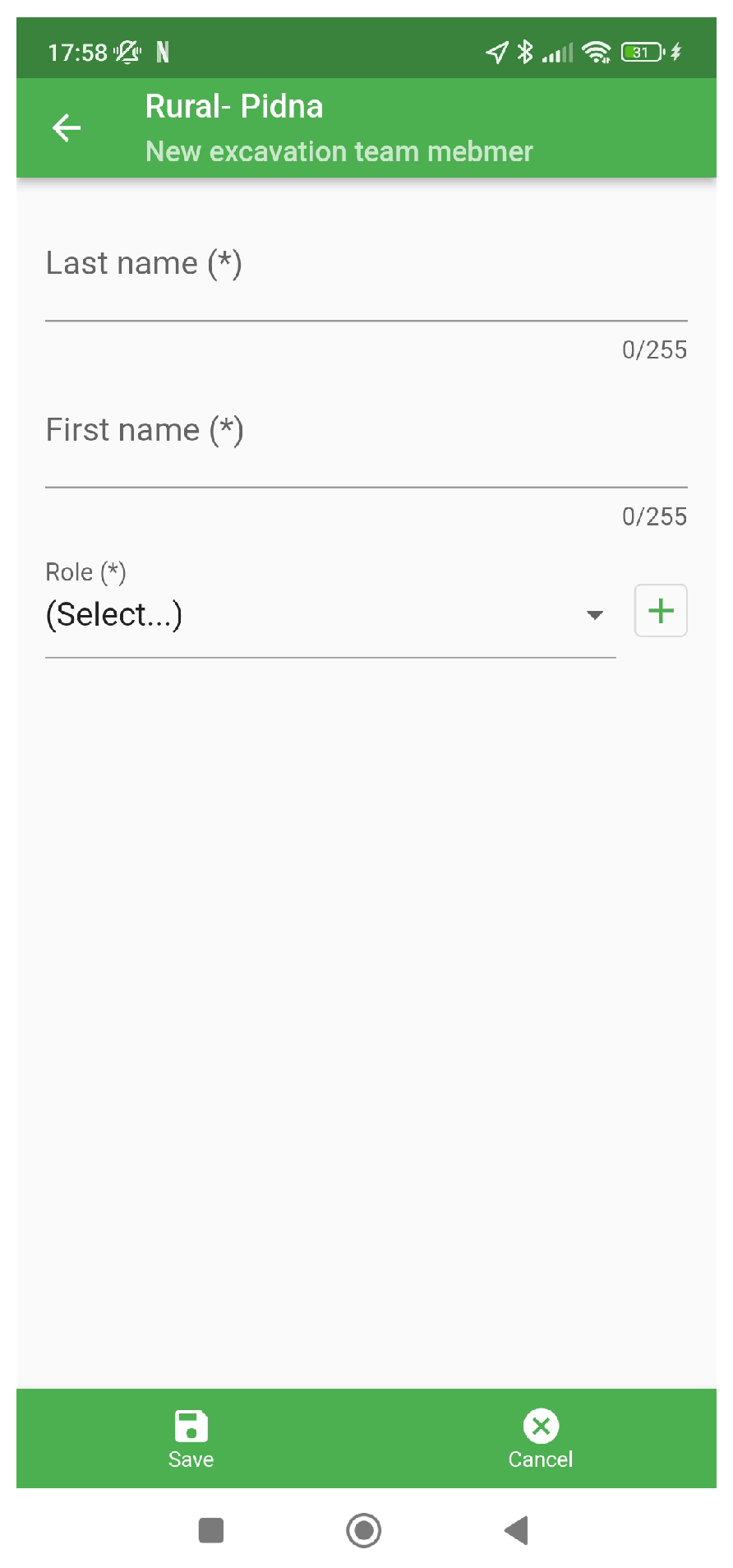
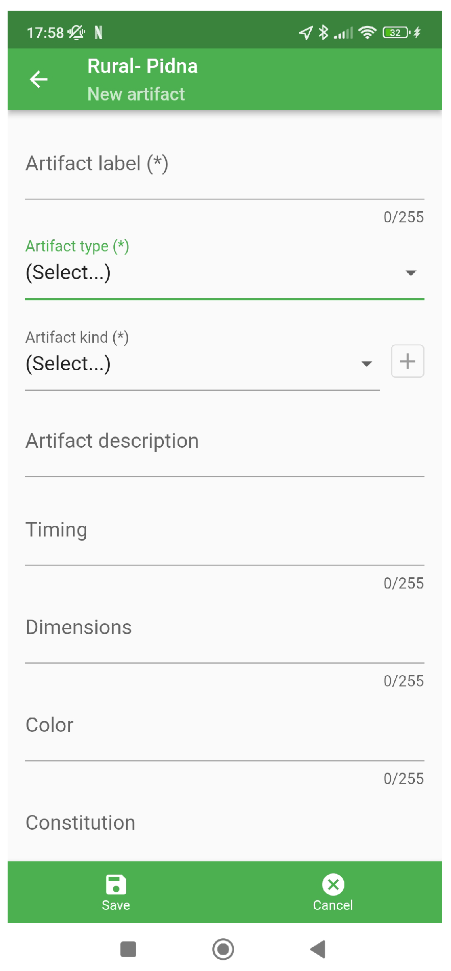




| Study | Methods Used | Applications | Limitations |
|---|---|---|---|
| Archaeological recording [25] | Sketching, drawing, note-taking, digital recording technologies (e.g., 3D documentation), geomatic techniques, digital photogrammetry | Recording cultural and biological remains, accurate mapping, data preservation | Cost, skill requirements, data processing time, weather constraints, airspace regulations |
| UAV applications [27] | Unmanned aerial vehicles, 3D and 4D documentation workflow | 3D documentation of archaeological excavations, historic site recording, landscape surveying, aerial exploration, under-canopy archaeology detection | Weather conditions, airspace regulations, skill requirements, ethical and legal concerns, initial investment costs |
| Digital photogrammetry [28] | Digital image processing and mapping | Fast and accurate mapping for archaeological sites, recording multiple temporal levels of ruins | Skill requirements for data processing, need for compatible hardware, learning curve |
| iDig [29] | Digital data recording, wireless connectivity | Streamlining field data recording, better collaboration, data preservation | Learning curve for users, reliance on compatible hardware, initial investment costs, may not fully replace traditional methods, no 3D modeling |
| Qfield [30] and low-cost digital technologies [31] | QGIS/Qfield app, DIY digital workflow | Field data collection, digital recording | Compatibility, accessibility, weather constraints |
| ArcGIS Collector [32] and spatiotemporal data [33] | ArcGIS Collector app, spatiotemporal data system | Survey data collection, stratigraphy extraction | Licensing, data processing, skill requirements |
| Digital archaeology [34] and ArchField [35] | Digital recording, ArchField software | Preservation, real-time recording | Integration, real-time data capture |
| Mobile GIS [36] and 3D digital workflow [37] | ESRI ArcPad, 3D digital workflow | On-site recording, intra-site analysis | Hardware compatibility, learning curve |
| Integrated Technologies | ||||||||
|---|---|---|---|---|---|---|---|---|
| Study | Sketching, Drawing, Note-Taking | Digital Recording Technologies | Geomatic Techniques | 3D Modeling, Visualization | Digital Image | Wireless Connectivity | Spatiotemporal Data System | AR |
| [25] | ✓ | ✓ | ✓ | |||||
| [27] | ✓ | |||||||
| [28] | ✓ | |||||||
| [29] | ✓ | ✓ | ||||||
| [30] | ||||||||
| [32] | ✓ | |||||||
| [34] | ✓ | |||||||
| [36] | ||||||||
| This study | ✓ | ✓ | ✓ | ✓ | ✓ | ✓ | ✓ | ✓ |
| Concept Aspect | Description |
|---|---|
| Digital Transformation | Shift from manual, paper-based methods to digital data collection and documentation. |
| Cross-Platform Accessibility | Accessibility on Android tablets initially, with potential future expansion to iOS. |
| Real-Time Collaboration | Enables researchers to collaborate in real time, regardless of physical locations. |
| Geospatial Integration | Integrates historical maps onto the modern landscape for contextual reference. |
| Efficient Data Collection | Facilitates on-site data collection, annotation, photography, and 3D modeling within a user-friendly interface. |
| Requirement | Description |
|---|---|
| Platform Compatibility | The mobile app must be compatible with Android tablets initially, with potential future expansion to iOS devices. |
| User-Friendly Interface | The user interface (UI) should be intuitive and efficient, catering to the needs of archaeologists and researchers conducting fieldwork. |
| Data Collection and Annotation | The app should allow for on-site data collection, annotation, and photography of artifacts. It should also support 3D modeling capabilities for precise documentation. |
| Real-Time Collaboration | The system must enable real-time collaboration among team members, allowing for simultaneous data entry and sharing. |
| Geospatial Integration | Integration with geospatial data is essential to overlay historical maps onto modern landscapes for contextual reference. |
| Data Security | Robust data security measures must be implemented to protect sensitive archaeological information, ensuring access is restricted to authorized users. |
| Scalability | The system should be designed with scalability in mind to accommodate future enhancements and expansions. |
| Training and Support | Comprehensive training and support materials must be provided to ensure users can effectively utilize the system. |
| Quality Assurance | Rigorous testing and quality assurance procedures are necessary to identify and rectify any issues or bugs. |
| Deployment | The app should be deployable on the Google Play Store for Android devices and prepared for potential deployment on the Apple App Store in the future. |
| Principle | Description |
|---|---|
| Consistency | Consistency in layout, navigation, and visual elements is maintained throughout the app and other system components. This consistency ensures that users can easily navigate and interact with the system without encountering unexpected changes. |
| Efficiency | Efficiency is a key principle. The design streamlines data collection and documentation processes, reducing the time and effort required for tasks. Intuitive interfaces and logical workflows contribute to efficiency. |
| Accessibility | The design prioritizes accessibility, ensuring that all users, including those with disabilities, can interact with the system. Features such as text-to-speech, adjustable font sizes, and clear contrast are integrated to enhance accessibility. |
| Feedback and Guidance | Providing clear feedback and guidance to users is essential. The UI offers informative prompts, tooltips, and feedback messages to guide users in performing tasks and understanding the system’s status. |
| Consideration | Description |
|---|---|
| Device Compatibility | Given the system’s initial compatibility with Android tablets, the UI is optimized for larger screens. Adequate spacing, touch-friendly elements, and layouts that make the most of tablet real estate are considered. |
| Intuitive Navigation | The navigation structure is designed to be intuitive, allowing users to access different features and sections of the app easily. Navigation menus and hierarchies are structured logically. |
| Data Entry | Data entry forms are designed with simplicity and efficiency in mind. User-friendly input methods, such as dropdown lists and checkboxes, reduce data entry errors and enhance user productivity. |
| Visual Aesthetics | Visual esthetics play a role in user engagement. The UI design incorporates a visually pleasing and cohesive color palette, icons, and imagery that align with the system’s archaeological context. |
| Real-Time Updates | In scenarios where real-time collaboration is essential, the UI accommodates real-time updates and notifications to keep users informed about changes made by team members. |
| Orientation and Context | The UI provides orientation and context, especially when overlaying historical maps onto modern landscapes. Features like markers and legends clarify the user’s position and the relevance of archaeological features. |
| Testing and Iteration | Usability testing is conducted with archaeologists and researchers to gather feedback on the UI design. Iterations are made based on user feedback to enhance the design’s effectiveness. |
| Cross-Platform Consistency | While the system is initially developed for Android tablets, consideration is given to maintaining consistency should the system expand to iOS in the future. Design elements that translate well across platforms are prioritized. |
| Scenario | Key Metrics | Performance Evaluation |
|---|---|---|
| Urban | - Time spent navigating to artifacts: 90 s - Location accuracy deviation: ±2 cm - On-site annotation completion rate: 85% | - Navigation was quick and obstacles were managed efficiently. - High precision in artifact location pinpointing. - Annotation process was completed effectively in most cases. |
| Rural | - Time to collect data per artifact: 2 min - Stability of system under harsh conditions: 92% uptime - Accuracy of geospatial overlays: within 5% of satellite data | - Efficient data collection demonstrated under remote conditions. - System maintained high uptime even in challenging environments. - Geospatial overlays closely matched satellite data, confirming accuracy. |
| Collaborative | - Delay in data sharing between devices: <5 s - Team satisfaction score: 95% | - Near-instantaneous data sharing facilitated smooth collaboration. - High team satisfaction indicates effective collaborative tools and features. |
Disclaimer/Publisher’s Note: The statements, opinions and data contained in all publications are solely those of the individual author(s) and contributor(s) and not of MDPI and/or the editor(s). MDPI and/or the editor(s) disclaim responsibility for any injury to people or property resulting from any ideas, methods, instructions or products referred to in the content. |
© 2024 by the authors. Licensee MDPI, Basel, Switzerland. This article is an open access article distributed under the terms and conditions of the Creative Commons Attribution (CC BY) license (https://creativecommons.org/licenses/by/4.0/).
Share and Cite
Dimara, A.; Tsakiridis, S.; Psarros, D.; Papaioannou, A.; Varsamis, D.; Anagnostopoulos, C.-N.; Krinidis, S. An Innovative System for Enhancing Archaeological In Situ Excavation through Geospatial Integration. Heritage 2024, 7, 2586-2619. https://doi.org/10.3390/heritage7050124
Dimara A, Tsakiridis S, Psarros D, Papaioannou A, Varsamis D, Anagnostopoulos C-N, Krinidis S. An Innovative System for Enhancing Archaeological In Situ Excavation through Geospatial Integration. Heritage. 2024; 7(5):2586-2619. https://doi.org/10.3390/heritage7050124
Chicago/Turabian StyleDimara, Asimina, Sotirios Tsakiridis, Doukas Psarros, Alexios Papaioannou, Dimitrios Varsamis, Christos-Nikolaos Anagnostopoulos, and Stelios Krinidis. 2024. "An Innovative System for Enhancing Archaeological In Situ Excavation through Geospatial Integration" Heritage 7, no. 5: 2586-2619. https://doi.org/10.3390/heritage7050124
APA StyleDimara, A., Tsakiridis, S., Psarros, D., Papaioannou, A., Varsamis, D., Anagnostopoulos, C.-N., & Krinidis, S. (2024). An Innovative System for Enhancing Archaeological In Situ Excavation through Geospatial Integration. Heritage, 7(5), 2586-2619. https://doi.org/10.3390/heritage7050124


