

A Conceptual Framework for Integrating Terrestrial Laser Scanning (TLS) into the Historic American Buildings Survey (HABS)


Abstract
:1. Introduction of Heritage Documentation Programs (HDP) and Historic American Buildings Survey (HABS) in the U.S.
1.1. Origin of America’s Heritage Documentation Programs
1.2. Evolution and Expansion of the HDP
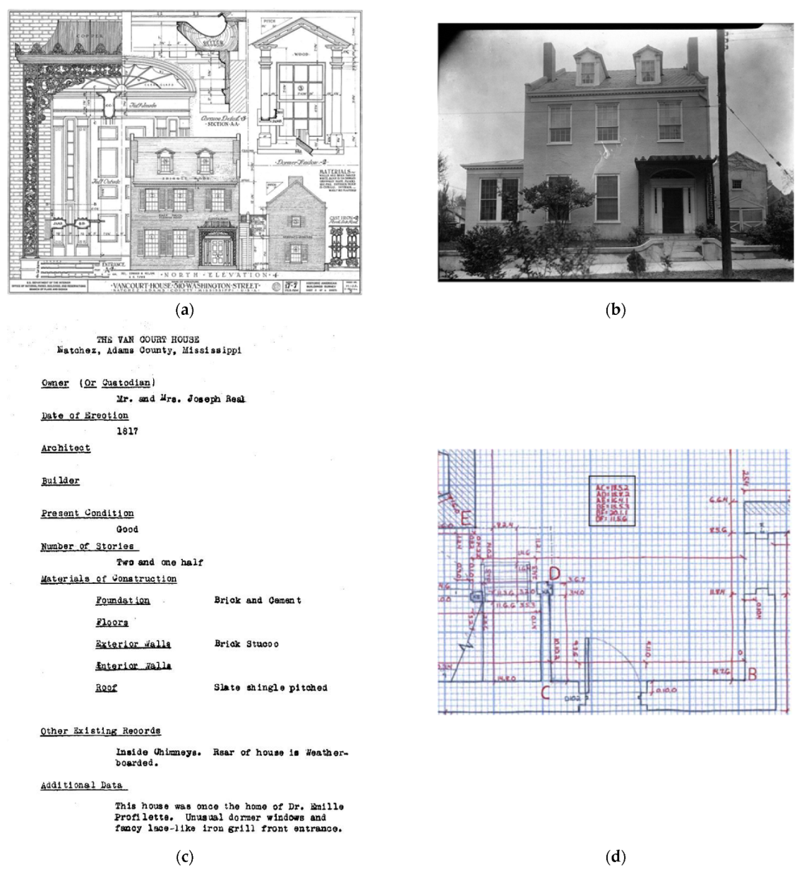
- HABS: As the cornerstone of HDP, established in 1933, the HABS’s mission revolves around documenting a diverse range of American structures, from grand architect-designed towers to the more modest vernacular constructions.
- HAER: Started in 1969, with a lens on America’s engineering marvels, the HAER captures the essence of bridges, ships, factories, and other feats of engineering.
- HALS: Commissioned in 2000, the HALS delves into the nation’s historic landscapes, capturing everything from meticulously designed gardens to expansive urban parks and untouched rural vistas.
1.3. Technological Evolution in HABS’s Documentation Methods
- Measured Drawings: The primary objective of measured drawings is to offer a detailed and accurate representation of a site’s architectural features. Produced after meticulous on-site measurements, these drawings capture the structure’s proportions, dimensions, and intricate details. The data recorded include scale-specific representations, detailed floor plans, elevations, cross-sectional views, and close-ups of specific architectural or engineering features.
- Large-Format Black and White Photography: This technique aims to visually document the site or structure in its current state, capturing its fine details, contrasts, and textures. Black and white photography is favored for its timeless quality and ability to provide a detailed visual archive. The photographs taken encompass exterior and interior views, close-up shots of specific architectural elements, and broader contextual images that place the structure within its environment.
- Written Historical Reports: These reports narrate the comprehensive history and significance of the site or structure. They encompass details about the site’s history, architectural style, construction methods, and any alterations it might have undergone. The data within these reports include a detailed historical background, architectural analysis, insights into the site’s cultural and social significance, and a bibliography of consulted sources.
- Field Notes: Field notes are a crucial supplement to other documentation techniques. They involve the recorder’s firsthand observations, sketches, and annotations made during on-site visits. The primary objective of field notes is to capture immediate insights, preliminary measurements, and contextual details that might not be evident in formal drawings or photographs. These notes often provide a richer understanding of the site, capturing nuances like material finishes, decay patterns, or anecdotal histories shared by locals. Over time, field notes have evolved from handwritten notes to digital annotations, but their essence remains the same: to provide a raw, unfiltered perspective of the site during the documentation process.
1.4. Challenges Faced by HABS
1.5. Objective and Significance of the Study
1.6. Nature of the Paper
1.7. Abbreviations
- AR: Augmented Reality
- BIM: Building Information Modeling
- CADD: Computer-Aided Design and Drafting
- CRGIS: Cultural Resources Geographic Information Systems
- GIS: Geographic Information Systems
- HABS: Historic American Buildings Survey
- HAER: Historic American Engineering Record
- HALS: Historic American Landscapes Survey
- HBIM: Heritage Building Information Modeling
- HDP: Heritage Documentation Program of the National Park Service
- LiDAR: Light Detection and Ranging
- MEP: Mechanical, Electrical, and Plumbing
- NPS: National Park Service of the U.S.
- PC: Point Cloud
- QAQC: Quality Assurance and Quality Control
- RC: Reality Capture
- TLS: Terrestrial Laser Scanning
- UAV: Unmanned Aerial Vehicle
- VR: Virtual Reality
2. A Comparative Analysis of Laser Scanning Technology in Building Construction and Historic Documentation
2.1. Introduction to Laser Scanning Technology
2.2. Comparative Analysis: Laser Scanning in Building Construction vs. Heritage Documentation
2.2.1. Laser Scanning for Building Construction
Scanning Methodology
Intended Outputs
2.2.2. Laser Scanning for Historic Documentation
Scanning Methodology
Intended Outputs
2.2.3. Comparison and Contrast of Laser Scanning Use in Both Disciplines
2.2.4. Combination of Methods from Both Disciplines and Contradictions
2.3. Gaps and Opportunities for Future Research
3. Laser Scanning in HABS Documentation
3.1. HDP’s “Brief” and Its Critiques on Laser Scanning for Heritage Documentation
3.2. Quantitative Analysis
- Accuracy of Captured Data: Laser scanning technology has revolutionized the heritage documentation field by providing unprecedented accuracy levels. Unlike traditional hand-measuring techniques, which are prone to human error and can be limited by physical constraints, laser scanners can capture highly detailed and precise measurements of structures, often down to the millimeter [13,51,52,53]. This high level of accuracy enhances the documentation’s quality and provides valuable data for conservation and restoration efforts.
- Time Saving: Other than its superior accuracy, laser scanning can offer significant time savings, especially when documenting large or complex structures. As Al-Bayari and Shatnawi’s study [19] mentioned, 25–30% of the time needed for field surveys could be reduced using TLS to capture and document heritage. While the initial investment in laser scanning equipment can be substantial, the efficiency gains can lead to considerable cost savings over time.
- Complete Coverage of Captured Structure: One of the key advantages of laser scanning is its ability to capture data from all the visible surfaces of a structure, including areas that may be difficult or impossible to reach with hand measuring. This ensures a more comprehensive documentation of the structure [15,16,17].
- Manageability of Digital Files: Digital files offer significant advantages in terms of manageability compared to traditional hard copy records (e.g., drawings, field notes). They can be easily organized, searched, and shared, making them highly accessible to a wide range of users [18].
- Economics and Accessibility of Cloud Storage: The trend in the field of heritage documentation is shifting towards the use of cloud storage for point cloud data generated from laser scanning [54]. With the advent of cloud storage, preserving large amounts of digital data has become increasingly affordable and accessible. Unlike physical storage for hard copy records, which can be costly and space-consuming, cloud storage offers a cost-effective and scalable solution for preserving digital records [55].
- Improved Permanence of Digital Records: While concerns have been raised about the permanence of digital records, advancements in digital storage technology have greatly improved their longevity. Data stored in the cloud are typically replicated across multiple servers and locations, providing high redundancy and protection against data loss [56]. Furthermore, cloud service providers routinely perform data integrity checks and offer robust data recovery options [57], which highlight the improved permanence of digital records compared to traditional hard copy records.
3.3. Qualitative Analysis
- Non-Invasive Contact Scanning Techniques: Laser scanning is a non-contact data collection method, which has a significant advantage when dealing with fragile or delicate heritage structures. This non-invasive technique ensures that the structure is not damaged or altered during documentation [16,17].
- Accessibility and High Visibility of PCs: Laser scanning produces high-density 3D PCs that can be easily visualized and manipulated on a computer, providing a highly interactive and engaging way for the public to explore heritage sites versus traditional 2D drawings or photographs. This can enhance public understanding and appreciation of these sites [58,59].
- Interpretation of Heritage with VR Technologies: The PCs produced by laser scanning can be integrated with VR technologies to create immersive experiences that bring heritage sites to life. This can provide a deeper level of engagement and understanding for the public, especially for sites that are not physically accessible [43,60].
- Use of Multiple Reality Capture Techniques: In most documentation projects, a combination of reality capture techniques is used, such as laser scanning, photogrammetry, 360-degree photography, and UAVs [20,61,62,63]. For instance, Markiewicz and Robak [64] generated high-resolution orthoimages based on TLS data and close-range images in their study. This multimodal approach ensures comprehensive coverage of the site and allows for the strengths of each technique to be leveraged.
- Enhanced Engagement through Technology: Laser scanning can actually enhance the recorder’s engagement with the heritage site. The planning process of setting up the scan locations and routes, selecting the appropriate settings for the scanners, registering and processing the captured scans, and interpreting the resulting PC data all require a deep understanding of the heritage and its characteristics [11,65]. This can foster a different but equally valuable form of engagement compared to traditional hand-measuring techniques.
- In-Depth Understanding of Heritage: Laser scanning provides a wealth of data that can reveal subtle details and patterns that may not be noticeable through hand measuring, for instance, the deflections of beams which are not visible during manual measurement but can be identified during modeling using PC data. This can lead to a more in-depth understanding of the structure, construction, and condition [62]. The process of analyzing these data can engage the recorder in a deep intellectual exploration of the site.
- Safety and Accessibility: The researchers argue that laser scanning can also allow recorders to engage with sites that would be inaccessible or unsafe for hand measuring. This can expand the range of sites that can be documented and provide opportunities for engagement with a wider variety of structures [66].
- Integration with Hand-Measuring Techniques: It is also worth noting that laser scanning does not have to replace hand measuring entirely. The two techniques can be used in conjunction, with laser scanning providing a broad overview of the site and hand measuring being used to document specific details or features [67]. This integrated approach can provide the best of both worlds, combining the efficiency and accuracy of laser scanning with the hands-on engagement of hand measuring (e.g., flowers or leaves in the arch details).
3.4. Discussion
- Development of Laser Scanning Guidelines for Data Acquisition and Management: The HABS should develop comprehensive guidelines that outline best practices for using laser scanning in heritage documentation. These guidelines would ensure that laser scanning is used effectively and consistently, maximizing its benefits while minimizing potential errors or issues. These guidelines should encompass all facets of data acquisition, including scanner selection, scan setup, data capture, and quality control [67]. They should also provide guidance on data management, including data processing, data format compatibility, and storage. However, while crafting these guidelines, the HABS must ensure they are not overly specific to allow for technological advancements and must consider the resource availability of the recorders [11].
- Acceptance of Diverse File Types for Heritage Documentation: The current HABS standards primarily accept 2D drawings for heritage documentation. However, laser scanning and other advanced technologies can produce various digital outputs, including PCs and 3D models [7]. To accommodate these advancements, they should update their standards to accept diverse file types. Specifically, for PCs, universal or popular formats like LAS, LAZ, and E57 should be considered. For 3D models, IFC formats are recommended for cases where textures are not essential, while native formats can be used for more descriptive information and textures. These diverse file types offer a more comprehensive and interactive documentation of heritage sites.
- Update of Digital Materials Management Systems and Platforms: To accommodate these diverse file types, the HABS will need to update its digital materials management systems and platforms. These systems should be capable of accepting, archiving, and sharing a wide range of digital files, including large and complex files like point clouds and HBIM models. They should also ensure the long-term preservation of these files, with robust data backup and recovery protocols. Furthermore, these platforms should be designed to facilitate public access to the digital files, allowing the public to explore and interact with the heritage sites in new and engaging ways [7].
4. Framework of a Study for Incorporation of TLS into the HABS Documentation
4.1. Dissertation Outline
- Chapter 1: Introduction. This chapter sets the stage by introducing the research topic, and highlighting the problem statement, research questions, goals, objectives, and the overall structure of the dissertation. It will:
- ○
- Highlight the significance of heritage building documentation and the challenges faced.
- ○
- Present the research questions that guide the study.
- ○
- Enumerate the research goals and objectives that the study aims to achieve.
- ○
- Define the scope of the research and provide an overview of the dissertation’s structure.
- ○
- Conclude by emphasizing the importance of the study in the context of heritage building documentation.
- Chapter 2: Literature Review. This chapter delves deep into the existing literature to provide a comprehensive understanding of the current state of heritage building documentation, the HABS, and TLS technology. It will:
- ○
- Begin with an overview of historic building documentation methods and their inherent challenges.
- ○
- Explore the capabilities and applications of terrestrial laser scanning (TLS) in this domain.
- ○
- Analyze previous studies that have attempted to integrate TLS data into historic building documentation.
- ○
- Provide a detailed review of the HABS standard, its implementation techniques, and the essential data elements it records.
- ○
- Discuss the integration of computer-aided design and drafting (CADD) into the HABS.
- ○
- Review techniques used to evaluate the effectiveness of historic building documentation.
- ○
- Identify gaps in the current literature that this study aims to address.
- Chapter 3: Methodology. This chapter outlines the research methodology employed in the study. It will:
- ○
- Discuss the overall research approach and design.
- ○
- Detail the methods and sources used for data collection, including the selection of historic buildings for case studies, interviews, and consultations.
- ○
- Describe the methods used for data analysis, including the identification of essential data elements and the development of the proposed framework.
- Chapter 4: Development of the Proposed Framework. This chapter focuses on the design and development of the proposed framework. It will:
- ○
- Discuss the design and structure of the framework.
- ○
- Explore how TLS techniques can be integrated into existing HABS documentation workflows for data acquisition.
- ○
- Consider the various aspects of TLS used for historic building documentation, including best practices, data processing, file formats and management, metadata standards, and interoperability.
- Chapter 5: Case Studies and Evaluation. This chapter applies the proposed framework to real-world scenarios. It will:
- ○
- Detail the application of the framework to selected historic buildings.
- ○
- Evaluate the framework’s effectiveness in capturing and enhancing essential data elements.
- ○
- Compare the outcomes with traditional HABS documentation methods in terms of quality, accuracy, and completeness.
- ○
- Assess the framework’s ability to enhance HABS documentation with TLS data.
- ○
- Discuss the feasibility of implementing the framework in real-world HABS documentation practices.
- Chapter 6: Conclusion and Future Work. This concluding chapter will:
- ○
- Recap the research objectives and summarize the key findings.
- ○
- Discuss the contributions of the study to the field of historic building documentation and HABS standards.
- ○
- Highlight the limitations of the study and suggest potential directions for future research.
- ○
- Offer recommendations for subsequent studies in this domain.
4.2. Study of HABS’s Adoption of CADD
4.3. Framework Development
- Guidelines for TLS Data Acquisition:
- ○
- Equipment Selection: A discussion on the types of TLS equipment suitable for heritage documentation, considering factors like resolution, range, and accuracy.
- ○
- Site Preparation: The steps to prepare a heritage site for scanning, including considerations for safety, obstructions, and optimal scanning positions.
- ○
- Scanning Protocols: The detailed procedures for conducting the scans, including scanner settings, number of scan positions, and overlap considerations.
- ○
- Quality Assurance: The methods to ensure the acquired data meet the required standards, such as using control points or reference markers.
- Guidelines for TLS Data Processing:
- ○
- Data Registration: The techniques to align and merge multiple scans into a cohesive point cloud.
- ○
- Noise Reduction: The procedures to remove unwanted data or noise from the scans, ensuring clarity.
- ○
- Data Simplification: The techniques, like decimation, to reduce the size of the dataset without significant loss of detail.
- ○
- Data Conversion: Converting PC data into formats suitable for HABS documentation, such as 2D drawings or 3D models.
- Guidelines for TLS Data Management:
- ○
- Data Storage: Recommendations for storing large TLS datasets, considering factors like data integrity, redundancy, and accessibility.
- ○
- Metadata Standards: Establishing standards for metadata accompanying TLS datasets, ensuring future users understand the context, equipment used, and any processing applied.
- ○
- Data Interoperability: Ensuring the data can be easily integrated with other datasets or platforms commonly used in the HABS documentation.
- ○
- Data Archival: The long-term preservation strategies for the data, considering evolving data formats and storage technologies.
4.4. Selecting Projects for Case Studies
- Historical Significance:
- ○
- Rationale: Projects that have a high historical or architectural significance would be ideal, as they represent the core mission of the HABS.
- ○
- Example: A church where significant Civil Rights Movement events took place and that has been a local landmark.
- Complexity of Structure:
- ○
- Rationale: Buildings with intricate designs or unique architectural features can test the precision and capabilities of TLS.
- ○
- Example: A historic courthouse with its complex vaults.
- Previous Documentation:
- ○
- Rationale: Buildings that have been previously documented using traditional HABS methods can provide a basis for comparison.
- ○
- Example: A historic courthouse that has detailed blueprints and photographs from decades ago.
- Restoration or Renovation Projects:
- ○
- Rationale: These projects often require detailed documentation before, during, and after the restoration, making them suitable for evaluating the continuous utility of TLS.
- ○
- Example: A historic church undergoing restoration to its original grandeur.
- Varied Size and Scale:
- ○
- Rationale: To test the scalability of TLS, projects ranging from small historic homes to large public buildings should be considered.
- ○
- Example: A small 19th-century slave cabin versus a sprawling university building from the early 20th century.
- Projects Under Threat:
- ○
- Rationale: Buildings that are under threat from urban development, natural disasters, or decay can be prioritized, as timely and detailed documentation can be crucial.
- ○
- Example: An historic chapel that is infested by termites.
4.5. Framework Implementation
- Data Acquisition: The initial step involves the meticulous acquisition of data from each selected historic building. This process will be guided by the comprehensive guidelines delineated in Chapter 4. The aim is to ensure that the data captured are both comprehensive and of high quality, setting a solid foundation for the subsequent stages of the framework.
- Data Processing: Once the raw data are acquired, they undergo a rigorous processing phase. The raw scans, which are often vast and intricate, are methodically converted into formats that are more suitable for HABS documentation. This transformation will make the data more manageable and optimize them for integration into the HABS system.
- Data Integration: The processed TLS data will then be integrated into the HABS documentation. This stage is crucial as it combines traditional documentation methods with the advanced capabilities of TLS. However, integration is not without its challenges. Some modifications to the initial framework may be necessary to ensure that the TLS data fit within the established HABS documentation standards. This step may also involve the key stakeholders of HABS documentation, such as heritage professionals, HABS documentation experts, or HABS staff. The researcher might consult them for feedback on the integrated documentation, ensuring it meets industry standards and expectations.
4.6. Evaluation of the Framework’s Effectiveness
- Data Enhancement: An enhancement in the essential data elements may be observed when the framework is applied. By comparing the documentation before and after the implementation of the framework, the added depth, detail, and dimensionality brought about by the TLS data may become evident.
- Comparison with Traditional Methods: When the outcomes produced by the framework are compared with traditional HABS documentation methods, distinctions will be noted. In terms of quality, the documentation derived from the framework may exhibit greater richness and detail. The accuracy of the documentation may also be enhanced with precise measurements and accurate spatial relationships.
4.7. Assessment of the Framework’s Enhancement
- TLS Data Integration: The integration of TLS data into HABS documentation may add significant value. This will likely be evident in the improved visual representations, the creation of detailed 3D models, and the ability to capture intricate measurements that might be overlooked in traditional methods.
- Stakeholder Feedback: Feedback will be sought from diverse stakeholders, including heritage professionals, HABS documentation experts, HABS/NPS staff, and other relevant parties. Their insights provide a holistic view of the resulting documentation, highlighting its strengths and areas for improvement.
- Feasibility of Framework Implementation: The practicality of implementing the proposed framework in real-world scenarios is also scrutinized. During case studies, potential challenges may occur. They may range from the limitations of the equipment used for TLS, to restrictions in accessing certain parts of the heritage sites, to complexities in data processing. Each challenge will provide valuable lessons for refining the framework.
5. Conclusions
Author Contributions
Funding
Institutional Review Board Statement
Informed Consent Statement
Data Availability Statement
Conflicts of Interest
References
- Balachowski, J.D. HABS/HAER Guidelines: Recording Structures and Sites with HABS Measured Drawings; U.S. Department of the Interior, National Park Service, Cultural Resources: Washington, DC, USA, 2001.
- Corkern, W.C. Architects, Preservationists, and the New Deal: The Historic American Buildings Survey, 1933–1942. Ph.D. Thesis, The George Washington University, Washington, DC, USA, 1984. [Google Scholar]
- Massey, J.C.; Schwartz, N.B.; Maxwell, S. Historic American Buildings Survey/Historic American Engineering Record: An Annotated Bibliography; Historic American Buildings Survey/Historic American Engineering Board; U.S. Department of the Interior, National Park Service: Washington, DC, USA, 1992.
- U.S. Department of the Interior, National Park Service. Secretary of the Interior’s Standards and Guidelines for Architectural and Engineering Documentation—HABS/HAER Standards; U.S. Department of the Interior, National Park Service: Washington, DC, USA, 1990.
- Barland, W.; Van Court, E.; Profilet, L.; Britton, A.; Baker, A.; Waterman, T.; Butters, J.; Granberry, T.; Nelson, E.; Martin, B.; et al. Historic American Buildings Survey; Library of Congress: Natchez, MS, USA, 1933. [Google Scholar]
- Akboy, S. The HABS Culture of Documentation with an Analysis of Drawing and Technology. Ph.D. Thesis, Texas A&M University, College Station, TX, USA, 2012. [Google Scholar]
- Borchers, P.E. Photogrammetry of the Indian Pueblos of New Mexico and Arizona. Photogrammetria 1975, 30, 189–196. [Google Scholar] [CrossRef]
- Burns, J.A. Recording Historic Structures; John Wiley & Sons: Hoboken, NJ, USA, 2003. [Google Scholar]
- Lemmens, M. Terrestrial Laser Scanning. In Geo-Information: Technologies, Applications and the Environment; Lemmens, M., Ed.; Geotechnologies and the Environment; Springer: Dordrecht, The Netherlands, 2011; pp. 101–121. ISBN 978-94-007-1667-4. [Google Scholar]
- Liu, J.; Azhar, S.; Willkens, D.; Li, B. Static Terrestrial Laser Scanning (TLS) for Heritage Building Information Modeling (HBIM): A Systematic Review. Virtual Worlds 2023, 2, 90–114. [Google Scholar] [CrossRef]
- Olsen, M.J.; Kuester, F.; Chang, B.J.; Hutchinson, T.C. Terrestrial Laser Scanning-Based Structural Damage Assessment. J. Comput. Civ. Eng. 2010, 24, 264–272. [Google Scholar] [CrossRef]
- Martín-Lerones, P.; Olmedo, D.; López-Vidal, A.; Gómez-García-bermejo, J.; Zalama, E. BIM Supported Surveying and Imaging Combination for Heritage Conservation. Remote Sens. 2021, 13, 1584. [Google Scholar] [CrossRef]
- Moyano, J.; Gil-Arizón, I.; Nieto-Julián, J.E.; Marín-García, D. Analysis and Management of Structural Deformations through Parametric Models and HBIM Workflow in Architectural Heritage. J. Build. Eng. 2022, 45, 103274. [Google Scholar] [CrossRef]
- Rocha, G.; Mateus, L. A Survey of Scan-to-BIM Practices in the AEC Industry—A Quantitative Analysis. ISPRS Int. J. Geo-Inf. 2021, 10, 564. [Google Scholar] [CrossRef]
- Abbate, E.; Invernizzi, S.; Spano, A. HBIM Parametric Modelling from Clouds to Perform Structural Analyses Based on Finite Elements: A Case Study on a Parabolic Concrete Vault. Appl. Geomat. 2022, 14, 79–96. [Google Scholar] [CrossRef]
- Franco, P.A.C.; de la Plata, A.R.; Franco, J.C. From the Point Cloud to BIM Methodology for the Ideal Reconstruction of a Lost Bastion of the Caceres Wall. Appl. Sci. 2020, 10, 6609. [Google Scholar] [CrossRef]
- Palcak, M.; Kudela, P.; Fandakova, M.; Kordek, J. Utilization of 3D Digital Technologies in the Documentation of Cultural Heritage: A Case Study of the Kunerad Mansion (Slovakia). Appl. Sci. 2022, 12, 4376. [Google Scholar] [CrossRef]
- Al-Bayari, O.; Shatnawi, N. Geomatics Techniques and Building Information Model for Historical Buildings Conservation and Restoration. Egypt. J. Remote Sens. Space Sci. 2022, 25, 563–568. [Google Scholar] [CrossRef]
- Alshawabkeh, Y.; Baik, A.; Fallatah, A. As-Textured As-Built BIM Using Sensor Fusion, Zee Ain Historical Village as a Case Study. Remote Sens. 2021, 13, 5135. [Google Scholar] [CrossRef]
- Mammoli, R.; Mariotti, C.; Quattrini, R. Modeling the Fourth Dimension of Architectural Heritage: Enabling Processes for a Sustainable Conservation. Sustainability 2021, 13, 5173. [Google Scholar] [CrossRef]
- Fobiri, G.; Musonda, I.; Muleya, F. Reality Capture in Construction Project Management: A Review of Opportunities and Challenges. Buildings 2022, 12, 1381. [Google Scholar] [CrossRef]
- El-Omari, S.; Moselhi, O. Integrating 3D Laser Scanning and Photogrammetry for Progress Measurement of Construction Work. Autom. Constr. 2008, 18, 1–9. [Google Scholar] [CrossRef]
- Gikas, V. Three-Dimensional Laser Scanning for Geometry Documentation and Construction Management of Highway Tunnels during Excavation. Sensors 2012, 12, 11249–11270. [Google Scholar] [CrossRef]
- Guan, S.; Zhu, Z.; Wang, G. A Review on UAV-Based Remote Sensing Technologies for Construction and Civil Applications. Drones 2022, 6, 117. [Google Scholar] [CrossRef]
- Liu, J.; Bugg, R.A.; Fisher, C.W. Advancing Erosion Control Analysis: A Comparative Study of Terrestrial Laser Scanning (TLS) and Robotic Total Station Techniques for Sediment Barrier Retention Measurement. Geomatics 2023, 3, 345–363. [Google Scholar] [CrossRef]
- Blair, S. Contractors Adopt Laser Scanners to Verify As-Builts. ENR Eng. News-Rec. 2015, 274, 31. [Google Scholar]
- Aryan, A.; Bosché, F.; Tang, P. Planning for Terrestrial Laser Scanning in Construction: A Review. Autom. Constr. 2021, 125, 103551. [Google Scholar] [CrossRef]
- Wetzel, E.; Liu, J.; Leathem, T.; Sattineni, A. The Use of Boston Dynamics SPOT in Support of LiDAR Scanning on Active Construction Sites. In Proceedings of the 39th International Symposium on Automation and Robotics in Construction (ISARC 2022), Bogota, Colombia, 12–15 July 2022. [Google Scholar]
- Liu, J.; Willkens, D. Reexamining the Old Depot Museum in Selma, Alabama, USA; WIT Press: Santiago de Compostela, Spain, 2021; Volume 205, pp. 171–186. [Google Scholar]
- Adami, A.; Bruno, N.; Rosignoli, O.; Scala, B. HBIM for Planned Conservation: A New Approach to Information Management. In Proceedings of the CHNT23, Vienna, Austria, 12–15 November 2018; p. 41. [Google Scholar]
- Banfi, F. HBIM, 3D Drawing and Virtual Reality for Archaeological Sites and Ancient Ruins. Virtual Archaeol. Rev. 2020, 11, 16–33. [Google Scholar] [CrossRef]
- Antonopoulou, S.; Bryan, P. BIM for Heritage: Developing a Historic Building Information Model; Liverpool University Press: Livepool, UK, 2017; ISBN 978-1-84802-487-8. [Google Scholar]
- Barontini, A.; Alarcon, C.; Sousa, H.S.; Oliveira, D.V.; Masciotta, M.G.; Azenha, M. Development and Demonstration of an HBIM Framework for the Preventive Conservation of Cultural Heritage. Int. J. Archit. Herit. 2022, 16, 1451–1473. [Google Scholar] [CrossRef]
- Liu, J.; Willkens, D.S.; Foreman, G. An introduction to technological tools and process of Heritage Building Information Modeling (HBIM). In Proceedings of the EGE Revista de Expresión Gráfica en la Edificación, Valencia, Spain, 30 June 2022; pp. 50–65. [Google Scholar]
- Anton, D.; Pineda, P.; Medjdoub, B.; Iranzo, A. As-Built 3D Heritage City Modelling to Support Numerical Structural Analysis: Application to the Assessment of an Archaeological Remain. Remote Sens. 2019, 11, 1276. [Google Scholar] [CrossRef]
- Pathak, R.; Saini, A.; Wadhwa, A.; Sharma, H.; Sangwan, D. An Object Detection Approach for Detecting Damages in Heritage Sites Using 3-D Point Clouds and 2-D Visual Data. J. Cult. Herit. 2021, 48, 74–82. [Google Scholar] [CrossRef]
- Muradov, M.; Kot, P.; Markiewicz, J.; Łapiński, S.; Tobiasz, A.; Onisk, K.; Shaw, A.; Hashim, K.; Zawieska, D.; Mohi-Ud-Din, G. Non-Destructive System for in-Wall Moisture Assessment of Cultural Heritage Buildings. Measurement 2022, 203, 111930. [Google Scholar] [CrossRef]
- Tejedor, B.; Lucchi, E.; Bienvenido-Huertas, D.; Nardi, I. Non-Destructive Techniques (NDT) for the Diagnosis of Heritage Buildings: Traditional Procedures and Futures Perspectives. Energy Build. 2022, 263, 112029. [Google Scholar] [CrossRef]
- Murphy, M.; McGovern, E.; Pavia, S. Historic Building Information Modelling (HBIM). Struct. Surv. 2009, 27, 311–327. [Google Scholar] [CrossRef]
- Banfi, F.; Previtali, M.; Stanga, C.; Brumana, R. A Layered-Web Interface Based on HBIM and 360° Panoramas for Historical, Material and Geometric Analysis. ISPRS-Int. Arch. Photogramm. Remote Sens. Spat. Inf. Sci. 2019, XLII-2/W9, 73–80. [Google Scholar] [CrossRef]
- Banfi, F. The Evolution of Interactivity, Immersion and Interoperability in HBIM: Digital Model Uses, VR and AR for Built Cultural Heritage. ISPRS Int. J. Geo-Inf. 2021, 10, 685. [Google Scholar] [CrossRef]
- Santos, C.G.R.; Araújo, T.D.O.; Chagas, P.R., Jr.; Neto, N.C.S.; Meiguins, B.S. Recognizing and Exploring Azulejos on Historic Buildings’ Facades by Combining Computer Vision and Geolocation in Mobile Augmented Reality Applications. J. Mob. Multimed. 2017, 13, 57–74. [Google Scholar]
- Rashidi, M.; Mohammadi, M.; Sadeghlou Kivi, S.; Abdolvand, M.M.; Truong-Hong, L.; Samali, B. A Decade of Modern Bridge Monitoring Using Terrestrial Laser Scanning: Review and Future Directions. Remote Sens. 2020, 12, 3796. [Google Scholar] [CrossRef]
- Li, J.; Jawadwala, H.; Pan, A.; Jeon, J.; Lin, Y.-C.; Hasheminasab, M.; Yin, H.; Habib, A.; Cai, H.; Qu, M. Digital Reconstruction and Restoration of Architectural Heritage: Samara House. Technol. Archit. Des. 2022, 6, 232–245. [Google Scholar] [CrossRef]
- Baik, A.H. Heritage Building Information Modelling for Implementing UNESCO Procedures: Challenges, Potentialities, and Issues; Routledge: London, UK, 2020; ISBN 978-1-00-007960-9. [Google Scholar]
- Lopez, R.; Mader, C.; Sarafraz, A.; Yin, L. HABS-Historic American Buildings Survey and the Integration of New Technology. Rev. Cient. Arquit. Urban. 2017, 38, 91–103. [Google Scholar]
- Glowacki, K.T.; Billingsley, A.J.; Baaske, B.; Briscoe, F.; Warden, R.; Champagne, L. Investigating Vernacular Design at the Treviño-Uribe Rancho Complex in San Ygnacio, Texas. In Proceedings of the 2020 Virtual Conference of the Vernacular Architecture Forum, Virtual, 9 May 2020. [Google Scholar]
- Wilson, A.R.; Schara, M. Castle Pinckney. WIT Trans. Built Environ. 2012, 123, 43–54. [Google Scholar]
- Lavoie, C.C.; Lockett, D. Producing HABS/HAER/HALS Measured Drawings from Laser Scans: The Pros and Cons of Using Laser Scanning for Heritage Documentation; U.S. Department of the Interior, National Park Service: Washington, DC, USA, 2016.
- Moyano, J.; Nieto-Julián, J.E.; Lenin, L.M.; Bruno, S. Operability of Point Cloud Data in an Architectural Heritage Information Model. Int. J. Archit. Herit. 2022, 16, 1588–1607. [Google Scholar] [CrossRef]
- Gonzalez-Jorge, H.; Solla, M.; Armesto, J.; Arias, P. Novel Method to Determine Laser Scanner Accuracy for Applications in Civil Engineering. IET Sci. Meas. Technol. 2012, 6, 6–12. [Google Scholar]
- Leon, I.; Pérez, J.J.; Senderos, M. Advanced Techniques for Fast and Accurate Heritage Digitisation in Multiple Case Studies. Sustainability 2020, 12, 6068. [Google Scholar] [CrossRef]
- Vo, A.-V.; Konda, N.; Chauhan, N.; Aljumaily, H.; Laefer, D.F. Lessons Learned with Laser Scanning Point Cloud Management in Hadoop HBase. In Advanced Computing Strategies for Engineering; Smith, I.F.C., Domer, B., Eds.; Springer International Publishing: Cham, Switzerland, 2018; pp. 231–253. [Google Scholar]
- Krumm, N.; Hoffman, N. Practical Estimation of Cloud Storage Costs for Clinical Genomic Data. Pract. Lab. Med. 2020, 21, e00168. [Google Scholar] [CrossRef] [PubMed]
- Lunt, B.M.; Linford, M.R.; Davis, R.C.; Jamieson, S.; Pearson, A.; Wang, H. Toward Permanence in Digital Data Storage. In Archiving Conference; Society of Imaging Science and Technology: Springfield, VA, USA, 2013; Volume 2013, pp. 132–136. [Google Scholar]
- LaBarca, J.E. Image Storage and Permanence Considerations in the Long-Term Preservation of Photographic Images—Update 2010. J. Phys. Conf. Ser. 2010, 231, 012008. [Google Scholar] [CrossRef]
- Sanchez, J.; Franco, P.; de la Plata, A. Achieving Universal Accessibility through Remote Virtualization and Digitization of Complex Archaeological Features: A Graphic and Constructive Study of the Columbarios of Merida. Remote Sens. 2022, 14, 3319. [Google Scholar] [CrossRef]
- Rocha, J.; Tomé, A. Multidisciplinarity and Accessibility in Heritage Representation in HBIM Casa de Santa Maria (Cascais)—A Case Study. Digit. Appl. Archaeol. Cult. Herit. 2021, 23, e00203. [Google Scholar] [CrossRef]
- Banfi, F.; Brumana, R.; Stanga, C. Extended Reality and Informative Models for the Architectural Heritage: From Scan-to-BIM Process to Virtual and Augmented Reality. Virtual Archaeol. Rev. 2019, 10, 14–30. [Google Scholar] [CrossRef]
- Fryskowska, A.; Stachelek, J. A No-Reference Method of Geometric Content Quality Analysis of 3D Models Generated from Laser Scanning Point Clouds for HBIM. J. Cult. Herit. 2018, 34, 95–108. [Google Scholar] [CrossRef]
- Rocha, G.; Mateus, L.; Fernandez, J.; Ferreira, V. A Scan-to-BIM Methodology Applied to Heritage Buildings. Heritage 2020, 3, 47–65. [Google Scholar] [CrossRef]
- Kot, P.; Markiewicz, J.; Muradov, M.; Lapinski, S.; Shaw, A.; Zawieska, D.; Tobiasz, A.; Al-Shamma’a, A. Combination of the Photogrammetric and Microwave Remote Sensing for Cultural Heritage Documentation and Preservation—Preliminary Results. Int. Arch. Photogramm. Remote Sens. Spat. Inf. Sci. 2020, XLIII-B2-2020, 1409–1413. [Google Scholar] [CrossRef]
- Markiewicz, J.; Robak, A. The Generation of High-Resolution Orthoimages Based on TLS Data and Close-Range Images—The Case Study. J. Mod. Technol. Cult. Herit. Preserv. 2022, 1, 1–13. [Google Scholar] [CrossRef]
- Banfi, F.; Roascio, S.; Paolillo, F.; Previtali, M.; Roncoroni, F.; Stanga, C. Diachronic and Synchronic Analysis for Knowledge Creation: Architectural Representation Geared to XR Building Archaeology (Claudius-Anio Novus Aqueduct in Tor Fiscale, the Appia Antica Archaeological Park). Energies 2022, 15, 4598. [Google Scholar] [CrossRef]
- Banfi, F.; Brumana, R.; Landi, A.G.; Previtali, M.; Roncoroni, F.; Stanga, C. Building Archaeology Informative Modelling Turned into 3D Volume Stratigraphy and Extended Reality Time-Lapse Communication. Virtual Archaeol. Rev. 2022, 13, 1–21. [Google Scholar] [CrossRef]
- Foreman, G.; Liu, J. Reality Capture for Historic BIM (HBIM) Development of the Old Polk County Courthouse in Bartow, Florida, USA. IOP Conf. Ser. Earth Environ. Sci. 2022, 1101, 082024. [Google Scholar] [CrossRef]
- Warchoł, A. The Concept of Lidar Data Quality Assessment in the Context of Bim Modeling. Int. Arch. Photogramm. Remote Sens. Spat. Inf. Sci. 2019, XLII-1-W2, 61–66. [Google Scholar] [CrossRef]


| Aspect | Building Construction | Heritage Documentation |
|---|---|---|
| Similarities | ||
| Planning | Both require thorough planning for field survey. | |
| Technology | Both may deploy other remote sensing technologies to enhance data capture, such as photogrammetry and Unmanned Aerial Vehicle (UAV). | |
| Outputs | Both generate 3D PCs. Both may subsequently create 2D drawings and BIM models using the PC data. | |
| Differences | ||
| Objectives | Document the project’s progress and record the building elements that might be enclosed or obscured in the later stages of construction. | Capture a comprehensive and accurate record of the heritage site or structure in its current state, and document the unique architectural details. |
| Scanning Process | Scanning process is fluid and carried out periodically. | Scanning process is more static and typically involves a one-time comprehensive survey. |
| Resolution | Lower resolution used due to the need for frequent scans and selective scan coverage. | Medium to high resolution used to capture fine details characteristic of historical architecture. |
| Personnel | Scans are carried out by field engineers, virtual design and construction (VDC) engineers, or professional surveyors. | Scans are carried out by researchers, preservationists, or professional surveyors. |
| Outputs | A series of PCs, as-built 2D drawings or BIM models, and QAQC reports. | HBIM models and 3D interactive environments integrating VR or AR with the scan data for public education and research. |
Disclaimer/Publisher’s Note: The statements, opinions and data contained in all publications are solely those of the individual author(s) and contributor(s) and not of MDPI and/or the editor(s). MDPI and/or the editor(s) disclaim responsibility for any injury to people or property resulting from any ideas, methods, instructions or products referred to in the content. |
© 2023 by the authors. Licensee MDPI, Basel, Switzerland. This article is an open access article distributed under the terms and conditions of the Creative Commons Attribution (CC BY) license (https://creativecommons.org/licenses/by/4.0/).
Share and Cite
Liu, J.; Willkens, D.; Gentry, R. A Conceptual Framework for Integrating Terrestrial Laser Scanning (TLS) into the Historic American Buildings Survey (HABS). Architecture 2023, 3, 505-527. https://doi.org/10.3390/architecture3030028
Liu J, Willkens D, Gentry R. A Conceptual Framework for Integrating Terrestrial Laser Scanning (TLS) into the Historic American Buildings Survey (HABS). Architecture. 2023; 3(3):505-527. https://doi.org/10.3390/architecture3030028
Chicago/Turabian StyleLiu, Junshan, Danielle Willkens, and Russell Gentry. 2023. "A Conceptual Framework for Integrating Terrestrial Laser Scanning (TLS) into the Historic American Buildings Survey (HABS)" Architecture 3, no. 3: 505-527. https://doi.org/10.3390/architecture3030028