


Atmosphere 2024, 15(5), 551; https://doi.org/10.3390/atmos15050551 (registering DOI) - 29 Apr 2024
Abstract
Urban surfaces play a crucial role in shaping the Urban Heat Island (UHI) effect by absorbing and retaining significant solar radiation. This paper explores the potential of high-resolution satellite imagery as an alternative method for characterizing urban surfaces to support UHI mitigation strategies
[...] Read more.
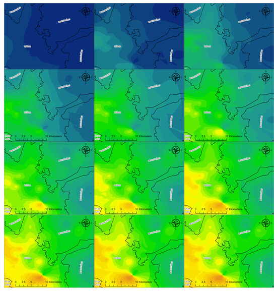
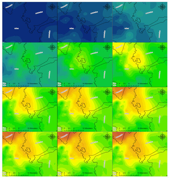
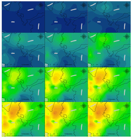
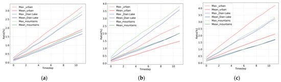
Urban surfaces play a crucial role in shaping the Urban Heat Island (UHI) effect by absorbing and retaining significant solar radiation. This paper explores the potential of high-resolution satellite imagery as an alternative method for characterizing urban surfaces to support UHI mitigation strategies in urban redevelopment plans. We utilized Landsat images spanning the past 40 years to analyze trends in Land Surface Temperature (LST). Additionally, WorldView-3 (WV3) imagery was acquired for surface characterization, and the results were compared with ground truth measurements using the ASD FieldSpec 4 spectroradiometer. Our findings revealed a strong correlation between satellite-derived surface reflectance and ground truth measurements across various urban surfaces, with Root Mean Square Error (RMSE) values ranging from 0.01 to 0.14. Optimal characterization was observed for surfaces such as bituminous membranes and parking with cobblestones (RMSE < 0.03), although higher RMSE values were noted for tiled roofs, likely due to aging effects. Regarding surface albedo, the differences between satellite-derived data and ground measurements consistently remained below 12% for all surfaces, with the lowest values observed in high heat-absorbing surfaces like bituminous membranes. Despite challenges on certain surfaces, our study highlights the reliability of satellite-derived data for urban surface characterization, thus providing valuable support for UHI mitigation efforts.
Full article
(This article belongs to the Special Issue UHI Analysis and Evaluation with Remote Sensing Data)


