


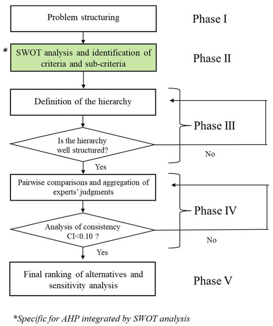
Land 2024, 13(5), 612; https://doi.org/10.3390/land13050612 (registering DOI) - 02 May 2024
Abstract
Land-use conflicts (LUCs) are pivotal in assessing human–land interaction, reflecting the intricate interplay between natural and anthropogenic drivers. However, existing studies often overlook nuanced non-linear responses and critical threshold recognition, focusing solely on linear correlations between isolated factors and LUCs. This study, situated
[...] Read more.
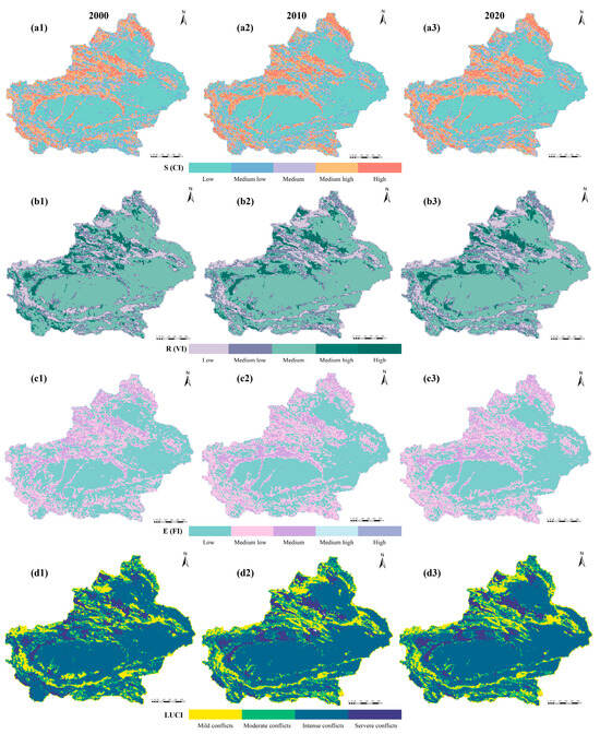
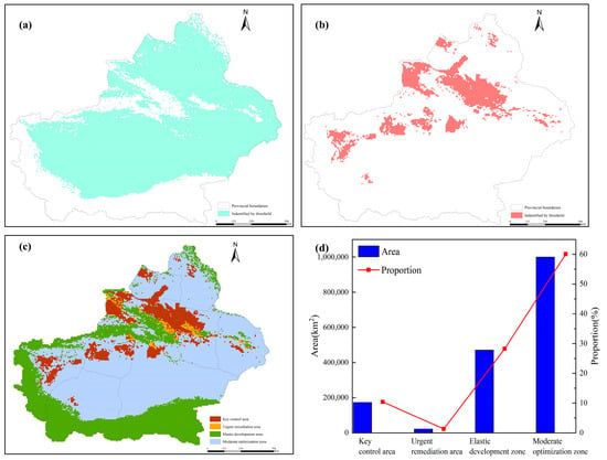
Land-use conflicts (LUCs) are pivotal in assessing human–land interaction, reflecting the intricate interplay between natural and anthropogenic drivers. However, existing studies often overlook nuanced non-linear responses and critical threshold recognition, focusing solely on linear correlations between isolated factors and LUCs. This study, situated in Xinjiang, China’s arid and semiarid region, introduces a novel analytical framework and threshold application model for LUCs. Integrating land-use and socioeconomic data, we quantified LUCs using Fragstats, correlation analysis, and restricted cubic spline (RCS) regression. Exploring non-linear dynamics between LUCs and 14 potential drivers, including natural and anthropogenic factors, we identified critical thresholds. LUC zones were delineated using a four-quadrant method, allowing tailored mitigation strategies. Our findings reveal Xinjiang’s distinct LUC spatial pattern, with intense conflicts surrounding mountainous areas and milder conflicts in basin regions, showing marked diminishment from 2000 to 2020. RCS effectively identifies LUC thresholds, indicating persisting severity pre- or post-specific thresholds. Xinjiang’s LUCs are categorized into key control areas, urgent regulation zones, elastic development territories, and moderate optimization regions, each with significant regional disparities. Tailored optimization suggestions mitigate linear analysis limitations, providing a fresh perspective on land zoning optimization. This research supports comprehensive land management and planning in Xinjiang, China.
Full article
(This article belongs to the Special Issue Spatial Optimization and Sustainable Development of Land Use)
►
Show Figures

Figure 1


