Article

Limitations and Opportunities of Spatial Planning to Enhance Wildfire Risk Reduction: Evidences from Portugal

1
Centre for Studies in Geography and Spatial Planning, CEGOT, Geography Department, Faculty of Arts and Humanities, University of Porto, Via Panorâmica, 4150-564 Porto, Portugal
2
Guarda’s Town Hall, Serviço Florestal e Desenvolvimento Rural, Praça do Município 5A, 6300-854 Guarda, Portugal
3
Centre for the Research and Technology of Agroenvironmental and Biological Sciences (CITAB), University of Trás-os-Montes and Alto Douro, 5001-801 Vila Real, Portugal
*
Author to whom correspondence should be addressed.
Forests 2023, 14(2), 303; https://doi.org/10.3390/f14020303
Submission received: 6 December 2022 / Revised: 24 January 2023 / Accepted: 31 January 2023 / Published: 3 February 2023

Abstract

:
Spatial planning potential for reducing natural risks including wildfires is widely recognized. This research is focused on Portugal, a wildfire-prone country in southern Europe, where the competencies for spatial planning lie on four geographical levels: (i) the national and regional levels, with a strategic nature, set the general goals or the agenda of principles for spatial planning and (ii) the inter-municipal and municipal levels use regulative land-use planning instruments. There is a trend to bring together spatial planning and wildfire management policies. Thus, this paper aims to identify which are the main difficulties and which are the major opportunities, regarding the implementation of the new Integrated Management System for Rural Fires (IMSRF) and the challenge of integrating wildfire risk reduction in the Portuguese spatial planning framework. Through a survey of municipal professionals with experience in applying the legislation of both policies, the major difficulties and the opportunities of alignment of these two spheres are identified, which can be extrapolated for the whole country or countries in a similar context.

1. Introduction

In the second half of the 20th century, agricultural abandonment in some European countries led to the accumulation of fuel through natural regeneration, which conduced to increase the landscape fire-hazard [1]. Therefore, the wildland–urban interface (WUI) area has been increasing with rising vulnerability in the proximity of the populated settlements [2], increasingly characterized over the last 25 years by the ongoing urban expansion and spatial dispersion. [3,4] argues that this change in the agricultural–forest frontier resulting from agricultural abandonment has triggered intense changes in wildfire regimes with increasing impacts on the WUI area.
Conceptually, spatial planning policies intend a balance through the strategic and spatial organization of land use to address a set of different interests, based on environmental and socioeconomic suitability [5]. On the other hand, risk reduction policies aim to minimize the “potential loss of life, injury, or destroyed or damaged assets, which could occur to a system, society or a community in a specific period of time, determined probabilistically as a function of hazard, exposure, vulnerability and capacity” [6]; thus, contributing to the resilience and sustainable development of communities.
Godschalk et al. [7] were the precursors in the research on the contribution of spatial planning to risk reduction. Spatial planning has been acknowledged as an important instrument that influences exposure, and vulnerability reduction i.e., operates at a preventive level [8,9]. It requires an assessment at the local scale [10,11]. Building hazard mitigation into spatial planning is an ongoing process that should supported by [7]:
  • Generating planning intelligence: the focus on the hazard by the study of the land-use patterns and on community vulnerability to hazard (type, location and intensity), the assessment of the feasibility and effectiveness of possible solutions.
  • Setting goals and objectives: the definition of targets for reduction in vulnerability that be supported by citizen participation and consensus building.
  • Adopting policies and programs: the analysis of alternative policies concerning its effectiveness, efficiency, equity and feasibility on accomplishing the defined goals and objectives.
  • Monitoring, evaluation and revision: when planners evaluate the ongoing impacts of policies in order to perfect the implementation in a continuous adaptation and adequacy to the context.
Wildfire risk reduction requires responses from the spatial planning framework in a multi-scale approach [4]. In this regard, imposing building restrictions, the use of fire-safe building materials and fuel management from the building scale (defensible space) to the landscape scale has been the most adopted spatial planning strategy with the aim of wildfire risk reduction [12,13,14,15,16].
The importance of this approach for wildfire risk reduction has been recognized more recently [17,18,19] in the expected context of a higher frequency of extreme wildfires [20]. These events overwhelm the capacity of control [21,22], being necessary to go beyond a reactive wildfire management approach to achieve resilience to wildfires [4].
Gonzalez-Mathiesen et al. [18] highlighted six major phases within the challenge for the integration of spatial planning and risk reduction policies, namely:
  • Recognition that the policies in the two fields often have independent origins, since these policies come from different institutional forums and with different thematic objectives that did not always coincide;
  • Development of a common and transversal knowledge base between the two fields, when recognized the emergence of identifying points in common between policies;
  • Inclusion of considerations concerning risk reduction in the spatial planning system in the design of the local instruments and plans;
  • Formalization of national institutional structures that implement the integration between the two fields and enable dialogue between the respective interlocutors, aligning the spatial planning and wildfire management institutions, based on articulated policy instruments and the vertical, horizontal and functional actors interaction;
  • Integrating key decision-making processes within and between agencies, through the clear definition of the responsibilities of the spatial planning agencies and wildfire management agencies, supported in the strengthening of cross-institutional arrangements, data sharing and the integration of wildfire expertise on spatial planning decision making;
  • Assumption that the dynamics of these two fields have different spatial and temporal scales, through the recognition of the emergence of the paramount transition from a static system of spatial planning and wildfire management to an adaptive system that takes into account the spatial and temporal dynamics of changes in land use and wildfire risk at different scales of the landscape and local contexts.
In this context, the most recognized program is FireSmart Canada, which was founded over 20 years ago to address common concerns about wildfire in the wildland urban interface. It is a national program to help Canadians increase community resilience to wildfire and minimize its negative impacts. Two of the seven FireSmart disciplines focus on municipal land-use policies (i.e., legislation) and development regulations (i.e., development), where the main measures were regulating fire hazards on private property (adopted by 68% of municipalities) and restricting development on steep slopes (53% of the municipalities) [17].
With about 97% of forest property being private, wildfire management solutions in Portugal have focused on suppressing rather than on prevention [23]. The failure of the solutions tested over the last 40 years means that, in the near future, the defence of the forest should focus more on the actors and institutions that ensure the governance of the integrated management of rural fires in Portugal in a context in which the relationship between climate change and forests will tend to be increasingly close, both in terms of vulnerability to wildfires and in terms of mitigating these changes through the conservation and management of forest areas [23].
Regarding the alignment between spatial planning and wildfire management in Portugal, the first relevant initiative, was the prohibition for a period of 10 years (Decree-Law n.° 327/90, 22 October 1990) of land-use change in properties with forest cover burned that were not classified for urban expansion in the Municipal Master Plans (i.e., the main instrument of spatial planning in the Portuguese legislation). This measure aimed to discourage the outbreak of wildfires in order to take advantage of burned areas to change land use, especially for urbanization purposes.
In 2006, the Defense System of Forest against Wildfires (DSFW in English; SDFCI in Portuguese) was instituted by the Decree-Law no 124/2006, 28 June 2006, which advocated the articulation of the two spheres through building permit constraints depending on the wildfire hazard map classes.
Afterwards, the main Portuguese instrument for spatial planning on the national scale, the National Program for Spatial Planning Policy (NPSPP), responsible for defining the strategies for the other programs and spatial plans, approved by Law no 99/2019, aimed for the “articulation of the master plans with the wildfire management instruments is of major importance in order to build a more integrated planning approach that better responds to the challenges of the territories and to safeguard people and goods” [24] (p. 243).
This decree-law remained active until 2021, when it was promulgated the Integrated Management System for Rural Fires (IMSRF in English; SGIFR in Portuguese) by the Decree-Law no 82/2021, 13 October 2021, advocating a better spatial planning and wildfire management articulation. Therefore, in Portugal, the use of spatial planning to promote wildfire risk reduction is recent.
This research aims to: (i) understand how the new Integrated Management System for Rural Fires (IMSRF) articulates the spatial planning and wildfire management policies; (ii) analyze the progress made by IMSFR compared with the previous management system (DSFW); (iii) identify the difficulties faced by the municipalities staff with the implementation of the IMSRF and their suggestions to improve wildfire risk management; and (iv) anticipate the potential impacts of the implementation of the IMSRF in rural areas development. The four research questions (RQ) are:
RQ1: Does the IMSRF introduce new tools/instruments to enhance the articulation of the spatial planning and wildfire risk reduction policies?
RQ2: Do the suggestions of municipalities’ staff for improving wildfire risk management change the approach?
RQ3: How can the difficulties identified by the municipalities’ staff contribute to improving the current IMSRF?
RQ4: What can be the potential consequences of the implementation of the IMSRF in rural areas development?
This article is organized as follows: Section 2 describes data collection and analysis methods; in Section 3, the results are described, while Section 4 discusses the key research findings. The final section highlights the main findings and considers the study’s limitations and future research prospects.

2. Materials and Methods
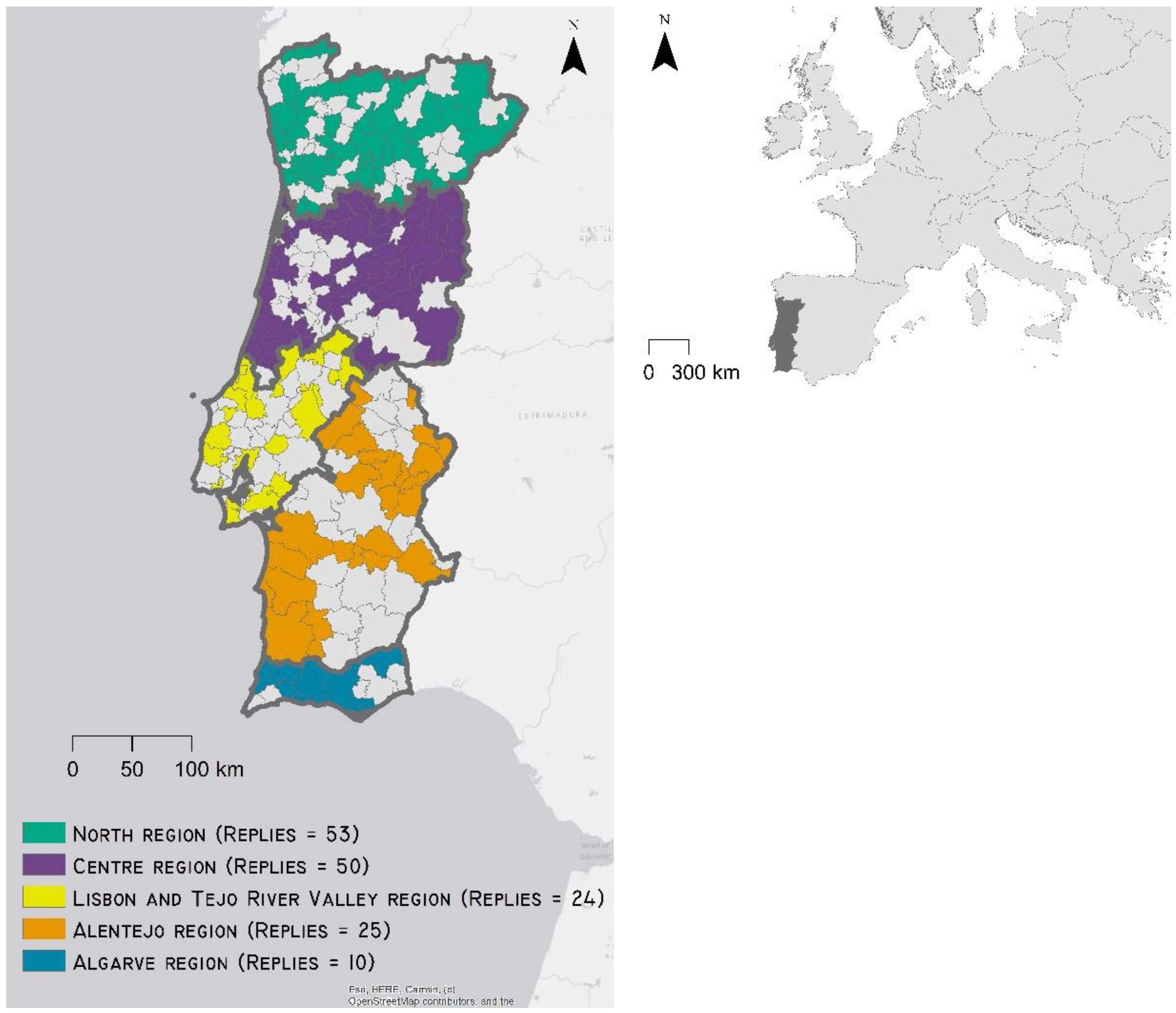
2.1. Study Area

This research is focused on mainland Portugal and its 275 out of 278 municipalities; the municipalities of Lisbon, Porto and São João da Madeira were excluded because they are just urban areas without wildlands besides the existing urban parks.
The climate of mainland Portugal, according to the Koppen classification, is divided into two regions: one with a temperate climate with a rainy winter, and a dry and slightly hot summer (Csb) in the north and centre of the country, and one with a temperate climate with a mild winter, dry and hot summer in the south of the country (Csa) [25].
The mean annual air temperature ranges from less than 6 °C in the mountainous interior of the center and north to 18 °C in the south of the country [25]. The mean air temperature in the summer months varies, predominantly, between 20 °C and 22 °C in the north and centre, and between 22 °C and 24 °C in the south, while the mean air temperature in the winter months varies, predominantly, between 2 °C and 10 °C in the north and centre region, and 10 °C and 14 °C in the south of the country [25]. In this sense, the mean maximum air temperature in the summer months varies essentially between 24 °C and 28 °C in the north and centre regions, and between 28 °C and 32 °C in the south. In turn, the mean minimum air temperature in the winter months varies mainly between 0 °C and 6 °C in the north and centre regions, and between 6 °C and 10 °C in the south [25].
The total annual precipitation exceeds 3000 mm in the mountainous areas in the north, descending to around 1200 mm in the centre of the country. In the south, the total annual precipitation varies, mostly, between 800 mm and less than 600 mm, where the shortage of water resources is tendentially aggravated by increasingly prolonged droughts. It should be noted that the rivers’ flow regime reflects not only the variations in rainfall, but also its seasonal variations, so that the rivers that flow in Portugal present a regime of enormous irregularity. In the summer, rainfall is scarce, and evaporation increases, with the flow decreasing more in the south rivers, which are commonly reduced to a succession of puddles.
Pedologically, in the north and center region, cambisols predominate (relatively mobile brown soils, product of ancient rocky complexes) and some lithosols (very thin and very little evolved stony soils, established on hard parent rocks), whereas in the south of the country the soils are essentially lithosols interspersed with some areas of luvisols (clayey soils with a high degree of base saturation).
According to the 2015 Portuguese Land Use/Cover Map, the predominant land uses in mainland Portugal are forest (39.0%) and agriculture (26.3%). Less representative are the other land uses, such as shrublands (12.4% of mainland Portugal territory), agroforestry systems (8.0%), pastures (6.5%) and urban space (5.1%). That said, 73.3% of the continental territory is mainly characterized by forest, agricultural and agroforestry cover which, together with areas of shrublands and pastures, represent 92.2% of the territory, which reveals, in this context, a high potential for forestry and agricultural production and for the natural capital valorization [26] (p. 133–135). Regionally, the forest cover significantly dominates land use in the central region (50%) and the northern region (38%). As for the southern regions, the forest cover represents 39% of the territory of the Algarve region and 32% of the Alentejo region [26] (p. 133–135).
Biogeographically, the mainland Portugal is characterized by the Mediterranean climate, although with some influence of the Atlantic Ocean. The Mediterranean region is particularly vulnerable to the impacts of climate change, as a border area with the African continent, where there is expected an increase of heat waves, drought, wildfires, loss of agricultural soil and biodiversity. There is also expected an increased competition between the various uses of water and demand for water for agriculture associated with reduced rainfall and runoff, and reductions in agricultural productivity. Thus, while some European regions will have to deal with increased water abundance and rising sea levels, other regions will be challenged by serious levels of drought and wildfires. Southern Europe has high levels of vulnerability to climate change as it associates high impact potentials (physical, environmental, economic, social and cultural) with weak reaction capacity (knowledge and awareness, technology, infrastructure, institutions and economic resources), as is the case of Portugal [26].
In the Portuguese context, climate change determines changes in the intensity and territorial incidence of the risks associated with river and coastal floods, heat waves and the occurrence of wildfires. Therefore, the rural communities will face a paramount challenge, given the expected wildfire frequency and intensity increase [25].

2.2. Material and Methods

Firstly, a review of the spatial constraints in the previous and the current wildfire management systems was made through the analysis of DSFW and IMSRF legislative documents.
Thereafter, between April and June of 2022, an online survey was conducted in 275 municipalities of mainland Portugal. The questionnaire constituted of close-ended and open-ended questions (Table S1—Supplementary Material).
The online survey response rate was 64% (175 municipalities—Figure 1), exceeding the necessary minimum sample size of 161 replies for a confidence level of 95% and a margin of error of 5%, using Laureano [27] equation, for extrapolating conclusions from the results. The 175 municipality responses were derived from five territorial regions within the IMSRF governance structure (Figure 1): north (53 replies; 62% of the region’s municipalities), centre (50 replies; 73% of the region’s municipalities), Lisbon and Tejo River Valley (24 replies; 44% of the region’s municipalities), Alentejo (25 replies; 53% of the region’s municipalities) and Algarve (10 replies; 63% of region’s municipalities), while thirteen (13) municipalities chose to remain anonymous.
Using NVivo software, version 1.6.1. [28], the data was analyzed through coding, which enabled the categorization of the survey open-ended responses and consequently made it possible to count the frequency of each response. An NVivo matrix query of the coding associated with the municipalities that responded was operated as a means to export this data to a format compatible with the integration in Statistical Package for the Social Sciences 26 (SPSS) [29].
Subsequently, in SPSS 26, a descriptive statistical analysis of the response categories was performed, which had been defined in NVivo, and an inferential statistical analysis was made, based on the cross-tabulation of the municipality response categories and two distinct variables, namely the influence of wildfire hazard and population change rate.
Based on the Wildfire Hazard Map for Portugal, the representation of (i) areas without wildfire hazard, (ii) areas with very low wildfire hazard, (iii) areas with low wildfire hazard, (iv) areas with medium wildfire hazard, (v) areas with high wildfire hazard and (vi) areas with very wildfire high hazard for each municipality that responded to the national survey were assessed using a geographic information system (GIS) through the clip tool of analysis tools in [30]. Likewise, the resident population change rate per municipality was calculated using data from the 2011 and 2021 Census.
In SPSS 26, an index for spatial expression of each hazard class was also carried out by calculating the percentage of each hazard class in each municipality. For each class in each municipality, the value of 1 was attributed to municipalities that had from 0% to 20% of the area of the municipal territory in that class; a value of 2 for municipalities that had greater or equal to 20% and less than 40% of the area of the municipal territory in this class; 3 for greater or equal to 40% and less than 60% of the territory in that class; 4 for greater or equal to 60% and less than 80% of the territory in that class; and 5 for greater or equal to 80% up to 100% in that class. Then, a variable based on the following sum was created (Equation (1)):
(Very Low Hazard Class spatial expression index) × 1 + (Low Hazard Class spatial expression index) × 2 + (Medium Hazard Class spatial expression index) × 3 + (High Hazard Class spatial expression index) × 4 + (Very High Hazard Class spatial expression index) × 5
Dividing its amplitude into 5 intervals allowed the definition of the five groups of municipalities classified according to the respective hazard influence: 1—Municipalities demarcated by very low hazard; 2—Municipalities demarcated by low hazard; 3—Municipalities demarcated by medium hazard; 4—Municipalities demarcated by high hazard; 5—Municipalities demarcated by very high hazard.
As for the demographic dynamics, the population change rate was calculated for each municipality in the period 2011–2021. Then the minimum change rate (−20.01%) and the maximum change rate (13,34%) were found for the known municipalities. The amplitude between the minimum and maximum population variation was divided into 5 equal intervals: [−20.01%, −13.34%]; [−13.34%, −6.67%]; [−6.67%, 0%]; [0%, 6,67%] and [6.67%, 13.34%]. In an ascending metric, these five intervals enabled the municipalities to be grouped into 5 respective groups, namely: 1—Municipalities demarcated by severe loss of population; 2—Municipalities demarcated by low loss of population; 3—Municipalities without significant population loss; 4—Municipalities demarcated by low population gain; 5—Municipalities demarcated by accentuated population gain.
In SPSS 26, the Chi-Square Independence Test, through cross-tabulation, was calculated with the purpose of studying the influence of high and very high hazard classes and the population variation between 2011 and 2021 in the municipality responses. The Chi-square test was chosen because it is a non-parametric test that aims to test whether two nominal qualitative variables (or treated as such) are related, based on the contingency table that crosses the two characteristics [27]. Thus, it was a suitable test to study the relationship between the response categories, being nominal variables, with the wildfire hazard influence categories and with the categories related to demographic dynamics. In this regard, only the variables with statistical significance were considered in this paper.
In short, the applied methodological process is presented in Figure 2.
For the 162 municipalities identified in the online survey, the cross-tabulations were analyzed with statistical significance between the various categorized responses from the online survey, along with the influence of the hazard and the population variation for each municipality; the inferential statistics of the total number of respondents for this analysis is 162 (those who did not wish to remain anonymous).

3. Results

3.1. The Integration of Spatial Planning and Wildfire Management Policies

3.1.1. The Evidences from the Policy Documents

The integration of wildfire management in spatial planning proposed by the DSFW was obtained through the obligation of incorporation of the wildfire hazard map in the constraints map of the municipal master plans and the definition of building permit constraints based on wildfire hazard classes. These procedures remained in the new Integrated Management System for Rural Fires (IMSRF; Decree-Law no 82/2021, 13 October 2021), despite having some differences (Supplementary Table S1).
It should be noted that the consolidated urban areas enshrined in the Municipal Forest Defense Plans Against Wildfires defined within the scope of the DSFW, did not match the urban spaces defined in the municipal master plans. Due to this, the new IMSRF came to regulate that the urban spaces and rural settlements of the Municipal Master Plans should be assumed as such for the definition of building permit constraints by wildfire hazard classes, in order to carry out the wildfire management implementation process aligned with the spatial plans.
Analyzing the constraints imposed by fire management systems, it is possible to state that the previous DSFW, enacted in 2006, was more prohibitive than the current IMSRF. Unlike the municipal master plans, the Municipal Forest Defense Plans against Wildfires were not directly binding on individuals because they did not meet the requirements of public discussion and public publication, essential to the production of legal effectiveness of any spatial plan, as enshrined in the Portuguese Constitution. This circumstance would only be solved by the Law no 76/2017, 17 August 2017, which amended the DSFW in this context, 11 years after its enactment.
Although the IMSRF identifies more exceptions than the DSFW in the legal writing, in practice, the building permit constraints based on wildfire hazard classes only gained greater expression following the publication of the New National Hazard Map in March of 2022 that increased the area with high and very high wildfire hazard classes, which generated great opposition from the municipalities due to the increase of areas associated to the restrictive nature regarding urban development.
The increase in the area of these wildfire hazard classes was due to the methodology proposed. Before that, the hazard maps were previously carried out on a municipal scale with higher spatial resolution and with greater accuracy in terms of land use and cover representation, one of the factors for calculating hazard. Now, the hazard assessment was carried out on a national scale with lower spatial resolution. Thus, the greater generalization of this new assessment led to a large increase in areas with high and very high wildfire hazards and, by implication, a greater expression of building permit constraints by wildfire hazard classes.

3.1.2. Level of Alignment between the Spatial Plans and the Wildfire Management Systems in Portugal

The municipal technicians find that the alignment between the IMSRF and spatial planning policies was reasonable to low ( x ¯ = 2.81; SD = ±0.81) (Figure 3) which represents a situation that is slightly worse when compared with the alignment in the previous legal framework ( x ¯ = 2.93; SD = ±0.75). There was a 29% increase in the number of individuals who responded that there is a low alignment (Figure 3 and Figure 4).

3.2. Difficulties Faced by the Municipalities with the Implementation of the Integrated Management System of Rural Fires

Most of the municipalities (97.71%) identified difficulties in implementing the IMSRF that were grouped into Legal Environment (n = 121; 69.14%), Risk Management (n = 95; 54.29%), and Governance (n = 47; 26.86% of replies) (Supplementary Table S2).

3.2.1. Main Difficulties

Most of the difficulties mentioned by the respondents are related to the Legal Environment (69.14%); it encompasses difficulties that are related to the understanding, interpretation, and operationalization of the legislation. The main difficulties identified are the delay in the formulation of regulations and complementary technical standards (n = 45; 25.71%), understanding the constraints on building permits (n = 33; 18.86%), the complexity, lack of clarity, and low objectivity of the legislation (n = 31; 17.71%), field implementation constraints (n = 3; 1.71%), and Omissions in the legislation (n = 2; 1.14%), among others.
Under the label of Risk Management are considered the difficulties related to hazard mapping, fire use, and risk reduction practices (especially fuel management). Difficulties classified as Risk Management were mentioned by 54.29% of the respondents. The most common difficulty is related with the hazard map [that] does not correspond to the existing reality in the territory (n = 30; 17.14%) because of its low spatial resolution and because it is not based on the urban spaces of the municipal master plans, fuel management monitoring (n = 13; 7.43%), definition of high and very high hazard areas prevents most initiatives for investment in rural areas (n = 8; 4.57%), rigidity in the regulation of fuel management strips (n = 7; 4.00%), lack of human and financial resources (n = 6; 3.43%), fireworks launch licensing (n = 4; 2.29%), difficulty in identifying landowners (n = 3; 1.71%), doubts about the fire use licensing (n = 3; 1.71%), survey and registration of burned areas (n = 2; 1.14%), conditioning of activities in high and very high hazardous areas in conflict with what is the spatial valorisation of the territory (n = 2; 1.14%), lack of awareness (fire use, use of machinery and access to high and very high hazardous areas) (n = 2; 1.14%), obstacles to cultural and sporting activities (n = 2; 1.14%), and Portuguese Land Use and Cover Map (COS) 2018 does not reflect the existing reality at the local level (n = 2; 1.14%), among others.
Governance category is related to the actors involved in IMSRF, their competencies and collaboration among them. About 26.86% of the respondents mentioned difficulties with the current model of governance identifying several problems. The most significant to the respondents was the dispersion of competencies and failure of articulation between involved entities (n = 9; 5.14%), and different interpretations between various entities (n = 7; 4.00%). Also relevant are the top-down imposition without knowing the local reality (n = 5; 2.86), the excessive municipal competences, such as the registration of all fuel management actions in the municipality (n = 5; 2.86%) and the undefinition of the exact competences of each entity with entities exempting themselves from responsibilities via abstention in the Municipal Integrated Management Committees (n = 5; 2.86%), mainly because the limited resources existing in the municipalities and the growing number of tasks resulting from growing competences. Other difficulties are the operationality dependent on several sources of financing (n = 3; 1.71%), misalignment between IMSRF and Spatial Plans (n = 3; 1.71%), Regional and Sub-regional Integrated Management Committees being too large (n = 2; 1.14%), lack of articulation and commitment of several entities due to the non-mandatory participation in the Municipal Committees for Integrated Management of Rural Fires (n = 2; 1.14%), and the inability of municipalities to implement building permit constraints and execution of fuel management strips (n = 2; 1.14%).

3.2.2. The Influence of the Hazard Map on the Difficulties Faced by the Municipalities’ Staff

The influence of the hazard map on the difficulties identified by the municipalities using chi-square just revealed statistical significance for two of the difficulties identified by the respondents. One is related to the Governance category (Table 1) and demonstrates that the difficulty of operationality dependent on several sources of financing is more felt by technicians of municipalities marked by high and very high hazard.
The influence of the hazard map in the difficulties grouped in the Risk Management category only revealed statistical significance for the rigidity in the regulation of fuel management strips; it is felt mainly by municipalities with very low and low hazard and by low hazard (Table 1).

3.2.3. Influence of Population Variation on the Difficulties Faced by the Municipalities’ Staff

The difficulty of rigidity in the regulation of fuel management strips is associated with municipalities without significant population loss and municipalities demarcated by low population gain (Table 2).

3.3. Impact of the Integrated Management System of Rural Fires on Some Challenges of Rural Areas

3.3.1. Depopulation in Rural Areas

In the opinion of 111 out of 175 respondents (63.43%), the restrictions established by the IMSRF may worsen the depopulation problems of many of the municipalities in inland Portugal (Supplementary Table S3) mainly due to the following:
(i)
The building permit constraints (n = 85; 48.57% of replies for this item) that restrict the construction of new buildings and discourage investments;
(ii)
The high and very high hazard areas (n = 33; 18.86%) defined by the current structural hazard map, published on 28th of March 2022. This hazard map increased the percentage of areas with high and/or very high hazard in each municipality. In the opinion of 2.86% of the respondents, the map is badly prepared because of the spatial resolution of some of the input data (e.g., land use and land cover data);
(iii)
The spatial planning framework (n = 12; 6.86%).
Other explanations provided by some municipalities highlighted that without people in rural areas, there is no change in land use due to fuel management and an inherent reduction in hazard index (n = 6; 3,43%), given that when fewer people live in rural territories, less human and financial resources will be available to manage the vegetable fuel that accumulates.
For respondents from 64 municipalities (36.57%), the implementation of the IMSRF is not going to increase depopulation (Supplementary Table S3). There are other contributing factors. For 23 respondents (13.14%) the current building permit constraints already existed in the previous wildfire management system (n = 7; 4.00%); thus, they are not a new imposition and at the same time there are exception regimes (n = 3; 1.71%).
Some respondents (n = 17; 13.14%) consider that the spatial planning framework may restrict development because of the people’s lack of interest in investing in rural areas and the lack of areas for urban expansion defined in the Municipal Master Plan, the main spatial plan in local scale.
Concerning the third category of explanations, namely Requalification (n = 5; 2.86%), some municipalities state that IMSRF allows concentrating and upgrading buildings in villages, and limit dispersed buildings (n = 3; 1.71%).
Regarding Management tools, it was explained that if the areas of high and very high hazard and the agroforestry areas are reviewed in the Portuguese Land Use and Cover Map, there is no big obstacle to building (n = 5; 2.86%).
The last category was labeled Building demand, the justifications were that polluting and job-generating industries should be established in isolation in the territory, and there should be an exception for their construction in areas of high and very high hazard, provided that adequate fuel management strip is guaranteed (n = 1; 0.57%); does not interfere with the need for permanent housing (n = 1; 0.57%); permission for agricultural buildings is quite reasonable (n = 1; 0.57%); it can contribute to the population increase in rural areas (n = 1; 0.57%).

The Influence of the Hazard Map on Depopulation Potential

There is a statistical interdependence between the recognition of the depopulation potential of the IMSRF and the hazard map and demographic dynamics (Table 3).
Although municipalities characterized by relatively low hazard (20.99%) are the ones that acknowledge this affirmation, there is a great prevalence in this regard of the municipalities of high hazard (17.90%), very low hazard (10.495), medium hazard (9.88%) and very high hazard (4.32%) when compared to those who do not recognize the depopulation potential of IMSRF, which are characterized by low hazard (14.81%), very low hazard (11.11%), medium hazard (5.55%), high hazard (4.32%) and very high hazard (0.61%) (Table 3).

3.4. The IMSRF Potential to the Transformation of the Rural World (Values, Behaviors, Needs) with Positive Effects on Reducing the Problem of Wildfires Fires

3.4.1. Main Needs

Only 34.86% (61 respondents) are optimistic and acknowledge the IMSRF potential in the promotion of a transformation of the rural world (values, behaviors, needs) with positive effects on reducing the problem of wildfires, with the majority (65.14%) denying it (skeptics) (Supplementary Table S4).
Many problems (n = 46; 26.29%) are pointed out by the skeptics. The transition to the new IMSRF (n = 16; 9.14%) is perceived as a continuation of DSFW with just some improvements (n = 12; 6.86%), leading to the need to revise the IMSRF, which does not improve the DSFW (n = 3; 1.71%), among others. Legal framework (N = 14; 8.00%) is also highlighted as a justification for not recognizing the transformative potential of IMSRF because of its complexity and poor clarity (n = 8; 4.57%), expectation in the formulation of additional orders for the execution of the IMSRF (n = 2; 1.14%) and the absence of complementary rules to the IMSRF (n = 2; 1.14%) among others. Governance problems (n = 12; 6.86%) are mainly due to the IMSRF top–down approach with no adaptive period, with municipalities having more powers assigned without any added support (n = 4; 2.29%), lack of flexibility and adaptation to local reality in the IMSRF (n = 3; 1.71%) and degradation of values due to the lack of articulation between the various entities that make up the regional and sub-regional commissions (n = 2; 1.14%), among others. Funding (n = 3; 1.71%) and the hazard map (n = 1; 0.57%) are other considered IMSRF problems.
Skeptics advocate that the major problems in the rural areas do not depend on IMSRF (n = 21; 12.00%), highlighting the maintenance of structural problems (depopulation and aging of the population, fragmentation of property and lack of identification of owners, among others) (n = 14; 8.00%) and that depopulation and aging in the interior areas do not depend on IMSRF (n = 5; 2.86%), among others.
IMSRF is considered a driver that will aggravate some problems (n = 15; 8.57%) through worsening rural abandonment (n = 11; 6.29%) and the lack of real forest management by the IMSRF (n = 4; 2.29%).
The stated negative impact on economic activities (n = 14; 8.00%) could derive mostly from the very restrictive legislation, without focusing on management (hunting, fishing, recreation, production) and conservation (fauna and flora) (n = 6; 3.43%).
Disbelief in the transforming power of the IMSRF also comes from the lack of incentives (n = 13; 7.43%) because fuel management around the buildings is penalizing and costly, preventing the profitability of the land (n = 2; 1.14%).
Skeptics highlight the lack of involvement of the population (n = 13; 7.43%), the need for community participation and awareness (n = 9; 5.14%) and the need of attracting the population to rural areas to encourage greater fuel management due to land use change (n = 3; 1.71%).
Ultimately, skeptics suggest the challenge of changing mentalities (n = 4; 2.29%).
Regarding those who recognize the transformative IMSRF potential, who can be labeled Optimists, there are several justifications presented. In this group of respondents, optimism stands out, based on the hope for the transformation of rural space by IMSRF (n = 20; 11.43%).
It is also denoted the IMSRF potential for changes in fire use and fuel management behaviors (n = 11; 6,29%), mainly expressed by the assumption of IMSRF as a way of changing risk behaviors (use of fire and fuel management) (n = 5; 2.86%) and the citizen accountability (n = 2; 1.14%), among others.
IMSRF is also seen as changing ways of life and fuel management (n = 8; 4.00%), where there is the belief that the National Action Program will change ways of life and fuel management practice in the medium and long term (n = 2; 1.14%), among other factors.
Regarding the articulation of entities, 3.43% (six respondents) think that entities involved in the IMSRF are better articulated and closer to the communities.
IMSRF is a way to the improvement of prevention, information, infrastructure, and firefight (n = 5; 2.86).
Despite believing in the transformative potential of IMSRF, several enthusiasts do not fail to mention that there are still problems with the IMSRF (n = 7; 2.86%), the urge for citizen engagement and adjustment to local realities (n = 4; 2.29%) and the lack of incentives (n = 2; 1.14%), among others.

The Influence of the Hazard Map on Reducing the Problem of Wildfires Fires

Some municipalities with very high hazard (1.23%) and high hazard (0.62%) are associated with the statement that to transform the rural area there is a necessity of attracting the population to rural areas to encourage greater fuel management due to land use change (Table 4).

3.5. Trust in Integrating Spatial Planning and Wildfire Management

Most municipalities (n = 110; 62.86%) have trust in integrating spatial planning and wildfire management to favor municipal development (Table S5).
The justifications presented by enthusiasts (the ones who responded “Yes”) are essentially the need for integration and articulation between the two spheres to share knowledge and resilience of the territory (n = 33; 18.86%); as long as it adapts to the local reality (forest, agricultural, environmental and social) (n = 13; 7.43%); may favor the development of the municipality (n = 5; 2.86%); though the environment enhancement by sport, leisure, tourism, culture, customs, agriculture, forestry, livestock, among others (n = 4; 2,29%); contribution to better forest management and enhancement of natural capital (n = 4; 2.29%); simplification of building licensing (n = 4; 2.29%); challenge of valuing the ecosystem services of the rural space (n = 3; 1.71%); attract people to settle in the interior through the attribution of incentives (n = 3; 1.71%) and Master Plan should value forest space and not focus on licensing urban operations (n = 3; 1.71%), among others (Table S5).
In the opinion of skeptics (those who answered “No”), the justifications ranged mainly from the worsening social and environmental inequality in rural communities (n = 6; 3.43%), among others.

The Influence of the Hazard Map on the Trust in Integrating Spatial Planning and Wildfire Management

Among those who do not believe that the alignment between spatial planning and wildfire management will contribute to municipal development, municipalities with high hazard (3.09%) justify that it could lead to worsening social and environmental inequality in rural communities (Table 5).

3.6. Auscultation of Municipalities during the Preparation of the IMSRF

As for the consultation of the municipalities during the elaboration of the IMSRF, only 36.57% (n = 64) of the municipalities responded that they had been heard (Supplementary Table S6).
These said that they were heard through the discussion of the preliminary version of the opinion of the National Association of Municipalities, which, however, was completely changed in the final version (not put up for discussion) (n = 10; 5.71%) and through the Intermunicipal Community (n = 2; 1.14%), among others (Supplementary Table S6).

3.7. Suggestions to Improve the Alignment between the Instruments of Spatial Planning and the Wildfire Management

Several suggestions were put to the consideration of the respondents to the national survey (Supplementary Table S7) (Figure 5).
Three stand out in particular, namely a fire risk reduction system based on a rural development model that goes beyond simple fuel management (n = 132; 75.43% of replies for this item); clarification of the building permit constraints set out in the IMSRF (n = 115; 65.71%); and an integrated management system adapted to local realities—bottom-up, based on the development strategy recommended in the Municipal Master Plan (n = 95; 54.29%) (Figure 5).
The other opportunities highlighted were a dynamic, participatory, and collaborative planning system with fewer top-down impositions (n = 87; 49.71%); valorisation of the forest by spatial plans (n = 86; 49.14%); encouraging the development of public participation initiatives as part of the fire risk reduction process (n = 77; 44.00%); outlining a results-oriented approach capable of promoting social well-being, community resilience and sustainable development (n = 75; 42.86%); simplification of definitions (n = 73; 41.71%); Master Plan review by classification and qualification of urban space and rustic space (n = 62; 35.43%); and the implementation of the new Municipal Programs for the Implementation of Integrated Management of Rural Fires (n = 50; 28.57%).

3.7.1. The Influence of the Hazard Map on the Considered Suggestions

Analyzing the suggestions proposed by each municipality and its level of hazard, it was found that the results of only two suggestions using chi-square have statistical significance. Municipalities with less hazard (very low; low; medium) highlight the need to simplify definitions within the scope of the IMSRF (Table 1).
With a higher prevalence in municipalities with less hazard, the recognition of the opportunity for valorisation of the forest by spatial plans is universal (Table 6).

3.7.2. The Influence of Population Variation on the Considered Suggestions

With the exception of municipalities with accentuated population gain, all municipalities with severe and low loss of population and the ones without significant population loss suggest that the Master Plan review by classification and qualification of urban space and rustic space is an opportunity. Thus, municipalities that have lost population may find that a very prohibitive master plan can block the people’s interest to live in their territories, as municipalities that are gradually gaining population may want to revise their master plans to accommodate the demand for urban expansion in their territories (Table 2).
With greater relevance for municipalities without significant population loss to low loss of population, the validation of the opportunity of valorisation of the forest by spatial plans is also wide (Table 7).

4. Discussion

4.1. The Integration of Spatial Planning and Wildfire Management Policies

Despite being more restrictive, the former DSFW had a more positive evaluation than the current IMSRF among municipal technicians. This fact could be due to the slowness with which the DSFW building permit constraints gained real legal effectiveness and due to the fact, until recently, hazard maps were made by the municipalities, which did use more spatial resolution in the definition of high and very high hazard classes, leading in practice to fewer restrictions for municipal development than those contemplated in the new IMSRF and its New National Hazard Map.
In synthesis, replying to RQ1, the IMSRF does not consider new tools but introduces new procedures. In the opinion of the municipal staff that replied to the survey, the main tools are the building permit constraints, based on the integration of the National Wildfire Hazard Map in spatial plans constraints map, and the imposition of a wide defensible space like that advocated in [19]. Concerning the procedures, the most significant differences from the previous wildfire management system (DSFW) are the proposition of some building permit exceptions to not aggravate depopulation in the rural areas, which is thwarted by the greater and widespread expression of high and very high hazard classes in the National Wildfire Hazard Map of 2022.
In Portugal, a disproportionate defensible space (50 m for buildings and 100 m for villages) is required, which becomes impossible to comply with in many places. In this sense, some municipalities with very low to low hazards do not agree with the rigidity of defensible space length in their territories.
Several studies demonstrated that up to 30 m of vegetation reduction around a structure can significantly increase the chance of structure survival, which is much lower than the regulations require [31,32,33,34,35,36]. The most effective treatment distance varied between 5 and 20 m from the building, but distances larger than 30 m did not provide additional protection, even for structures located on steep slopes [30]. In addition, evidence from the US shows that “fire-safe” structures, having >30 m defensible space or fire-resistant building materials, were destroyed, suggesting that other factors need to be accounted for to understand the full spectrum of structure loss contributors [12,27,31,32].

4.2. Difficulties Faced by the Municipalities with the Implementation of the Integrated Management System of Rural Fires

The list of difficulties identified is very long but the most mentioned are related to the delay in the formulation of regulations and complementary technical standards, understanding the constraints on building permits, facing the complexity and lack of clarity of the IMSRF’s legal framework, and to the fact that the hazard map does not correspond to the existing reality in the territory. Figure 6 expresses the main difficulties of implementing the IMSRF that needs to be addressed.
Regarding the wildfire hazard map, the land use map inputs as a factor of wildfire hazard assessment should have the best accuracy possible. However, having a time series with five reference years (1995, 2007, 2010, 2015, and 2018), the Portuguese Land Use and Cover Map (COS) is a product of orthophoto maps interpretation, referring to the previous years (up to 2 years before), with a spatial resolution of 20 linear meters and 1 ha as a minimum mappable area. These issues dictate a medium level of accuracy, which inherent generalization rules are sometimes responsible for the COS map not expressing the existing reality in the territory and thus leading to inappropriate wildfire hazard assessment.
Thus, land use/cover is a dynamic factor that can constantly undergo changes, such as, for example, through the management of fuel recommended in the IMSRF, which leads to a reduction in hazard. One opportunity lies in the dynamic modelling of wildfire likelihood, based on the potential wildfire behaviour in order to assess the hazard and the risk to homes, such as the U.S. Department of Agriculture Forest Service (USDA Forest Service) [37].
This could be a way of considering “more sophisticated approaches that allow greater consideration of the different landscape scales, local context, and the dynamic spatial and temporal dimensions of wildfire risk” [4] (p. 9) in aligning spatial planning and wildfire management spheres. Knowing that static approaches of spatial planning operationalization limit the consideration of new understandings about the dynamic spatial and temporal dimensions of the wildfire risk reduction context-specific characteristics [38,39], these options take into account the multiple scales of space and time in which actions can be taken is considered herein as a key dimension of effective integration [4,39].

4.3. Impact of the Integrated Management System of Rural Fires on Some Challenges of Rural Areas

The structural problems in the rural areas are not seen as a consequence of IMSRF, but the municipal technicians also consider that the current wildfire management system may affect rural areas development (RQ3) because of the very restrictive building permit constraints due to hazard classes, which could discourage investment and attraction of inhabitants that could contribute to the sustainable rural fuel management and inherent wildfire risk reduction. However, there is some hope that the IMSRF will be able to partially transform the current situation in rural areas, although the majority of municipalities were not heard when formulating the present wildfire management system.
Therefore, the IMSRF is not considered a depopulation factor by municipalities with very low and low hazard, since building permits constraints associated with high hazard do not have a great expression in their territory and thus are not considered as a restriction to urban expansion and development. In another context, alternatives of development for municipalities with high and very high hazards should be considered [7].

4.4. Suggestions Made by the Municipalities to Improve the Integrated Management System of Rural Fires

The suggestions made by municipalities’ staff for improving wildfire risk management change the approach (RQ2); the main suggestion proposed refers to the creation of a development model that safeguards the valorization of natural capital, as already advocated by the National Program for Spatial Planning Policy [24], to counter the trend of low profitability of the forest given the high number of forest plots and landowners. Another paramount need felt by municipal technicians is the clarification of the building permits defined by the IMSRF. In order for the alignment between the spatial plans and the wildfire management tools to be effective and efficient on the part of those who implement it on the ground, it is imperative to carry out workshops and training actions in order to elucidate the understanding of technicians about the IMSRF hermeneutics.
All other suggestions for improving the alignment between these two spheres concern the integration of public participation in the sense of finding bottom-up solutions, adapted to local realities, combining wildfire management and a development strategy, advocated in the spatial plans, which focus on enhancing forest as an ecological and economic resource.

5. Conclusions

So far, a conceptual model has been discussed which, starting from the identification of the main challenges facing the implementation of the IMSRF, has discussed continuous proposals for improvement within the scope of the alignment between spatial planning and wildfire management policies. It is important that the Integrated Management of Rural Fires (AGIF) guarantee the publication as soon as possible of the formulation of regulations and complementary technical standards essential to the full effectiveness of the IMSRF. At this point, a limitation of this research and opportunity for research is to regulate the standards to be applied to buildings with a view to their resistance to wildfires.
In addition, greater investment in training is needed to enable municipal technicians to understand the building permits, and a technical guide is needed to facilitate the application of IMSRF standards by municipal technicians, given its complexity and lack of clarity.
Likewise, it is essential that the hazard map calculation inputs have the highest available resolution in order to reflect the spatial and temporal dynamics, being an opportunity to consider one of the options presented regarding the integration of the wildfire hazard map in the constraint map of master plans.
In this way, the effectiveness and agility of the building licensing process according to the wildfire hazard can be greater, so that it does not constitute a factor that contributes to depopulation and the aging of rural areas of mainland Portugal; thus, leading to the worsening of future wildfire problems in many areas, given that it may entail less human and financial resources.
The integration of spatial planning and wildfire management is of paramount importance and it must be supported by a dynamic, collaborative and adaptive planning system with fewer top-down impositions, based on a congruent public participation process of all stakeholders, which did not happen in the design of the IMSRF.
A limitation of the present study is that it does not assess, quantitatively, the environmental, economic and social impact of spatial planning policies in wildfire risk reduction. As such, an opportunity lies in formulating a matrix of ex-ante and ex-post evaluation indicators of the impacts of spatial planning policies in the wildfire risk reduction.

Supplementary Materials

The following supporting information can be downloaded at: https://www.mdpi.com/article/10.3390/f14020303/s1, Table S1: Comparison between the spatial planning constraints of the previous and current wildfire management systems; Table S2: Main difficulties identified by the survey respondents, regarding the IMSRF implementation; Table S3: Impact of the IMSRF on the depopulation of rural areas, given the building constraints imposed by the IMSRF, considered by the survey respondents, given the building permit constraints; Table S4: IMSRF potential promotion of a transformation of the rural world (values, behaviors, needs) with positive effects on reducing the problem of wildfires; Table S5: Trust in integrating spatial planning and wildfire management for favour the municipal development; Table S6: Degree of municipalities’ consultation during the elaboration of the IMSRF; Table S7: Suggestions for increasing the articulation between the spatial planning and wildfire management; Survey S8: Applied survey referring to the diagnosis about the alignment of spatial planning and wildfire management policies.

Author Contributions

Conceptualization, F.T. and A.S.-A.; methodology, F.T and A.S.-A.; formal analysis, F.T. and A.S.-A.; investigation, F.T. and A.S.-A.; resources, A.S.-A., C.F. and F.T.; data curation, A.S.-A. and F.T.; writing—original draft preparation, A.S.-A. and F.T.; writing—review and editing, F.T., A.S.-A., C.C., J.A., F.C., D.M.P., C.F. and C.M.; supervision, F.T; AVODIS project administration, F.T. All authors have read and agreed to the published version of the manuscript.

Funding

This research was done in the frame of project ‘AVODIS—Understanding and building on the social context of rural Portugal to prevent wildfire disasters’ (PCIF/AGT/0054/2017), financed by national funds through FCT-Foundation for Science and Technology, Portugal. This research received dissemination support from the Centre of Studies in Geography and Spatial Planning (CEGOT), funded by national funds through the Foundation for Science and Technology (FCT) under the reference UIDB/04084/2020.

Data Availability Statement

Data is contained within the article or Supplementary Material. It is not possible to share more than what is available in the article or in the Supplementary Materials in order to guarantee the anonymity of the respondents.

Acknowledgments

The authors are grateful to all the respondents of the national survey.

Conflicts of Interest

The authors declare no conflict of interest.

References

  1. Moreno, M.V.; Conedera, M.; Chuvieco, E.; Pezzatti, G.B. Fire regime changes and major driving forces in Spain from 1968 to 2010. Environ. Sci. Policy 2014, 37, 11–22. [Google Scholar] [CrossRef]
  2. Bakker, M.; Veldkamp, A. Changing relationships between land use and environmental characteristics and their consequences for spatially explicit land-use change prediction. J. Land Use Sci. 2012, 7, 407–424. [Google Scholar] [CrossRef]
  3. Cugny-Seguin, M. Urban Sprawl in Europe—Scattered Urban Areas Continue to Expand—Joint EEA-FOEN Report; European Environment Agency: Copenhagen, Denmark, 2006. [Google Scholar]
  4. Galiana-Martín, L. Spatial Planning Experiences for Vulnerability Reduction in the Wildland-Urban Interface in Mediterranean European Countries. Eur. Countrys. 2017, 9, 577–593. [Google Scholar] [CrossRef]
  5. Samora-Arvela, A.; Vázquez Varela, C.; Martínez Navarro, J.M.; Tedim, F.O. Ordenamento do Território e Incêndios Rurais: Articulação ou desarticulação de políticas públicas? Estudo comparativo entre o caso de Portugal e da Comunidade Autónoma de Castilla-La-Mancha (Espanha). In XVII Coloquio Ibérico de Geografía. Nuevas Fronteras y Nuevos Horizontes en la Geografía Ibérica: Políticas y Transformaciones Territoriales. Libro de Actas; Asociación Española de Geografía: Madrid, Spain, 2022; pp. 257–269. [Google Scholar]
  6. UNDRR Terminology on Disaster Risk Reduction. Available online: https://www.undrr.org/terminology/resilience (accessed on 24 September 2022).
  7. Godschalk, D.R.; Kaiser, E.J.; Berke, P.R. Integrating hazard mitigation and local land use planning. In Cooperating with Nature: Confronting Natural Hazards with Land-Use Planning for Sustainable Communities; Burby, R.J., Ed.; Joseph Henry Press: Washington, DC, USA, 1998; pp. 85–118. [Google Scholar]
  8. Birkmann, J. Urban and Spatial Planning in Natural Hazard Risk Management—Oxford Research Encyclopedia of Natural Hazard Science; Oxford University Press: Oxford, UK, 2016. [Google Scholar] [CrossRef]
  9. Nordbeck, R.; Apperl, B.; Herrnegger, M.; Hogl, K.; Löschner, L.; Nachtnebel, H.P.; Scherhaufer, P.; Schulz, K.; Seher, W.; Senoner, T. Anticipatory Flood Risk Management under Climate Change Scenarios: From Assessment to Adaptation (RiskAdapt); Final Report; University of Natural Resources and Life Sciences (BOKU): Vienna, Austria, 2015. [Google Scholar]
  10. Löschner, L.; Nordbeck, R.; Scherhaufer, P.; Seher, W. Scientists-stakeholder workshops: An integrated assessment of flood risk and an evaluation of local response options. Environ. Sci. Policy 2016, 55, 345–552. [Google Scholar] [CrossRef]
  11. Löschner, L.; Herrnegger, M.; Apperl, B.; Senoner, T.; Seher, W.; Nachtnebel, H.P. Flood risk, climate change and settlement development: A micro-scale assessment of Austrian municipalities. Reg. Environ. Chang. 2017, 17, 311–322. [Google Scholar] [CrossRef]
  12. Syphard, A.D.; Brennan, T.J.; Keeley, J.E. The role of defensible space for residential structure protection during wildfires. Int. J. Wildland Fire 2014, 23, 1165–1175. [Google Scholar] [CrossRef]
  13. Syphard, A.D.; Bar Massada, A.; Butsic, V.; Keeley, J.E. Land Use Planning and Wildfire: Development Policies Influence Future Probability of Housing Loss. PLoS ONE 2013, 8, e71708. [Google Scholar] [CrossRef]
  14. Syphard, A.D.; Keeley, J.E.; Massada, A.B.; Brennan, T.J.; Radeloff, V.C. Housing Arrangement and Location Determine the Likelihood of Housing Loss Due to Wildfire. PLoS ONE 2012, 7, e33954. [Google Scholar] [CrossRef]
  15. Syphard, A.D.; Keeley, J.E. Factors associated with structure loss in the 2013–2018 California wildfires. Fire 2019, 2, 49. [Google Scholar] [CrossRef] [Green Version]
  16. Syphard, A.D.; Brennan, T.J.; Keeley, J.E. The importance of building construction materials relative to other factors affecting structure survival during wildfire. Int. J. Disaster Risk Reduct. 2017, 21, 140–147. [Google Scholar] [CrossRef]
  17. Gatti, E.; Mcgee, T. Survey of Municipal Land Use Planning for Wildfire Risk Mitigation in Alberta A Report Prepared for Alberta Agriculture and Forestry; University of Alberta, Faculty of Science: Edmonton, AB, Canada, 2021; Available online: www.eas.ualberta.ca/hazards-group (accessed on 10 October 2022).
  18. Gonzalez-Mathiesen, C.; Ruane, S.; March, A. Integrating wildfire risk management and spatial planning—A historical review of two Australian planning systems. Int. J. Disaster Risk Reduct. 2021, 53, 101984. [Google Scholar] [CrossRef]
  19. Mockrin, M.H.; Fishler, H.K.; Stewart, S.I. After the fire: Perceptions of land use planning to reduce wildfire risk in eight communities across the United States. Int. J. Disaster Risk Reduct. 2020, 45, 101444. [Google Scholar] [CrossRef]
  20. Keeley, J.E.; Syphard, A.D. Climate change and future fire regimes: Examples from California. Geosciences 2016, 6, 3. [Google Scholar] [CrossRef]
  21. Tedim, F.; McCaffrey, S.; Leone, V.; Delogu, G.M.; Castelnou, M.; McGee, T.K.; Aranha, J. What can we do differently about the extreme wildfire problem: An overview. In Extreme Wildfire Events and Disasters: Root Causes and New Management Strategies; Tedim, F., McGee, T.K., Leone, V., Eds.; Elsevier: Amesterdam, The Netherlands, 2020; pp. 233–263. [Google Scholar] [CrossRef]
  22. Tedim, F.; Leone, V.; Amraoui, M.; Bouillon, C.; Coughlan, M.R.; Delogu, G.M.; Fernandes, P.M.; Ferreira, C.; McCaffrey, S.; McGee, T.K.; et al. Defining Extreme Wildfire Events: Difficulties, Challenges, and Impacts. Fire 2018, 1, 9. [Google Scholar] [CrossRef]
  23. Ferrão, J. A Transição Florestal e a Governança do Risco de Incêndio em Portugal nos últimos 100 anos. Territorium 2017, 25, 145–146. [Google Scholar] [CrossRef]
  24. DGT. Primeira Revisão do Programa Nacional da Política de Ordenamento do Território—Lei n.º 99/2019 de 5 de Setembro, Diário da República n.º 170/2019; Direção-Geral do Território: Lisbon, Portugal, 2019. [Google Scholar]
  25. IGP. Atlas de Portugal; Instituto Geográfico Português: Lisbon, Portugal, 2005. [Google Scholar]
  26. DGT. Alteração do Programa Nacional da Política de Ordenamento do Território (PNPOT)—Relatório de Diagnóstico; Direção-Geral do Território: Lisbon, Portugal, 2018. [Google Scholar]
  27. Laureano, R. Teste de Hipóteses com o SPSS—2a Edição; Edições Sílabo: Lisbon, Portugal, 2013. [Google Scholar]
  28. QSR International Pty Ltd. NVivo (Version 12) [Software], QSR International: Melbourne, Australia, 2018.
  29. IBM. Statistical Package for the Social Sciences (SPSS) for Windows (Version 16) [Software], IBM: New York, NY, USA, 2019.
  30. ESRI. ArcMap [Software], ESRI: Redlands, CA, USA, 2022.
  31. Cohen, J.D. Home Ignitability in the Wildland-Urban Interface. J. For. 2000, 98, 15–21. [Google Scholar]
  32. Cohen, J. Relating Flame Radiation to Home Ignition Using Modeling and Experimental Crown Fires. Can. J. For. Res. 2004, 34, 1616–1626. [Google Scholar] [CrossRef]
  33. Penman, S.H.; Price, O.F.; Penman, T.D.; Bradstock, R.A. The Role of Defensible Space on the Likelihood of House Impact from Wildfires in Forested Landscapes of Southeastern Australia. Int. J. Wildland Fire 2019, 28, 4–14. [Google Scholar] [CrossRef]
  34. Miner, A. Defensible Space Optimization for Preventing Wildfire Structure Loss in the Santa Monica Mountains; Johns Hopkins University: Baltimore, MD, USA, 2014. [Google Scholar]
  35. Rahman, S.; Rahman, S. Defensible Spaces and Home Ignition Zones of Wildland-Urban Interfaces in the Fire-prone Areas of the World. Preprints 2019, 2019010256. [Google Scholar] [CrossRef]
  36. Samora-Arvela, A.; Aranha, J.; Correia, F.; Pinto, D.M.; Magalhães, C.; Tedim, F. Understanding Building Resistance to Wildfires: A Multi-Factor Approach. Fire 2023, 6, 32. [Google Scholar] [CrossRef]
  37. USDA. Wildfire Risk to Communities; United States Department of Agriculture Forest Service: Washington, DC, USA, 2023; Available online: https://wildfirerisk.org/explore (accessed on 13 October 2022).
  38. Gonzalez-Mathiesen, C.; March, A. Establishing design principles for wildfire resilient urban planning. Plan. Pract. Res. 2018, 33, 97–119. [Google Scholar] [CrossRef]
  39. González-Mathiesen, C. Spatial Planning to Promote Settlements’ Resilience to Bushfires. Ph.D. Thesis, University of Melbourne, Parkville, VIC, Australia, 2020. [Google Scholar]
Figure 1. Municipalities that responded to the online survey per IMSRF region (175 municipalities replied, but 13 chose to remain anonymous).
Forests 14 00303 g001
Figure 2. Applied methodological process.
Forests 14 00303 g002
Figure 3. Evaluation of the articulation between the IMSRF and the spatial planning policies ( x ¯ = 2.81; SD = ±0.81; N = 175).
Forests 14 00303 g003
Figure 4. Evaluation of the alignment between the DSFW and the spatial planning policies ( x ¯ = 2.93; SD = ±0.75; N = 175).
Forests 14 00303 g004
Figure 5. Considered importance for each suggestion to improve the alignment between the instruments of spatial planning and the wildfire management.
Forests 14 00303 g005
Figure 6. Main difficulties regarding the IMSRF implementation that should be prioritized.
Forests 14 00303 g006
Table 1. Relationships with statistical significance that were established between the difficulty of operationality dependent on several sources of financing, the difficulty of rigidity in the regulation of fuel management and the influence of hazard categories in the municipalities.
Municipalities Demarcated by Very Low HazardMunicipalities Demarcated by Low HazardMunicipalities Demarcated by Medium HazardMunicipalities Demarcated by High HazardMunicipalities Demarcated by Very High HazardTotal
Operationality dependent on several sources of financing

x2(4) = 9.934
p-value = 0.042
Replies000213
%
N = 162
0001.23%0.62%1.85%
Rigidity in the regulation of fuel management strips

x2(4) = 10.700
p-value = 0.030
Replies410005
%
N = 162
2.46%0.62%0%0%0%3.08%
Table 2. Relationships with statistical significance established between the difficulty of rigidity in the regulation of fuel management strips and the degree of depopulation between 2011–2021.
Municipalities Demarcated by Severe Loss of PopulationMunicipalities Demarcated by Low Loss of PopulationMunicipalities without Significant Population LossMunicipalities Demarcated by Low Population GainMunicipalities Demarcated by Accentuated Population GainTotal
Rigidity in the regulation of fuel management strips

x2(4) = 11.363
p-value = 0.023
Replies002305
%
N = 162
0%0%1.23%1.85%0%3.09%
Table 3. Relationships with statistical significance established between the recognition of the depopulation potential of the IMSRF, the lack of recognition of the depopulation potential of the IMSRF, and the influence of hazard in municipalities.
Municipalities Demarcated by Very Low HazardMunicipalities Demarcated by Low HazardMunicipalities Demarcated by Medium HazardMunicipalities Demarcated by High HazardMunicipalities Demarcated by Very High HazardTotal
Yes, IMSRF could increase the depopulation of Portuguese rural areas, given its building permit constraints

x2(4) = 10.480
p-value = 0.033
Replies173416297103
%
N = 162
10.49%20.99%9.88%17.90%4.32%63.58%
No, IMSRF will not increase the depopulation of Portuguese rural areas, given its building permit constraints

x2(4) = 10.480
p-value = 0.033
Replies182497159
%
N = 162
11.11%14.81%5.55%4.32%0.61%36.42%
Table 4. Relationships with statistical significance were established between the considered necessity of attracting the population to rural areas to encourage greater fuel management due to land use change and the influence of hazard in municipalities.
Municipalities Demarcated by Very Low HazardMunicipalities Demarcated by Low HazardMunicipalities Demarcated by Medium HazardMunicipalities Demarcated by High HazardMunicipalities Demarcated by Very High HazardTotal
Necessity of attracting population to rural areas to encourage greater fuel management due to land use change

x2(4) = 25.981
p-value = 0.000
Replies000123
%
N = 162
0%0%0%0.62%1.23%1.85%
Table 5. Relationships with statistical significance established between the considered threat of worsening social and environmental inequality in rural communities and the influence of hazard in municipalities.
Municipalities Demarcated by Very Low HazardMunicipalities Demarcated by Low HazardMunicipalities Demarcated by Medium HazardMunicipalities Demarcated by High HazardMunicipalities Demarcated by Very High HazardTotal
Worsening social and environmental inequality in rural

x2(4) = 13.721
p-value = 0.008
Replies010506
%
N = 162
0%0.62%0%3.09%0%3.70%
Table 6. Relationships with statistical significance established between the considered opportunity of simplification of definitions and valorisation of the forest capital by spatial plans, and the influence of wildfire hazard in municipalities.
Municipalities Demarcated by Very Low HazardMunicipalities Demarcated by Low HazardMunicipalities Demarcated by Medium HazardMunicipalities Demarcated by High HazardMunicipalities Demarcated by Very High HazardTotal
Simplification of definitions

x2(4) = 25.981
p-value = 0.000
Replies18171610364
%
N = 162
11.11%10.49%9.88%6.17%1.85%39.51%
Valorisation of the forest by spatial plans

x2(4) = 17.634
p-value = 0.001
Replies2233147379
%
N = 162
13.58%20.37%8.64%4.32%1.85%48.77%
Table 7. Relationships with statistical significance established between the considered opportunity of Master Plan review by classification and qualification of urban space and rustic space and valorisation of the forest by spatial plans, and the degree of depopulation between 2011–2021.
Municipalities Demarcated by Severe Loss of PopulationMunicipalities Demarcated by Low Loss Of PopulationMunicipalities without Significant Population LossMunicipalities Demarcated by Low Population GainMunicipalities Demarcated by Accentuated Population GainTotal
Master Plan review by classification and qualification of urban space and rustic space

x2(4) = 14.137
p-value = 0.007
Replies13151312558
%
N = 162
8.02%9.23%8.02%7.40%3.07%35.80%
Valorisation of the forest by spatial plans

x2(4) = 11.863
p-value = 0.018
Replies9232815479
%
N = 162
5.55%14.20%17.28%9.26%2.47%48.77%
Disclaimer/Publisher’s Note: The statements, opinions and data contained in all publications are solely those of the individual author(s) and contributor(s) and not of MDPI and/or the editor(s). MDPI and/or the editor(s) disclaim responsibility for any injury to people or property resulting from any ideas, methods, instructions or products referred to in the content.

