Next Issue
Volume 7, June
Previous Issue
Volume 6, December


Geosciences, Volume 7, Issue 1 (March 2017) – 17 articles

Cover Story (view full-size image): 
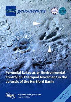
Parallel dinosaur trackways can be used to infer that their makers were group animals. In this study, we evaluate whether Early Jurassic theropods in eastern North America were gregarious by examining trackway orientations in different paleoenvironments. We show that trackways lack preferred orientations in playa lake deposits and that parallelism is restricted to permanent lacustrine environments. These results suggest that, rather than group activity, trackway parallelism resulted from the animals interacting with their environment (i.e., they followed the shoreline of a permanent lake). View this paper
  • Issues are regarded as officially published after their release is announced to the table of contents alert mailing list.
  • You may sign up for e-mail alerts to receive table of contents of newly released issues.
  • PDF is the official format for papers published in both, html and pdf forms. To view the papers in pdf format, click on the "PDF Full-text" link, and use the free Adobe Reader to open them.
Order results
Result details
Section
Select all
Export citation of selected articles as:
272 KiB  
Article
Ideal-Type Narratives for Engineering a Human Niche
by Martin Bohle
Geosciences 2017, 7(1), 18; https://doi.org/10.3390/geosciences7010018 - 22 Mar 2017
Cited by 4 | Viewed by 4536
Abstract
Humans have built an anthropocentric biogeosphere; called: ‘human niche’. Global change is part of this historical process of niche construction, which implies the intersection of the biogeosphere and the sphere of human activities of social, economic, cultural, and political natures. To construct these [...] Read more.
Humans have built an anthropocentric biogeosphere; called: ‘human niche’. Global change is part of this historical process of niche construction, which implies the intersection of the biogeosphere and the sphere of human activities of social, economic, cultural, and political natures. To construct these intersections, modern-day societies deploy ‘engineered systems’ and build narratives to frame these activities with purpose. This essay describes: (i) perceptions of what ‘engineered systems’ are about, (ii) their context such as global change, human agency, and societal implications of applied geosciences, and (iii) related narratives on how to handle global change through the design of ‘engineered systems’. Subsequently, regarding underpinning insights, it is shown that they: (i) are well-known, were used in the past, and now may be applied to handle global change; (ii) enshrine a distinct choice on how human activities and the biogeosphere shall intersect; and (iii) can be described by a simple ideal-type scheme, which does not require detailed scientific-technical understanding. Subsequently, it is illustrated how this ideal-type scheme leads to different narratives about what kind of ‘engineered systems’ are preferred. It is concluded that such ideal-type narratives for a messy world may help a lay-public to choose between options regarding how to handle global change. Full article
(This article belongs to the Special Issue Geosciences and Future Earth)
6149 KiB  
Article
Analysis of Climate and Topography Impacts on the Spatial Distribution of Vegetation in the Virunga Volcanoes Massif of East-Central Africa
by Alphonse Kayiranga, Felix Ndayisaba, Lamek Nahayo, Fidele Karamage, Jean Baptiste Nsengiyumva, Christophe Mupenzi and Enan Muhire Nyesheja
Geosciences 2017, 7(1), 17; https://doi.org/10.3390/geosciences7010017 - 22 Mar 2017
Cited by 17 | Viewed by 6874
Abstract
This paper aimed to investigate the influence of climatic and topographic factors on the distribution of vegetation in the Virunga Volcanoes Massif using GIS and remote sensing techniques. The climatic variables considered were precipitation, Land Surface Temperature (LST), and evapotranspiration (ET), whereas the [...] Read more.
This paper aimed to investigate the influence of climatic and topographic factors on the distribution of vegetation in the Virunga Volcanoes Massif using GIS and remote sensing techniques. The climatic variables considered were precipitation, Land Surface Temperature (LST), and evapotranspiration (ET), whereas the topographic factors considered were elevation and aspect. The dataset consisted of MODIS NDVI data, satellite-delivered precipitation, ET, and the LST. A 2014 Landsat 8 OLI image was used to produce a vegetation map of the study area, while DEM was used to derive the elevation attributes and to calculate the aspect angles. Moran’s I and Geographically Weighted Regression (GWR) Model was used to analyze the relationships between the climatic factors and NDVI changes over elevation and aspect. The results indicated that among the nine vegetation types inventoried in the area, the Mean NDVI varied from 0.33 to 0.59 and the optimal vegetation growth was found at an elevation between 2000 and 3900 m, with mean NDVI values larger than 0.50. The peak mean NDVI value of 0.59 was found at the elevation from 2100 to 2800 m. Vegetation growth was found to be more sensitive to elevation, as NDVI values were more varied at a lower elevation (<4000 m) than at a higher elevation (>4000 m). Considering the aspect, the greater vegetation growth was found in SE (132°, 148°), SW (182°, 186°), and NW (309.5°–337.5°), with mean NDVI values larger than 0.56. This indicated that vegetation was susceptible to better growth conditions in the lower elevation ranges and in shady areas. The vegetation NDVI in this study area was mostly uncorrelated with precipitation (R2 = 0.34), but was strongly correlated with LST (R2 = 0.99) and ET (R2 = 98). LST (≥18 °C) and ET (1286 mm/year−1) were found to provide optimal conditions for vegetation growth in the Virunga Volcanoes Massif. Empirically, the results concluded that elevation, aspect, LST, and ET are the main factors controlling the spatial distribution and vegetation growth in this area. This information is significantly helpful for biodiversity conservation and constitutes a valuable input to environmental and ecological research. Full article
(This article belongs to the Special Issue Geosciences and Future Earth)
Show Figures

Figure 1

12106 KiB  
Review
Spatio-Temporal Mapping of Plate Boundary Faults in California Using Geodetic Imaging
by Andrea Donnellan, Ramón Arrowsmith and Stephen DeLong
Geosciences 2017, 7(1), 15; https://doi.org/10.3390/geosciences7010015 - 21 Mar 2017
Cited by 8 | Viewed by 8795
Abstract
The Pacific–North American plate boundary in California is composed of a 400-km-wide network of faults and zones of distributed deformation. Earthquakes, even large ones, can occur along individual or combinations of faults within the larger plate boundary system. While research often focuses on [...] Read more.
The Pacific–North American plate boundary in California is composed of a 400-km-wide network of faults and zones of distributed deformation. Earthquakes, even large ones, can occur along individual or combinations of faults within the larger plate boundary system. While research often focuses on the primary and secondary faults, holistic study of the plate boundary is required to answer several fundamental questions. How do plate boundary motions partition across California faults? How do faults within the plate boundary interact during earthquakes? What fraction of strain accumulation is relieved aseismically and does this provide limits on fault rupture propagation? Geodetic imaging, broadly defined as measurement of crustal deformation and topography of the Earth’s surface, enables assessment of topographic characteristics and the spatio-temporal behavior of the Earth’s crust. We focus here on crustal deformation observed with continuous Global Positioning System (GPS) data and Interferometric Synthetic Aperture Radar (InSAR) from NASA’s airborne UAVSAR platform, and on high-resolution topography acquired from lidar and Structure from Motion (SfM) methods. Combined, these measurements are used to identify active structures, past ruptures, transient motions, and distribution of deformation. The observations inform estimates of the mechanical and geometric properties of faults. We discuss five areas in California as examples of different fault behavior, fault maturity and times within the earthquake cycle: the M6.0 2014 South Napa earthquake rupture, the San Jacinto fault, the creeping and locked Carrizo sections of the San Andreas fault, the Landers rupture in the Eastern California Shear Zone, and the convergence of the Eastern California Shear Zone and San Andreas fault in southern California. These examples indicate that distribution of crustal deformation can be measured using interferometric synthetic aperture radar (InSAR), Global Navigation Satellite System (GNSS), and high-resolution topography and can improve our understanding of tectonic deformation and rupture characteristics within the broad plate boundary zone. Full article
Show Figures

Graphical abstract

7071 KiB  
Article
Ophiolitic Remnants from the Upper and Intermediate Structural Unit of the Attic-Cycladic Crystalline Belt (Aegean, Greece): Fingerprinting Geochemical Affinities of Magmatic Precursors
by Christina Stouraiti, Iakovos Pantziris, Charalampos Vasilatos, Christos Kanellopoulos, Panagiotis Mitropoulos, Panagiotis Pomonis, Robert Moritz and Massimo Chiaradia
Geosciences 2017, 7(1), 14; https://doi.org/10.3390/geosciences7010014 - 21 Mar 2017
Cited by 25 | Viewed by 8368
Abstract
The ophiolitic rocks of the Attic-Cycladic crystalline belt are considered of key importance for understanding the Mesozoic tectonic evolution of the Aegean region. Unresolved questions concern their tectono-stratigraphic relationships across the region. The mode of occurrence of the Cycladic ophiolites varies, as they [...] Read more.
The ophiolitic rocks of the Attic-Cycladic crystalline belt are considered of key importance for understanding the Mesozoic tectonic evolution of the Aegean region. Unresolved questions concern their tectono-stratigraphic relationships across the region. The mode of occurrence of the Cycladic ophiolites varies, as they appear as: (a) dismembered blocks (olistoliths) within the supra-detachment units of Paros and Naxos; (b) mélange formations in the upper structural unit of western Samos and Skyros; and (c) meta-ophiolitic mélange in the Cycladic Blueschist Unit (CBU) from central Samos. The trace element geochemistry and Pb-Sr-Nd isotopes of the mafic ophiolitic rocks indicate four geochemical groups: (a) the upper unit metabasites from Paros and western Samos (Kallithea) display an evolved basaltic composition (Mg# 40.2–59.6), with low Zr/Nb values (5–16) and high Ce/Y values (1.3 to 2.6) compared to MORB, indicating island-arc tholeiite affinities; (b) Naxos upper unit metabasalts show spider diagrams patterns indicating ocean island basalt (OIB-type) affinities; (c) Central Samos metagabbros (CBU) are primitive rocks with Back-Arc Basin basalt affinities; (d) the Skyros metadolerites and Tinos (Mt Tsiknias) and S. Evia (CBU) metagabbros, cluster as a separate geochemical group; they exhibit high MgO values (>10 wt %), very low TiO2 values (0.1–0.2 wt %), Y and Yb, and depleted trace element N-MORB normalized patterns, similar to volcanic rocks formed in modern oceanic fore-arc settings, such as boninites. A combination of the Pb- and Sr-isotopic compositions of Cycladic metabasites indicate that the Pb and Sr incorporated in the Cycladic ophiolites correspond to mixtures of magmatic fluids with seawater (206Pb/204Pb = 18.51–18.80; 207Pb/204Pb = 15.59–15.7; 208Pb/204Pb = 39.03–39.80 and initial 87Sr/86Sr80 = 0.705–0.707). Furthermore, peridotite relicts from Samos, Paros, and Naxos—irrespective of the structural unit—display chemical affinities of ocean floor peridotites formed in a supra-subduction zone. The characteristics of harzburgite relicts in Cycladic serpentinites and Skyros indicate a highly residual nature of the mantle source. Geochemical data from this study shed further light on the complex structure of the oceanic lithosphere from which the Cycladic ophiolites originated. Full article
(This article belongs to the Special Issue Petrogenesis of Ophiolites)
Show Figures

Graphical abstract

11570 KiB  
Article
Perennial Lakes as an Environmental Control on Theropod Movement in the Jurassic of the Hartford Basin
by Patrick R. Getty, Christopher Aucoin, Nathaniel Fox, Aaron Judge, Laurel Hardy and Andrew M. Bush
Geosciences 2017, 7(1), 13; https://doi.org/10.3390/geosciences7010013 - 18 Mar 2017
Cited by 9 | Viewed by 7575
Abstract
Eubrontes giganteus is a common ichnospecies of large dinosaur track in the Early Jurassic rocks of the Hartford and Deerfield basins in Connecticut and Massachusetts, USA. It has been proposed that the trackmaker was gregarious based on parallel trackways at a site in [...] Read more.
Eubrontes giganteus is a common ichnospecies of large dinosaur track in the Early Jurassic rocks of the Hartford and Deerfield basins in Connecticut and Massachusetts, USA. It has been proposed that the trackmaker was gregarious based on parallel trackways at a site in Massachusetts known as Dinosaur Footprint Reservation (DFR). The gregariousness hypothesis is not without its problems, however, since parallelism can be caused by barriers that direct animal travel. We tested the gregariousness hypothesis by examining the orientations of trackways at five sites representing permanent and ephemeral lacustrine environments. Parallelism is only prominent in permanent lacustrine rocks at DFR, where trackways show a bimodal orientation distribution that approximates the paleoshoreline. By contrast, parallel trackways are uncommon in ephemeral lacustrine facies, even at sites with large numbers of trackways, and those that do occur exhibit differences in morphology, suggesting that they were made at different times. Overall, the evidence presented herein suggests that parallelism seen in Hartford Basin Eubrontes giganteus is better explained as a response to the lake acting as a physical barrier rather than to gregariousness. Consequently, these parallel trackways should not be used as evidence to support the hypothesis that the trackmaker was a basal sauropodomorph unless other evidence can substantiate the gregariousness hypothesis. Full article
(This article belongs to the Special Issue Middle Jurassic Dinosaurs in Context)
Show Figures

Figure 1

2176 KiB  
Article
Hydrochemistry and 222Rn Concentrations in Spring Waters in the Arid Zone El Granero, Chihuahua, Mexico
by Marusia Rentería-Villalobos, Alejandro Covarrubias-Muños, Alfredo Pinedo-Álvarez and Guillermo Manjon-Collado
Geosciences 2017, 7(1), 12; https://doi.org/10.3390/geosciences7010012 - 11 Mar 2017
Cited by 8 | Viewed by 3558
Abstract
Water in arid and semi-arid environments is characterized by the presentation of complex interactions, where dissolved chemical species in high concentrations have negative effects on the water quality. Radon is present in areas with a high uranium and radium content, and it is [...] Read more.
Water in arid and semi-arid environments is characterized by the presentation of complex interactions, where dissolved chemical species in high concentrations have negative effects on the water quality. Radon is present in areas with a high uranium and radium content, and it is the main contributor of the annual effective dose received by humans. The objective of this study was to evaluate concentrations of 222Rn and the water quality of spring waters. Water was classified as calcium sulfated and sodium sulfated. Most of the water samples with high radon concentrations presented higher concentrations of sulfates, fluorides, and total dissolved solids. 222Rn concentrations may be attributed to possible enhancement of 226Ra due to temperature and salinity of water, as well as evaporation rate. In 100% of the sampled spring waters the 222Rn levels exceeded the maximum acceptable limit which is proposed by international institutions. Aridity increases radiological risk related to 222Rn dose because spring waters are the main supply source for local populations. The implementation of environmental education, strategies, and technologies to remove the contaminants from the water are essential in order to reduce the health risk for local inhabitants. Full article
Show Figures

Figure 1

18571 KiB  
Article
Aquifer Drawdown and Recovery in the Northeast Groundwater Management Area, Wisconsin, USA: A Century of Groundwater Use
by John A. Luczaj, Julie Maas, David J. Hart and Jonathan Odekirk
Geosciences 2017, 7(1), 11; https://doi.org/10.3390/geosciences7010011 - 07 Mar 2017
Cited by 5 | Viewed by 8888
Abstract
The Northeast Groundwater Management Area of Wisconsin, USA contains two major cones of depression in a confined sandstone aquifer. Each cone is centered near cities that have used groundwater for over 100 years. Near one of these cities (Green Bay), episodic changes in [...] Read more.
The Northeast Groundwater Management Area of Wisconsin, USA contains two major cones of depression in a confined sandstone aquifer. Each cone is centered near cities that have used groundwater for over 100 years. Near one of these cities (Green Bay), episodic changes in the development of groundwater and surface water resources during this period have resulted in major changes to the potentiometric surface. On two occasions, roughly 50 years apart, reductions in groundwater withdrawals have resulted from the construction of pipelines drawing surface water from Lake Michigan. In each case, rapid recovery of the potentiometric surface by as much as 70 m has occurred in the northern of the two pumping cones. The most recent switch occurred during 2006 and 2007 when eight communities stopped pumping groundwater, reducing daily withdrawals by approximately 46.37 million liters. The rate of water level recovery has diminished in some areas, with a return to a flowing artesian state for some municipal and residential wells. Although the northern portion of the groundwater management area has returned to a sustainable condition in the confined aquifer, the portion with the southern cone of depression remains in a state of prolonged drawdown. Full article
Show Figures

Graphical abstract

5780 KiB  
Article
Volcanic Plume CO2 Flux Measurements at Mount Etna by Mobile Differential Absorption Lidar
by Simone Santoro, Stefano Parracino, Luca Fiorani, Roberto D’Aleo, Enzo Di Ferdinando, Gaetano Giudice, Giovanni Maio, Marcello Nuvoli and Alessandro Aiuppa
Geosciences 2017, 7(1), 9; https://doi.org/10.3390/geosciences7010009 - 03 Mar 2017
Cited by 10 | Viewed by 5480
Abstract
Volcanic eruptions are often preceded by precursory increases in the volcanic carbon dioxide (CO2) flux. Unfortunately, the traditional techniques used to measure volcanic CO2 require near-vent, in situ plume measurements that are potentially hazardous for operators and expose instruments to [...] Read more.
Volcanic eruptions are often preceded by precursory increases in the volcanic carbon dioxide (CO2) flux. Unfortunately, the traditional techniques used to measure volcanic CO2 require near-vent, in situ plume measurements that are potentially hazardous for operators and expose instruments to extreme conditions. To overcome these limitations, the project BRIDGE (BRIDging the gap between Gas Emissions and geophysical observations at active volcanoes) received funding from the European Research Council, with the objective to develop a new generation of volcanic gas sensing instruments, including a novel DIAL-Lidar (Differential Absorption Light Detection and Ranging) for remote (e.g., distal) CO2 observations. Here we report on the results of a field campaign carried out at Mt. Etna from 28 July 2016 to 1 August 2016, during which we used this novel DIAL-Lidar to retrieve spatially and temporally resolved profiles of excess CO2 concentrations inside the volcanic plume. By vertically scanning the volcanic plume at different elevation angles and distances, an excess CO2 concentration of tens of ppm (up to 30% above the atmospheric background of 400 ppm) was resolved from up to a 4 km distance from the plume itself. From this, the first remotely sensed volcanic CO2 flux estimation from Etna’s northeast crater was derived at ≈2850–3900 tons/day. This Lidar-based CO2 flux is in fair agreement with that (≈2750 tons/day) obtained using conventional techniques requiring the in situ measurement of volcanic gas composition. Full article
Show Figures

Figure 1

3190 KiB  
Article
Petrogenetic Implications for Ophiolite Ultramafic Bodies from Lokris and Beotia (Central Greece) Based on Chemistry of Their Cr-spinels
by Panagiotis Pomonis and Andreas Magganas
Geosciences 2017, 7(1), 10; https://doi.org/10.3390/geosciences7010010 - 03 Mar 2017
Cited by 7 | Viewed by 5662
Abstract
Cr-spinels from ultramafic rocks from Lokris (Megaplatanos and Tragana), and Beotia (Ypato and Alyki) ophiolitic occurrences were studied. These rocks comprise principally harzburgite with minor dunite. Small amounts of clinopyroxene-rich harzburgite and lherzolite have been observed along with the harzburgite in Alyki. The [...] Read more.
Cr-spinels from ultramafic rocks from Lokris (Megaplatanos and Tragana), and Beotia (Ypato and Alyki) ophiolitic occurrences were studied. These rocks comprise principally harzburgite with minor dunite. Small amounts of clinopyroxene-rich harzburgite and lherzolite have been observed along with the harzburgite in Alyki. The Cr# in the studied spinels displays a wide variability. The spinels hosted in harzburgite and cpx-rich harzburgite display low Cr# (<0.6), typical for oceanic (including back-arc basins) ophiolites, whereas the spinels hosted in dunite with Cr# (>0.6) characterize arc-related ophiolitic sequences. Cr-spinels from Alyki indicate a moderate fertile character and are analogous to those from abyssal peridotites. The dunitic and harzburgitic spinel–olivine pairs are consistent with a Supra-Subduction Zone origin. The relatively large range in spinel Cr# and Mg# may have been resulted from a wide range of degrees of mantle melting during the evolution of the host peridotites. Full article
(This article belongs to the Special Issue Petrogenesis of Ophiolites)
Show Figures

Figure 1

171 KiB  
Editorial
Introduction to the Special Issue on Climate Change and Geosciences
by Mary J. Thornbush and Nir Y. Krakauer
Geosciences 2017, 7(1), 8; https://doi.org/10.3390/geosciences7010008 - 17 Feb 2017
Cited by 1 | Viewed by 4615
Abstract
With increasing interdisciplinarity, more studies are examining environmental problems from an integrated perspective. This is apparent in the geological sciences and physical geography, which incorporate various disciplinary approaches, including biology, pedology, hydrology, geomorphology, and climatology. This Special Issue of Geosciences is comprised of [...] Read more.
With increasing interdisciplinarity, more studies are examining environmental problems from an integrated perspective. This is apparent in the geological sciences and physical geography, which incorporate various disciplinary approaches, including biology, pedology, hydrology, geomorphology, and climatology. This Special Issue of Geosciences is comprised of studies relevant to the biosphere, atmosphere, and hydrosphere, with terrestrial systems also considered. This Issue takes a geoscience perspective, embracing both geology (Earth science) and physical geography.[...] Full article
(This article belongs to the Special Issue Climate Change and Geosciences)
1644 KiB  
Article
Characterizing Degradation Gradients through Land Cover Change Analysis in Rural Eastern Cape, South Africa
by Zahn Münch, Perpetua I. Okoye, Lesley Gibson, Sukhmani Mantel and Anthony Palmer
Geosciences 2017, 7(1), 7; https://doi.org/10.3390/geosciences7010007 - 10 Feb 2017
Cited by 12 | Viewed by 5143
Abstract
Land cover change analysis was performed for three catchments in the rural Eastern Cape, South Africa, for two time steps (2000 and 2014), to characterize landscape conversion trajectories for sustained landscape health. Land cover maps were derived: (1) from existing data (2000); and [...] Read more.
Land cover change analysis was performed for three catchments in the rural Eastern Cape, South Africa, for two time steps (2000 and 2014), to characterize landscape conversion trajectories for sustained landscape health. Land cover maps were derived: (1) from existing data (2000); and (2) through object-based image analysis (2014) of Landsat 8 imagery. Land cover change analysis was facilitated using land cover labels developed to identify landscape change trajectories. Land cover labels assigned to each intersection of the land cover maps at the two time steps provide a thematic representation of the spatial distribution of change. While land use patterns are characterized by high persistence (77%), the expansion of urban areas and agriculture has occurred predominantly at the expense of grassland. The persistence and intensification of natural or invaded wooded areas were identified as a degradation gradient within the landscape, which amounted to almost 10% of the study area. The challenge remains to determine significant signals in the landscape that are not artefacts of error in the underlying input data or scale of analysis. Systematic change analysis and accurate uncertainty reporting can potentially address these issues to produce authentic output for further modelling. Full article
Show Figures

Figure 1

3032 KiB  
Article
Selection of Colloidal Silica Grouts with Respect to Gelling and Erosion Behaviour
by Pingqian Shen, Nicholas Hankins and Stephan Jefferis
Geosciences 2017, 7(1), 6; https://doi.org/10.3390/geosciences7010006 - 06 Feb 2017
Cited by 5 | Viewed by 5939
Abstract
Cembinder, Eka EXP36, and MEYCO MP320 are three colloidal silica materials that have been proposed for post-excavation grouting of deep tunnels in a radioactive waste repository. In this study, samples of these colloidal silicas were tested for their particle size distribution, gel induction [...] Read more.
Cembinder, Eka EXP36, and MEYCO MP320 are three colloidal silica materials that have been proposed for post-excavation grouting of deep tunnels in a radioactive waste repository. In this study, samples of these colloidal silicas were tested for their particle size distribution, gel induction time (tG), gel time (TG), and physical erosion, under mildly saline groundwater flow conditions. In order to achieve a desired gel time range, from 15 to 50 min, it is recommended that the colloidal silica is mixed with a NaCl accelerator at a 5:1 volume ratio. At 20 °C, the concentration range for the NaCl solution should be 1.5 to 1.7 M for MEYCO, 1.23 to 1.38 M for Eka EXP36, and 1.3 to 1.47 M for Cembinder. The physical erosion of the set silicas remained steady during a 10 h flow cell experiment, when grouts were subjected to 0.05 M NaCl at a superficial velocity of 2.2 × 10⁻⁵ m/s. For these test conditions, the results show that MEYCO has the highest average erosion rate (0.85 mg/h) of the three grout materials, as well as the greatest variability in this rate. Cembinder performed best with the lowest silica removal rate. Extrapolation of the measured erosion rates suggests that grout fracture dilation would not be significant under natural quiescent groundwater flow conditions, but would be high if there was hydraulic communication between the geosphere and the repository. Full article
Show Figures

Figure 1

6024 KiB  
Article
Assessing the Long-Term Behaviour of the Industrial Bentonites Employed in a Repository for Radioactive Wastes by Studying Natural Bentonites in the Field
by W. Russell Alexander, Heini M. Reijonen, Gillian MacKinnon, Antoni E. Milodowski, Alistair F. Pitty and Andreas Siathas
Geosciences 2017, 7(1), 5; https://doi.org/10.3390/geosciences7010005 - 18 Jan 2017
Cited by 4 | Viewed by 6013
Abstract
Bentonite makes an important contribution to the performance of the engineered barriers in most radioactive waste repository designs. The choice of bentonite results from its favourable properties for waste isolation and its stability in relevant geological environments. However, the longevity of bentonite (especially [...] Read more.
Bentonite makes an important contribution to the performance of the engineered barriers in most radioactive waste repository designs. The choice of bentonite results from its favourable properties for waste isolation and its stability in relevant geological environments. However, the longevity of bentonite (especially the resistance to waste container sinking) has been little studied. Modelling results suggest significant bentonite deformation and associated canister sinking is unlikely and, here, long-term natural system data are used as a reality check on model predictions. Results indicate that bentonite from the investigated site shows no significant deviation in bulk physical parameters from repository bentonite. However, micro-scale shear planes can be seen throughout the sampled cores. The presence of multi-directional S- and C-type shears suggests they originate from loading from the overlying limestone, not gravitational tectonics. The plastic limits and angles of shearing resistance for natural and repository bentonites suggest both are susceptible to shearing. The impact of bentonite shear under load could be minimised by appropriate design, but existing lower activity waste container designs do not consider the potentially high external stresses from the bentonite backfill and this should be addressed in future. Full article
Show Figures

Figure 1

146 KiB  
Editorial
A Special Issue of Geosciences: Mapping and Assessing Natural Disasters Using Geospatial Technologies
by Ruiliang Pu
Geosciences 2017, 7(1), 4; https://doi.org/10.3390/geosciences7010004 - 16 Jan 2017
Cited by 5 | Viewed by 3917
Abstract
Natural disasters, including floods, wildfires, volcanic eruptions, earthquakes, tsunamis, tropical storms, droughts, and landslides, can cause major losses of human lives and livelihoods, the destruction of economic and social infrastructure, as well as environmental damages.[...] Full article
(This article belongs to the Special Issue Mapping and Assessing Natural Disasters Using Geospatial Technologies)
6078 KiB  
Article
Bentonite Permeability at Elevated Temperature
by Katherine A. Daniels, Jon F. Harrington, Stephanie G. Zihms and Andrew C. Wiseall
Geosciences 2017, 7(1), 3; https://doi.org/10.3390/geosciences7010003 - 11 Jan 2017
Cited by 28 | Viewed by 7449
Abstract
Repository designs frequently favour geological disposal of radioactive waste with a backfill material occupying void space around the waste. The backfill material must tolerate the high temperatures produced by decaying radioactive waste to prevent its failure or degradation, leading to increased hydraulic conductivity [...] Read more.
Repository designs frequently favour geological disposal of radioactive waste with a backfill material occupying void space around the waste. The backfill material must tolerate the high temperatures produced by decaying radioactive waste to prevent its failure or degradation, leading to increased hydraulic conductivity and reduced sealing performance. The results of four experiments investigating the effect of temperature on the permeability of a bentonite backfill are presented. Bentonite is a clay commonly proposed as the backfill in repository designs because of its high swelling capacity and very low permeability. The experiments were conducted in two sets of purpose-built, temperature controlled apparatus, designed to simulate isotropic pressure and constant volume conditions within the testing range of 4–6 MPa average effective stress. The response of bentonite during thermal loading at temperatures up to 200 °C was investigated, extending the previously considered temperature range. The results provide details of bentonite’s intrinsic permeability, total stress, swelling pressure and porewater pressure during thermal cycles. We find that bentonite’s hydraulic properties are sensitive to thermal loading and the type of imposed boundary condition. However, the permeability change is not large and can mostly be accounted for by water viscosity changes. Thus, under 150 °C, temperature has a minimal impact on bentonite’s hydraulic permeability. Full article
Show Figures

Figure 1

63798 KiB  
Article
Folded Basinal Compartments of the Southern Mongolian Borderland: A Structural Archive of the Final Consolidation of the Central Asian Orogenic Belt
by Dickson Cunningham
Geosciences 2017, 7(1), 2; https://doi.org/10.3390/geosciences7010002 - 11 Jan 2017
Cited by 14 | Viewed by 6814
Abstract
The Central Asian Orogenic Belt (CAOB) records multiple Phanerozoic tectonic events involving consolidation of disparate terranes and cratonic blocks and subsequent reactivation of Eurasia’s continental interior. The final amalgamation of the CAOB terrane collage involved diachronous closure of the Permian-Triassic Solonker suture in [...] Read more.
The Central Asian Orogenic Belt (CAOB) records multiple Phanerozoic tectonic events involving consolidation of disparate terranes and cratonic blocks and subsequent reactivation of Eurasia’s continental interior. The final amalgamation of the CAOB terrane collage involved diachronous closure of the Permian-Triassic Solonker suture in northernmost China and the Jurassic Mongol-Okhotsk suture in northeast Mongolia and eastern Siberia. The distribution, style, and kinematics of deformation associated with these two terminal collision events is poorly documented in southern Mongolia and northernmost China because these regions were later tectonically overprinted by widespread Cretaceous basin and range-style crustal extension and Miocene-recent sinistral transpressional mountain building. These younger events structurally compartmentalized the crust into uplifted crystalline basement blocks and intermontane basins. Consequently, widespread Cretaceous and Late Cenozoic clastic sedimentary deposits overlie older Permian-Jurassic sedimentary rocks in most basinal areas and obscure the deformation record associated with Permian-Triassic Solonker and Jurassic Mongol-Okhotsk collisional suturing. In this report, satellite image mapping of basinal compartments that expose folded Permian-Jurassic sedimentary successions that are unconformably overlapped by Cretaceous-Quaternary clastic sediments is presented for remote and poorly studied regions of southern Mongolia and two areas of the Beishan. The largest folds are tens of kilometers in strike length, east-west trending, and reveal north-south Late Jurassic shortening (present coordinates). Late Jurassic fold vergence is dominantly northerly in the southern Gobi Altai within a regional-scale fold-and-thrust belt. Local refolding of older Permian north-south trending folds is also evident in some areas. The folds identified and mapped in this study provide new evidence for the regional distribution and kinematics of Jurassic and Permian-Triassic contractional tectonism in the southern Mongolia-northern China borderland region. The newly mapped folds are also important potential targets for hydrocarbon exploration and vertebrate paleontological discoveries. Full article
Show Figures

Figure 1

173 KiB  
Editorial
Acknowledgement to Reviewers of Geosciences in 2016
by Geosciences Editorial Office
Geosciences 2017, 7(1), 1; https://doi.org/10.3390/geosciences7010001 - 11 Jan 2017
Cited by 11 | Viewed by 2870
Abstract
The editors of Geosciences would like to express their sincere gratitude to the following reviewers for assessing manuscripts in 2016.[...] Full article
Previous Issue
Next Issue
Back to TopTop