Next Issue
Volume 7, October
Previous Issue
Volume 7, August


ISPRS Int. J. Geo-Inf., Volume 7, Issue 9 (September 2018) – 49 articles

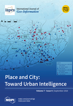
Cover Story (view full-size image): The citizenship place network of cities is still hidden. Although many authors foresee the spatial structure of a city theoretically, its operationalization remains constrained in urban studies. This research contributes to this discussion through the exploratory examination of the geographical relationship between a sense of place and social capital at the collective and individual level. Using spatial data collected through a web-map-based survey, we found that a sense of place and social capital spatial dimensions had a non-disjointed relationship for approximately half of the participants and showed a spatial clustering when they were aggregated. This research wants to open up the agenda for further research into exploratory place-based geography studies and sets up common ground for other socially-oriented conceptualizations or applications. View this paper.
  • Issues are regarded as officially published after their release is announced to the table of contents alert mailing list.
  • You may sign up for e-mail alerts to receive table of contents of newly released issues.
  • PDF is the official format for papers published in both, html and pdf forms. To view the papers in pdf format, click on the "PDF Full-text" link, and use the free Adobe Reader to open them.
Order results
Result details
Select all
Export citation of selected articles as:
13 pages, 2069 KiB  
Article
Using Remote Sensing to Analyse Net Land-Use Change from Conflicting Sustainability Policies: The Case of Amsterdam
by Mendel Giezen, Stella Balikci and Rowan Arundel
ISPRS Int. J. Geo-Inf. 2018, 7(9), 381; https://doi.org/10.3390/ijgi7090381 - 19 Sep 2018
Cited by 23 | Viewed by 8793
Abstract
In order to achieve the ambitious Sustainable Development Goal #11 (Sustainable Cities and Communities), an integrative approach is necessary. Complex outcomes such as sustainable cities are the product of a range of policies and drivers that are sometimes at odds with each other. [...] Read more.
In order to achieve the ambitious Sustainable Development Goal #11 (Sustainable Cities and Communities), an integrative approach is necessary. Complex outcomes such as sustainable cities are the product of a range of policies and drivers that are sometimes at odds with each other. Yet, traditional policy assessments often focus on specific ambitions such as housing, green spaces, etc., and are blind to the consequences of policy interactions. This research proposes the use of remote sensing technologies to monitor and analyse the resultant effects of opposing urban policies. In particular, we will look at the conflicting policy goals in Amsterdam between the policy to densify, on the one hand, and, on the other hand, goals of protecting and improving urban green space. We conducted an analysis to detect changes in land-uses within the urban core of Amsterdam, using satellite images from 2003 and 2016. The results indeed show a decrease of green space and an increase in the built-up environment. In addition, we reveal strong fragmentation of green space, indicating that green space is increasingly available in smaller patches. These results illustrate that the urban green space policies of the municipality appear insufficient to mitigate the negative outcomes of the city’s densification on urban green space. Additionally, we demonstrate how remote sensing can be a valuable instrument in investigating the net consequences of policies and urban developments that would be difficult to monitor through traditional policy assessments. Full article
(This article belongs to the Special Issue Geo-Information and the Sustainable Development Goals (SDGs))
Show Figures

Figure 1

7 pages, 2198 KiB  
Communication
Determining Optimal Video Length for the Estimation of Building Height through Radial Displacement Measurement from Space
by Andrew Plowright, Riccardo Tortini and Nicholas C. Coops
ISPRS Int. J. Geo-Inf. 2018, 7(9), 380; https://doi.org/10.3390/ijgi7090380 - 18 Sep 2018
Cited by 4 | Viewed by 3207
Abstract
We presented a methodology for estimating building heights in downtown Vancouver, British Columbia, Canada, using a high definition video (HDV) recorded from the International Space Station. We developed an iterative routine based on multiresolution image segmentation to track the radial displacement of building [...] Read more.
We presented a methodology for estimating building heights in downtown Vancouver, British Columbia, Canada, using a high definition video (HDV) recorded from the International Space Station. We developed an iterative routine based on multiresolution image segmentation to track the radial displacement of building roofs over the course of the HDV, and to predict the building heights using an ordinary least-squares regression model. The linear relationship between the length of the tracking vector and the height of the buildings was excellent (r2 ≤ 0.89, RMSE ≤ 8.85 m, p < 0.01). Notably, the accuracy of the height estimates was not improved considerably beyond 10 s of outline tracking, revealing an optimal video length for estimating the height or elevation of terrestrial features. HDVs are demonstrated to be a viable and effective data source for target tracking and building height prediction when high resolution imagery, spectral information, and/or topographic data from other sources are not available. Full article
(This article belongs to the Special Issue Cognitive Aspects of Human-Computer Interaction for GIS)
Show Figures

Graphical abstract

20 pages, 10671 KiB  
Article
Feature Extraction and Selection of Sentinel-1 Dual-Pol Data for Global-Scale Local Climate Zone Classification
by Jingliang Hu, Pedram Ghamisi and Xiao Xiang Zhu
ISPRS Int. J. Geo-Inf. 2018, 7(9), 379; https://doi.org/10.3390/ijgi7090379 - 18 Sep 2018
Cited by 67 | Viewed by 6019
Abstract
The concept of the local climate zone (LCZ) has been recently proposed as a generic land-cover/land-use classification scheme. It divides urban regions into 17 categories based on compositions of man-made structures and natural landscapes. Although it was originally designed for temperature study, the [...] Read more.
The concept of the local climate zone (LCZ) has been recently proposed as a generic land-cover/land-use classification scheme. It divides urban regions into 17 categories based on compositions of man-made structures and natural landscapes. Although it was originally designed for temperature study, the morphological structure concealed in LCZs also reflects economic status and population distribution. To this end, global LCZ classification is of great value for worldwide studies on economy and population. Conventional classification approaches are usually successful for an individual city using optical remote sensing data. This paper, however, attempts for the first time to produce global LCZ classification maps using polarimetric synthetic aperture radar (PolSAR) data. Specifically, we first produce polarimetric features, local statistical features, texture features, and morphological features and compare them, with respect to their classification performance. Here, an ensemble classifier is investigated, which is trained and tested on already separated transcontinental cities. Considering the challenging global scope this work handles, we conclude the classification accuracy is not yet satisfactory. However, Sentinel-1 dual-Pol SAR data could contribute the classification for several LCZ classes. According to our feature studies, the combination of local statistical features and morphological features yields the best classification results with 61.8% overall accuracy (OA), which is 3% higher than the OA produced by the second best features combination. The 3% is considerably large for a global scale. Based on our feature importance analysis, features related to VH polarized data contributed the most to the eventual classification result. Full article
Show Figures

Figure 1

26 pages, 12197 KiB  
Article
Beyond Spatial Proximity—Classifying Parks and Their Visitors in London Based on Spatiotemporal and Sentiment Analysis of Twitter Data
by Anna Kovacs-Györi, Alina Ristea, Ronald Kolcsar, Bernd Resch, Alessandro Crivellari and Thomas Blaschke
ISPRS Int. J. Geo-Inf. 2018, 7(9), 378; https://doi.org/10.3390/ijgi7090378 - 14 Sep 2018
Cited by 53 | Viewed by 9416
Abstract
Parks are essential public places and play a central role in urban livability. However, traditional methods of investigating their attractiveness, such as questionnaires and in situ observations, are usually time- and resource-consuming, while providing less transferable and only site-specific results. This paper presents [...] Read more.
Parks are essential public places and play a central role in urban livability. However, traditional methods of investigating their attractiveness, such as questionnaires and in situ observations, are usually time- and resource-consuming, while providing less transferable and only site-specific results. This paper presents an improved methodology of using social media (Twitter) data to extract spatial and temporal patterns of park visits for urban planning purposes, along with the sentiment of the tweets, focusing on frequent Twitter users. We analyzed the spatiotemporal park visiting behavior of more than 4000 users for almost 1700 parks, examining 78,000 tweets in London, UK. The novelty of the research is in the combination of spatial and temporal aspects of Twitter data analysis, applying sentiment and emotion extraction for park visits throughout the whole city. This transferable methodology thereby overcomes many of the limitations of traditional research methods. This study concluded that people tweeted mostly in parks 3–4 km away from their center of activity and they were more positive than elsewhere while doing so. In our analysis, we identified four types of parks based on their visitors’ spatial behavioral characteristics, the sentiment of the tweets, and the temporal distribution of the users, serving as input for further urban planning-related investigations. Full article
(This article belongs to the Special Issue Human-Centric Data Science for Urban Studies)
Show Figures

Graphical abstract

21 pages, 2611 KiB  
Article
Application of Industrial Risk Management Practices to Control Natural Hazards, Facilitating Risk Communication
by Jongook Lee and Dong Kun Lee
ISPRS Int. J. Geo-Inf. 2018, 7(9), 377; https://doi.org/10.3390/ijgi7090377 - 14 Sep 2018
Cited by 7 | Viewed by 5304
Abstract
Establishing a comprehensive management framework to manage the risk from natural hazards is challenging because of the extensive affected areas, uncertainty in predictions of natural disasters, and the involvement of various stakeholders. Applying risk management practices proven in the industrial sector can assist [...] Read more.
Establishing a comprehensive management framework to manage the risk from natural hazards is challenging because of the extensive affected areas, uncertainty in predictions of natural disasters, and the involvement of various stakeholders. Applying risk management practices proven in the industrial sector can assist systematic hazard identification and quantitative risk assessment for natural hazards, thereby promoting interactive risk communication to the public. The objective of this study is to introduce methods of studying risk commonly used in the process industry, and to suggest how such methods can be applied to manage natural disasters. In particular, the application of Hazard and Operability (HAZOP), Safety Integrated Level (SIL), and Quantitative Risk Analysis (QRA) was investigated, as these methods are used to conduct key studies in industry. We present case studies of the application of HAZOP to identify climate-related natural hazards, and of SIL and QRA studies that were performed to provide quantitative risk indices for landslide risk management. The analyses presented in this study can provide a useful framework for improving the risk management of natural hazards through establishing a more systematic context and facilitating risk communication. Full article
Show Figures

Figure 1

25 pages, 4886 KiB  
Article
The Geography of Taste: Using Yelp to Study Urban Culture
by Sohrab Rahimi, Sam Mottahedi and Xi Liu
ISPRS Int. J. Geo-Inf. 2018, 7(9), 376; https://doi.org/10.3390/ijgi7090376 - 13 Sep 2018
Cited by 13 | Viewed by 6826
Abstract
This study aims to put forth a new method to study the sociospatial boundaries by using georeferenced community-authored reviews for restaurants. In this study, we show that food choice, drink choice, and restaurant ambience can be good indicators of socioeconomic status of the [...] Read more.
This study aims to put forth a new method to study the sociospatial boundaries by using georeferenced community-authored reviews for restaurants. In this study, we show that food choice, drink choice, and restaurant ambience can be good indicators of socioeconomic status of the ambient population in different neighborhoods. To this end, we use Yelp user reviews to distinguish different neighborhoods in terms of their food purchases and identify resultant boundaries in 10 North American metropolitan areas. This dataset includes restaurant reviews as well as a limited number of user check-ins and rating in those cities. We use Natural Language Processing (NLP) techniques to select a set of potential features pertaining to food, drink and ambience from Yelp user comments for each geolocated restaurant. We then select those features which determine one’s choice of restaurant and the rating that he/she provides for that restaurant. After identifying these features, we identify neighborhoods where similar taste is practiced. We show that neighborhoods identified through our method show statistically significant differences based on demographic factors such as income, racial composition, and education. We suggest that this method helps urban planners to understand the social dynamics of contemporary cities in absence of information on service-oriented cultural characteristics of urban communities. Full article
Show Figures

Graphical abstract

15 pages, 5851 KiB  
Article
Geospatial Assessment of the Post-Earthquake Hazard of the 2017 Pohang Earthquake Considering Seismic Site Effects
by Han-Saem Kim, Chang-Guk Sun and Hyung-Ik Cho
ISPRS Int. J. Geo-Inf. 2018, 7(9), 375; https://doi.org/10.3390/ijgi7090375 - 10 Sep 2018
Cited by 28 | Viewed by 5088 | Correction
Abstract
The 2017 Pohang earthquake (moment magnitude scale: 5.4) was South Korea’s second strongest earthquake in decades, and caused the maximum amount of damage in terms of infrastructure and human injuries. As the epicenters were located in regions with Quaternary sediments, which involve distributions [...] Read more.
The 2017 Pohang earthquake (moment magnitude scale: 5.4) was South Korea’s second strongest earthquake in decades, and caused the maximum amount of damage in terms of infrastructure and human injuries. As the epicenters were located in regions with Quaternary sediments, which involve distributions of thick fill and alluvial geo-layers, the induced damages were more severe owing to seismic amplification and liquefaction. Thus, to identify the influence of site-specific seismic effects, a post-earthquake survey framework for rapid earthquake damage estimation, correlated with seismic site effects, was proposed and applied in the region of the Pohang earthquake epicenter. Seismic zones were determined on the basis of ground motion by classifying sites using the multivariate site classification system. Low-rise structures with slight and moderate earthquake damage were noted to be concentrated in softer sites owing to the low focal depth of the site, topographical effects, and high frequency range of the mainshocks. Full article
(This article belongs to the Special Issue Natural Hazards and Geospatial Information)
Show Figures

Figure 1

11 pages, 4172 KiB  
Article
Influences of the Shadow Inventory on a Landslide Susceptibility Model
by Cheng-Chien Liu, Wei Luo, Hsiao-Wei Chung, Hsiao-Yuan Yin and Ke-Wei Yan
ISPRS Int. J. Geo-Inf. 2018, 7(9), 374; https://doi.org/10.3390/ijgi7090374 - 9 Sep 2018
Cited by 4 | Viewed by 3660
Abstract
A landslide inventory serves as the basis for assessing landslide susceptibility, hazard, and risk. It is generally prepared from optical imagery acquired from spaceborne or airborne platforms, in which shadows are inevitably found in mountainous areas. The influences of shadow inventory on a [...] Read more.
A landslide inventory serves as the basis for assessing landslide susceptibility, hazard, and risk. It is generally prepared from optical imagery acquired from spaceborne or airborne platforms, in which shadows are inevitably found in mountainous areas. The influences of shadow inventory on a landslide susceptibility model (LSM), however, have not been investigated systematically. This paper employs both the shadow and landslide inventories prepared from eleven Formosat-2 annual images from the I-Lan area in Taiwan acquired from 2005 to 2016, using a semiautomatic expert system. A standard LSM based on the geometric mean of multivariables was used to evaluate the possible errors incurred by neglecting the shadow inventory. The results show that the LSM performance was significantly improved by 49.21% for the top 1% of the most highly susceptible area and that the performance decreased gradually by 15.25% for the top 10% most highly susceptible areas and 9.71% for the top 20% most highly susceptible areas. Excluding the shadow inventory from the calculation of landslide susceptibility index reveals the real contribution of each factor. They are crucial in optimizing the coefficients of a nondeterministic geometric mean LSM, as well as in deriving the threshold of a landslide hazard early warning system. Full article
Show Figures

Graphical abstract

27 pages, 9075 KiB  
Article
Sino-InSpace: A Digital Simulation Platform for Virtual Space Environments
by Liang Lyu, Qing Xu, Chaozhen Lan, Qunshan Shi, Wanjie Lu, Yang Zhou and Yinghao Zhao
ISPRS Int. J. Geo-Inf. 2018, 7(9), 373; https://doi.org/10.3390/ijgi7090373 - 8 Sep 2018
Cited by 4 | Viewed by 4203
Abstract
The implementation of increased space exploration missions reduces the distance between human beings and outer space. Although it is impossible for everyone to enter the remote outer space, virtual environments could provide computer-based digital spaces that we can observe, participate in, and experience. [...] Read more.
The implementation of increased space exploration missions reduces the distance between human beings and outer space. Although it is impossible for everyone to enter the remote outer space, virtual environments could provide computer-based digital spaces that we can observe, participate in, and experience. In this study, Sino-InSpace, a digital simulation platform, was developed to support the construction of virtual space environments. The input data are divided into two types, the environment element and the entity object, that are then supported by the unified time-space datum. The platform adopted the pyramid model and octree index to preprocess the geographic and space environment data, which ensured the efficiency of data loading and browsing. To describe objects perfectly, they were abstracted and modeled based on four aspects including attributes, ephemeris, geometry, and behavior. Then, the platform performed the organization of a visual scenario based on logical modeling and data modeling; in addition, it ensured smooth and flexible visual scenario displays using efficient data and rendering engines. Multilevel modes (application directly, visualization development, and scientific analysis) were designed to support multilevel applications for users from different grades and fields. Each mode provided representative case studies, which also demonstrated the capabilities of the platform for data integration, visualization, process deduction, and auxiliary analysis. Finally, a user study with human participants was conducted from multiple views (usability, user acceptance, presence, and software design). The results indicate that Sino-InSpace performs well in simulation for virtual space environments, while a virtual reality setup is beneficial for promoting the experience. Full article
Show Figures

Figure 1

25 pages, 9531 KiB  
Article
Digital Image Correlation (DIC) Analysis of the 3 December 2013 Montescaglioso Landslide (Basilicata, Southern Italy): Results from a Multi-Dataset Investigation
by Paolo Caporossi, Paolo Mazzanti and Francesca Bozzano
ISPRS Int. J. Geo-Inf. 2018, 7(9), 372; https://doi.org/10.3390/ijgi7090372 - 8 Sep 2018
Cited by 39 | Viewed by 7049
Abstract
Image correlation remote sensing monitoring techniques are becoming key tools for providing effective qualitative and quantitative information suitable for natural hazard assessments, specifically for landslide investigation and monitoring. In recent years, these techniques have been successfully integrated and shown to be complementary and [...] Read more.
Image correlation remote sensing monitoring techniques are becoming key tools for providing effective qualitative and quantitative information suitable for natural hazard assessments, specifically for landslide investigation and monitoring. In recent years, these techniques have been successfully integrated and shown to be complementary and competitive with more standard remote sensing techniques, such as satellite or terrestrial Synthetic Aperture Radar interferometry. The objective of this article is to apply the proposed in-depth calibration and validation analysis, referred to as the Digital Image Correlation technique, to measure landslide displacement. The availability of a multi-dataset for the 3 December 2013 Montescaglioso landslide, characterized by different types of imagery, such as LANDSAT 8 OLI (Operational Land Imager) and TIRS (Thermal Infrared Sensor), high-resolution airborne optical orthophotos, Digital Terrain Models and COSMO-SkyMed Synthetic Aperture Radar, allows for the retrieval of the actual landslide displacement field at values ranging from a few meters (2–3 m in the north-eastern sector of the landslide) to 20–21 m (local peaks on the central body of the landslide). Furthermore, comprehensive sensitivity analyses and statistics-based processing approaches are used to identify the role of the background noise that affects the whole dataset. This noise has a directly proportional relationship to the different geometric and temporal resolutions of the processed imagery. Moreover, the accuracy of the environmental-instrumental background noise evaluation allowed the actual displacement measurements to be correctly calibrated and validated, thereby leading to a better definition of the threshold values of the maximum Digital Image Correlation sub-pixel accuracy and reliability (ranging from 1/10 to 8/10 pixel) for each processed dataset. Full article
Show Figures

Figure 1

18 pages, 6520 KiB  
Article
An Efficient Graph-Based Spatio-Temporal Indexing Method for Task-Oriented Multi-Modal Scene Data Organization
by Bin Feng, Qing Zhu, Mingwei Liu, Yun Li, Junxiao Zhang, Xiao Fu, Yan Zhou, Maosu Li, Huagui He and Weijun Yang
ISPRS Int. J. Geo-Inf. 2018, 7(9), 371; https://doi.org/10.3390/ijgi7090371 - 8 Sep 2018
Cited by 7 | Viewed by 5234
Abstract
Task-oriented scene data in big data and cloud environments of a smart city that must be time-critically processed are dynamic and associated with increasing complexities and heterogeneities. Existing hybrid tree-based external indexing methods are input/output (I/O)-intensive, query schema-fixed, and difficult when representing the [...] Read more.
Task-oriented scene data in big data and cloud environments of a smart city that must be time-critically processed are dynamic and associated with increasing complexities and heterogeneities. Existing hybrid tree-based external indexing methods are input/output (I/O)-intensive, query schema-fixed, and difficult when representing the complex relationships of real-time multi-modal scene data; specifically, queries are limited to a certain spatio-temporal range or a small number of selected attributes. This paper proposes a new spatio-temporal indexing method for task-oriented multi-modal scene data organization. First, a hybrid spatio-temporal index architecture is proposed based on the analysis of the characteristics of scene data and the driving forces behind the scene tasks. Second, a graph-based spatio-temporal relation indexing approach, named the spatio-temporal relation graph (STR-graph), is constructed for this architecture. The global graph-based index, internal and external operation mechanisms, and optimization strategy of the STR-graph index are introduced in detail. Finally, index efficiency comparison experiments are conducted, and the results show that the STR-graph performs excellently in index generation and can efficiently address the diverse requirements of different visualization tasks for data scheduling; specifically, the STR-graph is more efficient when addressing complex and uncertain spatio-temporal relation queries. Full article
Show Figures

Figure 1

20 pages, 900 KiB  
Article
Raising Semantics-Awareness in Geospatial Metadata Management
by Cristiano Fugazza, Monica Pepe, Alessandro Oggioni, Paolo Tagliolato and Paola Carrara
ISPRS Int. J. Geo-Inf. 2018, 7(9), 370; https://doi.org/10.3390/ijgi7090370 - 7 Sep 2018
Cited by 8 | Viewed by 3289
Abstract
Geospatial metadata are often encoded in formats that either are not aimed at efficient retrieval of resources or are plainly outdated. Particularly, the quantum leap represented by the Semantic Web did not induce so far a consistent, interlinked baseline in the geospatial domain. [...] Read more.
Geospatial metadata are often encoded in formats that either are not aimed at efficient retrieval of resources or are plainly outdated. Particularly, the quantum leap represented by the Semantic Web did not induce so far a consistent, interlinked baseline in the geospatial domain. Datasets, scientific literature related to them, and ultimately the researchers behind these products are only loosely connected; the corresponding metadata intelligible only to humans, duplicated in different systems, seldom consistently. We address these issues by relating metadata items to resources that represent keywords, institutes, researchers, toponyms, and virtually any RDF data structure made available over the Web via SPARQL endpoints. Essentially, our methodology fosters delegated metadata management as the entities referred to in metadata are independent, decentralized data structures with their own life cycle. Our example implementation of delegated metadata envisages: (i) editing via customizable web-based forms (including injection of semantic information); (ii) encoding of records in any XML metadata schema; and (iii) translation into RDF. Among the semantics-aware features that this practice enables, we present a worked-out example focusing on automatic update of metadata descriptions. Our approach, demonstrated in the context of INSPIRE metadata (the ISO 19115/19119 profile eliciting integration of European geospatial resources) is also applicable to a broad range of metadata standards, including non-geospatial ones. Full article
Show Figures

Figure 1

21 pages, 3374 KiB  
Article
GIS-Assisted Prediction and Risk Zonation of Wildlife Attacks in the Chitwan National Park in Nepal
by Aleš Ruda, Jaromír Kolejka and Thakur Silwal
ISPRS Int. J. Geo-Inf. 2018, 7(9), 369; https://doi.org/10.3390/ijgi7090369 - 7 Sep 2018
Cited by 17 | Viewed by 7251
Abstract
Population growth forces the human community to expand into the natural habitats of wild animals. Their efforts to use natural sources often collide with wildlife attacks. These animals do not only protect their natural environment, but in the face of losing the potential [...] Read more.
Population growth forces the human community to expand into the natural habitats of wild animals. Their efforts to use natural sources often collide with wildlife attacks. These animals do not only protect their natural environment, but in the face of losing the potential food sources, they also penetrate in human settlements. The research was situated in the Chitwan National Park (CNP) in Nepal, and the aim of this study was to investigate possible geospatial connections between attacks of all kinds of animals on humans in the CNP and its surroundings between 2003 and 2013. The patterns of attacks were significantly uneven across the months, and 89% of attacks occurred outside the park. In total, 74% attacks occurred in the buffer zone forests and croplands within 1 km from the park. There was a strong positive correlation among the number of victims for all attacking animals with a maximum of one victim per 4 km2, except elephant and wild boar. The density of bear victims was higher where the tiger and rhino victims were lower, e.g., in the Madi valley. The data collected during this period did not show any signs of spatial autocorrelation. The calculated magnitude per unit area using the kernel density, together with purpose-defined land use groups, were used to determine five risk zones of wildlife attacks. In conclusion, it was found that the riskiest areas were locations near the forest that were covered by agricultural land and inhabited by humans. Our research results can support any local spatial decision-making processes for improving the co-existence of natural protection in the park and the safety of human communities living in its vicinity. Full article
(This article belongs to the Special Issue GIS for Safety & Security Management)
Show Figures

Figure 1

15 pages, 277 KiB  
Review
Critical Review of Methods to Estimate PM2.5 Concentrations within Specified Research Region
by Guangyuan Zhang, Xiaoping Rui and Yonglei Fan
ISPRS Int. J. Geo-Inf. 2018, 7(9), 368; https://doi.org/10.3390/ijgi7090368 - 7 Sep 2018
Cited by 40 | Viewed by 6090
Abstract
Obtaining PM2.5 data for the entirety of a research region underlies the study of the relationship between PM2.5 and human spatiotemporal activity. A professional sampler with a filter membrane is used to measure accurate values of PM2.5 at single points [...] Read more.
Obtaining PM2.5 data for the entirety of a research region underlies the study of the relationship between PM2.5 and human spatiotemporal activity. A professional sampler with a filter membrane is used to measure accurate values of PM2.5 at single points in space. However, there are numerous PM2.5 sampling and monitoring facilities that rely on data from only representative points, and which cannot measure the data for the whole region of research interest. This provides the motivation for researching the methods of estimation of particulate matter in areas having fewer monitors at a special scale, an approach now attracting considerable academic interest. The aim of this study is to (1) reclassify and particularize the most frequently used approaches for estimating the PM2.5 concentrations covering an entire research region; (2) list improvements to and integrations of traditional methods and their applications; and (3) compare existing approaches to PM2.5 estimation on the basis of accuracy and applicability. Full article
(This article belongs to the Special Issue Spatial Analysis of Pollution and Risk in a Changing Climate)
20 pages, 41607 KiB  
Article
Single-Tree Detection in High-Resolution Remote-Sensing Images Based on a Cascade Neural Network
by Dong Tianyang, Zhang Jian, Gao Sibin, Shen Ying and Fan Jing
ISPRS Int. J. Geo-Inf. 2018, 7(9), 367; https://doi.org/10.3390/ijgi7090367 - 6 Sep 2018
Cited by 19 | Viewed by 4223
Abstract
Traditional single-tree detection methods usually need to set different thresholds and parameters manually according to different forest conditions. As a solution to the complicated detection process for non-professionals, this paper presents a single-tree detection method for high-resolution remote-sensing images based on a cascade [...] Read more.
Traditional single-tree detection methods usually need to set different thresholds and parameters manually according to different forest conditions. As a solution to the complicated detection process for non-professionals, this paper presents a single-tree detection method for high-resolution remote-sensing images based on a cascade neural network. In this method, we firstly calibrated the tree and non-tree samples in high-resolution remote-sensing images to train a classifier with the backpropagation (BP) neural network. Then, we analyzed the differences in the first-order statistic features, such as energy, entropy, mean, skewness, and kurtosis of the tree and non-tree samples. Finally, we used these features to correct the BP neural network model and build a cascade neural network classifier to detect a single tree. To verify the validity and practicability of the proposed method, six forestlands including two areas of oil palm in Thailand, and four areas of small seedlings, red maples, or longan trees in China were selected as test areas. The results from different methods, such as the region-growing method, template-matching method, BP neural network, and proposed cascade-neural-network method were compared considering these test areas. The experimental results show that the single-tree detection method based on the cascade neural network exhibited the highest root mean square of the matching rate (RMS_Rmat = 90%) and matching score (RMS_M = 68) in all the considered test areas. Full article
(This article belongs to the Special Issue Geographic Information Science in Forestry)
Show Figures

Figure 1

3 pages, 177 KiB  
Editorial
Introduction to the Special Issue: “State-of-the-Art Virtual/Augmented Reality and 3D Modeling Techniques for Virtual Urban Geographic Experiments”
by Jianming Liang, Jianhua Gong and Yu Liu
ISPRS Int. J. Geo-Inf. 2018, 7(9), 366; https://doi.org/10.3390/ijgi7090366 - 5 Sep 2018
Cited by 2 | Viewed by 3343
13 pages, 19288 KiB  
Article
Spatial Assessment of the Potential Impact of Infrastructure Development on Biodiversity Conservation in Lowland Nepal
by Roshan Sharma, Bhagawat Rimal, Nigel Stork, Himlal Baral and Maheshwar Dhakal
ISPRS Int. J. Geo-Inf. 2018, 7(9), 365; https://doi.org/10.3390/ijgi7090365 - 5 Sep 2018
Cited by 14 | Viewed by 6073
Abstract
Biodiversity is declining at an unprecedented rate with infrastructure development being one of the leading causes. New infrastructure, such as roads, provides new access and results in increased land clearing and wildlife hunting. A number of large infrastructure projects, including new roads and [...] Read more.
Biodiversity is declining at an unprecedented rate with infrastructure development being one of the leading causes. New infrastructure, such as roads, provides new access and results in increased land clearing and wildlife hunting. A number of large infrastructure projects, including new roads and rail, are being planned in Nepal. We show the application of readily available remotely sensed data and geospatial tools to assess the potential impact of these future developments on habitat quality under three protection-level scenarios. Our findings reveal that there is currently large spatial heterogeneity in habitat quality across the landscape as a result of current anthropogenic threats, and that three areas in particular could have up to 40% reduction in habitat quality as a result of the planned infrastructure. Further research is required to determine more precisely the impact on key species. Strengthening protected areas and buffer zones will contribute to mitigating degradation to some degree, however, large areas of biologically significant areas outside protected areas will be affected without new controls. Our geographic information systems (GIS) based methodology could be used to conduct studies in data poor developing countries, where rapid infrastructure development across ecological sites are ongoing, in order to make society, policy makers, and development planners aware. Full article
Show Figures

Figure 1

25 pages, 1561 KiB  
Review
Revisiting the Role of Place in Geographic Information Science
by Helena Merschdorf and Thomas Blaschke
ISPRS Int. J. Geo-Inf. 2018, 7(9), 364; https://doi.org/10.3390/ijgi7090364 - 5 Sep 2018
Cited by 21 | Viewed by 12733
Abstract
Although place-based investigations into human phenomena have been widely conducted in the social sciences over the last decades, this notion has only recently transgressed into Geographic Information Science (GIScience). Such a place-based GIS comprises research from computational place modeling on one end of [...] Read more.
Although place-based investigations into human phenomena have been widely conducted in the social sciences over the last decades, this notion has only recently transgressed into Geographic Information Science (GIScience). Such a place-based GIS comprises research from computational place modeling on one end of the spectrum, to purely theoretical discussions on the other end. Central to all research that is concerned with place-based GIS is the notion of placing the individual at the center of the investigation, in order to assess human-environment relationships. This requires the formalization of place, which poses a number of challenges. The first challenge is unambiguously defining place, to subsequently be able to translate it into binary code, which computers and geographic information systems can handle. This formalization poses the next challenge, due to the inherent vagueness and subjectivity of human data. The last challenge is ensuring the transferability of results, requiring large samples of subjective data. In this paper, we re-examine the meaning of place in GIScience from a 2018 perspective, determine what is special about place, and how place is handled both in GIScience and in neighboring disciplines. We, therefore, adopt the view that space is a purely geographic notion, reflecting the dimensions of height, depth, and width in which all things occur and move, while place reflects the subjective human perception of segments of space based on context and experience. Our main research questions are whether place is or should be a significant (sub)topic in GIScience, whether it can be adequately addressed and handled with established GIScience methods, and, if not, which other disciplines must be considered to sufficiently account for place-based analyses. Our aim is to conflate findings from a vast and dynamic field in an attempt to position place-based GIS within the broader framework of GIScience. Full article
(This article belongs to the Special Issue Place-Based Research in GIScience and Geoinformatics)
Show Figures

Figure 1

21 pages, 1855 KiB  
Article
Cross-Domain Building Models—A Step towards Interoperability
by Laura Knoth, Johannes Scholz, Josef Strobl, Manfred Mittlböck, Bernhard Vockner, Caroline Atzl, Abbas Rajabifard and Behnam Atazadeh
ISPRS Int. J. Geo-Inf. 2018, 7(9), 363; https://doi.org/10.3390/ijgi7090363 - 4 Sep 2018
Cited by 19 | Viewed by 6523
Abstract
Buildings have a multifunctional character, which makes it hard to define just one model for all their diverse functions. As these diverse functions are addressed by actors of different perspectives and domain backgrounds, the possibility to exchange available building information would be desirable. [...] Read more.
Buildings have a multifunctional character, which makes it hard to define just one model for all their diverse functions. As these diverse functions are addressed by actors of different perspectives and domain backgrounds, the possibility to exchange available building information would be desirable. Two main models for the creation of building information are Industry Foundation Classes/Building Information Modelling (IFC/BIM) and City Geography Markup Language (CityGML). As the importance of information interchange has been recognized, several authors have tried to develop intermediate models for the information exchange between IFC/BIM and CityGML, e.g., the Unified Building Model (UBM), the BIM Oriented Indoor data Model (BO-IDM), the Indoor Emergency Spatial Model (IESM) and the BIM-GIS integration model for Flood Damage Assessment (FDA model). Nevertheless, all these models have been created with a certain use in mind. Our focus in this article is to identify common elements amongst these proposed models and to combine them into one “core model” that is as simple as possible, while simultaneously containing all important elements. Furthermore, this base model extracted from proposed intermediate models can then be expanded to serve specific use requirements, while still being exchangeable. To show this cross-domain character of the core model, we validated the resulting model with two cases of use (production environment/maintenance and 3D digital cadaster). Full article
Show Figures

Figure 1

21 pages, 5712 KiB  
Article
Road Extraction from VHR Remote-Sensing Imagery via Object Segmentation Constrained by Gabor Features
by Li Chen, Qing Zhu, Xiao Xie, Han Hu and Haowei Zeng
ISPRS Int. J. Geo-Inf. 2018, 7(9), 362; https://doi.org/10.3390/ijgi7090362 - 2 Sep 2018
Cited by 23 | Viewed by 4619
Abstract
Automatic road extraction from remote-sensing imagery plays an important role in many applications. However, accurate and efficient extraction from very high-resolution (VHR) images remains difficult because of, for example, increased data size and superfluous details, the spatial and spectral diversity of road targets, [...] Read more.
Automatic road extraction from remote-sensing imagery plays an important role in many applications. However, accurate and efficient extraction from very high-resolution (VHR) images remains difficult because of, for example, increased data size and superfluous details, the spatial and spectral diversity of road targets, disturbances (e.g., vehicles, shadows of trees, and buildings), the necessity of finding weak road edges while avoiding noise, and the fast-acquisition requirement of road information for crisis response. To solve these difficulties, a two-stage method combining edge information and region characteristics is presented. In the first stage, convolutions are executed by applying Gabor wavelets in the best scale to detect Gabor features with location and orientation information. The features are then merged into one response map for connection analysis. In the second stage, highly complete, connected Gabor features are used as edge constraints to facilitate stable object segmentation and limit region growing. Finally, segmented objects are evaluated by some fundamental shape features to eliminate nonroad objects. The results indicate the validity and superiority of the proposed method to efficiently extract accurate road targets from VHR remote-sensing images. Full article
Show Figures

Graphical abstract

15 pages, 18838 KiB  
Article
Automatic Seam-Line Detection in UAV Remote Sensing Image Mosaicking by Use of Graph Cuts
by Ming Li, Deren Li, Bingxuan Guo, Lin Li, Teng Wu and Weilong Zhang
ISPRS Int. J. Geo-Inf. 2018, 7(9), 361; https://doi.org/10.3390/ijgi7090361 - 31 Aug 2018
Cited by 8 | Viewed by 4694
Abstract
Image mosaicking is one of the key technologies in data processing in the field of computer vision and digital photogrammetry. For the existing problems of seam, pixel aliasing, and ghosting in mosaic images, this paper proposes and implements an optimal seam-line search method [...] Read more.
Image mosaicking is one of the key technologies in data processing in the field of computer vision and digital photogrammetry. For the existing problems of seam, pixel aliasing, and ghosting in mosaic images, this paper proposes and implements an optimal seam-line search method based on graph cuts for unmanned aerial vehicle (UAV) remote sensing image mosaicking. This paper first uses a mature and accurate image matching method to register the pre-mosaicked UAV images, and then it marks the source of each pixel in the overlapped area of adjacent images and calculates the energy value contributed by the marker by using the target energy function of graph cuts constructed in this paper. Finally, the optimal seam-line can be obtained by solving the minimum value of target energy function based on graph cuts. The experimental results show that our method can realize seamless UAV image mosaicking, and the image mosaic area transitions naturally. Full article
Show Figures

Figure 1

16 pages, 6117 KiB  
Article
Share Our Cultural Heritage (SOCH): Worldwide 3D Heritage Reconstruction and Visualization via Web and Mobile GIS
by Hari K. Dhonju, Wen Xiao, Jon P. Mills and Vasilis Sarhosis
ISPRS Int. J. Geo-Inf. 2018, 7(9), 360; https://doi.org/10.3390/ijgi7090360 - 30 Aug 2018
Cited by 26 | Viewed by 8442
Abstract
Despite being of paramount importance to humanity, tangible cultural heritage is often at risk from natural and anthropogenic threats worldwide. As a result, heritage discovery and conservation remain a huge challenge for both developed and developing countries, with heritage sites often inadequately cared [...] Read more.
Despite being of paramount importance to humanity, tangible cultural heritage is often at risk from natural and anthropogenic threats worldwide. As a result, heritage discovery and conservation remain a huge challenge for both developed and developing countries, with heritage sites often inadequately cared for, be it due to a lack of resources, nonrecognition of the value by local people or authorities, human conflict, or some other reason. This paper presents an online geo-crowdsourcing system, termed Share Our Cultural Heritage (SOCH), which can be utilized for large-scale heritage documentation and sharing. Supported by web and mobile GIS, cultural heritage data such as textual stories, locations, and images can be acquired via portable devices. These data are georeferenced and presented to the public via web-mapping. Using photogrammetric modelling, acquired images are used to reconstruct heritage structures or artefacts into 3D digital models, which are then visualized on the SOCH web interface to enable public interaction. This end-to-end system incubates an online virtual community to encourage public engagement, raise awareness, and stimulate cultural heritage ownership. It also provides valuable resources for cultural heritage exploitation, management, education, and monitoring over time. Full article
(This article belongs to the Special Issue Web and Mobile GIS)
Show Figures

Figure 1

19 pages, 5824 KiB  
Article
Capturing Flood Risk Perception via Sketch Maps
by Carolin Klonner, Tomás J. Usón, Sabrina Marx, Franz-Benjamin Mocnik and Bernhard Höfle
ISPRS Int. J. Geo-Inf. 2018, 7(9), 359; https://doi.org/10.3390/ijgi7090359 - 30 Aug 2018
Cited by 18 | Viewed by 6313
Abstract
The fact that an increasing number of people and local authorities are affected by natural hazards, especially floods, highlights the necessity of adequate mitigation and preparedness within disaster management. Many governments, though, have only insufficient monetary or technological capacities. One possible approach to [...] Read more.
The fact that an increasing number of people and local authorities are affected by natural hazards, especially floods, highlights the necessity of adequate mitigation and preparedness within disaster management. Many governments, though, have only insufficient monetary or technological capacities. One possible approach to tackle these issues is the acquisition of information by sketch maps complemented by questionnaires, which allows to digitally capture flood risk perception. We investigate which factors influence information collected by sketch maps and questionnaires in case studies in an area prone to pluvial flooding in Santiago de Chile. Our aim is to gain more information about the methods applied. Hereby, we focus on the spatial acquisition scale of sketch maps and personal characteristics of the participants, for example, whether they live at this very location of the survey (residents) or are pedestrians passing by. Our results show that the choice of the acquisition scale of the base map influences the amount and level of detail of information captured via sketch maps. Thus, detail base maps lead to more precise results when compared to reference data, especially in the case of residents. The results also reveal that the place of living of the respondents has an effect on the resulting information because on the neighborhood level the risk perception of residents is more detailed than the one of pedestrians. The study suggests that the integration of citizens via sketch maps can provide information about flood risk perception, and thus can influence the flood mitigation in the area. Full article
Show Figures

Figure 1

16 pages, 6140 KiB  
Article
Spatial-Temporal Analysis of Human Dynamics on Urban Land Use Patterns Using Social Media Data by Gender
by Chengcheng Lei, An Zhang, Qingwen Qi, Huimin Su and Jianghao Wang
ISPRS Int. J. Geo-Inf. 2018, 7(9), 358; https://doi.org/10.3390/ijgi7090358 - 29 Aug 2018
Cited by 17 | Viewed by 5105
Abstract
The relationship between urban human dynamics and land use types has always been an important issue in the study of urban problems in China. This paper used location data from Sina Location Microblog (commonly known as Weibo) users to study the human dynamics [...] Read more.
The relationship between urban human dynamics and land use types has always been an important issue in the study of urban problems in China. This paper used location data from Sina Location Microblog (commonly known as Weibo) users to study the human dynamics of the spatial-temporal characteristics of gender differences in Beijing’s Olympic Village in June 2014. We applied mathematical statistics and Local Moran’s I to analyze the spatial-temporal distribution of Sina Microblog users in 100 m × 100 m grids and land use patterns. The female users outnumbered male users, and the sex ratio ( S R varied under different land use types at different times. Female users outnumbered male users regarding residential land and public green land, but male users outnumbered female users regarding workplace, especially on weekends, as the S R on weekends ( S R was 120.5) was greater than that on weekdays ( S R was 118.8). After a Local Moran’s I analysis, we found that High–High grids are primarily distributed across education and scientific research land and residential land; these grids and their surrounding grids have more female users than male users. Low–Low grids are mainly distributed across sports centers and workplaces on weekdays; these grids and their surrounding grids have fewer female users than male users. The average number of users on Saturday was the highest value and, on weekends, the number of female and male users both increased in commercial land, but male users were more active than female users ( S R was 110). Full article
(This article belongs to the Special Issue Human-Centric Data Science for Urban Studies)
Show Figures

Figure 1

14 pages, 1830 KiB  
Article
Space–Time Analysis of Vehicle Theft Patterns in Shanghai, China
by Yuanyuan Mao, Shenzhi Dai, Jiajun Ding, Wei Zhu, Can Wang and Xinyue Ye
ISPRS Int. J. Geo-Inf. 2018, 7(9), 357; https://doi.org/10.3390/ijgi7090357 - 28 Aug 2018
Cited by 7 | Viewed by 5067
Abstract
To identify and compare the space–time patterns of vehicle thefts and the effects of associated environmental factors, this paper conducts a case study of the Pudong New Area (PNA), a major urban district in Shanghai, China’s largest city. Geographic information system (GIS)-based analysis [...] Read more.
To identify and compare the space–time patterns of vehicle thefts and the effects of associated environmental factors, this paper conducts a case study of the Pudong New Area (PNA), a major urban district in Shanghai, China’s largest city. Geographic information system (GIS)-based analysis indicated that there was a stable pattern of vehicle theft over time. Hotspots of vehicle theft across different time periods were identified. These data provide clues for how law enforcement can prioritize the deployment of limited patrol and investigative resources. Vehicle thefts, especially those of non-motor vehicles, tend to be concentrated in the central-western portion of the PNA, which experienced a dramatic rate of urbanization and has a high concentration of people and vehicles. Important factors contributing to vehicle thefts include a highly mobile and transitory population, a large population density, and high traffic volume. Full article
Show Figures

Figure 1

17 pages, 7076 KiB  
Article
Studies on Three-Dimensional (3D) Modeling of UAV Oblique Imagery with the Aid of Loop-Shooting
by Jia Li, Yongxiang Yao, Ping Duan, Yun Chen, Shuang Li and Chi Zhang
ISPRS Int. J. Geo-Inf. 2018, 7(9), 356; https://doi.org/10.3390/ijgi7090356 - 27 Aug 2018
Cited by 9 | Viewed by 4495
Abstract
Oblique imagery obtained from an Unmanned Aerial Vehicle (UAV) has been widely applied to large-scale three-dimensional (3D) reconstruction; however, the problems of partially missing model details caused by such factors as occlusion, distortion, and airflow, are still not well resolved. In this paper, [...] Read more.
Oblique imagery obtained from an Unmanned Aerial Vehicle (UAV) has been widely applied to large-scale three-dimensional (3D) reconstruction; however, the problems of partially missing model details caused by such factors as occlusion, distortion, and airflow, are still not well resolved. In this paper, a loop-shooting-aided technology is used to solve the problem of details loss in the 3D model. The use of loop-shooting technology can effectively compensate for losses caused by occlusion, distortion, or airflow during UAV flight and enhance the 3D model details in large scene- modeling applications. Applying this technology involves two key steps. First, based on the 3D modeling construction process, the missing details of the modeling scene are found. Second, using loop-shooting image sets as the data source, incremental iterative fitting based on aerotriangulation theory is used to compensate for the missing details in the 3D model. The experimental data used in this paper were collected from Yunnan Normal University, Chenggong District, Kunming City, Yunnan Province, China. The experiments demonstrate that loop-shooting significantly improves the aerotriangulation accuracy and effectively compensates for defects during 3D large-scale model reconstruction. In standard-scale distance tests, the average relative accuracy of our modeling algorithm reached 99.87% and achieved good results. Therefore, this technique not only optimizes the model accuracy and ensures model integrity, but also simplifies the process of refining the 3D model. This study can be useful as a reference and as scientific guidance in large-scale stereo measurements, cultural heritage protection, and smart city construction. Full article
Show Figures

Figure 1

17 pages, 1255 KiB  
Article
Achieving Complete and Near-Lossless Conversion from IFC to CityGML
by Rudi Stouffs, Helga Tauscher and Filip Biljecki
ISPRS Int. J. Geo-Inf. 2018, 7(9), 355; https://doi.org/10.3390/ijgi7090355 - 27 Aug 2018
Cited by 72 | Viewed by 6954
Abstract
The Singapore Government has embarked on a project to establish a three-dimensional city model and collaborative data platform for Singapore. The research herein contributes to this endeavour by developing a methodology and algorithms to automate the conversion of Building Information Models (BIM), in [...] Read more.
The Singapore Government has embarked on a project to establish a three-dimensional city model and collaborative data platform for Singapore. The research herein contributes to this endeavour by developing a methodology and algorithms to automate the conversion of Building Information Models (BIM), in the Industry Foundation Classes (IFC) data format, into CityGML building models, capturing both geometric and semantic information as available in the BIM models, and including exterior as well as interior structures. We adopt a Triple Graph Grammar (TGG) to formally relate IFC and CityGML, both semantically and geometrically, and to transform a building information model, expressed as an IFC object graph, into a city model expressed as a CityGML object graph. The work pipeline includes extending the CityGML data model with an Application Domain Extension (ADE), which allows capturing information from IFC that is relevant in the geospatial context but at the same time not supported by CityGML in its standard form. In this paper, we elaborate on the triple graph grammar approach and the motivation and roadmap for the development of the ADE. While a fully complete and lossless conversion may never be achieved, this paper suggests that both a TGG and an ADE are natural choices for supporting the conversion between IFC and CityGML. Full article
Show Figures

Figure 1

19 pages, 4476 KiB  
Article
On the Risk Assessment of Terrorist Attacks Coupled with Multi-Source Factors
by Xun Zhang, Min Jin, Jingying Fu, Mengmeng Hao, Chongchong Yu and Xiaolan Xie
ISPRS Int. J. Geo-Inf. 2018, 7(9), 354; https://doi.org/10.3390/ijgi7090354 - 27 Aug 2018
Cited by 13 | Viewed by 5645
Abstract
Terrorism has wreaked havoc on today’s society and people. The discovery of the regularity of terrorist attacks is of great significance to the global counterterrorism strategy. In this study, we improve the traditional location recommendation algorithm coupled with multi-source factors and spatial characteristics. [...] Read more.
Terrorism has wreaked havoc on today’s society and people. The discovery of the regularity of terrorist attacks is of great significance to the global counterterrorism strategy. In this study, we improve the traditional location recommendation algorithm coupled with multi-source factors and spatial characteristics. We used the data of terrorist attacks in Southeast Asia from 1970 to 2016, and comprehensively considered 17 influencing factors, including socioeconomic and natural resource factors. The improved recommendation algorithm is used to build a spatial risk assessment model of terrorist attacks, and the effectiveness is tested. The model trained in this study is tested with precision, recall, and F-Measure. The results show that, when the threshold is 0.4, the precision is as high as 88%, and the F-Measure is the highest. We assess the spatial risk of the terrorist attacks in Southeast Asia through experiments. It can be seen that the southernmost part of the Indochina peninsula and the Philippines are high-risk areas and that the medium-risk and high-risk areas are mainly distributed in the coastal areas. Therefore, future anti-terrorism measures should pay more attention to these areas. Full article
(This article belongs to the Special Issue GIS for Safety & Security Management)
Show Figures

Figure 1

20 pages, 9417 KiB  
Article
Novel Method for Virtual Restoration of Cultural Relics with Complex Geometric Structure Based on Multiscale Spatial Geometry
by Miaole Hou, Su Yang, Yungang Hu, Yuhua Wu, Lili Jiang, Sizhong Zhao and Putong Wei
ISPRS Int. J. Geo-Inf. 2018, 7(9), 353; https://doi.org/10.3390/ijgi7090353 - 27 Aug 2018
Cited by 23 | Viewed by 4767
Abstract
Because of the age of relics and the lack of historical data, the geometric forms of missing parts can only be judged by the subjective experience of repair personnel, which leads to varying restoration effects when the geometric structure of the complex relic [...] Read more.
Because of the age of relics and the lack of historical data, the geometric forms of missing parts can only be judged by the subjective experience of repair personnel, which leads to varying restoration effects when the geometric structure of the complex relic is reconstructed. Therefore, virtual repair effects cannot fully reflect the historical appearance of cultural relics. In order to solve this problem, this paper presents a virtual restoration method based on the multiscale spatial geometric features of cultural relics in the case of complex construction where the geometric shape of the damaged area is unknown, using the Dazu Thousand-Hand Bodhisattva statue in China as an example. In this study, the global geometric features of the three-dimensional (3D) model are analyzed in space to determine the geometric shape of the damaged parts of cultural relics. The local geometric features are represented by skeleton lines based on regression analysis, and a geometric size prediction model of the defective parts is established, which is used to calculate the geometric dimensions of the missing parts. Finally, 3D surface reconstruction technology is used to quantitate virtual restoration of the defective parts. This method not only provides a new idea for the virtual restoration of artifacts with complex geometric structure, but also may play a vital role in the protection of cultural relics. Full article
(This article belongs to the Special Issue Data Acquisition and Processing in Cultural Heritage)
Show Figures

Figure 1

24 pages, 7998 KiB  
Article
Exploring the Factors Driving Changes in Farmland within the Tumen/Tuman River Basin
by Cholhyok Kang, Yili Zhang, Basanta Paudel, Linshan Liu, Zhaofeng Wang and Ryongsu Li
ISPRS Int. J. Geo-Inf. 2018, 7(9), 352; https://doi.org/10.3390/ijgi7090352 - 27 Aug 2018
Cited by 6 | Viewed by 3354
Abstract
Understanding farmland changes and their mechanisms is important for food security and sustainable development. This study assesses the farmland changes and their drivers within the Tumen River of China and the Tuman River within the Democratic People’s Republic of Korea (DPR Korea) from [...] Read more.
Understanding farmland changes and their mechanisms is important for food security and sustainable development. This study assesses the farmland changes and their drivers within the Tumen River of China and the Tuman River within the Democratic People’s Republic of Korea (DPR Korea) from 1991 to 2016 (1991–2000, 2000–2010, and 2010–2016). Farmland surfaces in Tumen/Tuman River Basin (TRB) for each of the years were mapped from satellite imagery using an object-based image segmentation and a support vector machine (SVM) approach. A logistic regression was applied to discern the mechanisms underlying farmland changes. Results indicate that cultivated surfaces changes within the two regions were characterized by large differences during the three time periods. The decreases of cultivated surface of −15.55 km2 (i.e., 0.55% of total cultivated surface area in 2000) and −23.61 km2 (i.e., 0.83% of total cultivated surface area in 2016) occurred in China between 1991 and 2000 and between 2010 and 2016, respectively; while an increase of 30.98 km2 (i.e., 1.09% of total cultivated surface area in 2010) was seen between 2000 and 2010. Cultivated surfaces increased within DPR Korea side over the three time periods; a marked increase, in particular, was seen between 1991 and 2000 by 443.93 km2 (i.e., 23.43% of total cultivated surface area in 2000), while farmland increased by 140.87 km2 (i.e., 6.92% of total cultivated surface area in 2010) and 180.86 km2 (i.e., 1.78% of total cultivated surface area in 2016), respectively, between 2000 and 2010 and between 2010 and 2016. We also found that expansions and contractions in farmland within both regions of the TRB were mainly influenced by topographic, soil, climatic, and distance factors, which had different importance degrees. Among these significant forces, the temperatures in the two regions were paramount positive factors on farmland changes during 1991–2016 and slope in China and precipitation in DPR Korea were the paramount negative factors affecting farmland changes, respectively. Additionally, except for between 2000 and 2010 in DPR Korea TRB region, most of the factors significantly influencing the farmland changes revealed the same positive or negative effects in different periods, because of mountainous topography. This study allows enhancing understanding of the mechanisms underlying farmland changes in the TRB. Full article
Show Figures

Figure 1

Previous Issue
Next Issue
Back to TopTop