Next Issue
Volume 5, September
Previous Issue
Volume 5, March


Quaternary, Volume 5, Issue 2 (June 2022) – 10 articles

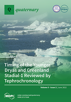
Cover Story (view full-size image): The exact spatial and temporal behaviour of rapid climate shifts during the Last Glacial–Interglacial Transition is still not entirely understood. To investigate these events, it is necessary to have detailed palaeoenvironmental reconstructions at geographically spread study sites combined with reliable correlations between them. Tephrochronology offers opportunities to examine the timing of events across wider regional scales. This study discussed the long-debated synchronous or asynchronous behaviour of the Late Glacial cold event known as the Younger Dryas. Although the results to some extent support the idea of a more synchronous Younger Dryas event than previously assumed, this issue requires further high-resolution proxy studies to overcome limitations of temporal precision. View this paper
  • Issues are regarded as officially published after their release is announced to the table of contents alert mailing list.
  • You may sign up for e-mail alerts to receive table of contents of newly released issues.
  • PDF is the official format for papers published in both, html and pdf forms. To view the papers in pdf format, click on the "PDF Full-text" link, and use the free Adobe Reader to open them.
Order results
Result details
Select all
Export citation of selected articles as:
33 pages, 6590 KiB  
Review
Theoretical Principles and Perspectives of Hyperspectral Imaging Applied to Sediment Core Analysis
by Kévin Jacq, Maxime Debret, Bernard Fanget, Didier Coquin, Pierre Sabatier, Cécile Pignol, Fabien Arnaud and Yves Perrette
Quaternary 2022, 5(2), 28; https://doi.org/10.3390/quat5020028 - 1 Jun 2022
Cited by 6 | Viewed by 4019
Abstract
Hyperspectral imaging is a recent technology that has been gaining popularity in the geosciences since the 1990s, both in remote sensing and in the field or laboratory. Indeed, it allows the rapid acquisition of a large amount of data that are spatialized on [...] Read more.
Hyperspectral imaging is a recent technology that has been gaining popularity in the geosciences since the 1990s, both in remote sensing and in the field or laboratory. Indeed, it allows the rapid acquisition of a large amount of data that are spatialized on the studied object with a low-cost, compact, and automatable sensor. This practical article aims to present the current state of knowledge on the use of hyperspectral imaging for sediment core analysis (core logging). To use the full potential of this type of sensor, many points must be considered and will be discussed to obtain reliable and quality data to extract many environmental properties of sediment cores. Hyperspectral imaging is used in many fields (e.g., remote sensing, geosciences and artificial intelligence) and offers many possibilities. The applications of the literature will be reviewed under five themes: lake and water body trophic status, source-to-sink approaches, organic matter and mineralogy studies, and sedimentary deposit characterization. Afterward, discussions will be focused on a multisensor core logger, data management, integrated use of these data for the selection of sample areas, and other opportunities. Through this practical article, we emphasize that hyperspectral imaging applied to sediment cores is still an emerging tool and shows many possibilities for refining the understanding of environmental processes. Full article
Show Figures

Figure 1

23 pages, 6006 KiB  
Review
Ecological and Wildfire Responses to Rapid Landscape Changes within the Last ~900 Years on the South Haven Peninsula, Dorset (Southern England)
by Daniel Howlett, Sabine Wulf, Scarlett Wharram, Mark Hardiman and Harry Byrne
Quaternary 2022, 5(2), 27; https://doi.org/10.3390/quat5020027 - 4 May 2022
Viewed by 2742
Abstract
A multi-proxy palaeoenvironmental dataset (LOI, pollen, charcoal, grain sizes and the humification index) was extracted and radiocarbon dated from a sedimentary sequence from Spur Bog, central South Haven Peninsula (Dorset, southern England) to reconstruct ecological and environmental changes within the last ~900 years. [...] Read more.
A multi-proxy palaeoenvironmental dataset (LOI, pollen, charcoal, grain sizes and the humification index) was extracted and radiocarbon dated from a sedimentary sequence from Spur Bog, central South Haven Peninsula (Dorset, southern England) to reconstruct ecological and environmental changes within the last ~900 years. These analyses reveal highly unstable environmental conditions at the site, evidencing the occurrence of multiple, often rapid changes during this period. The results significantly expand upon the existing palaeoenvironmental and geomorphological frameworks of the South Haven Peninsula which previously relied upon sparse, vague historical records prior to ~1750 AD. The multi-proxy dataset of Spur Bog sediments recorded a primary “development” phase (~1150–1470 AD) during which marine processes were the dominant control upon environmental conditions at the site, resulting in marked geomorphological changes that lead to the progressive eastward expansion of the South Haven Peninsula. This is followed by a secondary “maturation” phase (~1470–1880 AD) during which the Spur Bog sequence exhibits significant ecological changes in response to fluctuations in sea level, coastal erosion and human activity, demonstrating the vulnerability of the site to future climatic and anthropogenic pressures. Full article
Show Figures

Figure 1

17 pages, 15757 KiB  
Article
Novel Combined Approach of GIS and Electrical Tomography to Identify Marsh/Lake at Kastrouli Late Mycenaean Settlement (Desfina, Greece)
by Ioannis Liritzis, Niki Evelpidou, Ilias Fikos, Alexandros Stambolidis, Nectaria Diamanti, Theano Roussari, Maria Tzouxanioti, Prodromos Louvaris and Gregorios N. Tsokas
Quaternary 2022, 5(2), 26; https://doi.org/10.3390/quat5020026 - 4 May 2022
Cited by 1 | Viewed by 2256
Abstract
The Kastrouli Late Bronze settlement in Phocis province, central Greece, has been proved to have been an important center in the periphery of the Mycenaean palaces. It was reused at least partially and was cultivated until the 20th century. The presence of a [...] Read more.
The Kastrouli Late Bronze settlement in Phocis province, central Greece, has been proved to have been an important center in the periphery of the Mycenaean palaces. It was reused at least partially and was cultivated until the 20th century. The presence of a flat area off the Kastrouli hill and the seasonal flooding nowadays led to the present investigation, questioning the formation of an ancient lake or marsh/swamp. A methodological approach was applied combining the digital elevation model (DEM) and GIS of the wider and confined area, examining slopes between 0 and 5 degrees (0 and 8.75%), with electrical resistivity tomography (ERT) traverses of around 300 and 500 m, reaching a depth of 100 m. The ERT data were rapidly collected on profiles and provided a cross-sectional (2D) plot. It was found that, in the area, there is a basin with a length of 100 m and a depth of around 40–50 m. The sedimentation process over the millennia has filled the basin, with the upper 5–6 m surface layers of the area having a low resistivity. The presence of two natural sinkholes with apparent engineered hydraulic works is noted to conform to drainage and produce a habitable environment, protecting the cultivated land and avoiding a swamp associated with health issues. Full article
(This article belongs to the Special Issue Advances in Geoarchaeology and Cultural Heritage)
Show Figures

Figure 1

31 pages, 22247 KiB  
Article
Weather, Land and Crops in the Indus Village Model: A Simulation Framework for Crop Dynamics under Environmental Variability and Climate Change in the Indus Civilisation
by Andreas Angourakis, Jennifer Bates, Jean-Philippe Baudouin, Alena Giesche, Joanna R. Walker, M. Cemre Ustunkaya, Nathan Wright, Ravindra Nath Singh and Cameron A. Petrie
Quaternary 2022, 5(2), 25; https://doi.org/10.3390/quat5020025 - 1 May 2022
Cited by 5 | Viewed by 3627
Abstract
The start and end of the urban phase of the Indus civilization (IC; c. 2500 to 1900 BC) are often linked with climate change, specifically regarding trends in the intensity of summer and winter precipitation and its effect on the productivity of local [...] Read more.
The start and end of the urban phase of the Indus civilization (IC; c. 2500 to 1900 BC) are often linked with climate change, specifically regarding trends in the intensity of summer and winter precipitation and its effect on the productivity of local food economies. The Indus Village is a modular agent-based model designed as a heuristic “sandbox” to investigate how IC farmers could cope with diverse and changing environments and how climate change could impact the local and regional food production levels required for maintaining urban centers. The complete model includes dedicated submodels about weather, topography, soil properties, crop dynamics, food storage and exchange, nutrition, demography, and farming decision-making. In this paper, however, we focus on presenting the parts required for generating crop dynamics, including the submodels involved (weather, soil water, land, and crop models) and how they are combined progressively to form two integrated models (land water and land crop models). Furthermore, we describe and discuss the results of six simulation experiments, which highlight the roles of seasonality, topography, and crop diversity in understanding the potential impact of environmental variability, including climate change, in IC food economies. We conclude by discussing a broader consideration of risk and risk mitigation strategies in ancient agriculture and potential implications to the sustainability of the IC urban centres. Full article
(This article belongs to the Special Issue Human Activities and Development of Food Production in the Holocene)
Show Figures

Graphical abstract

13 pages, 9307 KiB  
Article
Quaternary Evolutionary Stages of Selinitsa Cave (SW Peloponnese, Greece) Reveal Sea-Level Changes Based on 3D Scanning, Geomorphological, Biological, and Sedimentological Indicators
by Isidoros Kampolis, Stavros Triantafyllidis, Vasilios Skliros and Evangelos Kamperis
Quaternary 2022, 5(2), 24; https://doi.org/10.3390/quat5020024 - 16 Apr 2022
Cited by 3 | Viewed by 3175
Abstract
Significant evolutionary stages of Selinitsa Cave (SW Peloponnese, Greece) were revealed by 3D mapping, as well as geomorphological study of the cave and the nearby landscape. Four marine terraces were identified in the area of the coastal cave at 6, 10.7, 16.6, and [...] Read more.
Significant evolutionary stages of Selinitsa Cave (SW Peloponnese, Greece) were revealed by 3D mapping, as well as geomorphological study of the cave and the nearby landscape. Four marine terraces were identified in the area of the coastal cave at 6, 10.7, 16.6, and 30–32 m above sea level (asl), with the terrace at 16.6 m representing Marine Isotope Stage (MIS) 5. The widest karstified space of Selinitsa Cave clusters between 15.73 and 18.05 m above sea level (asl), with the peak lying at 16.4 m asl, corresponding to the level where the phreatic/epiphreatic zone was stable for a sufficient period of time. A tidal notch at 16.4 m asl at the cave entrance is correlated to the marine terrace at 16.6 m. Both features correspond to the sea-level stand at which intense karstification occurred. The tidal notch bears a horizontal arrangement of Lithophaga borings at the vertex. Sedimentological investigation of the Selinitsa fine-grained deposit revealed the paleohydrologic regime of the cave. It is characterized by “slack-water” facies, indicating very low water flow speeds, whereas the thickness of the deposit points to stable hydrological conditions for prolonged periods. The cave sediment height of 18.8 m asl indicates a flooding level higher than sea level. The overlying Plattenkalk flysch is most probably the major source of detritus, and the predominance of authigenic dolomite (>98% modal in the carbonate fraction) indicates a hyposaline environment related to mixing of sea water with percolating fresh water. The approach of this study shows the significance of 3D mapping, bio-geo-Relative Sea Level (RSL) indicators, and sedimentology in deciphering the paleogeographic evolution of coastal karstic systems and subsequently defining the paleoclimate regime of coastal areas in Greece and the eastern Mediterranean during the Late Quaternary. Full article
Show Figures

Figure 1

28 pages, 6070 KiB  
Article
Late-Glacial and Holocene Lake-Level Fluctuations on the Kenai Lowland, Reconstructed from Satellite-Fen Peat Deposits and Ice-Shoved Ramparts, Kenai Peninsula, Alaska
by Edward E. Berg, Darrell S. Kaufman, R. Scott Anderson, Gregory C. Wiles, Thomas V. Lowell, Edward A. D. Mitchell, Feng Sheng Hu and Alan Werner
Quaternary 2022, 5(2), 23; https://doi.org/10.3390/quat5020023 - 8 Apr 2022
Cited by 2 | Viewed by 2973
Abstract
Recent decades of warmer climate have brought drying wetlands and falling lake levels to southern Alaska. These recent changes can be placed into a longer-term context of postglacial lake-level fluctuations that include low stands that were as much as 7 m lower than [...] Read more.
Recent decades of warmer climate have brought drying wetlands and falling lake levels to southern Alaska. These recent changes can be placed into a longer-term context of postglacial lake-level fluctuations that include low stands that were as much as 7 m lower than present at eight lakes on the Kenai Lowland. Closed-basin lakes on the Kenai Lowland are typically ringed with old shorelines, usually as wave-cut scarps, cut several meters above modern lake levels; the scarps formed during deglaciation at 25–19 ka in a kettle moraine topography on the western Kenai Lowland. These high-water stands were followed by millennia of low stands, when closed-basin lake levels were drawn down by 5–10 m or more. Peat cores from satellite fens near or adjoining the eight closed-basin lakes show that a regional lake level rise was underway by at least 13.4 ka. At Jigsaw Lake, a detailed study of 23 pairs of overlapping sediment cores, seismic profiling, macrofossil analysis, and 58 AMS radiocarbon dates reveal rapidly rising water levels at 9–8 ka that caused large slabs of peat to slough off and sink to the lake bottom. These slabs preserve an archive of vegetation that had accumulated on a lakeshore apron exposed during the preceding drawdown period. They also preserve evidence of a brief period of lake level rise at 4.7–4.5 ka. We examined plant succession using in situ peat sequences in nine satellite fens around Jigsaw Lake that indicated increased effective moisture between 4.6 and 2.5 ka synchronous with the lake level rise. Mid- to late-Holocene lake high stands in this area are recorded by numerous ice-shoved ramparts (ISRs) along the shores. ISRs at 15 lakes show that individual ramparts typically record several shove events, separated by hundreds or thousands of years. Most ISRs date to within the last 5200 years and it is likely that older ISRs were erased by rising lake levels during the mid- to late Holocene. This study illustrates how data on vegetation changes in hydrologically coupled satellite-fen peat records can be used to constrain the water level histories in larger adjacent lakes. We suggest that this method could be more widely utilized for paleo-lake level reconstruction. Full article
Show Figures

Figure 1

19 pages, 5143 KiB  
Article
The Evolution of an Ancient Coastal Lake (Lerna, Peloponnese, Greece)
by Efterpi Koskeridou, Danae Thivaiou, Christos Psarras, Evangelia Rentoumi, Niki Evelpidou, Giannis Saitis, Alexandros Petropoulos, Chryssanthi Ioakim, George Katopodis, Konstantinos Papaspyropoulos and Spyros Plessas
Quaternary 2022, 5(2), 22; https://doi.org/10.3390/quat5020022 - 8 Apr 2022
Cited by 1 | Viewed by 4755
Abstract
Degradation of coastal environments is an issue that many areas in Europe are facing. In the present work, an ancient coastal lake wetland is investigated, the so-called Lake Lerna in NE Peloponnese, Greece. The area hosted early agricultural populations of modern Greece that [...] Read more.
Degradation of coastal environments is an issue that many areas in Europe are facing. In the present work, an ancient coastal lake wetland is investigated, the so-called Lake Lerna in NE Peloponnese, Greece. The area hosted early agricultural populations of modern Greece that started modifying their environment as early as the early–middle Neolithic. Two drill cores in the area of the ancient lake were analysed to establish the sedimentological succession and the depositional environments using sub-fossil assemblages (molluscs and ostracods). Three lithological and faunal units were recovered, the latter being confirmed by the statistical ordination method (non-metric multidimensional scaling). The usage of sub-fossil mollusc species for the first time in the region enriched the dataset and contributed significantly to the delimitation of the faunas. These consist of environments characterised by various levels of humidity (from stagnant waters to freshwater lake) and salinity, with ephemeral intrusions of salt water to the lake, documented by mollusc and ostracod populations. We conclude that the lake and its included fauna and flora were mostly affected by climatic fluctuations rather than human intervention in the area. Full article
(This article belongs to the Special Issue Advances in Geoarchaeology and Cultural Heritage)
Show Figures

Figure 1

2 pages, 554 KiB  
Correction
Correction: Konidaris et al. Dating of the Lower Pleistocene Vertebrate Site of Tsiotra Vryssi (Mygdonia Basin, Greece): Biochronology, Magnetostratigraphy, and Cosmogenic Radionuclides. Quaternary 2021, 4, 1
by George E. Konidaris, Dimitris S. Kostopoulos, Matteo Maron, Mirjam Schaller, Todd A. Ehlers, Elina Aidona, Mattia Marini, Vangelis Tourloukis, Giovanni Muttoni, George D. Koufos and Katerina Harvati
Quaternary 2022, 5(2), 21; https://doi.org/10.3390/quat5020021 - 8 Apr 2022
Cited by 1 | Viewed by 1755
Abstract
The authors wish to make the following corrections to their paper [...] Full article
Show Figures

Figure 1

19 pages, 3595 KiB  
Article
Geoarchaeological Analyses of a Late-Copper-Age Kurgan on the Great Hungarian Plain
by Péter Cseh, Dávid Molnár, László Makó and Pál Sümegi
Quaternary 2022, 5(2), 20; https://doi.org/10.3390/quat5020020 - 3 Apr 2022
Cited by 3 | Viewed by 2766
Abstract
Kurgans are the custodians of outstanding archaeological, natural and environmental-historical value in the lowland landscape of Eastern Europe, which has been continuously transformed over millennia by agricultural activity. Their protection and study are, therefore, essential. By comparative soil and sedimentological analysis of the [...] Read more.
Kurgans are the custodians of outstanding archaeological, natural and environmental-historical value in the lowland landscape of Eastern Europe, which has been continuously transformed over millennia by agricultural activity. Their protection and study are, therefore, essential. By comparative soil and sedimentological analysis of the soil levels buried during the kurgans’ construction, the levels of buried soil, and the recent surface soil, we can gain information on the environmental changes of the second half of the Holocene; we can also gain information about how the activity of humans, even in the case of prehistoric cultures, can cause changes in the soil and environment on a local scale, beyond the regional scale. The aim of our research was to conduct a geoarchaeological examination of the Császárné Mound, which is one of the kurgans in the Hungarian Great Plain. For this purpose, sedimentological analyses (grain size distribution, magnetic susceptibility measurements), a pollen analysis, and a malacological analysis were carried out on the samples from the Császárné Mound. The complex geoarchaeological investigation of the mound allowed us to distinguish three different construction layers in the kurgan’s soil material. Besides the archaeological results, we were able to reconstruct steppe-like environmental conditions before and during construction in the local surroundings of the kurgan. Full article
(This article belongs to the Special Issue Quaternary Loess Deposition and Climate Change)
Show Figures

Figure 1

17 pages, 3007 KiB  
Article
Synchronous or Not? The Timing of the Younger Dryas and Greenland Stadial-1 Reviewed Using Tephrochronology
by Simon A. Larsson, Malin E. Kylander, A. Britta K. Sannel and Dan Hammarlund
Quaternary 2022, 5(2), 19; https://doi.org/10.3390/quat5020019 - 1 Apr 2022
Cited by 3 | Viewed by 3464
Abstract
The exact spatial and temporal behaviour of rapid climate shifts during the Last Glacial–Interglacial Transition are still not entirely understood. In order to investigate these events, it is necessary to have detailed palaeoenvironmental reconstructions at geographically spread study sites combined with reliable correlations [...] Read more.
The exact spatial and temporal behaviour of rapid climate shifts during the Last Glacial–Interglacial Transition are still not entirely understood. In order to investigate these events, it is necessary to have detailed palaeoenvironmental reconstructions at geographically spread study sites combined with reliable correlations between them. Tephrochronology, i.e., using volcanic ash deposits in geological archives as a dating and correlation tool, offers opportunities to examine the timing of events across wider regional scales. This study aims to review the posited asynchrony of the Younger Dryas stadial in comparison with Greenland Stadial-1 by correlating new proxy data from southernmost Sweden to previous palaeoclimate reconstructions in Europe based on the presence of the Hässeldalen Tephra, the Vedde Ash, and the Laacher See Tephra. μ-XRF core-scanning data were projected using a recently published age–depth model based on these tephras and several radiocarbon dates, and compared to previous findings, including by adapting previous chronologies to the recently proposed earlier date of the Laacher See Tephra (13,006 ± 9 cal. a BP). Although the results to some extent support the idea of a more synchronous Younger Dryas event than previously assumed, this issue requires further high-resolution proxy studies to overcome limitations of temporal precision. Full article
Show Figures

Figure 1

Previous Issue
Next Issue
Back to TopTop