Next Issue
Volume 2, March


GeoHazards, Volume 1, Issue 1 (December 2020) – 5 articles

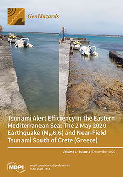
Cover Story (view full-size image): On 2 May 2020 a near-field tsunami was generated by a strong (Mw6.6) earthquake in Crete Isl., Greece. The event, although no damaging, has been a “crash-test” for the Mediterranean tsunami warning system which is based on national monitoring centers and operates under the IOC/UNESCO umbrella. For the first time in the system’s life since 2012 an in depth evaluation of the system’s performance and its operational effectiveness in conditions of extremely narrow time frames was contacted. It has been shown that the system’s upstream component improves if the alert time is shortened by a few minutes and the initial earthquake parameters are more accurate. Drastic improvement of the downstream component, however, is needed to achieve timely alerting for local authorities and communities. View this paper
  • Issues are regarded as officially published after their release is announced to the table of contents alert mailing list.
  • You may sign up for e-mail alerts to receive table of contents of newly released issues.
  • PDF is the official format for papers published in both, html and pdf forms. To view the papers in pdf format, click on the "PDF Full-text" link, and use the free Adobe Reader to open them.
Order results
Result details
Select all
Export citation of selected articles as:
17 pages, 3399 KiB  
Article
Tsunami Alert Efficiency in the Eastern Mediterranean Sea: The 2 May 2020 Earthquake (Mw6.6) and Near-Field Tsunami South of Crete (Greece)
by Gerassimos A. Papadopoulos, Efthymios Lekkas, Katerina-Navsika Katsetsiadou, Emmanouil Rovythakis and Amir Yahav
GeoHazards 2020, 1(1), 44-60; https://doi.org/10.3390/geohazards1010005 - 30 Jul 2020
Cited by 19 | Viewed by 5294
Abstract
The Mediterranean tsunami warning system is based on national monitoring centers (Tsunami Service Providers, TSPs) and operates under the IOC/UNESCO umbrella. For the first time we evaluate in depth the system’s performance for improving its operational effectiveness in conditions of extremely narrow time [...] Read more.
The Mediterranean tsunami warning system is based on national monitoring centers (Tsunami Service Providers, TSPs) and operates under the IOC/UNESCO umbrella. For the first time we evaluate in depth the system’s performance for improving its operational effectiveness in conditions of extremely narrow time frames due to the near-field tsunami sources. At time 10 (± 2) min from the origin time, to, of the 2 May 2020 (Mw6.6) earthquake in Crete, the Greek, Italian and Turkish TSPs sent alerts to civil protection subscribers. A small tsunami (amplitude ~16 cm a.m.s.l.) of magnitude Mt6.8, arriving at south Crete in ~17 min from to, was documented from tide-gauge records and macroscopic observations. The analysis of the upstream alert messages showed that the tsunami alert efficiency is not adequate, since (1) earthquake parameters of low accuracy were used for the initial message, (2) alerts were issued after some forecasted wave arrival times had expired, (3) alert messages are characterized by various discrepancies and uncertainties. Our calculations showed that the upstream component improves if the alert time is shortened by a few minutes and the initial earthquake parameters are more accurate. Very late procedures were noted in the Greek civil protection downstream component, thus rendering response actions useless. In Israel, a bit more time was available to the authorities for decision making. A drastic improvement of the downstream component is needed to achieve timely alerting for local authorities and communities. Full article
Show Figures

Figure 1

13 pages, 4088 KiB  
Article
Mapping the Recovery Process of Vegetation Growth in the Copper Basin, Tennessee Using Remote Sensing Technology
by Richard Blanton and A.K.M. Azad Hossain
GeoHazards 2020, 1(1), 31-43; https://doi.org/10.3390/geohazards1010004 - 22 Jun 2020
Cited by 1 | Viewed by 4949
Abstract
The Copper Basin (CB) of southeastern Tennessee, known as the Ducktown Mining District, is a classic example of forest and soil destruction due to extensive mining and smelting operations from the mid-1800s until 1987. The smelting operation released a sulfur dioxide by-product that [...] Read more.
The Copper Basin (CB) of southeastern Tennessee, known as the Ducktown Mining District, is a classic example of forest and soil destruction due to extensive mining and smelting operations from the mid-1800s until 1987. The smelting operation released a sulfur dioxide by-product that formed sulfuric acid precipitation which, in combination with heavy logging, led to the complete denudation of all vegetation covering 130 km2 in CB. The area has since been successfully revegetated. This study used remote sensing technology to map the different episodes of this vegetation recovery process. A time series of Landsat imagery acquired from 1977 through 2017 at 10-year intervals was used to map and analyze the changes in vegetation cover in CB. These maps were used to generate a single thematic map indicating in which 10-year period each parcel of land was revegetated. Analysis shows that the extent of non-vegetated areas continuously decreased from about 38.5 to 2.5 km2 between 1977 and 2017. The greatest increase in vegetation regrowth occurred between 1987 and 1997, which was the period when all mining and smelting activities ceased. This research could be very useful to better understand the recovery process of areas affected by mining and smelting processes. Full article
Show Figures

Figure 1

11 pages, 4700 KiB  
Article
A Remote Sensing-Based Method to Assess Water Level Fluctuations in Wetlands in Southern Brazil
by João P. D. Simioni, Laurindo A. Guasselli, Gabriel de Oliveira, Guilherme A. V. Mataveli and Thiago V. dos Santos
GeoHazards 2020, 1(1), 20-30; https://doi.org/10.3390/geohazards1010003 - 12 May 2020
Cited by 2 | Viewed by 3347
Abstract
The characterization of water level fluctuations is crucial to explain the hydrological processes that contribute to the maintenance of the structure and function of wetlands. The aim of this study was to develop a method based on remote sensing to characterize and map [...] Read more.
The characterization of water level fluctuations is crucial to explain the hydrological processes that contribute to the maintenance of the structure and function of wetlands. The aim of this study was to develop a method based on remote sensing to characterize and map the water level variation patterns, evapotranspiration, discharge, and rainfall over wetlands in the Gravataí River basin, Rio Grande do Sul (RS), Brazil. For this purpose, ground-based measurements of rainfall, water discharge, and evapotranspiration together with satellite data were used to identify the apparent water level based on the normalized difference water index (NDWI). Our results showed that the variation of the water level followed the rainfall, water discharge, and evapotranspiration seasonal patterns in the region. The NDWI showed similar values to the ground-based data collected 10 days prior to satellite image acquisition. The proposed technique allows for quantifying the pattern of flood pulses, which play an important role for establishing the connectivity between different compartments of wetlands in the study area. We conclude that our methodology based on the use of satellite data and ground measurements was a useful proposition to analyze the water level variation patterns in an area of great importance in terms of environmental degradation and use of agriculture. The information obtained may be used as inputs in hydrologic models, allowing researchers to evaluate the impact, at both local and regional scales, caused by advance of agriculture into natural environments such as wetlands. Full article
Show Figures

Figure 1

17 pages, 10682 KiB  
Article
Soil–Water Retention Curves Derived as a Function of Soil Dry Density
by Yulong Chen
GeoHazards 2020, 1(1), 3-19; https://doi.org/10.3390/geohazards1010002 - 27 Aug 2018
Cited by 26 | Viewed by 8275
Abstract
The soil–water retention curves (SWRC) of soil plays a key role in unsaturated soil mechanics, which is a relatively new field of study having wide applications particularly in geotechnical and geo-environmental engineering. SWRCs were used to evaluate the ability of unsaturated soils to [...] Read more.
The soil–water retention curves (SWRC) of soil plays a key role in unsaturated soil mechanics, which is a relatively new field of study having wide applications particularly in geotechnical and geo-environmental engineering. SWRCs were used to evaluate the ability of unsaturated soils to attract water with various water contents and matric suctions. Drying and wetting SWRCs for a sandy soil with different dry densities were studied in a laboratory. Proton nuclear magnetic resonance, image processing technology, and mercury intrusion porosimetry were used to characterize the microscopic mechanisms of pore size distribution in the soil. Soil–water retention in the soil samples was strongly dependent on the dry density. With zero matric suction, soil samples with a higher dry density had a lower initial volumetric water content. Volumetric water content changed at a slower rate when values of matric suction increased in soils with a higher dry density. Soil samples had residual matric suction and a larger air-entry value with a smaller slope of the SWRC when they had a higher density. Dry density change is mainly responsible for the large pores. The number of large pores decreased as dry density increased. As the dry density increased, the area of macropores occupying the largest portion decreased, while the area of mesopores and micropores increased. Minipores accounted for the smallest proportion of total area and they were nearly constant. The proportion of large diameter pores decreased relative to pores with small diameters in the tested soils. The total pore volume was lower for soil specimens that had larger dry densities, as compared to relatively loose specimens. There was hysteresis between the drying and wetting curves for all soil samples. Hysteresis decreased as the dry density of the soil increased. The different liquid–solid contact angle was the main factor causing hysteresis of SWRC. Full article
Show Figures

Figure 1

2 pages, 218 KiB  
Editorial
GeoHazards: A New Interdisciplinary Journal Devoted to the Study of Geomorphological Hazards
by Tiago Miguel Ferreira and Zhong Lu
GeoHazards 2020, 1(1), 1-2; https://doi.org/10.3390/geohazards1010001 - 02 Jun 2018
Cited by 1 | Viewed by 4228
Abstract
The name GeoHazards comes from the word “geomorphological”, which refers to the study of the physical features of the surface of the earth and their relation to its geological structures, and the word “hazard”, meaning an agent which has the potential to cause [...] Read more.
The name GeoHazards comes from the word “geomorphological”, which refers to the study of the physical features of the surface of the earth and their relation to its geological structures, and the word “hazard”, meaning an agent which has the potential to cause harm to a vulnerable target [...] Full article
Next Issue
Back to TopTop