
Spatial, Functional, and Landscape Changes in a Medium-Sized Post-Industrial City Based on Aerial Photo Analysis: The Case of Gorlice (Poland)


Abstract
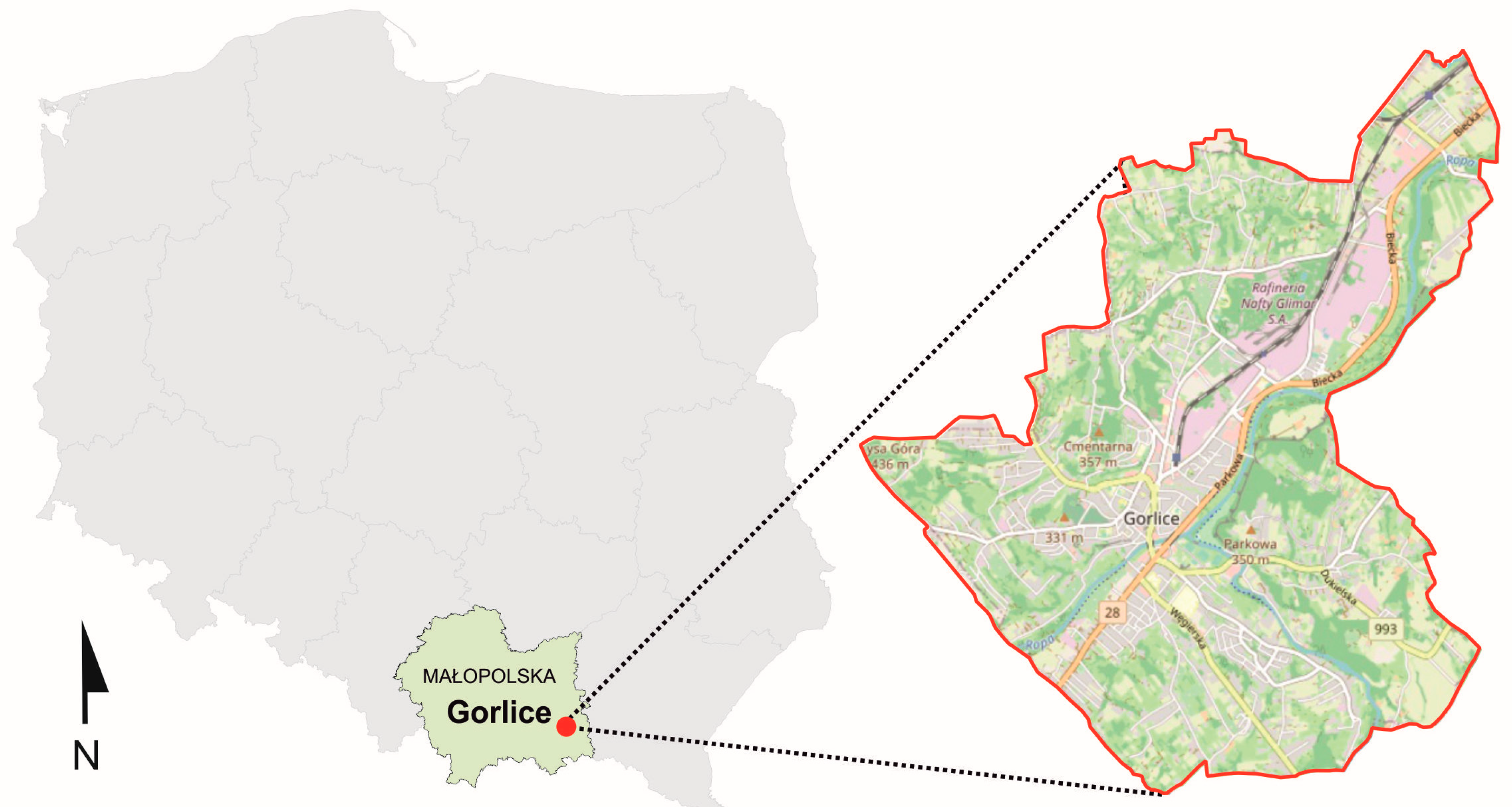
:1. Introduction
2. State of Research
3. Materials and Methods
4. Historical Background
5. Spatial and Functional Development of the City
6. Spatial and Functional Transformation of Industrial Areas
7. Research Results
- Reflection of a turbulent history in the spatial and functional structure of the city
- Post-industrial scar or processes of adaptation?
8. Discussion
9. Conclusions
Author Contributions
Funding
Institutional Review Board Statement
Informed Consent Statement
Data Availability Statement
Conflicts of Interest
References
- Yin, Y.; Stecke, K.E.; Li, D. The evolution of production systems from Industry 2.0 through Industry 4.0. Int. J. Prod. Res. 2017, 56, 848–861. [Google Scholar] [CrossRef] [Green Version]
- Groumpos, P.P. A critical historical and scientific overview of all industrial revolutions. IFAC-PapersOnLine 2021, 54, 464–471. [Google Scholar] [CrossRef]
- Storm, A. Post-Industrial Landscape Scars; Palgrave Macmillan: New York, NY, USA, 2014. [Google Scholar]
- Rachwał, T. Structural changes in Polish industry after 1989. Geogr. Pol. 2015, 88, 575–605. [Google Scholar] [CrossRef] [Green Version]
- Majer, A. Odrodzenie Miast; Wydawnictwo Naukowe Scholar: Łódź, Poland, 2014. [Google Scholar]
- Domański, B. Przemysł w Rozwoju Gospodarczym Małopolski, Geograficzne Uwarunkowania Rozwoju Małopolski; Instytut Geografii Gospodarki Przestrzennej Uniwersytetu Jagiellońskiego: Kraków, Poland, 2002; pp. 55–67. [Google Scholar]
- United Nations, Department of Economic and Social Affairs. The 2018 Revision of the World Urbanization Prospects. Available online: https://population.un.org/wup/publications/Files/WUP2018-Report.pdf (accessed on 6 February 2023).
- Lazzeroni, M. Industrial Decline and Resilience in Small Towns: Evidence from Three European Case Studies. Tijdschr. Econ. Soc. Geogr. 2019, 111, 182–195. [Google Scholar] [CrossRef]
- Masik, G. The concept of resilience: Dimensions, properties of resilient systems and spatial scales of resilience. Geogr. Pol. 2022, 95, 295–310. [Google Scholar] [CrossRef]
- Raźniak, P.; Dorocki, S.; Winiarczyk-Raźniak, A. Economic resilience of the command and control function of cities in Central and Eastern Europe. Acta Geogr. Slov. 2022, 60, 95–105. [Google Scholar] [CrossRef]
- European Commision. Cities of Tomorrow. Challenges, Visions, Ways Forward; Commission of the European Communitie: Brussels, Belgium, 2011; Available online: https://www.researchgate.net/publication/338385869_Cities_of_tomorrow_Challenges_visions_ways_forward (accessed on 12 February 2023).
- Servillo, L.; Atkinson, R.; Hamdouch, A. Small and Medium-Sized Towns in Europe: Conceptual, Methodological and Policy Issues. Tijdschr. Econ. Soc. Geogr. 2017, 108, 365–379. [Google Scholar] [CrossRef]
- Martin, R.L. Regional economic resilience, hysteresis and recessionary shocks. J. Econ. Geogr. 2012, 12, 1–32. [Google Scholar] [CrossRef] [Green Version]
- Kwiatek-Sołtys, A. Małe miasta w polskiej literaturze geograficznej ostatniego dwudziestolecia. In Kierunki i Uwarunkowania Rozwoju Małych Miast z Perspektywy 20 lat Transformacji. Studium Przypadków; Bartosiewicz, B., Marszał, T., Eds.; Wydawnictwo Uniwersytetu Łódzkiego: Łódź, Poland, 2011; pp. 9–55. [Google Scholar] [CrossRef]
- Kwiatek-Sołtys, A. Małe Miasta Województwa Małopolskiego w Okresie Transformacji Systemowej; Wydawnictwo Naukowe Akademii Pedagogicznej: Kraków, Polska, 2004. [Google Scholar]
- Grover, A.; Lall, S.V.; Maloney, W.F. Overview. In Place, Productivity, and Prosperity Revisiting Spatially Targeted Policies for Regional Development; World Bank Group: Washington, DC, USA, 2022. [Google Scholar]
- Zuzańska-Żyśko, E. Role of advanced producer services shaping globalization processes in a post-industrial region: The case of the Górnośląsko-Zagłębiowska Metropolis. Sustainability 2020, 13, 211. [Google Scholar] [CrossRef]
- Sikora, A. Heritage of the Polish Central Industrial District—New Cities. IOP Conf. Ser. Mater. Sci. Eng. Earth Environ. Sci. 2019, 362, 012021. [Google Scholar] [CrossRef]
- Grata, P. Central Industrial District as an Attempt to Implement the Principles of Sustainable Development in the Inter-War Period Poland. Eur. J. Sustain. Dev. 2019, 8, 137. [Google Scholar] [CrossRef]
- Furtak, M. COP: Centralny Okręg Przemysłowy 1936–1939. Architektura i Urbanistyka. Kraj, Region, Miasto, Fabryka, Osiedle, Budynek; Wydawnictwo Księży Młyn: Łódź, Poland, 2014. [Google Scholar]
- Macyra, R. 3i—Polskie ścieżki industrializacji (1918–1989): Propozycja weryfikacji ich efektywności ekonomicznej i społecznej użyteczności. Econ. Stud. 2019, 95, 46–71. [Google Scholar] [CrossRef] [Green Version]
- Blachut, J. Industrial Spaces in Small and Medium Cities in Southern Poland—The Selected Examples. IOP Conf. Ser. Mater. Sci. Eng. 2019, 471, 112082. [Google Scholar] [CrossRef]
- Gierańczyk, W.; Rachwał, T. Structural Changes in the Industry of Poland aagainst the Background of Eastern European Union States. Quaest. Geogr. 2012, 31, 83–93. [Google Scholar] [CrossRef] [Green Version]
- Martin, R.; Sunley, P. The place of path dependence in an evolutionary perspective on the economic landscape. In The Handbook of Evolutionary Economic Geography; Boschma, R., Martin, R., Eds.; Edward Elgar Publishing: Chichester, UK, 2010; Chapter 3. [Google Scholar]
- Dąbrowski, M.; Piskorek, K. The development of strategic spatial planning in Central and Eastern Europe: Between path dependence, European influence, and domestic politics. Plan. Perspect. 2018, 33, 571–589. [Google Scholar] [CrossRef] [Green Version]
- Terje, H. A path dependent systems perspective on participation in municipal land-use planning. Eur. Plan. Stud. 2021, 29, 1193–1210. [Google Scholar] [CrossRef]
- Barut, J. Gorlice: Studium Historyczno-Urbanistyczne Miasta; Wydawnictwo Muzeum Regionalne PTTK w Brzozowie: Brzozów, Poland, 1991. [Google Scholar]
- Barut, J.; Motyka, B.; Ślawski, T. Nad Rzeką Ropą; Wydawnictw Literackie: Kraków, Poland, 1962. [Google Scholar]
- Liana, A. Gorlice: Wiek Rozwoju; Muzeum Dwory Karwacjanów i Gładyszów: Gorlice, Poland, 2011. [Google Scholar]
- Friedrich, M. Ziemia Gorlicka a Rozwój Polskiego Przemysłu Naftowego In Historia Polskiego Przemysłu Naftowego; Duraj, B., Boryń, M., Chodubski, A., Eds.; Wydawnictwo Adam Marszałek: Toruń, Poland, 2014; pp. 98–115. [Google Scholar]
- Madurowicz-Urbańska, H.; Podraza, A. Regiony Gospodarcze Małopolski Zachodniej w Drugiej Połowie XVIII Wieku; Zakład Narodowy im. Ossolińskich: Warszwa, Poland, 1958. [Google Scholar]
- Dorocki, S. Spatial Differentiation of Educational Outcomes at Junior High and High School in the Region of Małopolska in a Historical Perspective. Przedsiębiorczość-Edukacja 2017, 13, 439–457. [Google Scholar] [CrossRef] [Green Version]
- Niemiec, J. Wpływ przemysłowego ośrodka Gorlic i Glinika Mariampolskiego na rolnicze zaplecze (na tle stosunków społeczno-gospodarczych powiatu gorlickiego). Rocz. Nauk.-Dydakt. 1958, 8, 173–185. [Google Scholar]
- Skrzypek, B. Przemysł naftowy i rafineryjny w PRL In Historia Polskiego Przemysłu Naftowego; Duraj, B., Boryń, M., Chodubski, A., Eds.; Wydawnictwo Adam Marszałek: Toruń, Poland, 2014; pp. 63–97. [Google Scholar]
- Zioło, Z. Formy koncentracji przemysłu w strukturze przestrzennej województwa rzeszowskiego. Rocz. Nauk.-Dydakt. Pr. Geogr. 1971, 40, 273–295. [Google Scholar]
- Zioł, Z. Typologia genetyczno-dynamiczna ośrodków przemysłowych. Rocz. Nauk.-Dydakt. Pr. Geogr. 1983, 88, 61–84. [Google Scholar]
- Chaberko, T.; Kretowicz, P. Konkurencyjność lokalnym transporcie zbiorowym a społeczna rola przewozów autobusowych (na przykładzie powiatu gorlickiego). Transp. Miej. Reg. 2011, 6, 28–35. [Google Scholar]
- Patoczka, P.M. Uwagi o architekturze w Gorlicach. Topiarius Stud. Kraj. 2016, 2, 23–48. [Google Scholar]
- Szymla, Z. Przestrzenne zróżnicowanie warunków życia ludności w województwie małopolskim. Zesz. Nauk./Akad. Ekon. Krakowie 2004, 645, 5–20. [Google Scholar]
- Bartosiewicz, B. Przemiany przestrzenno-funkcjonalne małych miast w Polsce w okresie transformacji ustrojowej. Stud. Pr. WNEIZ US 2014, 37, 179–188. [Google Scholar]
- Jażewicz, I. Przemiany społeczno-demograficzne i gospodarcze w małych miastach Pomorza Środkowego w okresie transformacji gospodarczej. Słupskie Pr. Geogr. 2005, 2, 71–79. [Google Scholar]
- Sołtys, J. Małe miasta z funkcją przemysłową w aktywizacji obszarów peryferyjnych północnej Polski. Stud. Ekon. 2013, 144, 33–46. [Google Scholar]
- Czapliński, P. Wpływ procesów transformacji na lokalne struktury przemysłu na przykładzie byłego województwa słupskiego. Pr. Kom. Geogr. Przem. Pol. Tow. Geogr. 2006, 9, 52–61. [Google Scholar] [CrossRef]
- Rajman, J. Miejska sieć osadnicza południowej Polski w okresie transformacji społeczno-gospodarczej kraju. Rocz. Nauk.-Dydakt. Pr. Geogr. 1998, 198, 15–23. [Google Scholar]
- Rydz, E.; Jażewicz, I. Przemiany strukturalne przemysłu na przykładzie małych miast Pomorza Środkowego. Pr. Kom. Geogr. Przem. Pol. Tow. Geogr. 2001, 3, 71–86. [Google Scholar] [CrossRef]
- Jaroszewska, E.; Wieczorek, M. Przemiany starych miast przemysłowych w kontekście koncepcji zależności od ścieżki (path dependence). Przykład Saint-Étienne i Wałbrzycha. Rozw. Reg. Polityka Reg. 2015, 32, 107–122. [Google Scholar]
- Dorocki, S.; Struś, P. Przestrzenne zróżnicowanie dynamiki rozwoju lokalnego w Małopolsce na podstawie wybranych cech społeczno-gospodarczych. Pr. Kom. Geogr. Przem. Pol. Tow. Geogr. 2017, 31, 7–25. [Google Scholar] [CrossRef]
- Local Data Bank. Available online: https://stat.gov.pl/ (accessed on 2 May 2023).
- Corbusier, L. La Charte d’Athènes. Urbanisme des CIAM avec un Discours Liminaire de Jean Giraudoux; Éditions de Minuit, collection Cahiers des Forces Vives: Paris, France, 1957. [Google Scholar]
- Dziewoński, K. Baza Ekonomiczna I Struktura Funkcjonalna Miast. Studium Rozwoju Pojęć, Metod i ich Zastosowań; Państwowe Wydawnictwo Naukowe: Warszawa, Poland, 1967. [Google Scholar]
- Słodczyk, J. (Ed.) Przemiany Bazy Ekonomicznej i Struktury Przestrzennej Miast; Wydawnictwo Uniwersytetu Opolskiego: Opole, Poland, 2002. [Google Scholar]
- Suliborski, A. Niektóre Problemy Badań Funkcji Miast w Świetle Podstawowych Założeń Koncepcji Systemowej; Wydawnictwo Uniwersytetu Łódzkiego: Łódź, Poland, 2016. [Google Scholar] [CrossRef]
- Dembicka-Niemiec, A. Zrównoważony Rozwój a Funkcje Miast: Badanie Związków Między Zrównoważonym Rozwojem Średnich Miast w Polsce a Ewolucją ich Struktury Funkcjonalnej; Wydawnictwo Uniwersytetu Opolskiego: Opole, Poland, 2017. [Google Scholar]
- Clark, C. The Economic Functions of a City in Relation to Its Size. Econometrica 1945, 13, 97–113. [Google Scholar] [CrossRef]
- Parr, J.B.; Jones, C. City Size Distributions and Urban Density Functions: Some Interrelationships. J. Reg. Sci. 1983, 23, 283–307. [Google Scholar] [CrossRef]
- Helsley, R.; Strange, W. City Formation with Commitment. Reg. Sci. Urban Econ. 1994, 24, 373–390. [Google Scholar] [CrossRef]
- Kurek, S.; Wójtowicz, M.; Gałka, J. Functional Urban Areas in Poland: Demographic Trends and Migration Patterns; Springer: Cham, Switzerland, 2020. [Google Scholar] [CrossRef]
- Niu, H.; Silva, E.A. Understanding temporal and spatial patterns of urban activities across demographic groups through geotagged social media data. Comput. Environ. Urban Syst. 2023, 100, 101934. [Google Scholar] [CrossRef]
- Liu, S.; Su, L.; Guo, H.; Chen, Y. Identification of Urban Functional Areas and Governance Measures Based on Point of Interest Data: A Case Study of the Shenyang Railway Station Area in Shenyang City. Buildings 2022, 12, 1038. [Google Scholar] [CrossRef]
- Tang, W.; Chakeri, A.; Krim, H. Discovering urban functional zones from biased and sparse points of interests and sparse human activities. Expert Syst. Appl. 2022, 207, 118062. [Google Scholar] [CrossRef]
- Chmielewski, J.M. Teoria Urbanistyki w Projektowaniu i Planowaniu Miast; Oficyna Wydawnicza Politechniki Warszawskiej: Warszawa, Poland, 2010. [Google Scholar]
- Domingo, D.; Palka, G.; Hersperger, A.M. Effect of zoning plans on urban land-use change: A multi-scenario simulation for supporting sustainable urban growth. Sustain. Cities Soc. 2021, 69, 102833. [Google Scholar] [CrossRef]
- Montgomery, J. Making a city: Urbanity, vitality and urban design. J. Urban Des. 1998, 3, 93–116. [Google Scholar] [CrossRef]
- Karakus, C.B.; Cerit, O.; Kavak, K.S. Determination of land use/cover changes and land use potentials of Sivas city and its surroundings using geographical information systems (GIS) and remote sensing (RS). Procedia Earth Planet. Sci. 2015, 15, 454–461. [Google Scholar] [CrossRef] [Green Version]
- Liu, B.; Deng, Y.; Li, M.; Yang, J.; Liu, T. Classification Schemes and Identification Methods for Urban Functional Zone: A Review of Recent Papers. Appl. Sci. 2021, 11, 9968. [Google Scholar] [CrossRef]
- Salet, W.; Vermeulen, R.; Savini, F.; Dembski, S.; Thierstein, A.; Nears, P.; Vink, B.; Healey, P.; Stein, U.; Schultz, H. Planning for the new European metropolis: Functions, politics, and symbols/Metropolitan regions: Functional relations between the core and the periphery/Business investment decisions and spatial planning policy/Metropolitan challenges, political responsibilities/Spatial imaginaries, urban dynamics and political community/Capacity-building in the city region: Creating common spaces/Which challenges for today’s European metropolitan spaces? Plan. Theory Pract. 2015, 16, 251–275. [Google Scholar] [CrossRef] [Green Version]
- Liu, J.; Fang, Y.; Yan, Q.; Chen, C. Modern zoning plans versus traditional landscape structures: Ecosystem service dynamics and interactions in rapidly urbanizing cultural landscapes. J. Environ. Manag. 2023, 331, 117315. [Google Scholar] [CrossRef]
- Görmar, F.; Harfst, J. Path renewal or path dependence? The role of industrial culture in regional restructuring. Urban Sci. 2019, 3, 106. [Google Scholar] [CrossRef] [Green Version]
- Gasidło, K. Kierunki reurbanizacji terenów poprzemysłowych w Polsce. Pr. Nauk. Uniw. Ekon. Katowicach 2019, 25–35. [Google Scholar]
- Bott, H.; Grassl, G.C.; Anders, S. Sustainable Urban Planning: Vibrant Neighbourhoods, Smart Cities, Resilience; Detail: Munich, Germany, 2019. [Google Scholar]
- Živković, J. Urban Form and Function. In Climate Action. Encyclopedia of the UN Sustainable Development Goals; Leal Filho, L.W., Azeiteiro, U., Azul, A., Brandli, L., Özuyar, P., Wall, T., Eds.; Springer: Cham, Switzerland, 2019. [Google Scholar] [CrossRef]
- Hajduková, R.; Sopirová, A. Perspectives of Post-Industrial Towns and Landscape in Eastern Slovakia—Case Study Strážske. Land 2022, 11, 1114. [Google Scholar] [CrossRef]
- Ženka, J.; Krtička, L.; Paszová, L.; Pundová, T.; Rudincová, K.; Šťastná, S.; Svetlíková, V.; Matula, J. Micro-Geographies of Information and Communication Technology Firms in a Shrinking Medium-Sized Industrial City of Ostrava (Czechia). Land 2021, 10, 695. [Google Scholar] [CrossRef]
- Gyurkovich, M.; Gyurkovich, J. New housing complexes in post-industrial areas in city centres in Poland versus cultural and natural heritage protection—With a particular focus on Cracow. Sustainability 2021, 13, 418. [Google Scholar] [CrossRef]
- Konior, A.; Pokojska, W. Management of Postindustrial Heritage in Urban Revitalization Processes. Sustainability 2020, 12, 5034. [Google Scholar] [CrossRef]
- Duží, B.; Jakubínský, J. Brownfield Dilemmas in The Transformation of Post-Communist Cities: A Case Study Of Ostrava, Czech Republic. Hum. Geogr. J. Stud. Res. Hum. Geogr. 2013, 7, 53–64. [Google Scholar] [CrossRef] [Green Version]
- Herman, K.; Szromek, A.; Naramski, M. Examining the utility of a sustainable business model for postindustrial tourism attractions: The case of the European Route of Industrial Heritage. J. Herit. Tour. 2023, 18, 36–55. [Google Scholar] [CrossRef]
- Duvernoy, I.; Zambon, I.; Sateriano, A.; Salvati, L. Pictures from the other side of the fringe: Urban growth and peri-urban agriculture in a post-industrial city (Toulouse, France). J. Rural Stud. 2018, 57, 25–35. [Google Scholar] [CrossRef]
- Morgan, J.L.; Gergel, S.E.; Ankerson, C.; Tomscha, S.A.; Sutherland, I.J. Historical Aerial Photography for Landscape Analysis. In Learning Landscape Ecology; Gergel, S., Turner, M., Eds.; Springer: New York, NY, USA, 2017. [Google Scholar] [CrossRef]
- Morgan, J.L.; Gergel, S.E.; Coops, N.C. Aerial photography: A rapidly evolving tool for ecological management. BioScience 2010, 60, 47–59. [Google Scholar] [CrossRef]
- Affek, A.N.; Wolski, J.; Latocha, A.; Zachwatowicz, M.; Wieczorek, M. The use of LiDAR in reconstructing the pre-World War II landscapes of abandoned mountain villages in southern Poland. Archaeol. Prospect. 2022, 29, 157–173. [Google Scholar] [CrossRef]
- Varol, B.; Yılmaz, E.Ö.; Maktav, D.; Bayburt, S.; Gürdal, S. Detection of illegal constructions in urban cities: Comparing LIDAR data and stereo KOMPSAT-3 images with development plans. Eur. J. Remote Sens. 2019, 52, 335–344. [Google Scholar] [CrossRef] [Green Version]
- Hecht, R.; Behnisch, M.; Herold, H. Innovative approaches, tools and visualization techniques for analysing land use structures and dynamics of cities and regions. J. Geovis. Spat. Anal. 2020, 4, 19. [Google Scholar] [CrossRef]
- Stamenov, S.; Stamenova, V. Geoinformation Technologies for Conservation of Cultural Heritage. In Digital Heritage. Progress in Cultural Heritage: Documentation, Preservation, and Protection, Revised Selected Papers 8, Proceedings of the 8th International Conference, EuroMed 2020, Virtual Event, 2–5 November 2020; Springer International Publishing: Cham, Switzerland, 2021; pp. 535–542. [Google Scholar]
- Kuśnierz-Krupa, D. Original historical spatial development research methodology on the example of the town of Skawina in Lesser Poland. Landsc. Archit. Art 2019, 14, 18–23. [Google Scholar] [CrossRef]
- Kroczak, R.; Fidelus-Orzechowska, J.; Bucała-Hrabia, A.; Bryndal, T. Land use and land cover changes in small Carpathian catchments between the mid-19th and early 21st centuries and their record on the land surface. J. Mt. Sci. 2018, 15, 2561–2578. [Google Scholar] [CrossRef]
- Azizi, P.; Soltani, A.; Bagheri, F.; Sharifi, S.; Mikaeili, M. An Integrated Modelling Approach to Urban Growth and Land Use/Cover Change. Land 2022, 11, 1715. [Google Scholar] [CrossRef]
- Bakrač, S.; Marković, V.; Drobnjak, S.; Đorđević, D.; Stamenković, N. Using historical aerial photography for monitoring of environment changes: A case study of Bovan Lake, Eastern Serbia. J. Environ. Eng. Landsc. Manag. 2021, 29, 305–317. [Google Scholar] [CrossRef]
- Kulha, N.; Pasanen, L.; Aakala, T. How to Calibrate Historical Aerial Photographs: A Change Analysis of Naturally Dynamic Boreal Forest Landscapes. Forests 2018, 9, 631. [Google Scholar] [CrossRef] [Green Version]
- Healy, M.; Rogan, J.; Roman, L.A.; Nix, S.; Martin, D.G.; Geron, N. Historical urban tree canopy cover change in two post-industrial cities. Environ. Manag. 2022, 70, 16–34. [Google Scholar] [CrossRef] [PubMed]
- Cohen, W.B.; Kushla, J.D.; Ripple, W.J.; Garman, S.L. An introduction to digital methods in remote sensing of forested ecosystems: Focus on the Pacific Northwest, USA. Environ. Manag. 1996, 20, 421–435. [Google Scholar] [CrossRef]
- Gkiatas, G.T.; Koutalakis, P.D.; Kasapidis, I.K.; Iakovoglou, V.; Zaimes, G.N. Monitoring and Quantifying the Fluvio-Geomorphological Changes in a Torrent Channel Using Images from Unmanned Aerial Vehicles. Hydrology 2022, 9, 184. [Google Scholar] [CrossRef]
- Meehan, A.J.; Williams, R.J.; Watford, F.A. Detecting trends in seagrass abundance using aerial photograph interpretation: Problems arising with the evolution of mapping methods. Estuaries 2005, 28, 462–472. [Google Scholar] [CrossRef]
- Kycko, M. Analiza zmian użytkowania ziemi w Gorlicach. Teledetekcja Sr. 2011, 45, 66–73. [Google Scholar]
- Kuśnierz, K. Gorlice: Zarys Rozwoju Przestrzennego Miasta do Czasów Najnowszych; Wydawnictwo Politechniki Krakowskiej: Kraków, Poland, 1990. [Google Scholar]
- Kuśnierz-Krupa, D. Jaśliska w Średniowieczu na tle Miast Dawnego Powiatu Bieckiego; Wydawnictwo Politechniki Krakowskiej: Kraków, Poland, 2013. [Google Scholar]
- Forczek-Brataniec, U.; Brataniec, M. Gorlice Cemetery—A Funeral Space in the Landscape. Tech. Trans. 2018, 115, 21–34. [Google Scholar] [CrossRef]
- Ruszaj, K. Wielka Wojna w Małym Mieście. Gorlice w Latach 1914–1918; Towarzystwo Wydawnicze “Historia Iagellonica”: Kraków, Poland, 2015. [Google Scholar]
- Kobylarczyk, K. Wielki Wybuch 1914–1918; MIK: Kraków, Poland, 2014. [Google Scholar]
- Klimecki, M. Historyczne Bitwy. Gorlice 1915; Wydawnictwo Bellona: Gorlice, Poland, 2009. [Google Scholar]
- Zgórniak, M. Bitwa pod Gorlicami w 1915 r. In Nad rzeką Ropą. Szkice Historyczne, T. 3; Żarnecka, Ż., Ed.; Wydawnictwo Literackie: Kraków, Poland, 1968; pp. 551–582. [Google Scholar]
- Franaszek, P. Fabryka Maszyn Wiertniczych i Górniczych “Glinik” w Gorlicach w strukturach organizacyjnych przemysłu naftowego i maszynowego po 1945 roku. In Polska w Nowej Rzeczywistości: Rok 1945 z Perspektywy Gospodarczej i Społecznej: Wrocławskie Spotkania z Historią Gospodarczą—Spotkanie XV; Klementowski, R., Ed.; Muzeum Historyczne w Lubinie: Lubin, Poland, 2020; pp. 29–38. [Google Scholar]
- Lorenz, K.; Szwed-Lorenz, J.; Ślusarczyk, S. Rozwój i upadek przemysłu naftowego w Galicji. Hered. Minariorum 2017, 4, 201–207. [Google Scholar]
- Ćmiech, A. Dzieje Fabryki Maszyn “Glinik”. Wydanie Pamiątkowe; Stowarzyszenie Inwestorów Finansowych GLINIK: Gorlice, Poland, 2014. [Google Scholar]
- Dobrowolska, M. Badania and geografią osiedli południowej Małopolski. Rocz. Nauk.-Dydakt. Geogr. 1958, 8, 93–124. [Google Scholar]
- Geoportal Website. Available online: https://www.geoportal.gov.pl/ (accessed on 20 November 2022).
- Dorocki, S.; Kroczak, R.; Bryndal, T. Zmiany pokrycia terenu w polskich Karpatach na przełomie XX i XXI w. a poziom rozwoju lokalnego. Przedsiębiorczość-Edukacja 2019, 15, 214–229. [Google Scholar] [CrossRef]
- Franaszek, P. Galicja Wschodnia: Ekonomiczne i organizacyjne centrum przemysłu naftowego na przełomie XIX i XX w. In Na Wschód od Linii Curzona: Księga Jubileuszowa Dedykowana Profesorowi Mieczysławowi Smoleniowi; Król-Mazur, R., Lubina, M., Eds.; Księgarnia Akademicka: Kraków, Poland, 2014; pp. 185–192. [Google Scholar]
- Wantuch-Matla, D. Przemiany lokalnego środowiska zabudowy mieszkaniowej i publicznej związanej z rozwojem przemysłu w gorlickim Gliniku Mariampolskim. Szkic badawczy. Przestrz. Urban. Archit. 2022, 2, 112–130. [Google Scholar] [CrossRef]
- Huebner, J.A. Znaczenie architektury dwudziestolecia międzywojennego w dziele edukacji narodu—Na przykładzie budowy publicznej szkoły powszechnej w Gliniku Mariampolskim. In Studia nad Architekturą i Urbanistyką Polski Międzywojennej. T. 5, Architektura dla Edukacji, Wypoczynku i Higieny w Małopolsce; Motak, M., Zachariasz, A., Eds.; Wydawnictwo Politechniki Krakowskiej: Kraków, Poland, 2021; pp. 9–37. [Google Scholar]
- Kaliński, J. Kryzys gospodarczy w latach 1979–1982 zwiastunem upadku PRL. Optim. Econ. Stud. 2021, 103, 3–23. [Google Scholar] [CrossRef]
- Kuśnierz, K. Historia rozwoju przestrzennego Gorlic w średniowieczu w kontekście bieżącej ochrony konserwatorskiej—Wybrane zagadnienia. Wiadomości Konserw. 2020, 64, 17–27. [Google Scholar] [CrossRef]
- Ciechowski, M. Zmiany struktury przestrzennej przemysłu województwa małopolskiego. Pr. Kom. Geogr. Przem. Pol. Tow. Geogr. 2014, 27, 197–210. [Google Scholar] [CrossRef]
- Ciechowski, M. Bezpośrednie inwestycje zagraniczne w zagospodarowaniu terenów poprzemysłowych w miastach województwa małopolskiego. Pr. Kom. Geogr. Przem. Pol. Tow. Geogr. 2016, 30, 213–227. [Google Scholar] [CrossRef]
- Reichel, M. Regionalny system innowacji województwa małopolskiego—Ujęcie modelowe. Krak. Stud. Małopolskie 2008, 12, 147–164. [Google Scholar] [CrossRef] [Green Version]
- Sobala-Gwosdz, A.M. Gazele biznesu jako probierz poziomu rozwoju gospodarczego aktualnych i potencjalnych ośrodków wzrostu w województwie podkarpackim. Ann. Univ. Mariae Curie-Sklodowska Sect. B Geogr. Geol. Mineral. Petrogr. 2017, 71, 207–221. [Google Scholar] [CrossRef]
- Bogusz, M.; Galiszewska, S. Determinanty rozwoju agroturystyki w powiecie gorlickim. Tur. Rozw. Reg. 2017, 8, 25–34. [Google Scholar] [CrossRef]
- Ćwikła, M. Starting a business as part of the LAG “Beskid Gorlicki” recruitment in the context of structural changes in the area of industry and services. Stud. Ind. Geogr. Comm. Pol. Geogr. Soc. 2021, 35, 119–133. [Google Scholar] [CrossRef]
- Projekt Strategii Rozwoju Miasta Gorlice na lata 2021–2030 pn. “Gorlice 2030”. Available online: https://www.gorlice.pl/files/files/Projekt%20Strategii%20Rozwoju%20Miasta%20Gorlice%20na%20lata%202021-2030.pdf (accessed on 10 March 2023).
- CSOa. Miasta w Liczbach 2009. Available online: https://stat.gov.pl/cps/rde/xbcr/gus/oz_miasta_w_liczbach_2009_notatka_infor.pdf (accessed on 5 March 2023).
- Jażdżewska, I. Rzeki jako bariery w kształtowaniu miejskiej sieci osadniczej Polski w świetle zastosowanych systemów informacji geograficznej. In Miasto. Księga Jubileuszowa w 70. Rocznicę Rodzin Profesora Stanisława Liszewskiego, Organizacja Przestrzeni Zewnętrznej Miasta; Kaczmarek, S., Ed.; Wydawnictwo Uniwersytetu Łódzkiego: Łódz, Poland, 2011; pp. 145–167. [Google Scholar]
- Guzik, R. Dojazdy do Pracy w Województwie Małopolskim 2006–2011; Wojewódzki Urząd Pracy w Krakowie: Kraków, Poland, 2015. [Google Scholar]
- Guzik, R. Dostępność transportowa wybranych miast Małopolski 2014–2023: Raport z badania dostępności w 2014 roku wraz z prognozą dostępności w latach 2020 i 2023; Małopolskie Obserwatorium Rozwoju Regionalnego. Departament Polityki Regionalnej. Urząd Marszałkowski Województwa Małopolskiego: Kraków, Poland, 2014. [Google Scholar]
- Markiewicz, D. Program Opieki nad Zabytkami Powiatu Gorlickiego na lata 2017–2020; Starostwo Powiatowe w Gorlicach: Gorlice, Poland, 2016; Available online: https://bip.malopolska.pl/e,pobierz,get.html?id=2596263 (accessed on 8 September 2022).
- Gminny Program Rewitalizacji Miasta Gorlice na lata 2016–2023. Aktualizacja. Available online: https://www.gorlice.pl/pl/366/6813/gminny-program-rewitalizacji-miasta-gorlice-na-lata-216-223-aktualizacja.html (accessed on 7 July 2023).
- Kuna, J. The Orthophotomap of Lublin 1944: From Luftwaffe photographs to map application—Idea, methods, contemporary challenges of processing and publishing archival aerial photographs. Pol. Cartogr. Rev. 2022, 54, 123–142. [Google Scholar] [CrossRef]


| MAIN TYPOLOGICAL GROUPS RELATING TO GENERALISED LAND USE CATEGORIES AND THEIR COLOR CODING | ||
|---|---|---|
| BUILT-UP AREAS | ||
| a. |  | higher density built-up areas |
| b. |  | medium density built-up areas |
| c. |  | industrial service built-up areas |
| BIOLOGICALLY ACTIVE AREAS | ||
| a. |  | areas of cultivated fields and meadows |
| b. |  | forest areas |
| c. |  | other green areas |
| d. |  | rivers, streams |
| COMMUNICATION AREAS | ||
| a. |  | road transportation routes, squares and paved areas |
Disclaimer/Publisher’s Note: The statements, opinions and data contained in all publications are solely those of the individual author(s) and contributor(s) and not of MDPI and/or the editor(s). MDPI and/or the editor(s) disclaim responsibility for any injury to people or property resulting from any ideas, methods, instructions or products referred to in the content. |
© 2023 by the authors. Licensee MDPI, Basel, Switzerland. This article is an open access article distributed under the terms and conditions of the Creative Commons Attribution (CC BY) license (https://creativecommons.org/licenses/by/4.0/).
Share and Cite
Wantuch-Matla, D.; Dorocki, S.; Kroczak, R. Spatial, Functional, and Landscape Changes in a Medium-Sized Post-Industrial City Based on Aerial Photo Analysis: The Case of Gorlice (Poland). Sustainability 2023, 15, 11821. https://doi.org/10.3390/su151511821
Wantuch-Matla D, Dorocki S, Kroczak R. Spatial, Functional, and Landscape Changes in a Medium-Sized Post-Industrial City Based on Aerial Photo Analysis: The Case of Gorlice (Poland). Sustainability. 2023; 15(15):11821. https://doi.org/10.3390/su151511821
Chicago/Turabian StyleWantuch-Matla, Dorota, Sławomir Dorocki, and Rafał Kroczak. 2023. "Spatial, Functional, and Landscape Changes in a Medium-Sized Post-Industrial City Based on Aerial Photo Analysis: The Case of Gorlice (Poland)" Sustainability 15, no. 15: 11821. https://doi.org/10.3390/su151511821