Article

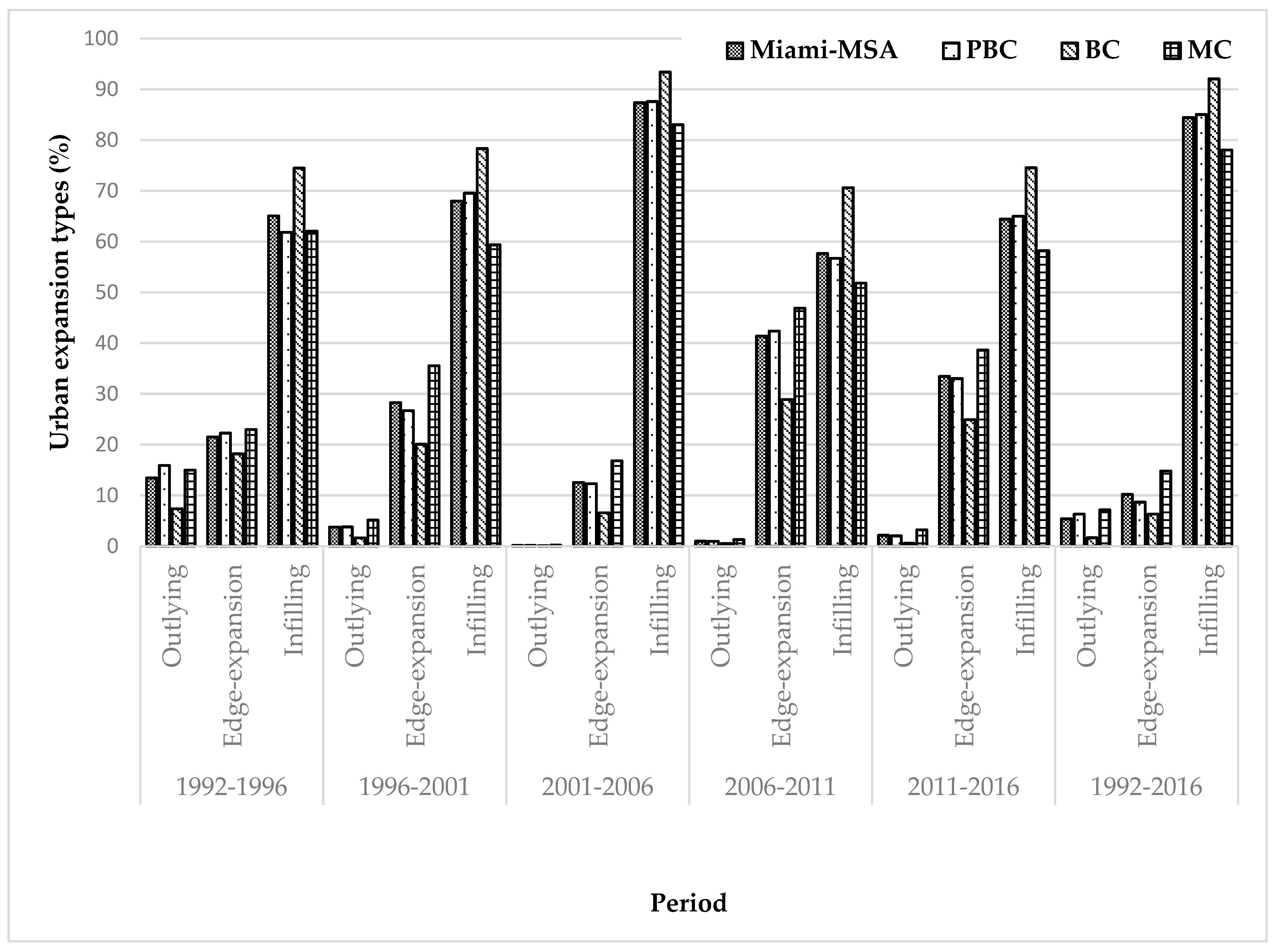
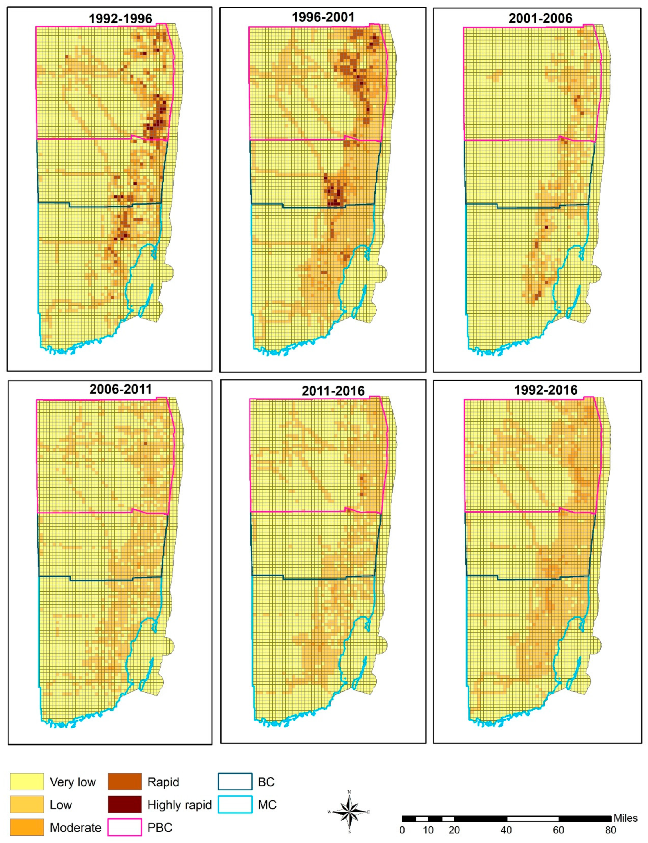
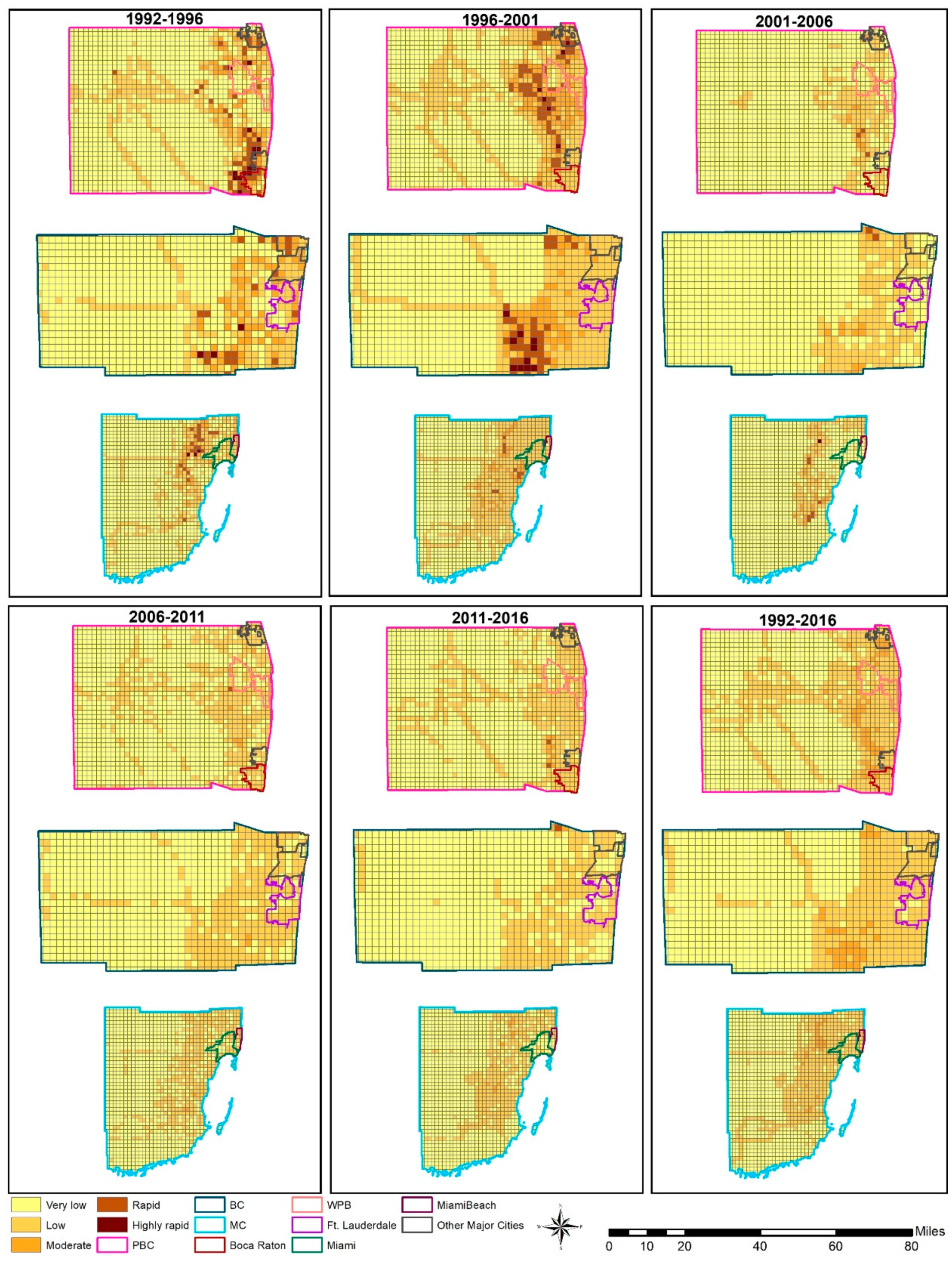
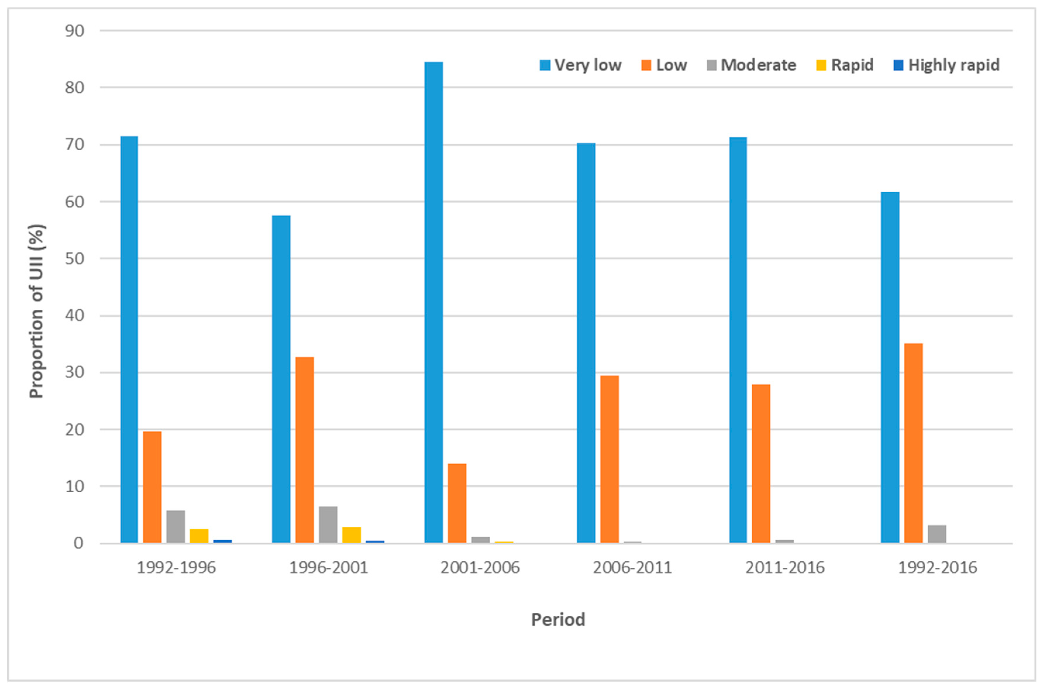
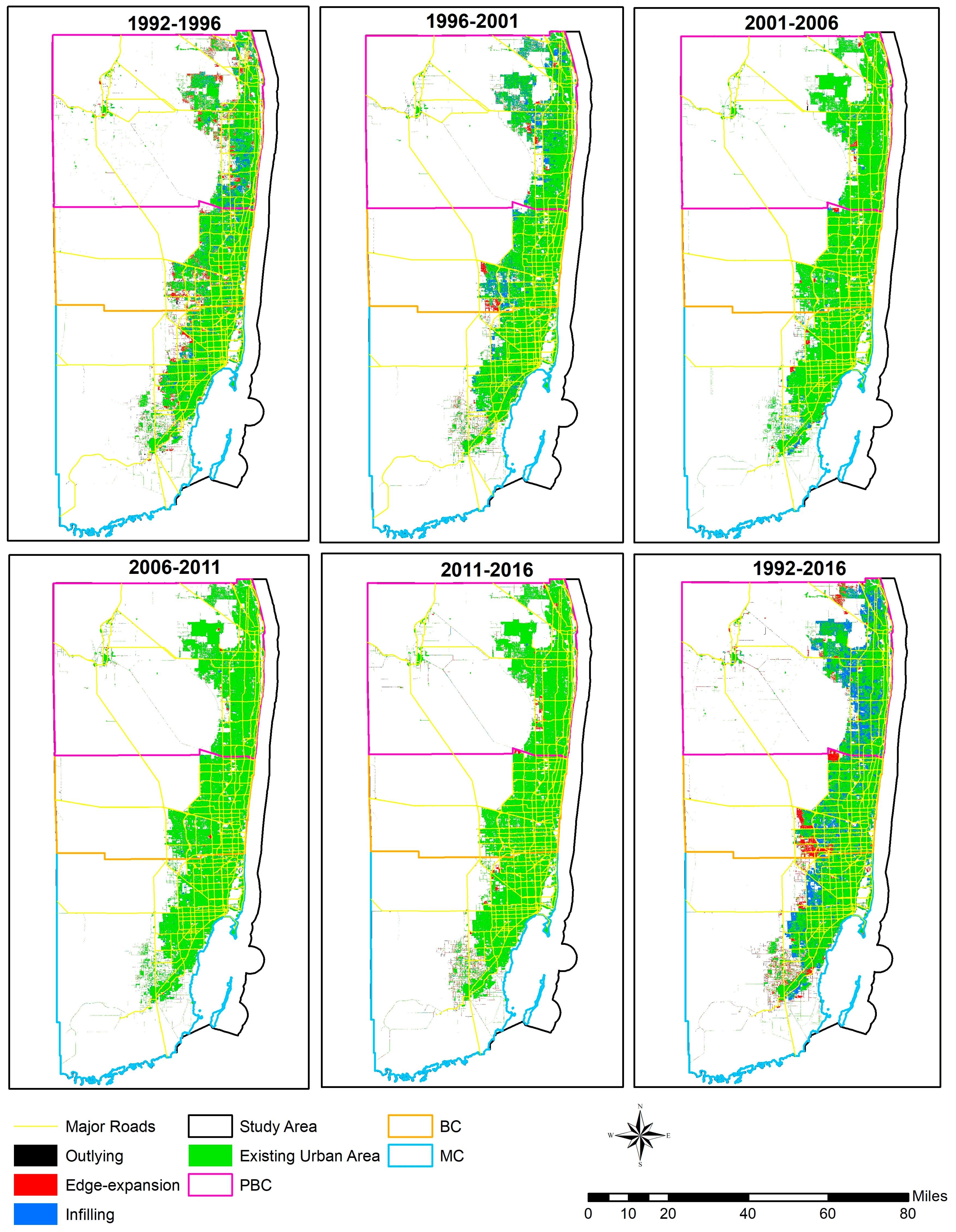
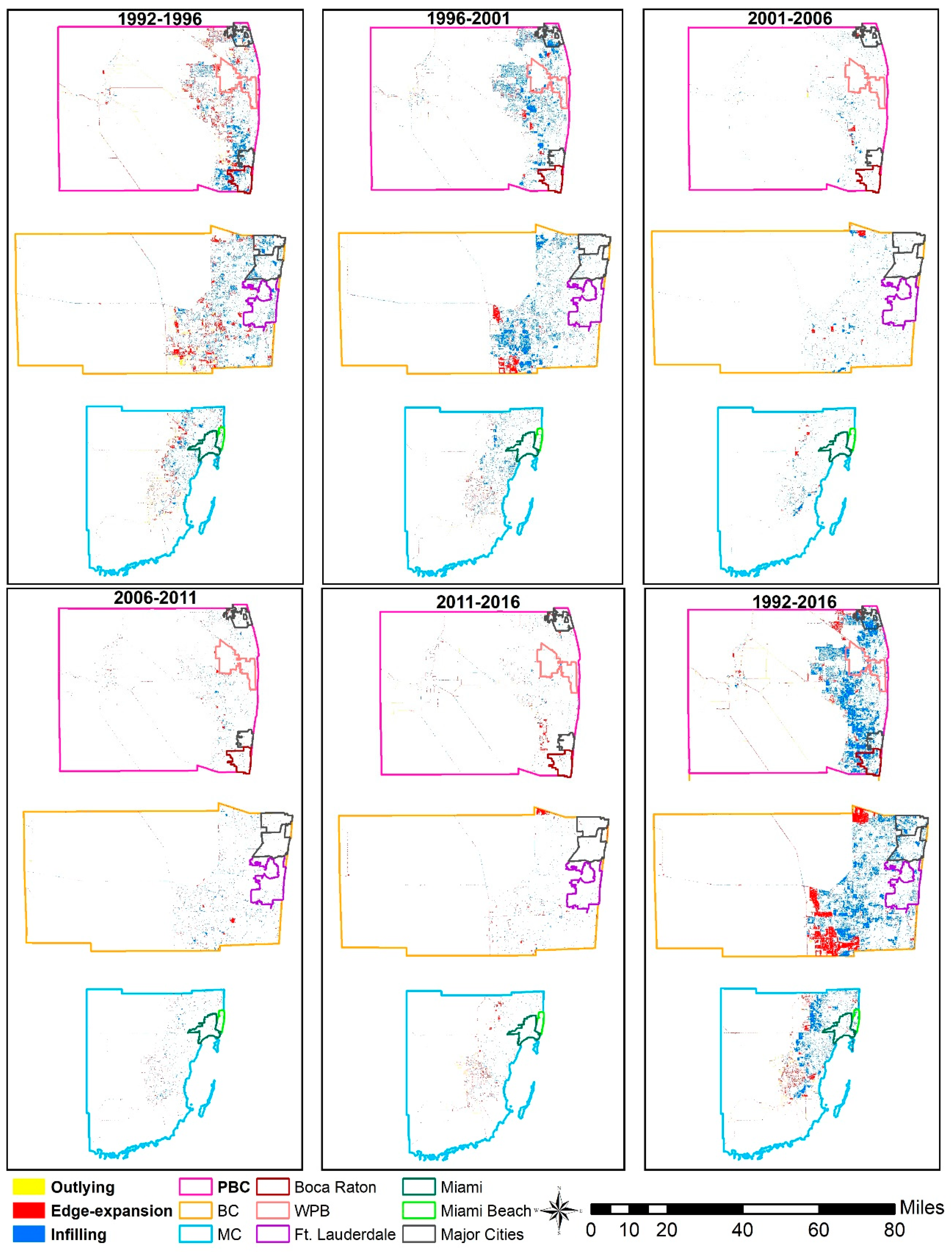
Quantifying Spatiotemporal Patterns and Major Explanatory Factors of Urban Expansion in Miami Metropolitan Area During 1992–2016

by
Shaikh Abdullah Al Rifat
and
Weibo Liu
*
Department of Geosciences, Florida Atlantic University, Boca Raton, FL 33431, USA
*
Author to whom correspondence should be addressed.
Remote Sens. 2019, 11(21), 2493; https://doi.org/10.3390/rs11212493
Submission received: 25 September 2019 / Revised: 22 October 2019 / Accepted: 23 October 2019 / Published: 25 October 2019
(This article belongs to the Special Issue Remote Sensing Applications in Coastal Environment)

Abstract

Urban expansion is one of the most dramatic forms of land transformation in the world and it is one of the greatest challenges in achieving sustainable development in the 21st century. Previous studies analyzed urbanization patterns in areas with rapid urban expansion while urban areas with low to moderate expansion have been overlooked, especially in developed countries. In this study, we examined the spatiotemporal dynamics of urban expansion patterns in South Florida, United States (US) over the last 25 years (1992–2016) using Remote Sensing and GIS techniques. The main goal of this paper was to investigate the degree and spatiotemporal patterns of urban expansion at different administrative level in the study area and how spatiotemporal variance in different explanatory factors influence urban expansion in this region. More specifically, this research quantifies the rates, types, intensity, and landscape metrics of urban expansion in Miami-Fort Lauderdale-Palm Beach, Florida Metropolitan Statistical Area (Miami MSA) which is the 7th largest MSA and 4th largest urbanized area in the US using remote sensing (satellite imageries) data from National Land Cover Datasets (NLCD) and Coastal Change Analysis Program (C-CAP) at 30 m spatial resolution. We further investigated the urban growth patterns at the county and city areas that are located within this MSA to portray the local ‘picture’ of urban growth in this region. Urban expansion in this region can be divided into two time periods: pre-2001 and post-2001 where the former experienced rapid urban expansion and the later had comparatively slow urban expansion. Results suggest that infilling was the dominant type of urban expansion followed by edge-expansion and outlying. Results from landscape metrics represent that newly developed urban lands became more aggregated and simplified in form as the time progressed in the study region. Also, new urban lands were generated away from the east coast and historic cities which eventually created new urban cores. We also used correlation analysis and multiple linear stepwise regression to address major explanatory factors of spatiotemporal change in urban expansion during the study period. Although the influence of factors on urban expansion varied temporally, Population and Distance to Coast were the strongest variables followed by Distance to Roads and Median Income that influence overall urban expansion in the study area.
Keywords: urban expansion; remote sensing and GIS; expansion types and rates; major explanatory factors; Miami metropolitan area urban expansion; remote sensing and GIS; expansion types and rates; major explanatory factors; Miami metropolitan area
Graphical Abstract

