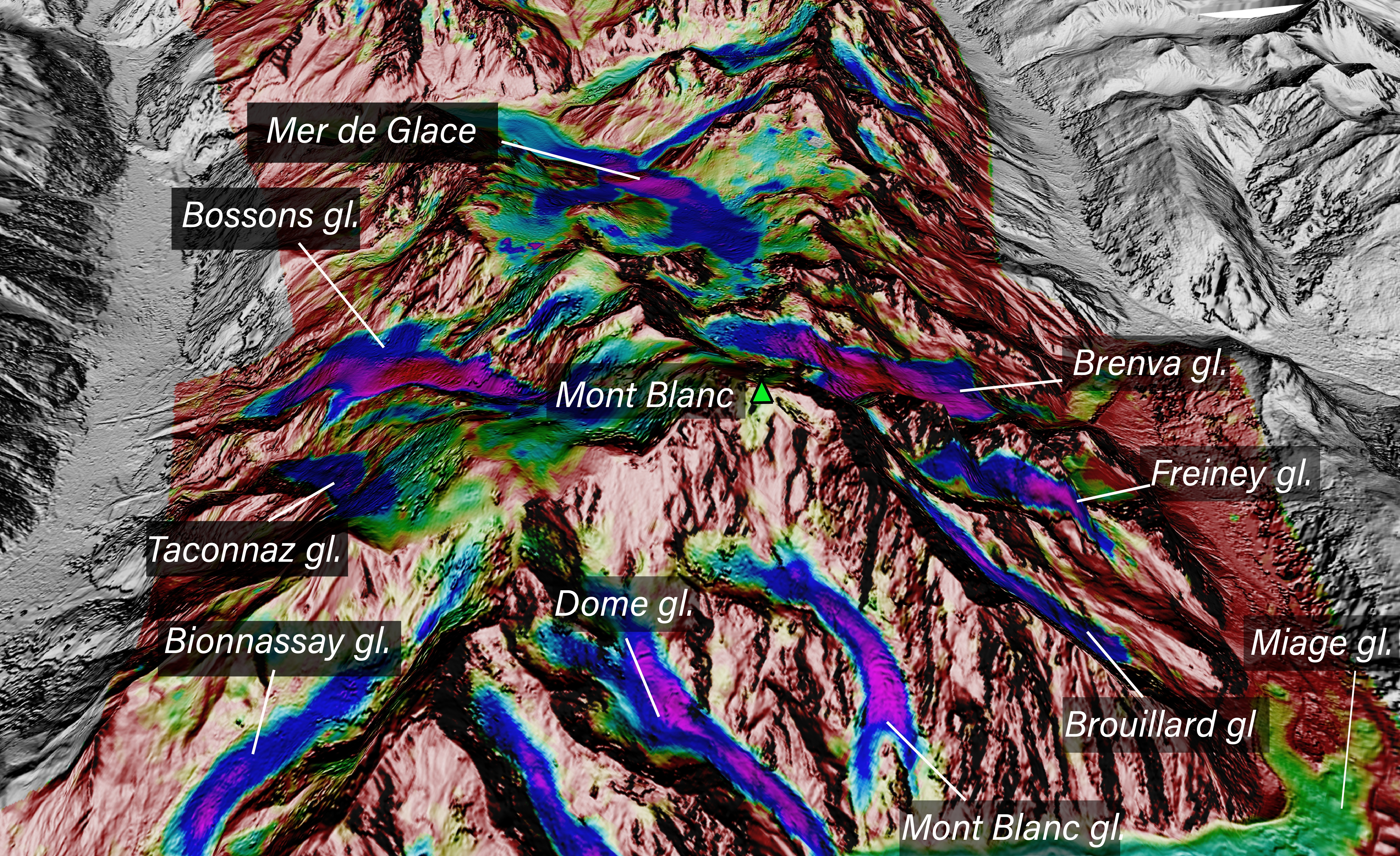
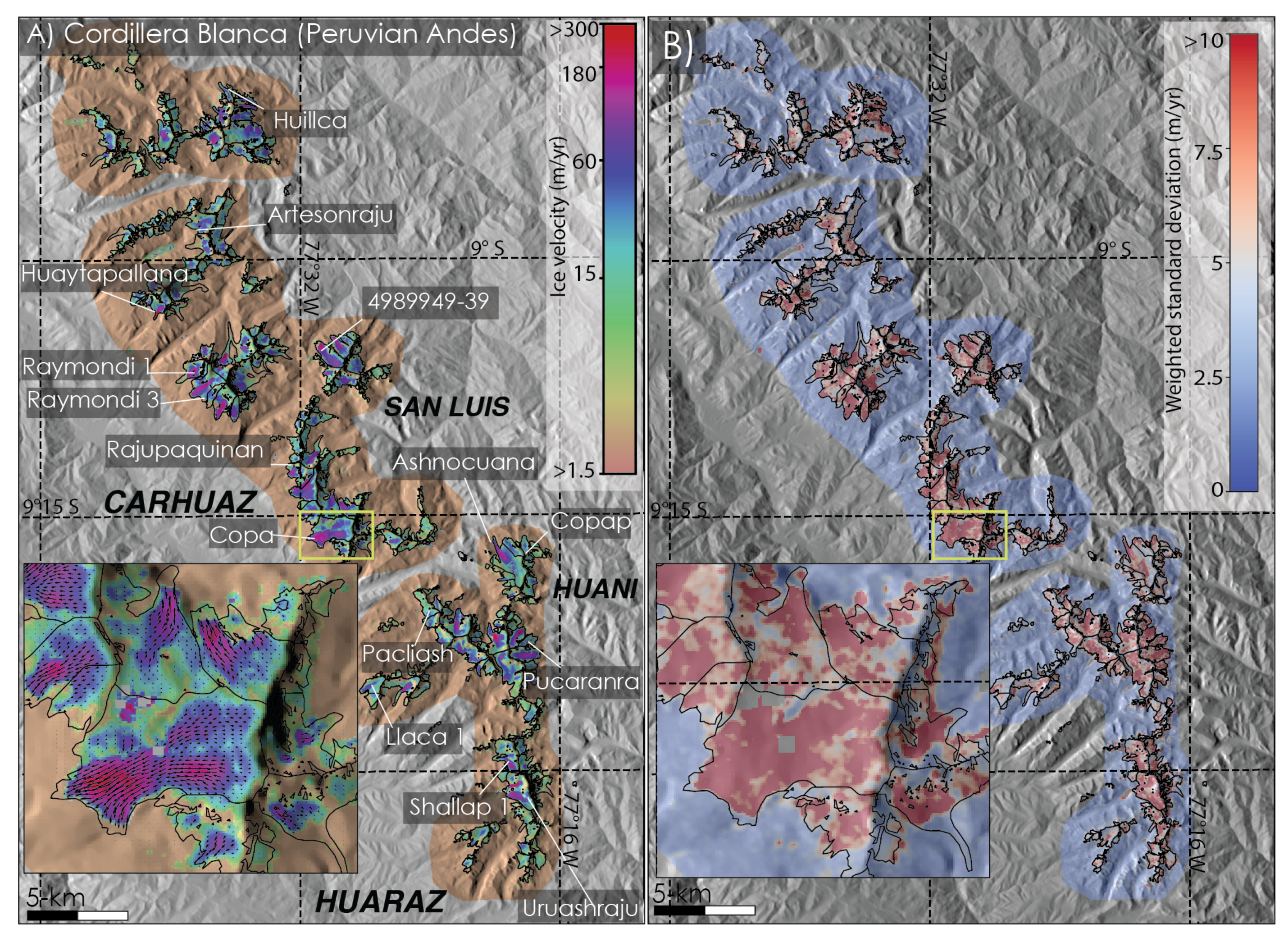
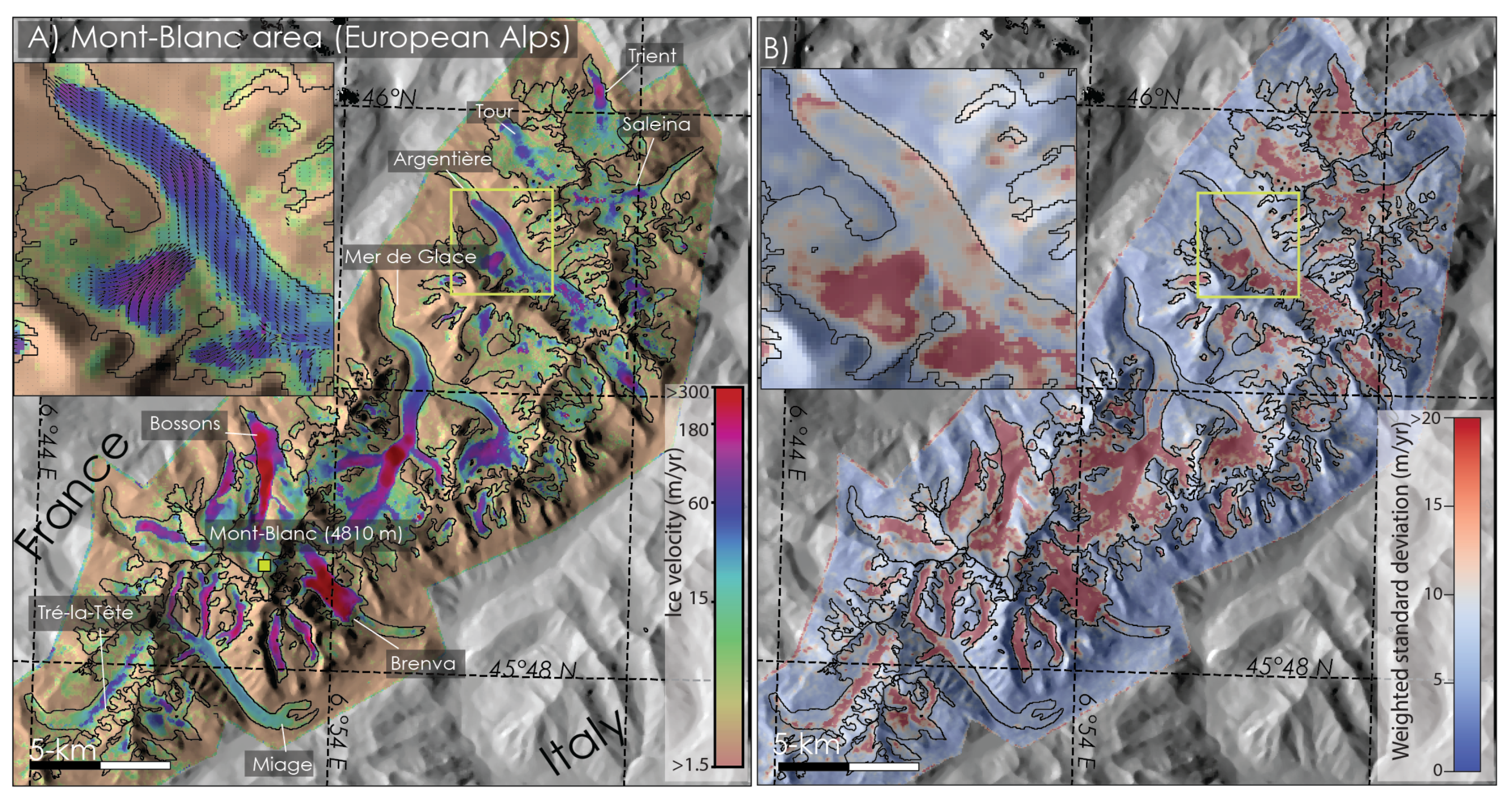
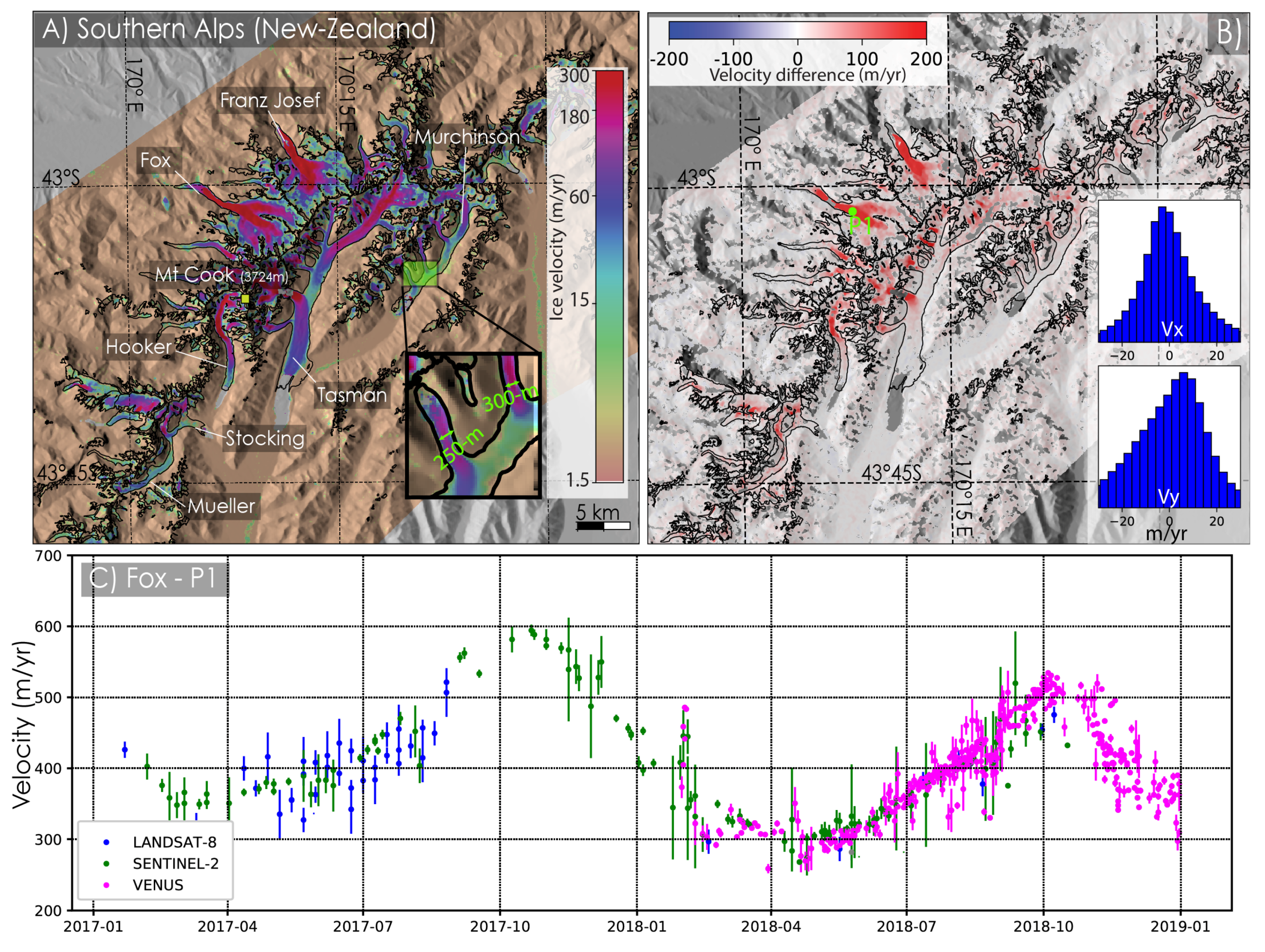
Mapping Surface Flow Velocity of Glaciers at Regional Scale Using a Multiple Sensors Approach

 , , , ,
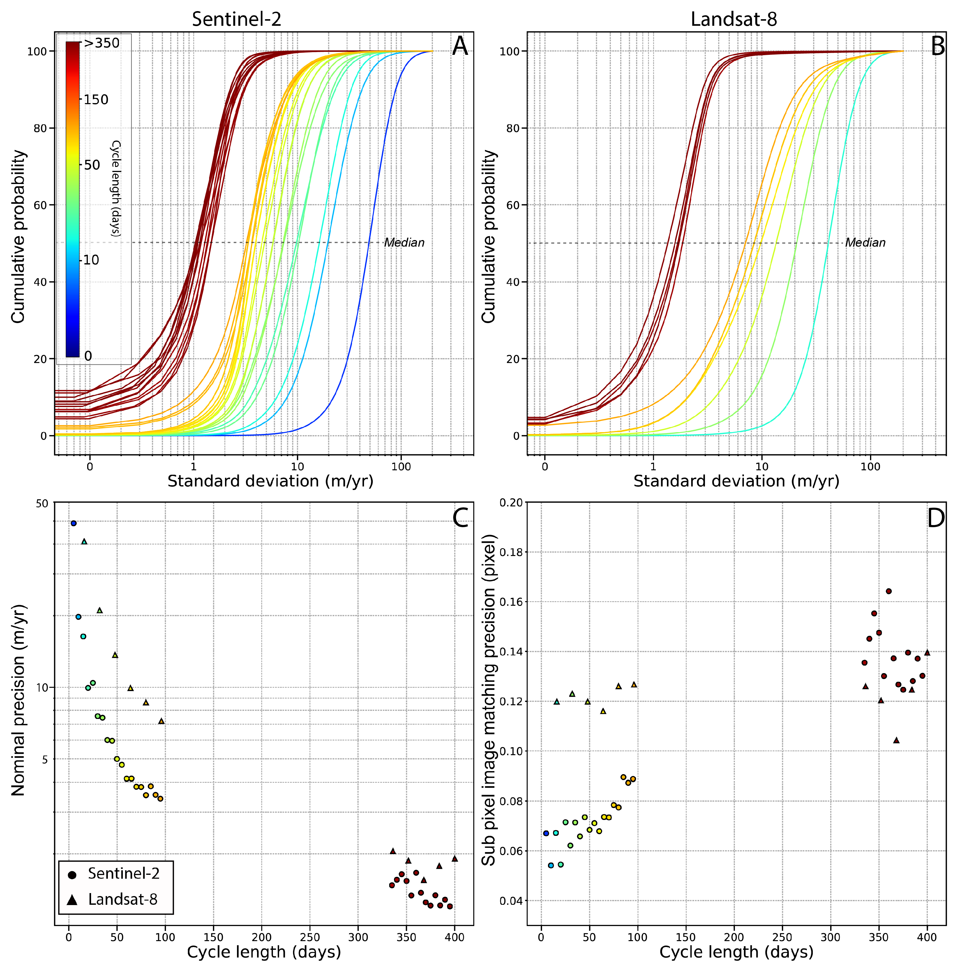
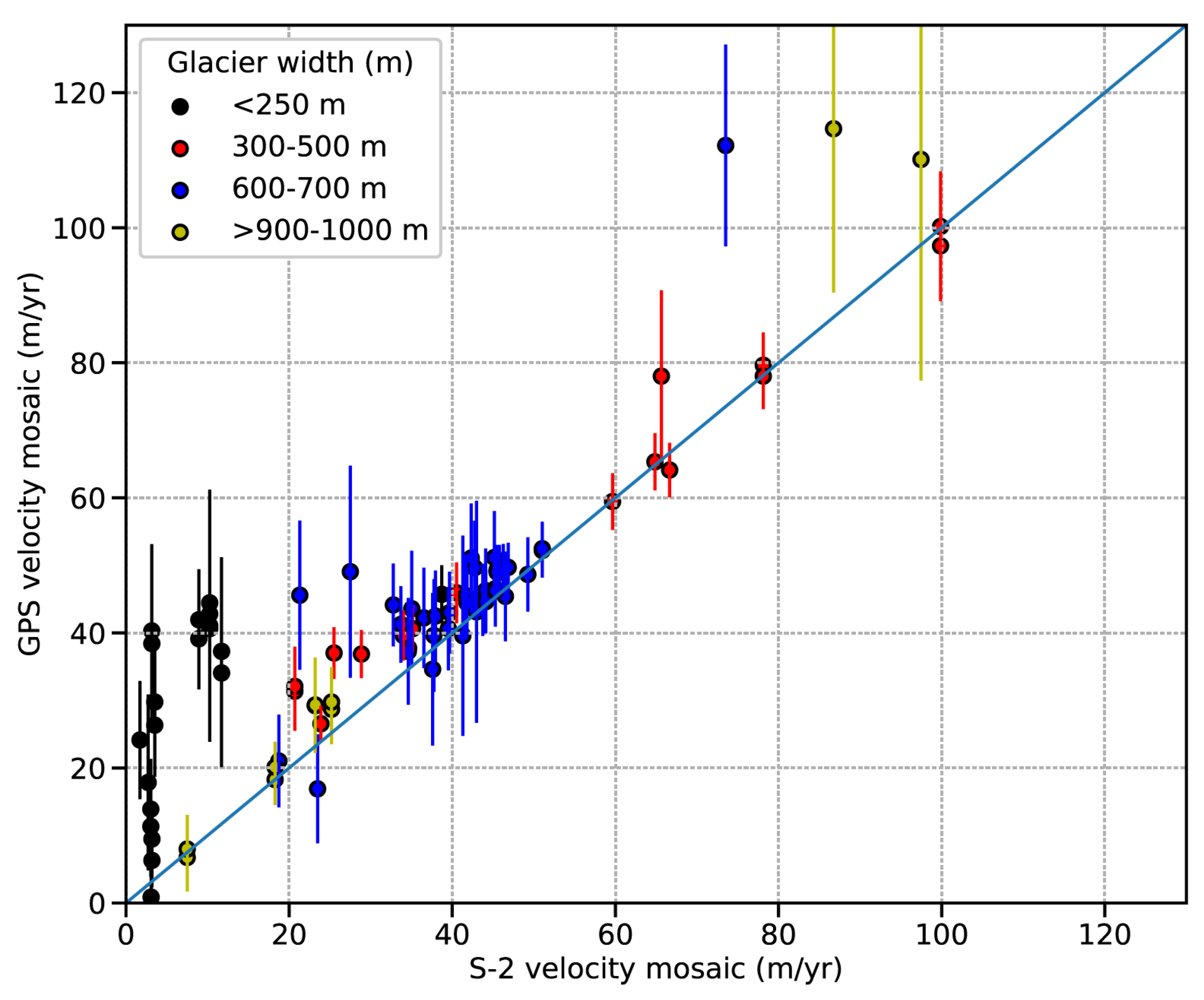
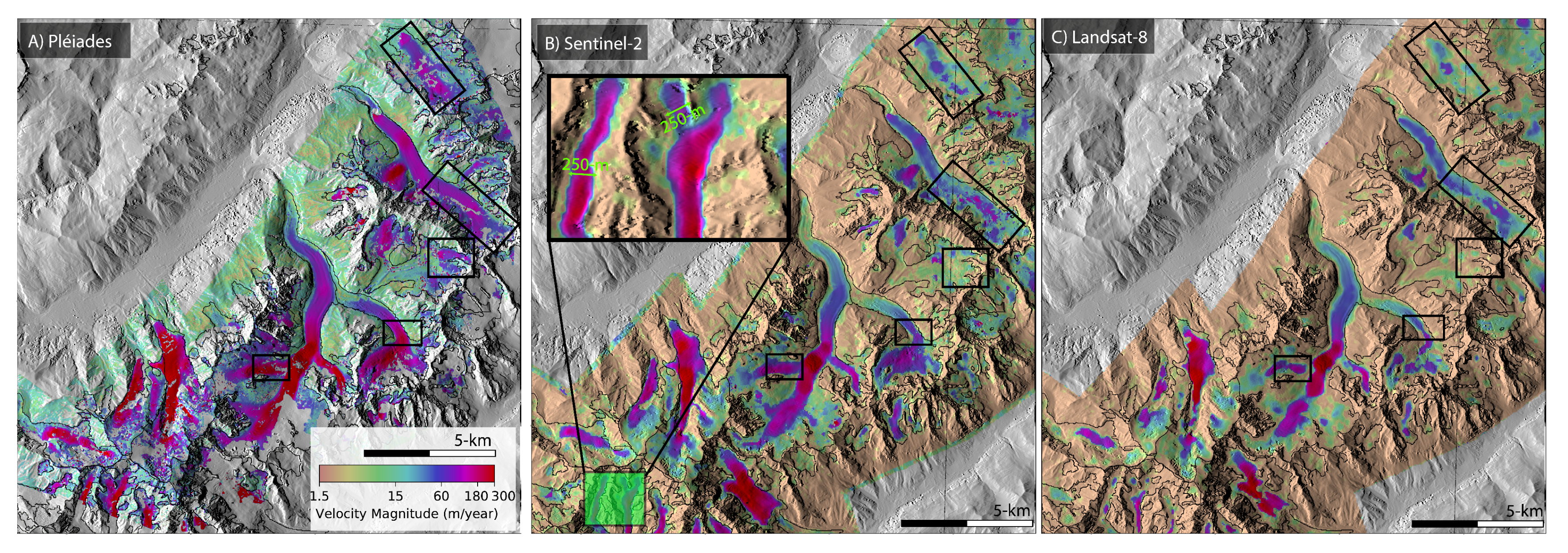
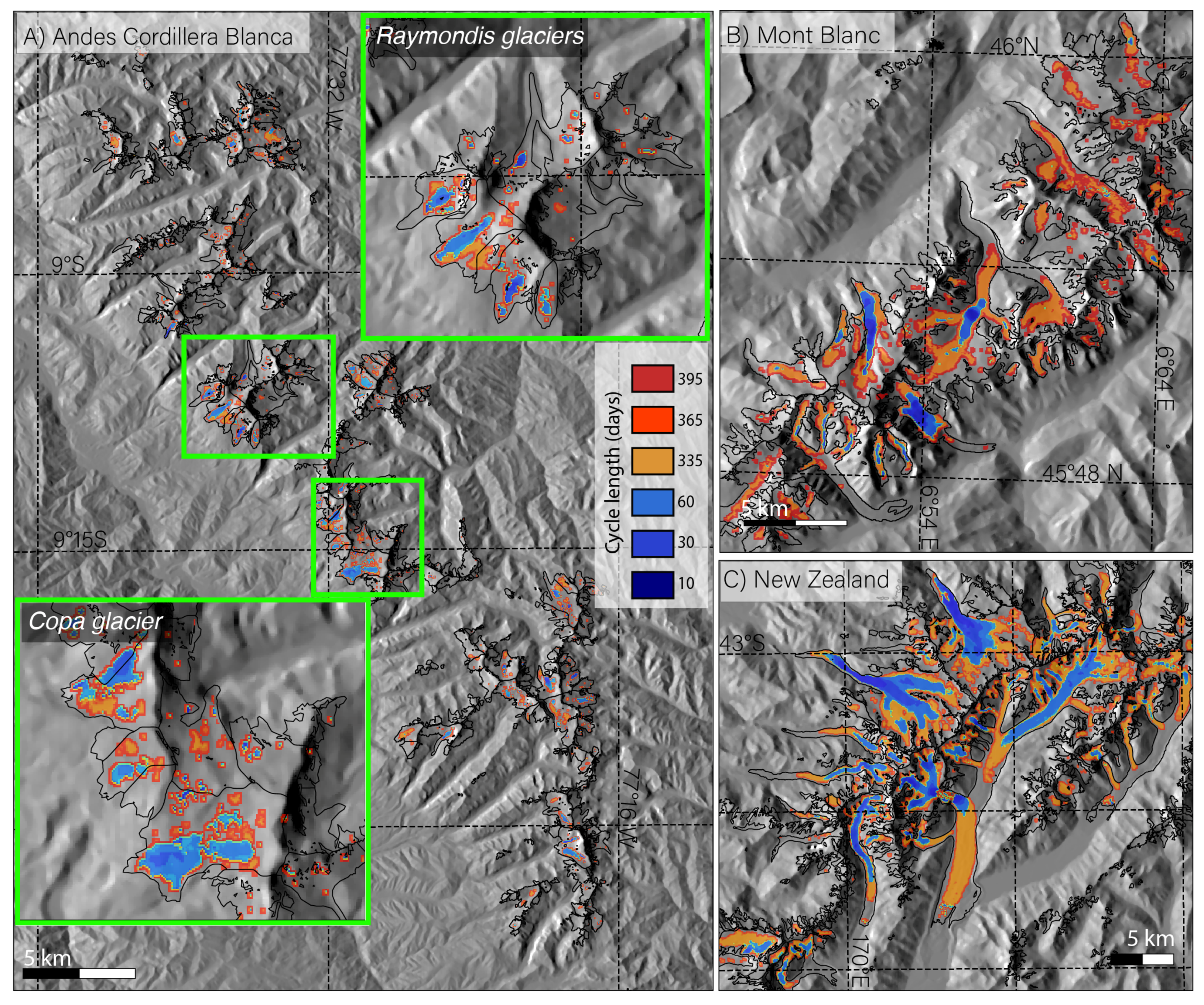
 Abstract

Share and Cite
Millan, R.; Mouginot, J.; Rabatel, A.; Jeong, S.; Cusicanqui, D.; Derkacheva, A.; Chekki, M. Mapping Surface Flow Velocity of Glaciers at Regional Scale Using a Multiple Sensors Approach. Remote Sens. 2019, 11, 2498. https://doi.org/10.3390/rs11212498
Millan R, Mouginot J, Rabatel A, Jeong S, Cusicanqui D, Derkacheva A, Chekki M. Mapping Surface Flow Velocity of Glaciers at Regional Scale Using a Multiple Sensors Approach. Remote Sensing. 2019; 11(21):2498. https://doi.org/10.3390/rs11212498
Chicago/Turabian StyleMillan, Romain, Jérémie Mouginot, Antoine Rabatel, Seongsu Jeong, Diego Cusicanqui, Anna Derkacheva, and Mondher Chekki. 2019. "Mapping Surface Flow Velocity of Glaciers at Regional Scale Using a Multiple Sensors Approach" Remote Sensing 11, no. 21: 2498. https://doi.org/10.3390/rs11212498
APA StyleMillan, R., Mouginot, J., Rabatel, A., Jeong, S., Cusicanqui, D., Derkacheva, A., & Chekki, M. (2019). Mapping Surface Flow Velocity of Glaciers at Regional Scale Using a Multiple Sensors Approach. Remote Sensing, 11(21), 2498. https://doi.org/10.3390/rs11212498