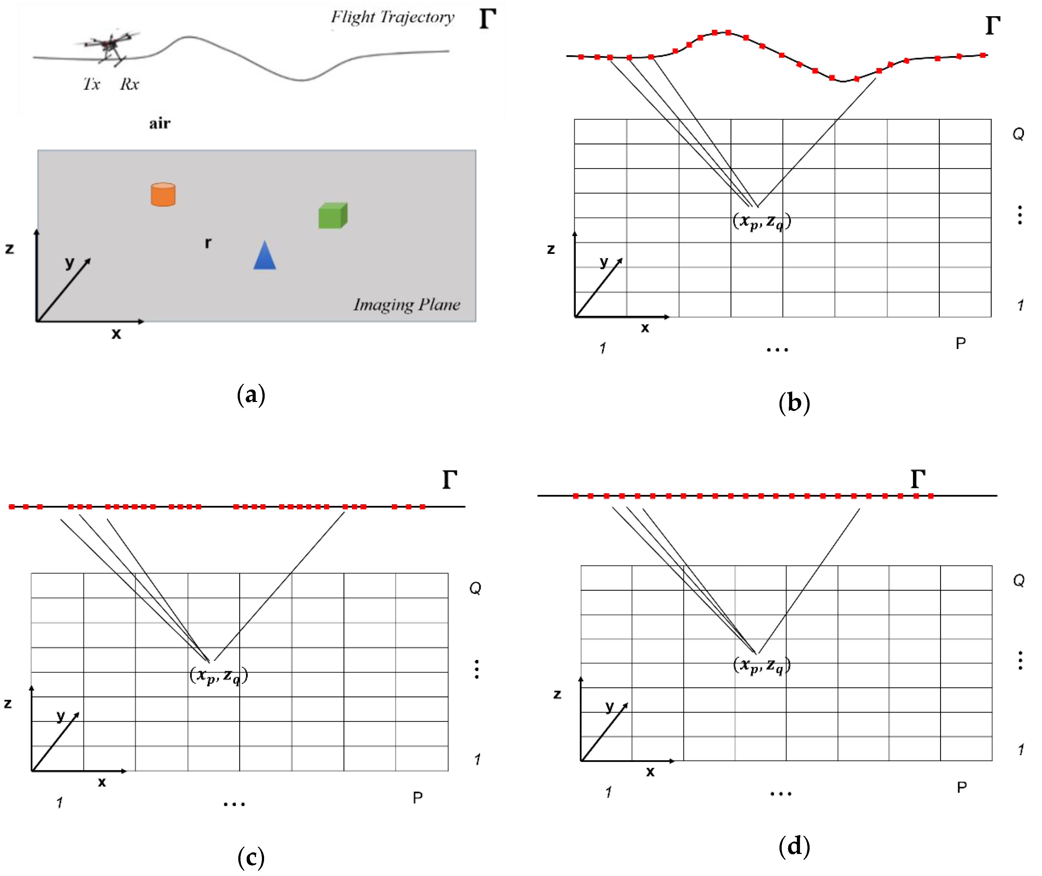
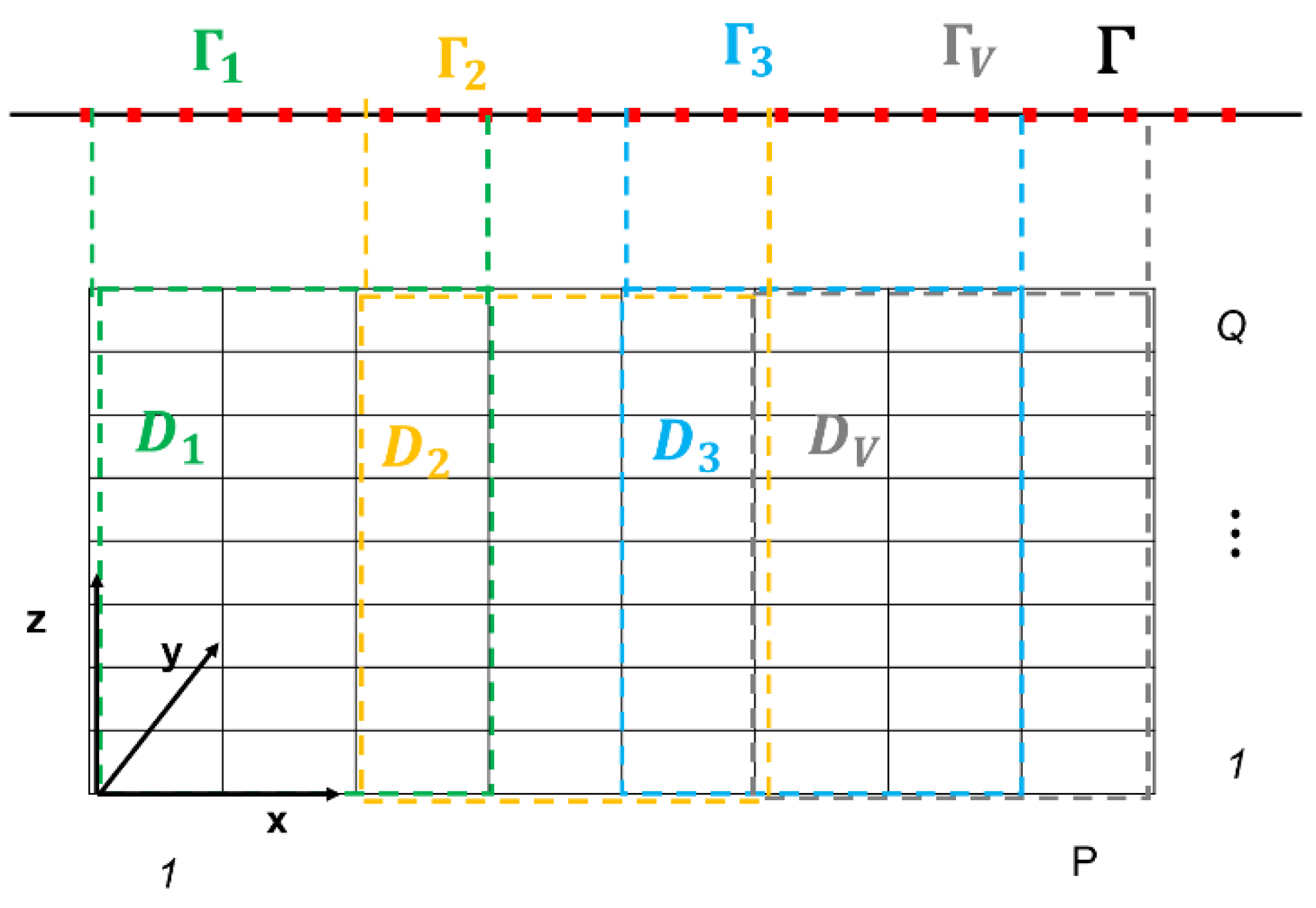
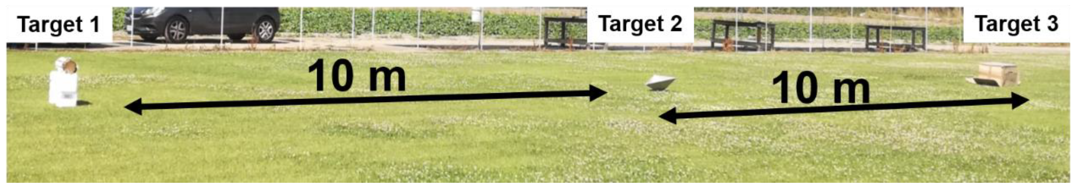
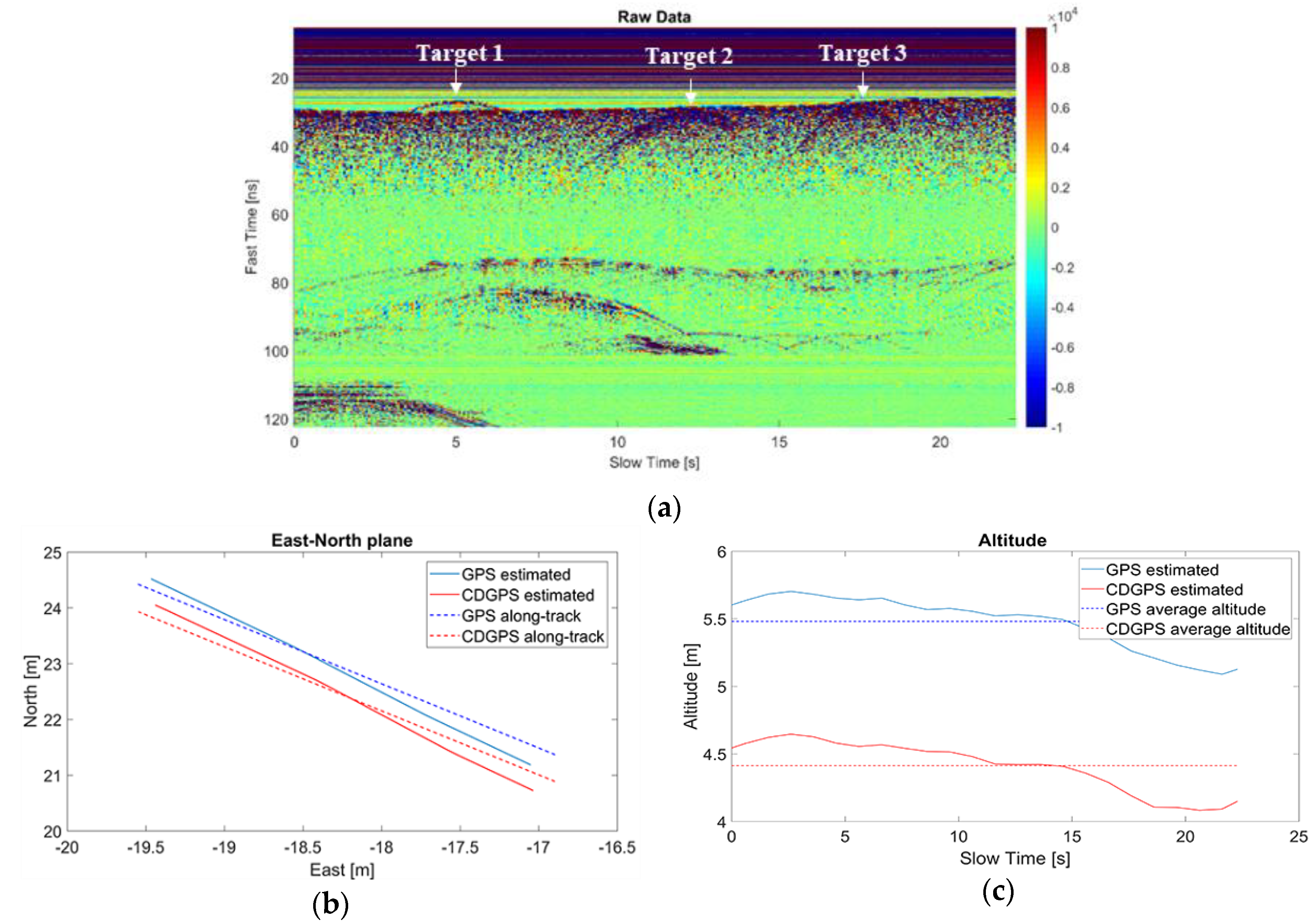
Small-UAV Radar Imaging System Performance with GPS and CDGPS Based Motion Compensation


 , ,
, ,  and
and 
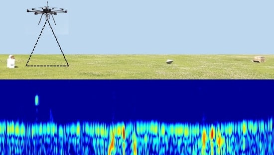
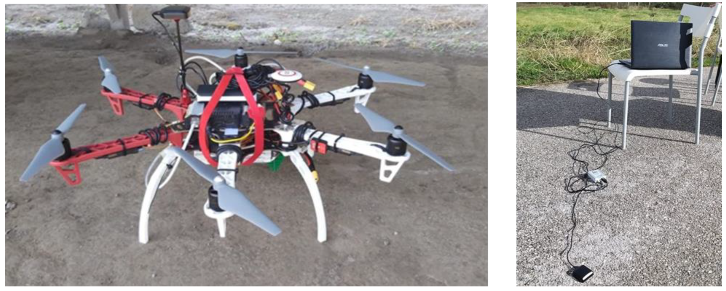
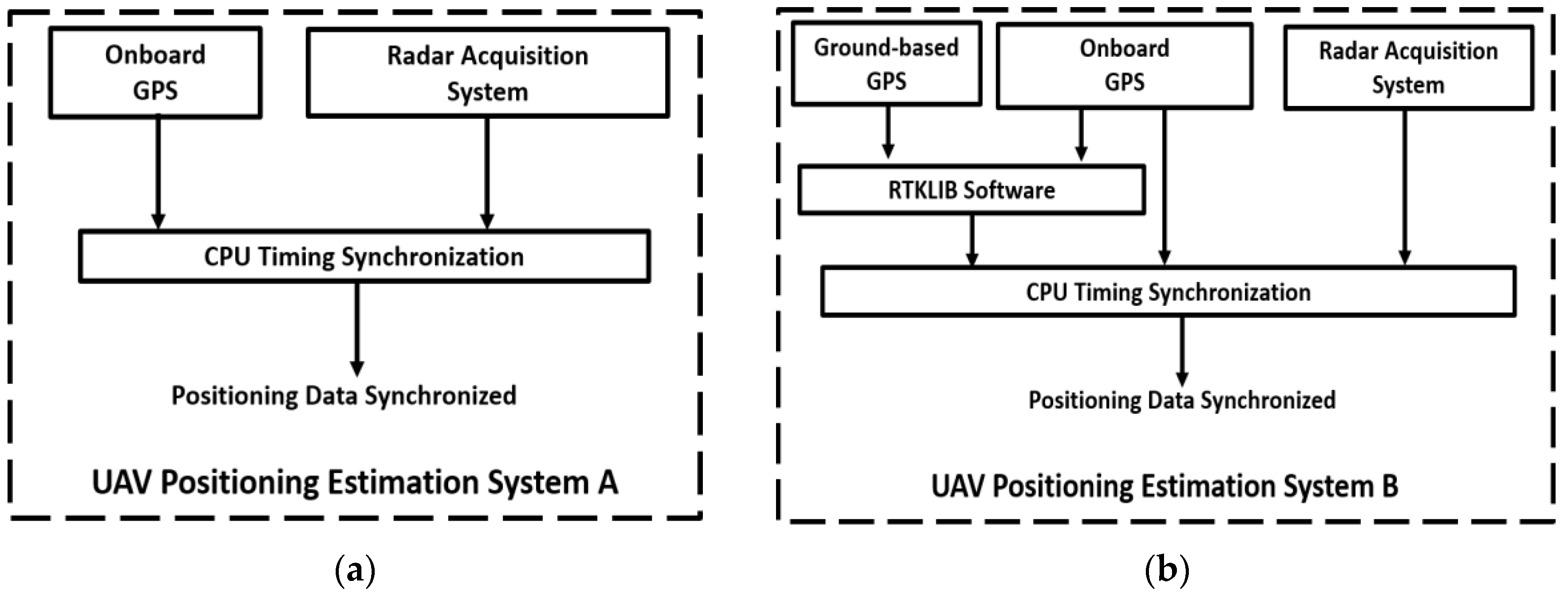
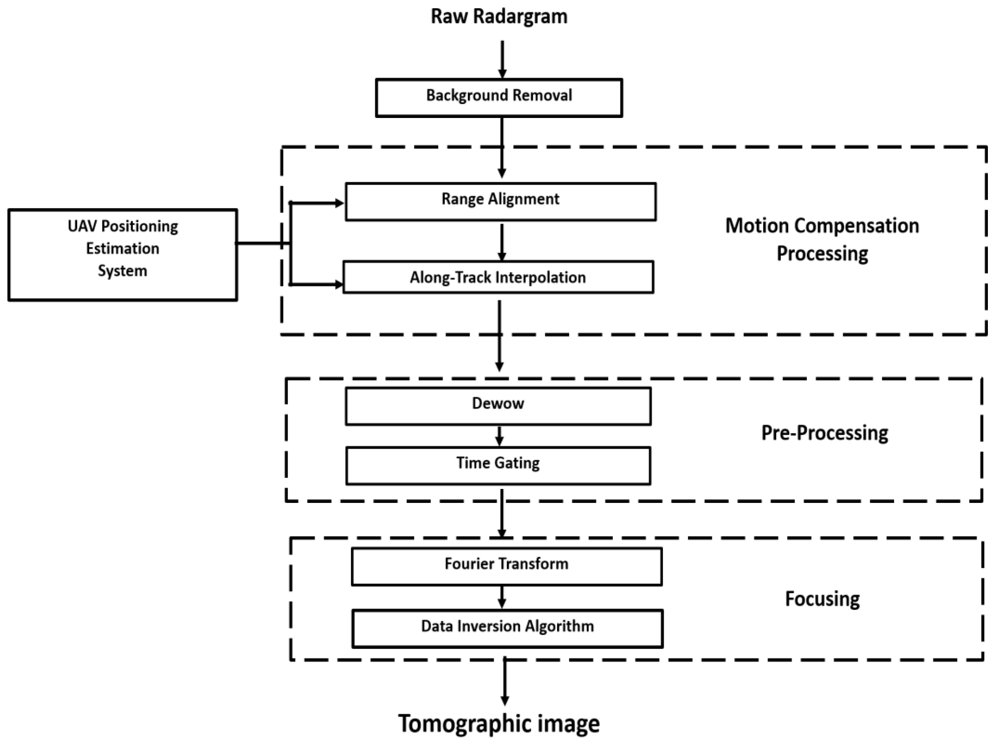
Abstract
Share and Cite
Noviello, C.; Esposito, G.; Fasano, G.; Renga, A.; Soldovieri, F.; Catapano, I. Small-UAV Radar Imaging System Performance with GPS and CDGPS Based Motion Compensation. Remote Sens. 2020, 12, 3463. https://doi.org/10.3390/rs12203463
Noviello C, Esposito G, Fasano G, Renga A, Soldovieri F, Catapano I. Small-UAV Radar Imaging System Performance with GPS and CDGPS Based Motion Compensation. Remote Sensing. 2020; 12(20):3463. https://doi.org/10.3390/rs12203463
Chicago/Turabian StyleNoviello, Carlo, Giuseppe Esposito, Giancarmine Fasano, Alfredo Renga, Francesco Soldovieri, and Ilaria Catapano. 2020. "Small-UAV Radar Imaging System Performance with GPS and CDGPS Based Motion Compensation" Remote Sensing 12, no. 20: 3463. https://doi.org/10.3390/rs12203463
APA StyleNoviello, C., Esposito, G., Fasano, G., Renga, A., Soldovieri, F., & Catapano, I. (2020). Small-UAV Radar Imaging System Performance with GPS and CDGPS Based Motion Compensation. Remote Sensing, 12(20), 3463. https://doi.org/10.3390/rs12203463