Article

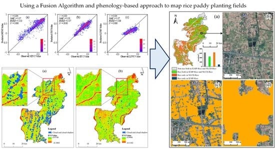
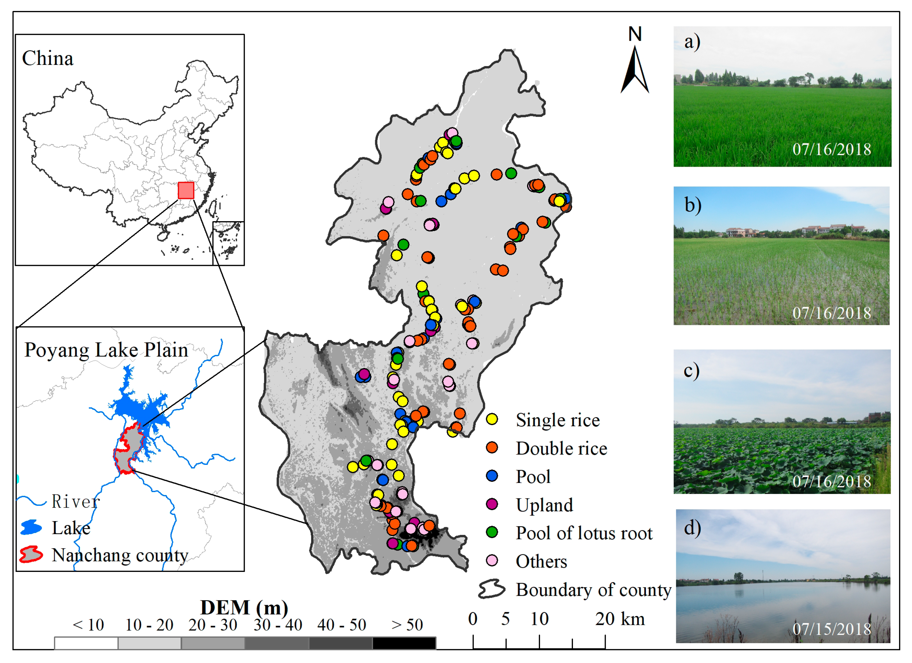
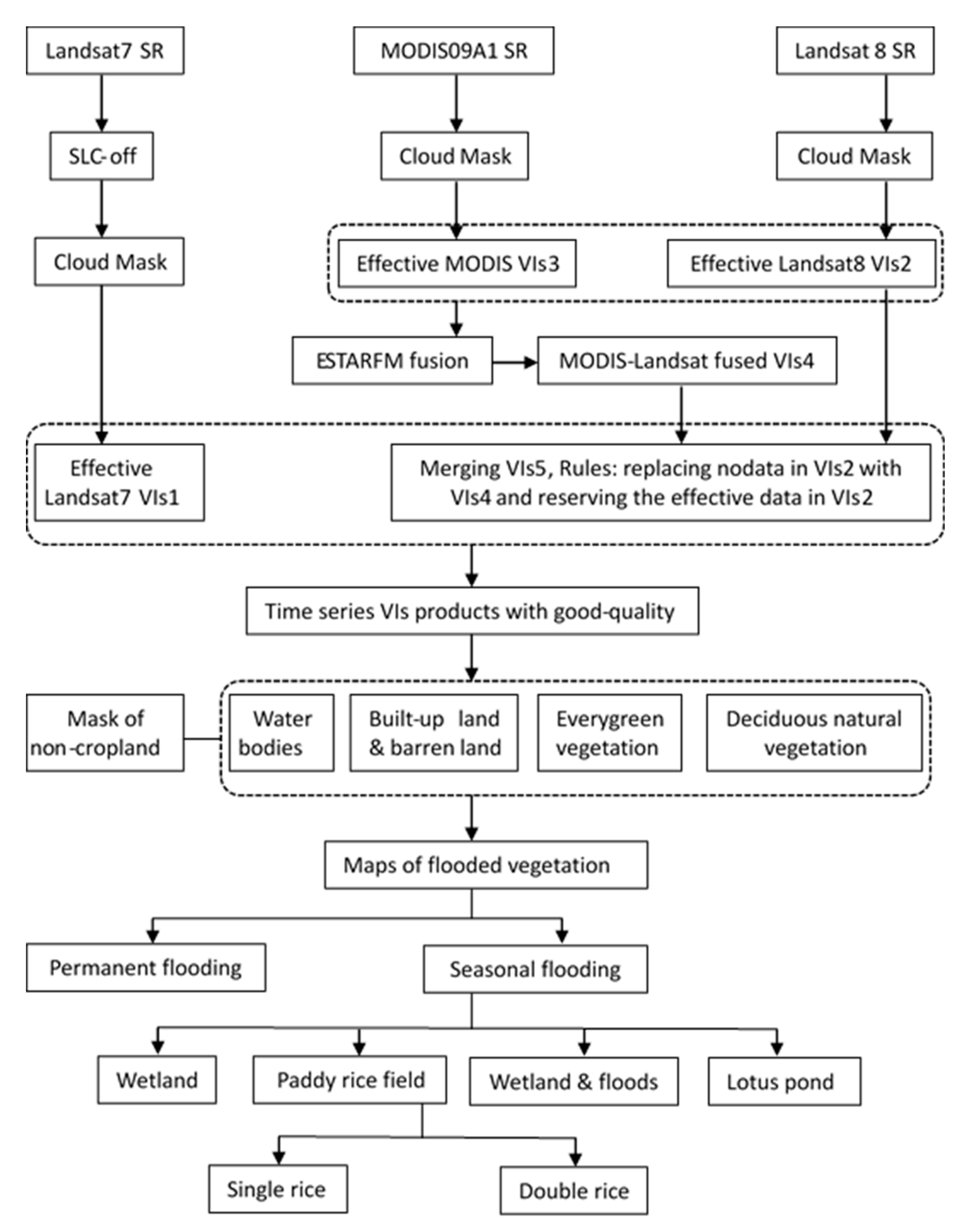
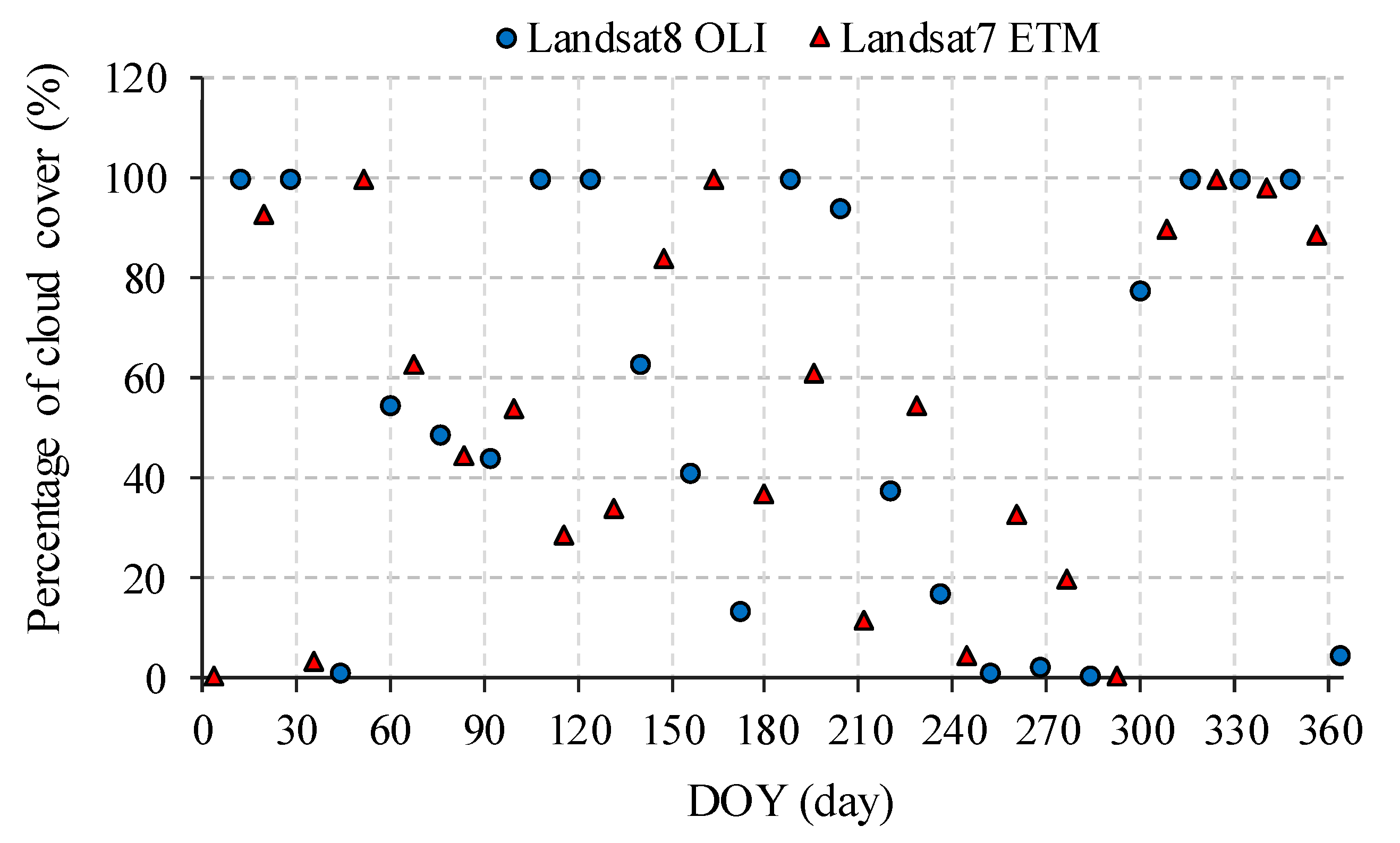
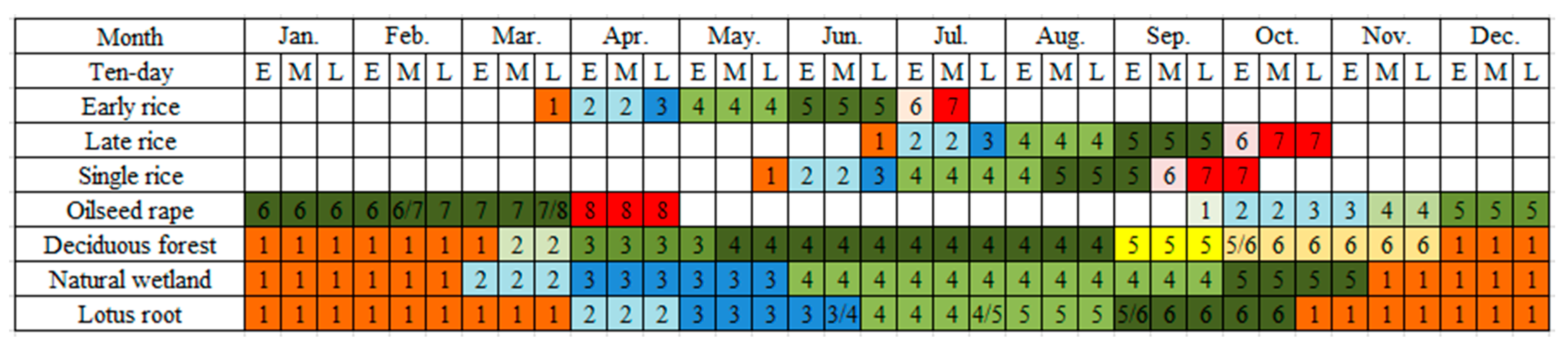
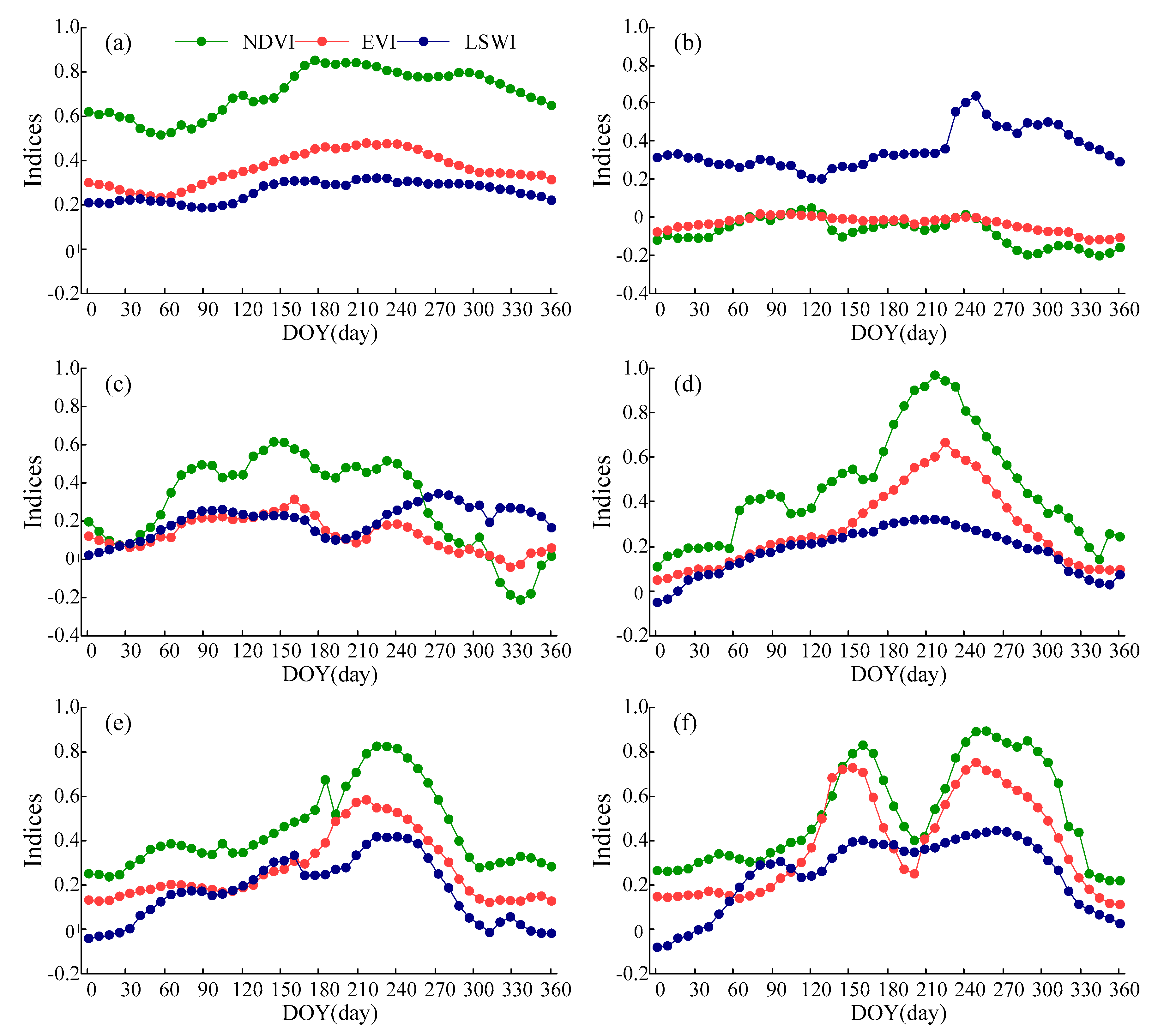
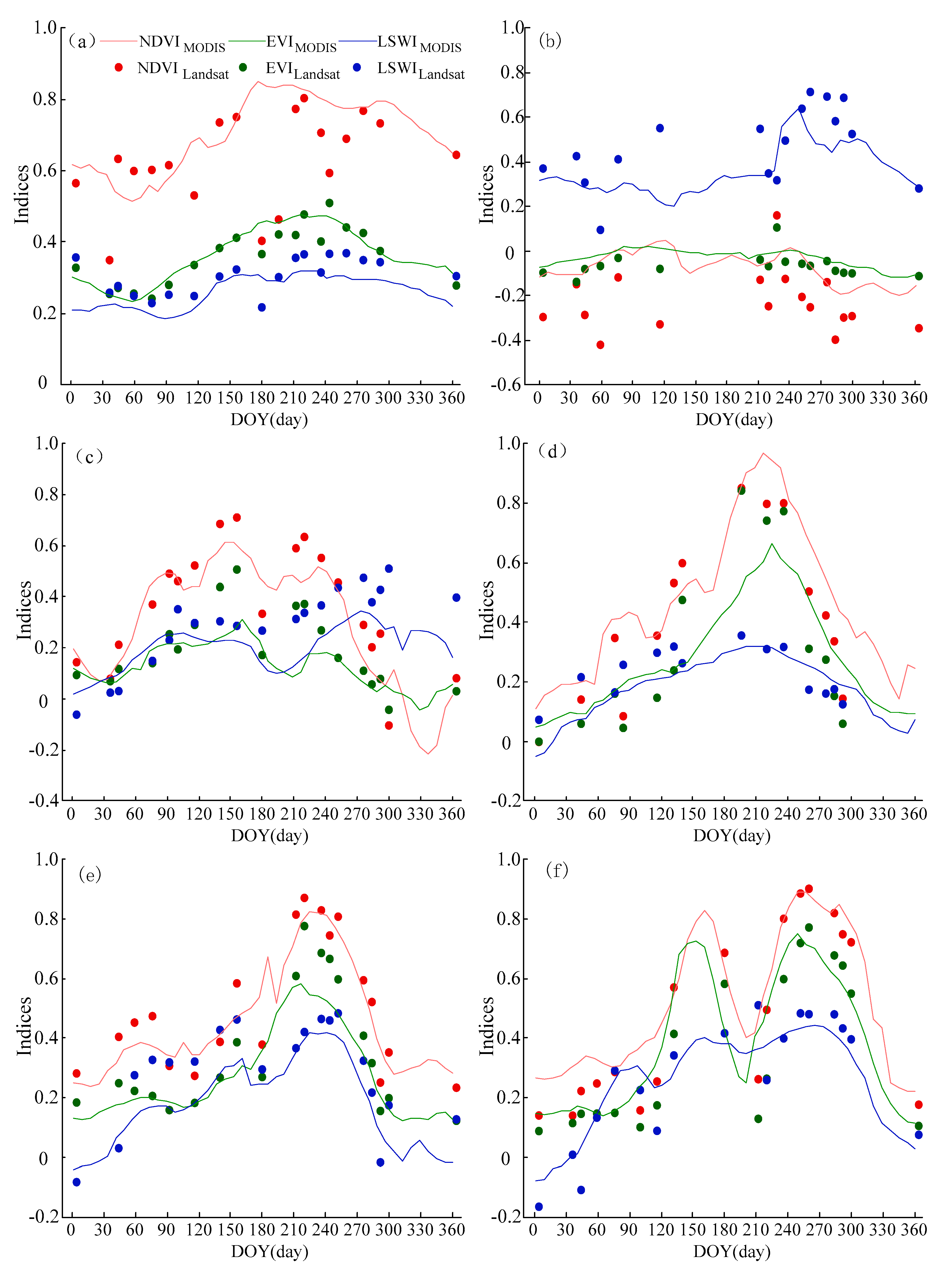
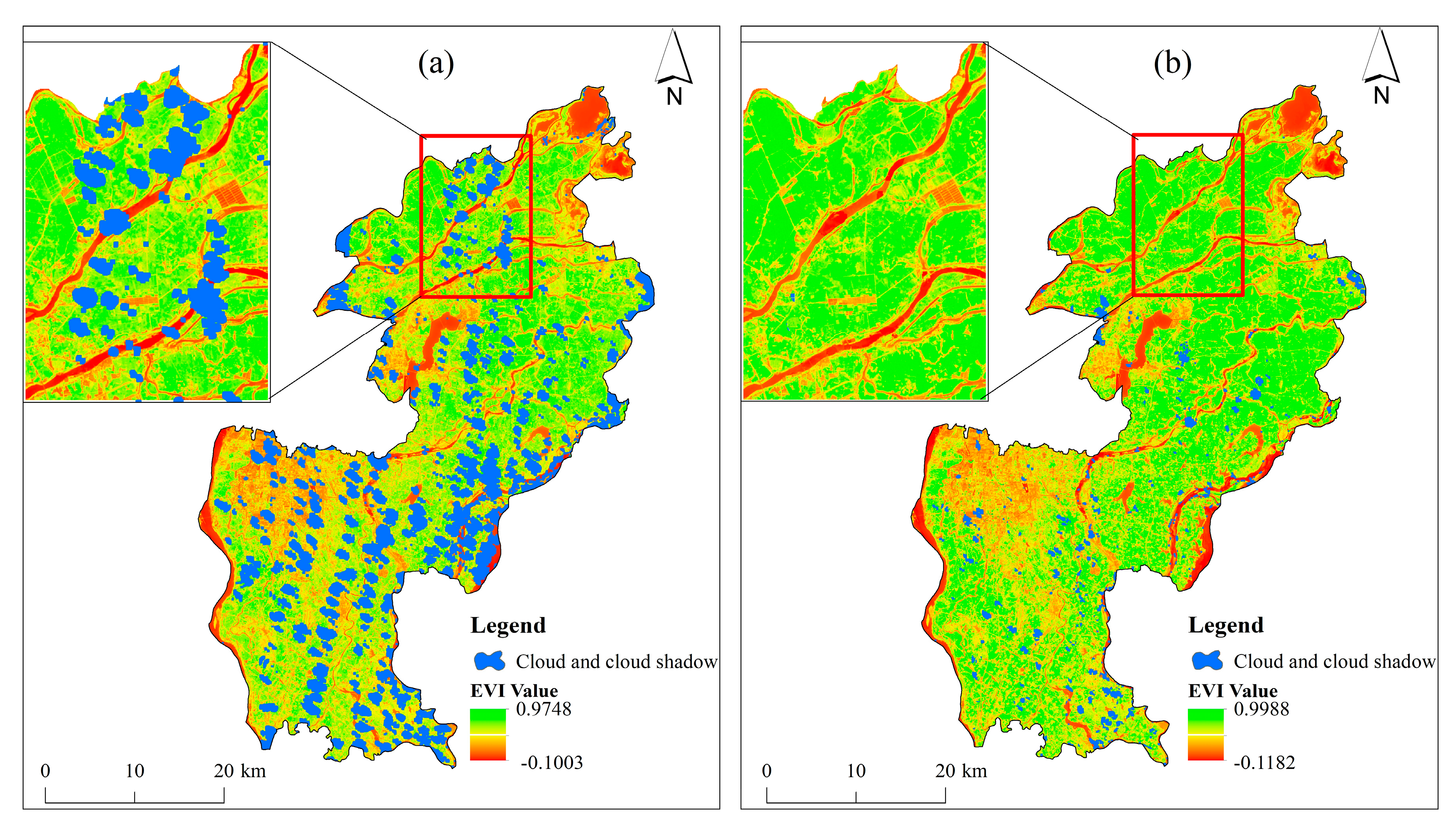
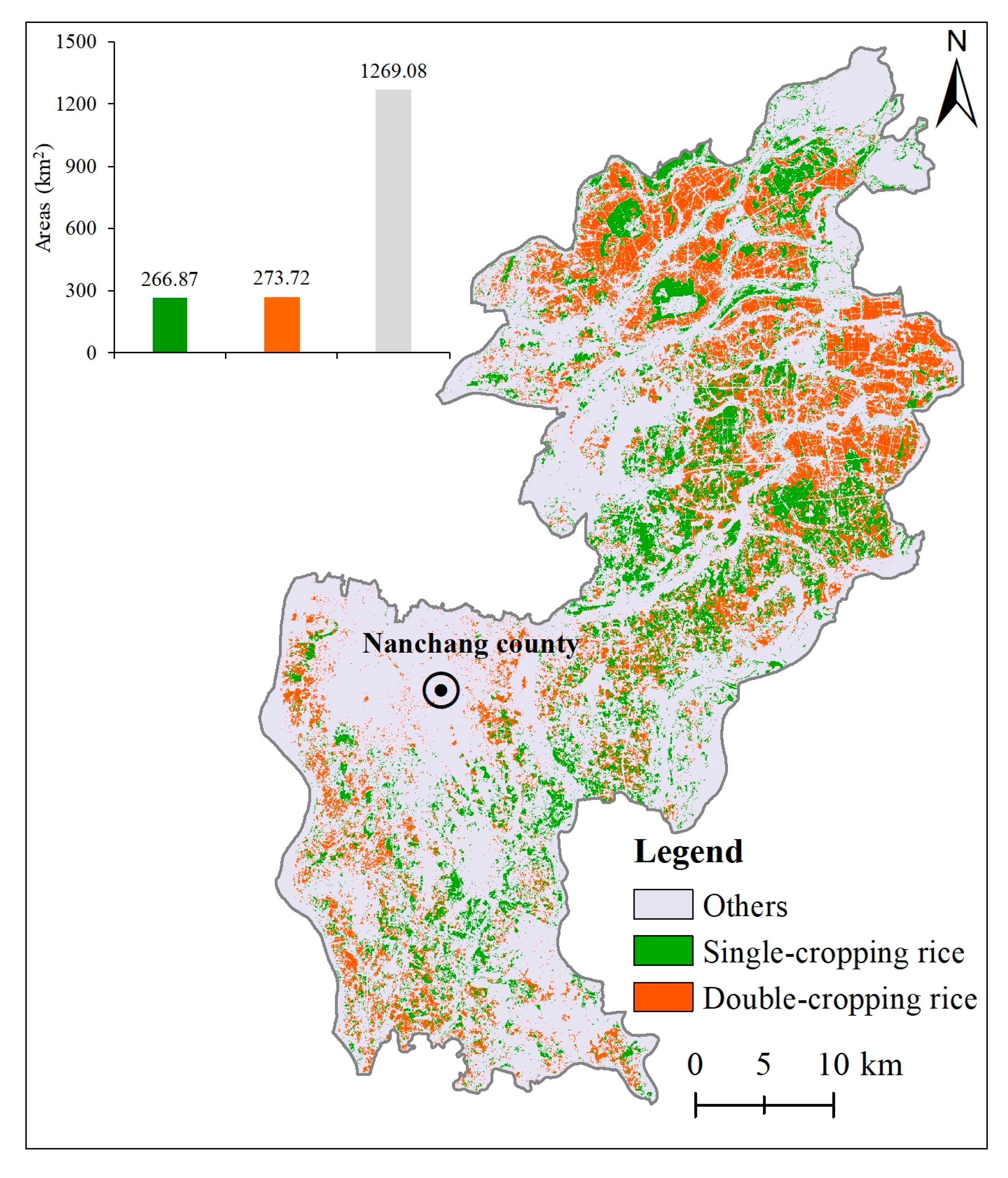
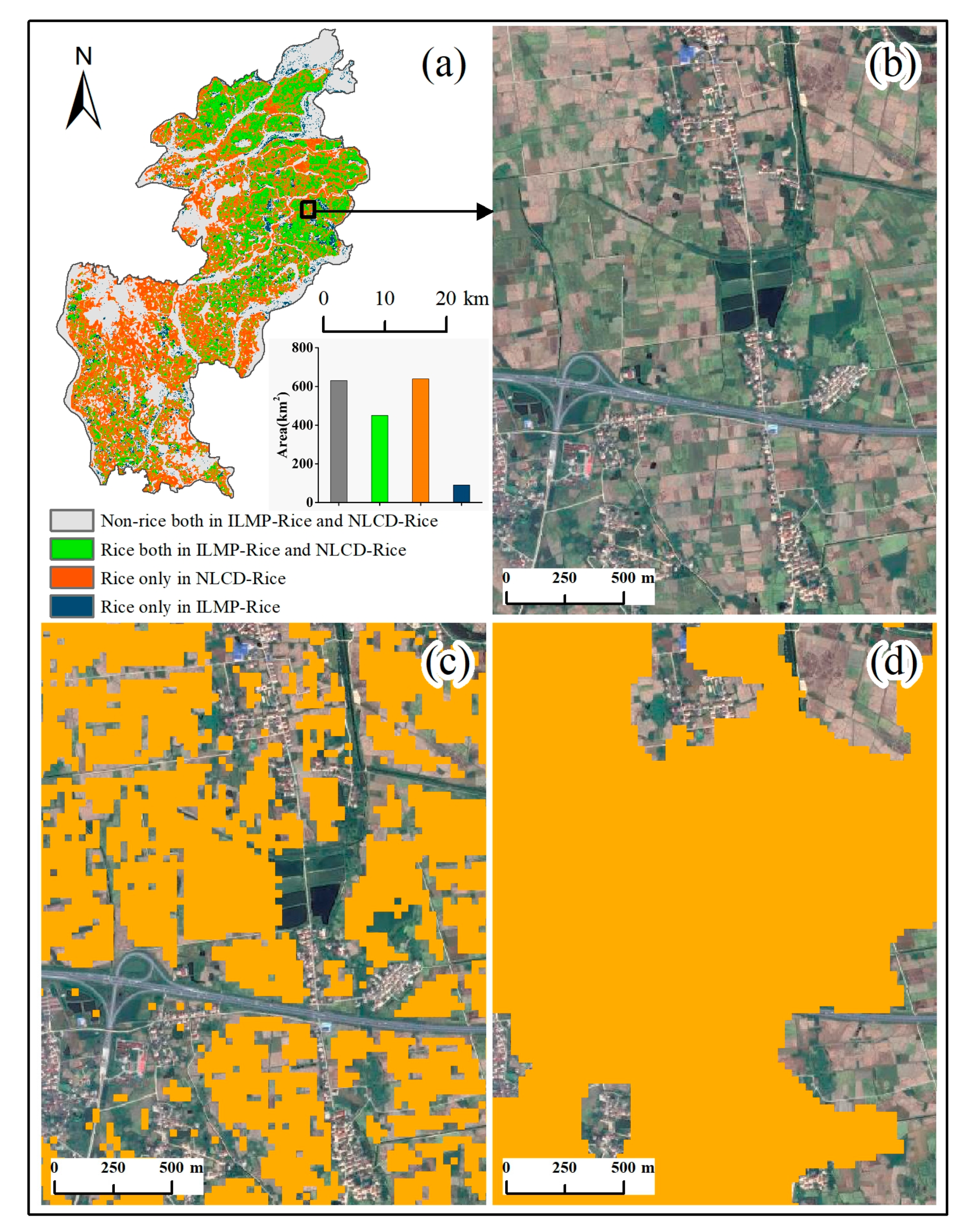
Phenology-Based Rice Paddy Mapping Using Multi-Source Satellite Imagery and a Fusion Algorithm Applied to the Poyang Lake Plain, Southern China

1
Key Lab of Poyang Lake Wetland and Watershed Research of Ministry of Education and School of Geography and Environment, Jiangxi Normal University, Nanchang 330028, China
2
Fujian Key Laboratory of Pattern Recognition and Image Understanding, Xiamen University of Technology, Xiamen 361024, China
3
Department of Spatial Information Science and Engineering, Xiamen University of Technology, Xiamen 361024, China
4
School of Geospatial Engineering and Science, Sun Yat-Sen University, Guangzhou 510275, China
*
Author to whom correspondence should be addressed.
Remote Sens. 2020, 12(6), 1022; https://doi.org/10.3390/rs12061022
Submission received: 29 January 2020 / Revised: 17 March 2020 / Accepted: 17 March 2020 / Published: 22 March 2020

Abstract

Accurate information about the spatiotemporal patterns of rice paddies is essential for the assessment of food security, management of agricultural resources, and sustainability of ecosystems. However, accurate spatial datasets of rice paddy fields and multi-cropping at fine resolution are still lacking. Landsat observation is the primary source of remote sensing data that has continuously mapped regional rice paddy fields at a 30-m spatial resolution since the 1980s. However, Landsat data used for rice paddy studies reveals some challenges, especially data quality issues (e.g., cloud cover). Here, we present an algorithm that integrates time-series Landsat and MODIS (Moderate-resolution Imaging Spectroradiometer) images with a phenology-based approach (ILMP) to map rice paddy planting fields and multi-cropping patterns. First, a fusion of MODIS and Landsat data was used to reduce the cloud contamination, which added more information to the Landsat time series data. Second, the unique biophysical features of rice paddies during the flooding and open-canopy periods (which can be captured by the dynamics of the vegetation indices) were used to identify rice paddy regions as well as those of multi-cropping. This algorithm was tested for 2015 in Nanchang County, which is located on the Poyang Lake plain in southern China. We evaluated the resultant map of the rice paddy and multi-cropping systems using ground-truth data and Google Earth images. The overall accuracy and kappa coefficient of the rice paddy planting areas were 93.66% and 0.85, respectively. The overall accuracy and kappa coefficient of the multi-cropping regions were 92.95% and 0.89, respectively. In addition, our algorithm was more capable of capturing detailed information about areas with fragmented cropland than that of the National Land Cover Dataset (NLCD) from 2015. These results demonstrated the great potential of our algorithm for mapping rice paddy fields and using the multi-cropping index in complex landscapes in southern China.
Keywords: rice paddies; Landsat; MODIS; fusion algorithm; phenology; southern China rice paddies; Landsat; MODIS; fusion algorithm; phenology; southern China
Graphical Abstract

