The Suitability of Remote Sensing Images at Different Resolutions for Mapping of Gullies in the Black Soil Region, Northeast China
Abstract
:1. Introduction
2. Materials
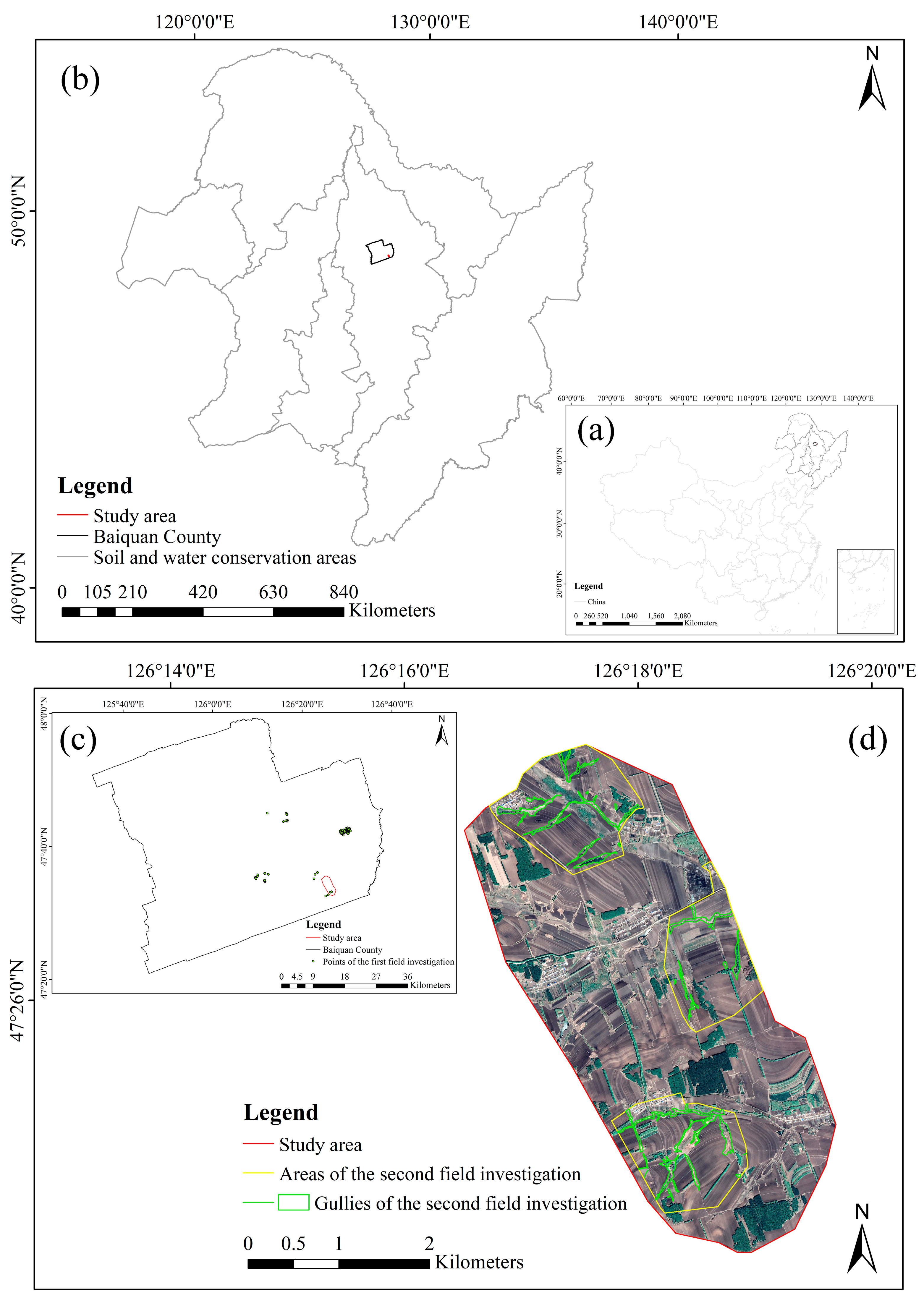
2.1. Study Area
2.2. Data Sources
3. Method
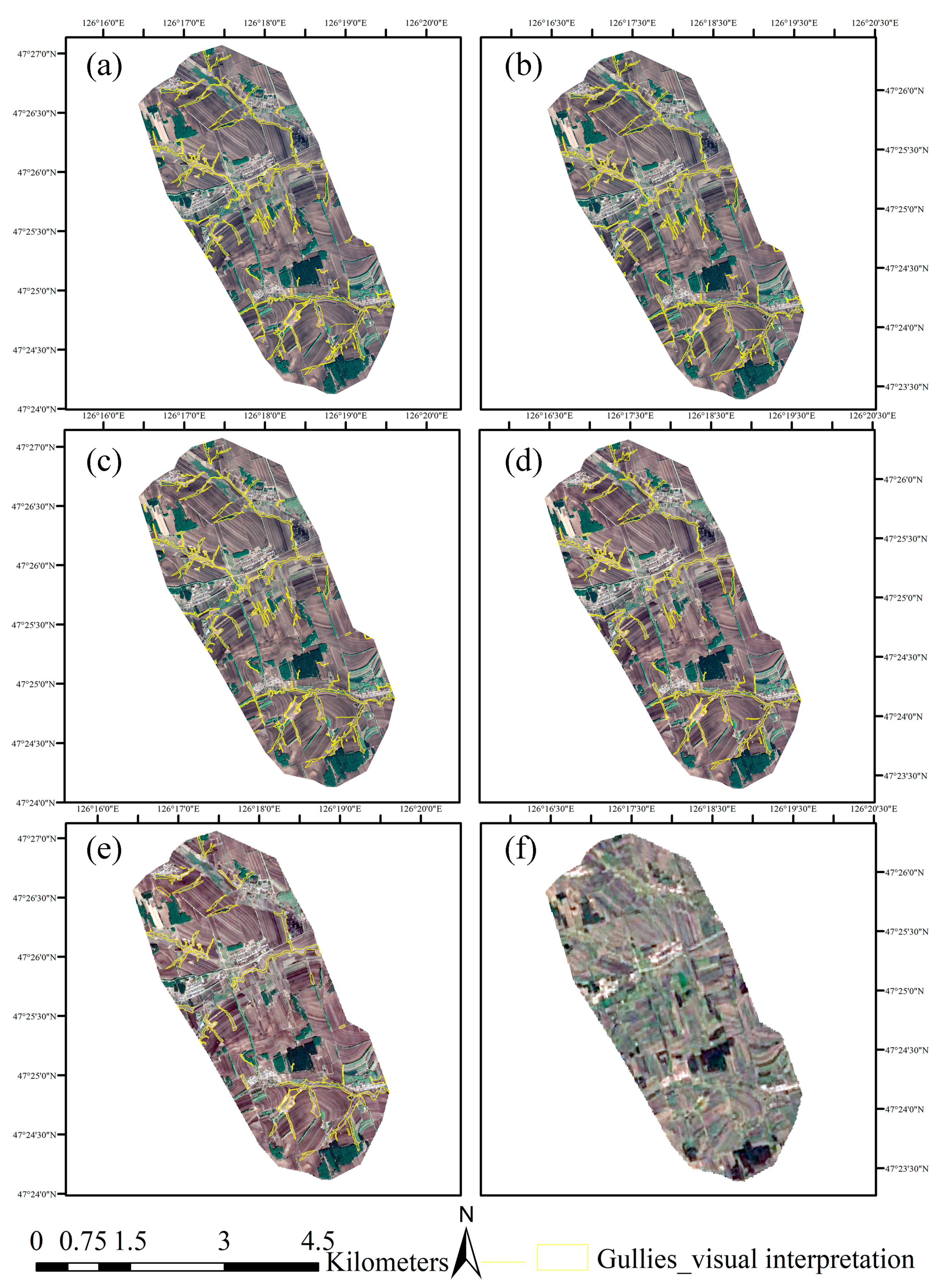
3.1. Visual Interpretation for Gully Mapping
3.2. Selection of Optimal Spatial Resolution
4. Results
4.1. Overall Situation of Gully Interpretation
4.2. Interpretation of Different Types of Gullies
5. Discussion
6. Conclusions
Author Contributions
Funding
Data Availability Statement
Acknowledgments
Conflicts of Interest
References
- Yongli, M.; Feiyan, W.; Yuheng, W. Geography Dictionary; Shanghai Lexicographical Publishing House: Shanghai, China, 1983. (In Chinese) [Google Scholar]
- Denevan, W.M. Livestock numbers in nineteenth-century new mexico, and the problem of gullying in the southwest. Ann. Assoc. Am. Geogr. 1967, 57, 691–703. [Google Scholar] [CrossRef]
- Maojuan, L.; Tianqi, L.; Lianqi, Z.; Meadows, M.E. Effect of land use change on gully erosion density in the black soil region of northeast china from 1965 to 2015: A case study of the kedong county. Front. Environ. Sci. 2021, 9, 111. [Google Scholar]
- Gang, H.; Yongqiu, W.; Baoyuan, L.; Zhangtao, Y.; Zhimin, Y.; Yongguang, Z. Short-term gully retreat rates over rolling hill areas in black soil of northeast china. Catena 2007, 71, 321–329. [Google Scholar]
- Yongqiu, W.; Qiuhong, Z.; Yongguang, Z.; Baoyuan, L.; Hong, C.; Yanzai, W. Development of gullies and sediment production in the black soil region of northeastern china. Geomorphology 2008, 101, 683–691. [Google Scholar]
- Amiri, M.; Pourghasemi, H.R.; Ghanbarian, G.A.; Afzali, S.F. Assessment of the importance of gully erosion effective factors using Boruta algorithm and its spatial modeling and mapping using three machine learning algorithms. Geoderma 2019, 340, 55–69. [Google Scholar] [CrossRef]
- Arabameri, A.; Pradhan, B.; Rezaei, K. Gully erosion zonation mapping using integrated geographically weighted regression with certainty factor and random forest models in GIS. J. Environ. Manag. 2019, 232, 928–942. [Google Scholar] [CrossRef] [PubMed]
- Ranghu, W.; Shuwen, Z.; Luoman, P.; Jiuchun, Y.; Chaobin, Y.; Jing, C.; Cong, G.; Qing, W.; Dan, C.; Bolin, F.; et al. Gully erosion mapping and monitoring at multiple scales based on multi-source remote sensing data of the Sancha River catchment, northeast China. ISPRS Int. Geo-Inf. 2016, 5, 200. [Google Scholar]
- Santisteban, L.M.D.; Casalí, J.; López, J.J. Assessing soil erosion rates in cultivated areas of Navarre (Spain). Earth Surf. Process. Landf. 2010, 31, 487–506. [Google Scholar] [CrossRef]
- Adediji, A.; Ibitoye, M.O. Urban gully development in southwestern Nigeria. Positioning 2013, 4, 183–191. [Google Scholar] [CrossRef] [Green Version]
- Ghimire, S.K.; Higaki, D.; Bhattarai, T.P. Gully erosion in the Siwalik Hills, Nepal: Estimation of sediment production from active ephemeral gullies. Earth Surf. Process. Landf. 2006, 31, 155–165. [Google Scholar] [CrossRef]
- Tebebu, T.; Abiy, A.Z.; Dahlke, H.E.; Easton, Z.; Zegeye, A.D.; Tilahun, S.; Collick, A.S.; Kidnau, S.; Moges, S.; Dadgari, F.; et al. Surface and subsurface flow effect on permanent gully formation and upland erosion near lake tana in the northern highlands of ethiopia. Hydrol. Earth Syst. Sci. 2010, 7, 5235–5265. [Google Scholar]
- Langran, K.J. Potential for monitoring soil erosion features and soil erosion modelling components from remotely sensed data. In Proceedings of the IGARSS’83, San Francisco, CA, USA, 31 August–2 September 1983; pp. 2.1–2.4. [Google Scholar]
- Stromquist, L.; Lundén, B.A.; Chakela, Q.K. Sediment sources, sediment transfer in a small lesotho catchment- a pilot study of the spatial distribution of erosion features and their variation with time and climate. S. Afr. Geogr. J. 1985, 67, 3–13. [Google Scholar] [CrossRef]
- D’Oleire-Oltmanns, S.; Marzolff, I.; Tiede, D.; Blaschke, T. Detection of gully-affected areas by applying object-based image analysis (obia) in the region of Taroudannt, Morocco. Remote Sens. 2014, 6, 8287–8309. [Google Scholar] [CrossRef] [Green Version]
- Kai, L.; Hu, D.; Guoan, T.; Chunqiao, S.; Yiwen, L.; Ling, J.; Bangyuan, Z.; Yunfei, G.; Ronghua, M. Large-scale mapping of gully-affected areas: An approach integrating google earth images and terrain skeleton information. Geomorphology 2018, 314, 13–26. [Google Scholar]
- Garosi, Y.; Sheklabadi, M.; Conoscenti, C.; Pourghasemi, H.R.; Oost, K.V. Assessing the performance of gis-based machine learning models with different accuracy measures for determining susceptibility to gully erosion. Sci. Total Environ. 2019, 664, 1117–1132. [Google Scholar] [CrossRef]
- Singh, B.M. Interpretation of satellite imagery for delineation of ravines. J. Indian Soc. Remote Sens. 1977, 5, 31–34. [Google Scholar]
- Mararakanye, N.; Le Poux, J.J. Gully location mapping at a national scale for South Africa. S. Afr. Geogr. J. 2012, 94, 208–218. [Google Scholar] [CrossRef]
- Gafurov, A.M.; Yermolayev, O.P. Automatic gully detection: Neural networks and computer vision. Remote Sens. 2020, 12, 1743. [Google Scholar] [CrossRef]
- Kai, L.; Hu, D.; Guoan, T.; Axing, Z.; Xin, Y.; Sheng, J.; Jianjun, C. An object-based approach for two-level gully feature mapping using high-resolution dem and imagery: A case study on hilly loess plateau region, china. Chin. Geogr. Sci. 2017, 27, 415–430. [Google Scholar]
- Metternicht, G.I.; Zinck, J.A. Evaluating the information content of jers-1 sar and landsat tm data for discrimination of soil erosion features. ISPRS J. Photogramm. Remote Sens. 1998, 53, 143–153. [Google Scholar] [CrossRef]
- Shruthi, R.B.V.; Kerle, N.; Jetten, V. Object-based gully feature extraction using high spatial resolution imagery. Geomorphology 2011, 134, 260–268. [Google Scholar] [CrossRef]
- Karami, A.; Khoorani, A.; Noohegar, A.; Shamsi, S.R.F. Gully erosion mapping using object-based and pixel-based image classification methods. Environ. Eng. Geosci. 2015, 21, 101–110. [Google Scholar] [CrossRef]
- Trias-Sanz, R.; Stamon, G.; Louchet, J. Using colour, texture, and hierarchial segmentation for high-resolution remote sensing. ISPRS-J. Photogramm. Remote Sens. 2008, 63, 156–168. [Google Scholar] [CrossRef]
- Lathrop, R.G.; Montesano, P.; Haag, S. A multi-scale segmentation approach to mapping seagrass habitats using airborne digital camera imagery. Photogramm. Eng. Remote Sens. 2006, 72, 665–675. [Google Scholar] [CrossRef] [Green Version]
- Xiaoyu, L.; Yingkui, L.; Washington-Allen, R.A.; Yanan, L.; Li, H.; Qingwu, H. The effect of grid size on the quantification of erosion, deposition, and rill network. Int. Soil Water Conserv. Res. 2017, 5, 241–251. [Google Scholar]
- Luoman, P.; Shuwen, Z.; Ranghu, W.; Liping, C.; Jiuchun, Y. Analysis of erosion gully information extraction based on multi-resource remote sensing images. Geogr. Geo-Inf. Sci. 2016, 32, 90–94. (In Chinese) [Google Scholar]
- Younes, G.; Mohsen, S.; Pourghasemi, H.R.; Besalatpour, A.A.; Conoscenti, C.; Oost, K.V. Comparison of differences in resolution and sources of controlling factors for gully erosion susceptibility mapping. Geoderma 2018, 330, 65–78. [Google Scholar]
- Shruthi, R.B.V.; Kerle, N.; Jetten, V.; Abdellah, L.; Machmach, I. Quantifying temporal changes in gully erosion areas with object oriented analysis. Catena 2015, 128, 262–277. [Google Scholar] [CrossRef]
- Xiaobing, L.; Xiaozeng, H.; Chunyu, S.; Herbert, S. Soil organic carbon dynamics in black soils of China under different agricultural management systems. Commun. Soil Sci. Plant Anal. 2003, 34, 973–984. [Google Scholar]
- MWR (Ministry of Water Resources of the People’s Republic of China). Bulletin of First National Water Census for Soil and Water Conservation; China Water and Power Press: Beijing, China, 2013. (In Chinese)
- General Office of MWR (General Office of the Ministry of Water Resources of the People’s Republic of China). General Situation of “National Soil and Water Conservation Ecological Civilization County” Construction in Baiquan County, Heilongjiang Province; General Office of the Ministry of Water Resources of the People’s Republic of China: Beijing, China, 2016. (In Chinese)
- Platoncheva, E.V. Investigation of the dynamics of ephemeral gully erosion on arable land of the forest-steppe and steppe zone of the east of the Russian Plain from remote sensing data. IOP Conf. 2018, 107, 012019. [Google Scholar] [CrossRef]
- Qianfansoft.net. Available online: http://help.qianfansoft.net/cpjj.html (accessed on 27 October 2020). (In Chinese).
- Baoyuan, L.; Yang, Y.; Shaojuan, L. Discriminations on common soil erosion terms and their implications for soil and water conservation. Sci. Soil Water Conserv. 2018, 16, 9–16. (In Chinese) [Google Scholar]
- Wenku.baidu.com. Available online: https://wenku.baidu.com/view/b680aef982d049649b6648d7c1c708a1294a0a5c.html (accessed on 18 May 2021). (In Chinese).
- Taruvinga, K. Gully Mapping Using Remote Sensing: Case Study in Kwazulu-Natal, South Africa. Master’s Thesis, University of Waterloo, Waterloo, ON, Canada, 2009. [Google Scholar]
- Yechao, Y.; Shuwen, Z.; Shuping, Y. Classification of erosion gullies by remote sensing and spatial pattern analysis in black soil region of eastern Kebai. Sci. Geogr. Sin. 2007, 27, 193–199. (In Chinese) [Google Scholar]
- Hayes, D.J.; Cohen, W.B. Spatial, spectral and temporal patterns of tropical forest cover change as observed with multiple scales of optical satellite data. Remote Sens. Environ. 2007, 106, 1–16. [Google Scholar] [CrossRef]
- Cheng, Z.; Zhaoning, G.; Huachang, Q.; Yuan, Z.; Demin, Z. Mapping typical salt-marsh species in the yellow river delta wetland supported by temporal-spatial-spectral multidimensional features. Sci. Total Environ. 2021, 783, 147061. [Google Scholar]
- Frankl, A.; Poesen, J.; Haile, M.; Deckers, J.; Nyssen, J. Quantifying long-term changes in gully networks and volumes in dryland environments: The case of northern ethiopia. Geomorphology 2013, 201, 254–263. [Google Scholar] [CrossRef] [Green Version]
- Frankl, A.; Zwertvaegher, A.; Poesen, J.; Nyssen, J. Transferring google earth observations to gis-software: Example from gully erosion study. Int. J. Digit. Earth 2013, 6, 196–201. [Google Scholar] [CrossRef] [Green Version]
- Andrea, R.; Brigitta, L.; Balázs, S. Quantifying lavaka (gully) density and extension using freely accessible satellite imagery. In Proceedings of the EGU General Assembly 2014, Vienna, Austria, 27 April–2 May 2014. [Google Scholar]
- Potere, D. Horizontal positional accuracy of google earth’s high-resolution imagery archive. Sensors 2008, 8, 7973–7981. [Google Scholar] [CrossRef]
- Mclnnes, J.; Vigiak, O.; Roberts, A. Using google earth to map gully extent in the west gippsland region (victoria, australia). In Proceedings of the 19th International Congress on Modelling and Simulation, Perth, Australia, 12–16 December 2011. [Google Scholar]
- Marzolff, I.; Poesen, J.; Ries, J.B. Short to medium-term gully development: Human activity and gully erosion variability in selected spanish gully catchments. Landf. Anal. 2011, 17, 111–116. [Google Scholar]
- Gong, C.; Lei, S.; Bian, Z.; Liu, Y.; Zhang, Z.; Cheng, W. Analysis of the development of an erosion gully in an open-pit coal mine dump during a winter freeze-thaw cycle by using low-cost uavs. Remote Sens. 2019, 11, 1356. [Google Scholar] [CrossRef] [Green Version]
- Yanru, W.; Kasielke, T.; Hao, L.; Bin, Z.; Zepp, H. May agricultural terraces induce gully erosion? A case study from the black soil region of northeast china. Sci. Total Environ. 2020, 750, 141715. [Google Scholar]
- Bathrellos, G.D.; Skilodimou, H.D. Land use planning for natural hazards. Land 2019, 8, 128. [Google Scholar] [CrossRef] [Green Version]
- Barvels, E.; Fensholt, R. Earth observation-based detectability of the effects of land management programmes to counter land degradation: A case study from the highlands of the ethiopian plateau. Remote Sens. 2021, 13, 1297. [Google Scholar] [CrossRef]


| Classification Criteria | Type of Gully | Ground Photo | GE Image (0.5 m) | Image Feature |
|---|---|---|---|---|
| Severity and morphology | Ephemeral gully |  | 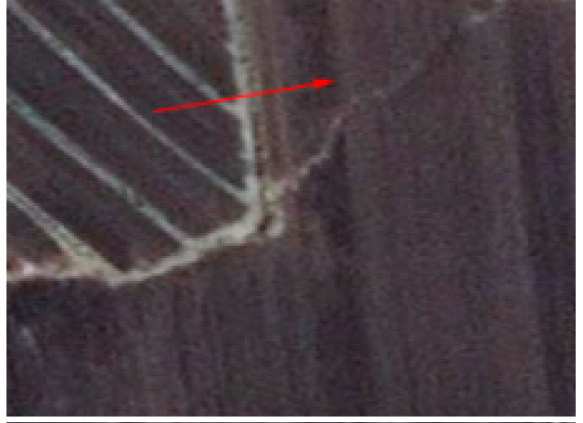 | Linear and tortuous |
| Permanent gully | 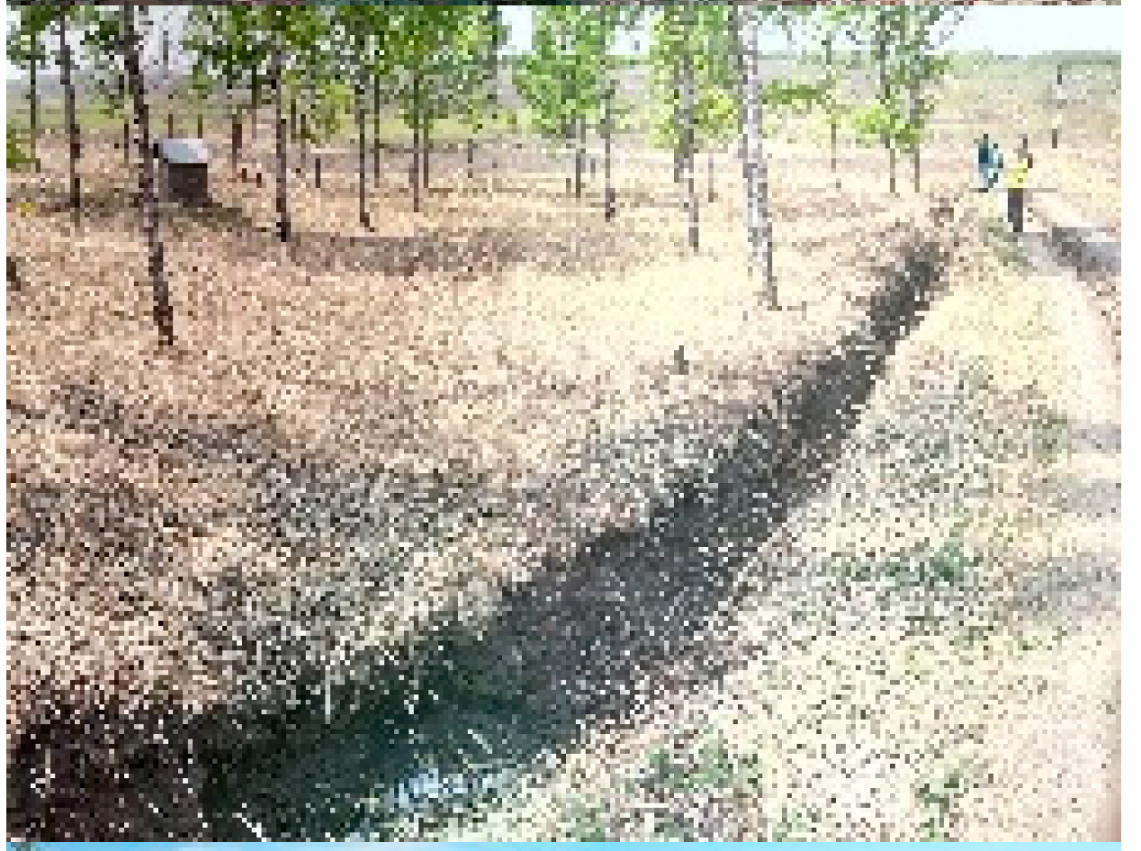 | 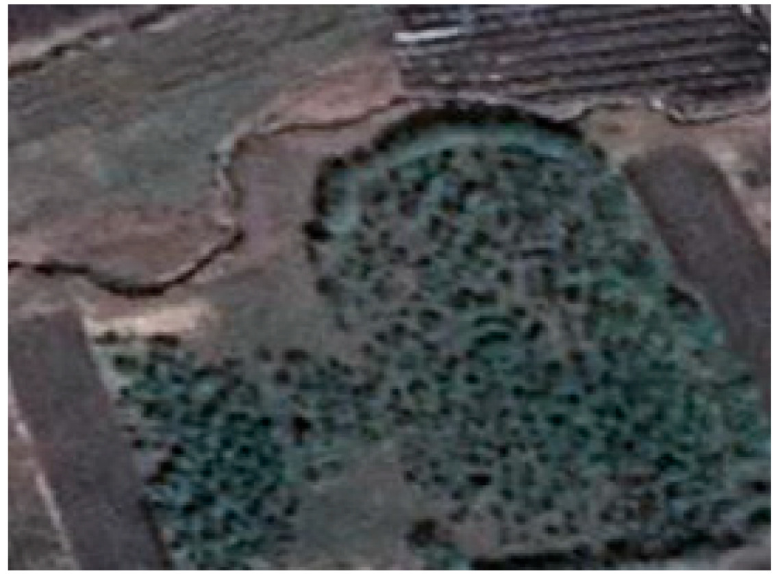 | Relatively narrow and dark | |
| Modern incised valley | 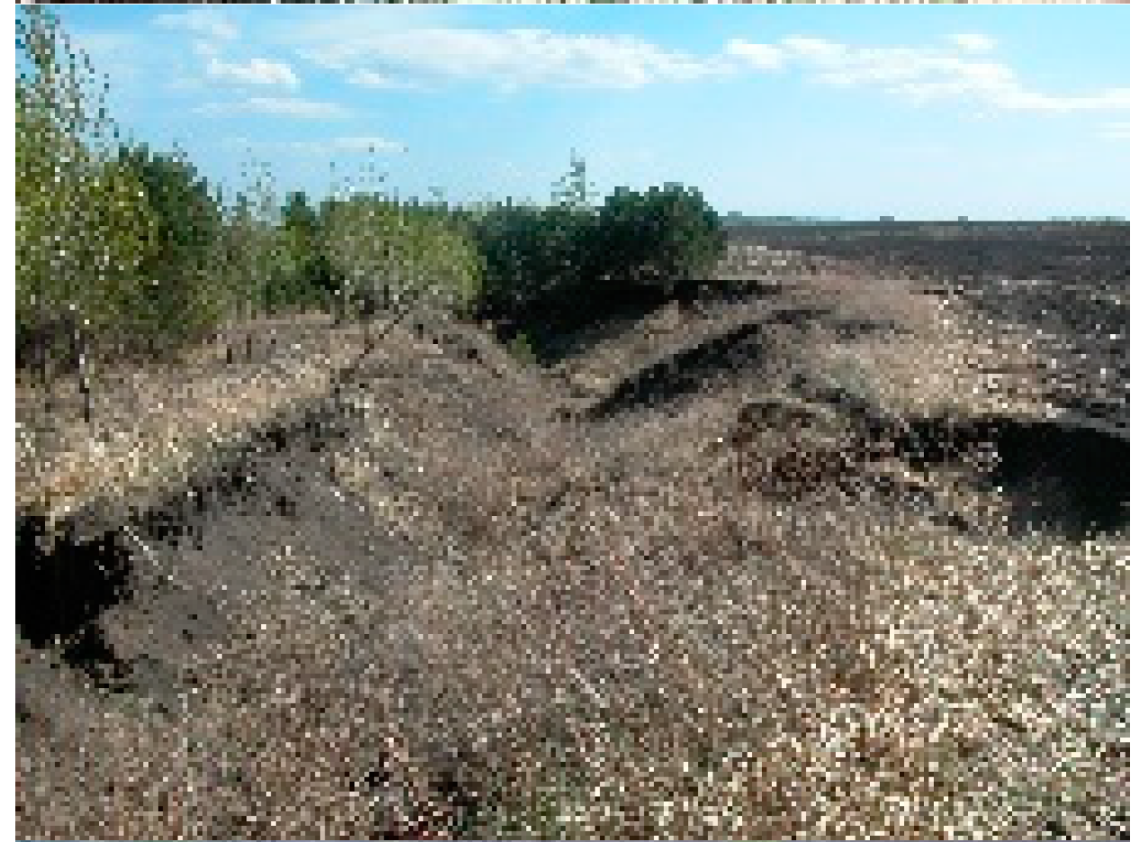 |  | Wider and lighter | |
| Activity | Active gully |  |  | The color is dark brown or straw-yellow |
| Stable gully |  |  | Lots of green mixed with dark brown or straw-yellow | |
| Treatment | Untreated gully | 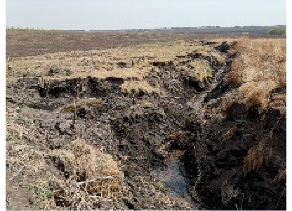 |  | Unclear boundary, complex and uneven texture inside |
| Treated gully |  | 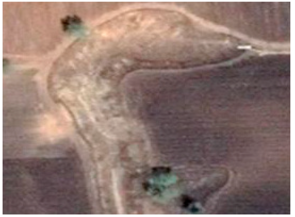 | Clear and regular boundary, uniform texture inside |
| Resolution | Validation Area | Precision (%) | Recall (%) | F-Score (%) | Average of F-Score (%) |
|---|---|---|---|---|---|
| 0.51 m | I | 89.56 | 99.06 | 94.07 | 96.52 |
| II | 98.68 | 98.71 | 98.69 | ||
| III | 94.82 | 98.87 | 96.80 | ||
| 1.02 m | I | 99.47 | 99.10 | 99.28 | 98.07 |
| II | 98.93 | 97.57 | 98.24 | ||
| III | 94.77 | 98.66 | 96.68 | ||
| 2.04 m | I | 99.40 | 98.05 | 98.72 | 96.60 |
| II | 97.96 | 94.04 | 95.96 | ||
| III | 93.60 | 96.71 | 95.13 | ||
| 4.08 m | I | 84.05 | 84.11 | 84.08 | 83.35 |
| II | 79.51 | 79.49 | 79.50 | ||
| III | 83.58 | 89.58 | 86.48 | ||
| 8.16 m | I | 68.77 | 85.37 | 76.18 | 66.13 |
| II | 62.79 | 52.41 | 57.13 | ||
| III | 65.73 | 64.47 | 65.09 |
| Resolution | Type of Gully | Validation Area | Precision (%) | Recall (%) | F-Score (%) | Average of F-Score (%) |
|---|---|---|---|---|---|---|
| 0.51 m | Permanent gully | I | 99.21 | 99.34 | 99.28 | 98.68 |
| II | 99.55 | 98.93 | 99.24 | |||
| III | 98.16 | 96.88 | 97.51 | |||
| Modern incised valley | I | 99.55 | 99.05 | 99.30 | 98.49 | |
| II | 97.95 | 98.43 | 98.19 | |||
| III | 96.77 | 99.21 | 97.98 | |||
| 1.02 m | Permanent gully | I | 99.06 | 99.34 | 99.20 | 98.37 |
| II | 99.42 | 98.33 | 98.87 | |||
| III | 96.61 | 97.46 | 97.03 | |||
| Modern incised valley | I | 100.00 | 99.63 | 99.82 | 98.55 | |
| II | 98.56 | 97.45 | 98.00 | |||
| III | 96.78 | 98.94 | 97.85 | |||
| 2.04 m | Permanent gully | I | 97.31 | 91.66 | 94.40 | 93.12 |
| II | 98.34 | 92.94 | 95.57 | |||
| III | 92.03 | 86.93 | 89.41 | |||
| Modern incised valley | I | 99.44 | 98.24 | 98.83 | 95.36 | |
| II | 91.68 | 89.65 | 90.65 | |||
| III | 95.32 | 97.87 | 96.58 | |||
| 4.08 m | Permanent gully | I | 0.00 | 0.00 | - | 88.48 |
| II | 97.05 | 88.95 | 92.83 | |||
| III | 87.52 | 80.98 | 84.12 | |||
| Modern incised valley | I | 83.13 | 84.49 | 83.80 | 77.03 | |
| II | 57.41 | 63.14 | 60.14 | |||
| III | 84.04 | 90.49 | 87.14 | |||
| 8.16 m | Permanent gully | I | - | 0.00 | - | - |
| II | - | 0.00 | - | |||
| III | - | 0.00 | - | |||
| Modern incised valley | I | 68.71 | 87.35 | 76.92 | 45.49 | |
| II | 3.47 | 6.38 | 4.50 | |||
| III | 51.14 | 59.61 | 55.05 |
| Resolution | Type of Gully | Validation Area | Precision (%) | Recall (%) | F-Score (%) | Average of F-Score (%) |
|---|---|---|---|---|---|---|
| 0.51 m | Active gully | I | 99.65 | 98.90 | 99.27 | 98.62 |
| II | 98.82 | 98.71 | 98.76 | |||
| III | 96.88 | 98.78 | 97.82 | |||
| Stable gully | I | 99.26 | 99.48 | 99.37 | 99.21 | |
| II | 0.00 | 0.00 | - | |||
| III | 99.86 | 98.26 | 99.05 | |||
| 1.02 m | Active gully | I | 99.52 | 98.98 | 99.25 | 98.49 |
| II | 99.05 | 97.95 | 98.49 | |||
| III | 96.71 | 98.74 | 97.72 | |||
| Stable gully | I | 99.31 | 99.35 | 99.33 | 99.22 | |
| II | 0.00 | 0.00 | - | |||
| III | 100.00 | 98.25 | 99.11 | |||
| 2.04 m | Active gully | I | 99.47 | 97.46 | 98.46 | 96.57 |
| II | 97.96 | 94.04 | 95.96 | |||
| III | 95.54 | 95.04 | 95.29 | |||
| Stable gully | I | 99.20 | 99.51 | 99.35 | 87.19 | |
| II | 0.00 | 0.00 | - | |||
| III | 60.66 | 98.32 | 75.03 | |||
| 4.08 m | Active gully | I | 73.44 | 78.66 | 75.96 | 80.62 |
| II | 79.51 | 79.49 | 79.50 | |||
| III | 84.47 | 88.41 | 86.40 | |||
| Stable gully | I | 92.66 | 76.55 | 83.84 | 89.63 | |
| II | 0.00 | 0.00 | - | |||
| III | 92.34 | 98.70 | 95.42 | |||
| 8.16 m | Active gully | I | 46.31 | 79.96 | 58.65 | 59.98 |
| II | 62.79 | 52.41 | 57.13 | |||
| III | 64.76 | 63.55 | 64.15 | |||
| Stable gully | I | - | 0.00 | - | - | |
| II | 0.00 | 0.00 | - | |||
| III | - | 0.00 | - |
| Resolution | Type of Gully | Validation Area | Precision (%) | Recall (%) | F-Score (%) | Average of F-Score (%) |
|---|---|---|---|---|---|---|
| 0.51 m | Untreated gully | I | 1.00 | 0.99 | 0.99 | 0.98 |
| II | 0.99 | 0.99 | 0.99 | |||
| III | 0.94 | 0.99 | 0.96 | |||
| Treated gully | I | 0.99 | 0.99 | 0.99 | 0.99 | |
| II | 0.98 | 0.96 | 0.97 | |||
| III | 0.99 | 0.99 | 0.99 | |||
| 1.02 m | Untreated gully | I | 1.00 | 0.99 | 0.99 | 0.98 |
| II | 0.99 | 0.98 | 0.99 | |||
| III | 0.94 | 0.98 | 0.96 | |||
| Treated gully | I | 0.99 | 0.99 | 0.99 | 0.98 | |
| II | 0.97 | 0.97 | 0.97 | |||
| III | 0.99 | 0.99 | 0.99 | |||
| 2.04 m | Untreated gully | I | 0.99 | 0.97 | 0.98 | 0.89 |
| II | 0.98 | 0.94 | 0.96 | |||
| III | 0.58 | 0.91 | 0.71 | |||
| Treated gully | I | 0.99 | 1.00 | 0.99 | 0.87 | |
| II | 0.97 | 0.97 | 0.97 | |||
| III | 0.93 | 0.50 | 0.65 | |||
| 4.08 m | Untreated gully | I | 0.82 | 0.79 | 0.80 | 0.78 |
| II | 0.97 | 0.77 | 0.86 | |||
| III | 0.59 | 0.84 | 0.69 | |||
| Treated gully | I | 0.87 | 0.95 | 0.91 | 0.64 | |
| II | 0.12 | 0.97 | 0.22 | |||
| III | 0.93 | 0.68 | 0.78 | |||
| 8.16 m | Untreated gully | I | 0.46 | 0.80 | 0.59 | 0.50 |
| II | 0.59 | 0.51 | 0.55 | |||
| III | 0.28 | 0.58 | 0.37 | |||
| Treated gully | I | - | 0.00 | - | - | |
| II | - | 0.00 | - | |||
| III | - | 0.00 | - |
| Type of Satellite | Name | Country | Resolution (m) | Price (CNY/km2) | |
|---|---|---|---|---|---|
| Panchromatic | Multispectral | ||||
| Optical satellite | Worldview-2 | United States | 0.5 | 2 | 195 |
| Geoeye-1 | United States | 0.5 | 1.65 | 195 | |
| Pleiades | France | 0.5 | 2 | 195 | |
| SuperView-1 | China | 0.5 | 2 | 195 | |
| DMC3 | China | 1 | 4 | 145 | |
| GF-1 | China | 2 | 8 | 3 | |
| ZY-3 | China | 2.1 | 5.8 | 1.6 | |
Publisher’s Note: MDPI stays neutral with regard to jurisdictional claims in published maps and institutional affiliations. |
© 2021 by the authors. Licensee MDPI, Basel, Switzerland. This article is an open access article distributed under the terms and conditions of the Creative Commons Attribution (CC BY) license (https://creativecommons.org/licenses/by/4.0/).
Share and Cite
Wang, B.; Zhang, Z.; Wang, X.; Zhao, X.; Yi, L.; Hu, S. The Suitability of Remote Sensing Images at Different Resolutions for Mapping of Gullies in the Black Soil Region, Northeast China. Remote Sens. 2021, 13, 2367. https://doi.org/10.3390/rs13122367
Wang B, Zhang Z, Wang X, Zhao X, Yi L, Hu S. The Suitability of Remote Sensing Images at Different Resolutions for Mapping of Gullies in the Black Soil Region, Northeast China. Remote Sensing. 2021; 13(12):2367. https://doi.org/10.3390/rs13122367
Chicago/Turabian StyleWang, Biwei, Zengxiang Zhang, Xiao Wang, Xiaoli Zhao, Ling Yi, and Shunguang Hu. 2021. "The Suitability of Remote Sensing Images at Different Resolutions for Mapping of Gullies in the Black Soil Region, Northeast China" Remote Sensing 13, no. 12: 2367. https://doi.org/10.3390/rs13122367
APA StyleWang, B., Zhang, Z., Wang, X., Zhao, X., Yi, L., & Hu, S. (2021). The Suitability of Remote Sensing Images at Different Resolutions for Mapping of Gullies in the Black Soil Region, Northeast China. Remote Sensing, 13(12), 2367. https://doi.org/10.3390/rs13122367


