
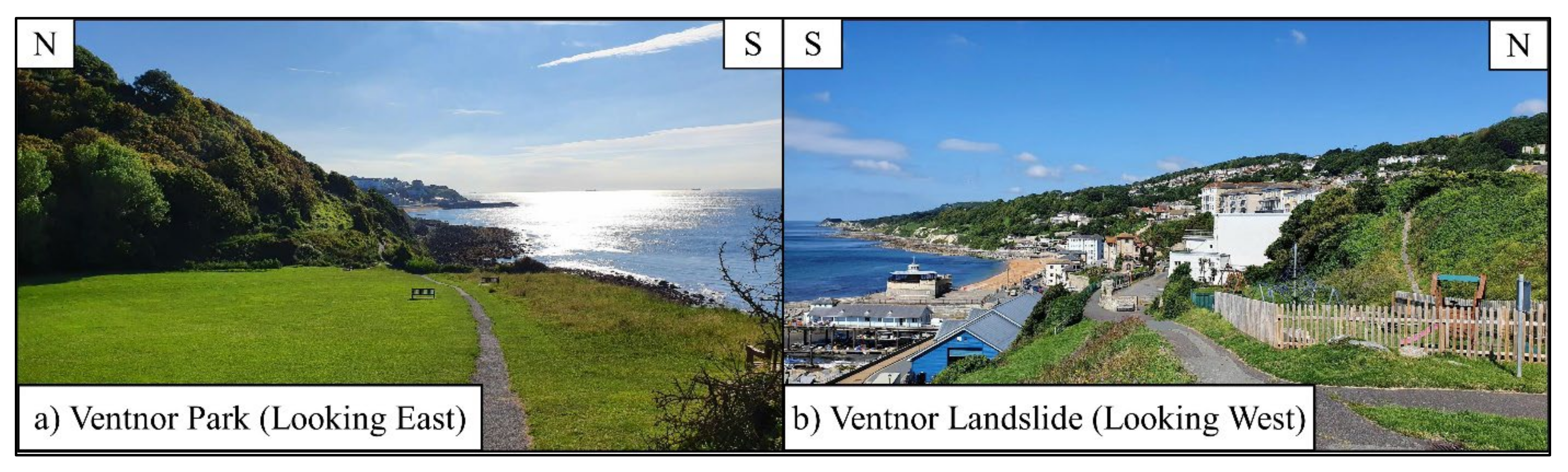
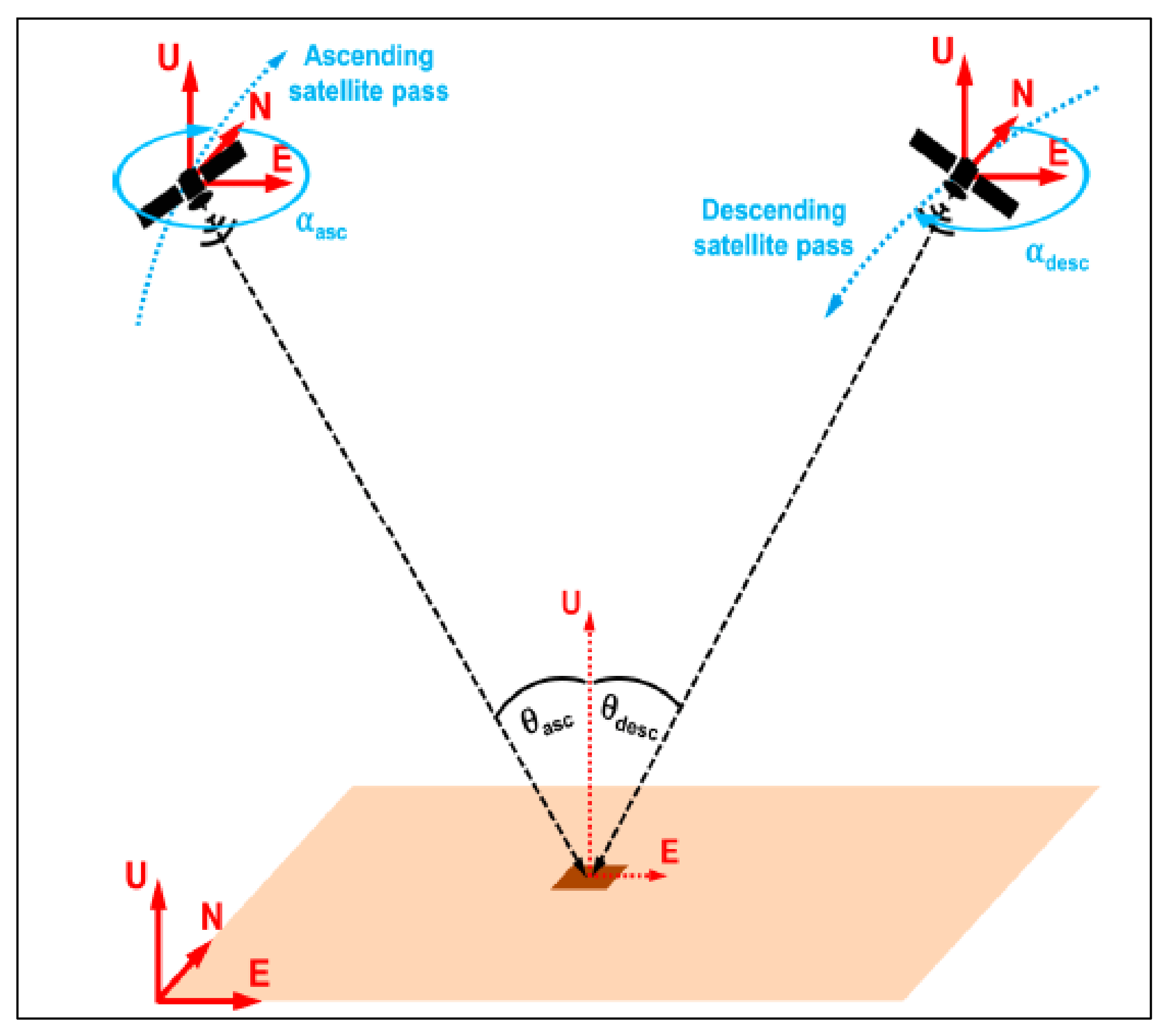
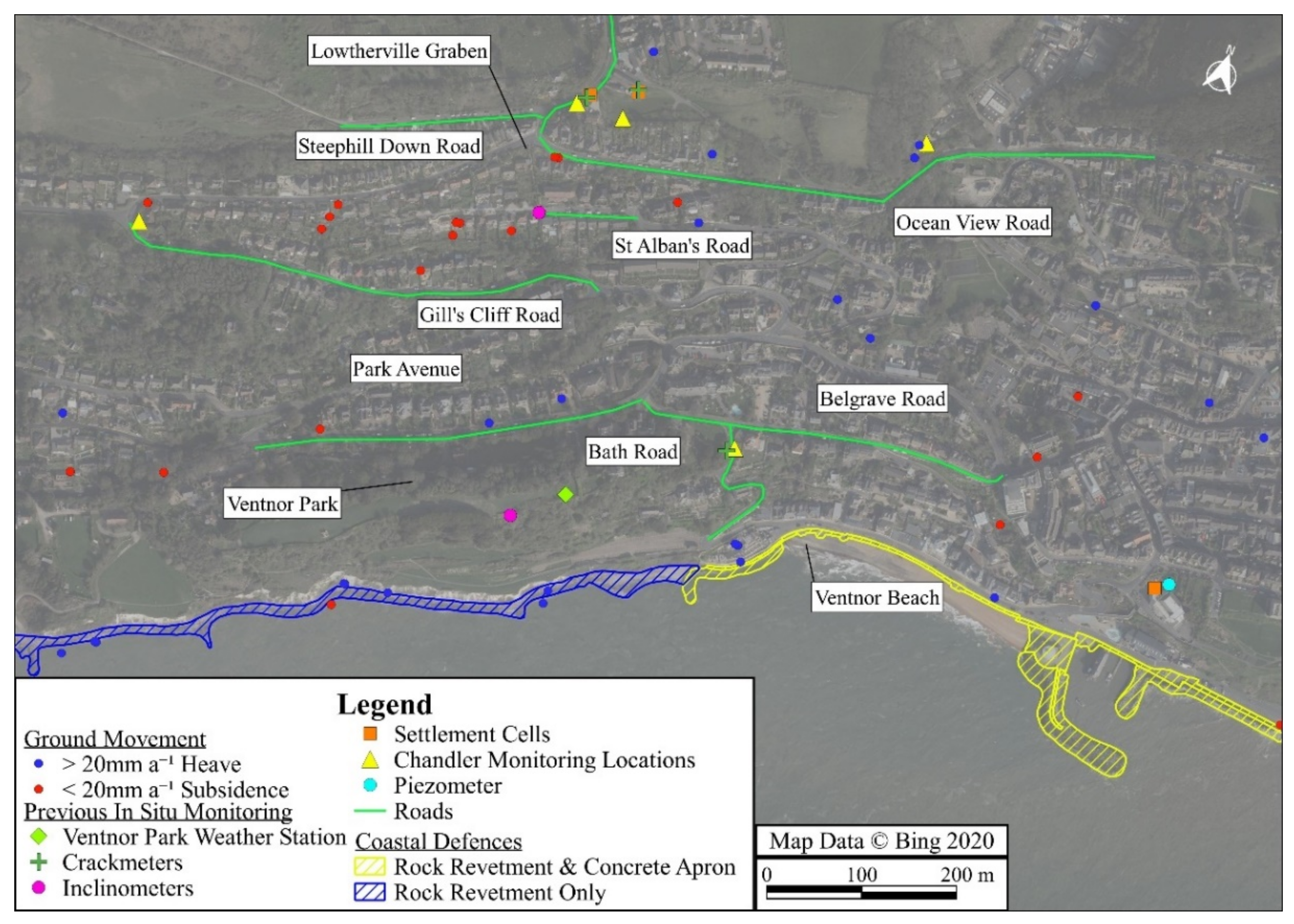
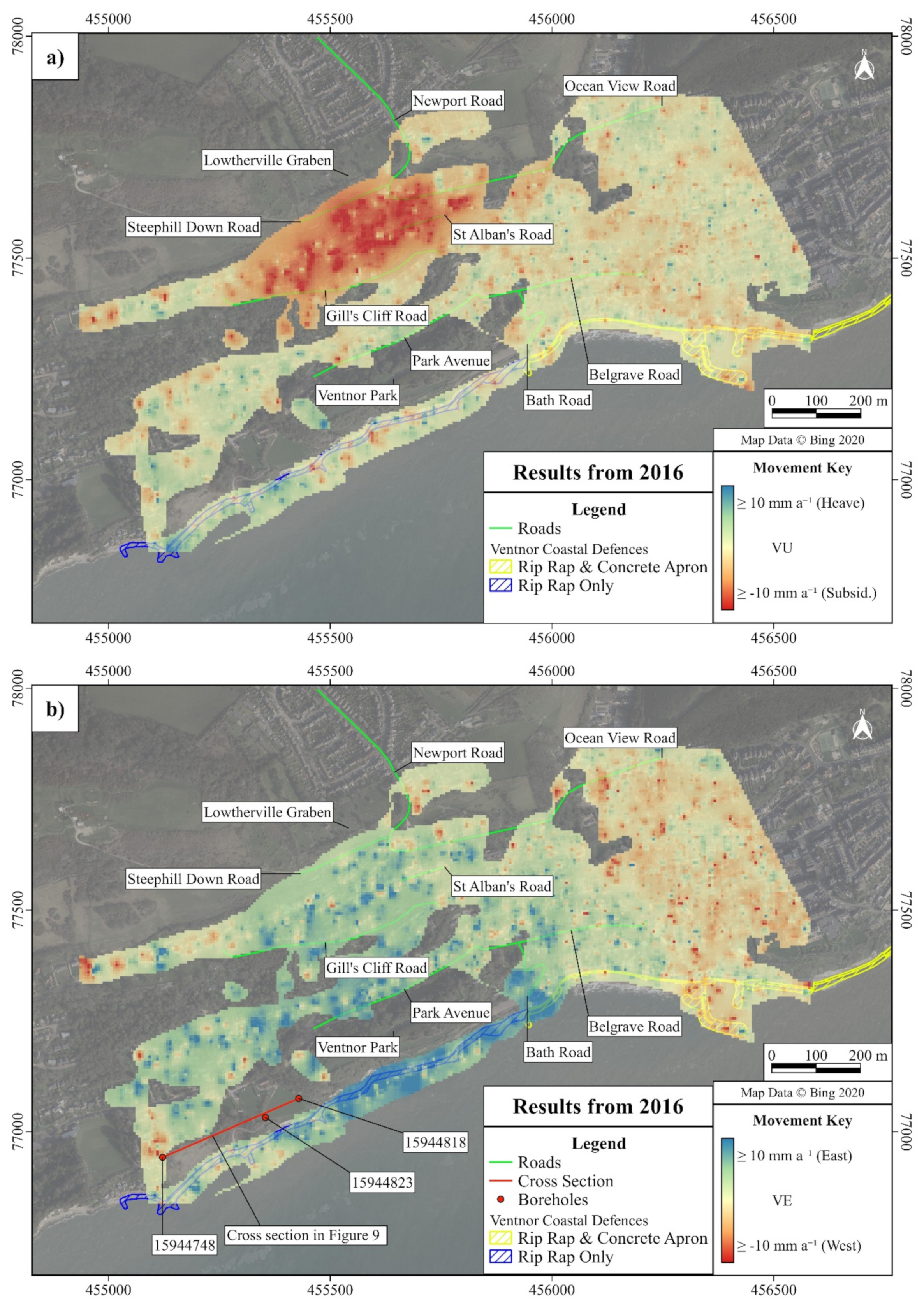
An Investigation into Ground Movement on the Ventnor Landslide Complex, UK Using Persistent Scatterer Interferometry

 , ,
, ,  ,
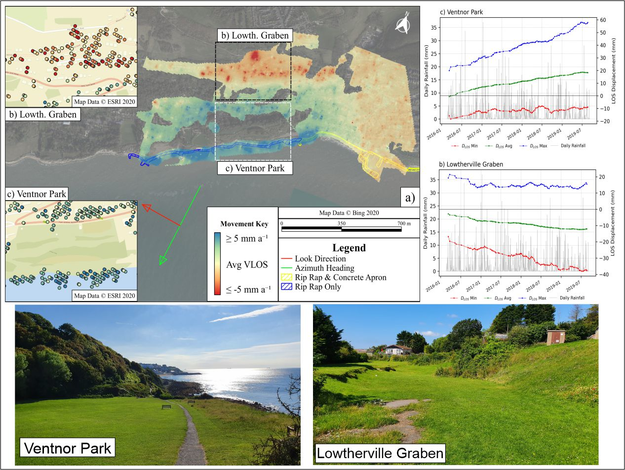
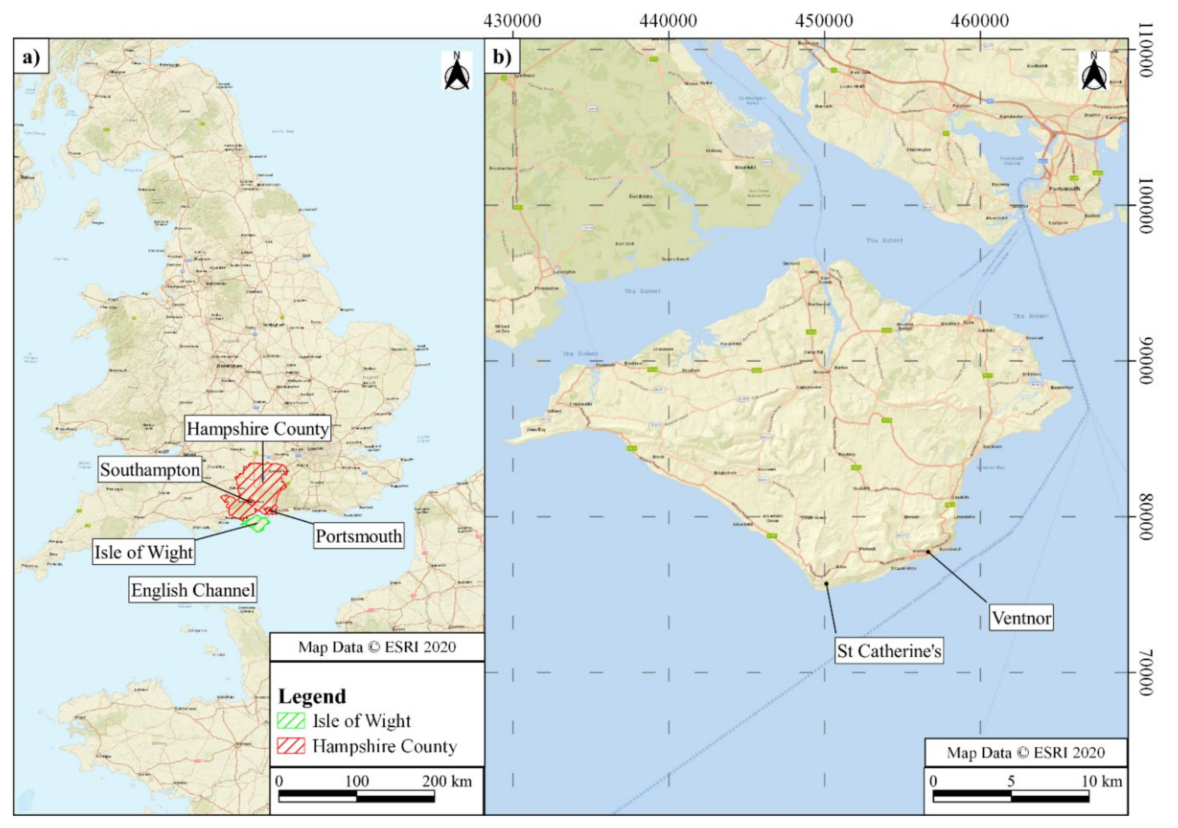
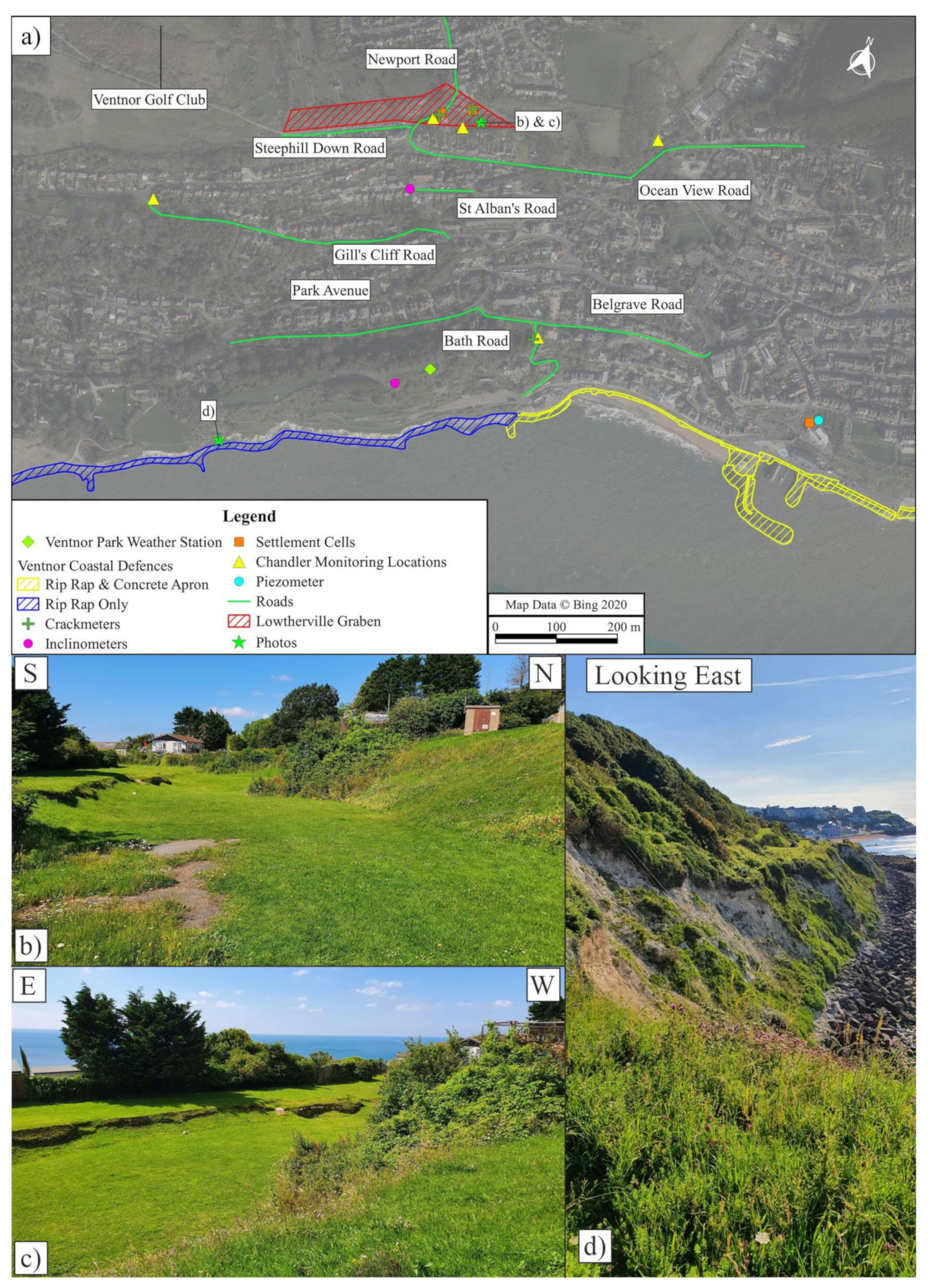
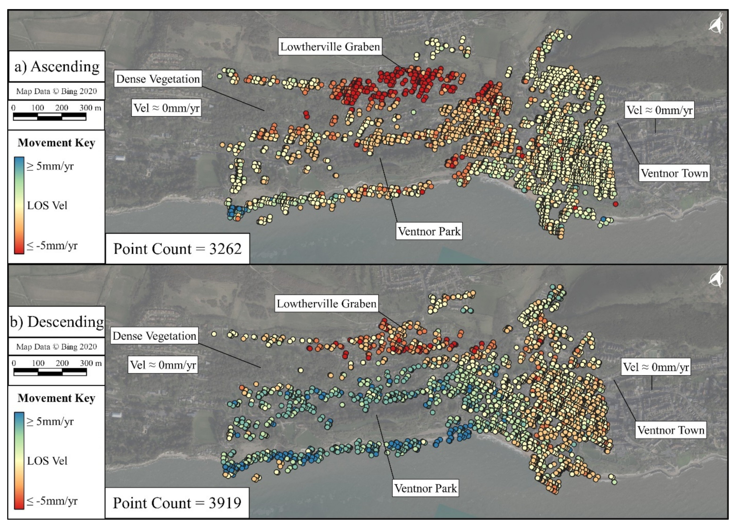
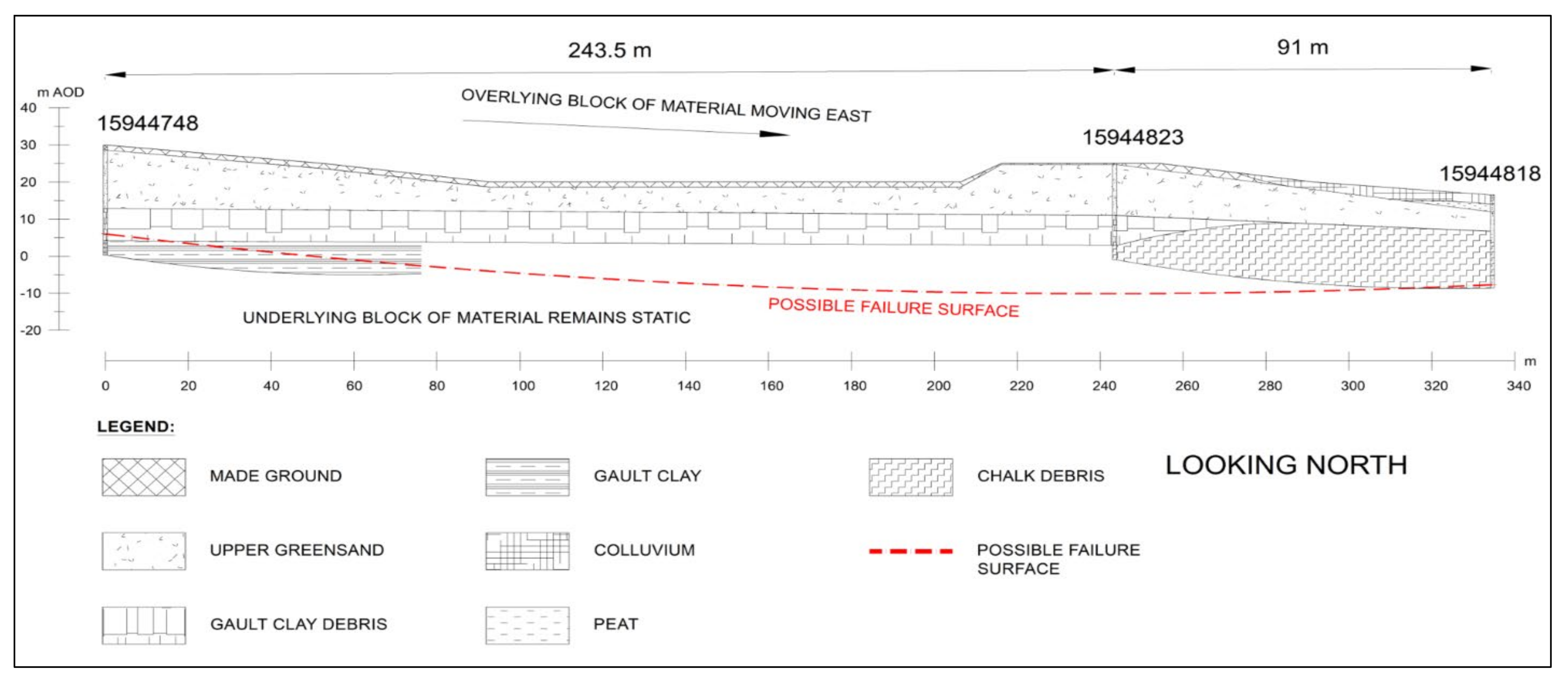
, Abstract

Share and Cite
O’Connor, W.; Mider, G.; Lawrence, J.A.; Agar, S.; Mason, P.J.; Ghail, R.; Scoular, J. An Investigation into Ground Movement on the Ventnor Landslide Complex, UK Using Persistent Scatterer Interferometry. Remote Sens. 2021, 13, 3711. https://doi.org/10.3390/rs13183711
O’Connor W, Mider G, Lawrence JA, Agar S, Mason PJ, Ghail R, Scoular J. An Investigation into Ground Movement on the Ventnor Landslide Complex, UK Using Persistent Scatterer Interferometry. Remote Sensing. 2021; 13(18):3711. https://doi.org/10.3390/rs13183711
Chicago/Turabian StyleO’Connor, William, Gosia Mider, James A. Lawrence, Stewart Agar, Philippa J. Mason, Richard Ghail, and Jennifer Scoular. 2021. "An Investigation into Ground Movement on the Ventnor Landslide Complex, UK Using Persistent Scatterer Interferometry" Remote Sensing 13, no. 18: 3711. https://doi.org/10.3390/rs13183711
APA StyleO’Connor, W., Mider, G., Lawrence, J. A., Agar, S., Mason, P. J., Ghail, R., & Scoular, J. (2021). An Investigation into Ground Movement on the Ventnor Landslide Complex, UK Using Persistent Scatterer Interferometry. Remote Sensing, 13(18), 3711. https://doi.org/10.3390/rs13183711