Technical Note

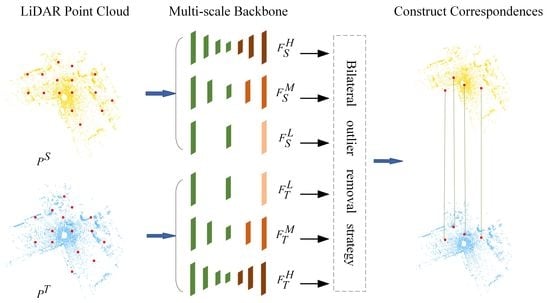
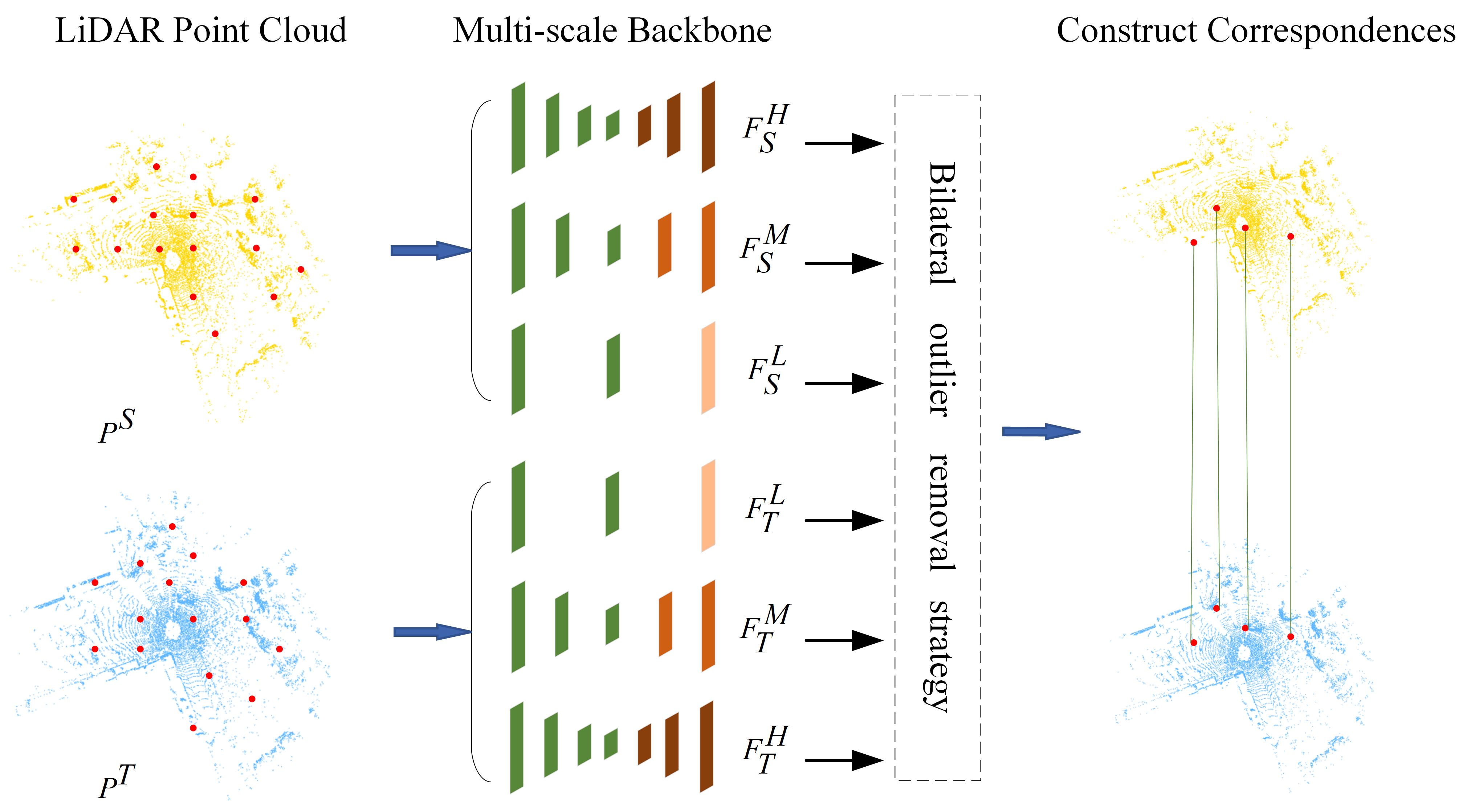
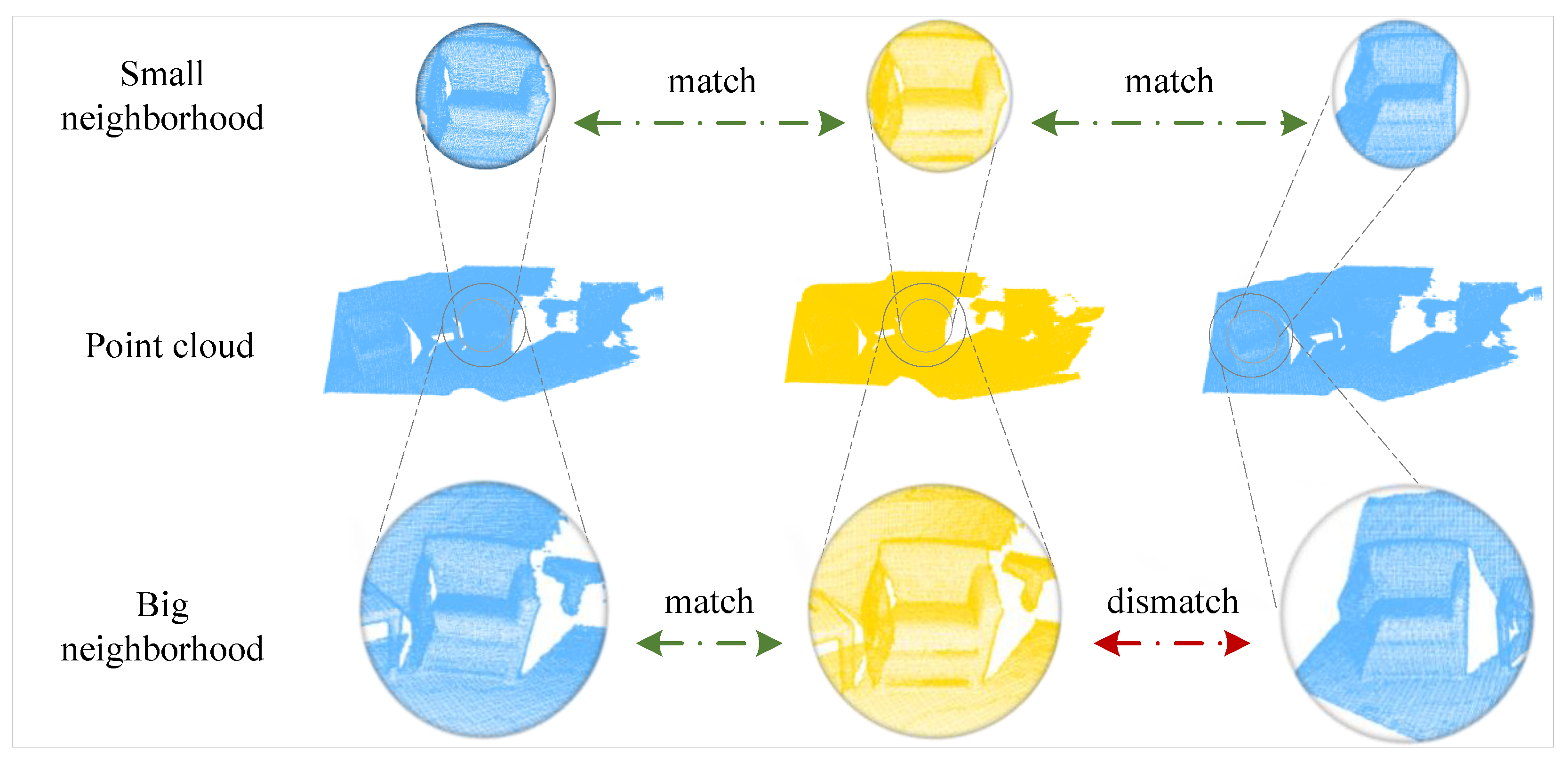
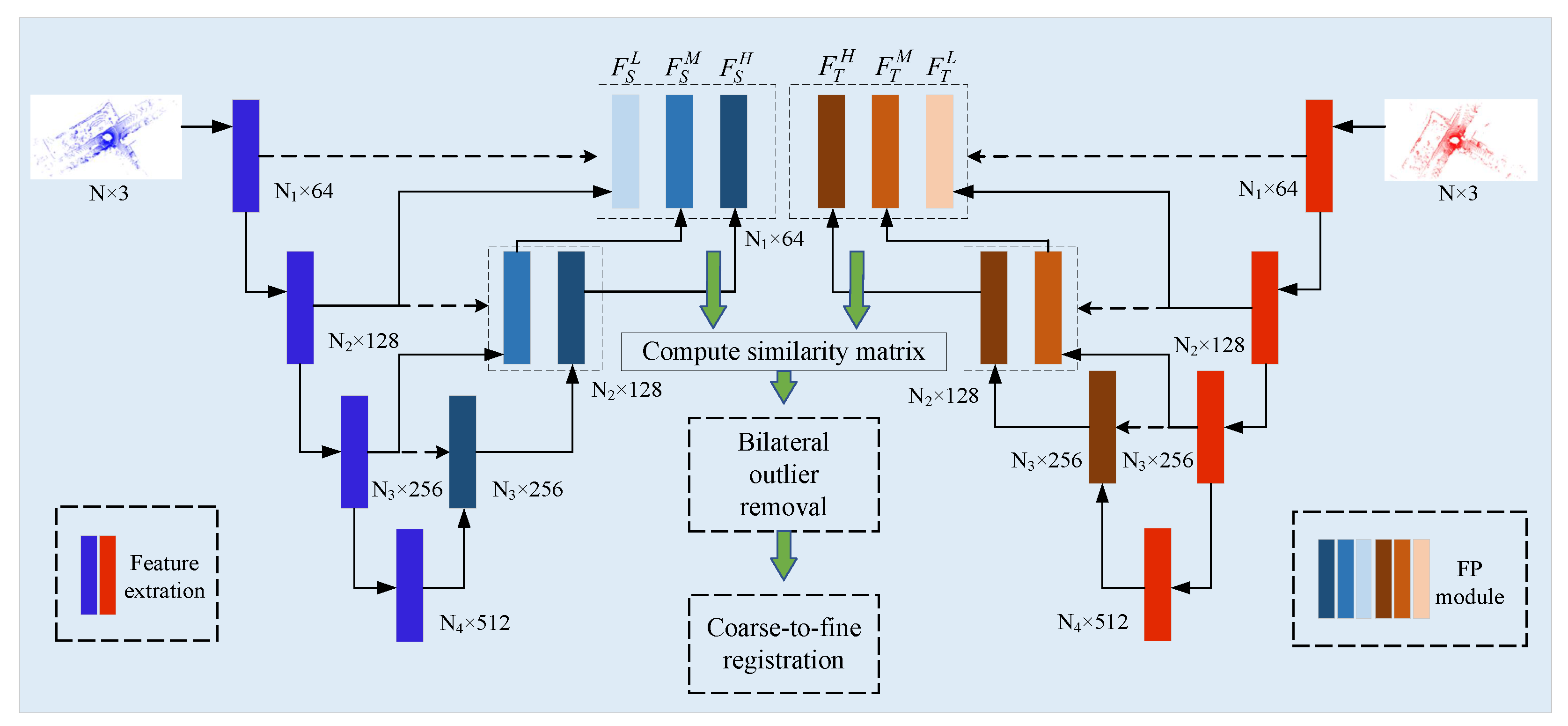
MSPR-Net: A Multi-Scale Features Based Point Cloud Registration Network

1
Key Laboratory of Cognitive Science, State Ethnic Affairs Commission, Hubei Key Laboratory of Medical Information Analysis and Tumor Diagnosis & Treatment, School of Biomedical Engineering, South-Central Minzu University, Wuhan 430074, China
2
School of Artificial Intelligence and Automation, Huazhong University of Science and Technology, Wuhan 430074, China
*
Author to whom correspondence should be addressed.
Remote Sens. 2022, 14(19), 4874; https://doi.org/10.3390/rs14194874
Submission received: 5 September 2022 / Revised: 20 September 2022 / Accepted: 25 September 2022 / Published: 29 September 2022
(This article belongs to the Special Issue Machine Learning for LiDAR Point Cloud Analysis)

Abstract

Point-cloud registration is a fundamental task in computer vision. However, most point clouds are partially overlapping, corrupted by noise and comprised of indistinguishable surfaces, especially for complexly distributed outdoor LiDAR point clouds, which makes registration challenging. In this paper, we propose a multi-scale features-based point cloud registration network named MSPR-Net for large-scale outdoor LiDAR point cloud registration. The main motivation of the proposed MSPR-Net is that the features of two keypoints from a true correspondence must match in different scales. From this point of view, we first utilize a multi-scale backbone to extract the multi-scale features of the keypoints. Next, we propose a bilateral outlier removal strategy to remove the potential outliers in the keypoints based on the multi-scale features. Finally, a coarse-to-fine registration way is applied to exploit the information both in feature and spatial space. Extensive experiments conducted on two large-scale outdoor LiDAR point cloud datasets demonstrate that MSPR-Net achieves state-of-the-art performance.
Keywords: multi-scale features; 3D point cloud; registration multi-scale features; 3D point cloud; registration
Graphical Abstract

