Communication

One Algorithm to Rule Them All? Defining Best Strategy for Land Surface Temperature Retrieval from NOAA-AVHRR Afternoon Satellites

by
Yves Julien
*,
José A. Sobrino
and
Juan-Carlos Jiménez-Muñoz
Global Change Unit, Image Processing Laboratory, University of Valencia, 46980 Paterna, Spain
*
Author to whom correspondence should be addressed.
Remote Sens. 2024, 16(15), 2720; https://doi.org/10.3390/rs16152720
Submission received: 21 May 2024 / Revised: 25 June 2024 / Accepted: 23 July 2024 / Published: 25 July 2024

Abstract

:
The NOAA-AVHRR (National Oceanographic and Atmospheric Administration–Advanced Very High-Resolution Radiometer) archive includes data from 1981 onwards, which allow for estimating land surface temperature (LST), a key parameter for the study of global warming as well as surface characterization. However, algorithms for LST retrieval were developed before the latest sensors and were based on more reduced atmospheric datasets. Here, we present 50 novel sets of coefficients for an LST retrieval algorithm from NOAA-AVHRR sensors, to which we added one historical methodology, which we validate against historical in situ as well as independent satellite data. This validation shows that the historical algorithm performs surprisingly well, with an in situ RMSE below 1.5 K and a quasi-null bias when compared with independent satellite data. A couple of the novel algorithms also perform within expectations (errors below 1.5 K), so any of these could be used for the complete processing of the AVHRR dataset. In our case, considering consistency with previous works, we opt for the use of the historical algorithm, now also tested for more recent periods.
Keywords:
split-window; LST; LTDR

1. Introduction

For monitoring surface temperatures, the NOAA-AVHRR (National Oceanographic and Atmospheric Administration Advanced Very High-Resolution Radiometer) archive presents the longest publicly available time span (1981 to present). Indeed, this time span covers the acceleration in temperature increase that our planet is suffering from. Despite known limitations (such as the influence of the orbital drift effect—see [1]), this dataset is therefore of the uttermost importance for precise climate warming assessment studies. Moreover, recent advances have shown that an accurate correction of such limitations is within reach [2].
Additionally, the surface temperature over land is a key parameter in the study of vegetation behavior (evapotranspiration [3], growth modeling [4]) and changes [5,6,7], as well as climate modeling [8], Urban Heat Island effect characterization [9,10], climate modeling (see, for example, [11]), and air temperature estimation [12].
Due to the longevity of the NOAA-AVHRR program, algorithms for the retrieval of land surface temperature (LST) already exist [13,14,15,16,17,18,19,20,21,22]. However, because most of these algorithms were developed at least 20 years ago, newer instruments’ band filters have not been taken into account. Therefore, there is a need for testing and validating such historic algorithms for newer sensors.
However, validating new algorithms for this historical dataset is tricky. Field campaigns over areas large enough to be representative at the sensor footprint scale (typically several kilometers) are few currently and were almost inexistent in the 1980s. Historically, algorithms have been validated with limited measurements [20], although recently a considerable amount of data is sometimes used [23].
Finally, atmospheric databases now include a larger number of profiles, mandatory for coefficient estimation, and therefore could be useful for the development of newer algorithms. As regards their implementation strategy, a single algorithm to process the whole dataset would allow for an easier application, although, failing that, a combination of algorithms could be used.
This is the aim of this paper: testing and validating both a historical and several novel algorithms for the estimation of LST from the NOAA-AVHRR archive. More specifically, we will:
  • Provide information on the different datasets used for the simulation and validation of LST algorithms (Section 2);
  • Describe the methodology used for algorithm coefficients determination and their validation (Section 3);
  • Present the results of this validation (Section 4);
  • And discuss the obtained results and select which algorithm or combination of algorithms we will use for further studies of the NOAA-AVHRR archive (Section 5).

2. Data

2.1. Simulation Data

Algorithm coefficients are retrieved from simulated datasets of at-sensor brightness temperatures under a number of atmospheric conditions and surface emissivities. These simulated datasets were generated from forward simulations based on the radiative transfer equation and MODTRAN-5 outputs, as described in [24]. This procedure allows us to reproduce the sensor brightness temperatures of the different sensor bands under different atmospheric conditions and over different surface types. Atmospheric conditions were simulated from five different atmospheric vertical profile databases, namely, TIGR61, TIGR1761, TIGR2311, STD66, and GAPRI. These are radiosonde datasets that include air temperature, relative humidity, and pressure at different atmospheric layers for the whole world. The different versions of the TIGR database and the STD66 database are described in detail in [25], whereas the GAPRI database is described in detail in [26].
Surface conditions (emissivity values) were characterized through emissivity laboratory spectra extracted from the ECOSTRESS spectral library [27], which includes both natural and artificial surfaces’ emissivities measured in laboratory conditions, although only natural surfaces were considered in this work. Spectral outputs were averaged using the spectral response functions of the different sensor bands.

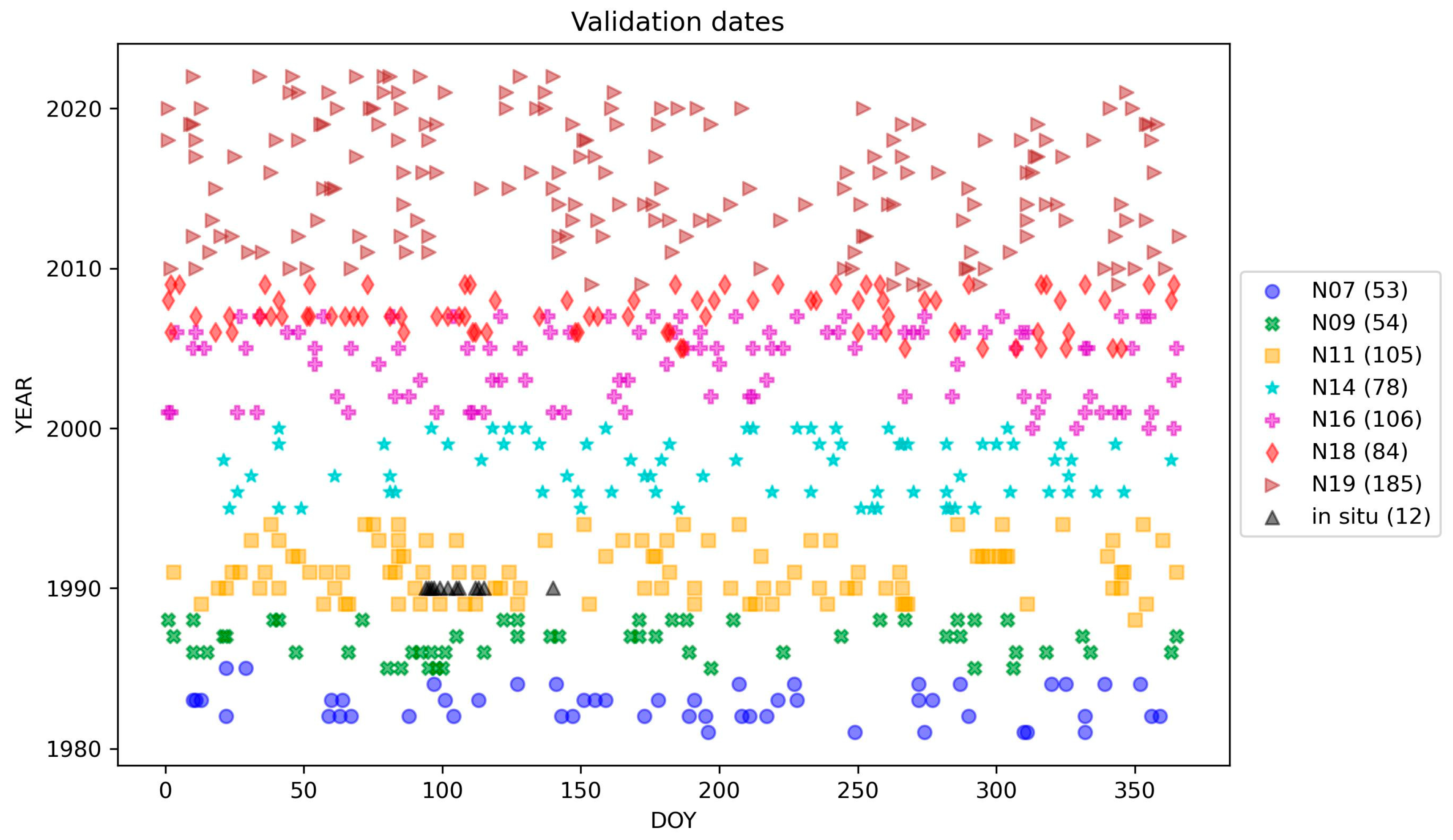
2.2. In Situ Validation Data

In the absence of large and publicly available validation data before 2000, we settled for the use of already published in situ LST data fully described in [28,29]. The location of their study is the Walpeup site in NW Victoria, Australia (35°11′58′′S, 142°03′51′′E), in a wheat growing area of 1.2 km extension with a dry climate. In situ data were retrieved by means of contact temperature transducers placed both on the ground and at crop height after thorough calibration. More details about this site can be found in [28]. For our validation, we used the data shown in Table 4 of Ref. [29], corresponding to the daytime surface temperatures retrieved from solid-state temperature transducers covered with foil between 4 April and 20 May 1990.

2.3. NOAA-AVHRR Data

Long-Term Data Record Version 5 (LTDR-V5 [30]) AVH09C1 products have been used in this study. These data include the surface reflectances in red, near-, and short-wave infrared images, as well as brightness temperatures in thermal infrared images, and their quality assessment. Although the sensor spatial footprint at nadir is 1.1 km, the spatial resolution of the dataset is 0.1° in both latitude and longitude. Data are available from July 1981 to present at a daily temporal resolution. In our case, we used the red, near-infrared, and thermal infrared images available within each product, as well as the cloud mask information. For validation purposes, we randomly selected 665 dates over the entire time span of the dataset (1981–2022), covering the activity periods of NOAA-7, 9, 11, 14, 16, 18, and 19 (hereafter labeled as N07, N09, N11, N14, N16, N18, and N19, respectively). To these random dates, we added the 12 dates with matching in situ data availability (see Section 2.2). Figure 1 shows the time distribution of the complete satellite validation dataset.

2.4. Independent Satellite LST Data

Additionally, independent LST data from an MSG-SEVIRI (Meteosat Second Generation-Spinning Enhanced Visible and InfraRed Imager) sensor have been used. These data are retrieved through the application of a split-window approach similar to the one presented here, with the additional inclusion of observation angle effects [23] to the raw data received by our antenna at our facilities, following a standard retrieval procedure [31]. The MSG-SEVIRI data correspond to a hemispherical view of our planet centered above the (0, 0) longitude and latitude coordinates and are acquired every 15 min at a spatial resolution of 3 by 3 km at nadir. The raw data comprise information in the red, as well as near-, short-wave, and thermal infrared ranges, although we used only the cloud-masked final LST product for our validation. To save computational time, we used the 177 BELMANIP [32] sites located within the SEVIRI observational disk for this validation. These sites were originally selected for their homogeneity and their large span of validated land cover types, useful for remote sensing validation. For more information on these sites, please refer to [2]. The MSG-SEVIRI LST data corresponding to the AVHRR observations for the period between 2007 and 2015 in Figure 1 were used.

3. Methodology

3.1. LST Algorithm

We used a split-window algorithm for LST retrieval. This algorithm is a physics-based algorithm derived directly from radiative transfer equations under minimal empirical simplifications [20,33]. This algorithm is based on the differential absorption concept, which states that atmospheric effects on brightness temperatures are proportional to their differences in two different spectral bands. The general structure of the algorithm used in this work is as follows:
T s = T 4 + a 1 T 4 T 5 + a 2 T 4 T 5 2 + a 0 + a 3 + a 4 w 1 ε + ( a 5 + a 6 w ) ε ,
where Ts corresponds to the LST; T4 and T5 are the brightness temperatures of AVHRR channels 4 and 5, respectively; w is the total amount of atmospheric water vapor, and ε and ∆ε correspond, respectively, to the average and differential emissivity of AVHRR channels 4 and 5. a0 to a6 are the algorithm coefficients, to be determined by statistical regression from the simulated data (Section 2.1). The algorithm given by Equation (1) has been used in a number of studies for LST retrieval from different sensors, and it has been validated over different land covers [20,24].

3.2. Validation

For the Walpeup site, we retrieved LST values to the nearest pixel for each algorithm and each date and then estimated standard statistics (bias, RMSE) to assess the error. To validate our algorithms for more recent platforms (NOAA-18 and 19), we used independent LST data (from 2007 to 2015) from the MSG-SEVIRI platform. Since SEVIRI data have a similar spatial resolution to publicly available datasets (such as the Long-Term Data record [30]), these independent data should allow for an adequate validation of our algorithms. MSG-SEVIRI data, with a 15-min temporal resolution, can help retrieve LST observations concomitant to an NOAA-AVHRR overpass. To this end, the approximated timing of the NOAA-AVHRR overpass for each of the 177 BELMANIP selected sites has been estimated [2]. To this end, we used a harmonic approximation [34] of the Equator Crossing Times of the NOAA platforms from which the LST has been retrieved, which allowed us to compare them to simultaneous MSG-SEVIRI observations. As for the previous case, we estimated bias and RMSE values between each of the described algorithms and the MSG-SEVIRI-derived LST values averaged over all the selected sites.
Finally, we compared our new algorithms against the reference algorithm presented in [20] (hereafter referred to as SR2000). To that end, we estimated the spatially averaged RMSE for each of the 665 dates shown in Figure 1, between each algorithm and the reference one, and then averaged the obtained RMSEs for each satellite platform (N07 to 14).

4. Results

Table 1 presents the coefficients obtained from radiative transfer simulations of each filter (each satellite, as well as averaged filters for N07 to 14, 16 to 19, and 7 to 19) by using each of the aforementioned atmospheric databases. Along with these coefficients, the overall error for all the simulated databases is shown. This error reaches unsatisfactory values (>1.5 K) in one case for the STD66 dataset, and in 4 to 5 cases for the TIGR1761 and TIGR2311 datasets. As for the two remaining datasets, they present satisfactory error values, although the ones for the TIGR61 dataset are slightly lower. We also included in Table 1 the coefficients of the SR2000 algorithm, which were estimated from a different radiosonde database and using only the NOAA7 to 14 instrument filters [20].
Table 2 presents the results of the validation of the different LST algorithms including N11 satellite data and using the different atmospheric databases presented. The lowest absolute bias values (<0.1 K) correspond to N11 algorithms based on the GAPRI and TIGR1761 atmospheric datasets, as well as to the N07–19 algorithm based on the TIGR61 atmospheric dataset. As for the RMSE values, they are satisfactory (<1.5 K) in most cases, excluding the N11 algorithms based on the STD66, TIGR2311, and TIGR61 atmospheric datasets, as well as the N07–14 algorithm based on the TIGR61 dataset. The lowest RMSE value (1.09 K) is obtained for the N07–19 algorithm based on the TIGR61 dataset. Note that the SR2000 algorithm performs satisfyingly, in agreement with the error presented in [20].
Table 3 presents the average bias values of our algorithms when compared with the LST values retrieved from independent satellite data (MSG-SEVIRI). These biases have been averaged for N18 and 19 to evaluate the bias of using these algorithms while correcting the LTDR-V5 dataset between 2007 and 2015, as an alternative to using the N16–19 or N07–19 generic algorithms. These biases have been detailed for each of the atmospheric datasets used to determine algorithm coefficients. Most values are above our acceptability threshold (1.5 K). Once again, among the novel algorithms, the N07–19 algorithm derived from the TIGR61 dataset performs best. However, the SR2000 algorithm reaches a quasi-null bias value. The RMSE values are, for all cases, between 6 and 7 K. These results remain true when clustering the errors by vegetation classes. Although high, these errors are not unexpected because the differences between the compared datasets in terms of sun–target–sensor geometry and the spatial footprint of each pixel are large.
Table 4 presents the average errors (RMSEs) of our tested algorithms when compared with the SR2000 method. These errors have been averaged for NOAA7, 9, 11, and 14 to evaluate the error when using these algorithms while correcting the LTDR-V5 dataset up to roughly 2000, as an alternative to using the NOAA7–14 or NOAA7–19 algorithms. These errors have been detailed for each of the atmospheric datasets used to determine algorithm coefficients. These errors are acceptable (<1.5 K) in most cases, except for the N07–19 algorithm coefficients estimated with the GAPRI dataset, and for the individual satellites, as well as for the N07–19 algorithms using the TIGR1761 datasets.

5. Discussion

5.1. Validation Strategy

As mentioned in the introduction, the main problem with validating algorithms for historical datasets with coarse resolution is the lack of suitable in situ data. Due to the size of the pixel footprint of the LTDR-V5 dataset (roughly 10 km by 10 km), the sheer size of the area to characterize and over which temperature measurements should be carried out makes extensive field campaigns unrealistic. The measurements carried out in [27], while still not extensive enough to characterize our pixel footprint, are representative enough of the area for the validation task to be carried out and to provide satisfactory results. As a matter of fact, these measurements were used to validate the SR2000 historical algorithm, although with the AVHRR sensor’s native resolution (1.1 km), and led to similar RMSE errors to the ones obtained for this very algorithm in this study.
Although historically algorithms have been validated with few measurements, we opted to complement our limited in situ validation with a comparison to the SR2000 algorithm, since it has been used widely for LST estimation [20,35,36]. Moreover, we compared our results from thoroughly characterized sites with independent satellite data validated with four years of hourly data from four in situ sites [23]. MSG-SEVIRI’s 15-min temporal resolution allows for a coincident LST estimation with the NOAA-AVHRR instrument, although the differences in their pixel footprint size and geometry lead to high RMSE values. Other satellite data could be used, although errors due to pixel footprints should be similar, as should additional errors due to the temporal mismatch between LST observations.
Alternative datasets, such as the ERA5 [37], are not well suited for validation tasks [38,39]. First, ERA5’s skin temperature is structurally different from LST as it is an interpolation of the air temperature at ground level. Second, the spatial resolution of the dataset is of the order of 0.3° at best, while homogeneous land covers at this scale are rare.

5.2. Selection of Best Suited Algorithm

When estimating the LST in the NOAA-AVHRR data, three different strategies can be used: implementing a different algorithm for each platform; implementing two algorithms, one for each instrument version (the AVHRR/2 for up to NOAA14 and the AVHRR/3 for those afterwards); or implementing a unique algorithm for the whole dataset. Of course, implementing a unique algorithm is easier and may decrease spurious discontinuities during satellite transition (in addition to orbital drift effects [1]). However, in case this option was to be discarded due to unacceptable errors, the other options had to be tested.
Nonetheless, we see that for all validation strategies, the observed errors generally decrease with the number of platforms considered in the algorithm coefficient estimation, such that the N07–19 option (one algorithm for all platforms) seems to be the best option. This could be explained by the averaging effect of considering several filters thus decreasing the sensitivity of the coefficients to specific factors (emissivity, water vapor).
Because the usually accepted error in LST retrieval for NOAA-AVHRR data is below 1.5 K, the N07–19 algorithm, for which coefficients have been determined by simulations with the TIGR2311 dataset, has to be rejected due to its RMSE from the simulation itself (Table 1). All remaining algorithms perform satisfactorily when compared with the ground truth (Table 2), although after comparison with independent MSG LST data over the period of 2007–2015, the only algorithms with biases below 1.5 K are the TIGR2311, STD66, TIGR61, and SR2000. As a matter of fact, the latter has a quasi-null bias value. When comparing our new algorithms with the one published in [20] (Table 4), we see that the algorithms based on the GAPRI and TIGR1761 datasets present unacceptable deviations.
The reason why the SR2000 algorithm, for which coefficients were estimated from a smaller atmospheric dataset, behaves comparably to or better than the novel algorithms presented here remains unclear. This could be due to a more linear distribution of the water vapor amount used to simulate different atmospheres. However, this deserves to be investigated thoroughly, although it is beyond the scope of this paper.
In light of the results presented here, and considering that the SR2000 algorithm had already been deemed fit for LST estimations from the NOAA-7, -9, and -11 platforms [40], it seems that the SR2000 algorithm is perfectly suited for the estimation of LST for the afternoon platforms NOAA-07 to NOAA-19, as these are the ones based on the STD66 and TIGR61 datasets. Moreover, the SR2000 is the algorithm we have been using in previous works. Therefore, this is the algorithm we will use for further time series investigations and orbital drift corrections of the whole NOAA dataset.

6. Conclusions

In this work, we have tested 51 different algorithms to estimate LSTs from historical NOAA data (up to present). These algorithms have been compared with rare historical in situ data, as well as with independent MSG-SEVIRI satellite data and a historical algorithm based on pre-2000 NOAA-AVHRR characteristics. As a general result, the larger the number of satellite platforms included in the algorithm coefficient retrieval, the lower the resulting validation error. Interestingly, the historical algorithm performs slightly better than the proposed algorithms based on more extensive atmospheric datasets and a higher number of platforms. Therefore, we will use this historical algorithm to process the whole NOAA-AVHRR archive for orbital drift correction and time series research.

Author Contributions

Conceptualization, Y.J., J.-C.J.-M. and J.A.S.; methodology, Y.J., J.-C.J.-M. and J.A.S.; software, Y.J. and J.-C.J.-M.; validation, Y.J.; formal analysis, Y.J.; investigation, Y.J.; resources, J.A.S.; data curation, Y.J. and J.-C.J.-M.; writing—original draft preparation, Y.J. and J.-C.J.-M.; writing—review and editing, J.A.S.; visualization, Y.J.; project administration, J.A.S.; funding acquisition, J.A.S. All authors have read and agreed to the published version of the manuscript.

Funding

This study has been funded by Thales Alenia Space España S.A (MORERA, project MIG-20201026).

Data Availability Statement

Dataset available on request from the authors.

Conflicts of Interest

The authors declare no conflicts of interest.

References

  1. Price, J.C. Using spatial context in satellite data to infer regional scale evapotranspiration. IEEE Trans. Geosci. Remote Sens. 1990, 28, 940–948. [Google Scholar] [CrossRef]
  2. Julien, Y.; Sobrino, J.A. Towards a Reliable Correction of NOAA AVHRR Orbital. Drift. Front. Remote Sens. 2022, 3, 8. [Google Scholar] [CrossRef]
  3. Sobrino, J.A.; Gómez, M.; Jiménez-Muñoz, J.C.; Olioso, A. Application of a simple algorithm to estimate daily evapotranspiration from NOAA-AVHRR images for the Iberian Peninsula. Remote Sens. Environ. 2007, 110, 139–148. [Google Scholar] [CrossRef]
  4. Corbari, C.; Sobrino, J.A.; Mancini, M.; Hidalgo, V. Land surface temperature representativeness in a heterogeneous area through a distributed energy-water balance model and remote sensing data. Hydrol. Earth Syst. Sci. 2010, 14, 2141–2151. [Google Scholar] [CrossRef]
  5. Nemani, R.; Running, S. Land cover characterization using multitemporal red, near-IR, and thermal-IR data from NOAA/AVHRR. Ecol. Appl. 1997, 7, 79–90. [Google Scholar] [CrossRef]
  6. Julien, Y.; Sobrino, J.A. The Yearly Land Cover Dynamics (YLCD) method: An analysis of global vegetation from NDVI and LST parameters. Remote Sens. Environ. 2009, 113, 329–334. [Google Scholar] [CrossRef]
  7. Sobrino, J.A.; Julien, Y. Trend analysis of global MODIS-Terra vegetation indices and land surface temperature between 2000 and 2011. IEEE J. Sel. Top. Appl. Earth Obs. Remote Sens. 2013, 6, 2139–2145. [Google Scholar] [CrossRef]
  8. Flato, G.; Marotzke, J.; Abiodun, B.; Braconnot, P.; Chou, S.C.; Collins, W.; Cox, P.; Driouech, F.; Emori, S.; Eyring, V.; et al. Evaluation of Climate Models. In Climate Change 2013: The Physical Science Basis. Contribution of Working Group I to the Fifth Assessment Report of the Intergovernmental Panel on Climate Change; Stocker, T.F., Qin, D., Plattner, G.-K., Tignor, M., Allen, S.K., Boschung, J., Nauels, A., Xia, Y., Bex, V., Midgley, P.M., Eds.; Cambridge University Press: Cambridge, UK; New York, NY, USA, 2013. [Google Scholar]
  9. Sobrino, J.A.; Oltra-Carrió, R.; Sòria, G.; Jiménez-Muñoz, J.C.; Franch, B.; Hidalgo, V.; Mattar, C.; Julien, Y.; Cuenca, J.; Romaguera, M.; et al. Evaluation of the surface urban heat island effect in the city of Madrid by thermal remote sensing. Int. J. Remote Sens. 2013, 34, 3177–3192. [Google Scholar] [CrossRef]
  10. Lehoczky, A.; Sobrino, J.A.; Skokovic, D.; Aguilar, E. The Urban Heat Island Effect in the City of Valencia: A Case Study for Hot Summer Days. Urban Sci. 2017, 1, 9. [Google Scholar] [CrossRef]
  11. Tomlinson, C.J.; Chapman, L.; Thornes, J.E.; Baker, C. Remote sensing land surface temperature for meteorology and climatology: A review. Met. Apps 2011, 18, 296–306. [Google Scholar] [CrossRef]
  12. Prihodko, L.; Goward, S.N. Estimation of air temperature from remotely sensed surface observations. Remote Sens. Environ. 1997, 60, 335–346. [Google Scholar] [CrossRef]
  13. Price, J.C. Land surface temperature measurements from split-window channels of the NOAA advance very high-resolution radiometer. J. Geophys. Res. 1984, 89, 7231–7237. [Google Scholar] [CrossRef]
  14. Prata, A.J.; Platt, C.M.R. Land surface temperature measurements from the AVHRR. In Proceedings of the 5th AVHRR Data Users Meeting, Tromso, Norway, 25–28 June 1991; EUM PO9. pp. 433–438. [Google Scholar]
  15. Vidal, A. Atmospheric and emissivity correction of land surface temperature measured from satellite using ground measurements or satellite data. Int. J. Remote Sens. 1991, 12, 2449–2460. [Google Scholar] [CrossRef]
  16. Ulivieri, C.; Castronuovo, M.M.; Francioni, R.; Cardillo, A. A split-window algorithm for estimating land surface temperature satellites. Research 1994, 14, 59–65. [Google Scholar] [CrossRef]
  17. Becker, F.; Li, Z. Surface temperature and emissivity at various scales: Definition, measurement and related problems. Remote Sens. Rev. 1995, 12, 225–253. [Google Scholar] [CrossRef]
  18. Francois, C.; Ottle, C. Atmospheric corrections in the thermal infrared: Global and water vapor dependent split-window algorithms-applications to ATSR and AVHRR data. IEEE Trans. Geosci. Remote Sens. 1996, 34, 457–470. [Google Scholar] [CrossRef]
  19. Wan, Z.; Dozier, J. A generalized split-window algorithm for retrieving land-surface temperature from space. IEEE Trans. Geosci. Remote Sens. 1996, 34, 892–905. [Google Scholar] [CrossRef]
  20. Sobrino, J.A.; Raissouni, N. Toward remote sensing methods for land cover dynamic monitoring: Application to Morocco. Int. J. Remote Sens. 2000, 21, 353–366. [Google Scholar] [CrossRef]
  21. Ma, Y.; Tsukamoto, O. Combining Satellite Remote Sensing with Field Observations for Land Surface Heat Fluxes Over Inhomogeneous Landscape, China Meteorol.; China Meteorological Press: Beijing, China, 2002. [Google Scholar]
  22. Wan, Z. New refinements and validation of the collection-6 MODIS land-surface temperature/emissivity product. Remote Sens. Environ. 2014, 140, 36–45. [Google Scholar] [CrossRef]
  23. Sobrino, J.A.; Julien, Y.; Jiménez-Muñoz, J.-C.; Skokovic, D.; Sòria, G. Near real-time estimation of Sea and Land surface temperature for MSG SEVIRI sensors. Int. J. Appl. Earth Obs. Geoinf. 2020, 89, 2096. [Google Scholar] [CrossRef]
  24. Jimenez-Munoz, J.-C.; Sobrino, J.A. Split-window coefficients for land surface temperature retrieval from low-resolution thermal infrared sensors. IEEE Geosci. Remote Sens. Lett. 2008, 5, 806–809. [Google Scholar] [CrossRef]
  25. Jimenez-Munoz, J.C.; Cristobal, J.; Sobrino, J.A.; Soria, G.; Ninyerola, M.; Pons, X. Revision of the single-channel algorithm for land surface temperature retrieval from landsat thermal-infrared data. IEEE Trans. Geosci. Remote Sens. 2009, 47, 339–349. [Google Scholar] [CrossRef]
  26. Mattar, C.; Durán-Alarcón, C.; Jiménez-Muñoz, J.C.; Santamaría-Artigas, A.; Olivera-Guerra, L.; Sobrino, J.A. Global Atmospheric profiles from reanalysis information (GAPRI): A new database for earth surface temperature retrieval. Int. J. Remote Sens. 2015, 36, 5045–5060. [Google Scholar] [CrossRef]
  27. Meerdink, S.K.; Hook, S.J.; Roberts, D.A.; Abbott, E.A. The ECOSTRESS spectral library version 1.0. Remote Sens. Environ. 2019, 230, 111196. [Google Scholar] [CrossRef]
  28. Prata, A.J.; O’Brien, D.M.; Platt, C.M.R. Algorithms for deriving land surface temperature from satellite measurements. In Proceedings of the 5th Australasian Remote Sensing Conference, Perth, WA, Australia, 8–12 October 1990; pp. 256–266. [Google Scholar]
  29. Prata, A.J. Validation Data for Land Surface Temperature Determination from Satellites; /A.J. Prata. Aspendale, Vic.; CSIRO Division of Atmospheric Research: Mordialloc, Australia, 1994. [Google Scholar]
  30. Pedelty, J.; Devadiga, S.; Masuoka, E.; Brown, M.; Pinzon, J.; Tucker, C.; Vermote, E.; Prince, S.; Nagol, J.; Justice, C.; et al. Generating a long-term land data record from the AVHRR and MODIS Instruments. In Proceedings of the 2007 IEEE International Geoscience and Remote Sensing Symposium, Barcelona, Spain, 23–28 July 2007; pp. 1021–1025. [Google Scholar] [CrossRef]
  31. Julien, Y.; Sobrino, J.A.; Sòria, G. Retrieving and broadcasting near-real-time biophysical parameters from MODIS and SEVIRI receiving stations at the global change unit of the University of Valencia. Int. J. Remote Sens. 2015, 36, 5273–5288. [Google Scholar] [CrossRef]
  32. Baret, F.; Morissette, J.; Fernandes, R.; Champeaux, J.L.; Myneni, R.; Chen, J.; Plummer, S.; Weiss, M.; Bacour, C.; Garrigues, S.; et al. Evaluation of the representativeness of networks of sites for the validation and inter-comparison of land bio-physical products proposition of the CEOS-BELMANIP. IEEE Trans. Geosci. Remote Sens. 2006, 44, 1794–1803. [Google Scholar] [CrossRef]
  33. Sobrino, J.A.; Li, Z.-L.; Stoll, M.P.; Becker, F. Multi-channel and multi-angle algorithms for estimating sea and land surface temperature with ATSR data. Int. J. Remote Sens. 1996, 17, 2089–2114. [Google Scholar] [CrossRef]
  34. Ignatov, A.; Laszlo, I.; Harrod, E.D.; Kidwell, K.B.; Goodrum, G.P. Equator crossing times for NOAA, ERS and EOS sun-synchronous satellites. Int. J. Remote Sens. 2004, 25, 5255–5266. [Google Scholar] [CrossRef]
  35. Sobrino, J.A.; Julien, Y. Exploring the Validity of the Long-Term Data Record V4 Database for Land Surface Monitoring. IEEE J. Sel. Top. Appl. Earth Obs. Remote Sens. 2016, 9, 3607–3614. [Google Scholar] [CrossRef]
  36. Sobrino, J.; Julien, Y.; Morales, L. Multitemporal analysis of PAL images for the study of land cover dynamics in South America. Glob. Planet. Chang. 2006, 51, 172–180. [Google Scholar] [CrossRef]
  37. Kalnay, E.; Kanamitsu, M.; Kistler, R.; Collins, W.; Deaven, D.; Gandin, L.; Iredell, M.; Saha, S.; White, G.; Woollen, J.; et al. The NCEP/NCAR 40-year reanalysis project. In Renewable Energy; Routledge: London, UK, 2018; pp. Vol1_146–Vol1_194. [Google Scholar]
  38. Trigo, I.F.; Boussetta, S.; Viterbo, P.; Balsamo, G.; Beljaars, A.; Sandu, I. Comparison of model land skin temperature with remotely sensed estimates and assessment of surface-atmosphere coupling. J. Geophys. Res. Atmos. 2015, 120, 12096–12111. [Google Scholar] [CrossRef]
  39. Johannsen, F.; Ermida, S.; Martins, J.P.A.; Trigo, I.F.; Nogueira, M.; Dutra, E. Cold Bias of ERA5 Summertime Daily Maximum Land Surface Temperature over Iberian Peninsula. Remote Sens. 2019, 11, 2570. [Google Scholar] [CrossRef]
  40. Sobrino, J.A.; Morales Salinas, L. Final Project Report: Impacto del Cambio Climático en la Sustentabilidad de la Producción Ganadera de la Región Mediterránea Árida y Semiárida de Chile, Agencia Española de Cooperación Internacional AECI A/229/03); Sobrino, J.A., Ed.; University of Valencia: Valencia, Spain, 2005. [Google Scholar]
Figure 1. Distribution of the satellite validation data through 1981–2022. The number of validation data points for each satellite are in parentheses.
Remotesensing 16 02720 g001
Table 1. Algorithm coefficients (Equation (1)) for each NOAA platform, as well as averaged filters for N07 to 14, N16 to 19, and N07 to 19 for each atmospheric dataset (column 1). RMSE represents the overall error for all the simulated databases (in K). Values in bold are above expected accuracy (1.5 K).
AlgorithmFiltera1a2a3a4a5a6a0RMSE
SR2000N07–141.400.3257.00−5.00−161.0030.000.831.30
GAPRIN071.810.1551.47−3.50−134.4721.080.231.35
N092.050.1550.35−3.20−146.7123.260.331.45
N111.930.1551.05−3.39−140.8622.260.271.40
N141.530.1351.91−3.58−118.1818.330.181.21
N161.560.1952.17−3.52−123.4218.840.141.27
N181.420.1452.11−3.63−113.6217.510.141.17
N191.270.1352.18−3.63−105.4116.020.101.11
N07–141.820.1551.30−3.46−134.4821.130.251.35
N07–191.630.1551.89−3.59−124.7719.370.191.27
N16–191.410.1552.13−3.58−113.5317.370.121.18
STD66N071.650.3547.13−2.99−127.2319.420.211.43
N091.960.3245.95−2.57−141.1622.270.281.56
N111.810.3446.53−2.79−134.5720.950.241.50
N141.380.2947.71−3.17−110.8416.600.271.27
N161.240.4548.67−3.38−111.6615.560.151.30
N181.200.3148.18−3.33−105.2115.310.141.22
N191.000.3048.77−3.51−95.8013.440.131.13
N07–141.690.3246.89−2.91−127.7619.680.251.43
N07–191.430.3447.76−3.20−116.3517.320.191.33
N16–191.140.3448.50−3.39−103.6414.690.141.21
TIGR61N071.570.4149.66−4.29−126.5818.710.141.27
N091.870.4249.18−4.18−139.4120.940.201.37
N111.720.4149.53−4.28−133.2119.900.171.32
N141.300.3549.66−4.27−109.6415.930.221.13
N161.220.4849.27−4.00−114.6116.370.131.19
N181.130.3549.58−4.22−105.6415.240.111.10
N190.950.3449.35−4.12−97.0713.730.101.04
N07–141.600.4049.60−4.29−126.5418.750.181.26
N07–191.360.3949.72−4.28−116.4516.970.141.19
N16–191.090.3849.34−4.09−105.1615.020.111.11
TIGR1761N071.780.1942.54−1.05−119.8017.540.201.56
N092.020.1840.81−0.21−131.3619.640.261.69
N111.910.1941.75−0.68−126.1318.720.231.63
N141.520.1743.12−1.25−104.8715.110.261.38
N161.500.2544.71−1.85−106.5814.640.161.41
N181.380.1844.08−1.73−99.1813.950.151.32
N191.210.1744.79−2.02−90.4412.300.131.22
N07–141.800.1842.14−0.85−120.0517.670.241.56
N07–191.590.1943.38−1.41−110.0015.780.191.44
N16–191.350.2044.52−1.87−98.1313.540.151.31
TIGR2311N072.020.2152.23−7.38−130.5919.08−0.031.62
N092.320.1950.52−6.77−144.6621.440.041.76
N112.170.2051.48−7.12−137.9920.360.001.69
N141.710.1852.81−7.54−113.7116.410.031.45
N161.690.2854.06−7.82−116.3316.58−0.071.49
N181.540.2053.69−7.86−107.2815.26−0.091.39
N191.340.1954.29−8.04−97.3313.52−0.101.31
N07–142.040.2051.86−7.25−131.0619.220.011.62
N07–191.800.2153.05−7.65−119.4217.21−0.041.51
N16–191.510.2254.00−7.90−106.3115.02−0.091.39
Table 2. Bias and RMSE statistics for the Walpeup site for the different tested algorithms (see Section 3 for details). Values in bold are above expected accuracy (1.5 K).
Atmospheric DatasetBIAS (K)RMSE (K)
N11N07–14N07–19N11N07–14N07–19
GAPRI−0.090.130.491.221.131.09
STD66−0.46−0.230.191.631.451.27
TIGR17610.040.230.561.251.171.15
TIGR2311−0.46−0.240.151.551.381.21
TIGR61−0.61−0.360.091.801.591.35
SR2000−0.421.41
Table 3. Average bias between the tested and MSG-SEVIRI algorithms for each atmospheric dataset in the case of all individual platform algorithms N18 to N19 (second column), the N16–19 algorithm (third column), and the N07–19 algorithm (third column). Values in bold are above the expected accuracy (1.5 K).
Atmospheric DatasetBias (K)
N11N07–14N07–19
GAPRI−2.16−2.18−1.66
STD66−1.58−1.50−0.93
TIGR1761−2.26−2.24−1.76
TIGR2311−1.81−1.76−1.21
TIGR61−1.41−1.33−0.70
SR20000.04
Table 4. Average RMSE between the tested and SR2000 algorithms for each atmospheric dataset in the case of all individual platform algorithms N07 to N14 (second column), the N07–14 algorithm (third column), and the N07–19 algorithm (third column). Values in bold are above the expected accuracy (1.5 K).
Atmospheric DatasetRMSE (K)
N07, N09, N11, N14N07–14N07–19
GAPRI1.331.191.52
STD661.090.931.10
TIGR17611.581.451.70
TIGR23111.160.971.19
TIGR611.100.981.04
Disclaimer/Publisher’s Note: The statements, opinions and data contained in all publications are solely those of the individual author(s) and contributor(s) and not of MDPI and/or the editor(s). MDPI and/or the editor(s) disclaim responsibility for any injury to people or property resulting from any ideas, methods, instructions or products referred to in the content.

