Technical Note

Laser Observations of GALILEO Satellites at the CBK PAN Astrogeodynamic Observatory in Borowiec

Space Research Centre Polish Academy of Sciences (CBK PAN), Astrogeodynamic Observatory in Borowiec, ul. Bartycka 18a, 00-716 Warszawa, Poland
*
Author to whom correspondence should be addressed.
Remote Sens. 2024, 16(15), 2862; https://doi.org/10.3390/rs16152862
Submission received: 12 June 2024 / Revised: 19 July 2024 / Accepted: 23 July 2024 / Published: 5 August 2024
(This article belongs to the Special Issue Advanced Remote Sensing Technology in Modern Geodesy)

Abstract

:
The laser station (BORL) owned by the Space Research Centre of the Polish Academy of Sciences and situated at the Astrogeodynamic Observatory in Borowiec near Poznań regularly observes more than 100 different objects in low Earth orbit (LEO) and medium Earth orbit (MEO). The BORL sensor’s laser observation range is from 400 km to 24,500 km. The laser measurements taken by the BORL sensor are utilized to create various products, including the geocentric positions and movements of ground stations, satellite orbits, the components of the Earth’s gravitational field and their changes over time, Earth’s orientation parameters (EOPs), and the validation of the precise Galileo orbits derived using microwave measurements, among others. These products are essential for supporting local and global geodetic and geophysics research related to time. They are crucial for the International Terrestrial Reference Frame (ITRF), which is managed by the International Earth Rotation and Reference Systems Service (IERS). In 2023, the BORL laser station expanded its list of tracked objects to include all satellites of the European satellite navigation system GALILEO, totaling 28 satellites. During that year, the BORL laser station recorded 77 successful passes of GALILEO satellites, covering a total of 21 objects. The measurements taken allowed for the registration of 7419 returns, resulting in 342 normal points. The average RMS for all successful GALILEO observations in 2023 was 13.5 mm.

1. Introduction

The Astrogeodynamic Observatory of the Space Research Centre of the Polish Academy of Sciences in Borowiec is a unique research center in Poland. It is the only facility in the country that conducts both local and global geodynamic, metrological, and gravimetric research related to time. The observatory regularly performs measurements using laser technology (Satellite Laser Ranging—SLR) and Global Navigation Satellite Systems (GNSS) like GPS, GLONASS, GALILEO, and BeiDou, as well as gravimetric techniques [1]. The results of laser observations from the BORL station were obtained using picosecond and nanosecond pulsed Nd:YAG lasers to determine the orbits of various satellites and space debris objects. The high accuracy and precision of picosecond laser measurements support global research in geodesy, geodynamics, and geophysics. The processing of these measurements contributes to defining the International Terrestrial Reference System (ITRS), which is physically implemented as the International Terrestrial Reference Frame (ITRF). The ITRF is created and maintained by the International Earth Rotation and Reference Systems Service (IERS).
Additionally, the laser ranging measurements are used for calibrating GNSS orbits, determining the positions and velocities of ground stations, and calculating coefficients of the Earth’s gravitational field and their variations over time (models of the Earth’s gravitational field), tidal parameters, determining the parameters of the Earth’s rotation, and validation of satellite orbits [2,3,4,5,6,7,8,9,10].
The CBK PAN observatory in Borowiec contributes to global research by studying the rotation of satellites and space debris. This research is crucial for enhancing the understanding of artificial objects’ orbits in Earth’s orbit. The laser observations conducted by CBK PAN have enabled active participation in the development of the national and European Space Surveillance and Tracking (SST) program, which is a key component of the Space Situational Awareness (SSA) program, which is a flagship initiative of the European Commission and the Space Safety program of the European Space Agency (ESA). Additionally, CBK PAN has engaged in new campaigns and observation programs, including safeguarding the European SENTINEL satellites of the COPERNICUS system, which is a significant space program of the European Commission.
In 2023, the BORL laser station began conducting regular measurements of the GALILEO satellites, which form the European Union’s Global Navigation Satellite System. The system currently comprises 28 satellites. GALILEO is compatible with the GPS and GLONASS systems. It is managed by the European Union Agency for the Space Program (EUSPA) with its headquarters in Prague, Czechia. The Control Centers are situated in Oberpfaffenhofen, Germany, and Fucino, Italy.
The International Laser Ranging Service (ILRS) [3] coordinates laser observations of satellites, involving 44 laser stations from around the world [11]. According to data from the ILRS, the first successful laser measurements of GALILEO satellites were carried out on 29 November 2011, using the now-closed Transportable Integrated Geodetic Observatory (TIGO) laser station in Concepcion, Chile. The measurements involved the GALILEO-FM2 satellite, identified as NORAD 37847.
Currently, the ILRS coordinates the observations of 122 objects in all orbital regimes from low Earth orbit (LEO) to Geostationary Orbit (GEO) [12]. Two, so-called “LARGE” GNSS satellite observation campaigns have been conducted, involving satellites from the GLONASS, GALILEO, and COMPASS systems. The initial GNSS satellite campaign, referred to as the first LARGE campaign, took place from 15 February to 15 May 2018. It involved 10 GALILEO satellites being observed by 30 ILRS stations and resulted in a total of 9107 normal points [13]. The subsequent campaign, known as the second LARGE campaign, featured 8 GALILEO satellites and occurred from 1 August to 31 October 2018. During this campaign, 30 ILRS stations provided laser measurements, yielding a total of 11,720 normal points [14]. The primary objective of both campaigns was to enhance the measurement coverage, specifically improving the temporal and spatial coverage of selected satellites from each constellation.

2. Laser Sensor at CBK PAN Borowiec (BORL)

The CBK PAN Borowiec laser station (BORL) is located at the Astrogeodynamic Observatory in Borowiec near Poznań, which is owned by CBK PAN, Warsaw, Poland. A satellite laser sensor is a complex device that includes several components such as a transmitting and receiving telescope, laser modules (picosecond and nanosecond), a time scale, and measurement equipment that consists of two important components: the returning photon detection system and the counter for measuring time intervals. The BORL laser station is the only sensor of its kind in Poland. It was integrated into the ILRS on 13 May 1988 and is now part of the EUROpean LASer network (EUROLAS) consortium, which brings together European stations. The station’s identification details are as follows:
  • Station code: BORL;
  • Station number: 7811;
  • Country: Poland;
  • CDDIS SOD database number: 78113802;
  • IERS DOMES database number: 12205S001.
The complete setup of the laser station can be found on the ILRS website [15]. The primary telescope is installed in a 65 cm Cassegrain transmitting and receiving system, functioning in the azimuth–elevation system. The current laser light source consists of two independent pulsed Nd:YAG laser modules as depicted in Figure 1.
The larger laser is the EKSPLA PL-2250 picosecond pulsed laser manufactured by EKSPLA, Vilnius, Lithuania, which is used to observe active satellites equipped with retroreflectors that reflect the laser beam. The smaller laser is the high-power CONTINUUM SURELITE III nanosecond pulsed laser manufactured by Continuum (today Amplitude), San Jose, CA, USA, which is used to observe space debris objects in the LEO region, such as inactive satellites and launch vehicle units (rocket bodies). The basic parameters of the lasers are presented in Table 1.
One operator controls the entire laser sensor. The sensor control software includes the following functions: preparing an observation plan by taking the ephemeris of objects and converting them to the telescope position, sensor calibration, performing laser distance measurements to observed objects (satellites/space debris), processing measurement data, saving observation results in specific formats, and sending them to databases.
The BORL sensor’s laser observations cover distances ranging from 400 km to approximately 24,500 km. The tracking list comprises over 100 objects, which includes the entire GALILEO satellite constellation consisting of 28 satellites. More detailed information about the construction of the BORL sensor can be found in [16]. The main tasks of the CBK PAN laser sensor in Borowiec are as follows:
  • Performing continuous observations of laser satellites covered by the ILRS.
  • Supporting missions such as LAGEOS-1, LAGEOS-2, LARES, LARES-2, GRACE, and others for the needs of modern geodesy and geodynamics.
  • Providing support for altimetry missions with laser measurements, including missions such as CRYOSAT-2 or JASON-3.
  • Calibrating GNSS satellite orbits.
  • Providing support with laser measurements for Special Mission Support (SMS) for remote sensing missions such as SENTINEL-3A, SENTINEL-3B, and SENTINEL-6A/JASON-CS-A, and contributing to the European COPERNICUS program.
  • Performing continuous observations of space debris under the Space Safety program of the ESA and the Space Surveillance and Tracking program of the European Commission.
Figure 2 displays the quantity of objects monitored by the BORL station from 1992 to 2023. It is evident from the figure that for nearly 20 years, the number of objects detected by the BORL station did not surpass 21. A significant rise in the number of tracked objects occurred in 2015. Subsequently, two separate laser modules were introduced at the BORL station (Figure 1), enabling the initiation of data collection not only from satellites on the ILRS list but also from numerous debris objects.
In addition, between 2011 and 2022, many new satellites were added to the ILRS tracking list, with over 80 being mainly GNSS satellites (62 objects in total) that are still being tracked by laser stations. This increase in satellites also led to a significant rise in the number of objects monitored by the BORL station.

3. GALILEO Constellation

The GALILEO system currently has 28 satellites (Figure 3). The constellation creates two different types of satellites based on their operational nature. The first type is the In-orbit Validation (IOV) satellites, which consist of 4 satellites: E11 (G101), E12 (G102), E19 (G103), and E20 (G104). The second type comprises the remaining 24 satellites, known as the Full Operational Capability (FOC) satellites.
Figure 4 depicts an artist’s representation of the FOC satellite. The GALILEO constellation was divided into three groups due to orbital parameters, orbiting the Earth in circular MEO orbits at an altitude of 23,222 km with an inclination of 56 degrees. Out of the entire GALILEO constellation, two objects failed to reach their intended orbits and instead ended up orbiting the Earth in eccentric orbits with an inclination of 50 degrees. These are the first pair of the FOC GALILEO satellites, E14 and E18, which were launched in 2014 aboard a Soyuz ST rocket, also known as GALILEO objects GSAT-201 (GALILEO 5, Doresa) and GSAT-202 (GALILEO 6, Milena). All GALILEO satellites are equipped with retroreflectors [12], but the IOV and FOC groups differ in the number, size, and material of the retroreflectors they are made of. IOV satellites have 84 Corner Cube Retroreflectors (CCRs) measuring 33 mm × 23.3 mm, made of doped fused silica (Suprasil 311). Satellites from the FOC group have 60 CCRs measuring 28.2 mm × 19.1 mm, made of fused silica.
It has been shown in a paper [19] that kHz laser ranging measurements are important for determining the attitude of GALILEO satellites. By measuring the angle at which the laser beam hits the satellite’s panels to the tracking station, the satellite’s attitude can be determined. It has been found that the FOC GALILEO satellite panels have irregular reflection patterns because of the uneven distribution of retroreflectors in this group of GALILEO satellites [20].
The GALILEO constellation is managed by the EUSPA based in Prague. The GALILEO system offers various high-performance services:
  • Open Service (OS);
  • High-Accuracy Service (HAS);
  • Public Regulated Service (PRS);
  • Search and Rescue Service (SAR);
  • Open Service Navigation Message Authentication (OSNMA);
  • Commercial Authentication Service (CAS);
  • GALILEO Emergency Warning Satellite Service (EWSS).
The GNSS market is growing as more devices and services are being developed using signals from GNSS satellites. According to the EUSPA report, global revenues from GNSS operations are projected to increase from EUR 260 billion in 2023 to around EUR 580 billion [21]. These figures demonstrate the significant impact of GNSS technology on the global economy. Additionally, the GNSS technique and the GALILEO constellation play a crucial role in scientific development by supporting the implementation of the International Terrestrial Reference Frame [22] and the determination of Earth Rotation Parameters (ERPs), which necessitate highly precise satellite orbits [23,24,25].
However, there is inconsistency in determining the orbits of GNSS satellites using single techniques. Therefore, combined solutions (GNSS + SLR) are being proposed. According to a study by [26], the bias of the Length-of-Day parameter is 20% lower in the combined solution compared to the microwave technique. Another significant scientific aspect related to the operation of the GALILEO constellation is the study of general relativity. While these satellites may not be suitable for satellite navigation applications, they are effectively utilized in other scientific research and advanced physical experiments related to general relativity [27,28]. By using the onboard atomic clocks of these satellites (hydrogen masers), it is possible to determine the gravitational redshift with high accuracy. Satellite laser measurements have played a crucial role in these studies, enabling a precise estimation of the orbital uncertainties of the GALILEO satellites [29,30].

4. The Results of Laser Ranging to the GALILEO Satellites

The laser measurements for GALILEO satellites were conducted from 2 April to 28 December 2023. During this period, 77 successful observations of 21 GALILEO satellites were made. A total of 342 normal points and 7419 returns were recorded during these observations, with an average RMS of 1.35 cm for all measurements. The results for all satellites are gathered in Table 2. The normal point window (bin size) for GALILEO satellites is set at 300 s. The laser was fired at the satellites for a total of 33 h, 40 min, and 22 s. The effective measurement time, which is the time when returns were obtained, was 24 h, 21 min, and 14 s.
The most successful measurements were obtained for the G104 (E20), G103 (E19), and G212 (E03) satellites, with 2534, 1118, and 623 returns, respectively. The fewest measurements were obtained for satellites G215 (E21), G204 (E22), G203 (E26), G219 (E36), and G216 (E25), with 17, 24, 32, 36, and 39 returns, respectively. The average root mean square (RMS) from all passes for individual satellites ranges from 0.92 cm to 1.76 cm. The observation conditions for GALILEO satellites at the BORL station have been established to begin when the objects are at an elevation of 50 degrees. The maximum duration for a single-pass observation is limited to 30 min, which is the longest observation period allowed at the BORL station. This limitation is necessary because the GALILEO satellites have high orbits at approximately 23,200 km, resulting in extended pass times over the station, lasting several hours and up to a maximum of around 6.5 h when passing at the zenith. Other objects with high observational priority also pass by during these long pass times.
There are more than 100 objects on the tracking list at the BORL station. If the observation window permits, it can take measurements of the same GALILEO satellite in the next observation slot. The highest number of normal points obtained during a single pass was seven. Typically, there are four normal points per one GALILEO’s observation, and the average duration of successful measurements is approx. 19 min.
Figure 5, Figure 6, Figure 7 and Figure 8 display sample results of laser measurements taken by the BORL sensor for four GALILEO satellites: G212 (E03), GALILEO-104 (E20), GALILEO-208 (E08), and GALILEO-202 (E14). The slant range plots clearly show distinct lines with echoes received from the observed satellites. The fit residuals obtained after post-processing range within single centimeters, with a maximum of +/− 8 cm. The average pass RMS for the passes shown in Figure 5, Figure 6, Figure 7 and Figure 8 is 1.61 cm, the average time bias 11.83 ms, and the average range bias −10.10 m. The results from the BORL station demonstrate high quality and enable the BORL laser station to actively participate in new LARGE campaigns dedicated to GNSS satellites.

5. Summary and Outlook

The BORL station is conducting laser measurements on the GALILEO satellites. The list of objects being tracked will be expanded to include more satellites. Currently, the BORL laser sensor observes 83 cooperative objects from the ILRS list, which includes 28 LEOs and 55 MEOs. The BORL sensor has a range of 24,500 km and provides high-quality laser distance measurements to GALILEO satellites. On average, each pass yields 100 returns and 4 normal points, with an average RMS of 13.5 mm.
However, a major challenge for the BORL station is to increase the number of successful measurements. This challenge is due to the technical limitations of the sensor, specifically tracking inaccuracy caused by the outdated 3-ton telescope assembly from the 1980s. Objects in MEOs face difficulty in being visually observed due to this issue. The worn-out Maksutov auxiliary telescope with a 20 cm aperture and the Tayama CCD camera model TC-3102-08D are unable to capture images of the GNSS satellite on the observation monitor. As a result, the observer must search for the satellite’s photon trace in the observation program.
The BORL station is still using the HAMAMATSU H5023 photodetector, which currently has a low quantum efficiency of several percent. Efforts are underway to install a new auxiliary telescope and a digital camera to observe the sky during laser measurements in the coming months. The new high-resolution system will enable the observation of satellites from the GEO region.
Attention should be focused on the issue of the low number of active laser stations operating within ILRS. The number of satellites equipped with reflectors that need laser measurements has been increasing rapidly in recent years. Only 7 new laser stations have been added in the past decade. However, several stations were shut down during the same period and some were marked as “inactive”. There are 11 upcoming laser stations that are yet to be opened. This indicates that there are essentially no additional active laser stations, as there are currently 44 in operation.
The number of satellites on the ILRS tracking list is increasing rapidly, with a current count of 122. This poses challenges in maintaining a sufficient number of measurements for each mission. Additionally, the distribution of laser stations is uneven, primarily concentrated in the northern hemisphere, particularly in Europe. Some stations do not track during the day, and weather conditions play a significant role in reducing the number of measurements. Other factors that contribute to fewer measurements include failures of the laser sensors and ongoing modernization and repair work at the stations.
The BORL laser station is one of the stations that only observe at night. The fair-weather factor for the station’s geographic location is approximately 40%. This means that the station has around 146 nights suitable for making laser measurements, which are referred to as good observation nights. All laser stations must participate in observing all satellites listed on the ILRS. The stations need to allocate the majority of their observation time to GNSS satellites, which currently number 96, making up 75% of all objects on the ILRS list.
A potential solution could involve using a specialized compact laser sensor designed to measure GNSS satellites. For instance, the miniSLR laser sensor proposal by DLR and DIGOS is a notable example. This system is contained within an aluminum housing measuring 130 × 180 cm [31]. Deploying a suitable number of these automated sensors globally would guarantee comprehensive coverage for the laser measurements of the GNSS satellites, thereby ensuring consistent data collection and precise orbit determination for GALILEO satellites.

Author Contributions

Conceptualization, P.L.; methodology, P.L.; formal analysis, P.L.; data curation, P.M., A.S., M.M. and S.Z.; writing—original draft, P.L.; writing—review & editing, P.L., P.M., T.S., A.S., M.M. and S.Z.; visualization, P.L., P.M. and A.S. All authors have read and agreed to the published version of the manuscript.

Funding

This research received no external funding.

Data Availability Statement

Data is contained within the article.

Conflicts of Interest

The authors declare no conflicts of interest.

References

  1. Annual Report 2022; Centrum B adań Kosmicznych Polska Akademia Nauk; Space Research Centre Polish Academy of Sciences: Warsaw, Poland, 2022; ISBN 978-83-89439-09-3.
  2. Pearlman, M.; Arnold, D.; Davis, M.; Barlier, F.; Biancale, R.; Vasiliev, V.; Ciufolini, I.; Paolozzi, A.; Pavlis, E.C.; Sośnica, K. Laser geodetic satellites: A high-accuracy scientific tool. J. Geod. 2019, 93, 2181–2194. [Google Scholar] [CrossRef]
  3. Pearlman, M.R.; Noll, C.E.; Pavlis, E.C.; Lemoine, F.G.; Combrink, L.; Degnan, J.J.; Kirchner, G.; Schreiber, U. The ILRS: Approaching 20 years and planning for the future. J. Geod. 2019, 93, 2161–2180. [Google Scholar] [CrossRef]
  4. Lejba, P.; Schillak, S. Determination of station positions and velocities fromlaser ranging observations to Ajisai, Starlette and Stella satellites. Adv. Space Res. 2011, 47, 654–662. [Google Scholar] [CrossRef]
  5. Shen, Y.; Guo, J.; Zhao, C.; Yu, X.; Li, J. Earth rotation parameter and variation during 2005–2010 solved with LAGEOS SLR data. Geod. Geodyn. 2015, 6, 55–60. [Google Scholar] [CrossRef]
  6. Sośnica, K.; Jäggi, A.; Meyer, U.; Thaller, D.; Beutler, G.; Arnold, D.; Dach, R. Time variable Earth’s gravity field from SLR satellites. J. Geod. 2015, 89, 945–960. [Google Scholar] [CrossRef]
  7. Jagoda, M.; Rutkowska, M.; Kraszewska, K. The evaluation of time variability of tidal parameters h and l using SLR technique. Acta Geodyn. Geomater. 2016, 14, 153–158. [Google Scholar] [CrossRef]
  8. Bloßfeld, M.; Rudenko, S.; Kehm, A.; Panafidina, N.; Müller, H.; Angermann, D.; Hugentobler, U.; Seitz, M. Consistent estimation of geodetic parameters from SLR satellite constellation measurements. J. Geod. 2018, 92, 1003–1021. [Google Scholar] [CrossRef]
  9. Schillak, S.; Lejba, P.; Michałek, P. Analysis of the quality of SLR station coordinates determined fromLaser Ranging to the LARES satellite. Sensors 2021, 21, 737. [Google Scholar] [CrossRef] [PubMed]
  10. Zajdel, R.; Masoumi, S.; Sośnica, K.; Gałdyn, F.; Strugarek, D.; Bury, G. Combination and SLR validation of IGS Repro3 orbits for ITRF2020. J. Geod. 2023, 97, 87. [Google Scholar] [CrossRef]
  11. ILRS Operational Station Identification Table, Active Stations. Available online: https://ilrs.cddis.eosdis.nasa.gov/network/stations/active/index.html (accessed on 8 May 2024).
  12. ILRS Current Missions. Available online: https://ilrs.gsfc.nasa.gov/missions/satellite_missions/current_missions/index.html (accessed on 8 May 2024).
  13. First 2018 ILRS LARGE (Laser Ranging to GNSS s/c Experiment) Campaign, Summary Report. May 2018. Available online: https://ilrs.gsfc.nasa.gov/docs/2018/LARGE1_20180215_20180515_final.pdf (accessed on 10 June 2024).
  14. Second 2018 ILRS LARGE (Laser Ranging to GNSS s/c Experiment) Campaign, Summary Report. February 2019. Available online: https://ilrs.gsfc.nasa.gov/docs/2018/LARGE2_20180801_20181031_final.pdf (accessed on 10 June 2024).
  15. ILRS BORL Site Log. Available online: https://ilrs.cddis.eosdis.nasa.gov/network/stations/active/BORL_sitelog.html (accessed on 8 May 2024).
  16. Smagło, A.; Lejba, P.; Schillak, S.; Suchodolski, T.; Michałek, P.; Zapaśnik, S.; Bartoszak, J. Measurements to space debris in 2016-2020 by laser sensor at Borowiec Poland. Artif. Satell. J. Planet. Geod. 2022, 56, 119–134. [Google Scholar] [CrossRef]
  17. The Constellation of GALILEO Satellites CREDIT European Space Agency—J. Huart. Available online: https://www.esa.int/ESA_Multimedia/Images/2007/05/GALILEO_constellation (accessed on 8 May 2024).
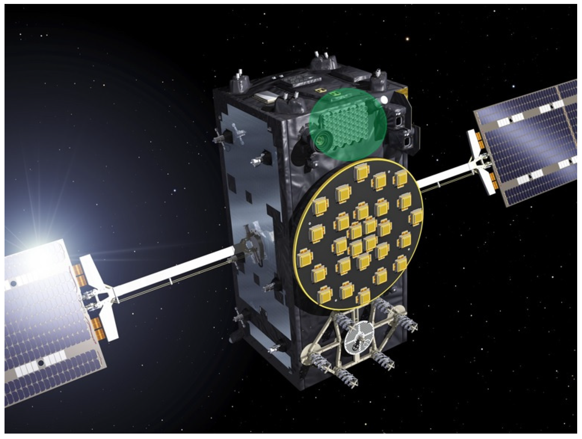
  18. Artist’s View of a GALILEO Full Operational Capability (FOC) CREDIT European Space Agency—Pierre Carril. Available online: https://www.esa.int/ESA_Multimedia/Images/2014/07/GALILEO_satellite2 (accessed on 8 May 2024).
  19. Steindorfer, M.A.; Kirchner, G.; Koidl, F.; Wang, P.; Wirnsberger, H.; Schoenemann, E.; Gonzalez, F. Attitude determination of Galileo satellites using high-resolution kHz SLR. J. Geod. 2019, 93, 1845–1851. [Google Scholar] [CrossRef]
  20. Steindorfer, M.A.; Koidl, F.; Kirchner, G.; Wang, P.; Dilssner, F.; Schoenemann, E.; Strangfeld, A.; Gonzalez, F. Satellite laser ranging to Galileo satellites: Symmetry conditions and improved normal point formation strategies. GPS Solut. 2024, 28, 73. [Google Scholar] [CrossRef]
  21. EUSPA EO and GNSS Market Report; Publications Office of the European Union: Luxembourg, 2024; ISBN 978-92-9206-079-4.
  22. Altamimi, Z.; Rebischung, P.; Collilieux, X.; Metivier, L.; Chanard, K. ITRF2020: Main results and key performance indicators. In Proceedings of the EGU General Assembly 2022, Vienna, Austria, 23–27 May 2022; pp. 23–27. [Google Scholar]
  23. Sośnica, K.; Bury, G.; Zajdel, R.; Strugarek, D.; Drożdżewski, M.; Kazmierski, K. Estimating global geodetic parameters using SLR observations to GALILEO, GLONASS, BeiDou, GPS, and QZSS. Earth Planets Space 2019, 71, 20. [Google Scholar] [CrossRef]
  24. Zajdel, R.; Sośnica, K.; Bury, G.; Dach, R.; Prange, L. System-specific systematic errors in earth rotation parameters derived from GPS, GLONASS, and GALILEO. GPS Solut. 2020, 24, 74. [Google Scholar] [CrossRef]
  25. He, Z.; Wei, E.; Zhang, Q.; Wang, L.; Li, Y.; Liu, J. Earth rotation parameters from BDS, GPS, and GALILEO data: An accuracy analysis. Adv. Space Res. 2023, 71, 3968–3980. [Google Scholar] [CrossRef]
  26. Bury, G.; Sośnica, K.; Zajdel, R.; Strugarek, D.; Hugentobler, U. Determination of precise GALILEO orbits using combined GNSS and SLR observations. GPS Solut. 2021, 25, 11. [Google Scholar] [CrossRef]
  27. Sośnica, K.; Prange, L.; Kaźmierski, K.; Bury, G.; Drożdżewski, M.; Zajdel, R.; Hadas, T. Validation of GALILEO orbits using SLR with a focus on satellites launched into incorrect orbital planes. J. Geod. 2018, 92, 131–148. [Google Scholar] [CrossRef]
  28. Sośnica, K.; Bury, G.; Zajdel, R.; Ventura-Traveset, J.; Mendes, L. GPS, GLONASS, and Galileo orbit geometry variations caused by general relativity focusing on Galileo in eccentric orbits. GPS Solut. 2022, 26, 5. [Google Scholar] [CrossRef]
  29. Ciufolini, I.; Matzner, R.; Paolozzi, A.; Pavlis, E.C.; Sindoni, G.; Ries, J.; Gurzadyan, V.; Koenig, R. Satellite Laser-Ranging as a Probe of Fundamental Physics. Sci. Rep. 2019, 9, 15881. [Google Scholar] [CrossRef]
  30. Delva, P.; Puchades, N.; Schönemann, E.; Dilssner, F.; Courde, C.; Bertone, S.; Gonzalez, F.; Hees, A.; Le Poncin-Lafitte, C.; Meynadier, F. Gravitational Redshift Test Using Eccentric Galileo Satellites. Phys. Rev. Lett. 2018, 121, 231101. [Google Scholar] [CrossRef] [PubMed]
  31. Hampf, D.; Niebler, F.; Bartels, N.; Riede, W. The miniSLR®: A low-cost, high-performance laser ranging system for the ILRS. In Proceedings of the 22nd International Workshop on Laser Ranging (IWLR), Yebes, Spain, 7–11 November 2022. [Google Scholar]
Figure 1. The CBK PAN laser sensor in Borowiec consists of two independent laser modules: a smaller, nanosecond one in the foreground and a larger, picosecond one in the background.
Remotesensing 16 02862 g001
Figure 2. Number of tracked objects by BORL station in years 1992–2023.
Remotesensing 16 02862 g002
Figure 3. The constellation of GALILEO satellites [17].
Remotesensing 16 02862 g003
Figure 4. Artist’s view of a GALILEO Full Operational Capability (FOC). The green circle marks the panel with laser retroreflectors [18].
Remotesensing 16 02862 g004
Figure 5. Pass of GALILEO-212 (E03) registered by the BORL sensor on 3 May 2023, 23:12 UTC, showing slant ranges (a) and fit residuals (b) with 159 valid returns. The min. and max. distances to the satellite were 23,589 km and 23,790 km, respectively.
Remotesensing 16 02862 g005
Figure 6. Pass of GALILEO-104 (E20) registered by the BORL sensor on 21 May 2023, 21:27 UTC, showing slant ranges (a) and fit residuals (b) with 592 valid returns. The min. and max. distances to the satellite were 23,701 km and 24,115 km, respectively.
Remotesensing 16 02862 g006
Figure 7. Pass of GALILEO-208 (E08) registered by the BORL sensor on 22 May 2023, 20:59 UTC, showing slant ranges (a) and fit residuals (b) with 214 valid returns. The min. and max. distances to the satellite were 23,612 km and 23,958 km, respectively.
Remotesensing 16 02862 g007
Figure 8. Pass of GALILEO-202 (E14) registered by the BORL sensor on 21 September 2023, 22:37 UTC, showing slant ranges (a) and fit residuals (b) with 310 valid returns. The min. and max. distances to the satellite were 19,701 km and 20,292 km, respectively.
Remotesensing 16 02862 g008
Table 1. The basic parameters of the laser used by the BORL station.
PARAMETEREKSPLA PL-2250CONTINUUM SURELITE III
Frequency10 Hz10 Hz
Pulse energy0.05 J0.45 J
Pulse length60 ps4 ns
Peak power833 MW112.5 MW
Average power0.5 W4.5 W
Table 2. The results of the observations of GALILEO satellites obtained by the BORL station in 2023.
NRSATNAMEPASSESRETURNSNORMAL POINTSAVG RMS [cm]
1GALILEO-103101118431.72
2GALILEO-104112534551.69
3GALILEO-2022488111.76
4GALILEO-20313231.05
5GALILEO-20412441.42
6GALILEO-20526161.20
7GALILEO-206218381.35
8GALILEO-20727781.17
9GALILEO-2086482341.19
10GALILEO-2094304161.52
11GALILEO-2104160181.72
12GALILEO-2113111111.68
13GALILEO-2127623301.57
14GALILEO-2137565311.30
15GALILEO-2144238161.13
16GALILEO-21511721.47
17GALILEO-21613970.92
18GALILEO-2173120131.13
19GALILEO-21913641.14
20GALILEO-220210481.22
21GALILEO-2223103140.99
Disclaimer/Publisher’s Note: The statements, opinions and data contained in all publications are solely those of the individual author(s) and contributor(s) and not of MDPI and/or the editor(s). MDPI and/or the editor(s) disclaim responsibility for any injury to people or property resulting from any ideas, methods, instructions or products referred to in the content.

