Article

Long-Horizon Mining Subsidence Forecasting and Ecological Time-Lag Assessment Using Multi-Source Remote Sensing

1
Engineering Technology Innovation Center for Ecological Protection and Restoration in the Middle Yellow River, Ministry of Natural Resources, Taiyuan 030024, China
2
Key Laboratory of Ionic Rare Earth Resources and Environment, Ministry of Natural Resources of the People’s Republic of China, Ganzhou 341000, China
3
College of Geological and Surveying Engineering, Taiyuan University of Technology, Taiyuan 030024, China
4
Shanxi Geological Environment Monitoring and Ecological Restoration Center, Taiyuan 030024, China
*
Author to whom correspondence should be addressed.
These authors contributed equally to this work.
Remote Sens. 2026, 18(16), 2829; https://doi.org/10.3390/rs18162829
Submission received: 2 July 2026 / Revised: 12 August 2026 / Accepted: 17 August 2026 / Published: 20 August 2026

Abstract

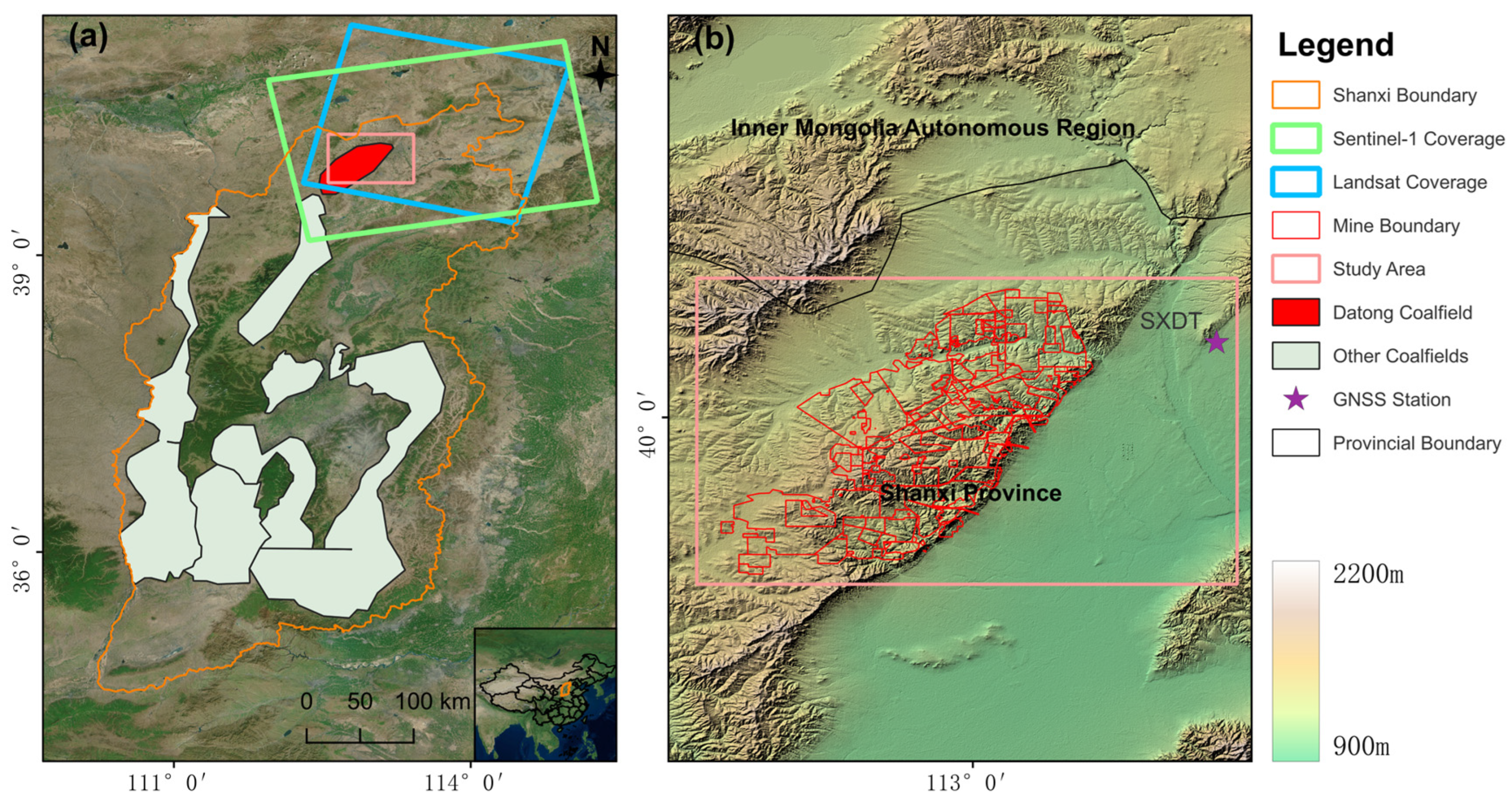
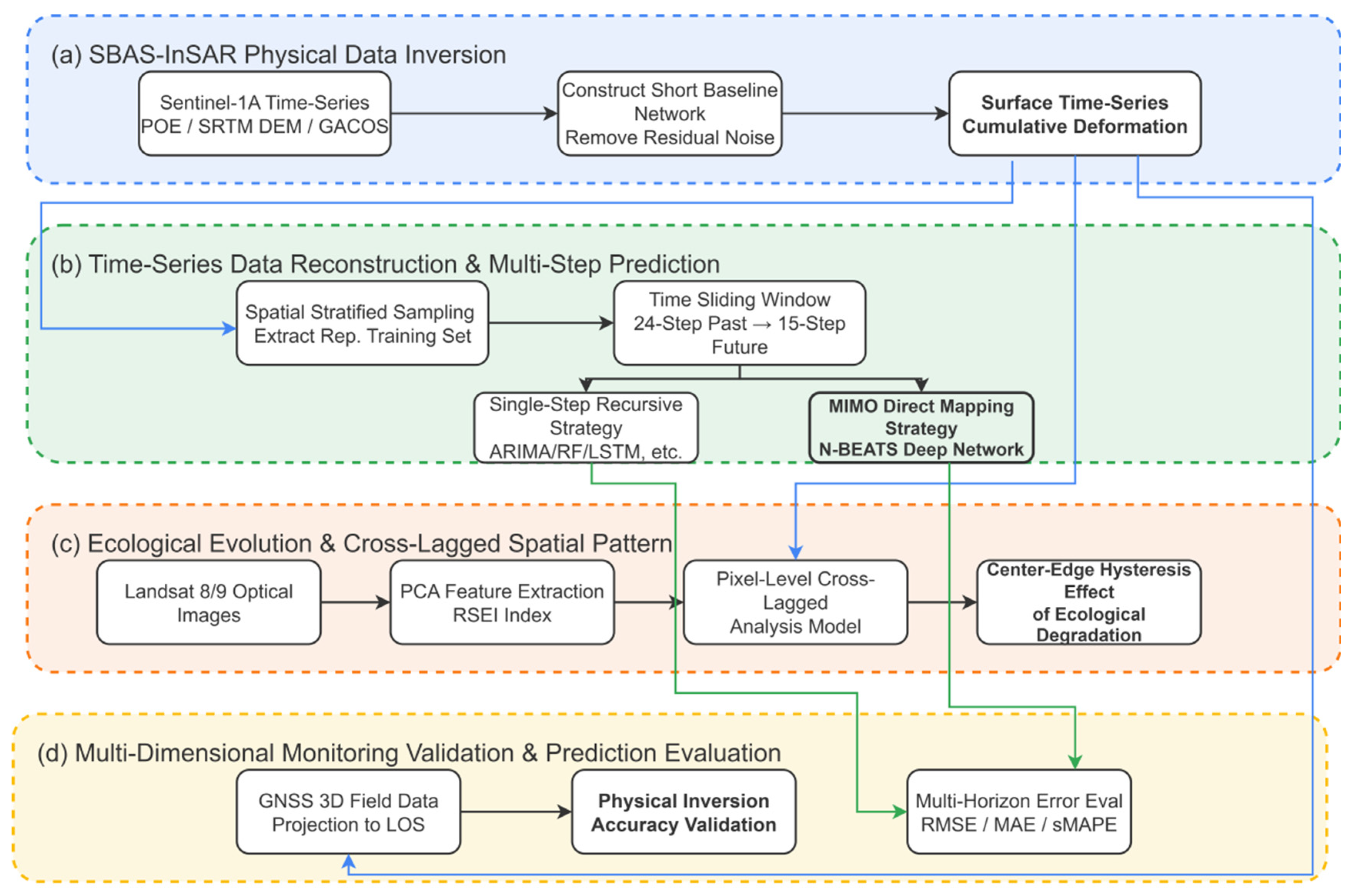
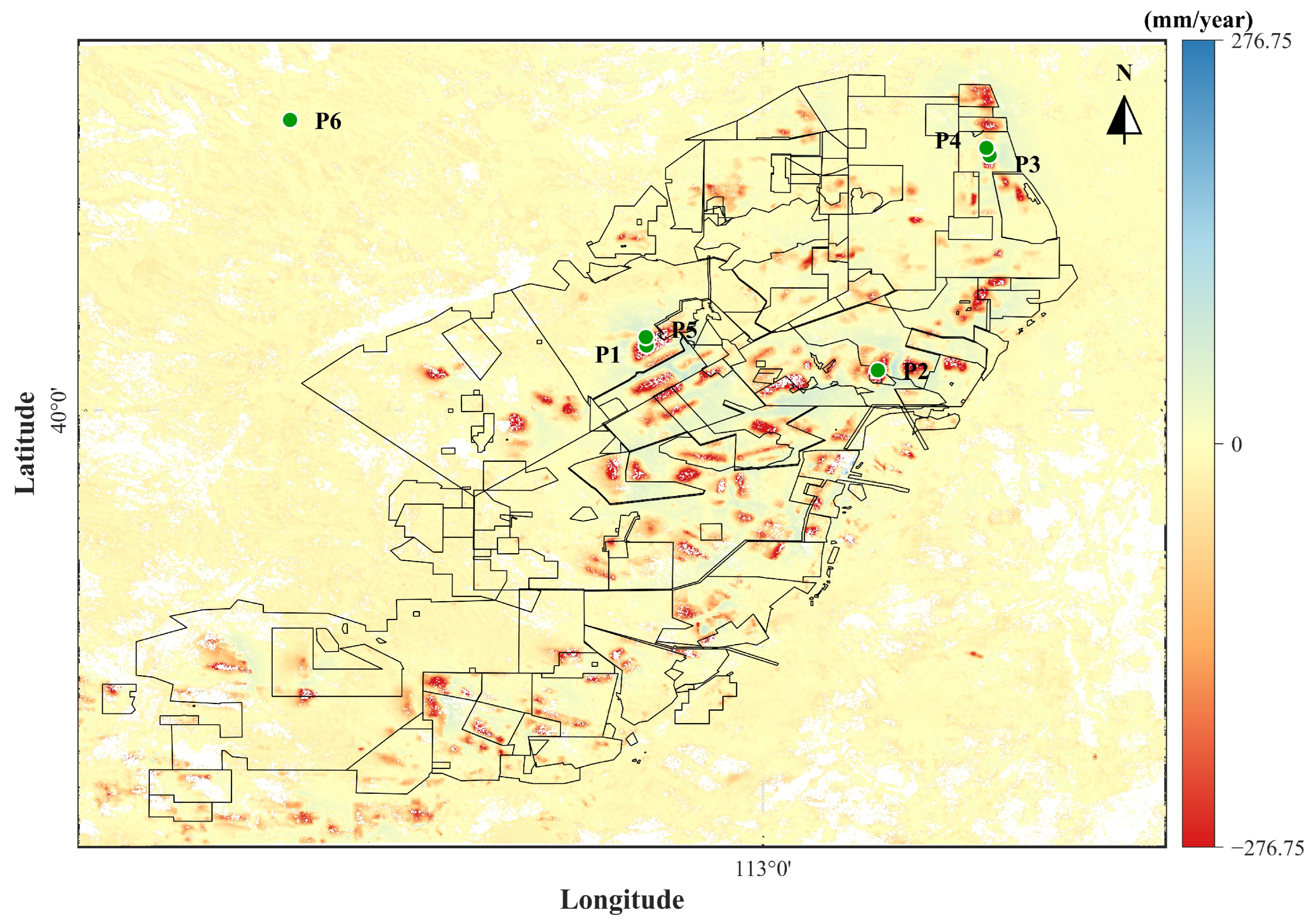
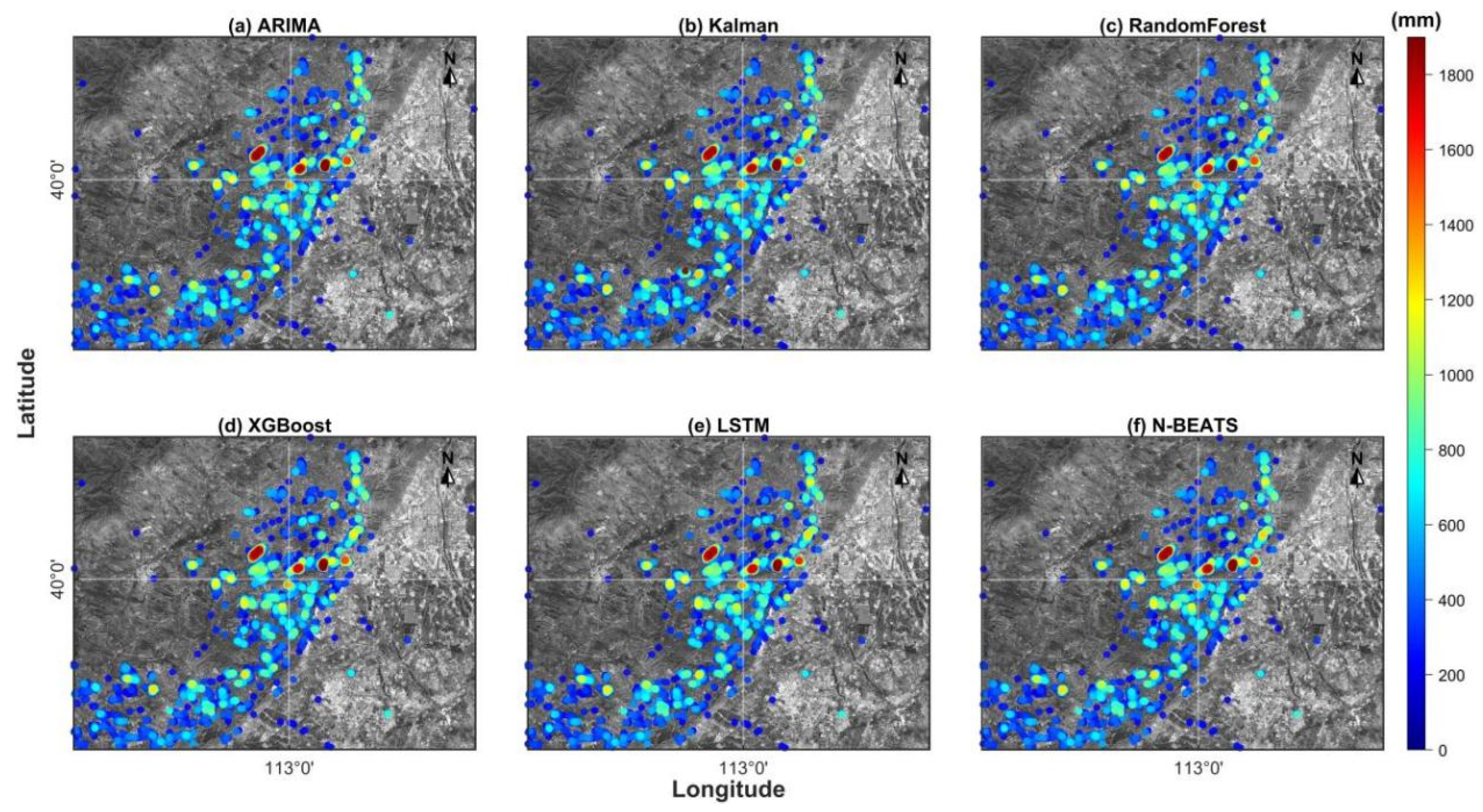
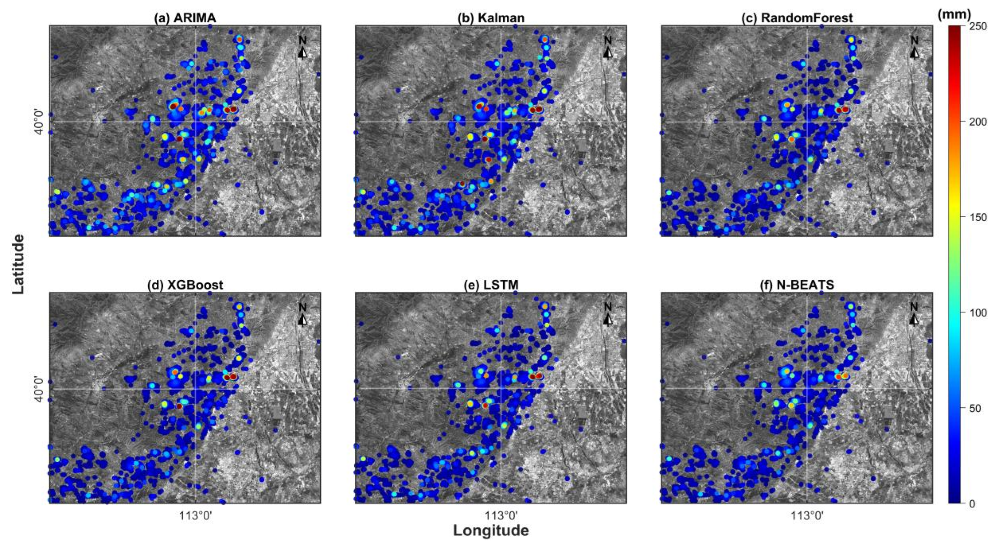
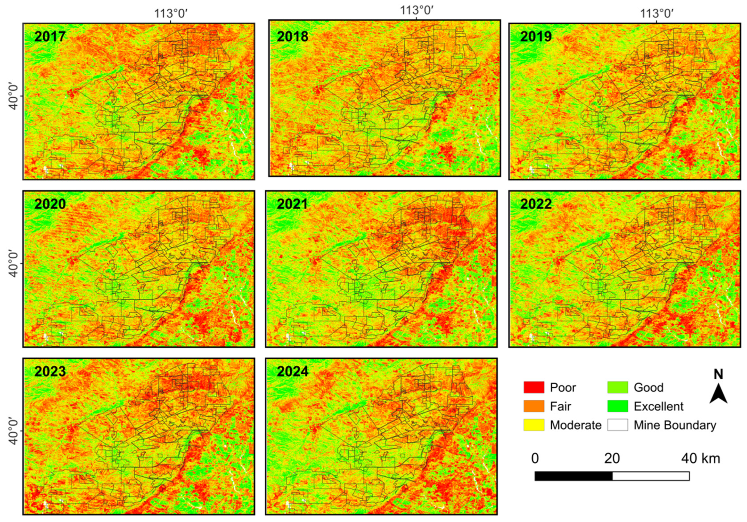
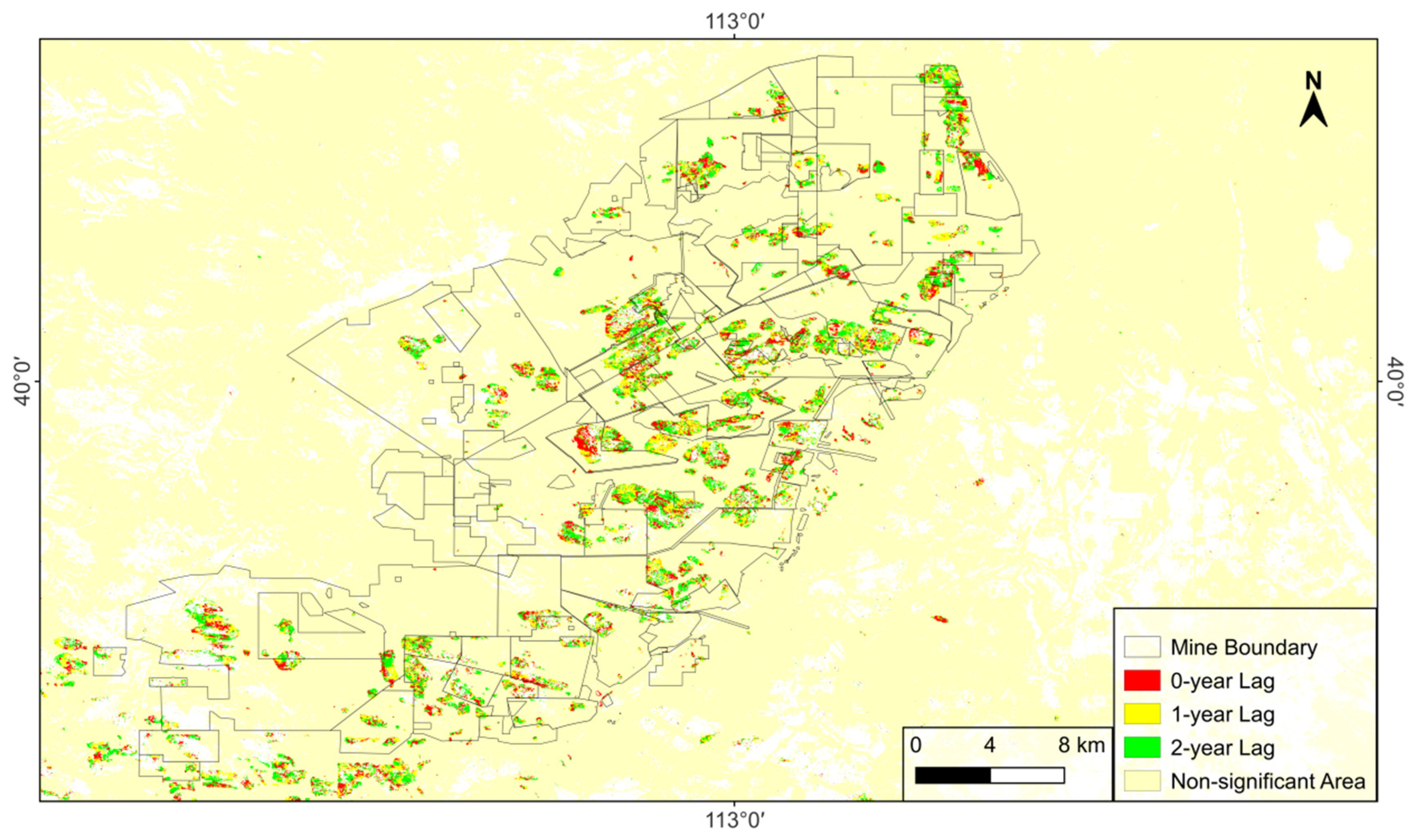
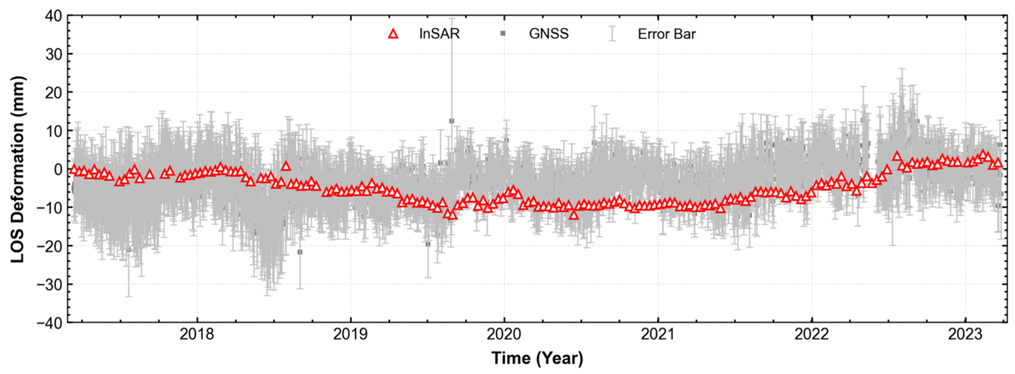
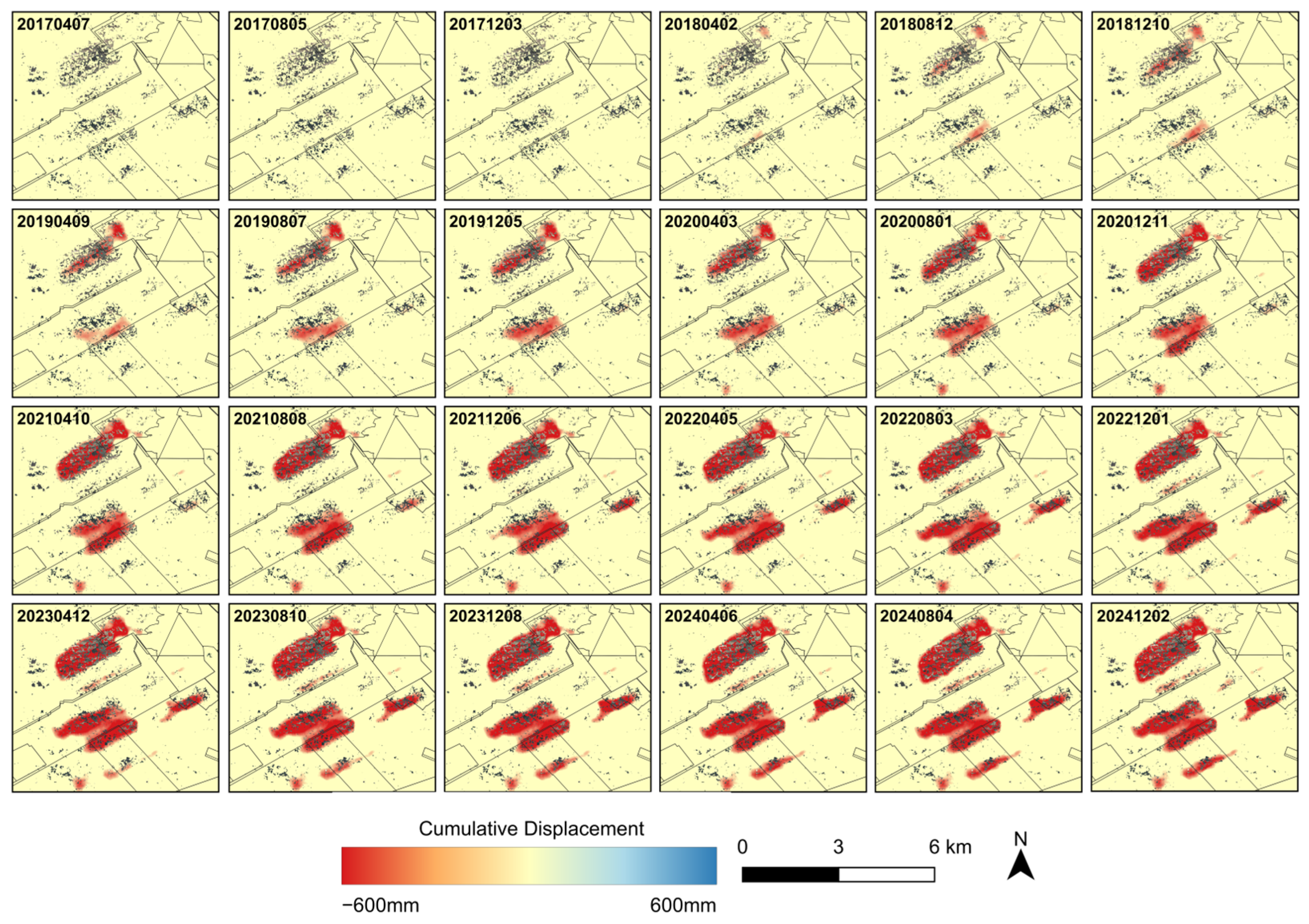
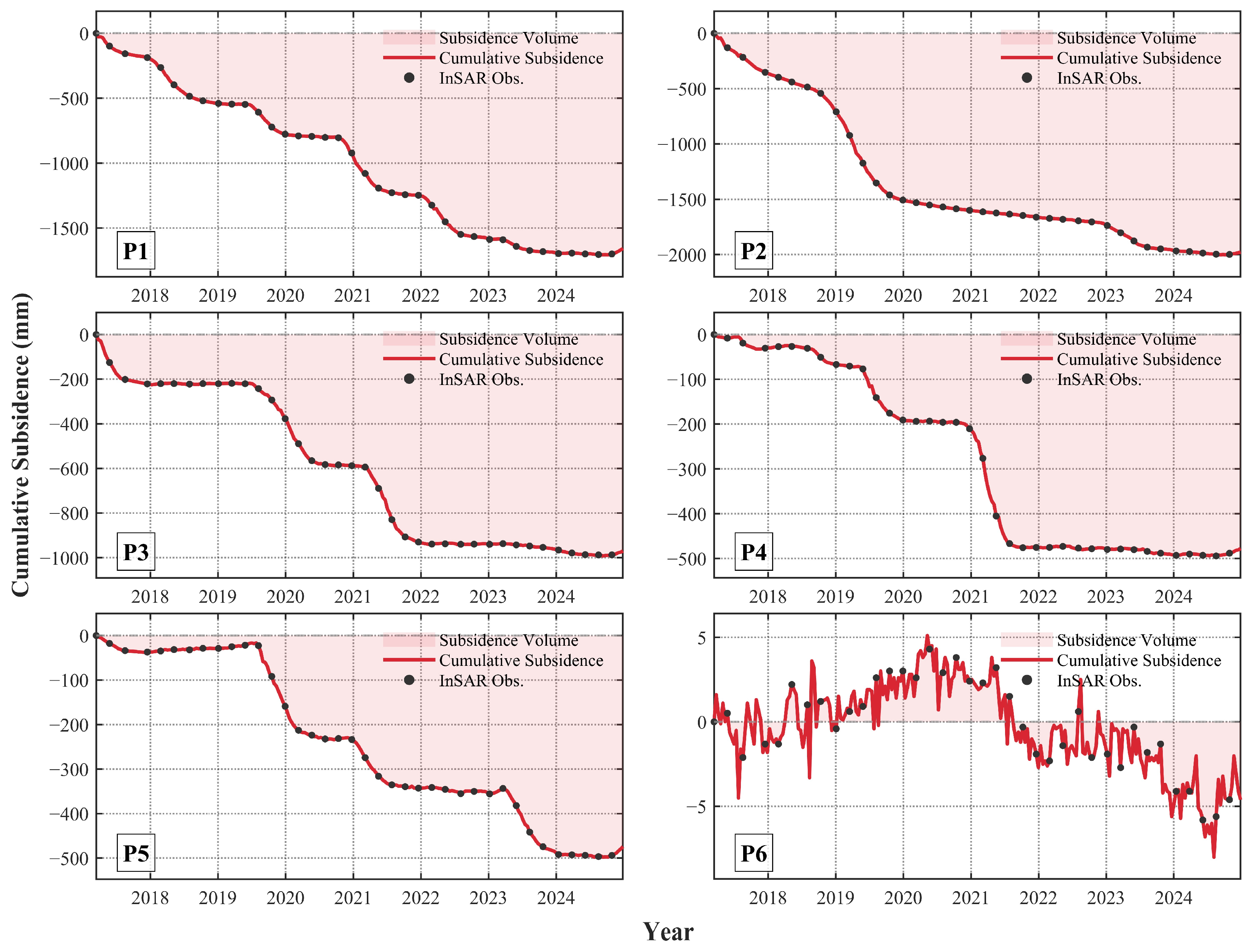
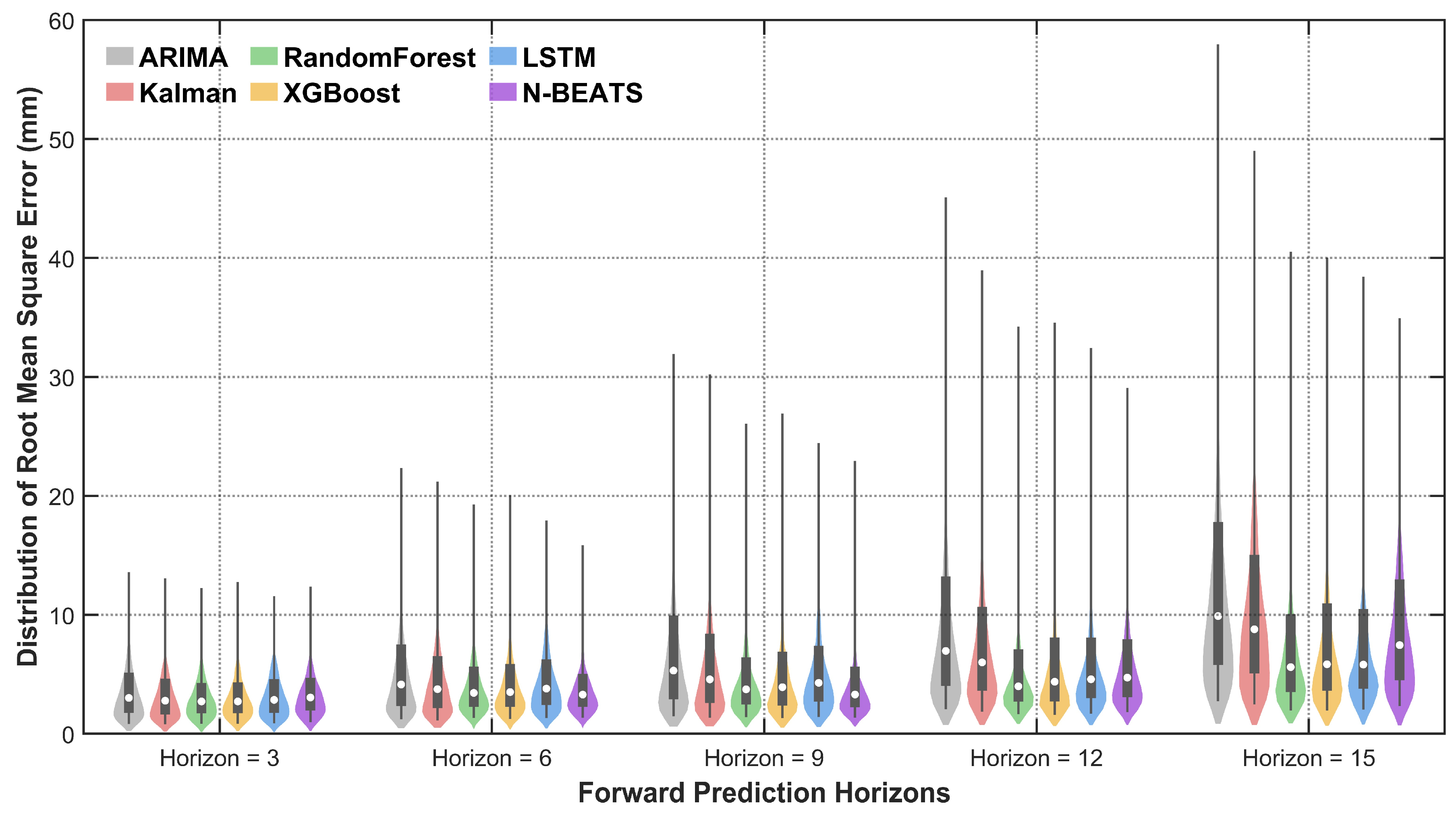
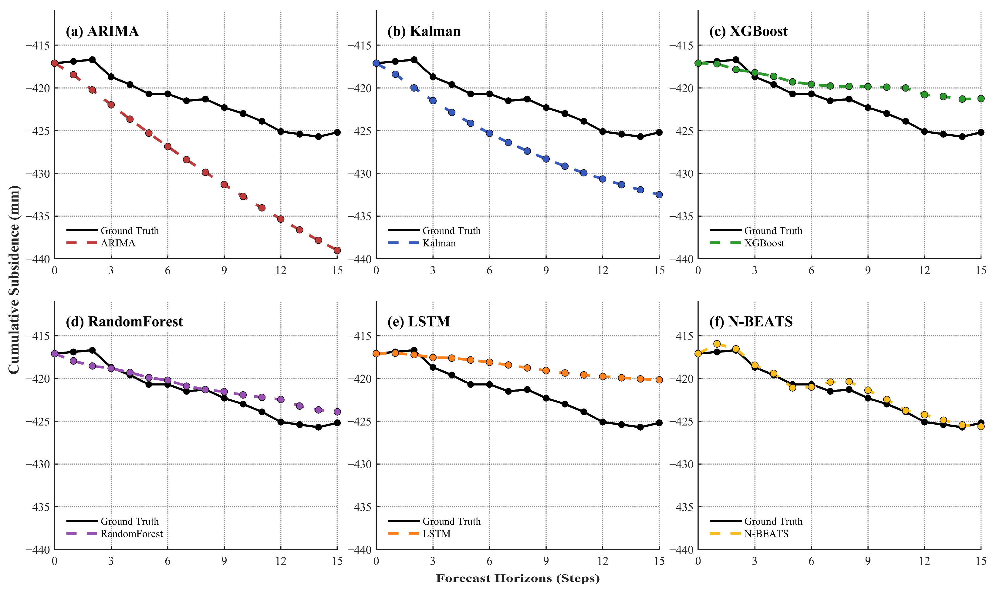
Surface deformation induced by underground coal mining is characterized by strong nonlinearity and spatial heterogeneity, which complicates early warning and ecological assessment. While InSAR-driven data assimilation models and remote sensing-based ecological indices are widely used for long-term monitoring, three fundamental limitations remain unresolved: (1) severe spatial imbalance in deformation samples biases data-driven models toward mean-reverting predictions, (2) recursive multi-step forecasting accumulates errors, leading to instability in long-horizon extrapolation, and (3) in ecological monitoring, vegetation resilience further induces a multi-year observation lag, resulting in a “pseudo-stable” bias in optical indicators. To address these issues, this study proposes an unified framework integrating multi-step deformation prediction and ecological time-lag analysis. Taking the Datong Coalfield as the study area, we utilized 231 Sentinel-1A images from March 2017 to December 2024 for SBAS-InSAR deformation inversion. A spatial stratified sampling strategy is used to extract 5894 representative points. A 24-step backward and 15-step forward windows were reconstructed to systematically compare six predictive models. Simultaneously, the Remote Sensing Ecological Index (RSEI) derived from Landsat data is used for cross-lagged analysis. The results demonstrate that: (1) The maximum deformation rate reached −276.75 mm/year, with cumulative subsidence exceeding −2000 mm. (2) At 3-step short-term forecasting, all models proved robust, with LSTM performing best (RMSE = 5.78 mm). At 15-step extreme extrapolation, however, traditional recursive models diverged significantly (Kalman, RMSE = 45.70 mm), whereas N-BEATS maintained stability and effectively mitigated temporal error cascades with an RMSE of 17.98 mm. (3) The core collapse zone exhibited concurrent ecological degradation (Lag 0), while the marginal basin presented a hidden degradation period of one to two years. It provides reliable scientific support for precise tracking and proactive safety management in complex mining areas.
Keywords: mining-induced subsidence; SBAS-InSAR; spatial stratified sampling; time-series forecasting; ecological time-lag effect mining-induced subsidence; SBAS-InSAR; spatial stratified sampling; time-series forecasting; ecological time-lag effect