Article

Multiscale Estimation of Mangrove Biomass in Fujian Province Using UAV as a Bridging Scale

College of Forestry, Fujian Agriculture and Forestry University, No. 15 Shangxiadian Road, Fuzhou 350002, China
*
Author to whom correspondence should be addressed.
Remote Sens. 2026, 18(16), 2831; https://doi.org/10.3390/rs18162831
Submission received: 23 June 2026 / Revised: 14 August 2026 / Accepted: 19 August 2026 / Published: 20 August 2026

Abstract

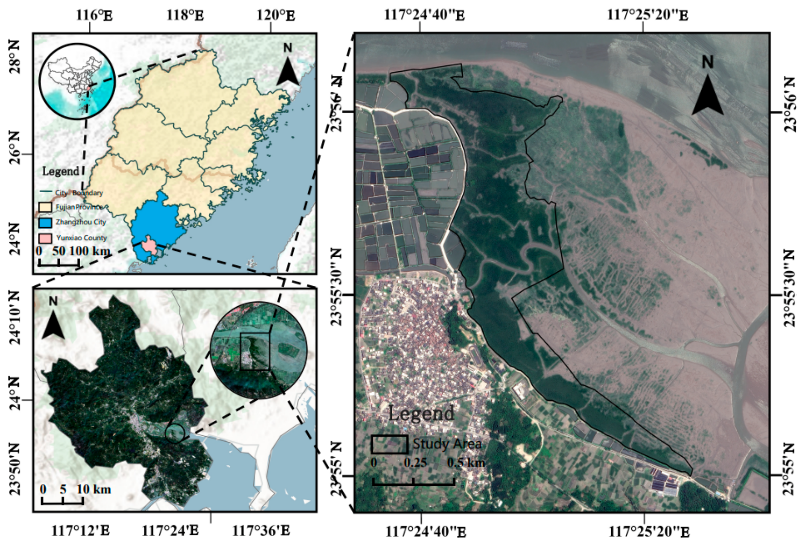
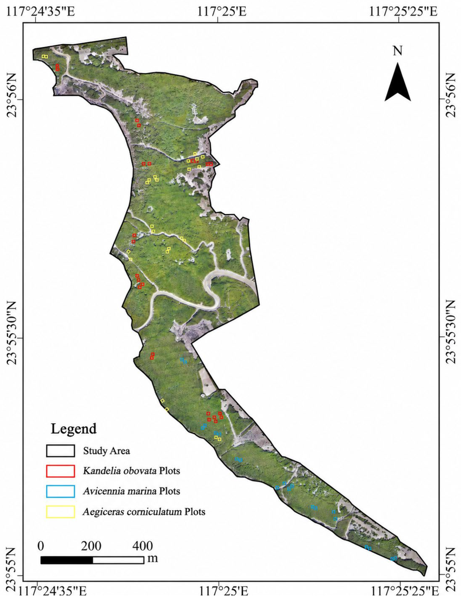
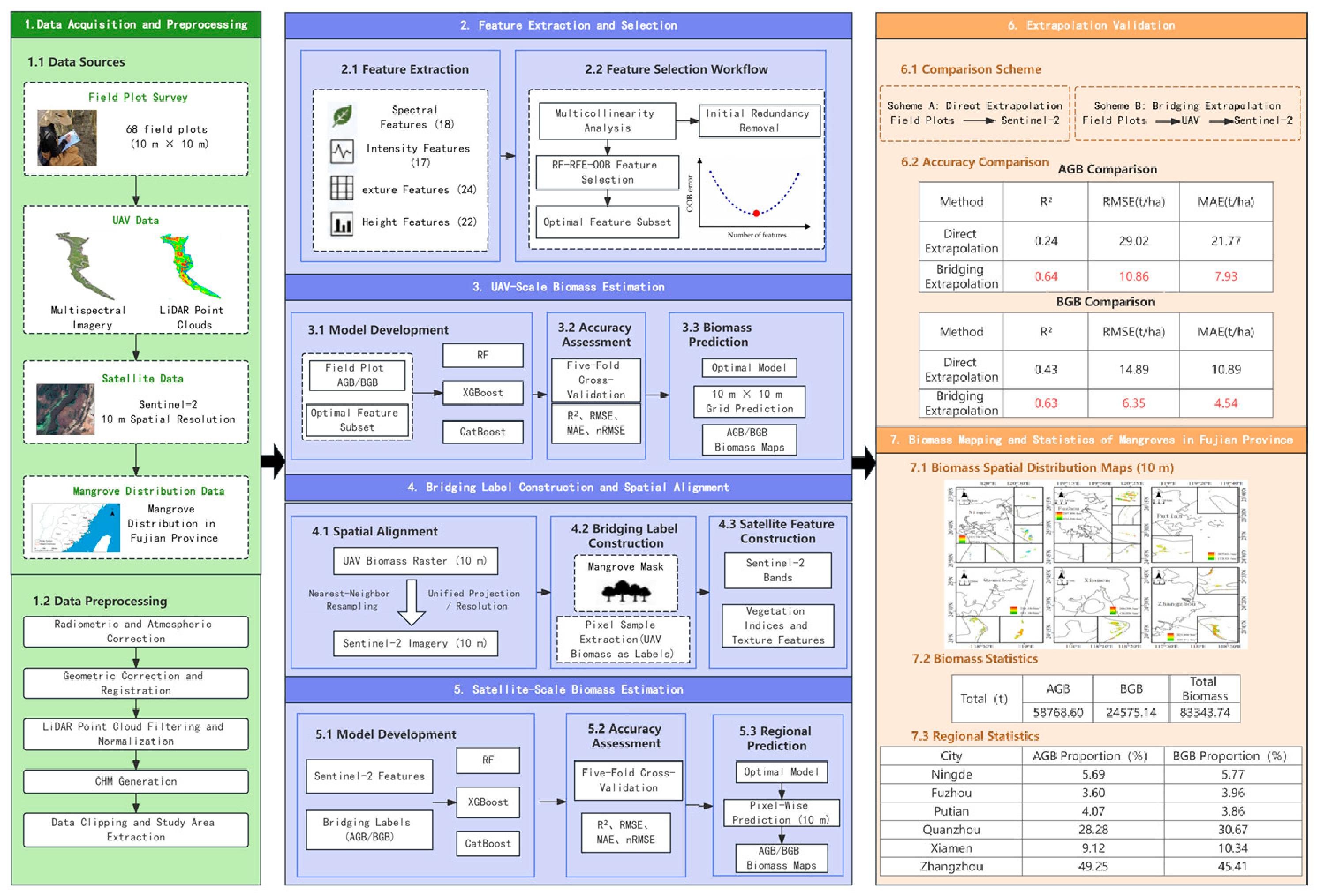
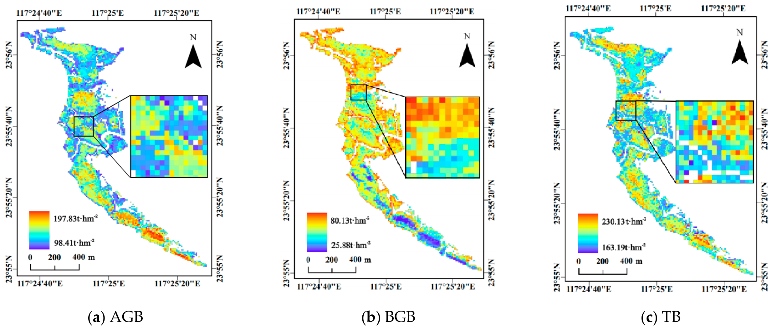
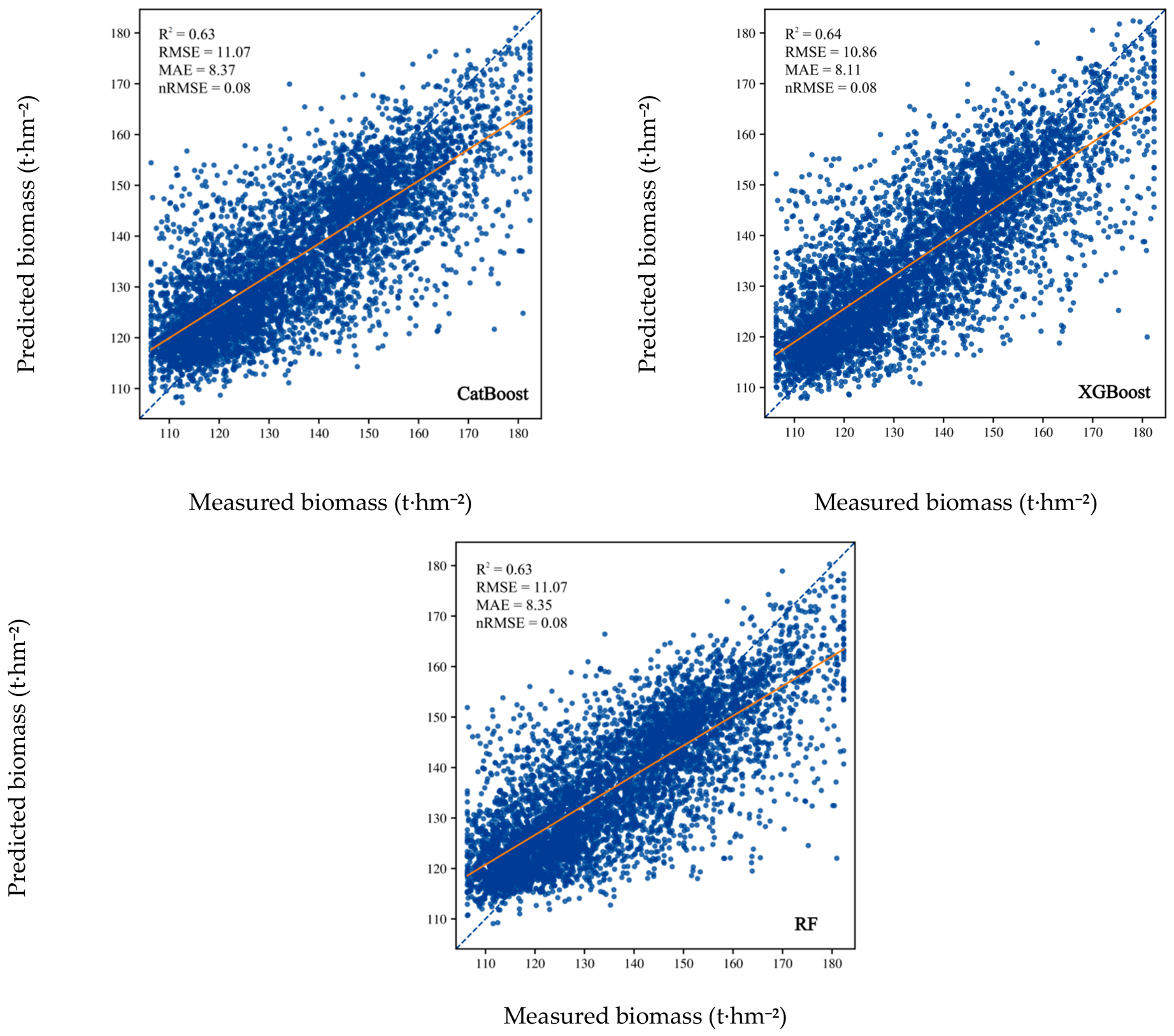
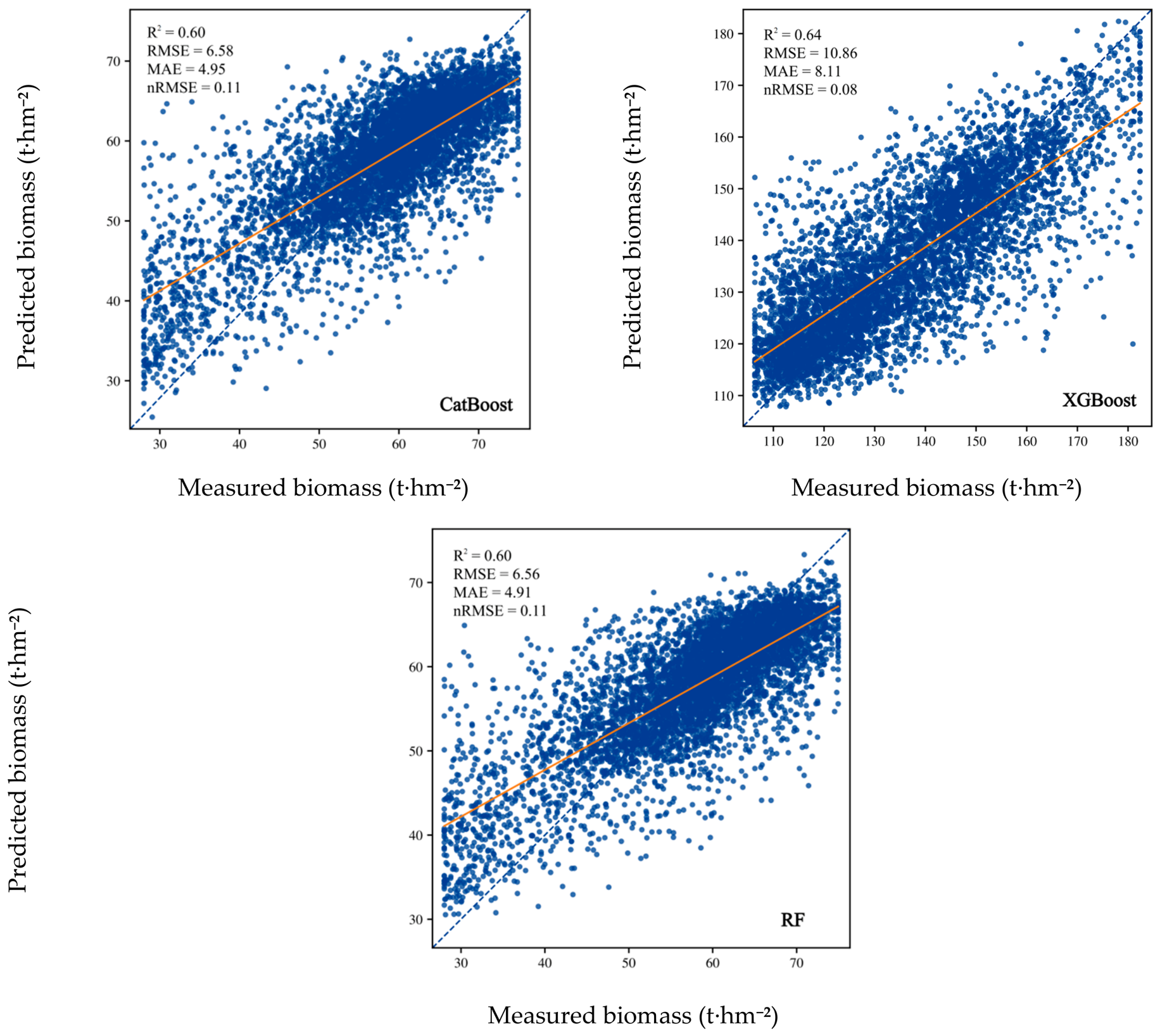
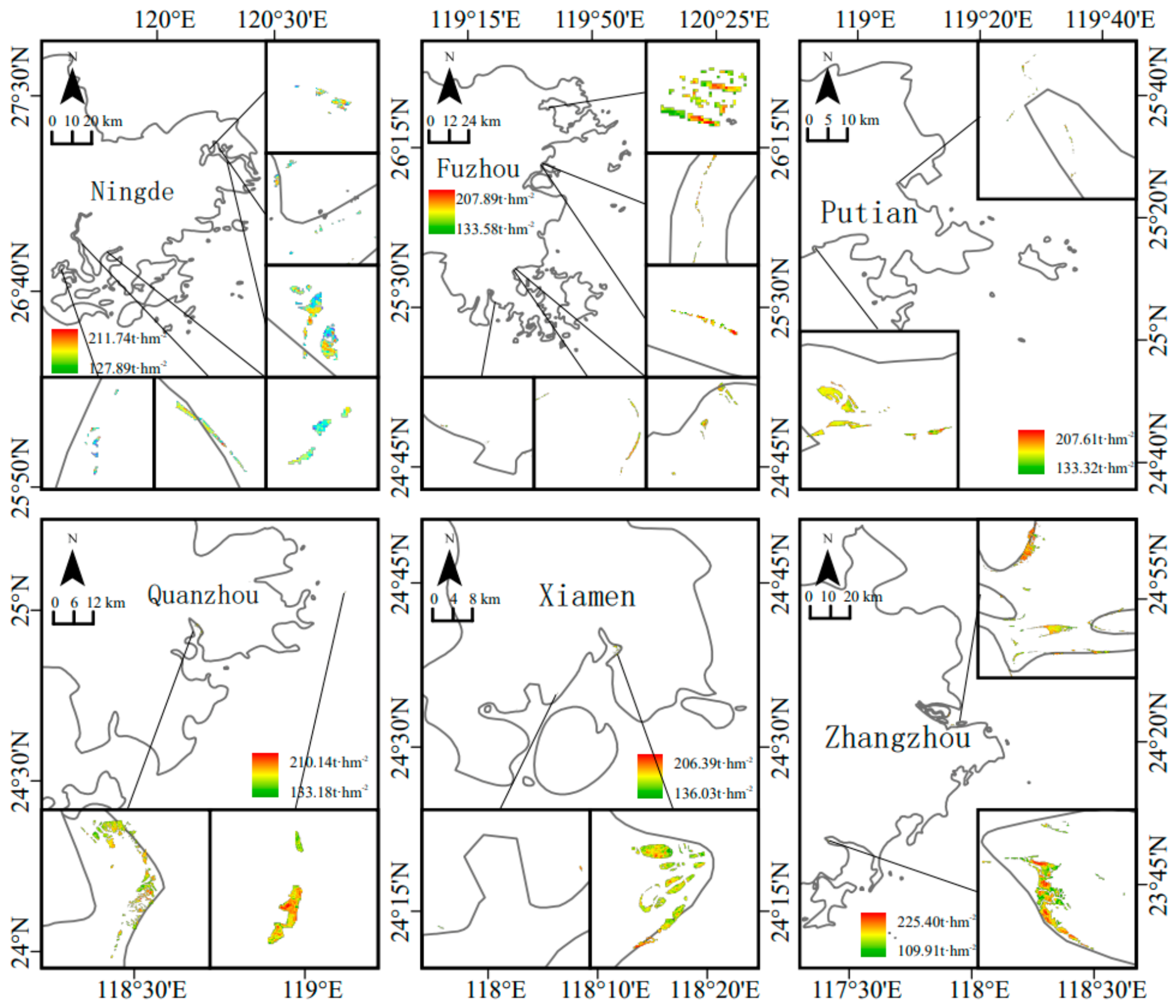
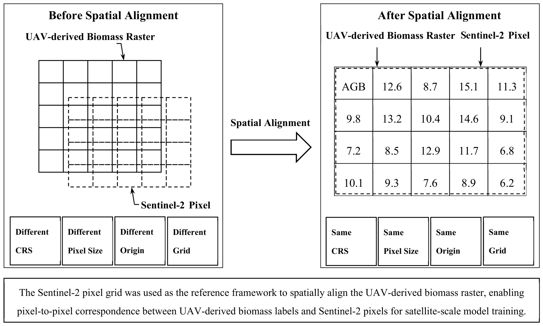
Mangroves are important coastal blue-carbon ecosystems, and accurate biomass estimation is essential for carbon stock assessment and ecological monitoring. To address the limitation of regional-scale biomass estimation caused by the scale mismatch between field plots and satellite pixels, this study selected the Zhangjiangkou National Mangrove Nature Reserve in Fujian Province as the study area and the mangrove distribution region of Fujian Province as the extrapolation area. A multiscale biomass estimation framework integrating field plots, unmanned aerial vehicles (UAVs), and satellite remote sensing was established. The results showed that (1) the optimal UAV-scale models achieved R2 values of 0.69 and 0.78 for aboveground biomass (AGB) and belowground biomass (BGB), respectively, with corresponding root mean square error (RMSE) values of 18.55 and 9.52 t·ha−1 and normalized root mean square error (nRMSE) values of 0.14 and 0.17 demonstrating reliable predictive performance; (2) after introducing UAV-derived bridging labels, the R2 of the AGB model increased from 0.24 to 0.64, while the RMSE decreased from 29.02 to 10.86 t·ha−1. Similarly, the R2 of the BGB model increased from 0.43 to 0.63, accompanied by a reduction in RMSE from 14.89 to 6.35 t·ha−1, demonstrating a substantial improvement in satellite-scale biomass estimation accuracy; (3) the total AGB and BGB of mangroves in Fujian Province were estimated at 58,768.60 t and 24,575.14 t, respectively, with high-biomass areas mainly distributed along the coastal regions of Zhangzhou and Quanzhou. Unlike conventional field-to-satellite extrapolation approaches, the proposed framework introduces UAV-derived biomass maps as intermediate bridging labels for pixel-level supervised learning, thereby establishing an effective link between field measurements and satellite observations. This strategy effectively reduces the scale mismatch between field and satellite data, significantly improves satellite-scale biomass estimation accuracy, and provides a transferable and scalable framework for regional mangrove biomass mapping and blue-carbon assessment.
Keywords: mangrove; biomass estimation; UAV remote sensing; scale extrapolation; Sentinel-2; blue carbon mangrove; biomass estimation; UAV remote sensing; scale extrapolation; Sentinel-2; blue carbon