Article

A Terrain-Corrected Vegetation Index Strategy for Improving Leaf Area Index Estimation in Mountainous Areas


1
College of Earth and Planet Sciences, Chengdu University of Technology, Chengdu 610059, China
2
Wanglang Mountain Remote Sensing Observation and Research Station of Sichuan Province, Mianyang 621000, China
3
College of Geography and Planning, Chengdu University of Technology, Chengdu 610059, China
*
Author to whom correspondence should be addressed.
Remote Sens. 2026, 18(17), 2977; https://doi.org/10.3390/rs18172977
Submission received: 23 June 2026 / Revised: 28 August 2026 / Accepted: 31 August 2026 / Published: 2 September 2026
(This article belongs to the Section Forest Remote Sensing)

Abstract


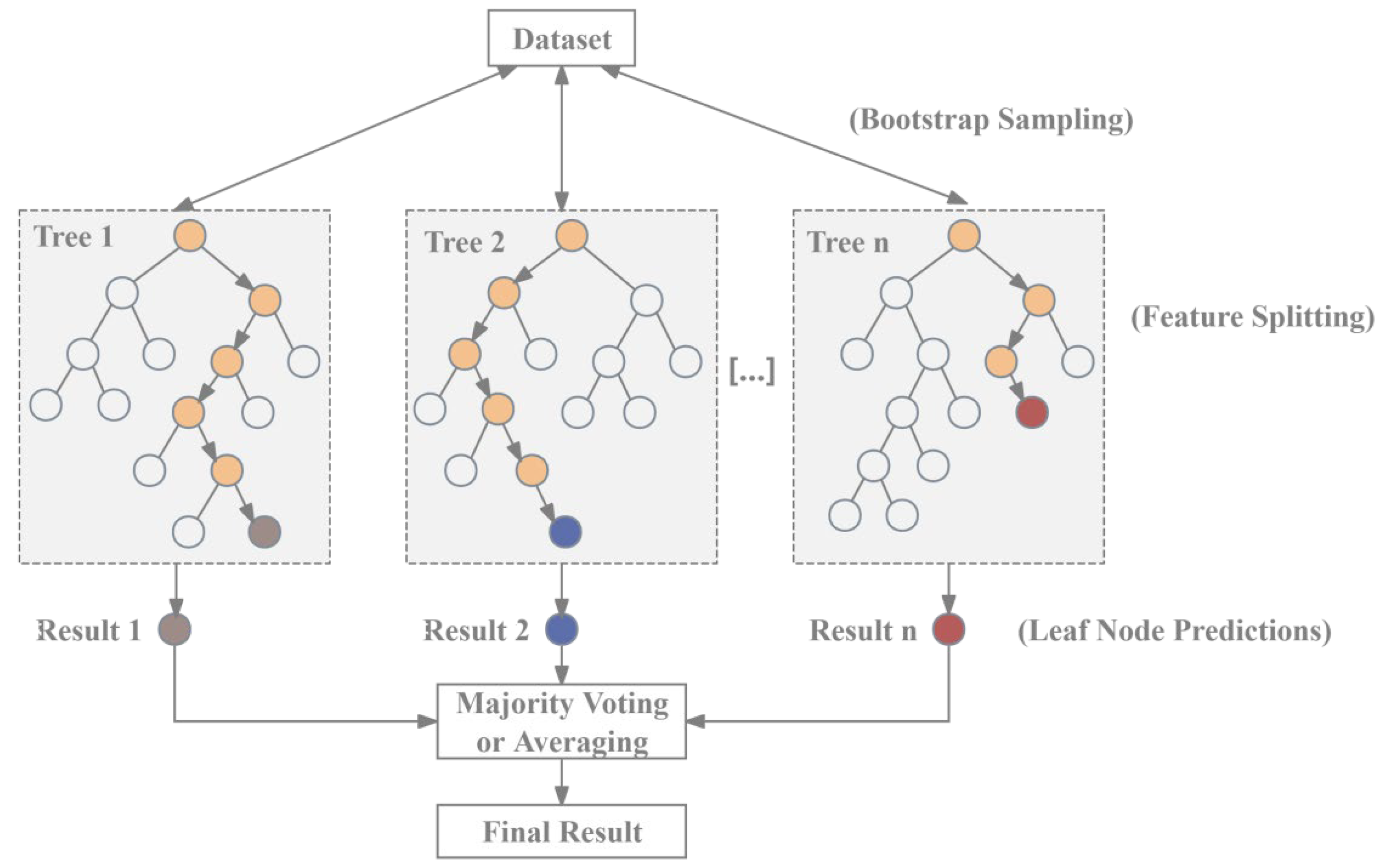
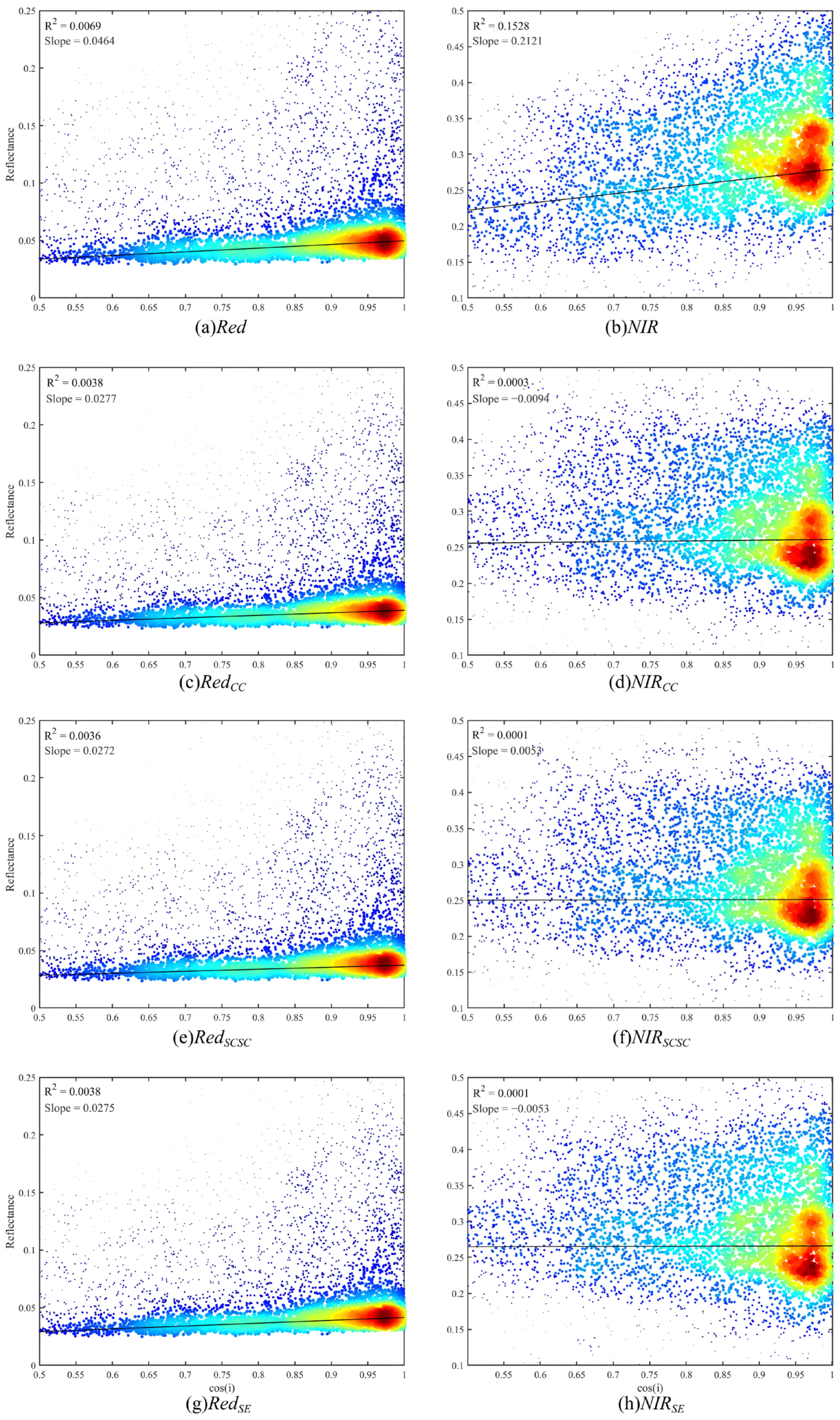
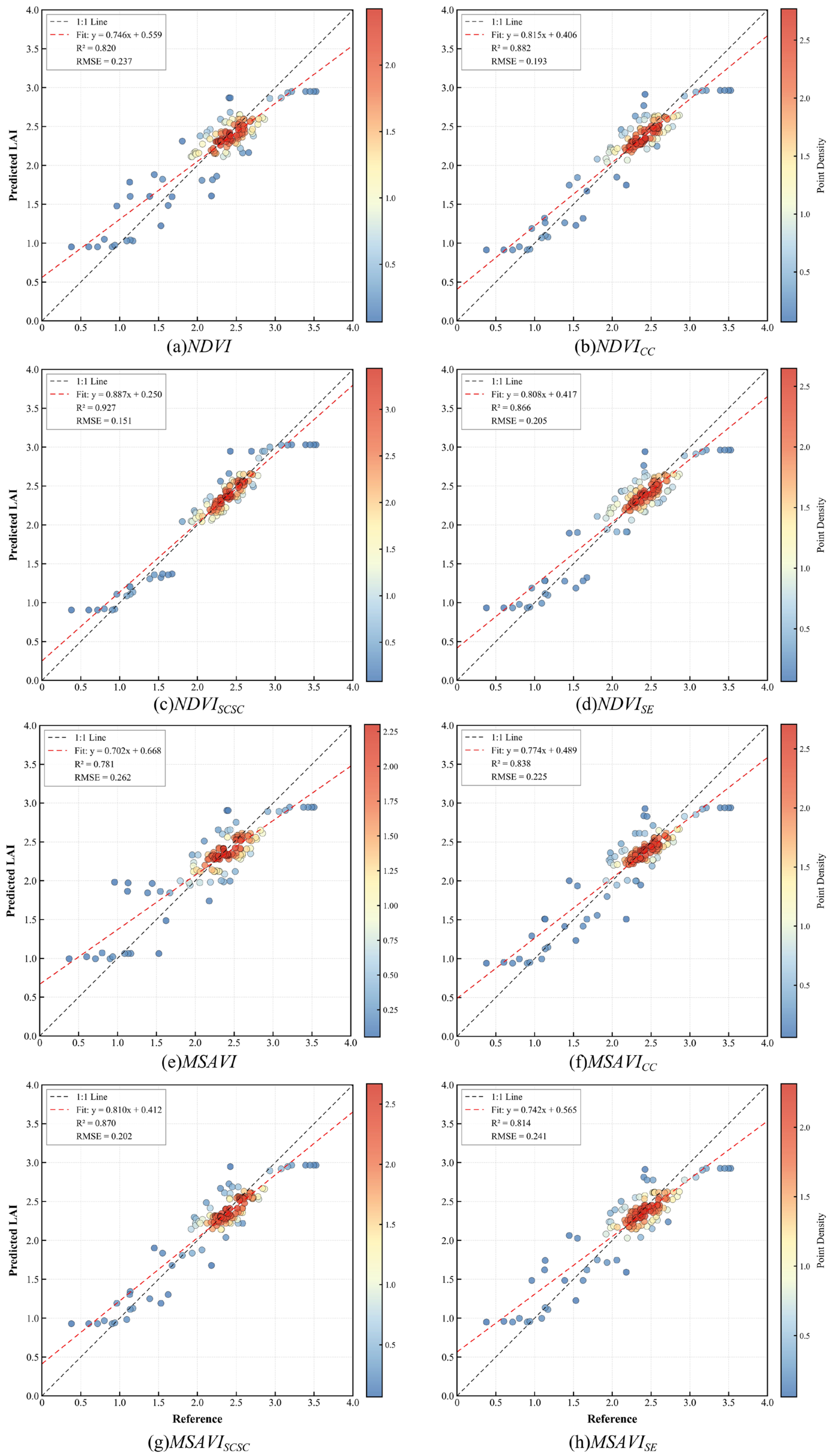
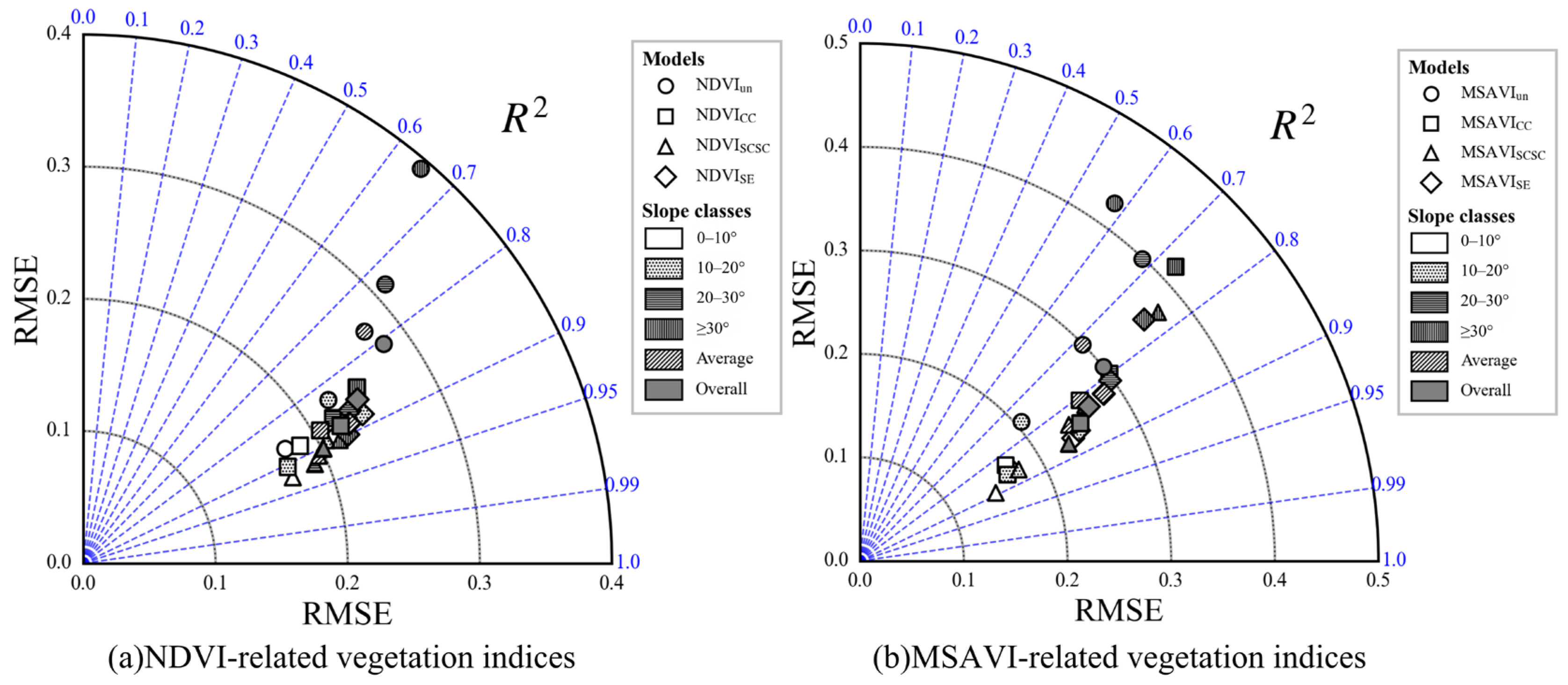
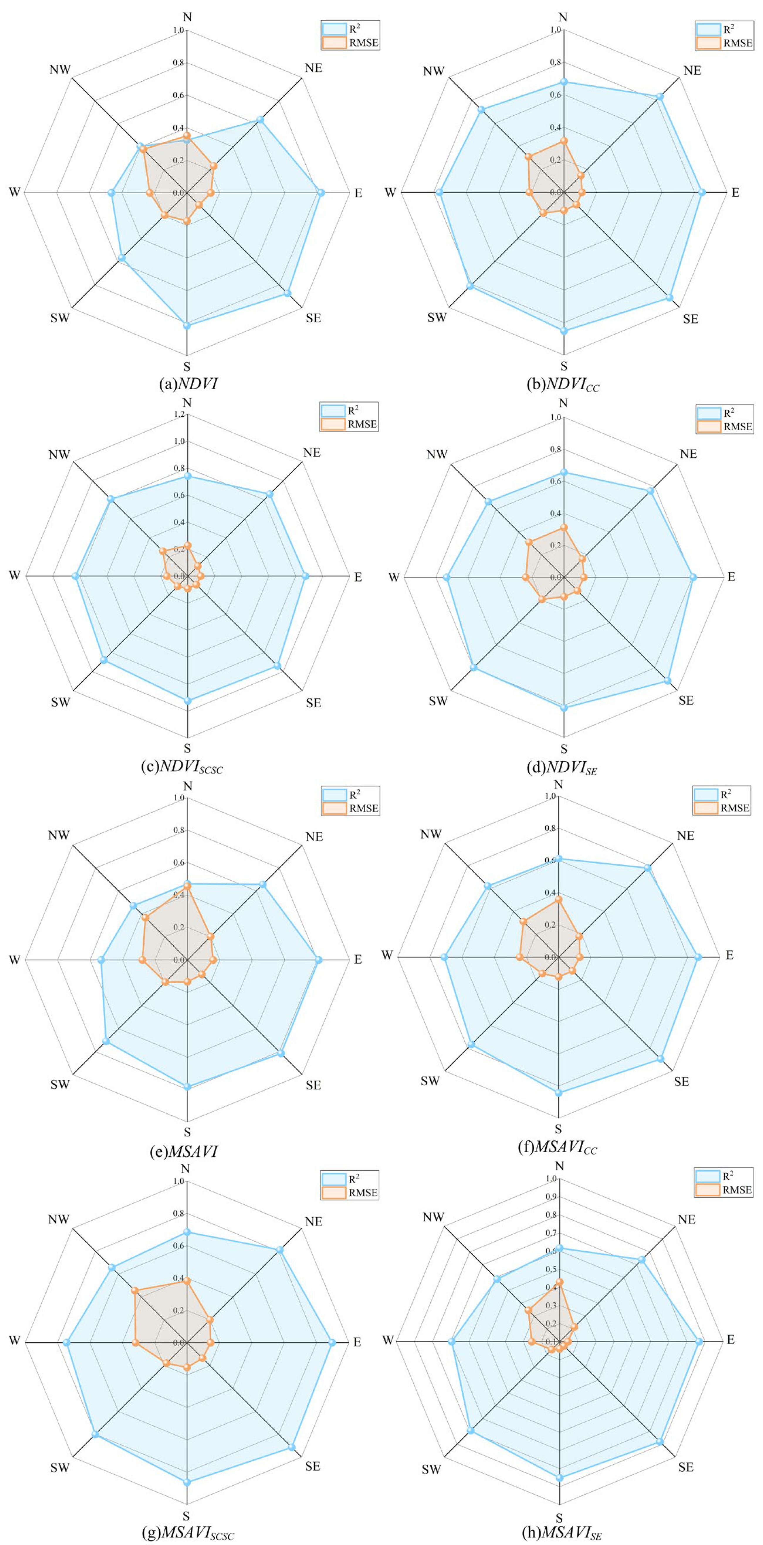
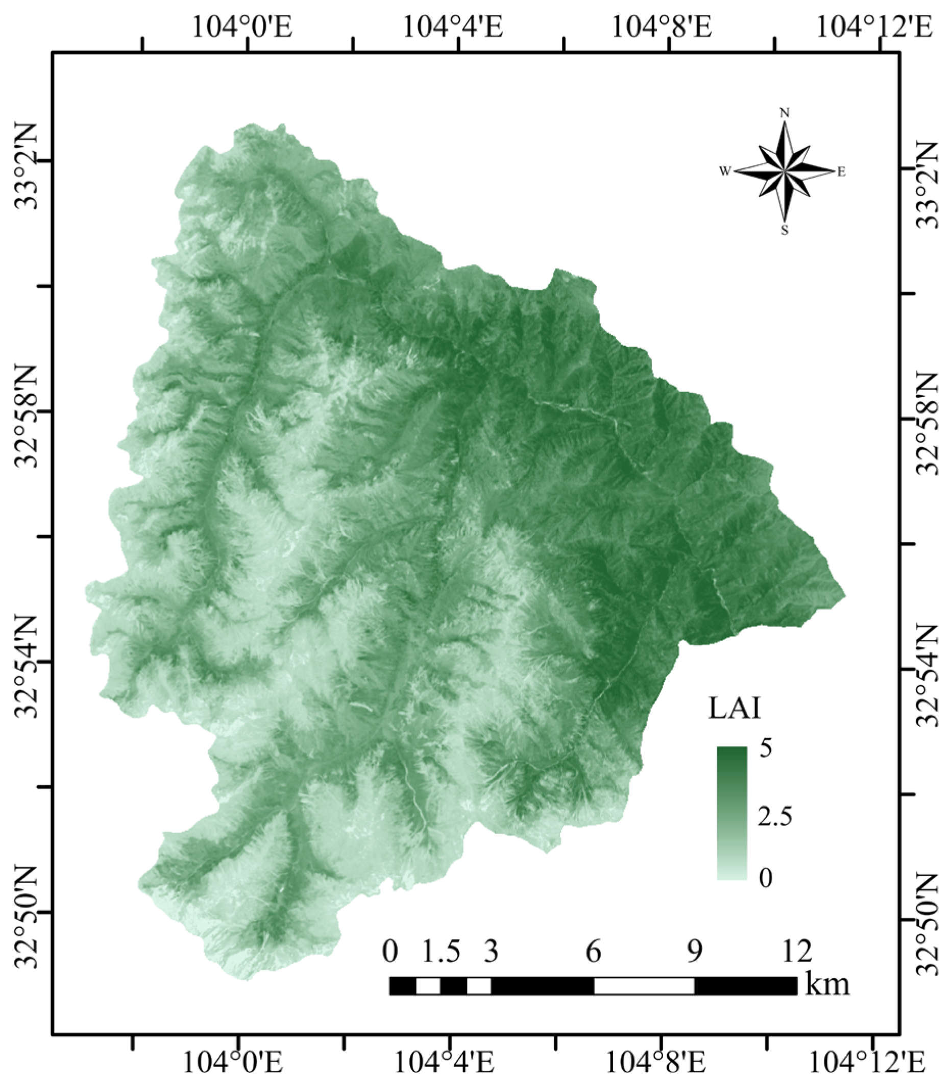
Leaf Area Index (LAI) is an important biophysical parameter in studies of regional and global ecosystems. However, terrain-induced distortion of surface reflectance can reduce the reliability of vegetation indices (VIs) in characterizing the canopy structure, thereby introducing uncertainties in LAI retrieval. In this study, an LAI retrieval method for mountainous areas based on the combination of terrain-corrected VIs and the random forest algorithm was proposed. Typical topographic correction models (Cosine+C, SCS+C, and Statistical–Empirical) were applied to normalize surface reflectance, and the terrain-corrected normalized difference vegetation index (NDVI) and modified soil-adjusted vegetation index (MSAVI) were constructed accordingly. Then, random forest regression was used for LAI retrieval, and the proposed method was validated through comparisons of this LAI with the field observations and original VI-based methods. The results showed that topographic correction effectively reduced the radiometric distortions induced by topography, and the NDVISCSC-based retrieval method performed well under various terrain conditions (with R2 and RMSE of 0.927 and 0.151, respectively). In addition, to investigate the effects of different terrain factors and illumination conditions on LAI retrieval, methods based on the original and terrain-corrected VIs were compared for surfaces with different slopes and aspects. The results revealed that the terrain-corrected VIs can improve the performance of LAI retrieval in areas with terrain-induced reflectance distortion. Finally, the optimal method successfully estimated LAI in the study area. Therefore, the proposed LAI retrieval method for mountainous areas is an effective tool for extracting surface biophysical parameters, and can provide a reliable approach for regional ecological monitoring and evaluation.
Keywords: Leaf Area Index (LAI); topographic correction; vegetation indices; random forest regression; terrain factors Leaf Area Index (LAI); topographic correction; vegetation indices; random forest regression; terrain factors