Article

From Storm Damage Detection to Windthrow Susceptibility Mapping: Evaluating Regional Transferability in Radiata Pine Plantations


1
Bioeconomy Science Institute, Tuhiraki, 19 Ellesmere Junction Road, Lincoln 7608, New Zealand
2
Indufor Asia Pacific, 55–65 Shortland Street, Auckland 1010, New Zealand
3
Bioeconomy Science Institute, Titokorangi Drive, Private Bag 3020, Rotorua 3046, New Zealand
4
Forest Research, Northern Research Station, Roslin, Midlothian EH25 9SY, UK
*
Author to whom correspondence should be addressed.
Remote Sens. 2026, 18(17), 3020; https://doi.org/10.3390/rs18173020
Submission received: 9 July 2026 / Revised: 31 August 2026 / Accepted: 2 September 2026 / Published: 4 September 2026

Abstract

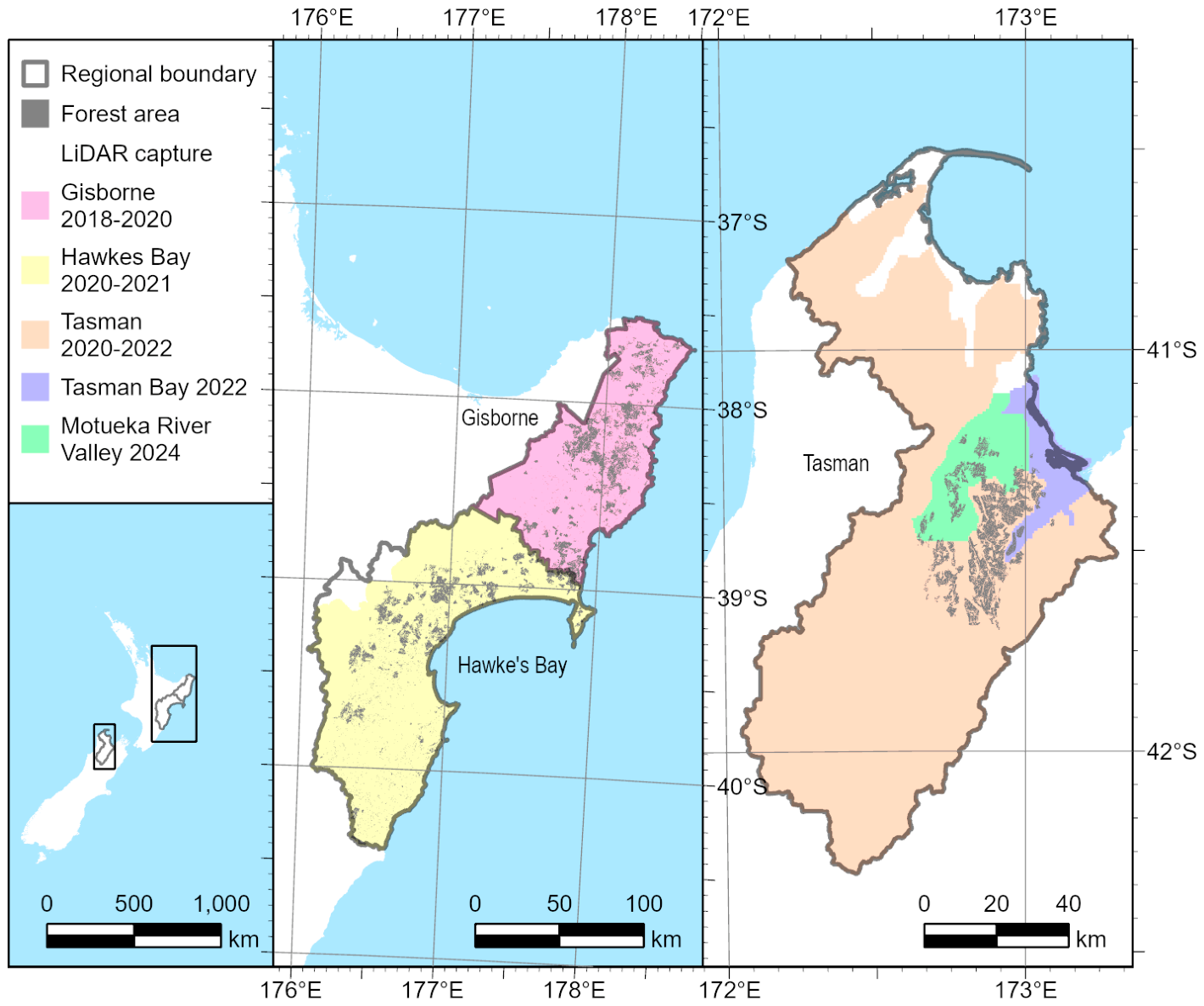
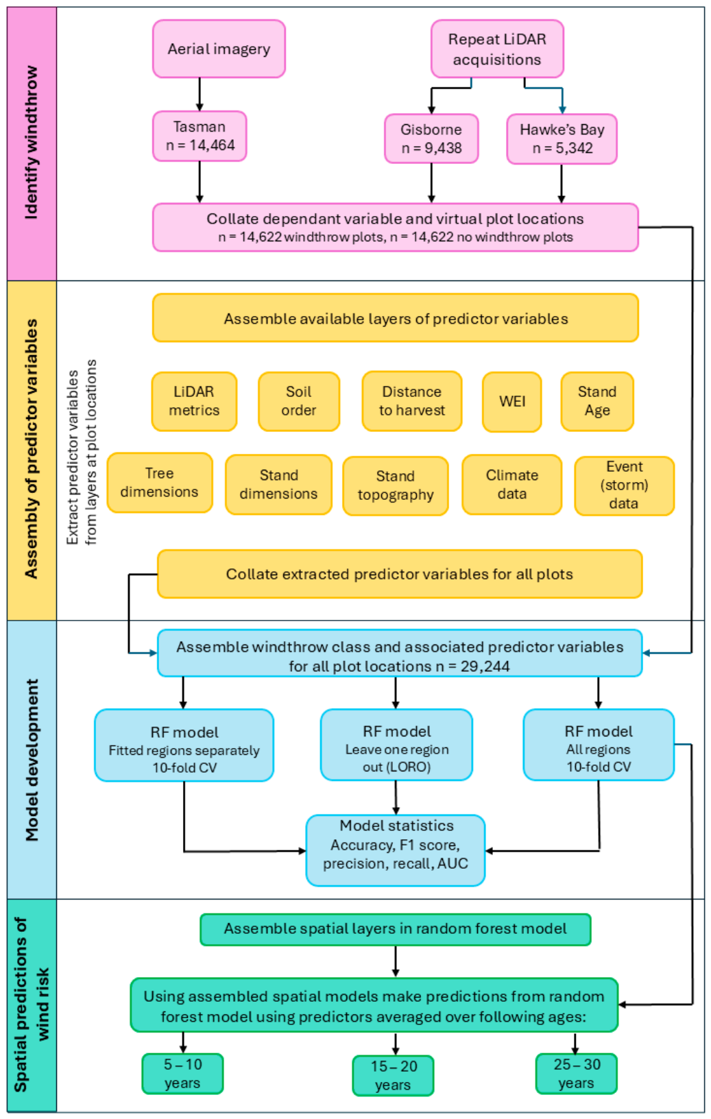
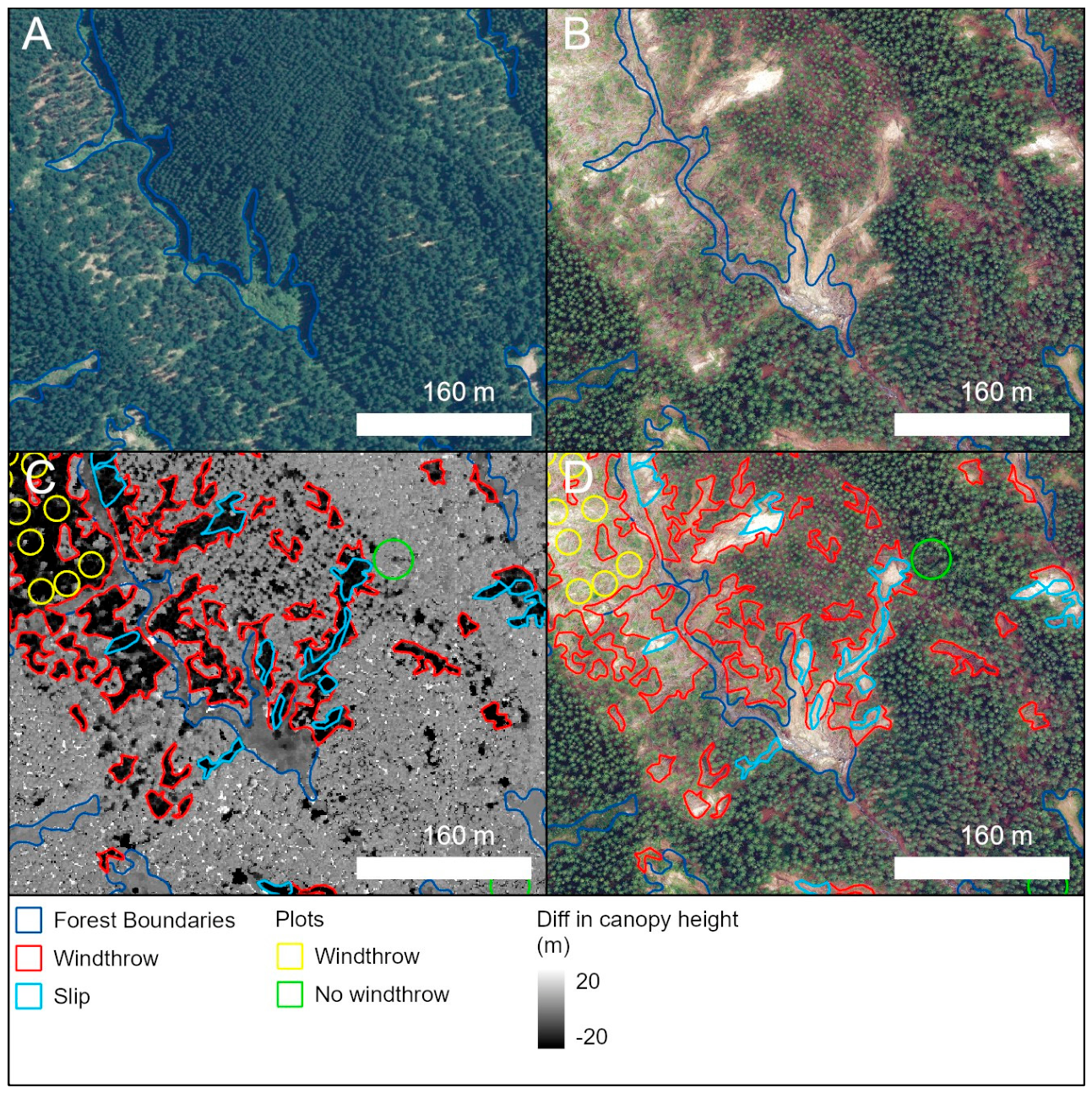
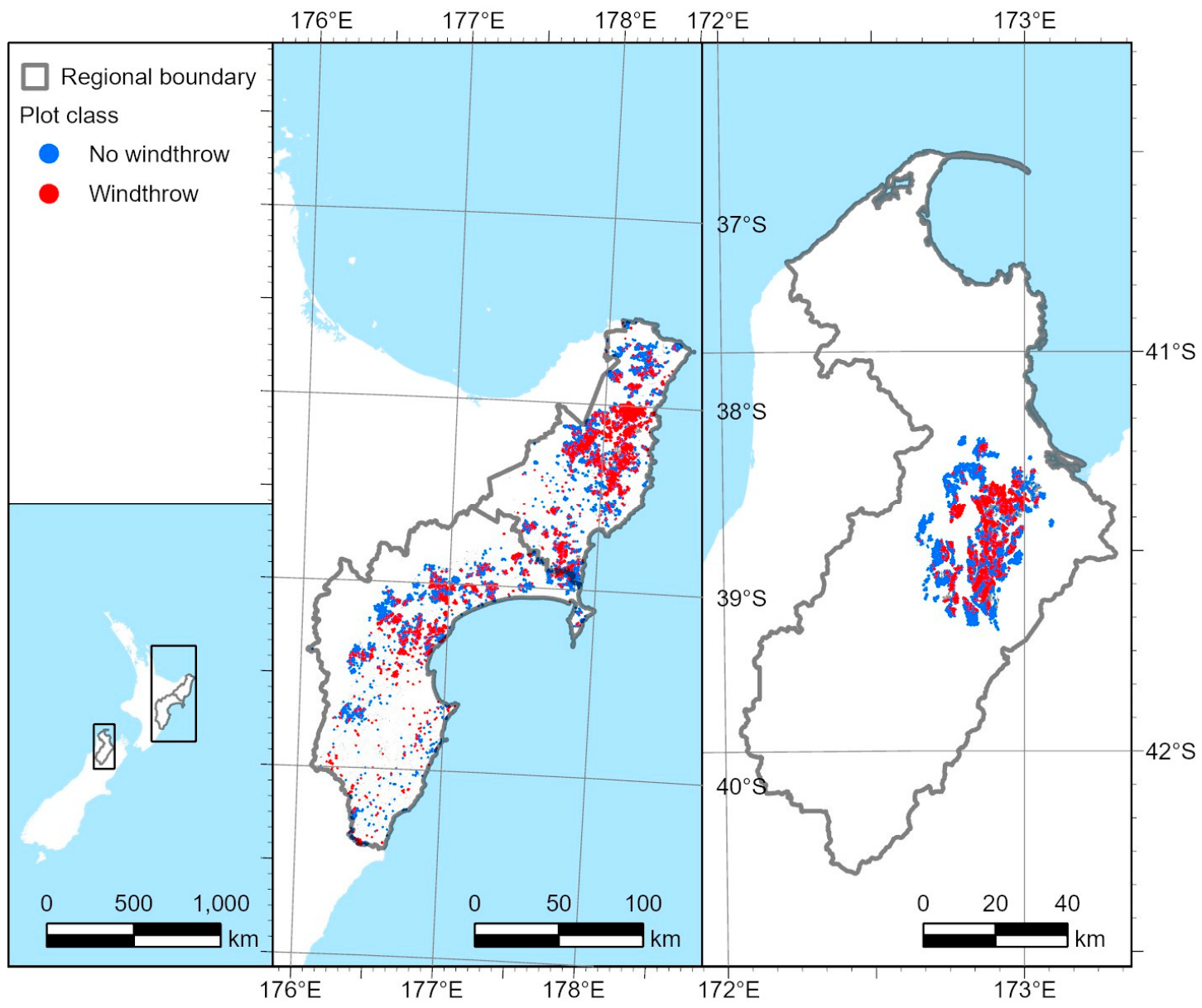
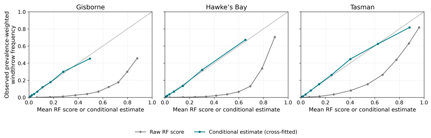
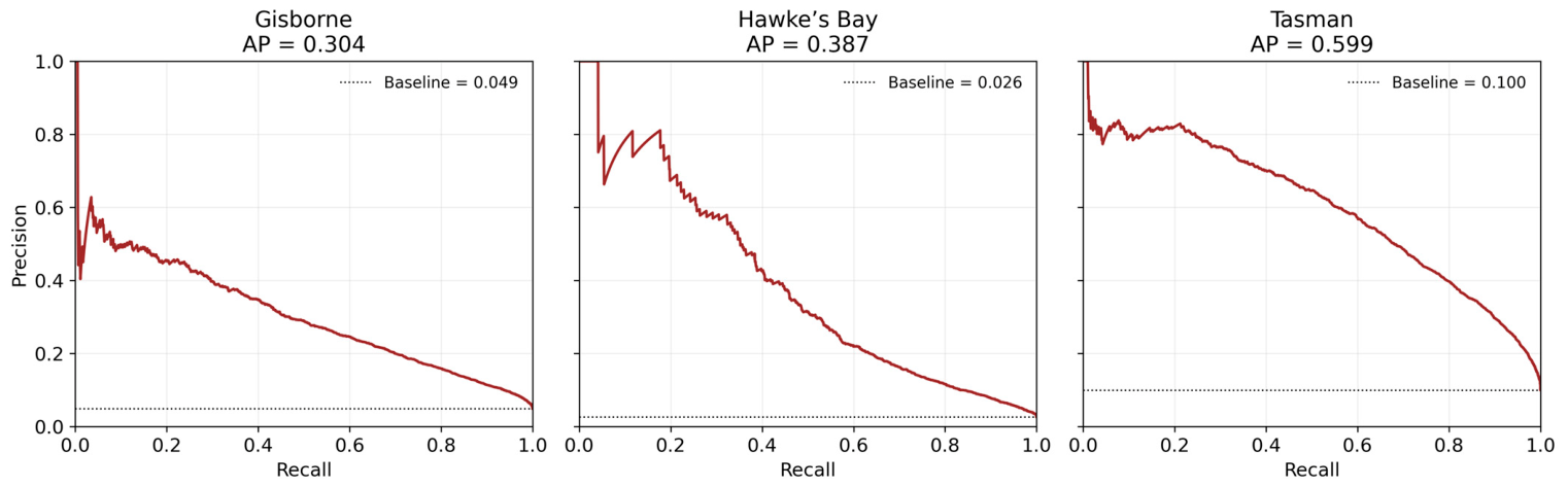
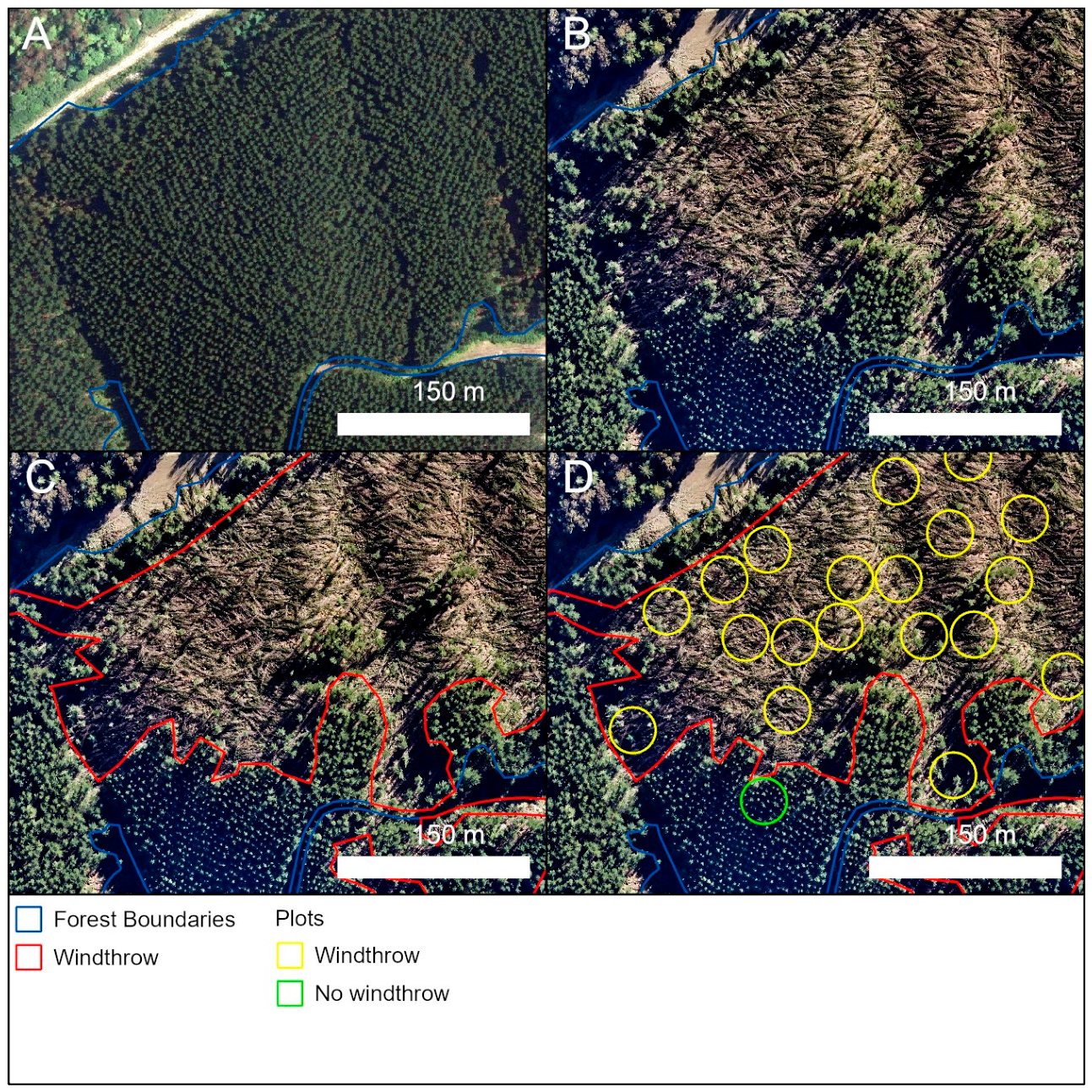
Windthrow is a major disturbance risk for radiata pine (Pinus radiata D. Don) plantations, but operational susceptibility models must transfer across regions and storm events. We developed a multi-regional framework combining airborne laser scanning (ALS), aerial imagery, mapped stand and site variables, climate, soils, and event-period weather. These data were used to detect storm damage and model windthrow susceptibility following major storm events in Gisborne, Hawke’s Bay and Tasman, New Zealand. Windthrow was mapped from repeat ALS canopy-height differencing in Gisborne and Hawke’s Bay, and from post-storm aerial imagery in Tasman, producing 29,244 balanced windthrow and no-windthrow plot observations. Random-forest models were evaluated using stand-grouped, spatially blocked and leave-one-region-out validation. Stand structure provided the strongest predictive signal, with windthrow concentrated in older, taller and higher-volume stands. Adding long-term climate produced the largest improvement beyond the Base stand/site formulation, giving a pooled ROC–AUC of 0.901 ± 0.013. Spatially blocked ROC–AUC for the selected model ranged across the three regions from 0.780 to 0.856, while leave-one-region-out ROC–AUC ranged from 0.649 to 0.802, demonstrating useful but region-dependent transfer. Adding soil and event-period weather did not consistently improve transferability. Prevalence-calibrated conditional scenario estimates increased with stand development under the mapped regional prevalence and the conditions represented by the reference events. These estimates provide a scalable basis for comparative windthrow-risk screening but should not be interpreted as independently validated absolute or annual windthrow probabilities.
Keywords: airborne laser scanning; plantation risk mapping; Pinus radiata; random forest; stand density; taper; wind damage airborne laser scanning; plantation risk mapping; Pinus radiata; random forest; stand density; taper; wind damage