
Mitigation of Flood Risks with the Aid of the Critical Points Method

 ,
,  , ,
, , 
Abstract
:1. Introduction
2. Materials and Methods
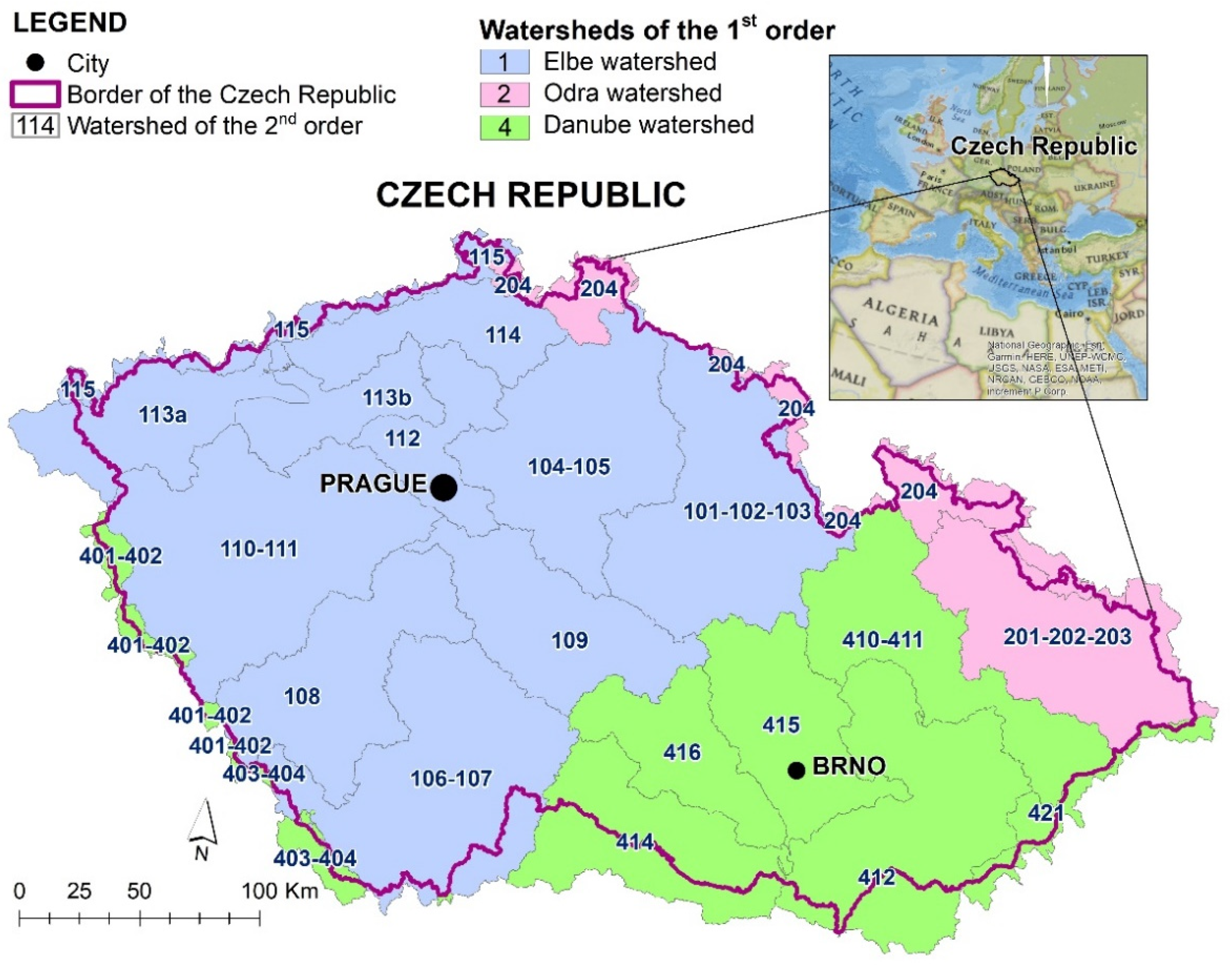
2.1. Study Area
2.2. Determination of Critical Points
- C1—size of catchment area (Ac) (0.3 ≤ Ac ≤ 10.0 km2)
- C2—average slope (Ip) of catchment area (Ip ≥ 3.5%)
- C3—percentage of arable land (AL) in catchment area (AL ≥ 40%)
- 4.
- C4—indicator of critical conditions (F ≥ 1.85)
- C1A size of catchment area (Ac) (1.0 ≤ Ac ≤ 10.0 km2)
- C2A average slope (Ip) of catchment area (Ip ≥ 5%)
2.3. Evaluation of Influence of Critical Conditions within Catchment Areas on Run-Off Characteristics in Watersheds
3. Results and Discussion
4. Conclusions
Author Contributions
Funding
Institutional Review Board Statement
Informed Consent Statement
Data Availability Statement
Conflicts of Interest
References
- Markantonis, V.; Meyer, V.; Lienhoop, N. Evaluation of the Environmental Impacts of Extreme Floods in the Evros River Basin Using Contingent. Nat. Hazards 2013, 69, 1535–1549. [Google Scholar] [CrossRef]
- Grežo, H.; Močko, M.; Izsóf, M.; Vrbičanová, G.; Petrovič, F.; Straňák, J.; Muchová, Z.; Slámová, M.; Olah, B.; Machar, I. Flood Risk Assessment for the Long-Term Strategic Planning Considering the Placement of Industrial Parks in Slovakia. Sustainability 2020, 12, 4144. [Google Scholar] [CrossRef]
- Igaz, D.; Šinka, K.; Varga, P.; Aydin, E. The Evaluation of the Accuracy of Interpolation Methods in Crafting Maps of Physical and Hydro-Physical Soil Properties. Water 2021, 13, 212. [Google Scholar] [CrossRef]
- Merz, B.; Kreibich, H.; Schwarze, R.; Thieken, A. Review Article “Assessment of Economic Flood Damage”. Nat. Hazards Earth Syst. Sci. 2010, 10, 1697–1724. [Google Scholar] [CrossRef]
- Janeček, M.; Dostál, T.; Kozlovsky-Dufková, J.; Dumbrovský, M.; Hůla, J.; Kadlec, V.; Konečná, J.; Kovář, P.; Krása, J.; Kubátová, E.; et al. Methodical Handbook—Protection of Agricultural Soils from the Soil Erosion; Czech University of Life Sciences Prague: Prague, Czech Republic, 2012. (In Czech) [Google Scholar]
- Thieken, A.H.; Müller, M.; Kreibich, H.; Merz, B. Flood Damage and Influencing Factors: New Insights from the August 2002 Flood in Germany. Water Resour. Res. 2005, 41, 1–16. [Google Scholar] [CrossRef]
- Mohor, G.S.; Thieken, A.H.; Korup, O. Residential Flood Loss Estimated from Bayesian Multilevel Models. Nat. Hazards Earth Syst. Sci. 2020, 21, 1599–1614. [Google Scholar] [CrossRef]
- Dráb, A.; Říha, J. An Approach to the Implementation of European Directive 2007/60/EC on Flood Risk Management in the Czech Republic. Nat. Hazards Earth Syst. Sci. 2010, 10, 1977–1987. [Google Scholar] [CrossRef]
- Štepánková, P.; Tejkalová, J.; Drbal, K. Process of Implementation of Directive 2007/60/EC on the Assessment and Management of Flood Risks in Conditions of the Czech Republic. Water Manag. Tech. Econ. Inf. J. 2017, 59, 10–16. (In Czech) [Google Scholar]
- Terêncio, D.P.S.; Fernandes, L.F.S.; Cortes, R.M.V.; Moura, J.P.; Pacheco, F.A.L. Science of the Total Environment Flood Risk Attenuation in Critical Zones of Continental Portugal Using Sustainable Detention Basins. Sci. Total Environ. 2020, 721, 137727. [Google Scholar] [CrossRef]
- Suwal, N.; Kuriqi, A.; Huang, X.; Walega, A. Environmental Flows Assessment in Nepal: The Case of Kaligandaki River. Sustain. Artic. 2020, 12, 8766. [Google Scholar] [CrossRef]
- Zeleňáková, M.; Gaňová, L.; Purcz, P.; Horský, M.; Satrapa, L.; Blišťan, P.; Diaconu, D.C. Mitigation of the Adverse Consequences of Floods for Human Life, Infrastructure, and the Environment. Nat. Hazards Rev. 2017, 18, 05017002. [Google Scholar] [CrossRef]
- Woodward, M.; Kapelan, Z.; Gouldby, B. Adaptive Flood Risk Management Under Climate Change Uncertainty Using Real Options and Optimization. Risk Anal. 2014, 34, 75–92. [Google Scholar] [CrossRef] [PubMed]
- Kundzewicz, Z.W.; Kanae, S.; Seneviratne, S.I.; Nicholls, N.; Peduzzi, P.; Mechler, R.; Bouwer, M.; Arnell, N.; Mach, K.; Muir-wood, R.; et al. Flood Risk and Climate Change: Global and Regional Perspectives. Hydrol. Sci. J. 2014, 59, 1–28. [Google Scholar] [CrossRef] [Green Version]
- European Environment Agency. Climate Change, Impacts and Vulnerability in Europe 2012: An Indicator-Based Report. 2012. Available online: http://www.eea.europa.eu/publications/climate-impacts-and-vulnerability-2012/at_download/file (accessed on 21 March 2022).
- Svoboda, V.; Hanel, M.; Máca, P.; Kyselý, J. Projected changes of rainfall event characteristics for the Czech Republic. J. Hydrol. Hydromech. 2016, 64, 415–425. [Google Scholar] [CrossRef] [Green Version]
- Beranová, R.; Kyselý, J.; Hanel, M. Characteristics of sub-daily precipitation extremes in observed data and regional climate model simulations. Theor. Appl. Climatol. 2018, 132, 515–527. [Google Scholar] [CrossRef]
- European Commission. Directive 2007/60/EC of the European Parliament and of the Council of 23 October 2007 on the assessment and management of flood risks. Off. J. Eur. Union 2007, 288, 27–34. Available online: http://eur-lex.europa.eu/legal-content/EN/TXT/?uri=CELEX:32007L0060 (accessed on 11 March 2009).
- Green, O.O.; Garmestani, A.S.; van Rijswick, H.M.F.W.; Keessen, A.M. EU water governance: Striking the right balance between regulatory flexibility and enforcement? Ecol. Soc. 2013, 18, 10. [Google Scholar] [CrossRef]
- Haer, T.; Husby, T.G.; Botzen, W.J.W.; Aerts, J.C.J.H. The safe development paradox: An agent-based model for flood risk under climate change in the European Union. Glob. Environ. Change 2020, 60, 1–12. [Google Scholar] [CrossRef]
- Lugeri, N.; Genovese, E.; Lavalle, C.; de Roo, A. Flood Risk in Europe: Analysis of Exposure in 13 Countries. 2006. Available online: https://www.preventionweb.net/publication/flood-risk-europe-analysis-exposure-13-countries (accessed on 21 March 2022).
- Barredo, J.I.; de Roo, A.; Lavalle, C. Flood Risk Mapping at European Scale. Water Sci. Technol. 2007, 56, 11–17. Available online: https://www.oieau.org/eaudoc/system/files/documents/42/210234/210234_doc.pdf (accessed on 21 March 2022). [CrossRef]
- Nones, M. Flood hazard maps in the European context. Water Int. 2017, 42, 324–332. [Google Scholar] [CrossRef]
- Klemešová, K. Flood Maps in the Czech Republic: Content, Perception and Information value. In E3S Web of Conferences; EDP Sciences: Les Ulis, France, 2016; Volume 7. [Google Scholar] [CrossRef] [Green Version]
- Baggaley, N.; Lilly, A.; Blackstock, K.; Dobbie, K.; Carson, A.; Leith, F. Soil risk maps—Interpreting soils data for policy makers, agencies and industry. Soil Use Manag. 2020, 36, 19–26. [Google Scholar] [CrossRef]
- Kubát, J.; Sandev, M.; Květoň, V.; Šercl, P.; Havlík, A.; Chroumal, J.; Brtníková, H.; Daňhelka, J.; Kocman, T.; Dumbrovský, M.; et al. Evaluation of Floods in June and July 2009 in the Czech Republic; Czech Hydrometeorological Institute: Prague, Czech Republic, 2009. (In Czech)
- Drbal, K.; Štěpánková, P.; Levitus, V.; Říha, J.; Dráb, A.; Satrapa, L.; Horský, M.; Valenta, P.; Valentová, J.; Friedmannová, L. Methodology for the Creation of Flood Hazard and Flood Risk; Masaryk, T.G., Ed.; Water Research Institute: Prague, Czech Republic, 2009. (In Czech) [Google Scholar]
- Dumbrovský, M.; Korsuň, S. Optimisation of Soil Conservation Systems within Integrated Territorial Protection. Soil Water Res. 2009, 2009, 57–65. [Google Scholar] [CrossRef] [Green Version]
- Ekotoxa. Determination of Contributing Areas over the Sealing Profiles of Erosively Threatened Arable Drainage Pathways for Needs of the Water Framework Directive 2000/60/EC; Ekotoxa: Opava, Czech Republic, 2011. (In Czech) [Google Scholar]
- Grešková, A. Analysis of Selected Basin Parameters from the Point of View of Flash Flood Occurrence. Geogr. Cas. 2005, 57, 131–144. (In Slovak) [Google Scholar]
- Zeleňáková, M.; Gaňová, L.; Purcz, P.; Satrapa, L.; Horský, M.; Harbuľáková, V.O. Flood Risk Assessment from Flash Floods in Bodva River Basin, Slovakia. In Dependability Engineering and Complex Systems; Zamojski, W., Mazurkiewicz, J., Tomasz, S., Janusz, W., Eds.; Springer International Publishing: Cham, Switzerland, 2016; pp. 583–595. [Google Scholar] [CrossRef]
- Scholz, M.; Yang, Q. Landscape and Urban Planning Guidance on Variables Characterizing Water Bodies Including Sustainable Flood Retention Basins. Landsc. Urban Plan. 2010, 98, 190–199. [Google Scholar] [CrossRef]
- Čimo, J.; Šinka, K.; Novotná, B.; Tárník, A.; Aydin, E.; Toková, L.; Kišš, V.; Kotuš, T. Change in Temperature Conditions of Slovakia to the Reference Period 1961–2010 and Their Expected Changes to Time Horizons Years 2035, 2050, 2075 and 2100 under the Conditions of Changing Climate. J. Ecol. Eng. 2020, 21, 232–240. [Google Scholar] [CrossRef]
- Gunnell, K.; Mulligan, M.; Francis, R.A.; Hole, D.G. Science of the Total Environment Evaluating Natural Infrastructure for Fl Ood Management within the Watersheds of Selected Global Cities. Sci. Total Environ. 2019, 670, 411–424. [Google Scholar] [CrossRef]
- Khaleefah, N.; Alwan, W.S. Identification of Flood Risk Zones in the Region of Yogyakarta Identification of Flood Risk Zones in the Region of Yogyakarta. IOP Conf. Ser. Mater. Sci. Eng. 2019, 650, 012061. [Google Scholar] [CrossRef]
- Kourgialas, N.N.; Karatzas, G.P.; Kourgialas, N.N.; Karatzas, G.P. Flood Management, and a GIS Modelling Method to Assess Flood-Hazard Areas—A Case Study Flood Management and a GIS Modelling Method to Assess Flood-Hazard Areas—A Case Study. Hydrol. Sci. J. 2011, 52, 212–225. [Google Scholar] [CrossRef]
- Šinka, K.; Kaletová, T. Determining the Characteristics of Direct Runoff from Real Rain Using GIS Environment. Acta Hortic. Regiotect. 2013, 16, 48–52. [Google Scholar] [CrossRef] [Green Version]
- Robinson, M.; Scholz, M.; Bastien, N.; Carfrae, J. Classification of Different Sustainable Flood Retention Basin Types. J. Environ. Sci. 2010, 22, 898–903. [Google Scholar] [CrossRef]
- de Brito, M.M.; Evers, M. Multi-Criteria Decision-Making for Flood Risk Management: A Survey of the Current State of the Art. Nat. Hazards Earth Syst. Sci. 2016, 16, 1019–1033. [Google Scholar] [CrossRef] [Green Version]
- Roub, R.; Hejduk, T.; Novák, P. Optimization of Flood Protection by Semi-Natural Means and Retention in the Catchment Area: A Case Study of Litavka River (Czech Republic). Morav. Geogr. Rep. 2013, 21, 51–56. [Google Scholar] [CrossRef]
- Pekárová, P.; Halmová, D.; Bačová Mitková, V.; Miklánek, P.; Pekár, J.; Škoda, P. Historic Flood Marks and Flood Frequency Analysis of the Danube River at Bratislava, Slovakia. J. Hydrol. Hydromech. 2013, 61, 326–333. [Google Scholar] [CrossRef] [Green Version]
- Hlavčová, K.; Danáčová, M.; Kohnová, S.; Szolgay, J.; Valent, P.; Výleta, R. Estimating the Effectiveness of Crop Management on Reducing Flood Risk and Sediment Transport on Hilly Agricultural Land—A Myjava Case Study, Slovakia. Catena 2019, 172, 678–690. [Google Scholar] [CrossRef]
- Húska, D.; Jurík, Ľ.; Tátošová, L.; Šinka, K.; Jakabovičová, J. Cultural Landscape, Floods and Remote Sensing. J. Ecol. Eng. 2017, 18, 31–36. [Google Scholar] [CrossRef]
- Šercl, P.; Janál, P.; Daňhelka, J.; Březková, L.; Kyznarová, H.; Novák, P. Possibilities of Prediction of Floods in Conditions of the Czech Republic; Czech Hydrometeorological Institute: Prague, Czech Republic, 2015. (In Czech)
- Liao, K.-H. From Flood Control to Flood Adaptation: A Case Study on the Lower Green River Valley and the City of Kent. Nat. Hazards 2014, 71, 723–750. [Google Scholar] [CrossRef]
- Poussin, J.K.; Botzen, W.J.W.; Aerts, J.C.J.H. Effectiveness of Flood Damage Mitigation Measures: Empirical Evidence from French Flood Disasters. Glob. Environ. Chang. 2015, 31, 74–84. [Google Scholar] [CrossRef]
- Poussin, J.K.; Bubeck, P.; Aerts, J.C.J.H.; Ward, P.J. Potential of Semi-Structural and Non-Structural Adaptation Strategies to Reduce Future Flood Risk: Case Study for the Meuse. Nat. Hazards Earth Syst. Sci. 2012, 12, 3455–3471. [Google Scholar] [CrossRef]
- Dawson, R.J.; Ball, T.; Werritty, J.; Werritty, A.; Hall, J.W.; Roche, N. Assessing the Effectiveness of Non-Structural Flood Management Measures in the Thames Estuary under Conditions of Socio-Economic and Environmental Change. Glob. Environ. Chang. 2011, 21, 628–646. [Google Scholar] [CrossRef]
- Izakovičová, Z.; Petrovič, F. The Integrated Approach to Landscape Management—Experience from Slovakia. Sustainability 2019, 11, 4554. [Google Scholar] [CrossRef] [Green Version]
- Jakubcová, A.; Grežo, H.; Hrešková, A.; Petrovič, F. Impacts of Flooding on the Quality of Life in Rural Regions of Southern Slovakia. Appl. Res. Qual. Life 2016, 11, 221–237. [Google Scholar] [CrossRef]
- Țîncu, R.; Luis, J.; Crăciun, I.; Lazăr, G.; Lazăr, I. Land Use Policy Quantitative Micro-Scale Flood Risk Assessment in a Section of the Trotuș. Land Use Policy 2020, 95, 103881. [Google Scholar] [CrossRef]
- Malczewski, J. Spatial Multicriteria Decision Analysis. In Spatial Multicriteria Decision Making and Analysis: A Geographic Information Sciences Approach; Thill, J.-C., Ed.; Ashgate Publishing: New York, NY, USA, 1999; pp. 11–48. [Google Scholar]
- Lin, H.; Wan, Q.; Li, X.; Chen, J.; Kong, Y. GIS-Based Multicriteria Evaluation for Investment Environment. Environ. Plan. B Plan. Des. 1997, 24, 403–414. [Google Scholar] [CrossRef]
- Drbal, K.; Dumbrovský, M. Methodical Guide for CP Identification; Ministry of the Environment: Brno, Czech Republic, 2009. (In Czech)


| Region | Number of CPs | Catchment Area of CPs (km2) |
|---|---|---|
| South Bohemian Region | 804 | 1822 |
| South Moravian Region | 713 | 1507 |
| Karlovarský Region | 204 | 671 |
| Region Vysočina | 854 | 1852 |
| Královéhradecký Region | 708 | 1589 |
| Liberecký Region | 476 | 1209 |
| Moravian and Silesian Region | 727 | 1609 |
| Olomoucký Region | 683 | 1564 |
| Pardubický Region | 715 | 1563 |
| Plzeňský Region | 752 | 1671 |
| Prague | 24 | 59 |
| Central Bohemian Region | 1288 | 2776 |
| Ústecký Region | 669 | 1770 |
| Zlínský Region | 644 | 1688 |
| Total | 9261 | 21,350 |
| F | Number of CP | Size of Catchment Areas (Ac) (km2) | Arable Land within Catchment Area (AL) (km2) |
|---|---|---|---|
| 37 | 526 | 3552 | 2217 |
| 40 | 427 | 2972 | 1914 |
| 45 | 305 | 2233 | 1519 |
| 52 | 206 | 1608 | 1123 |
| 59 | 101 | 836 | 631 |
| Risk Rate | Number of Watersheds of 4th Order | Average Size of Watersheds of 4th Order (km2) | Total Area (km2) | Share of Area (%) |
|---|---|---|---|---|
| High | 616 | 7.34 | 4524 | 5.7 |
| Middle | 1448 | 9.97 | 14,442 | 18.3 |
| Low | 1992 | 16.26 | 32,381 | 41.1 |
| Without any risk | 4899 | 5.62 | 27,520 | 34.9 |
| Groups of Watersheds | F-WA | R | Fr | S-Area (%) | |||
|---|---|---|---|---|---|---|---|
| Min | Max | Min | Max | Min | Max | ||
| 101–102–103 | 1.299 | 69.885 | 0.006 | 1.000 | 0.024 | 67.808 | 19.75 |
| 104–105 | 1.746 | 71.933 | 0.006 | 0.997 | 0.018 | 70.638 | 32.00 |
| 106–107 | 1.903 | 76.899 | 0.007 | 0.994 | 0.021 | 74.856 | 20.16 |
| 108 | 1.865 | 61.759 | 0.011 | 0.998 | 0.046 | 55.804 | 15.65 |
| 109 | 1.527 | 80.373 | 0.010 | 0.997 | 0.026 | 78.914 | 21.94 |
| 110–111 | 1.051 | 60.998 | 0.008 | 0.999 | 0.018 | 55.228 | 13.58 |
| 112 | 2.179 | 69.418 | 0.010 | 0.996 | 0.031 | 55.610 | 42.00 |
| 113a | 1.356 | 40.382 | 0.006 | 0.969 | 0.020 | 30.000 | 0.00 |
| 113b | 2.486 | 52.355 | 0.021 | 0.925 | 0.052 | 43.093 | 5.25 |
| 114 | 1.567 | 48.809 | 0.018 | 0.983 | 0.062 | 24.130 | 2.57 |
| 115 | 1.691 | 16.734 | 0.016 | 0.999 | 0.068 | 12.870 | 0.00 |
| 201–202–203 | 2.125 | 82.001 | 0.004 | 0.994 | 0.010 | 51.185 | 28.82 |
| 204 | 1.898 | 36.280 | 0.017 | 0.996 | 0.056 | 32.717 | 14.25 |
| 401–402 | 1.672 | 19.600 | 0.072 | 0.974 | 0.120 | 19.091 | 0.00 |
| 403–404 | – | – | – | – | – | – | – |
| 410–411 | 2.138 | 63.276 | 0.015 | 0.999 | 0.053 | 49.174 | 16.79 |
| 412 | 1.835 | 81.285 | 0.010 | 0.999 | 0.042 | 69.225 | 15.60 |
| 414 | 1.471 | 79.793 | 0.016 | 0.999 | 0.053 | 71.492 | 24.80 |
| 415 | 1.859 | 55.484 | 0.020 | 0.999 | 0.064 | 53.732 | 40.84 |
| 416 | 2.289 | 52.638 | 0.016 | 0.995 | 0.051 | 44.624 | 25.43 |
| 421 | 2.091 | 19.540 | 0.014 | 0.974 | 0.057 | 17.528 | 0.00 |
Publisher’s Note: MDPI stays neutral with regard to jurisdictional claims in published maps and institutional affiliations. |
© 2022 by the authors. Licensee MDPI, Basel, Switzerland. This article is an open access article distributed under the terms and conditions of the Creative Commons Attribution (CC BY) license (https://creativecommons.org/licenses/by/4.0/).
Share and Cite
Drbal, K.; Dumbrovský, M.; Muchová, Z.; Sobotková, V.; Štěpánková, P.; Šarapatka, B. Mitigation of Flood Risks with the Aid of the Critical Points Method. Agronomy 2022, 12, 1300. https://doi.org/10.3390/agronomy12061300
Drbal K, Dumbrovský M, Muchová Z, Sobotková V, Štěpánková P, Šarapatka B. Mitigation of Flood Risks with the Aid of the Critical Points Method. Agronomy. 2022; 12(6):1300. https://doi.org/10.3390/agronomy12061300
Chicago/Turabian StyleDrbal, Karel, Miroslav Dumbrovský, Zlatica Muchová, Veronika Sobotková, Pavla Štěpánková, and Bořivoj Šarapatka. 2022. "Mitigation of Flood Risks with the Aid of the Critical Points Method" Agronomy 12, no. 6: 1300. https://doi.org/10.3390/agronomy12061300
APA StyleDrbal, K., Dumbrovský, M., Muchová, Z., Sobotková, V., Štěpánková, P., & Šarapatka, B. (2022). Mitigation of Flood Risks with the Aid of the Critical Points Method. Agronomy, 12(6), 1300. https://doi.org/10.3390/agronomy12061300