
Study into the Evolution of Spatiotemporal Characteristics and Driving Mechanisms of Production–Living–Ecological Spaces on the Indochina Peninsula

Abstract
:1. Introduction
2. Materials and Methods
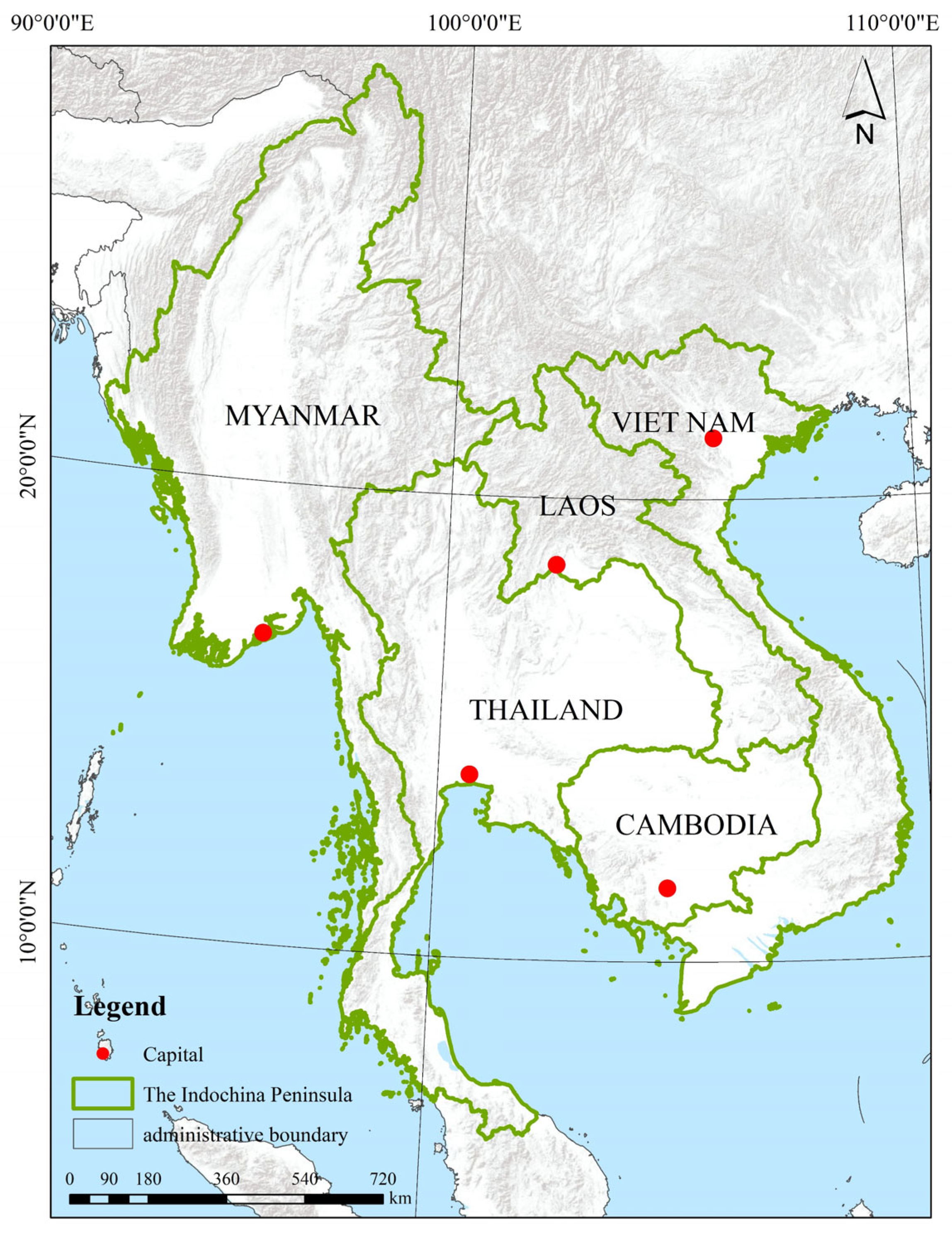
2.1. Site Description
2.2. Data Source
2.3. Data Preprocessing
2.4. Research Methods
2.4.1. Transfer Matrix of PLES
2.4.2. Land-Use Dynamics Index
2.4.3. Standard Deviation Ellipse Model
2.4.4. GTWR Model
3. Results
3.1. Analysis of the Dynamics of Spatiotemporal Patterns in PLES
3.2. Spatiotemporal Analysis of the Evolutionary Process of PLES
3.2.1. Quantitative Analysis of Land-Use-Type Shifts in PLES
3.2.2. Analysis of the Process of Transferring Land-Use Types in PLES
3.3. Analysis of PLES Spatiotemporal Pattern Evolution Drivers
4. Discussion
5. Conclusions
- The area of interconversion of PLES utilization types in the Indochina Peninsula from 2010 to 2020 was 212,818.70 km2, which was manifested in the conversion of ecological space into productive space and the interconversion of woodland ecological space and grassland ecological space.
- There was a spatial variation in the rate of change in spatial patterns, with Cambodia having the fastest rate of change in PLES, followed by Laos and Myanmar the slowest.
- The migration path of the center of gravity of PLES on the Indochina Peninsula demonstrates significant directional differences. In 2010–2020, production space migrated to the southwest, living space shifted to the northeast, and ecological space shifted to the east.
- The transfer of PLES functional types throughout the Indochina Peninsula was influenced by social context and regional environment, the degree of influence of each factor having significant spatial and temporal heterogeneities. The distribution areas of positive and negative feedback effects for each factor were different, as were the transfer directions.
Author Contributions
Funding
Data Availability Statement
Conflicts of Interest
Appendix A


References
- Perz, S.G.; Qiu, Y.; Xia, Y.; Southworth, J.; Sun, J.; Marsik, M.; Rocha, K.; Passos, V.; Rojas, D.; Alarcón, G.; et al. Trans-Boundary Infrastructure and Land Cover Change: Highway Paving and Community-Level Deforestation in a Tri-National Frontier in the Amazon. Land Use Policy 2013, 34, 27–41. [Google Scholar] [CrossRef]
- Li, Q.; Lu, R.; Li, G. Research progress on regional land-use change along national border and it’s interactive relationship with frontier trade development. China Land Sci. 2015, 29, 16–23. [Google Scholar] [CrossRef]
- Feng, J.; Li, P.; Xiao, C.; Qi, Y.; Xia, L. Border prone characteristics of agricultural expansion and intensification in the borders of Thailand and its neighboring countries (Cambodia, Laos and Myanmar) under the context of geo-economy. J. Geo-Inf. Sci. 2021, 23, 479–491. [Google Scholar]
- Xiao, C.; Rao, D.; Liu, Y.; Feng, Z.; Li, P. Construction land expansion in the Mohan Boten port area between China and Laos in the geoeconomic cooperation context. J. Geoinf. Sci. 2019, 21, 1576–1585. [Google Scholar] [CrossRef]
- Disperati, L.; Virdis, S.G.P. Assessment of Land-Use and Land-Cover Changes from 1965 to 2014 in Tam Giang-Cau Hai Lagoon, Central Vietnam. Appl. Geogr. 2015, 58, 48–64. [Google Scholar] [CrossRef]
- Zaehringer, J.G.; Llopis, J.C.; Latthachack, P.; Thein, T.T.; Heinimann, A. A Novel Participatory and Remote-Sensing-Based Approach to Mapping Annual Land Use Change on Forest Frontiers in Laos, Myanmar, and Madagascar. J. Land Use Sci. 2018, 13, 16–31. [Google Scholar] [CrossRef]
- Lambin, E.F.; Geist, H.J.; Lepers, E. Dynamics of Land-Use and Land-Cover Change in Tropical Regions. Annu. Rev. Environ. Resour. 2003, 28, 205–241. [Google Scholar] [CrossRef]
- Geist, H.J.; Lambin, E.F. Proximate Causes and Underlying Driving Forces of Tropical Deforestation. BioScience 2002, 52, 143. [Google Scholar] [CrossRef]
- Fox, J.; Vogler, J.B. Land-Use and Land-Cover Change in Montane Mainland Southeast Asia. Environ. Manag. 2005, 36, 394–403. [Google Scholar] [CrossRef]
- Lambin, E.F.; Turner, B.L.; Geist, H.J.; Agbola, S.B.; Angelsen, A.; Bruce, J.W.; Coomes, O.T.; Dirzo, R.; Fischer, G.; Folke, C.; et al. The Causes of Land-Use and Land-Cover Change: Moving beyond the Myths. Glob. Environ. Chang. 2001, 11, 261–269. [Google Scholar] [CrossRef]
- Zou, L.; Liu, Y.; Yang, J.; Yang, S.; Wang, Y.; Cao, Z.; Hu, X. Quantitative Identification and Spatial Analysis of Land Use Ecological-Production-Living Functions in Rural Areas on China’s Southeast Coast. Habitat Int. 2020, 100, 102182. [Google Scholar] [CrossRef]
- Xie, X.; Li, X.; Fan, H.; He, W. Spatial Analysis of Production-Living-Ecological Functions and Zoning Method under Symbiosis Theory of Henan, China. Environ. Sci. Pollut. Res. Int. 2021, 28, 69093–69110. [Google Scholar] [CrossRef] [PubMed]
- Liu, C.; Xu, Y.; Liu, Y.; Sun, P.; Huang, A.; Zhou, J. Research on Land Use Functions Classification and Evaluation System Based on System Theory. Beijing Daxue Xuebao Acta Sci. Nat. Univ. Pekin. 2018, 54, 181–188. [Google Scholar] [CrossRef]
- Bennett, E.M.; Peterson, G.D.; Gordon, L.J. Understanding Relationships among Multiple Ecosystem Services. Ecol. Lett. 2009, 12, 1394–1404. [Google Scholar] [CrossRef]
- Wang, J.; Sun, Q.; Zou, L. Spatial-Temporal Evolution and Driving Mechanism of Rural Production-Living-Ecological Space in Pingtan Islands, China. Habitat Int. 2023, 137, 102833. [Google Scholar] [CrossRef]
- Beshir, S.; Moges, A.; Dananto, M. Trend Analysis, Past Dynamics and Future Prediction of Land Use and Land Cover Change in Upper Wabe-Shebele River Basin. Heliyon 2023, 9, e19128. [Google Scholar] [CrossRef]
- Ustaoglu, E.; Perpiña Castillo, C.; Jacobs-Crisioni, C.; Lavalle, C. Economic Evaluation of Agricultural Land to Assess Land Use Changes. Land Use Policy 2016, 56, 125–146. [Google Scholar] [CrossRef]
- Zalles, V.; Hansen, M.C.; Potapov, P.V.; Parker, D.; Stehman, S.V.; Pickens, A.H.; Parente, L.L.; Ferreira, L.G.; Song, X.-P.; Hernandez-Serna, A.; et al. Rapid Expansion of Human Impact on Natural Land in South America since 1985. Sci. Adv. 2021, 7, eabg1620. [Google Scholar] [CrossRef]
- Lai, L.; Huang, X.; Yang, H.; Cai, X.; Zhang, M.; Zhong, T.; Chen, Y.; Chen, Y.; Wang, X.; Thompson, J. Carbon Emissions from Land-Use Change and Management in China between 1990 and 2010. Sci. Adv. 2016, 2, e1601063. [Google Scholar] [CrossRef]
- Arowolo, A.O.; Deng, X. Land Use/Land Cover Change and Statistical Modelling of Cultivated Land Change Drivers in Nigeria. Reg. Environ. Change 2018, 18, 247–259. [Google Scholar] [CrossRef]
- Shi, Z.; Deng, W.; Zhang, S. Spatio-Temporal Pattern Changes of Land Space in Hengduan Mountains during 1990–2015. J. Geogr. Sci. 2018, 28, 529–542. [Google Scholar] [CrossRef]
- Hongjun, S.; Ge, S.; Hongmei, Z. Identification of production-living-ecological space at Keshan County level in main grain producing areas in northern Songnen Plain, China. Trans. Chin. Soc. Agric. Eng. 2020, 36, 264–271. [Google Scholar]
- Yoshida, A.; Chanhda, H.; Ye, Y.-M.; Liang, Y.-R. Ecosystem Service Values and Land Use Change in the Opium Poppy Cultivation Region in Northern Part of Lao PDR. Acta. Ecol. Sin. 2010, 30, 56–61. [Google Scholar] [CrossRef]
- Laurance, W.F. Forest Destruction in Tropical Asia. Curr. Sci. 2007, 93, 1544–1550. [Google Scholar]
- Wannasai, N.; Shrestha, R.P. Role of Land Tenure Security and Farm Household Characteristics on Land Use Change in the Prasae Watershed, Thailand. Land Use Policy 2008, 25, 214–224. [Google Scholar] [CrossRef]
- Wang, Q.; Wang, H. Dynamic Simulation and Conflict Identification Analysis of Production–Living–Ecological Space in Wuhan, Central China. Integr. Environ. Assess Manag. 2022, 18, 1578–1596. [Google Scholar] [CrossRef]
- Zhang, R.; Li, S.; Wei, B.; Zhou, X. Characterizing Production–Living–Ecological Space Evolution and Its Driving Factors: A Case Study of the Chaohu Lake Basin in China from 2000 to 2020. ISPRS Int. J. Geo-Inf. 2022, 11, 447. [Google Scholar] [CrossRef]
- Wu, S.; Wang, Z.; Du, Z.; Huang, B.; Zhang, F.; Liu, R. Geographically and Temporally Neural Network Weighted Regression for Modeling Spatiotemporal Non-Stationary Relationships. Int. J. Geogr. Inf. Sci. 2021, 35, 582–608. [Google Scholar] [CrossRef]
- Liu, C.; Xu, Y.; Lu, X.; Han, J. Trade-Offs and Driving Forces of Land Use Functions in Ecologically Fragile Areas of Northern Hebei Province: Spatiotemporal Analysis. Land Use Policy 2021, 104, 105387. [Google Scholar] [CrossRef]
- Fan, Q.; Song, X.; Shi, Y.; Gao, R. Influencing Factors of Spatial Heterogeneity of Land Surface Temperature in Nanjing, China. IEEE J. Sel. Top. Appl. Earth Obs. Remote Sens. 2021, 14, 8341–8349. [Google Scholar] [CrossRef]
- Fotheringham, A.S.; Yang, W.; Kang, W. Multiscale Geographically Weighted Regression (MGWR). Ann. Am. Assoc. Geogr. 2017, 107, 1247–1265. [Google Scholar] [CrossRef]
- Wei, C.; Liu, C.; Gui, F. Geographically Weight Seemingly Unrelated Regression (GWSUR): A Method for Exploring Spatio-Temporal Heterogeneity. Appl. Econ. 2017, 49, 4189–4195. [Google Scholar] [CrossRef]
- Huang, B.; Wu, B.; Barry, M. Geographically and Temporally Weighted Regression for Modeling Spatio-Temporal Variation in House Prices. Int. J. Geogr. Inf. Sci. 2010, 24, 383–401. [Google Scholar] [CrossRef]
- Kelly, P.L. Escalation of Regional Conflict: Testing the Shatterbelt Concept. Political Geogr. Q. 1986, 5, 161–180. [Google Scholar] [CrossRef]
- Wu, Z. Classical Geopolitics, Realism and the Balance of Power Theory. J. Strateg. Stud. 2018, 41, 786–823. [Google Scholar] [CrossRef]
- Chen, A.L.Q. The Belt and Road Initiative as a Variegated Agglomeration of Multi-Scalar State Spatial Strategies. Territ. Polit. Gov. 2023, 11, 478–501. [Google Scholar] [CrossRef]
- Chen, S.; Li, Y. Study on the traffic network system of international subregional cooperation of the connective part of the China, Laos, Burma and Thailand. Econ. Geogr. 2000, 6, 84–87+96. [Google Scholar] [CrossRef]
- Zhang, L.; Wu, Y.; Li, J.; Li, C. Analysis of land use and landscape pattern change in Myanmar section of the Golden Quadrangle Region in the border of China, Myanmar, Thailand and Laos. World Reg. Stud. 2018, 27, 21–33. [Google Scholar]
- Thongmanivong, S.; Fujita, Y. Recent Land Use and Livelihood Transitions in Northern Laos. Mt. Res. Dev. 2006, 26, 237–244. [Google Scholar] [CrossRef]
- Yang, X. Analysis of the “Four Corners” Economic Cooperation Program among China, Lao People’s Democratic Republic, Myanmar and Thailand. Southeast Asian Stud. 1999. [Google Scholar] [CrossRef]
- Lin, G.; Jiang, D.; Fu, J.; Cao, C.; Zhang, D. Spatial Conflict of Production–Living–Ecological Space and Sustainable-Development Scenario Simulation in Yangtze River Delta Agglomerations. Sustainability 2020, 12, 2175. [Google Scholar] [CrossRef]
- Fu, J.; Gao, Q.; Jiang, D.; Li, X.; Lin, G. Spatial–temporal distribution of global production–living–ecological space during the period 2000–2020. Sci. Data 2023, 10, 589. [Google Scholar] [CrossRef] [PubMed]
- Li, H.; Guan, L.; Chen, J. Study on Remote Sensing Monitoring of Land Use Based on Road Net Buffer. In Proceedings of the PIAGENG 2013: Intelligent Information, Control, and Communication Technology for Agricultural Engineering, Sanya, China, 19 March 2013; SPIE: St Bellingham, WA, USA; Volume 8762, pp. 262–267. [Google Scholar] [CrossRef]
- Li, Q.; Su, Y.; Feng, Z.; Xin, Z.; Ligang, G.; Xiaohong, M.; Geng, L. Study on production-living-ecological space function coupling coordination in Fen river basin. SSWC 2021, 19, 115–125. [Google Scholar] [CrossRef]
- Zheng, F.; Xiao, C.; Feng, Z. Impact of Armed Conflict on Land Use and Land Cover Changes in Global Border Areas. Land Degrad. Dev. 2023, 34, 873–884. [Google Scholar] [CrossRef]
- Pettit, L. Conditioning Diagnostics: Collinearity and Weak Data in Regression. J. R. Stat. Soc. Ser. C (Appl. Stat.) 1992, 41, 601. [Google Scholar] [CrossRef]
- Naes, T.; Mevik, B.-H. Understanding the Collinearity Problem in Regression and Discriminant Analysis: Collinearity Problem In Regression And Discriminant Analysis. J. Chemom. 2001, 15, 413–426. [Google Scholar] [CrossRef]
- Ding, Y.; Zhang, J.; Liu, Y.; Lu, C.; Wang, S.; Qin, J.; Ding, S. Spatial distribution characteristics and influencing factors of soil organic carbon in Yihe River Basin based on GWR model. Acta Ecol. Sin. 2021, 41, 4876–4885. [Google Scholar] [CrossRef]
- Zhang, S.; Shao, H.; Li, X.; Xian, W.; Shao, Q.; Yin, Z.; Lai, F.; Qi, J. Spatiotemporal Dynamics of Ecological Security Pattern of Urban Agglomerations in Yangtze River Delta Based on LUCC Simulation. Remote Sens. 2022, 14, 296. [Google Scholar] [CrossRef]
- Liu, C.; Xu, R.; Xu, K.; Lin, Y.; Cao, Y. Carbon Emission Effects of Land Use in Chaobai River Region of Beijing–Tianjin–Hebei, China. Land 2023, 12, 1168. [Google Scholar] [CrossRef]
- Yang, L.; Liu, F. A study on the evolution of the spatial pattern of tri-generation in central Yunnan urban agglomeration based on LUCC. Shanghai Land Resour. 2023, 44, 28–35. [Google Scholar]
- Zhang, Y.; Jiang, P.; Cui, L.; Yang, Y.; Ma, Z.; Wang, Y.; Miao, D. Study on the Spatial Variation of China’s Territorial Ecological Space Based on the Standard Deviation Ellipse. Front. Environ. Sci. 2022, 10, 982734. [Google Scholar] [CrossRef]
- Luo, Y. From the GMS to the Lancang-Mekong Cooperation: Competing international institutions on the Indochina Peninsula. Diplomatic Review. J. Foreign Aff. Coll. 2018, 35, 119–156. [Google Scholar] [CrossRef]
- Mather, A.S. The Forest Transition. Area 1992, 24, 367–379. [Google Scholar] [CrossRef]
- Tran, H.; Tran, T.; Kervyn, M. Dynamics of Land Cover/Land Use Changes in the Mekong Delta, 1973–2011: A Remote Sensing Analysis of the Tran Van Thoi District, Ca Mau Province, Vietnam. Remote Sens. 2015, 7, 2899–2925. [Google Scholar] [CrossRef]
- Wu, X.; Yang, S.; Yin, S.; Xu, H. Spatial-temporal Dynamic Characteristics and lts Driving Mechanism of Urban Built-Up Area in Yangtze River Delta Based on GTWR Model. Resour. Environ. Yangtze Basin 2021, 30, 2594–2606. [Google Scholar]
- Deng, Y.; Liu, Y.; Liu, J.; Xu, S.; Luo, A. Application of GBGWR Model in Spatial Distribution Simulation of Precipitation. Bull. Survcying Mapp. 2018, 3, 32–37+42. [Google Scholar] [CrossRef]


| Primary Category | Secondary Category | Data Source |
|---|---|---|
| The production space | 1—Agricultural production space; | GlobeLand30: cropland |
| 2—Industrial production space; | GlobeLand30: artificial surface (excluding the range of living space defined by SEDAC) | |
| The living space | 3—Urban living space; | SEDAC: the population density is greater than 1500/km2 |
| 4—Rural living space; | SEDAC: the population density is 300–1500/km2 | |
| The ecological space | 5—Forest ecological space; | GlobeLand30: forest, bush |
| 6—Grassland ecological space; | GlobeLand30: grass | |
| 7—Water ecological space; | GlobeLand30: wetlands, water, glaciers, and permanent snow cover | |
| 8—Other ecological spaces | GlobeLand30: tundra, bare land |
| Datatypes | Parameter | Factor | Introduction to Data | Data Source |
|---|---|---|---|---|
| Humanistic location | X1 | Distance to railway | Indicates the distance from the center of each pixel to the nearest railway line | https://www.openstreetmap.org (accessed on 10 July 2023) https://www.naturalearthdata.com/ (accessed on 7 July 2023) |
| X2 | Distance to road | Indicates the distance from the center of each pixel to the nearest road | Socioeconomic Data and Applications Center | SEDAC (columbia.edu) https://www.openstreetmap.org | |
| X3 | Distance to river | Indicates the distance from the center of each pixel to the nearest river | https://www.openstreetmap.org | |
| Social economy | X4 | Night lights | Indicates the nighttime light value within each pixel | VIIRS Nighttime Light (mines.edu) geodata.cn |
| X5 | Population density | Denotes the value of the population density within each pixel | https://sedac.ciesin.columbia.edu/ (accessed on 4 June 2023) | |
| Natural environment | X6 | Precipitation | Indicates the value of rainfall within each pixel | Climatic Research Unit—Groups and Centres (uea.ac.uk) |
| X7 | Normalized difference vegetation index (NDVI) | Indicates the NDVI value within each pixel | https://ladsweb.modaps.eosdis.nasa.gov/ (accessed on 8 July 2023) | |
| Geopolitics | X8 | Armed conflict events | Indicates the number of deaths from armed conflicts in each pixel. | ACLED | Bringing Clarity to Crisis (acleddata.com) |
| VIF | X1 | X2 | X3 | X4 | X5 | X6 | X7 | X8 |
|---|---|---|---|---|---|---|---|---|
| 2010 | 1.125 | 1.068 | 1.069 | 1.283 | 1.326 | 1.061 | 1.104 | 1.035 |
| 2020 | 1.140 | 1.121 | 1.068 | 1.065 | 1.088 | 1.072 | 1.077 | 1.040 |
| 2010–2020 | 1.131 | 1.077 | 1.063 | 1.166 | 1.196 | 1.06 | 1.085 | 1.038 |
| ID | Category | Laos | Cambodia | Myanmar | Thailand | Vietnam | The Indochina Peninsula |
|---|---|---|---|---|---|---|---|
| 1 | Agricultural production space | 0.80% | 1.97% | −0.14% | 0.01% | 0.47% | 0.25% |
| 2 | Industrial production space | 63.19% | 7.56% | 5.50% | 13.69% | 10.85% | 9.84% |
| 3 | Urban living space | 2.53% | 6.63% | −0.42% | 7.45% | 2.12% | 3.44% |
| 4 | Rural living space | 3.14% | 1.12% | 1.64% | −1.59% | 0.42% | 0.18% |
| 5 | Forest ecological space | −0.18% | −1.23% | −0.05% | 0.00% | −0.55% | −0.24% |
| 6 | Grassland ecological space | 0.10% | −0.70% | −0.02% | −1.05% | −0.58% | −0.36% |
| 7 | Water ecological space | 1.96% | 0.42% | 0.37% | −0.51% | 1.57% | 0.34% |
| 8 | Other ecological spaces | 1.40% | −2.62% | 422.08% | 8.21% | −0.42% | |
| Comprehensive land-use dynamic index | 0.14% | 0.71% | 0.07% | 0.13% | 0.30% | 0.16% | |
| Id | Category | Center X | Center Y |
|---|---|---|---|
| 1 | The production space 2020 | 101.075225 | 18.664372 |
| 2 | The production space 2010 | 101.064734 | 18.789373 |
| 3 | The living space 2020 | 104.048867 | 16.76586 |
| 4 | The living space 2010 | 104.001003 | 16.56669 |
| 5 | The ecological space 2020 | 101.289046 | 17.13435 |
| 6 | The ecological space 2010 | 101.024312 | 17.142921 |
| Year | Category | X1 | X2 | X3 | X4 | X5 | X6 | X7 | X8 |
|---|---|---|---|---|---|---|---|---|---|
| 2010 | Agricultural production space | −0.264 | −0.169 | 0.011 | −3.810 | 4.692 | −0.250 | −0.478 | −0.286 |
| Industrial production space | −0.021 | −0.034 | −0.010 | 0.038 | 0.617 | −0.002 | −0.018 | −0.063 | |
| Urban living space | −0.127 | −0.119 | −0.092 | −1.857 | 6.327 | −0.079 | −0.038 | 1.049 | |
| Rural living space | −0.001 | −0.043 | −0.012 | 0.626 | 1.574 | −0.023 | −0.007 | −0.075 | |
| Forest ecological space | 0.384 | 0.314 | 0.158 | 3.360 | −13.91 | 0.344 | 0.551 | −0.203 | |
| Grassland ecological space | 0.045 | −0.012 | −0.033 | −0.710 | 0.056 | −0.033 | 0.019 | −0.280 | |
| Water ecological space | −0.002 | 0.060 | −0.028 | 0.539 | −0.142 | 0.000 | −0.044 | −0.121 | |
| Other ecological spaces | 0.000 | 0.002 | −0.003 | 0.016 | 0.043 | −0.002 | −0.002 | −0.005 | |
| 2020 | Agricultural production space | −0.301 | −0.551 | −0.013 | −6.364 | 5.143 | −0.191 | −0.448 | 1.449 |
| Industrial production space | −0.024 | −0.081 | −0.008 | 0.346 | 0.623 | −0.003 | −0.021 | −0.044 | |
| Urban living space | −0.106 | −0.291 | −0.061 | 2.112 | 6.758 | 0.041 | −0.038 | −2.406 | |
| Rural living space | −0.001 | −0.059 | −0.007 | 1.461 | 1.575 | −0.021 | −0.009 | −0.151 | |
| Forest ecological space | 0.409 | 0.726 | 0.126 | 4.707 | −16.17 | 0.161 | 0.561 | 0.653 | |
| Grassland ecological space | 0.056 | −0.002 | −0.023 | −1.960 | 0.604 | −0.006 | 0.012 | −0.095 | |
| Water ecological space | −0.009 | 0.112 | −0.021 | −0.546 | 0.269 | −0.003 | −0.043 | −0.152 | |
| Other ecological spaces | 0.000 | 0.001 | −0.001 | 0.010 | 0.045 | −0.001 | −0.002 | 0.001 |
Disclaimer/Publisher’s Note: The statements, opinions and data contained in all publications are solely those of the individual author(s) and contributor(s) and not of MDPI and/or the editor(s). MDPI and/or the editor(s) disclaim responsibility for any injury to people or property resulting from any ideas, methods, instructions or products referred to in the content. |
© 2023 by the authors. Licensee MDPI, Basel, Switzerland. This article is an open access article distributed under the terms and conditions of the Creative Commons Attribution (CC BY) license (https://creativecommons.org/licenses/by/4.0/).
Share and Cite
Lu, S.; Zhou, Z.; Houding, M.; Yang, L.; Gao, Q.; Cao, C.; Li, X.; Bu, Z. Study into the Evolution of Spatiotemporal Characteristics and Driving Mechanisms of Production–Living–Ecological Spaces on the Indochina Peninsula. Land 2023, 12, 1767. https://doi.org/10.3390/land12091767
Lu S, Zhou Z, Houding M, Yang L, Gao Q, Cao C, Li X, Bu Z. Study into the Evolution of Spatiotemporal Characteristics and Driving Mechanisms of Production–Living–Ecological Spaces on the Indochina Peninsula. Land. 2023; 12(9):1767. https://doi.org/10.3390/land12091767
Chicago/Turabian StyleLu, Shuang, Zibo Zhou, Mingyang Houding, Liu Yang, Qiang Gao, Chenglong Cao, Xiang Li, and Ziqiang Bu. 2023. "Study into the Evolution of Spatiotemporal Characteristics and Driving Mechanisms of Production–Living–Ecological Spaces on the Indochina Peninsula" Land 12, no. 9: 1767. https://doi.org/10.3390/land12091767
APA StyleLu, S., Zhou, Z., Houding, M., Yang, L., Gao, Q., Cao, C., Li, X., & Bu, Z. (2023). Study into the Evolution of Spatiotemporal Characteristics and Driving Mechanisms of Production–Living–Ecological Spaces on the Indochina Peninsula. Land, 12(9), 1767. https://doi.org/10.3390/land12091767