Abstract
The Gulf Cooperation Council (GCC) countries experience a harsh environment with low precipitation and high evaporation rates. This presents a significant challenge of water scarcity and water quality degradation which is exacerbated by land use practices. Agriculture, urbanization, and industrialization are impacting the management of water resources. This paper examines the state of water resources in the GCC countries and presents the impact of land use practices. A detailed analysis of the relationship between land use and groundwater is conducted with a focus on the Kingdom of Saudi Arabia (KSA), the Sultanate of Oman, and the United Arab Emirates (UAE). The results indicate a drop in agricultural activities, an increase in bare land and urban areas, depletion of groundwater, and water quality degradation. These changes were attributed to excessive agricultural and industrial uses, climate change, and rapid urbanization. The findings show the need for sustainable land use practices and water resources management. Further research addressing the impact of land use on water in Kuwait, Qatar, and Bahrain, and evaluating the effectiveness of policy, is essential.
1. Introduction
Land use refers to how human beings use and manage land and its resources as a way of sustaining their lives. It differs from land cover, which refers to the biological and physical materials that exist on the surface of land, whether natural or manmade. Land use includes agricultural, residential, commercial, or any other anthropogenic uses of the land by people. This implies the exploitation of land, and the associated resources, which translates into denaturalizing the land. Land cover, on the other hand, includes both the natural and man-made/caused changes that occur on the surface of land over time. Land use and land cover are often referred to together as land use/land cover change (LULC), which is regarded as the product of natural and socio-economic aspects of an area and their accompanying anthropogenic manipulation in space and time [1].
Land use practices may vary in different parts of the world, but they often lead to similar outcomes. These include the ever-increasing human demand for natural resources, economic pressures on those resources, and detrimental effects on the environment. Throughout the history of urban development, literature has demonstrated the environmental impacts of land use practices on various scales. These impacts range from atmospheric pollution to changes in the global ecosystem.
Climate change is also an essential factor affecting the cycle of the water. Many studies consider this factor in more detail; however, climate change is global, but its effects differ from region to region. The land use pattern is crucial to the region’s vulnerability and resiliency.
A crucial change happened in the GCC region’s water history, strongly related to the oil and gas industry in the region. After the Second World War, huge investments were made in the GCC region, leading to a drastic population boom. Until the mid-1950s, the primary source of water was groundwater.
The GCC countries are located in areas with low precipitation, hence, they are referred to as arid regions. These regions face challenges with water scarcity, flash floods, and water resource management. These challenges are exacerbated due to the complexity of shifts in the hydrologic conditions, making water resource management difficult [2]. The term “arid” is used to describe regions with extremely high temperatures and less than 100 mm of annual rainfall. Conversely, “semi-arid” refers to areas receiving between 250 and 500 mm of rainfall per year. Arid and semi-arid regions experience higher rates of evapotranspiration than precipitation, leading to the possibility of frequent droughts and occasional floods. These regions are recognized as some of the most water-stressed areas, where groundwater (GW) from aquifers is the primary water resource. However, the over-reliance on GW is unsustainable due to the slow recharge rate caused by low precipitation. Moreover, heavy reliance on GW, coupled with intense pumping, increases the risk of pollution, including salinity intrusion [3].
The quality and availability of water are significant natural resources for communities. The extraction of water from streams and groundwater systems to cater to the needs of cities and the associated land use changes have negative consequences on the natural environment [4]. LULC changes are causing the change of natural habitats to urban and agricultural areas, which results in water degradation. In addition to the quantity of water affected over time, non-point source pollution from agriculture and urbanization is increasingly impacting water quality globally [5]. Agricultural, sewage, and industrial waste, and the introduction of pollutants such as fertilizers and pesticides, are causing water quality degradation.
The impact of land use planning is severely affecting water resources. In addition to the short-term effects on water resources, land use practices have a critical role in long-term and strategic plans for water sustainability and regional resilience. Developing water management strategies that support sustainable development while protecting water resources for future generations requires an understanding of the relationships that exist between land use practices, governance, socioeconomic factors, environmental dynamics, and water resources. Governance informed by scientific studies and engagement with different sectors is essential to reduce the risks to water resources. Specifically, based on the estimated annual risk index, governance and food security were found to be stronger influential factors to the risks to groundwater in the Gulf Cooperation Council countries than the storage reserves [6].
Water resources are essential for any country across the globe, and the GCC countries are no exception. Despite being rich in oil and gas reserves, these countries have low stocks of water and little suitable land for agriculture and farming. According to UN reports, except Oman, the GCC countries fall under the category of “acute scarcity” of water [7], meaning the annual sustainable source of water is below 500 m3/capita. Some environmental experts estimate this to be as low as 100 cubic meters. In addition, in 2015, the region’s demand for water exceeded the available supply by 67%. According to the GCC Statistics Center, the long-term precipitation rate in the GCC countries from 1980 to 2009 was 263 billion cubic meters [8]. In 2022, the precipitation for all GCC countries was recorded to be 214.1 billion cubic meters [8].
Using academic literature and case studies as a guide, the significance of this review lies in the examination of the complex relationship between land use patterns and water resources in the GCC countries. The objectives of this paper are to understand the connection between water resources and land use activities and to highlight research gaps. This is conducted by answering the following research question: What is the impact of land use practices on groundwater quantity and quality in the GCC countries?
2. Materials and Methods
2.1. Study Area
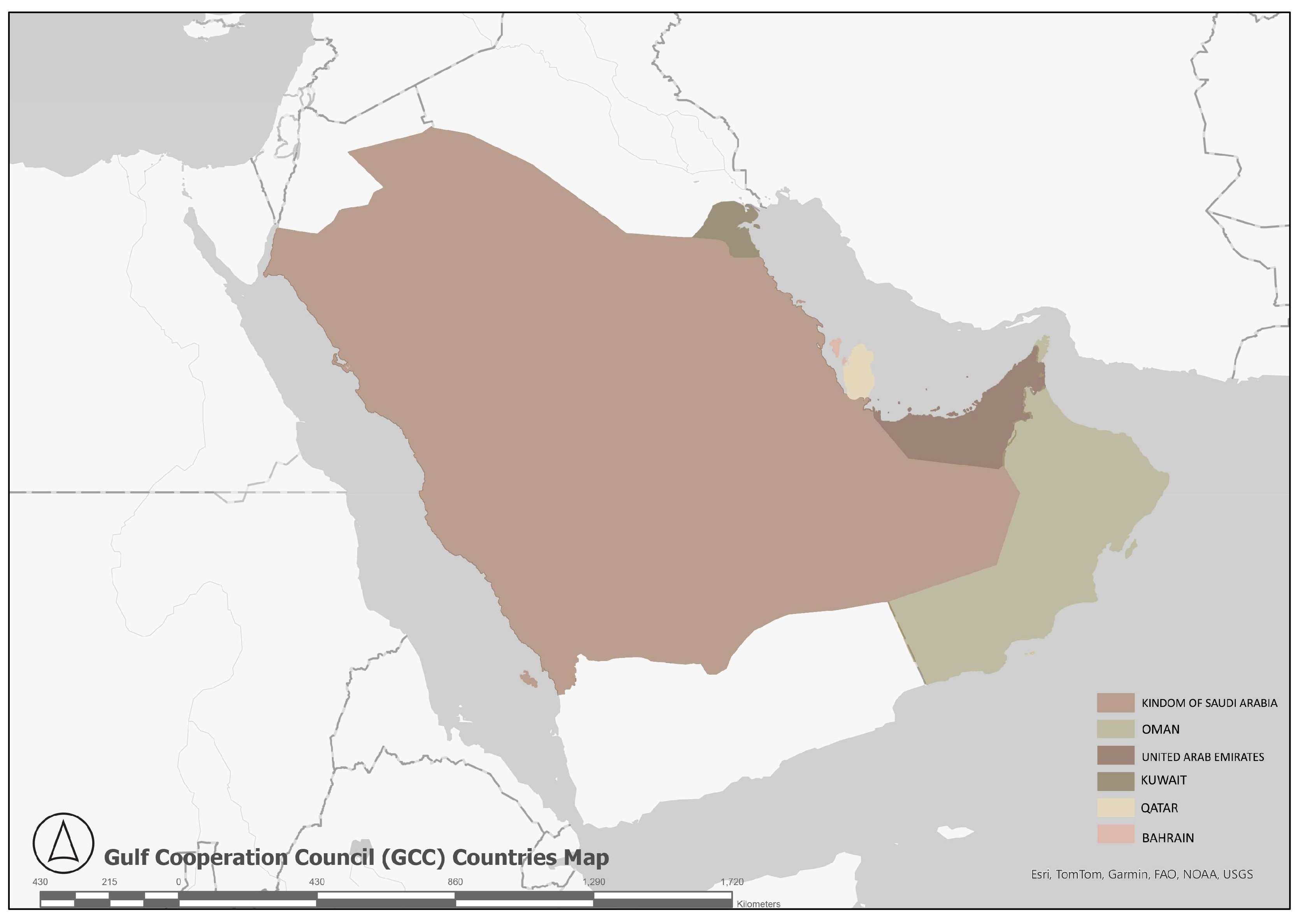
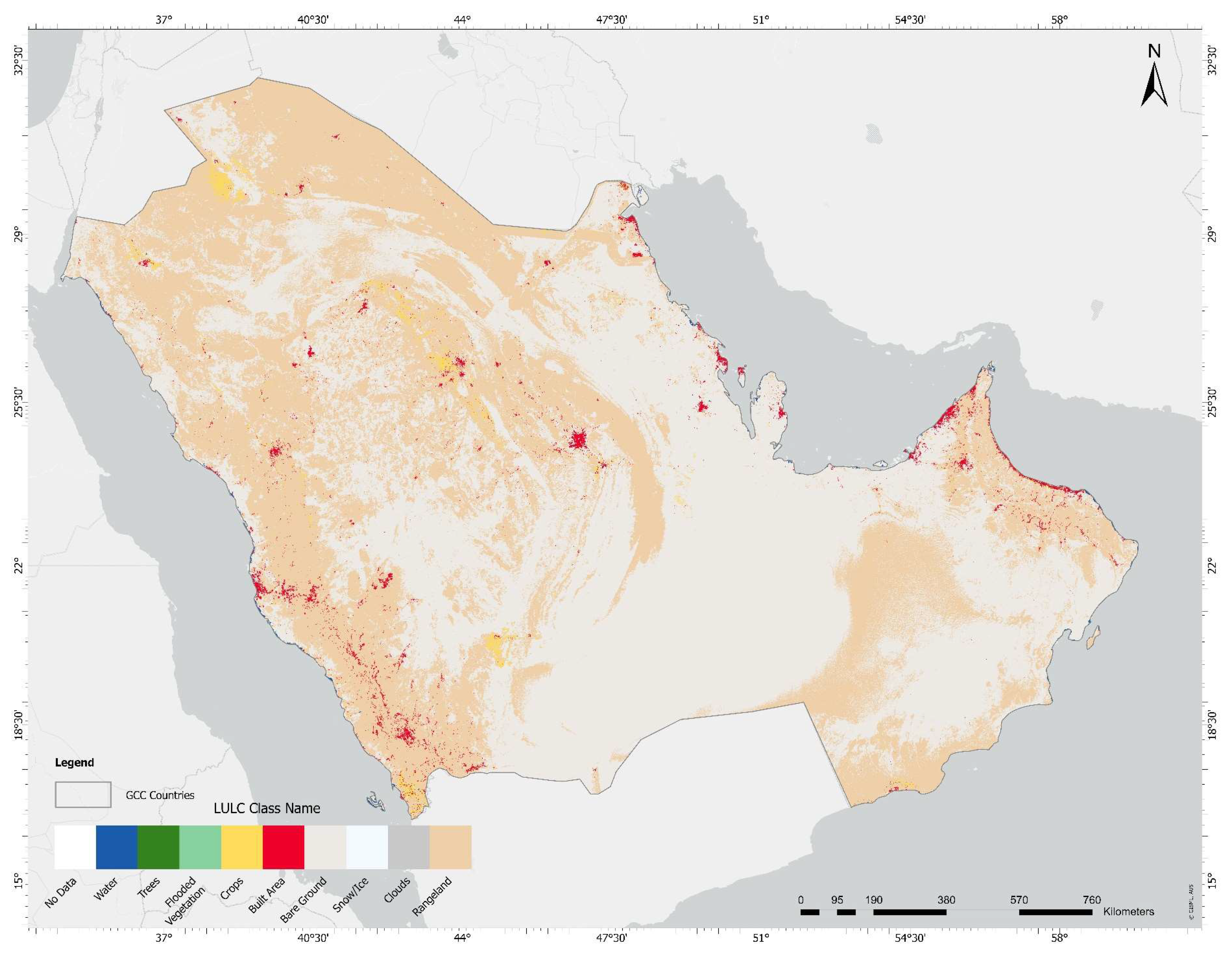
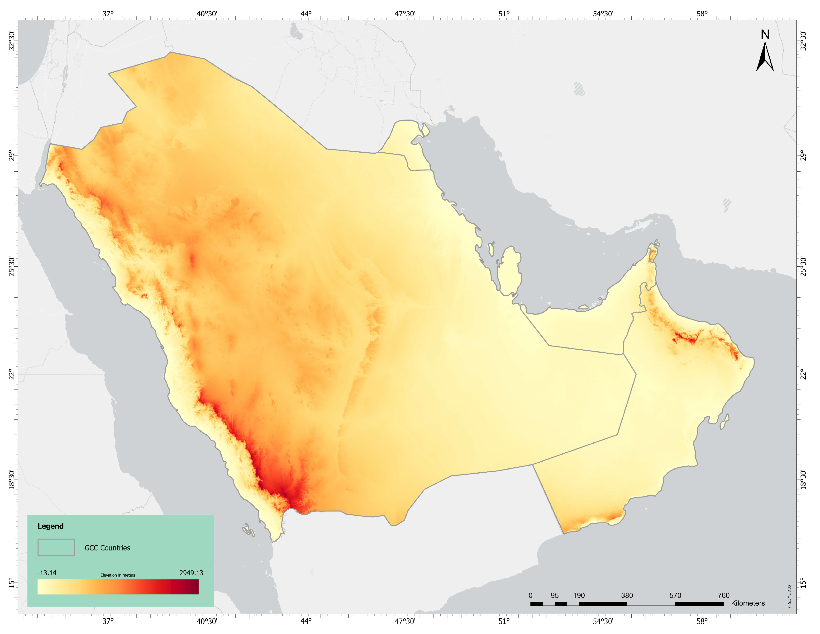
In 1981, the Gulf Cooperation Council (GCC) was formed by the integration of six countries: the United Arab Emirates (UAE), the Kingdom of Bahrain, the Kingdom of Saudi Arabia (KSA), the Sultanate of Oman, the State of Qatar, and the State of Kuwait (Figure 1) [9]. Based on 2021 statistics obtained from the GCC statistics center, the GCC countries have a total area of 2,410,687 square kilometers and a population of approximately 56.4 million, making the aggregated population density 23.5 persons per square kilometer (Table 1) [10]. The largest GCC country, Saudi Arabia, accounts for 83% of this land, with the highest population in the GCC of 34.1 million, accounting for 60.5% of the total GCC population [11]. Bahrain is the smallest country in the region, consisting of 33 islands with a total area of 787 square kilometers and a population of 1.5 million [11]. The population density in Bahrain is much higher than that of other GCC countries, with 1906 inhabitants per square kilometer. Oman is the second largest GCC country in terms of land; the country has a population of 4.5 million and an area of 309,500 square kilometers, with the lowest population density of 15 persons per square kilometer [11]. In terms of land area, Oman is followed by UAE, Kuwait, and Qatar, with areas of 71,000, 17,800, and 11,600 square kilometers, respectively [10]. Examining the LULC, most of the land is bare ground and rangeland (Figure 2). Higher elevations can be observed in the southwest of KSA and the northeast of Oman (Figure 3). Similarly, Figure 4 shows lower temperatures near higher elevations and higher temperatures near lower elevations.

Figure 1.
Location of the Gulf Cooperation Council (GCC) countries.

Table 1.
Data on the GCC countries based on 2021 statistics from the GCC-STAT center [10,11].

Figure 2.
LULC in the Gulf Cooperation Council (GCC) countries.

Figure 3.
Elevation in the Gulf Cooperation Council (GCC) countries.
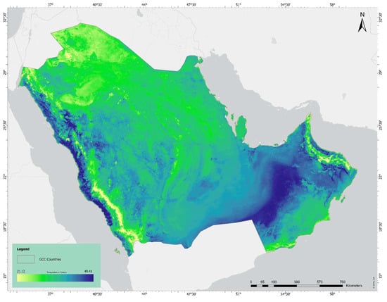
Figure 4.
Temperature in the Gulf Cooperation Council (GCC) countries.
2.2. Methodology
An extensive review of scholarly articles, reports, and statistics related to the relationship between land use practices and water resources in the Gulf Cooperation Council (GCC) countries was conducted. The literature ranged from 2000 to 2023 and can be classified under the categories in Table 2. Subject-specific databases were utilized to identify relevant publications, such as ScienceDirect, IEEE Xplore, and other multidisciplinary databases, such as Google Scholar. The selection process involved a chronological organization of papers and reports to determine the most relevant results. This was followed by a categorization based on key topics and countries. Relevant data on each country were extracted from the selected literature, including findings, methodologies used, study areas, and temporal coverage. The findings were synthesized and analyzed to identify patterns and trends related to the impact of land use practices on water quantity and quality. As a result of the wide range of studies on this topic in Saudi Arabia, Oman, and UAE, the review comprehensively discusses them as case studies to provide insights into the water conditions in the GCC countries.
Table 2.
Literature Categories.
3. Results
3.1. Water Resource Availability and Management in the GCC Region
One of the most significant challenges in the GCC region is water scarcity. This is due to reasons such as the limited rainfall that typically happens as rare bursts during a short period, the high evaporation rate as a result of the climate, and the low recharge rate of groundwater. This presents a risk to the sustainable development of the GCC countries [12]. The water resources can be categorized into conventional, including surface water and groundwater, and non-conventional, such as desalination and treated wastewater (Table 3). The GCC countries are mainly dependent on groundwater, followed by desalination, reused water, and surface water. During the period from 2017 to 2020, the freshwater available for use per capita dropped by 25.7% [13]. Accordingly, the countries are moving towards utilizing non-conventional resources to meet the increasing demand for water with lower stress on the scarce conventional resources. However, examining the 2020 data from the GCC Statistics Center [10], groundwater is the main water resource for KSA, Oman, and UAE (Table 4). On the other hand, Qatar and Bahrain are mainly dependent on desalination. Kuwait depends almost equally on both groundwater and desalination. Reused water is the least used resource, probably due to the associated constraints.
Table 3.
GCC freshwater available for use 2017–2020 by water resource [13].
Table 4.
Distribution of total freshwater in the GCC in 2020 by source [10].
3.1.1. Surface Water
Surface water is a scarce resource in the GCC countries as a result of the region’s harsh climate and topography. The average annual precipitation falls in the range of 70 to 130 mm, except in Oman, the shore to the east, and the zones in the southwest of KSA [14]. These limited precipitation levels are accompanied by high evaporation rates that may reach more than 3000 mm annually [14,15]. KSA has the highest level of renewable water, followed by Oman and UAE, see Table 5. This resource is almost absent in Kuwait, Qatar, and Bahrain (Table 5). The total annual surface water in the GCC is estimated to be 4.14 BCM [14]. As a result of their agricultural activities, KSA, Oman, and UAE have the highest water consumption levels [14]. Currently, only KSA, Oman, and UAE are utilizing dams to harvest surface water, recharge the groundwater, and protect against risks of flooding.
Table 5.
Surface water resources in the GCC countries [14,16,17].
3.1.2. Groundwater
Groundwater is the main water resource in the GCC countries. Renewable groundwater can be found in shallow aquifers, which are crucial for meeting urban and rural water demands, specifically in KSA and Oman [14]. These aquifers are at risk due to land use activities such as agricultural, residential, and industrial uses [14]. Non-renewable groundwater can be found in deep aquifers, especially in KSA and Oman. These aquifers formed as a result of heavy rainfall during the Pleistocene and the Pliocene periods [14]. During the period from 2017 to 2020, the percentage of extracted groundwater in the total available freshwater in the GCC dropped to 70.5% in 2020 (Table 3). Although the GCC countries are shifting some of their dependence from groundwater extraction to other non-conventional resources, the rate of groundwater depletion is still considerably high. The dependence on groundwater resources to compensate for the limited surface water in the GCC has resulted in a decrease in the water quantity, damage to springs, and damage to the quality of water due to the mixing of seawater with coastal aquifers [14]. In 2020, a study was conducted to calculate the ratio of water extraction to available resources, mainly focusing on understanding the level of groundwater depletion. The results showed that Kuwait had the highest depletion, a ratio of 0.75, while Oman had the lowest, 0.021 [12]. These ratios can be interpreted in terms of the lifespans of the water resources. If the current conditions hold constant, the spans until depletion are 50, 25, 12, 8, 3, and 1 year for Oman, Saudi Arabia, Qatar, UAE, Bahrain, and Kuwait, respectively [12].
3.1.3. Desalination
Desalination, the process of producing fresh water from salty water, gained popularity due to the high stress on water in the region and the availability of energy sources. The process presents a way to diversify water dependence away from groundwater and to maintain quality standards, specifically for residential and industrial sectors [18]. The GCC countries are desalinating using mainly multi-stage flash distillation (MSF) and multi-effect distillation (MED) in addition to more recent advanced technologies such as reverse osmosis (RO) [14]. The GCC countries experienced a population increase of 12.6% in 2020 compared to 2015 [13]. Accordingly, they increased the capacity of their desalination stations from 7.5 BCM in 2015 to 8.3 BCM in 2020 [13]. Currently, residential demand is mainly dependent on desalination. Mainly, the highest consumption of desalinated water is by the municipal sector, except in Qatar and Bahrain, where the industrial sector is dominant. Table 6 details daily desalinated water consumption across the six Gulf Cooperation Council (GCC) countries in various sectors. UAE and Saudi Arabia (KSA) exhibit the highest overall consumption, particularly in the municipal and industrial sectors. UAE leads municipal usage with 2.691 MCM/day and industrial usage with 2.142 MCM/day, while KSA follows closely. Consumption in the power and military sectors is minimal across all countries, with the military sector showing no usage in Oman, Qatar, and Bahrain. The tourism sector sees significant usage in KSA and UAE, and agricultural consumption is highest in KSA and Bahrain. This table highlights substantial differences in desalinated water usage patterns among the countries and sectors [14,19]. The total annual desalination capacity of the GCC countries is estimated at 26.4 BCM, with KSA and UAE having the highest capacities [14]. KSA has 35% of the desalination stations, while UAE has 33% [20].
Table 6.
Desalinated water consumption by sector (MCM/day) [14,19].
3.1.4. Treated Wastewater
Wastewater contains dangerous components including organic materials, nutrients, metals, bacteria, and viruses that can result in water pollution. Large amounts of wastewater are being discharged into seawater [14]. The treatment of wastewater is an important step that provides an alternative to the disadvantages of desalination in terms of energy consumption and environmental damage and reduces non-renewable groundwater abstraction. Wastewater treatment depends on the geography of the location, the density of the population, and the proximity of the population to the stations [14]. Highly populated zones in close proximity are likely to be cost-effective. Around 300 treatment facilities are located in the GCC [21], with KSA having the highest production among the countries [21], and UAE steadily increasing its production [14]. In the GCC, the total freshwater available for use in 2019 amounted to 26.2 BCM, of which 4.6% was reused water and 13.6% was treated wastewater [13]. In 2020, the GCC reused 34% of the total treated wastewater [13]. The total annual treated wastewater in the GCC is estimated to be 10.07 BCM [14]. The treated wastewater is mainly used in the landscaping of parks and roads, aquifer recharging, and the production of fodder crops [22]. Further uses are hindered by societal acceptance, religious reasons, and safety of use.
3.2. The Kingdom of Saudi Arabia (KSA)
3.2.1. Status of Source Water
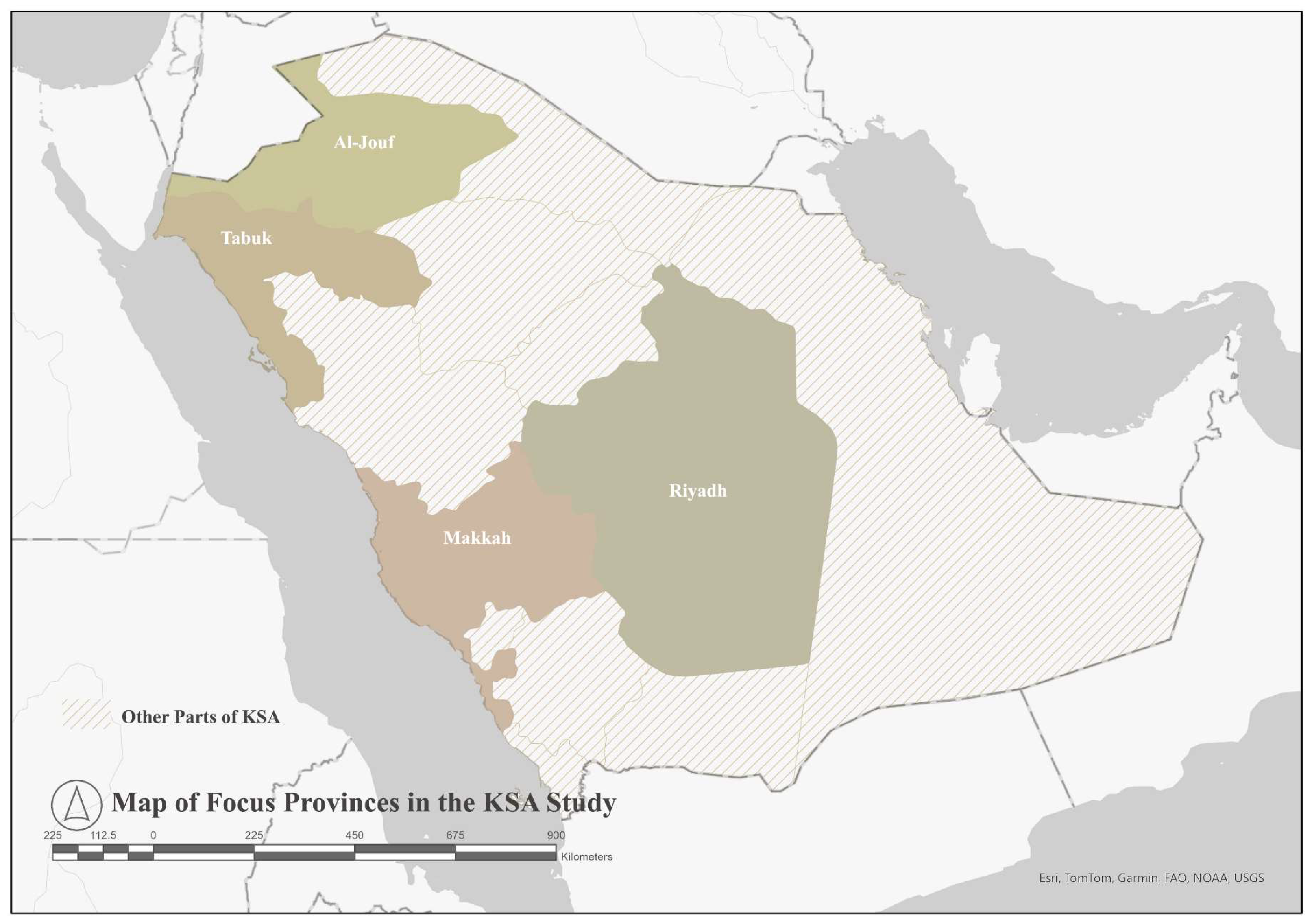
Saudi Arabia, consisting of 13 provinces, has the largest area and population among the GCC countries (Figure 5). In 2020, KSA had 563 dams, the highest number in the GCC, with a total capacity of 2.6 BCM [6]. However, Saudi Arabia is mainly dependent on its groundwater resources and desalination due to the limited surface water, as a result of low rainfall and high evaporation [23]. The major sectors abstracting groundwater were agriculture, the water supply industry, and manufacturing industries. Agriculture accounted for almost 90.6% of the abstracted groundwater in the country [12]. In 2020, Saudi Arabia allocated 12.9 BCM, which represents 69.8% of the total extracted groundwater in the GCC, to its agricultural sector [13]. Desalination is also a primary water resource in KSA. The country desalinated 2.3 BCM in 2020, which is an increase of 0.8% compared to 2019. KSA’s desalinated water production constitutes almost 10% of the global desalinated water production [14]. This percentage constitutes 50% of the country’s demand for water [14]. Wastewater treatment is an under-utilized option in the country. Currently, KSA has a treated wastewater capacity of 1970 MCM annually, achieved through 97 treatment facilities [24]. However, in 2019, the percentage of reused water of the total freshwater available for use in KSA was the lowest in the GCC, amounting to 2.1%, 336 MCM. In addition, the percentage of reused water in the total treated wastewater was 18.1% in 2020. This is the second lowest after Kuwait, 12.6%, among the GCC countries [13]. Currently, KSA is reusing 43% of the treated wastewater. A study has shown that reusing wastewater in KSA has the potential to provide 29% of the total water demand by the industrial sector [25].

Figure 5.
Provinces of KSA.
3.2.2. Land Use Impacts on Water Resources
Land use activities, mainly agriculture, are impacting the natural water resources in KSA. Saudi Arabia uses a high share of its land resources for agricultural purposes. Almost 88% of the country’s water demand was consumed by irrigation systems for agriculture [26]. This has stressed the water resources in the country, especially due to the land reclamation project which intensified agriculture during the mid-1970s and severely reduced groundwater levels [27,28]. Most of the agricultural areas are located in Riyadh as it significantly depends on the groundwater available, with fewer in Jeddah and Makkah [28]. This overexploitation of water resources has led to KSA’s water management regulations.
As a result of the dramatic decrease in the country’s groundwater inventory, the government changed its agricultural support policy [29]. One of the approaches was to reduce the agricultural demand for water by reducing fodder crops. A study examining the agricultural Al-Jouf area in KSA evaluated land use/cover changes (LULC) during the years from 2017 to 2021. The results showed a decrease of almost 39% in the annual average of cultivated areas in 2021, with a variation between seasons. As agricultural land decreased, land use shifted towards orchards, which increased by 84%. The area of crops decreased by 24%, while that of bare land increased by almost 10% [30]. Another study of the LULC changes in Riyadh, Jeddah, and Makkah, from 2000 to 2014, indicated that agricultural areas decreased significantly to become bare soil as a result of scarce groundwater [28]. The excessive agricultural and industrial use originally intensified this scarcity.
Although the country is moving its policies towards lower water depletion, some areas are still suffering from depletion due to irrigation. A study was recently conducted to examine the water used for crops at Wadi Uranah, Makkah. The results revealed that the area is used for growing fruits, which requires high water consumption. The amount of irrigation water used was found to be seven times more than the estimated annual recharge of the aquifer through rainfall. The study indicated that the groundwater aquifer is severely impacted and may be at a more critical risk than the calculations show, due to irrigation inefficiency and the types of crops grown [26].
Looking at the main cities in KSA, a study conducted on Riyadh, Jeddah, Makkah, Al-Taif, and the eastern area, from 1985 to 2014, showed a high rate of development and urbanization in all of the cities [31]. This expansion can be explained by governmental movements towards development and by the higher population due to migration to these cities. In addition to the issues KSA faces due to its location and harsh climate, anthropogenic activities, which have a more rapid impact compared to natural factors [28], are causing environmental damage. This damage is highly linked to domestic and industrial activities, which are in close proximity to ecologically sensitive zones [32]. This has negatively impacted the ecosystems in the five studied cities [31].
Al-Aba Oasis, west of Ras Tanura, is an ecologically sensitive location. A study of the LULC changes in the area has shown an increase during the years 1985, 2000, and 2021 in built and agricultural areas. The results show that sabkhas are being influenced by urbanization and agricultural growth. As a result of the LULC changes, the area is suffering from several environmental issues including a drop in groundwater levels, urbanization, expansion of agriculture, and human interference [33].
In Tabuk City, a study of the impact of LULC changes on groundwater from 1985 to 2015 has revealed that 64% of the transformed barren land became agricultural while 36% became urban [34]. The results indicate that the water consumption for agriculture increased significantly, which resulted in the abstraction of eight times more groundwater in 2015 relative to 1995. The study links the LULC changes and the irrigation methods to the risks of groundwater depletion, salinity, and ecosystem degradation.
The impact is not only limited to the quantity of water but also to the quality. Groundwater quality is affected by the geology of aquifers and anthropogenic activities [35]. One of the major factors impacting the quality is land use [36,37]. For instance, residential activities such as waste management and sanitation, and agricultural, industrial, and urban activities, negatively affect groundwater [38]. In different locations in Al-Madinah, 23 groundwater samples were evaluated in terms of groundwater parameters indicating water quality. The results found were attributed to sewage from industrial and septic tanks [39]. The groundwater degradation was linked to the relations between agriculture, industry, rocks, and water.
3.3. The Sultanate of Oman
3.3.1. Water Conditions
Oman, consisting of 11 provinces, has the second-largest area and the lowest population density among the GCC countries (Figure 6). In 2020, Oman had 155 dams with a capacity of 323 MCM, which are used for storage, recharge, and flood mitigation [12]. Oman is heavily dependent on the extraction of groundwater to meet water demand, which is mainly from the agricultural and residential sectors. With regard to water quality, a study has found that the coastal aquifers in Oman are at risk due to many sources of salinity [40]. In 2020, groundwater abstraction for the agriculture and water supply industries amounted to 800 MCM [12]. In addition to groundwater, the country uses desalination in some villages [41]. The amount of water produced through desalination amounted to 326 MCM in 2020 [12]. Water desalination in Oman provides 27% of its water demand [14]. Currently, this share constitutes 86% of Oman’s residential water demand [14] and is expected to amount to 600 MCM annually in the next 10 years [42]. In 2020, Oman had a considerable percentage of 61.1% of reused water in the total treated wastewater [13]. Annually, Oman utilizes almost 67% of the capacity of its wastewater treatment plants, and the authorities plan to double the plants’ capacity by the year 2030 [20].
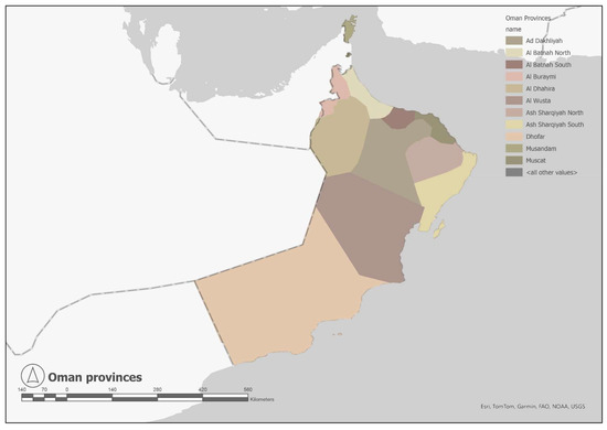
Figure 6.
Provinces of the Sultanate of Oman.
3.3.2. Land Use Impacts on Water Resources
Since 1970, Oman has been experiencing a rapid expansion of its agricultural and urban areas, which has caused an imbalance in its groundwater [43]. Most of the cities are growing in an unorganized manner due to intensive urbanization. The country’s main water source is groundwater [44], which is currently being overexploited. In addition, the intrusion of seawater is impacting the coastal aquifers [45]. Oman is known for its traditional irrigation system, “Aflaj”, which consists of tunnels that move water from shallow water tables to the surface, where it can be utilized for agricultural and residential uses. Without pumping, these systems have types as complicated as the Daudi falaj, extracting water from 10 to 30 m underground to the surface [45]. Currently, there are 3000 Aflaj systems, which account for 30% of the groundwater in Oman [46].
A study documenting the impact of LULC changes on the Aflaj systems in 7 Omani cities over 36 years has found a severe decline in areas cultivated by groundwater, vegetation, water bodies, and wetlands [45]. The selected cities have high populations and the highest number of Aflaj systems. A sample of 1268 of the different types of Aflaj systems was used. The results, from 1985 to 2021, show a major shift from bare soil to urban areas and from vegetation cover to bare soil as a result of depleted groundwater. The urban areas increased by 10.5% from 1985 to 2021. Almost 40% of Al-Muyasser Falaj, 39% of Daris Falaj, and 32% of Al-Malikir Falaj were converted from agriculture to urban areas, which is a threat to the Aflaj systems. The most alarming change was the significant increase in bare soil. This can be attributed to the increase in agriculture, urbanization, and climate change. Moreover, the rise in sea levels is expected to influence the salinity of groundwater aquifers. The conditions of the Aflaj are not promising due to intensive pumping and climate change [47]. Impervious surfaces resulting from urbanization are also limiting infiltration and groundwater recharge.
Another study has confirmed the decline in agriculture at Al-Jebel Al-Akhdar from 2009 to 2012 [48]. This decline is due to a drastic fall in the Aflaj flow rates by 59% by 2000 as compared to 1997. The agricultural areas decreased by 27% from 2005 to 2013. This can negatively impact tourism in the region, which is partially dependent on these agricultural terraces.
Another study analyzed the effect of LULC changes on the sustainability of Aflaj systems in Oman [49]. The results showed that market-oriented approaches and rising water demand had more than doubled by 2018 compared to 2007 due to urban sprawl endangering the systems in Al-Jebel Al-Akhdar. A vulnerability assessment of water resources was carried out to understand the factors affecting the water resources in Al-Jebel Al-Akhdar [50]. The factors were the stress on resources, water development pressures, ecological health, and the capacity of management. The main factor driving the vulnerability was the management capacity, followed by ecological health and water resource stress. The vulnerability index is high, meaning that the stress on water resources is at a high level. The stress on water resources in Al-Jebel Al-Akhdar was also documented by another study looking at five oases in the region in 1978 and in 2005 [51]. The excessive groundwater extraction from the same aquifer due to rapid urbanization has caused a decline in water supply that cannot meet the increased demand, causing an imbalance. Comparing 2005 to 1978, the results showed that the sustainability of water resources in all of the oases in the region has significantly diminished, except for Masayrat and Ruwajah.
3.4. The United Arab Emirates (UAE)
3.4.1. Water Conditions
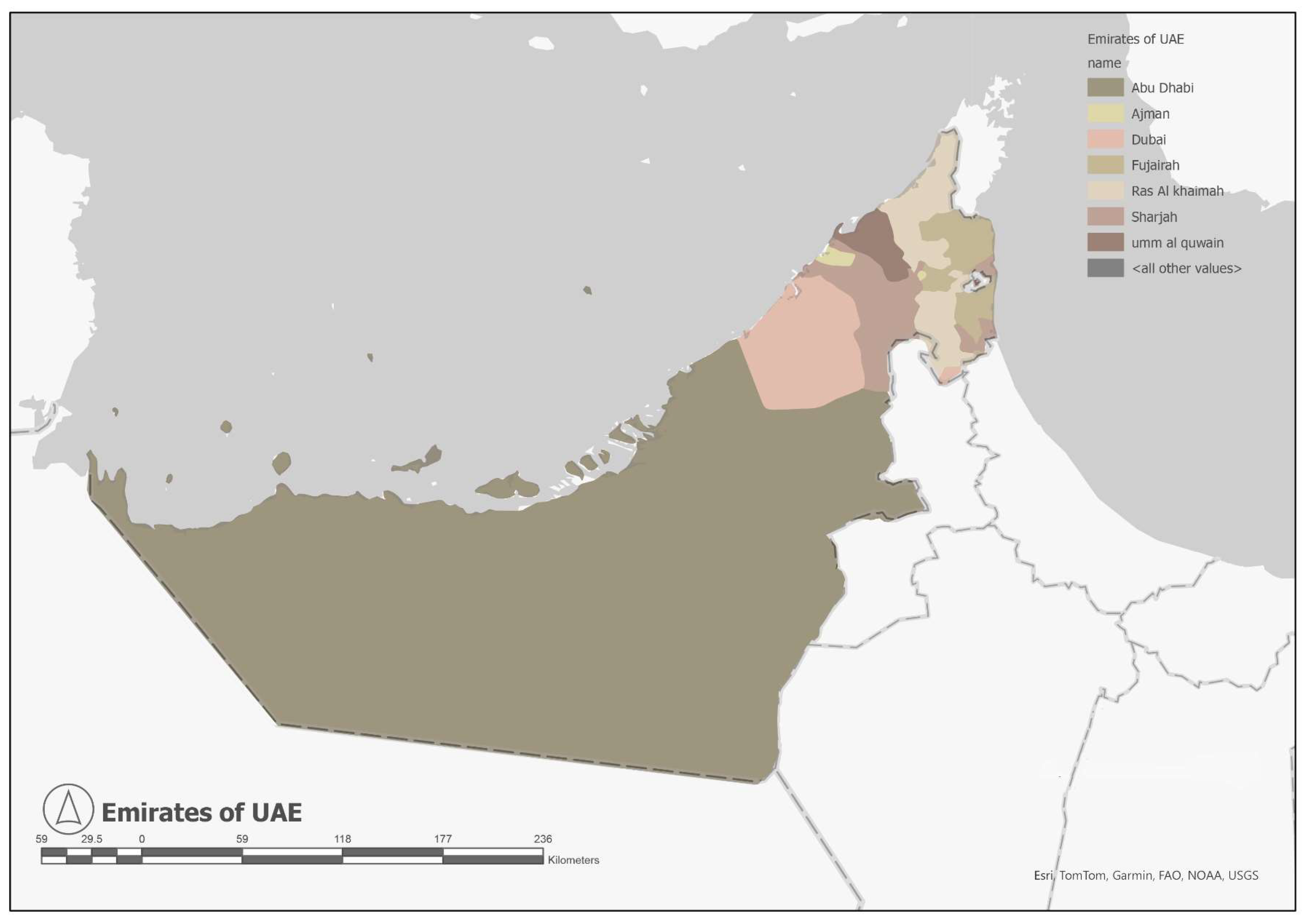
UAE, consisting of seven emirates, is the third largest country among the GCC countries and has the second-highest population after KSA (Figure 7). In 2020, the UAE had 140 dams providing a capacity of 120 MCM; these were utilized to recharge the groundwater reserves and reduce the impact of floods [12]. The country provides 49% of its freshwater through groundwater abstraction (Table 4). Agriculture accounted for almost 16.1% of the abstracted groundwater in the country [13]. Desalination is one of the major water resources in the UAE, accounting for 40% of total freshwater (Table 4). Around 42% of the water consumption in the UAE is provided through desalination plants [14]. The country depends on this non-conventional resource to address high water demand. Although the capacity of the GCC desalination stations increased in 2020, the UAE’s desalination stations capacity decreased by 0.7% compared to 2015 [13]. In 2020, the total yearly desalinated water reached 2.1 BCM, almost 5.84 MCM/day [12]. This represented approximately 39% of the country’s total water budget. This percentage has increased from less than 10% in 1995 to the present 39% [12]. Wastewater treatment is another method the country uses for recycling water from sewage, industry, and agricultural activities. In 2020, the country had the highest proportion (69.6%) of reused water in the GCC’s total treated wastewater. Most of the 92 treatment plants use conventional treatments [12], producing approximately 736 MCM of treated water, of which 75% is used for urban landscaping [52]. UAE has wastewater treatment facilities with a capacity of around 840 MCM annually, and the amount of water treated annually is 653 MCM [14].

Figure 7.
The United Arab Emirates.
3.4.2. Land Use Impacts on Water Resources
UAE has experienced noticeably rapid development over the past years. These changes are affecting the groundwater in the country. The groundwater abstraction rate is much higher than the recharge rate, which signals a high risk of depletion by 2030 [53]. The impact of LULC changes and the increasing population on the groundwater in the northern UAE was examined during the years 1990, 2000, 2010, and 2018 [54]. Built-up and vegetated areas were found to have increased. The results indicated that the depletion in the groundwater quantity and quality was strongly linked to the LULC changes. When the rate of groundwater depletion was compared to agricultural and urban expansion, the connection of expansion and population growth with the level of groundwater was obvious. This link is also clear when observing changes in domestic areas and their water consumption.
Agricultural areas and groundwater levels were found to be negatively related. The main water consumer was the agricultural sector, consuming around 60% of the total consumption, while industrial and residential use consumed the rest [53,55,56]. The high consumption by irrigation resulted in higher soil and water salinity, groundwater depletion, and seawater intrusion due to over-pumping, especially in Fujairah and Ras Al-Khaimah [53,56,57]. The impact of agricultural areas is related to the water consumption needed for irrigation. On the other hand, the impact of the built-up areas is due to surfaces hindering water infiltration and, consequently, reducing the recharge rate [58,59,60]. The quality of groundwater was also affected and attributed to soil salinity, fertilizers, and irrigation flow [60,61]. Although the flow helps recharge the levels, it negatively impacts the water quality and results in higher concentrations of NO3 [54].
Examining the impacts of LULC changes on groundwater in Ajman, a study revealed a significant decline in the quantity and quality of groundwater [58]. The depth to groundwater increased, indicating a decrease of 40% in the groundwater from 2000 to 2015. A strong linear relationship was observed between the depth to the groundwater table and the LULC changes. The different land uses have affected environmental quality in various locations. Increases in trace elements were found in residential areas in the west and the middle regions. Industrial activities in the south have led to high cadmium and chromium levels, while factories and landfills in the north have raised iron, nitrate, and lead concentrations. Medical and institutional facilities in the middle region have also contributed to high cadmium and chromium levels. Agriculture is a source of nitrate in groundwater, though its specific location was not specified, see Table 7. The results show that the water in the west of the study area was the most affected and had minimal quality values. The level of water contamination increased over the 15 years, in addition to a serious depletion from the east to the west. Industrial areas, residential activity in Ajman City, Mesharief, and Al-Jarf, and agriculture in Dibdibba were found to be the main reasons for the groundwater contamination [58].
Table 7.
Impact of land uses on groundwater in Ajman [58].
The impact of LULC changes on the groundwater in Al-Ain was documented by a study that showed an increase of 7.4% in agricultural areas and 10.5% in urban areas from 2006 to 2016 [62]. During those years, the agricultural demand for water increased by 9.6%, while that of urban areas increased by 22.2%. Groundwater is a vital water resource in Al-Ain region. A direct relationship between changes in land use and the decline in groundwater was documented. Although desalination was used to accommodate the region’s water needs, the increase in demand resulted in significant groundwater withdrawals. This pressure on groundwater caused an average decline rate of 40.4% of the groundwater depth, mainly in the southwest region [62].
Examining the conditions in Abu Dhabi, the capital, a study documented the impact of LULC on groundwater through remote sensing from 2000 to 2020 [63]. The results indicate significant changes to the groundwater level, which was depleted by 40 m. In addition, the areas with water of high quality decreased by 479 Km2, 0.79%. As shown in Table 8, anthropogenic activities are causing severe contamination of the groundwater in Abu Dhabi. The built-up areas and roofs more than doubled, causing a lower infiltration rate and, consequently, higher groundwater depletion. The areas impacted by this depletion increased by 70% from 2000 to 2020, while the areas contaminated by NO3 increased by 14%. The study identified nitrate contamination in agricultural areas as the major issue in arid regions [58,64].
Table 8.
Impact of land uses on groundwater in Abu Dhabi [63].
In Abu Dhabi, different land uses impact groundwater quality across its regions. Residential areas in the east, west, and south have seen increased trace elements. Industrial activities have elevated cadmium and chromium levels in the east and west. Landfills have introduced bacteria, viruses, and household chemicals into groundwater. Medical and institutional areas have also increased cadmium and chromium levels. Agriculture has been a major source of nitrates. Factories and landfills have caused high iron, nitrate, and lead concentrations [58,64]. Airports have contributed to air pollution, affecting groundwater quality through the water cycle, see Table 8.
Furthermore, higher salinity and TDS were observed near the coastal area and the southeast. The areas affected by TDS increased by 27% in 2020. The higher nitrate, TDS, salinity, and groundwater depletion can be related to salt dissolution, excessive fertilizers, and the return flow to the aquifer [60,61].
3.5. The State of Kuwait
Water Conditions
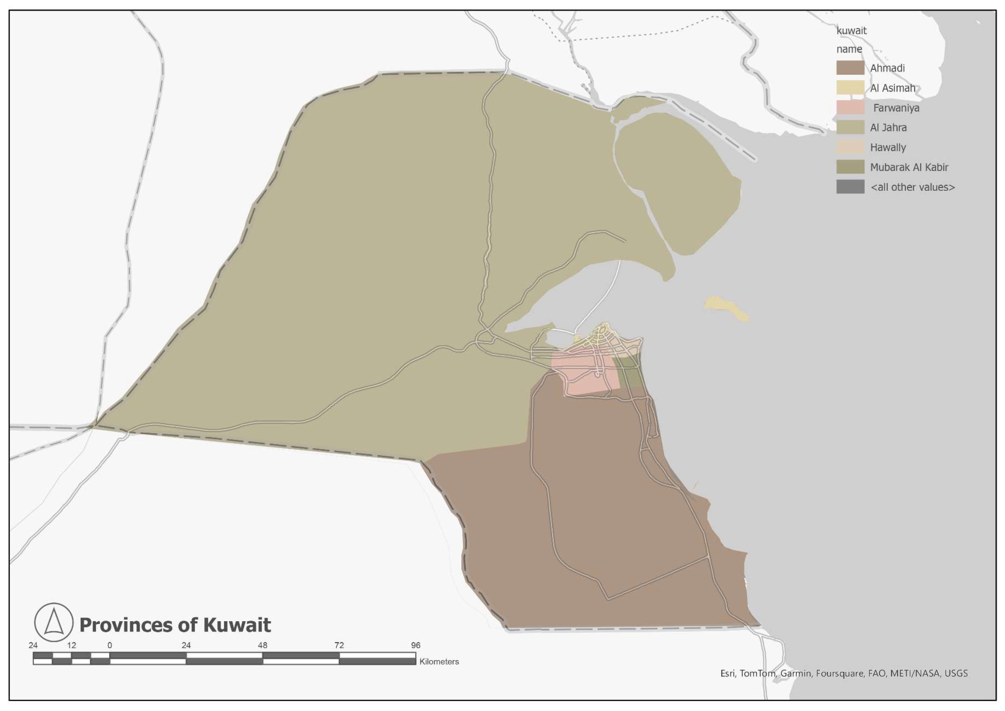
Kuwait, consisting of six provinces, accounts for 0.74% of the total area of the GCC countries (Figure 8). The country provides 49% of its freshwater through groundwater abstraction, see Table 4. Approximately 838 MCM are annually extracted from groundwater resources [12]. Around 48% of the total freshwater is produced through desalination [10]. The country has 10 desalination plants with a total capacity of 1.0 BCM, producing around 717 MCM [12]. Kuwait started wastewater treatment during the 1950s [14]. The country is currently using reverse osmosis (RO) to achieve high-quality water. The treatment capacity of wastewater in Kuwait is around 300 MCM annually, and the amount of water treated is about 250 MCM annually [14]. In 2020, Kuwait reused 42% of its treated wastewater [65]. This is in the direction of the “zero release” project of the Kuwaiti Ministry of Public Works to use all of the country’s treated water [66].

Figure 8.
Provinces of Kuwait.
3.6. The State of Qatar
Water Conditions
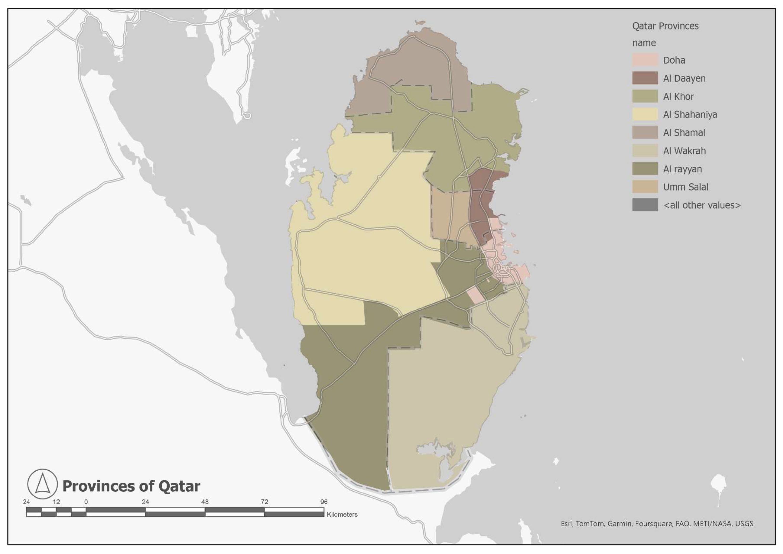
Qatar, consisting of eight provinces (Figure 9), has the second smallest area among the GCC countries, accounting for 0.48% of the total GCC area. According to the GCC Statistics Center report on the SDGs, the stress on freshwater increased by 73% in Qatar from 2016 to 2020 [67]. Qatar provides 22% of its freshwater through groundwater abstraction, see Table 4. In 2020, approximately 190 MCM were obtained through groundwater extraction [12]. Around 62% of the total freshwater is produced through desalination [10]. The country has 9 desalination plants with an annual capacity of 621 MCM that produced 540 MCM in 2020 [12]. Desalinated water helps Qatar fulfill 87% of its water demands [14]. Although Qatar’s 2019 total freshwater available for use was the second lowest in the GCC after that of Bahrain, the country has the highest percentage of reused water, 15.7%, 172 MCM [13]. In 2020, Qatar had a significant portion of reused water in its total treated wastewater, amounting to 61.3% [13]. The total capacity of treated wastewater is about 100 MCM annually [14]. The treated water is used in agriculture, landscaping, and recharging aquifers [14].
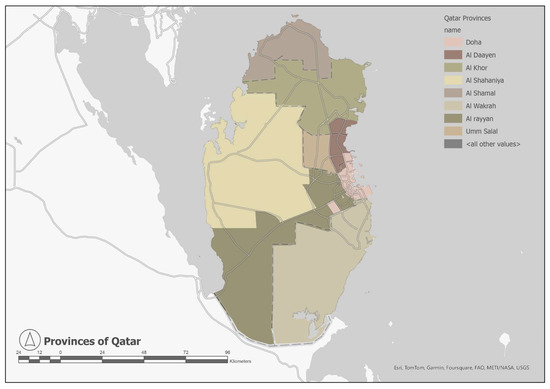
Figure 9.
Provinces of Qatar.
3.7. The Kingdom of Bahrain
Water Conditions
Bahrain, consisting of four governorates, is the smallest among the GCC countries and has the highest population density (Figure 10). Bahrain experienced a significant decrease in groundwater quantity and quality in the past decade [14]. The country provides 34% of its freshwater through groundwater abstraction, see Table 4. In 2020, the total freshwater in Bahrain amounted to 424 MCM, of which 153 MCM was extracted groundwater [12]. The two major sectors consuming water were fisheries and household consumption, which accounted for 65.3% and 22.1% of the extracted groundwater, respectively [12]. The least water-consuming sectors were the water supply and manufacturing industries, and agriculture, accounting for 11.3% and 1.3%, respectively [12]. Currently, the country relies heavily on desalination and wastewater treatment. In 2020, water production through treatment and desalination accounted for 67% of the total freshwater available in Bahrain [12]. The capacity of desalination stations in Bahrain remained constant from 2015 to 2020 [13]. The country has 5 desalination plants with an annual capacity of 312.7 MCM that produced 243 MCM in 2020 [12]. Desalination satisfies 36% of Bahrain’s demand for water [14]. Bahrain has 11 wastewater treatment facilities, amounting to a capacity of 135 MCM annually [14].
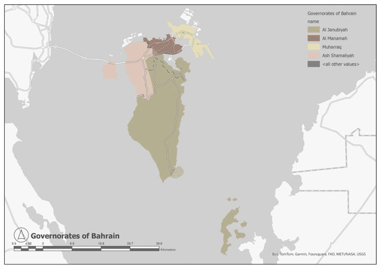
Figure 10.
Governorates of Bahrain.
3.8. Land Use Impacts on Water Resources in Kuwait, Qatar, and Bahrain
Research on the impact of land use on water resources in Kuwait, Qatar, and Bahrain is limited. Most studies focus on detecting LULC changes more than assessing water resources in the region. In Kuwait, a study spanning from 2016 to 2021 revealed substantial LULC changes: built-up areas surged by 27%, vegetation cover plummeted by 28%, and barren land decreased by 18%. To put it into perspective, the built-up area expanded from 359 km2 to 455 km2, vegetation cover shrunk from 89 km2 to 64 km2, and barren land reduced from 406 km2 to 332 km2. Moreover, water bodies saw a significant increase of 38%, expanding from 8 km2 to 11 km2 [68], refer to Table 9. A study in Qatar observed even more drastic changes between 1997 and 2010. The built-up area increased by 289% and recreational spaces grew by 426%. However, there was a severe decline in open spaces, which decreased from 77% to 25% [69] (Table 9).
Table 9.
Land cover in Kuwait’s Metropolitan Region in 2016 and 2021 [68].
Groundwater abstraction in Qatar is much higher than the rate of recharge, especially due to irrigation inefficiency and the high agricultural demand for 91% of the renewable water resources [70]. Petrochemical and refining sectors are major consumers of water in Qatar (38% and 15%, respectively). In addition, the quality of the groundwater is deteriorating due to high salination levels. The study indicates a significant decline in the groundwater of low total dissolved solids (TDS) from 1971 to 2009, which is a consequence of the excessive abstraction rate and low recharge rate. Another study found that during the period of study, 2002 to 2020, the level of groundwater substantially declined by an average of 0.24 ± 0.20 cm every year due to extensive groundwater abstraction, mainly for irrigation [71].
The literature on LULC changes’ impact on water in Bahrain is even more limited and outdated. A study took samples from 125 boreholes over 12 years to understand changes in the water table [72]. The results found that the water levels at deep aquifers were declining at a rate ranging from 78 mm to 277 mm annually. Shallow aquifers were more complex to analyze. However, the results indicated a rising water table in reclaimed land zones. This presents a risk to land use in those zones. These changes were consequences of high irrigation consumption and inefficient water supply networks. Furthermore, the quality of water in the Dammam aquifer, the main aquifer in Bahrain, was examined by a study that identified the sources of salination. The results show that the agricultural and residential sectors caused water salination [73]. The major factor causing water deterioration in the Dammam aquifer is the upward movement of brackish water.
4. Conclusions
Water scarcity and high water demand in a hot arid region like that of the GCC countries exert pressure on already strained water resources. Land use practices such as agriculture, urbanization, and industrialization have adverse effects on the water quantity and quality in the GCC region. The negative consequences of extensive land development and groundwater abstraction on the availability of quality water necessitate coordinated land use planning and efficient water management strategies.
In KSA, groundwater depletion has been mainly due to extensive agriculture, particularly in Riyadh, which has led to changes in policies. Water depletion is evident in Wadi Uranah and Makkah, where irrigation exceeds rates of recharge, putting aquifers at risk. Ecologically sensitive places like Al-Aba Oasis and Tabuk City face degradation due to urban growth and agriculture. In Oman, rapid urban and agricultural expansion has strained groundwater resources, threatening the traditional Aflaj irrigation systems. Studies show declining cultivated areas and vegetation, with urbanization encroaching on agricultural land. Rising sea levels are exacerbating groundwater salinity. Declining agriculture in areas like Al-Jebel Al-Akhdar impacts tourism and water sustainability. UAE’s rapid development strains groundwater, with urban and agricultural expansion depleting resources and contaminating water. Ajman and Al-Ain’s studies show declining levels and quality, while Abu Dhabi’s remote sensing reveals significant depletion and contamination due to urban and agricultural activities. In Kuwait, built-up areas have increased while vegetation and barren land have decreased. Qatar has witnessed drastic built-up area expansion alongside a decline in open spaces, with groundwater abstraction exceeding recharge rates, leading to deteriorating water quality. In Bahrain, limited and outdated research shows declining water levels in deep aquifers and rising levels in reclaimed land zones due to high irrigation consumption and inefficient water supply networks. Agricultural and residential sectors contribute to water salination in the main aquifer, the Dammam aquifer.
The findings underscore the necessity for a more comprehensive exploration within the literature regarding how land use dynamics influence water resources in Kuwait, Qatar, and Bahrain. There exists a critical need to delve into both the positive and negative impacts of land use practices on water patterns over time, highlighting the importance of implementing effective policies for resource allocation across the entire GCC region. To facilitate this understanding, adopting a holistic approach is imperative, necessitating cross-sectional analyses and quantitative assessments to track changes and evaluate the efficacy of existing water exchange mechanisms.
A notable gap in the current literature lies in the lack of specificity regarding the spatial scope of studies, particularly evident in the case of Saudi Arabia. Many studies fail to delineate the specific regions or areas under examination, hindering a nuanced understanding of localized water resource dynamics. Addressing this gap is crucial for developing targeted interventions and management strategies tailored to the unique challenges faced within each region.
Furthermore, it is imperative to scrutinize the ramifications of urban sprawl and infrastructure development, including transportation networks, on water resources. Sustainable agricultural practices, such as innovative irrigation techniques, warrant thorough investigation for their potential to positively influence water resource sustainability.
In light of the escalating impacts of climate change, it becomes increasingly pertinent to assess its intersection with land use dynamics and its consequent effects on water resources. Identifying and implementing strategies to mitigate these impacts is paramount for ensuring long-term water security and resilience in the face of environmental challenges.
Moreover, diversifying water resources and prioritizing wastewater recycling and management emerge as critical components of sustainable land use planning [74]. Future research endeavors should thus focus on elucidating the intricate interplay between land use planning strategies and their impacts on water resources in Kuwait, Qatar, and Bahrain. This necessitates a deeper exploration of methods to alleviate resource strain and the formulation of robust water security policies tailored to the unique contexts of each nation within the region.
Author Contributions
All the authors of this manuscript have contributed significantly to the work reported here. Conceptualization, M.A.; Methodology, B.H. Investigation, M.A. and B.H.; Writing—Original Draft Preparation, B.H, M.A., I.P.O.; Writing—Review and Editing, T.A.; Visualization, M.A. and R.G.; Supervision, T.A.; Project Administration, T.A. and M.M.; Funding Acquisition, T.A. and M.M. All authors have read and agreed to the published version of the manuscript.
Funding
This research was funded by the American University of Sharjah through grant number FRG21-M-E77.
Data Availability Statement
Data is contained within the article.
Acknowledgments
The work in this paper was supported, in part, by the Open Access Program from the American University of Sharjah and that this paper represents the opinions of the authors and does not mean to represent the position or opinions of the American University of Sharjah.
Conflicts of Interest
The authors declare no conflicts of interest.
References
- Parveen, S.; Basheer, J.; Praveen, B. A Literature Review on Land Use Land Cover Changes. Int. J. Adv. Res. 2018, 6, 1–6. [Google Scholar] [CrossRef] [PubMed]
- Sherif, M.; Singh, V.P.; Sefelnasr, A.; Abrar, M. Water Resources Management and Sustainability; Springer: Berlin/Heidelberg, Germany, 2023. [Google Scholar]
- Alsaeed, B.S.; Hunt, D.V.L.; Sharifi, S. Sustainable Water Resources Management Assessment Frameworks (SWRM-AF) for Arid and Semi-Arid Regions: A Systematic Review. Sustainability 2022, 14, 15293. [Google Scholar] [CrossRef]
- Weatherhead, E.; Howden, N. The relationship between land use and surface water resources in the UK. Land Use Policy 2009, 26, 243–250. [Google Scholar] [CrossRef]
- Kaushal, S.S.; Mayer, P.M.; Vidon, P.G.; Smith, R.M.; Pennino, M.J.; Newcomer, T.A.; Duan, S.; Welty, C.; Belt, K.T. Land Use and Climate Variability Amplify Carbon, Nutrient, and Contaminant Pulses: A Review with Management Implications. JAWRA J. Am. Water Resour. Assoc. 2014, 50, 585–614. [Google Scholar] [CrossRef]
- Lezzaik, K.; Milewski, A. A quantitative assessment of groundwater resources in the Middle East and North Africa region. Hydrogeol. J. 2017, 26, 251–266. [Google Scholar] [CrossRef]
- Raouf, M. Water Issues in the Gulf: Time for Action. 1 January 2009. Available online: https://www.mei.edu/publications/water-issues-gulf-time-action (accessed on 17 January 2024).
- GCC Statistics Centre. Water Statistics Report 2022; GCC STAT CENTER: Muscat, Oman, 2024. [Google Scholar]
- Secretariat General of the Gulf Cooperation Council About GCC. Available online: https://www.gcc-sg.org/en-us/AboutGCC/Pages/StartingPointsAndGoals.aspx (accessed on 17 January 2024).
- GCC Statistics Centre. GCC Statistical Atlas; GCC-STAT: Muscat, Oman, 2021. [Google Scholar]
- GCC Statistics Centre. Annual Summary on Population Statistics; GCC-STAT: Muscat, Oman, 2022. [Google Scholar]
- Al Rashed, M.; Sefelnasr, A.; Sherif, M.; Murad, A.; Alshamsi, D.; Aliewi, A.; Ebraheem, A.A. Novel concept forwater scarcity quantification considering nonconventional and virtual water resources in arid countries: Application in Gulf Cooperation Council countries. Sci. Total Environ. 2023, 882, 163473. [Google Scholar] [CrossRef] [PubMed]
- GCC Statistics Centre. Water Statistics in GCC Countries—Executive Summary; GCC-STAT: Muscat, Oman, 2020. [Google Scholar]
- Sherif, M.; Liaqat, M.U.; Baig, F.; Al-Rashed, M. Water resources availability, sustainability and challenges in the GCC countries: An overview. Heliyon 2023, 9, e20543. [Google Scholar] [CrossRef] [PubMed]
- Krampera, E.-G.I.C.-T. Water in the GCC. 17 February 2021. Available online: https://www.egic.info/water-in-the-gcc (accessed on 9 September 2023).
- World Bank. The World Bank in the Gulf Cooperation Council. Available online: https://www.worldbank.org/en/country/gcc (accessed on 19 January 2024).
- Aquastat FAO’s Global Information System on Water and Agriculture. Available online: https://www.fao.org/aquastat/en/ (accessed on 19 January 2024).
- Hashemi, H.; Berndtsson, R.; Kompani-Zare, M.; Persson, M. Natural vs. Artificial groundwater recharge, quantification through inverse modeling. Hydrol. Earth 2013, 17, 637–650. [Google Scholar] [CrossRef]
- GCC Statistics Centre. GCC Statistical Atlas 2019; GCC Statistics Centre: Muscat, Oman, 2020. [Google Scholar]
- GCC Statistics Centre. GCC Statistical Center—Home. 26 January 2024. Available online: https://www.gccstat.org/en/ (accessed on 26 January 2024).
- Qureshi, A. Challenges and prospects of using treated wastewater to manage water scarcity crises in the Gulf cooperation Council (GCC) countries. Water 2020, 12, 1971. [Google Scholar] [CrossRef]
- Chowdhury, S.; Al-Zahrani, M. Water resources and water consumption pattern in Saudi Arabia. In Proceedings of the 10th Gulf Water Conference, Doha, Qatar, 22–24 April 2012. [Google Scholar]
- Al-Saud, M.; Teutsch, G.; Schüth, C.; Rausch, R. Challenges for an integrated groundwater management in the Kingdom of Saudi Arabia. Int. J. Water Resour. Arid. Environ. 2011, 1, 65–70. [Google Scholar]
- Ouda, O. Treated wastewater use in Saudi Arabia: Challenges and initiatives. Int. J. Water Resour. Dev. 2016, 32, 799–809. [Google Scholar] [CrossRef]
- Kajenthira, A.; Siddiqi, A.; Anadon, L. A new case for promoting wastewater reuse in Saudi Arabia: Bringing energy into the water equation. J. Environ. Manag. 2012, 102, 184–192. [Google Scholar] [CrossRef] [PubMed]
- Gabr, S.S.; Farg, E.F.; Habeebullah, T.M.; Arafat, S.M. Irrigation water consumption and its impact on the groundwater aquifer of Wadi Uranah, Makkah, Saudi Arabia using remote sensing techniques. Egypt. J. Remote Sens. Space Sci. 2020, 23, 167–180. [Google Scholar] [CrossRef]
- Ouda, O. Impacts of agricultural policy on irrigation water demand: A case study of Saudi Arabia. Int. J. Water Resour. Dev. 2014, 30, 282–292. [Google Scholar] [CrossRef]
- Alqurashi, A.F.; Kumar, L. An assessment of the impact of urbanization and land use changes in the fast-growing cities of Saudi Arabia. Geocarto Int. 2017, 34, 78–97. [Google Scholar] [CrossRef]
- Al-Shayaa, M.; Baig, M.; Straquadine, G. Agricultural extension in the Kingdom of Saudi Arabia: Difficult present and demanding future. J. Anim. Plan Sci. 2012, 22, 239–246. [Google Scholar]
- Mahmoud, A.G. Land Use/Cover Changes in Al-Jouf, KSA in Response to Water Management Strategies Using Multi-Sensor/-Temporal Data in Google Earth Engine. Sci. J. Agric. Sci. 2022, 4, 142–151. [Google Scholar] [CrossRef]
- Alqurashi, A.F.; Kumar, L. Spatiotemporal patterns of urban change and associated environmental impacts in five Saudi Arabian cities: A case study using remote sensing data. Habitat Int. 2016, 58, 75–88. [Google Scholar] [CrossRef]
- Vincent, P. Saudi Arabia: An Environmental Overview; CRC Press: Boca Raton, FL, USA, 2008. [Google Scholar]
- Chouari, W. Land Use/Land Cover change detection in the wetlands. A case study: Al-Aba Oasis, west of Ras Tanura, Kingdom of Saudi Arabia. J. Water Land Dev. 2022, 229–237. [Google Scholar] [CrossRef]
- Albalawi, E. Assessing and Predicting the Impact of Land Use and Land Cover Change on Groundwater Using Geospatial Techniques: A Case Study of Tabuk, Saudi Arabia. Ph.D. Thesis, Curtin University, Perth, Australia, 2020. [Google Scholar]
- Camp, V.E.; Roobol, M.J. The Arabian continental alkali basalt province: Part I. Evolution of Harrat Rahat. GSA Bull. 1989, 101, 71–95. [Google Scholar] [CrossRef]
- Reddy, V.K.; Reddy, V.; Murthy, K. Geomatics for Land use/Land cover and Water Quality changes. Int. J. Sci. Res. Sci. Technol. 2018, 4, 1614–1618. [Google Scholar]
- Ukah, B.U.; Egbueri, J.C.; Unigwe, C.O.; Ubido, O. Extent of heavy metals pollution and health risk assessment of groundwater in a densely populated industrial area, Lagos, Nigeria. Int. J. Energy Water Resour. 2019, 3, 291–303. [Google Scholar] [CrossRef]
- Ukah, B.U.; Ameh, P.D.; Egbueri, J.C.; Unigwe, C.O. Impact of effluent-derived heavy metals on the groundwater quality in Ajao industrial area, Nigeria: An assessment using entropy water quality index (EWQI). Int. J. Energy Water Resour. 2020, 4, 231–244. [Google Scholar] [CrossRef]
- Khan, M.Y.A.; ElKashouty, M.; Bob, M. Impact of rapid urbanization and tourism on the groundwater quality in Al Madinah city, Saudi Arabia: A monitoring and modeling approach. Arab. J. Geosci. 2020, 13, 922. [Google Scholar] [CrossRef]
- AAskri, B.; Ahmed, A.T.; Bouhlila, R. Origins and processes of groundwater salinisation in barka coastal aquifer, sultanate of Oman. Phys. Chem. Earth Parts A/B/C 2022, 126, 103116. [Google Scholar] [CrossRef]
- McDonnel, R. Groundwater Use and Policies in Oman. In IWMI Project Report; International Water Management Institute: Battaramulla, Sri Lanka, 2017. [Google Scholar]
- Zapata-Sierra, A.; Cascajares, M.; Alcayde, A.; Manzano-Agugliaro, F. Worldwide research trends on desalination. Desalination 2021, 519, 115305. [Google Scholar] [CrossRef]
- Deadman, M.; Al-Sadi, A.; Al-Wardi, M.; Al-Kiyumi, K.; Deadman, W.; Al Said, F. Spatio-Temporal Dynamics of Land Use Changes in Response to External Pressures in Oman: Greenhouse Cropping as an Example. J. Agric. Mar. Sci. 2016, 21, 33–46. [Google Scholar] [CrossRef]
- Rajmohan, N.; Al-Futaisi, A.; Jamrah, A. Evaluation of Long-Term Groundwater Level Data in Regular Monitoring Wells, Barka, Sultanate of Oman. Hydrol. Process. 2007, 21, 3367–3379. [Google Scholar] [CrossRef]
- Al-Kindi, K.M.; Alqurashi, A.F.; Al-Ghafri, A.; Power, D. Assessing the Impact of Land Use and Land Cover Changes on Aflaj Systems over a 36-Year Period. Remote Sens. 2023, 15, 1787. [Google Scholar] [CrossRef]
- Al-Marshudi, A.S. Traditional Irrigated Agriculture in Oman: Operation and Management of the Aflaj System. Water Int. 2001, 26, 259–264. [Google Scholar] [CrossRef]
- Alsharhan, A.; Rizk, Z. Challenges Facing Water Resources BT-Water Resources and Integrated Management of the United Arab Emirates; Springer International Publishing: Cham, Switzerland, 2020. [Google Scholar]
- Al-Kalbani, M.S.; Price, M.F.; O’Higgins, T.; Ahmed, M.; Abahussain, A. Integrated environmental assessment to explore water resources management in Al Jabal Al Akhdar, Sultanate of Oman. Reg. Environ. Chang. 2015, 16, 1345–1361. [Google Scholar] [CrossRef]
- Buerkert, A.; Dix, B.; Al Rawahi, M.; Schlecht, E. Agro-Ecological Landuse Transformation in Oasis Systems of Al Jabal Al Akhdar, Northern Oman. Sci. Rep. 2021, 11, 7709. [Google Scholar] [CrossRef] [PubMed]
- Al-Kalbani, M.S.; Price, M.F.; Abahussain, A.; Ahmed, M.; O’Higgins, T. Vulnerability Assessment of Environmental and Climate Change Impacts on Water Resources in Al Jabal Al Akhdar, Sultanate of Oman. Water 2014, 6, 3118–3135. [Google Scholar] [CrossRef]
- Luedeling, E.; Buerkert, A. Effects of land use changes on the hydrological sustainability of mountain oases in northern Oman. Plant Soil 2008, 304, 1–20. [Google Scholar] [CrossRef]
- MOEI. Annual Statistical Book (Internal Report); Ministry of Energy and Infrastructure: Dubai, United Arab Emirates, 2021. [Google Scholar]
- Brook, M.; Dawoud, M.A. Coastal Water Resources Management in The United Arab Emirates, Abu Dhabi: Environmental Research and Wildlife Development Agency, Abu Dhabi. 2005. Available online: https://citeseerx.ist.psu.edu/document?repid=rep1&type=pdf&doi=b75f7587497fb3efbf3d102e08950f1f60baaeb6 (accessed on 28 January 2024).
- Elmahdy, S.; Mohamed, M.; Ali, T. Land Use/Land Cover Changes Impact on Groundwater Level and Quality in the Northern Part of the United Arab Emirates. Remote Sens. 2020, 12, 1715. [Google Scholar] [CrossRef]
- JICA (Japanese International Cooperation Agency). The Master Plan Study on the Groundwater Resources Development for Agriculture in the Vicinity of Al Dhaid in the UAE, Final Report Sharjah; JICA (Japanese International Cooperation Agency): Tokyo, Japan, 1996. [Google Scholar]
- Sherif, M.; Singh, V.P. Effect of climate change on sea water intrusion in coastal aquifers. Hydrol. Process. 1999, 13, 1277–1287. [Google Scholar] [CrossRef]
- Mahmood, R.; Pielke, R.S.; Hubbard, K.; Niyogi, D.; Bonan, G.; Lawrence, P.; Qian, B. Impacts of land use/land cover change on climate and future research priorities. Bull. Am. Meteorol. Soc. 2010, 91, 37–46. [Google Scholar] [CrossRef]
- Elmahdy, S.; Mohamed, M. Land use/land cover change impact on groundwater quantity and quality: A case study of Ajman Emirate, the United Arab Emirates, using remote sensing and GIS. Arab. J. Geosci. 2016, 9, 722. [Google Scholar] [CrossRef]
- Samy, I.; Mohamed, M. Natural hazards susceptibility mapping in the Kuala Lumpur, Malaysia: An assessment using remote sensing and geographic information system (GIS). Geomat. Nat. Hazards Risk 2012, 4, 71–91. [Google Scholar]
- Shahin, S.; Salem, M. The Challenges of Water Scarcity and the Future of Food Security in the United Arab Emirates (UAE). Nat. Resour. Conserv. 2015, 3, 1–6. [Google Scholar] [CrossRef]
- Saou, A.; Maza, M.; Seidel, J. Hydrogeochemical Processes Associated with Double Salinization of Water in an Algerian Aquifer, Carbonated and Evaporitic. Pol. J. Environ. Stud. 2012, 21, 1013–1024. [Google Scholar]
- Liaqat, M.U.; Mohamed, M.M.; Chowdhury, R.; Elmahdy, S.I.; Khan, Q.; Ansari, R. Impact of land use/land cover changes on groundwater resources in Al Ain region of the United Arab Emirates using remote sensing and GIS techniques. Groundw. Sustain. Dev. 2021, 14, 100587. [Google Scholar] [CrossRef]
- Elmahdy, S.I.; Mohamed, M.M. The impact of land use land cover on groundwater level and quality in the Emirate of Abu Dhabi, UAE: An integration approach using remote sensing and hydrological data. Geocarto Int. 2023, 38, 2272664. [Google Scholar] [CrossRef]
- Elmahdy, S.; Mohamed, M. Remote sensing and geophysical survey applications for delineating near-surface palaeochannels and shallow aquifer in the United Arab Emirates. Geocarto Int. 2015, 30, 723–736. [Google Scholar] [CrossRef]
- Ministry of Public Works. Yearly Statistical Book; Internal Report; Ministry of Public Works: Surra, Kuwait, 2021. [Google Scholar]
- Aleisa, E.; Al-Zubari, W. Wastewater reuse in the countries of the Gulf cooperation Council (GCC): The lost opportunity. Environ. Monit. Assess. 2017, 189, 553. [Google Scholar] [CrossRef] [PubMed]
- GCC Statistics Centre. Measuring General Trends for the SGD’s in the GCC 2016–2020; GCC-STAT: Muscat, Oman, 2022. [Google Scholar]
- Al-Dousari, A.E.; Mishra, A.; Singh, S. Land use land cover change detection and urban sprawl prediction for Kuwait metropolitan region, using multi-layer perceptron neural networks (MLPNN). Egypt. J. Remote Sens. Space Sci. 2023, 26, 381–392. [Google Scholar] [CrossRef]
- Hashem, N.; Balakrishnan, P. Change analysis of land use/land cover and modelling urban growth in Greater Doha. Qatar. Ann. GIS 2015, 21, 233–247. [Google Scholar] [CrossRef]
- Alhaja, M.; Mohammed, S.; Darwish, M.; Hassan, A.; Al-Ghamdia, S.G. A review of Qatar’s water resources, consumption and virtual water trade. Desalination Water Treat. 2017, 70, 70–85. [Google Scholar] [CrossRef]
- Bilal, H.; Govindan, R.; Al-Ansari, T. Investigation of Groundwater Depletion in the State of Qatar Its Implication to Energy Water and Food Nexus. Water 2021, 13, 2464. [Google Scholar] [CrossRef]
- Mahmood, H.R.; Twigg, D.R. Statistical analysis of water table variations in Bahrain. Q. J. Eng. Geol. Hydrogeol. 1995, 28, S63–S74. [Google Scholar] [CrossRef]
- Zubari, W.K. The Dammam aquifer in Bahrain—Hydrochemical characterization and alternatives for management of groundwater quality. Hydrogeol. J. 1999, 7, 197–208. [Google Scholar] [CrossRef]
- Mortula, M.; Ahmed, M.A.; Sadri, A.M.; Ali, T. Improving Resiliency of Water Supply System in Arid Regions: Integrating Centrality and Hydraulic Vulnerability. J. Manag. Eng. 2020, 36, 05020011. [Google Scholar] [CrossRef]


Disclaimer/Publisher’s Note: The statements, opinions and data contained in all publications are solely those of the individual author(s) and contributor(s) and not of MDPI and/or the editor(s). MDPI and/or the editor(s) disclaim responsibility for any injury to people or property resulting from any ideas, methods, instructions or products referred to in the content. |
© 2024 by the authors. Licensee MDPI, Basel, Switzerland. This article is an open access article distributed under the terms and conditions of the Creative Commons Attribution (CC BY) license (https://creativecommons.org/licenses/by/4.0/).