

Land, Volume 13, Issue 7 (July 2024) – 214 articles
Cover Story (view full-size image):
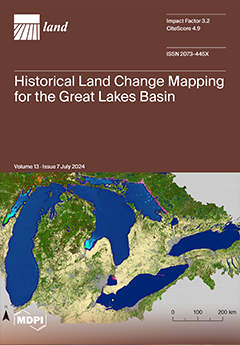
The goal for this study was to identify changes in land cover occurring in Great Lakes Basin (GLB) landscapes over three time periods to provide insights into historical land cover changes occurring on a bi-national watershed scale and to better understand legacy effects on current conditions. Both radiometric and categorical change analysis was used for assessing the time series data. Results include maps of annual land cover transition from 1985 to 1995 and 1995 to 2010 in the GLB and an assessment of the magnitude and direction of change by land cover type. Change for both time periods displayed large net decreases in deciduous forest and agriculture and net increases in suburban cover, which is shown to influence the aquatic nitrogen implicated in the expansion of the invasive wetland plants. View this paper
- Issues are regarded as officially published after their release is announced to the table of contents alert mailing list.
- You may sign up for e-mail alerts to receive table of contents of newly released issues.
- PDF is the official format for papers published in both, html and pdf forms. To view the papers in pdf format, click on the "PDF Full-text" link, and use the free Adobe Reader to open them.
Previous Issue
Next Issue